September 15, 2021 (UT, WY, CO)
-
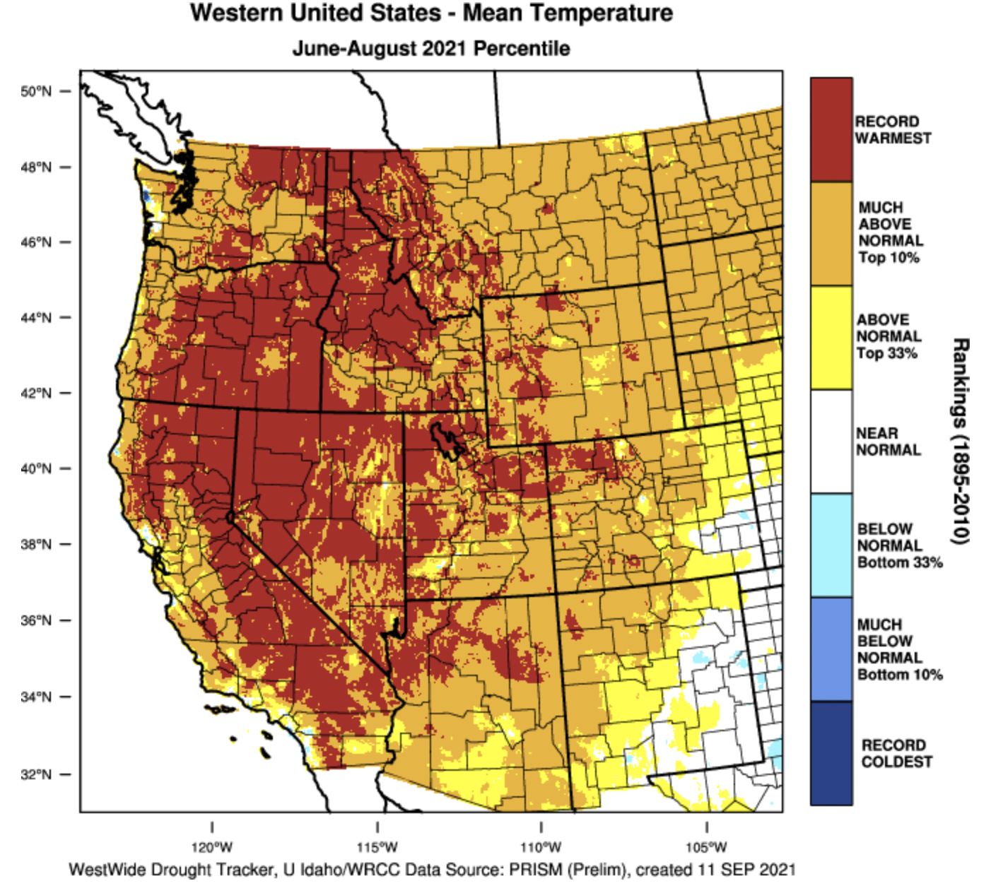
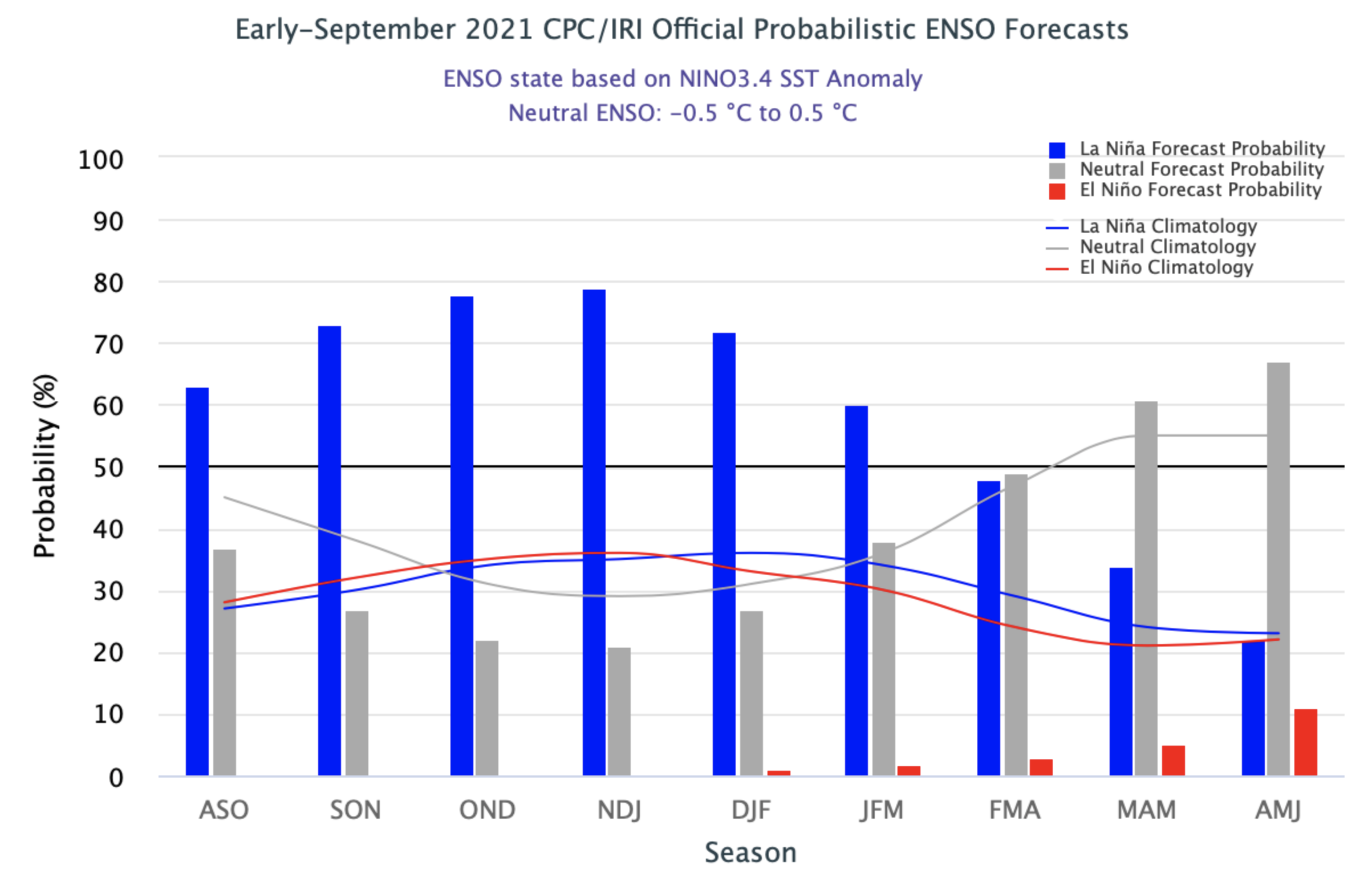
Much above average rainfall in Utah and western Wyoming during August caused some improvement to drought conditions in the Intermountain West, but drought persists across nearly the entire region except eastern Colorado. Improvements to drought conditions were aided by a return to near normal temperatures during August. Despite near-normal August temperatures, much of Utah and parts of western Colorado and Wyoming experienced record hot summer (June-August) temperatures. There is a 60 - 80% probability of La Niña conditions developing during fall and persisting through winter.
-
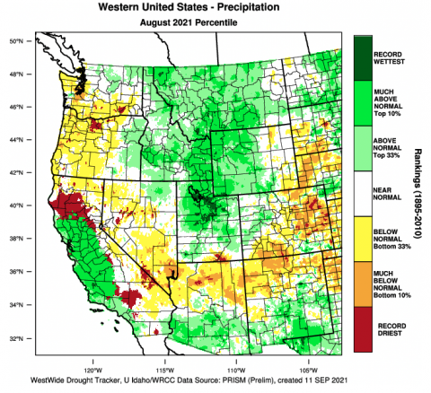
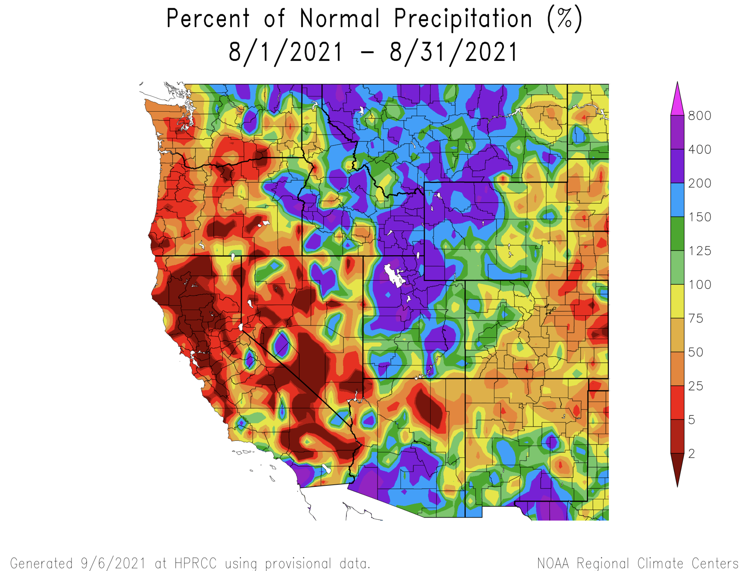
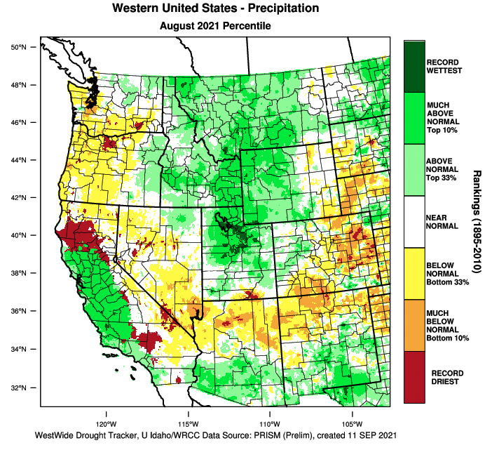
Precipitation was much above normal during August for much of the region, especially in Utah and western Wyoming due to a strong North American monsoon that brought precipitation further west and north than normal. Much of Utah and western Wyoming received 150-200% of normal August rainfall; many of these locations received up to 400% of normal August precipitation and isolated areas received even greater rainfall totals. August is a dry month in the Intermountain West and even 400% of normal is not enough to recover from long-term drought, however areas of northern Utah and northwest Wyoming received 1.5 – 3 inches more rainfall than typically falls in August. The eastern two-thirds of Colorado, including the Front Range and eastern Wyoming received below normal precipitation during August.
Image
-
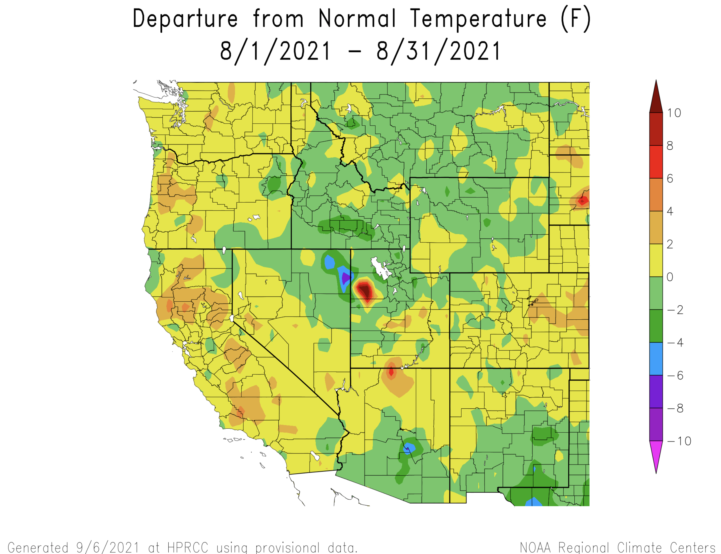
During August, Intermountain West temperatures were near-normal. In much of Utah and Wyoming, temperatures that were up to 2 degrees below normal and temperatures were up to 2 degrees above normal for much of Colorado. Despite a near-normal August temperatures, nearly half of Utah and parts of northwestern Colorado and western Wyoming experienced the hottest June - August on record. June – August 2021 was among the 12 hottest summers on record for the nearly the entire region.
Image Image
Image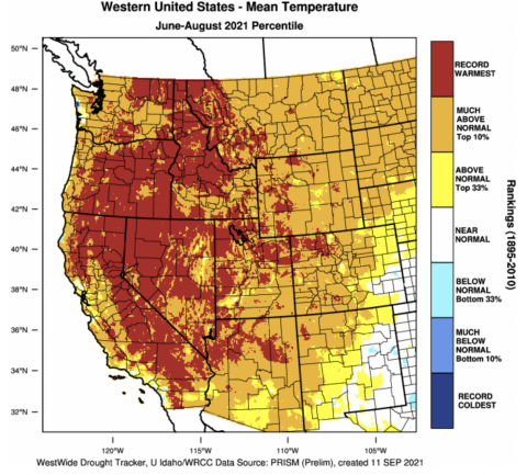
-
Prior to the onset of monsoonal rains in July and August, many regional rivers were approaching record-low streamflow values. A relatively wet August increased streamflow so that large areas of Colorado, Utah and Wyoming saw near-normal streamflow during August. Despite recent rainfall, rivers in western Utah, western Wyoming and northwestern Colorado were flowing below to much-below normal during August. Record low August streamflow was observed in the Weber and Logan Rivers in northern Utah.
Image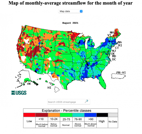
-
Above average August monsoonal rains led to a one category improvement of drought conditions across portions of Utah and western Wyoming. Extreme and exceptional drought (D3-D4) persist across Utah, Wyoming and western Colorado, but conditions improved slightly during August. Improvements to drought conditions were most significant in Utah. In Utah, areal coverage of extreme drought decreased from 99% to 88% during August and the area of exceptional drought decreased by a factor of two, from 52% to 24% of the state. In Wyoming, drought conditions improved slightly in the western portion of the stated but worsened in the southeastern corner. Drought conditions improved by one category in portions of western Colorado, but a dry August caused areas of abnormally dry and D1 drought conditions to develop in the eastern plains of Colorado.
Image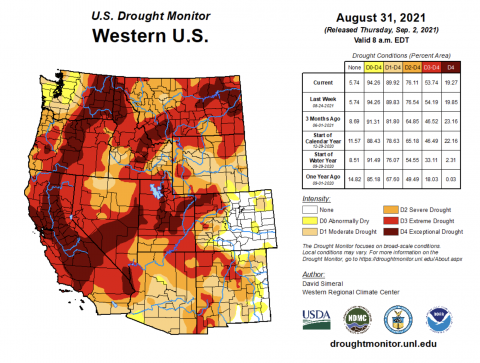
-
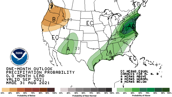
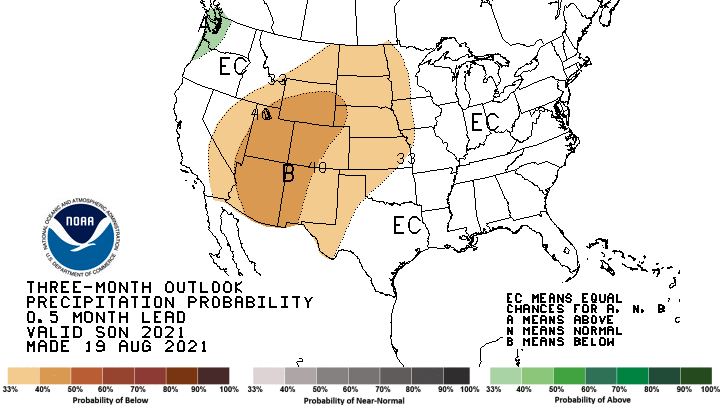
Eastern Pacific Ocean temperatures are slightly below normal, but regional climate remains in an ENSO-neutral condition. There is a 60 – 80% chance of La Niña conditions developing during fall and greater than a 50% probability of La Niña conditions persisting through late winter. There is an increased probability for above average precipitation during September in southern Colorado. During September – November, the NOAA seasonal forecast predicts an increased probability for above average temperatures and below average precipitation for the entire region.
Image Image
Image Image
Image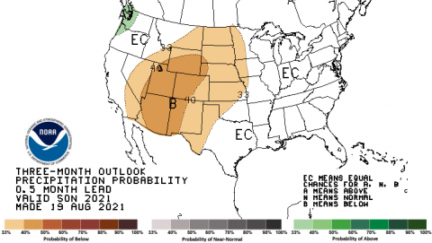
-
Significant August weather event. Heavy monsoonal rains caused record August precipitation in parts of northern Utah. August rainfall was above to much-above normal for two-thirds of Utah and half of Wyoming during August. While rainfall was not great enough to alleviate multi-year drought, the heavy rainfall did improve drought conditions and eased fire danger during August. In Utah, parts of Carbon, Davis, Duchesne, Juab, Millard, Salt Lake, Summit, and Wasatch Counties received record amounts of August precipitation. Daily precipitation records were set at 43 locations in Utah during August. On August 18-19, 36 sites in Utah broke daily precipitation records.
Image