September 5, 2024 - CO, UT, WY
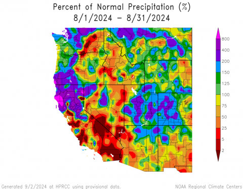
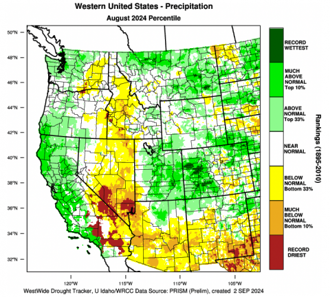
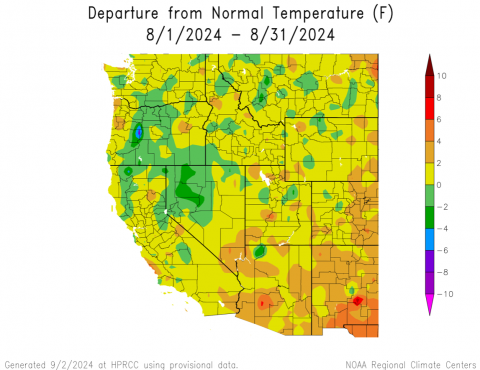
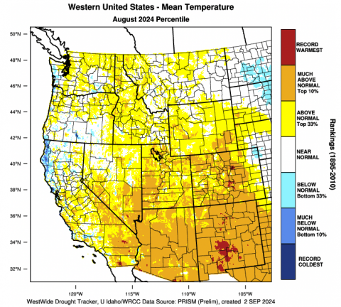
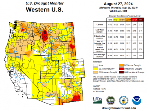
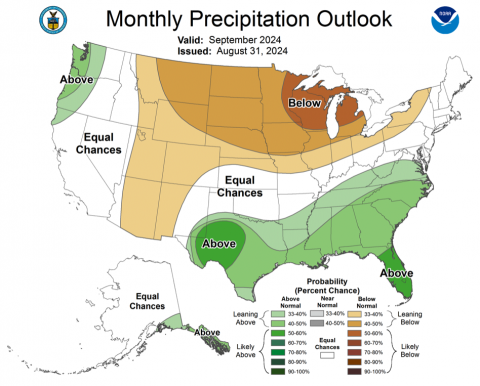
August precipitation was average to much-above average across the region. Parts of Utah and western Colorado received 2 to 4 times the average August precipitation and it was the wettest August on record for some locations in Colorado. Moisture from the North American monsoon also caused severe thunderstorms and flash flooding, especially in Moab where the August 23rd flood event was the third of the summer. August temperatures were a few degrees above average for most of the region. Drought covers 24% of the region and is most severe in Wyoming where extreme drought conditions developed during August. ENSO-neutral conditions currently exist; a weak La Niña may form during earlier winter, but the majority of winter 2024-2025 will likely see neutral ENSO conditions. September is likely to be drier and warmer than average.
Much of the region received average to much-above average precipitation during August. Large areas of Utah, western Colorado and southwestern Wyoming received 150-400% of average August precipitation. Heavy rains caused record wet August conditions in parts of western Colorado. Record August precipitation was observed in Fruita and Ridgway, CO and Loa and Scofield, UT. August precipitation was 178% of average at Utah SNOTEL sites, 167% at Colorado SNOTEL sites and 138% at Wyoming sites with 12 sites in Utah and 9 sites in Colorado breaking August precipitation records. As of September 1st, water year precipitation is 108% of average in Colorado, 139% of average in Utah and 115% of average in Wyoming.
August temperatures were up to two degrees above average across most of the region. In eastern Colorado and southeastern Wyoming, August temperatures were 2 to 4 degrees above average and record hot conditions were recorded in parts of the Front Range.
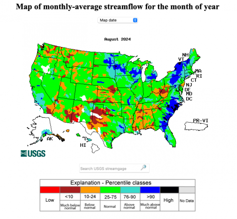
August monthly streamflow was near-normal for most of Utah and western Colorado river basins. Below average monthly streamflow was observed in parts of the Arkansas, Blue, Clear Creek, Colorado, Fraser and South Platte River Basins in Colorado. In Wyoming, August streamflow was below the 5th percentile in parts of the Snake and Wind River Basins. Regional reservoir storage remains above normal in Utah (114% of median capacity) and near-normal in Colorado (93% median capacity) and Wyoming (95% median capacity).
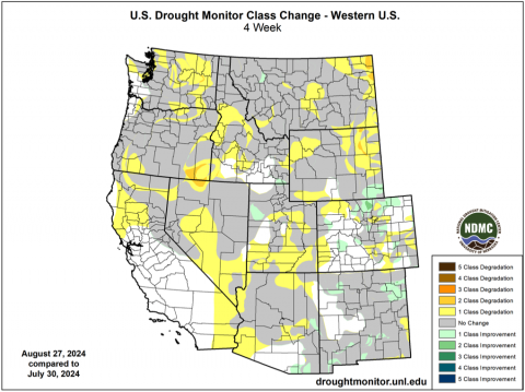
At the end of August, 24% of the region was covered by drought. While total regional coverage of drought changed little in August, drought conditions generally worsened in Wyoming and improved along the northern Front Range of Colorado. In Wyoming, coverage of D1 drought expanded, D2 drought developed in northwestern Wyoming and D3 drought developed in northeastern Wyoming. Drought conditions were removed from parts of the northern Front Range and southeastern Wyoming during August. In Utah, a small area of D1 drought developed near St. George.
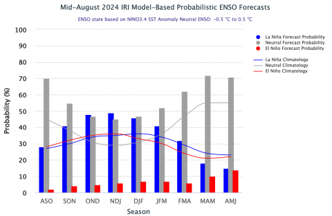
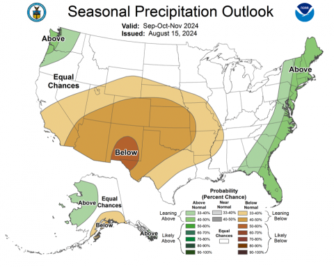
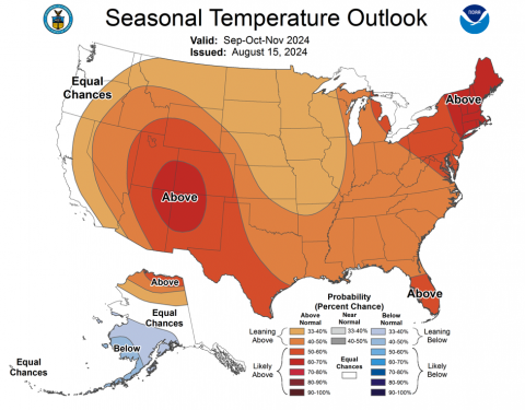
Sea surface temperatures in the eastern Pacific Ocean are near average and consistent with ENSO-neutral conditions. Current ENSO forecasts suggest that a weak La Niña may develop in early winter, but that ENSO-neutral conditions are likely to dominate during winter 2024-2025. During both September and September - November, there is an increased probability of below average precipitation for the entire region. There is an increased probability of above average temperatures for the entire region during September – November including a 60-70% probability of above average temperatures during September.
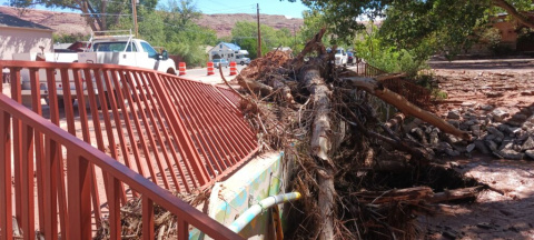
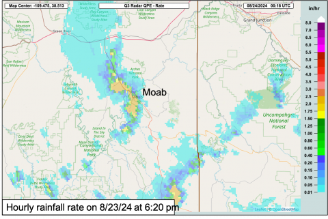
August weather event. More flash flooding in Moab. A significant flash flood tore through Mill Creek in downtown Moab for the third time this summer. In the early evening of August 23rd, a line of severe thunderstorms passed through Moab and the La Sal Mountains, dropping 0.1-1.1” of rain in less than 30 minutes. Despite the modest rainfall amount, the rapid rainfall rate caused severe flash flooding. Mill Creek, which typically flows through downtown Moab at 5 cubic feet per second (cfs) during summer. At 8:15 pm, approximately two hours after the rain event, Mill Creek flow peaked at 6,660 cfs. Debris caught on bridges over Mill Creek caused water to back up and flow through Main Street in Moab and severely damaged one bridge. The August 23rd flash flood event marks the third time this summer that heavy rainfall has caused severe flooding in Moab. On 6/21, heavy rainfall caused severe flooding in Moab due to a flash flooding Mill Creek which had a peak flow of 5,080 cfs. On 6/27, another round of heavy rainfall on the north side of Moab caused flooding primarily due to rapid rainfall rates and surface runoff. Since the August 23rd flood event, Utah Governor Spencer Cox declared a state of emergency in Moab.
