October 8, 2021 (CO, UT, WY)
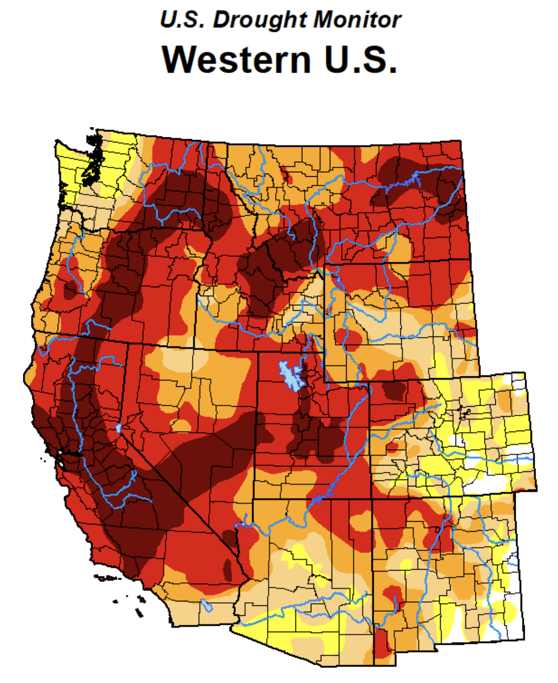
- September was a relatively quiet month for weather after a summer of extreme heat, monsoonal rains and wildfire smoke across the region. Precipitation was near-normal for much of the region and temperatures were slightly above normal. Monsoonal rains in July and August brought streamflow up to near-normal levels for much of the region. Drought developed or worsened in parts of Colorado and Wyoming, now covering 82% of the region (96% if abnormally dry conditions are included).
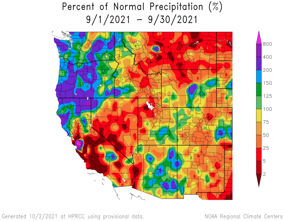
- After heavy monsoonal precipitation during August, September precipitation was below normal throughout much of the region. Above average precipitation fell in a swath across the region from southeastern Utah through eastern Wyoming; below average precipitation fell in the Front Range, western Utah and northern Wyoming.
Image
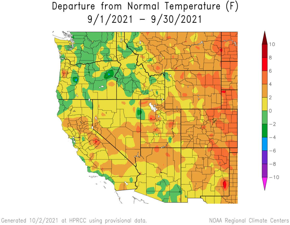
- September temperatures were above normal throughout the entire region. Temperatures in Utah were near-normal to slightly warmer than average. Temperatures were generally 2 to 4 degrees above normal in Colorado and Wyoming with slightly hotter temperatures across eastern Colorado and eastern Wyoming.
Image
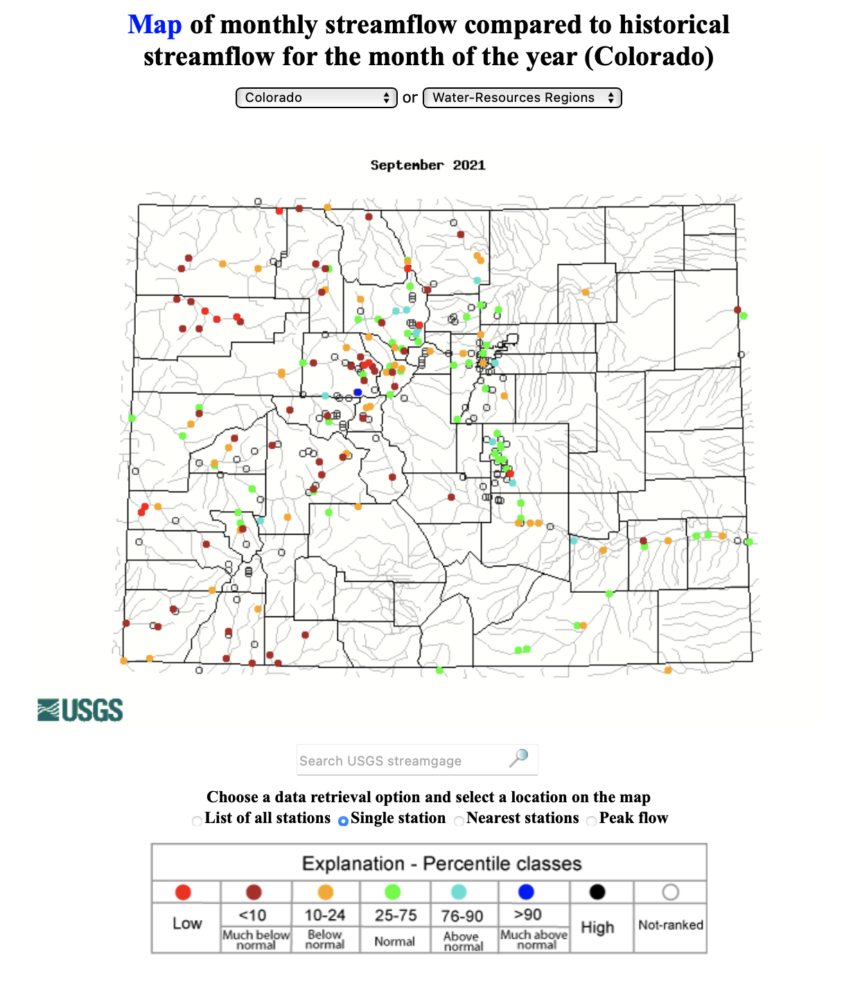
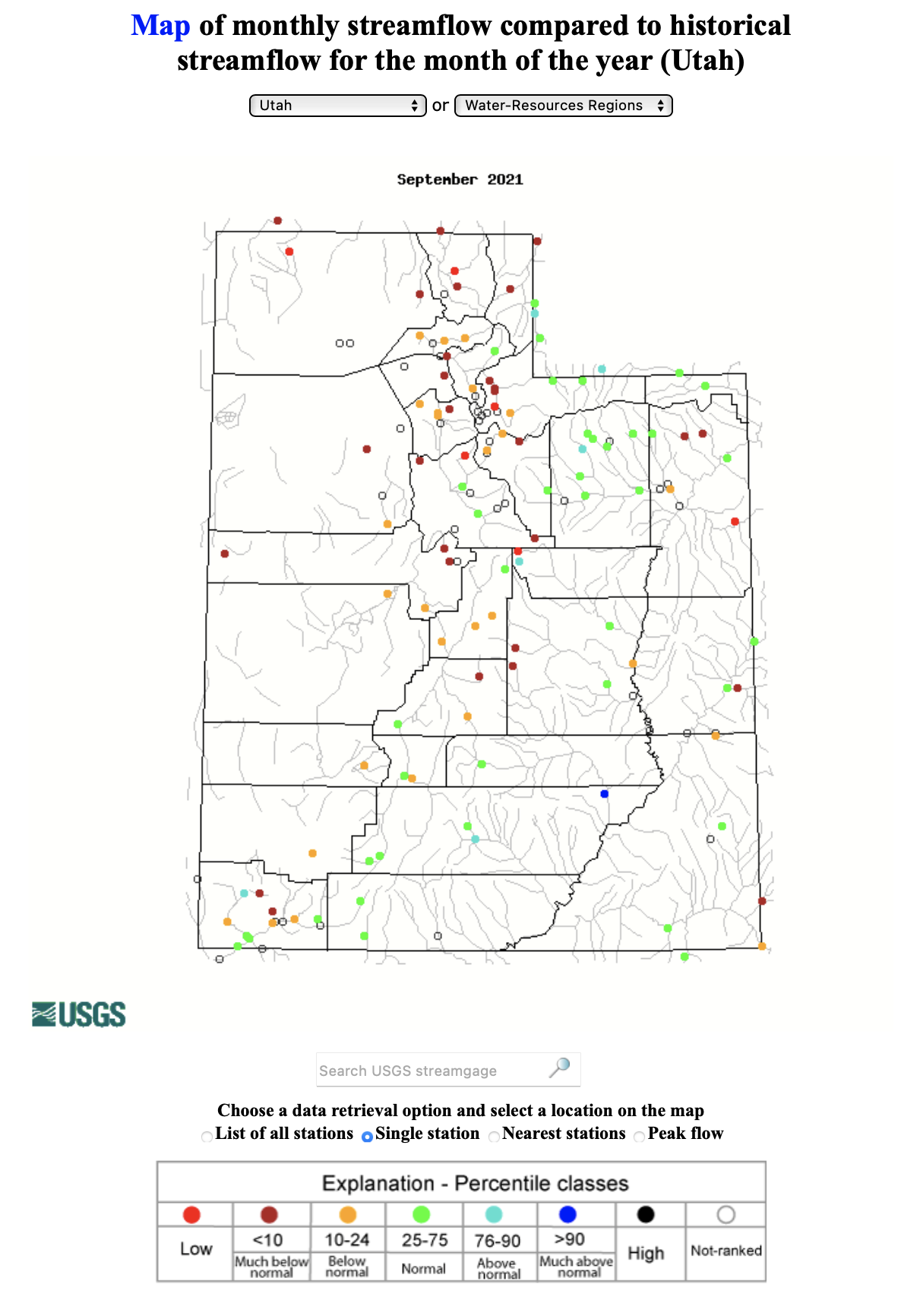
- Regional streamflow during September was a mix of above-normal and near-normal conditions. In Colorado, streamflow was generally much below normal on the West Slope and near-normal on the Front Range; record low September streamflow was observed on the Dolores and White Rivers. In Utah, September streamflow was near-normal in much of southern and eastern Utah and much below normal in northern Utah with record low monthly streamflow on the Logan, Weber and White Rivers.
Image
Image
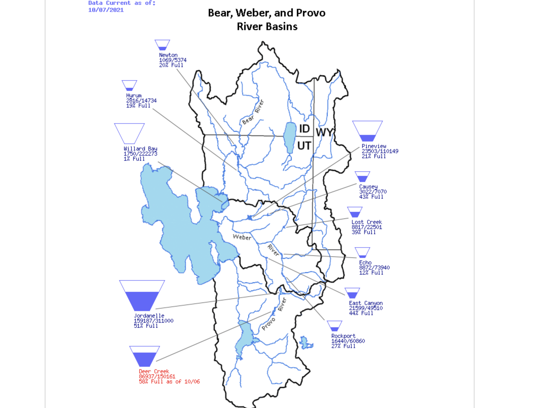
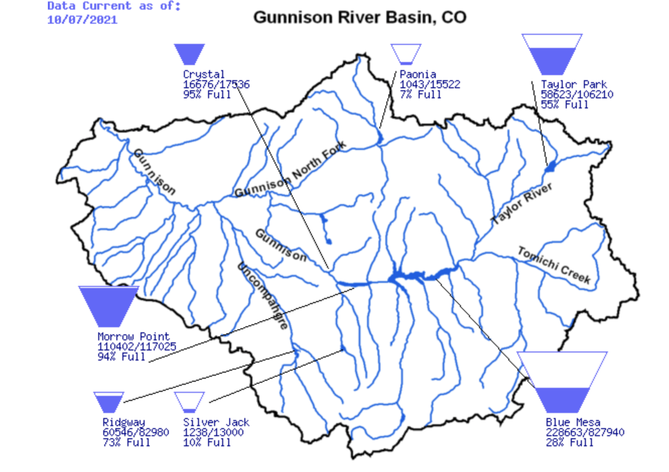
- Although streamflow in many regional rivers has rebounded from early July minimums, the effects of long-term drought are evident in regional reservoir storage. While Lake Powell headlines the list of diminished reservoirs at 30% full, many medium-sized, regionally important reservoirs are very low. On October 1st, reservoirs in Utah were 59% of capacity and 85% of median October 1st storage, a decrease of 15% compared to 2020. Along the Watch Front, reservoirs in the Weber River Basin are particularly low; on October 7th, total basin storage in 7 reservoirs was at 15% capacity of 543,000 acre-feet of total storage. The Gunnison River Basin has the lowest basin-wide storage in Colorado at 40% of storage and 54% of median October 1st storage. Blue Mesa Reservoir, the largest in the Gunnison Basin, is lowest at 29% full and 38% of median October 1st storage. Reservoir storage in Wyoming is relatively high considering the severity of regional drought. October 1st storage in most Wyoming river basins was 85-100% of median with the exception of the Snake River Basin where Jackson Lake is 16% full (646,000 acre-feet storage) and 23% of median October 1st storage.
Image
Image
- During September, drought worsened by one category in the Front Range and eastern plains of Colorado and across parts of Wyoming. In eastern Utah and northwestern Colorado, drought conditions improved slightly as the area of extreme and exceptional drought contracted. Colorado experienced the greatest expansion of regional drought conditions; the coverage of moderate (D1) drought increased by 18% and abnormally dry (D0) conditions expanded by nearly 40%. In Wyoming, severe (D2) and extreme (D3) drought conditions increased in coverage by 10% and 6%, respectively.
Image
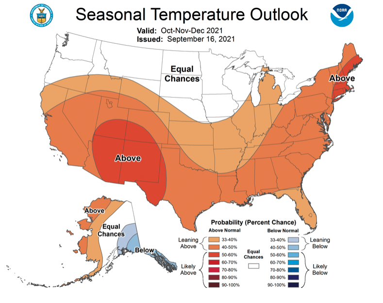
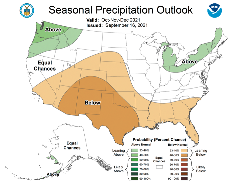
- A La Niña watch was in effect during September as Pacific Ocean temperatures were slightly below normal and models project a 60-70% probability of the emergence of La Niña conditions during late fall to early winter. The NOAA seasonal outlook for October suggests an increased probability of above average temperatures for most of the region and a slight increase in the probability of above average precipitation for eastern Colorado. During fall (October – December) the NOAA seasonal outlook projects an increased probability of above average temperatures, especially in the Four Corners and below average precipitation for the entire region except northwestern Utah and Wyoming.
Image
Image
Image
Image
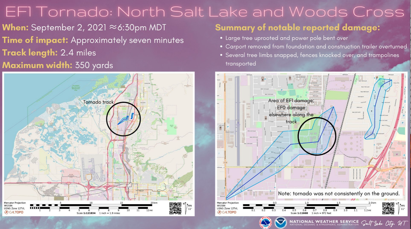
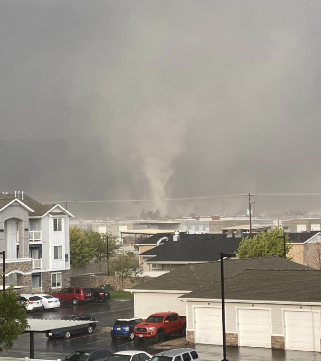
- Significant September weather event. An EF1 tornado formed north of Salt Lake City on September 2nd and caused minor damage in Woods Cross and North Salt Lake. Winds were estimated at up to 110 mph and the tornado was on the ground for approximately 7 minutes along a 2.4 mile path. The tornado’s size and scope of damage was small relative to tornadoes that form in eastern Colorado. However, the tornado was significant for Utah because there are an average of only 3 tornadoes per year. In the West, only Nevada, Oregon and Washington have a lower annual incidence of tornadoes.