October 5, 2023 - CO, UT, WY
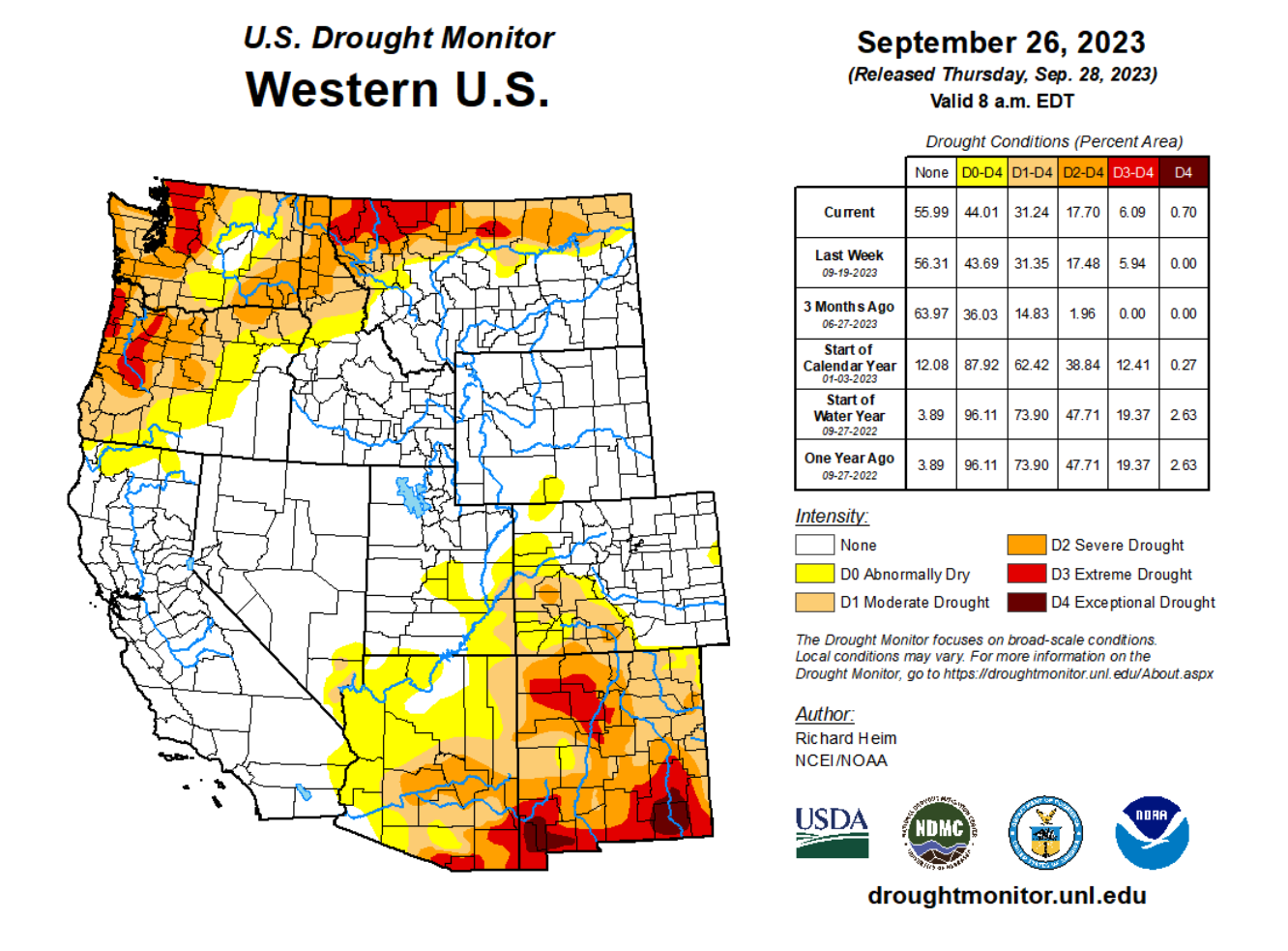
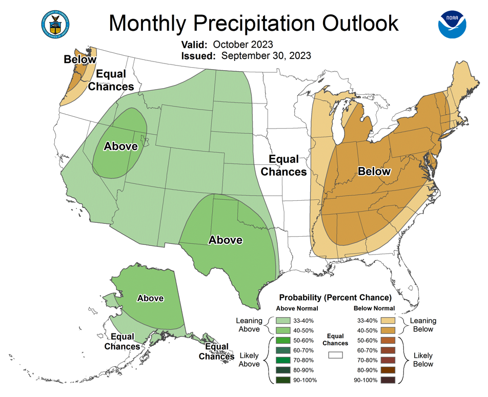
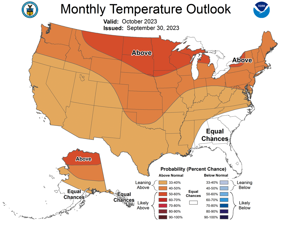
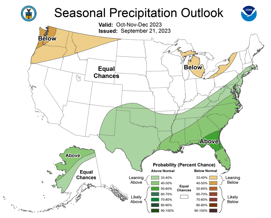
Often a month of weather transitions, early September brought the last monsoonal storms of the season and by mid-month, the first snows fell over the region’s highest peaks. Overall, regional precipitation was a mix of wet and dry with the wettest conditions in Utah, southeastern Colorado and northeastern Wyoming. September temperatures were generally near average in the western portion of the region and above average in eastern Colorado and much of Wyoming. Regionally, drought conditions improved slightly, now covering 8% of the region with drought conditions present in eastern Utah and western Colorado. A moderate El Niño is expected to continue through spring, but does not provide any long-term guidance on winter precipitation. NOAA seasonal forecasts for October-December suggest equal chances of above or below average precipitation.
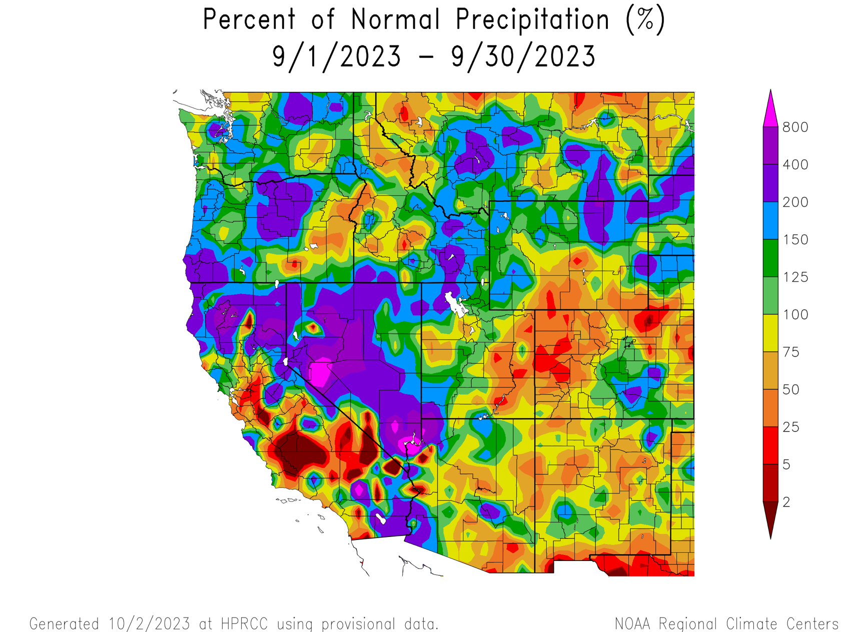
Regional precipitation during September was a mix of much-above normal and much-below normal. Both monsoonal thunderstorms and colder fall storms occurred during September. Greater than 150% of average precipitation was observed in southeastern Colorado, western Utah and northeastern Wyoming. Below average September precipitation was observed over most of Colorado, eastern Utah and southern Wyoming.
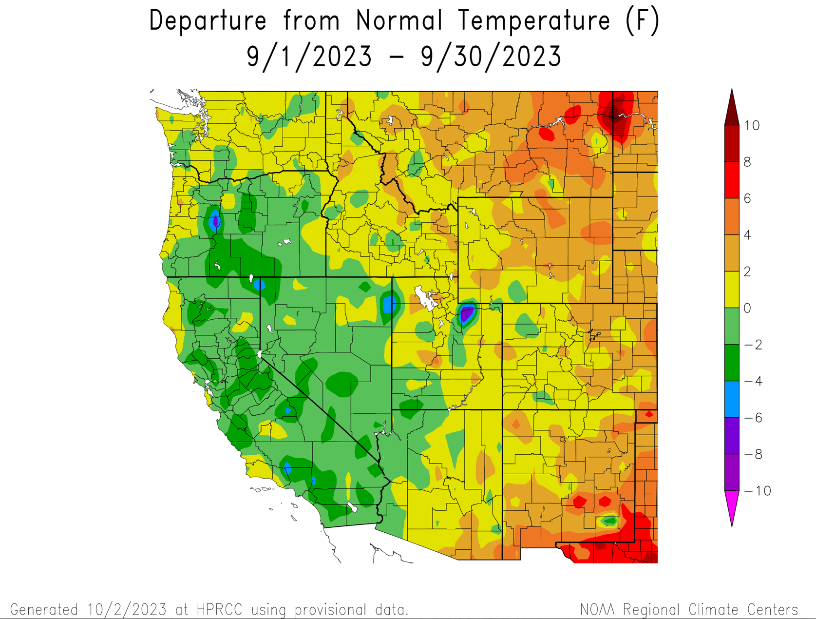
September temperatures were near-normal (+/- 2 degrees of average) in most of Utah, western Colorado and western Wyoming. Across much of Wyoming and eastern Colorado, September temperatures were 2 to 6 degrees above normal.
The first accumulating snow fell across many mountain locations above 10,000 feet during two late September storms. Snowfall from the September 22-23 storm quickly melted at all SNOTEL sites, but may remain for winter at the highest elevation north-facing locations in Colorado. A larger and colder storm that began on September 30, again caused accumulating snow at locations above 10,000 feet. Snow continued through the first two days of October; October weather will determine whether high elevation snow is here for the winter or merely a reminder of the upcoming seasonal change.
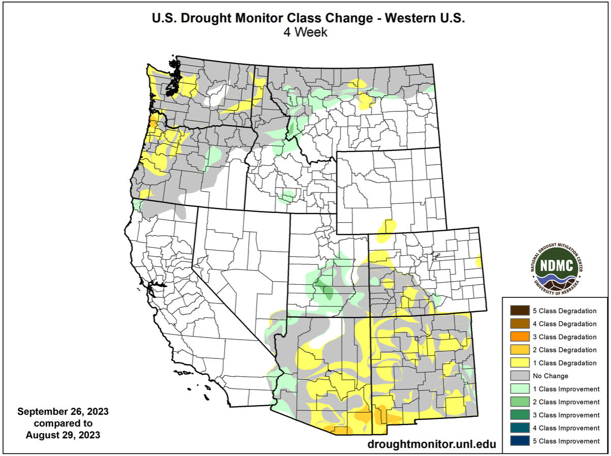
At the end of September, drought covered 8% of the region, a slight decrease from late August. Wyoming remains drought-free and regional drought is isolated to western Colorado and eastern Utah. In Utah, there was a 1-2 category improvement in drought conditions. In western Colorado, some locations experience a 1 category worsening of drought conditions. Regional drought conditions improved in most locations during summer; drought was removed from Wyoming, eastern Colorado and most of Utah. Summer was dry in eastern Utah and western Colorado; drought re-developed in this region after long-term drought was removed during late winter.
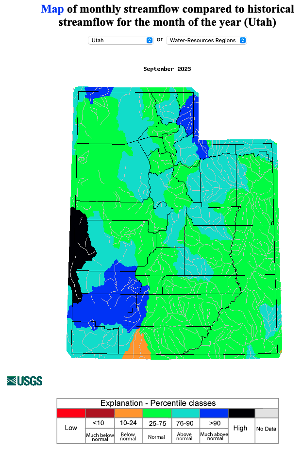
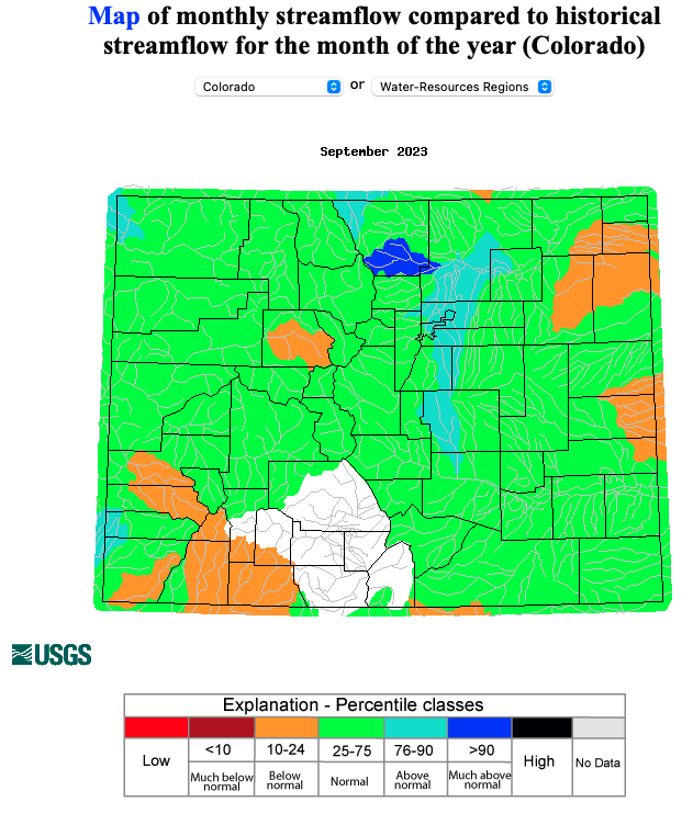
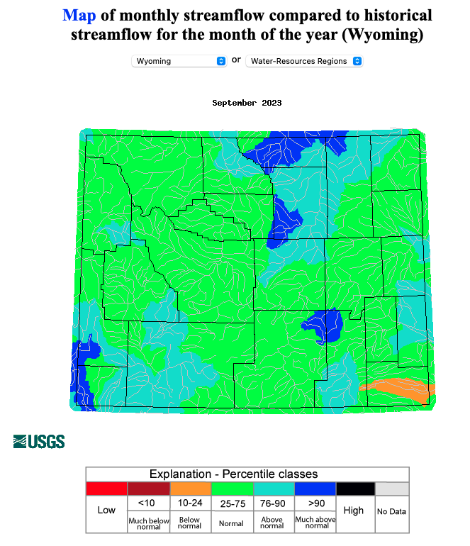
After much-above average winter precipitation and a wet summer in much of the region, regional rivers were generally flowing at near-normal levels during September. On a river-basin scale, September streamflow was normal or above normal in all river basins except the Upper Rio Grande River and Eagle River basin where September flows were below average.
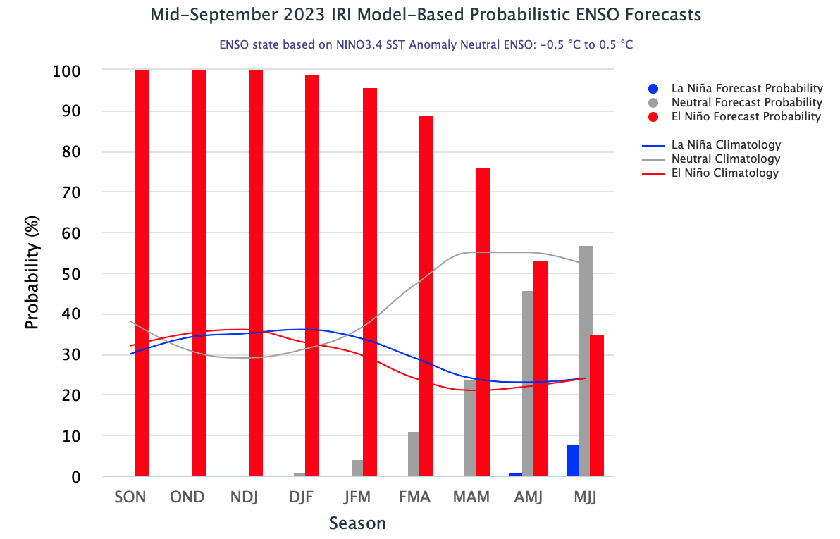
An El Niño advisory remained in place during September as eastern Pacific Ocean sea-surface temperatures warmed to the level of moderate El Niño conditions. El Niño conditions are projected to remain in place through late spring; there is greater than a 75% chance of El Niño conditions continuing through the March-May forecast period. The NOAA monthly outlook for October suggests an increased probability of above average precipitation and above average temperatures for the entire region. The NOAA seasonal outlook for October-December suggests an increased probability of above average temperatures for the western portion of the region. Considering the presence of a moderate El Niño, it is somewhat surprising that the NOAA seasonal forecast suggests equal chances of above or below average precipitation for the entire region. El Niño conditions often bring above winter-average precipitation to southern Utah and southwestern Colorado.
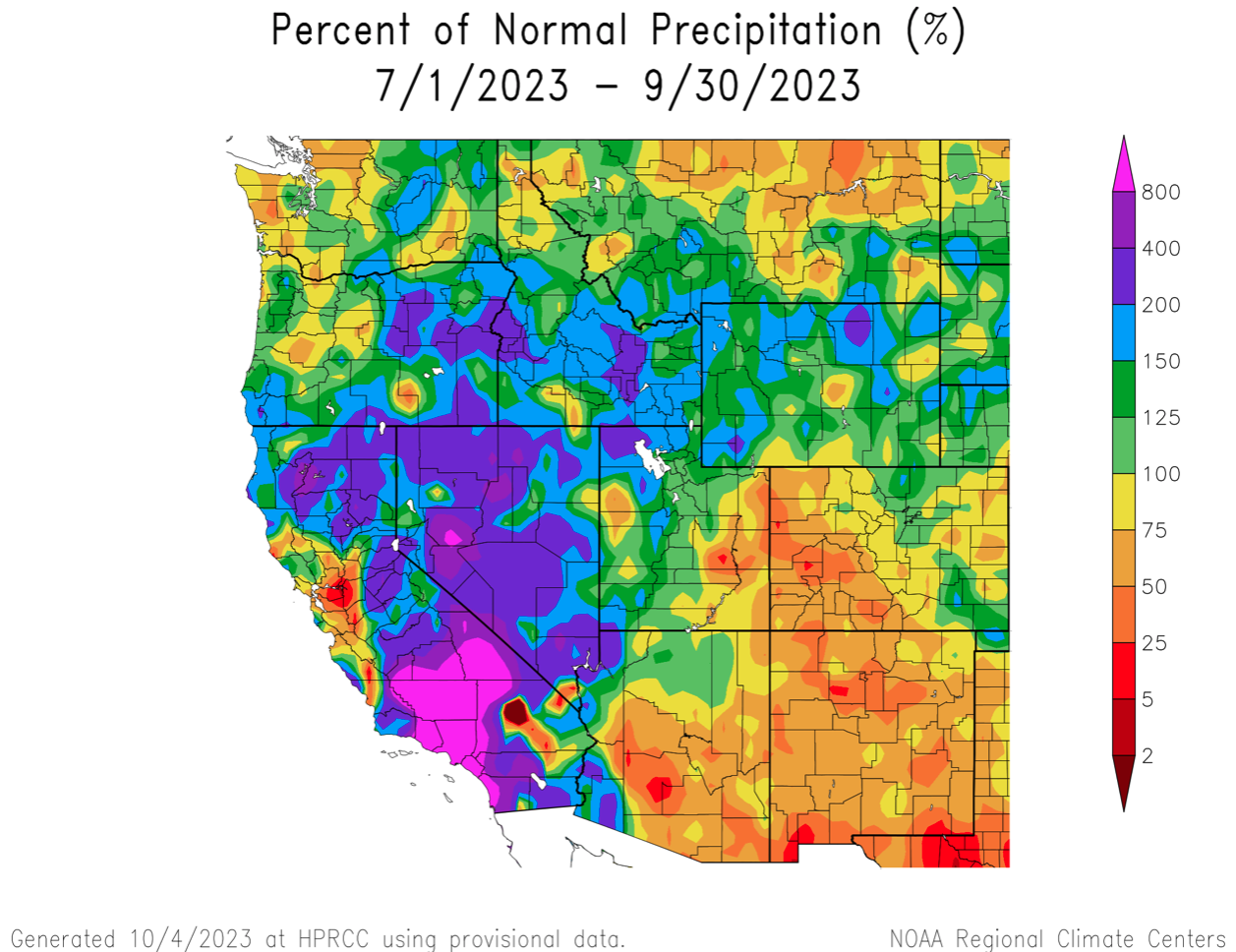
September weather event. Labor Day monsoonal moisture. A surge of monsoonal moisture impacted Utah over Labor Day weekend (9/1-9/4), especially southwestern Utah. Three-day rainfall totals in southwestern Utah ranged from 1.5-4”. St. George received 3.83” of rain during the first three days of September. By month’s end, the 2023 water year in St. George was the wettest on record with 15.83” of precipitation, surpassing the 15.77” of precipitation that fell in 1932. The monsoonal thunderstorms pushed into northern Utah on 9/4 where up to 1.9” of rain fell and daily records were broken at 19 locations with at least 50 years of weather data. Looking back at the 2023 monsoon season (July-September), the western two-thirds of Utah and most of Wyoming experienced above average precipitation. Monsoonal precipitation was below average over most of Colorado and Montrose saw its driest July-September on record. Elsewhere in the Southwest, monsoonal precipitation was very low in most of Arizona and New Mexico; July-September 2023 was the driest on record for Phoenix. Tropical Storm Hilary was a major contributor to much-above normal July-September precipitation in southern California, Nevada, northwestern Utah and southern Idaho.