October 5, 2022 - CO, UT, WY
Precipitation during September was near-to-above average in Utah and Wyoming, but below average in much of Colorado. September temperatures were the hottest on record in much of Utah, western Colorado and western Wyoming. Consistent monsoonal precipitation throughout the summer left most regional rivers flowing at near-average levels but below average reservoir storage remains throughout most of the region, especially in Colorado and Utah. Coverage of drought decreased slightly during September, but still covers 64% of the region. La Niña conditions are expected to persist through most of winter and conditions during fall are likely to be warm and dry.
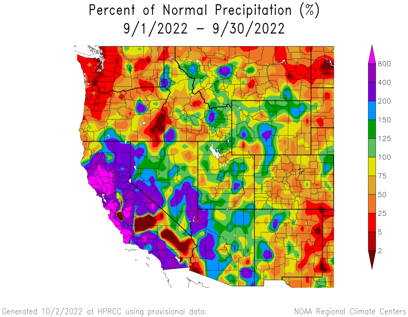
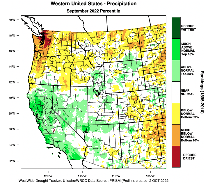
September precipitation was near-to-above average in much of Utah and Wyoming and below average for most of Colorado. Southwestern Utah, central Utah and central Wyoming and northeastern Wyoming received greater than 150% of normal September precipitation. The majority of Colorado and southeastern Wyoming received less than 75% of normal September precipitation. The remnants of Hurricane Kay, at one point a category 2 storm, impacted Utah, Wyoming and Colorado on September 13-16 and monsoonal flow brought rain to the region during the last ten days of the month.
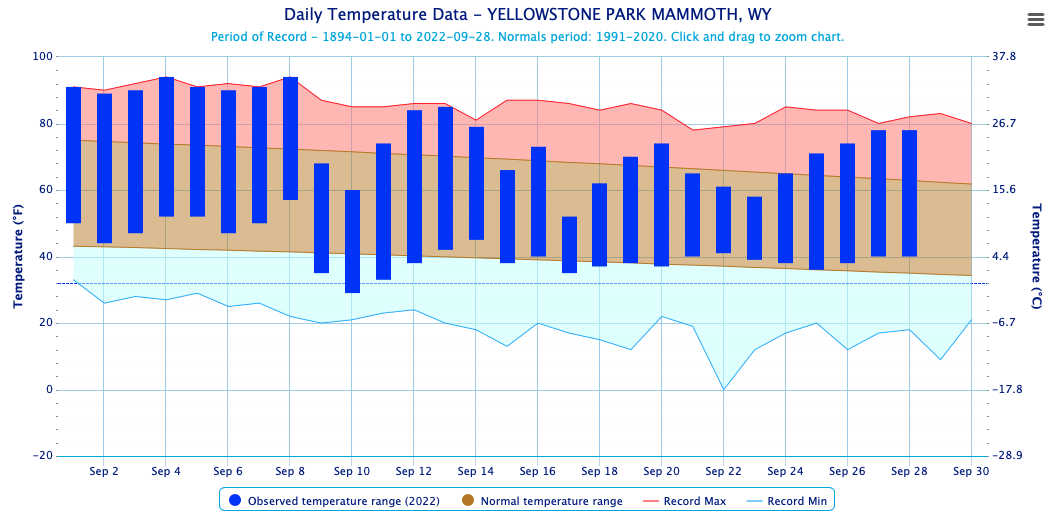
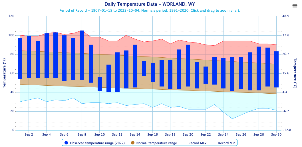
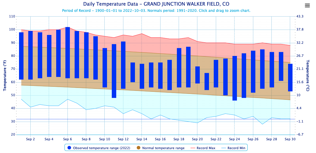
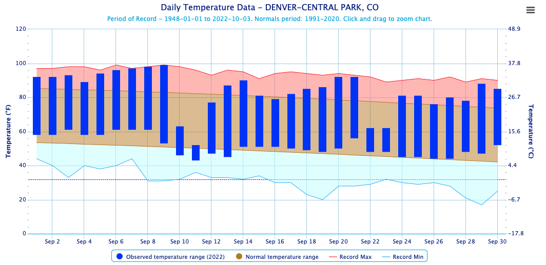
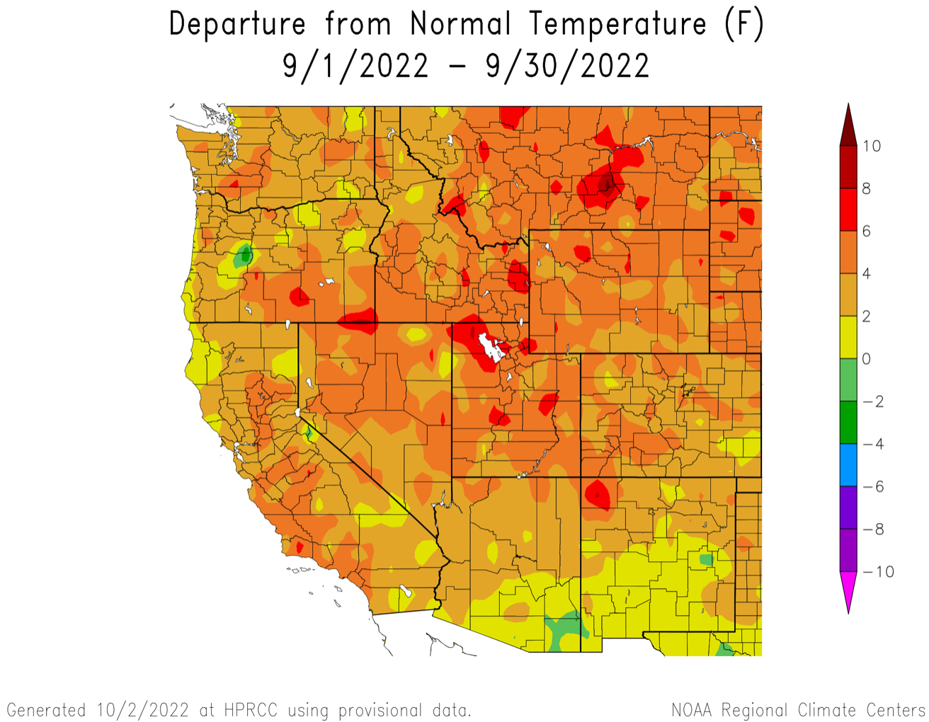
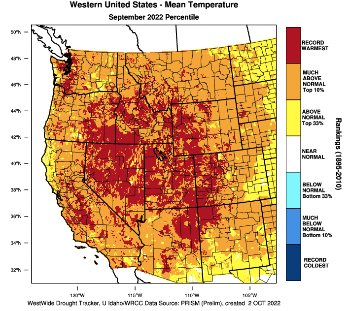
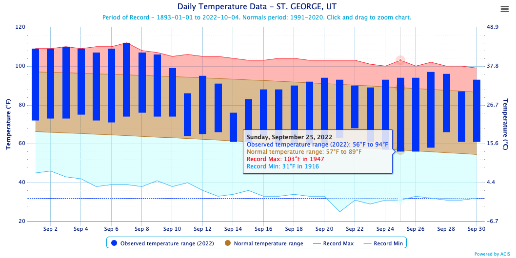
September temperatures were at least 2-4 degrees above normal throughout the entire region. Much of Utah and Wyoming experienced temperatures that were 4-6 degrees above normal in September. The regional hot spot during September was the Great Salt Lake Basin where temperatures were 6-8 degrees above normal. An early September heat wave was a major contributor to regional high temperatures. Above average monthly temperatures were driven by a significant regional heat wave from September 1-8 and much of Utah, western Colorado and western Wyoming experienced the hottest September on record.
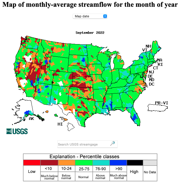
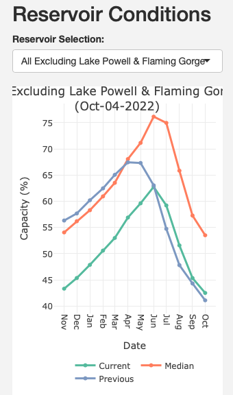
September streamflow in most regional rivers was near-normal. Below-to-much-below streamflow was observed in northwestern and central Utah and a few other isolated reaches of rivers in Colorado and Wyoming. Reservoir storage is below average for the entire region. Reservoirs in Utah, excluding Lake Powell and Flaming Gorge, are just over 40% full which is about 75% of median October 1st water storage. In Colorado, reservoirs are 54% full which is 76% of median October 1st water storage. Wyoming reservoirs in the Bighorn, Green, Lower North Platte, Shoshone and Wind River basins are relatively full (85-100% of median storage). Reservoir storage in the Upper North Platte is at 63% of median and Jackson Lake on the Snake River is nearly empty. The large reservoirs on the Colorado River system are relatively lower than statewide storage; Flaming Gorge is 71% full (84% of median storage), Blue Mesa Reservoir is 35% full (46% median) and Lake Powell is 24% full (40% median).
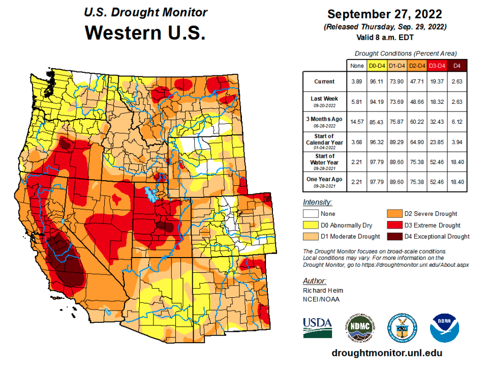
Drought conditions cover 64% of the Intermountain West, a slight decrease from last month. Approximately half of Colorado and Wyoming and all of Utah are currently in drought. Drought conditions improved by one category in the Four Corners region and central Wyoming; D3 drought was removed from southeastern Utah. In southeastern Wyoming, D3 drought expanded during September.
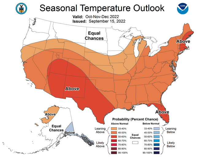
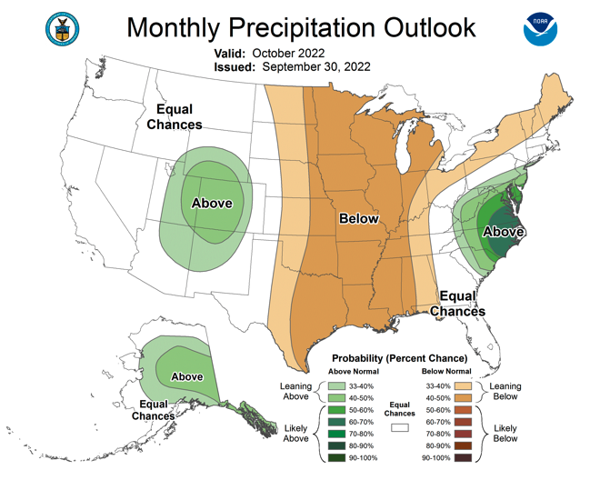
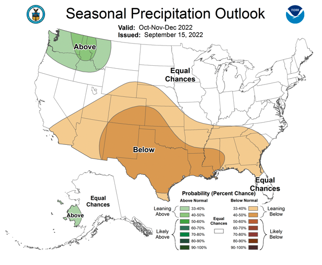
La Niña conditions continue in the eastern Pacific Ocean as sea surface temperatures were 1-2 degrees Celsius below normal during September. There is a 60-90% probability of La Niña continuing through mid-winter 2023. NOAA seasonal forecasts suggest an increased probability of above average temperatures from October to December for the entire region. There is an increased probability of above average precipitation during October for Colorado, Utah and southern Wyoming. In Colorado, much of Utah and southeastern Wyoming, there is an increased probability for below average October-December precipitation.
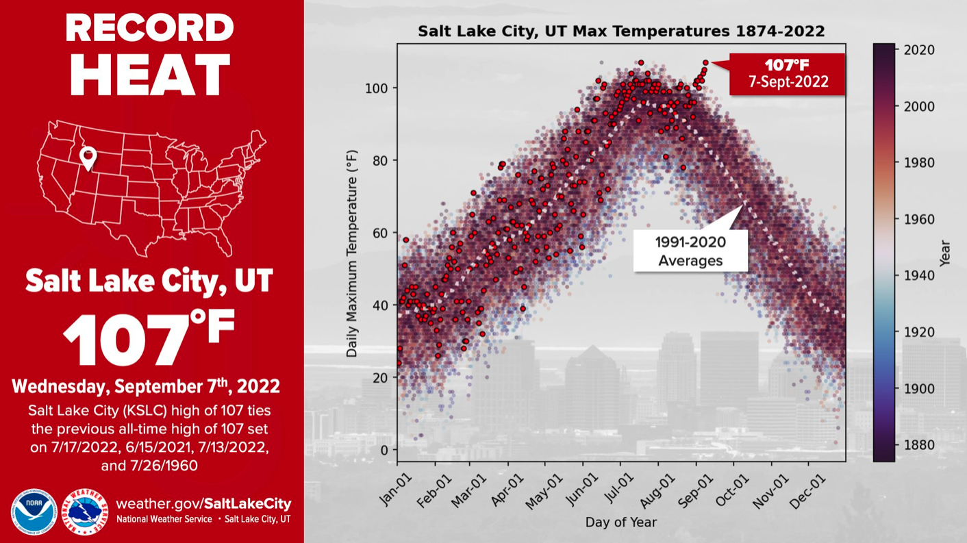
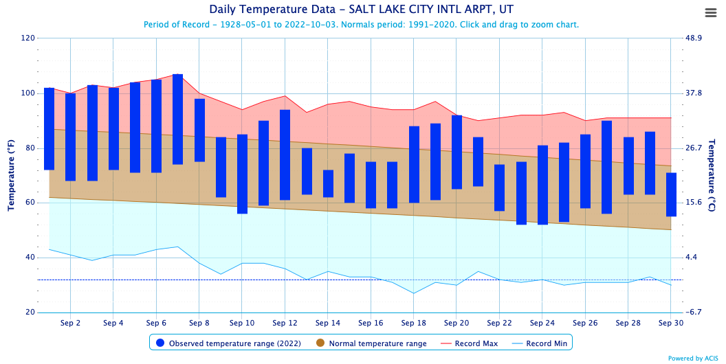
Significant September weather event. Extreme September heat. A major heat wave impacted the region from September 1-8. Utah was most strongly impacted by the heat wave, but Colorado and Wyoming also saw significant impacts. The early September heat wave was perhaps the hottest September heat wave in recorded in the Intermountain West. In Salt Lake City, the all-time high temperature of 107º was tied on 9/9 for the second time this year. The first 7 days of September exceeded 100ºF in Salt Lake City and along with the last two days of August, the 9 consecutive days of 100ºF temperatures was the second-longest streak on record. Salt Lake City set the record for number of days with 100ºF temperatures in 2022 at 35 days, smashing the old record of 23 days. Elsewhere in Utah, temperatures were still extremely hot. Daily records were set at 30-60% of sites with at least 50 years of data on each day from September 1-8. Temperatures reached 112ºF in St. George on September 7. All-time September maximum temperatures were set at 55% of sites in Utah with at least 50 years of data.
The heat wave also impacted Wyoming from September 1-8. On each day from September 4-8, 30-50% weather monitoring sites in set daily record high temperatures. Similar to Utah, 53% of sites in Wyoming with at least 50 years of data set all-time record high temperatures for September. Northwest Wyoming was a hot spot with sites in Yellowstone and Teton National Park setting all-time monthly high temperatures and 100ºF was exceeded in many locations, including Casper, Cody, Sheridan, Thermopolis, Weston and Worland. Temperatures reached 106ºF in Weston, 105ºF in Worland and 104ºF in Sheridan and Thermopolis, nearly reaching all-time record high temperatures. Colorado was less severely impacted by the heat wave, but all-time September high temperatures were set at 26% of sites in Colorado with at least 50 years of data. Temperatures exceeded 100ºF in Grand Junction, Akron and Yuma and reached 99ºF in Denver and Cortez during the heat wave.