November 8, 2021 (CO, UT, WY)
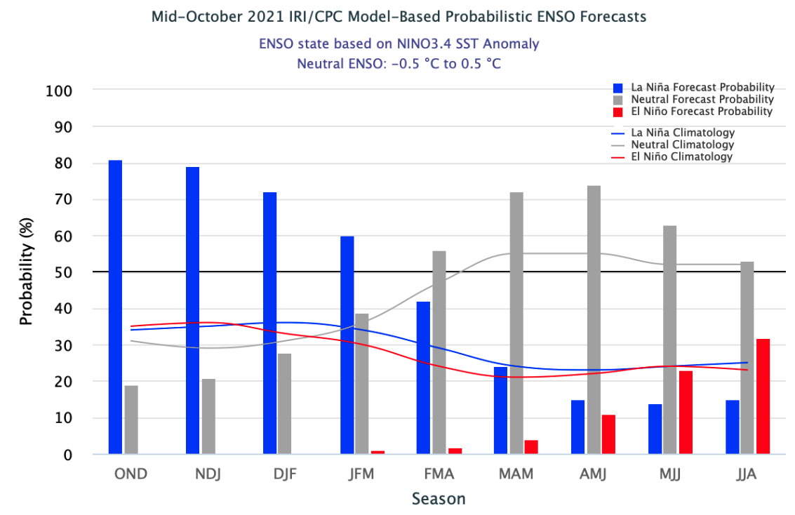
- The 2022 water year started well for much of the region. Large areas of Utah and Wyoming received much-above average precipitation and most areas above 8,000 feet have average to much-above average snowpack. Wet conditions caused a contraction of D3 and D4 drought in Utah and Wyoming, but drought conditions expanded in eastern Colorado and central Wyoming. La Niña conditions currently exist and are likely to continue through at least mid-winter. La Niña conditions typically increase the probability of above average precipitation in the northern part of the region and increase the probability of below average precipitation in the southern part of our region.
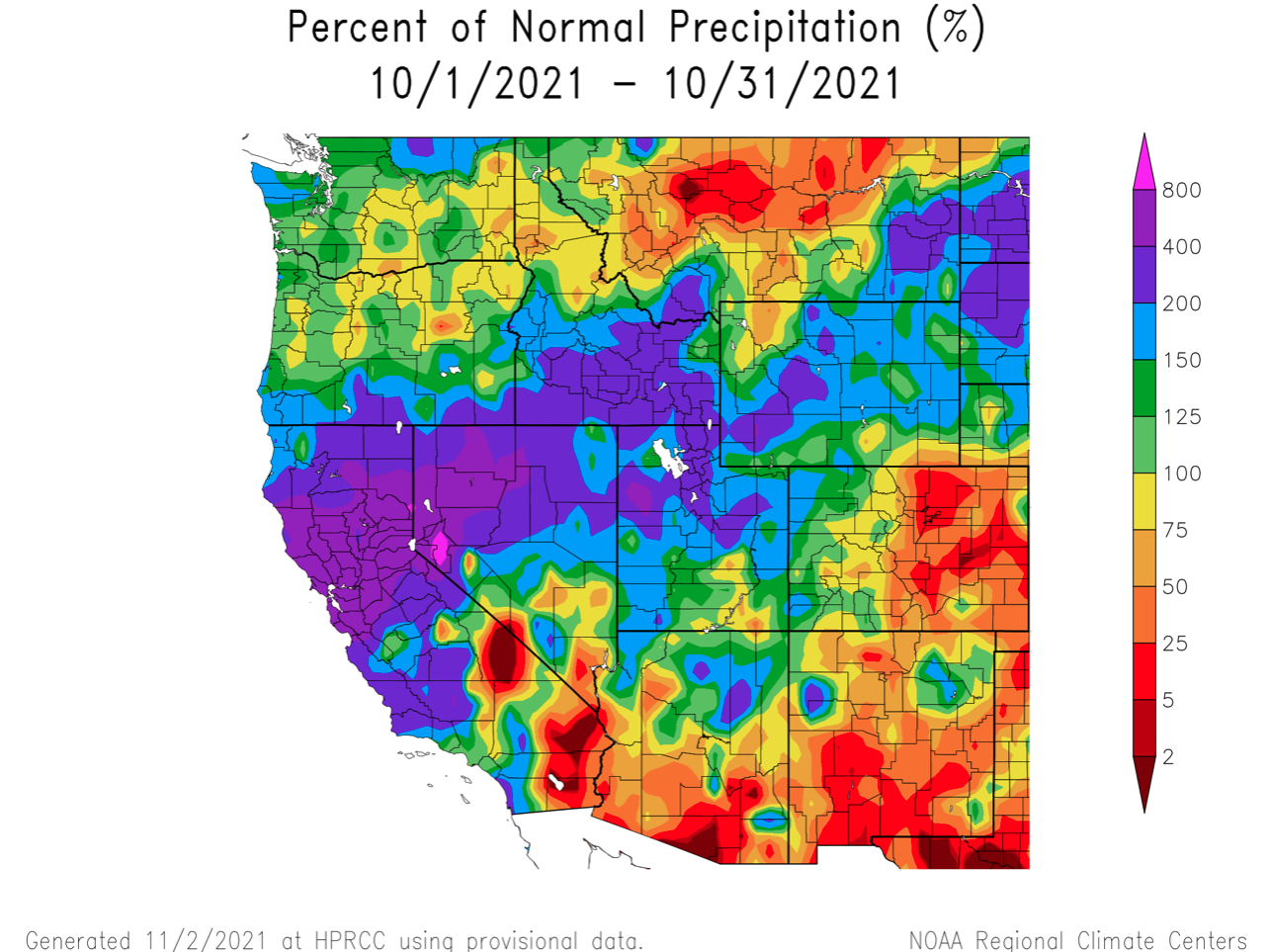
- October precipitation was much-above normal in Utah and Wyoming; large areas of both states received greater than 150 – 400% of normal precipitation. Western Colorado received slightly above average precipitation, but most of eastern Colorado saw less than 50% of normal precipitation.
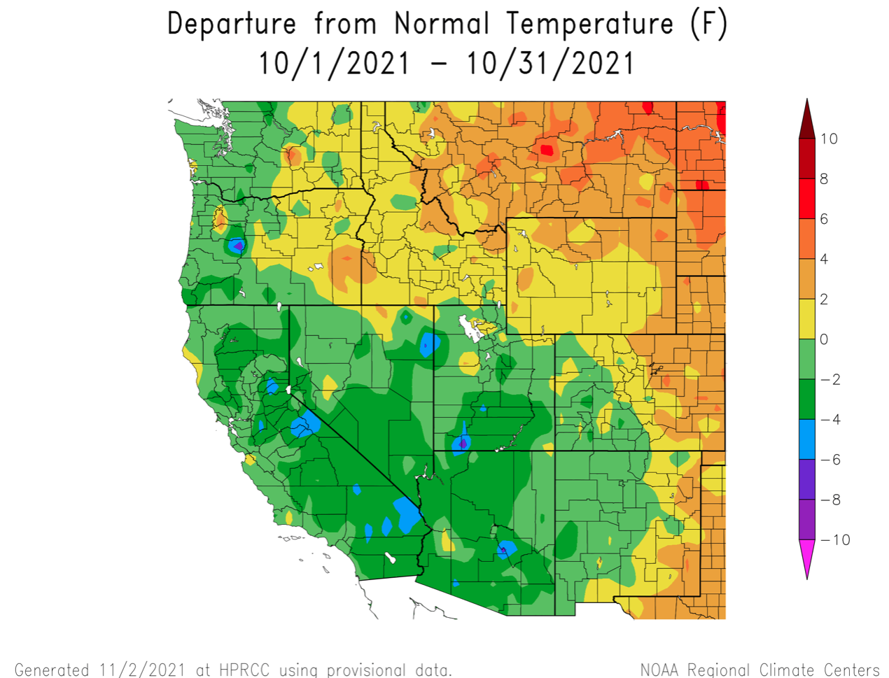
- Temperatures were cooler than average in Utah with southern Utah temperatures up to 4 degrees below normal. Most of Colorado and Wyoming saw near-normal temperatures (+/- 2 degrees) except in eastern Colorado and Wyoming where temperatures were up to 4 degrees above normal.
Image
Image
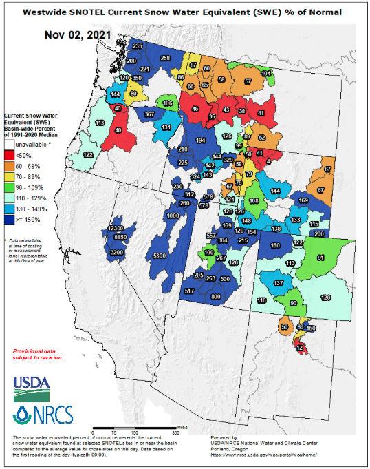
- Snowfall for most of the region was much-above normal during October. Much of the precipitation that fell in Utah, Wyoming and western Colorado fell as snow at elevations above 8,000 feet. Winter is off to a great start as all regional river basins have above average snow water equivalent (SWE) except for northern Wyoming, South Platte and Rio Grande River basins. While percent of normal figures can be a bit skewed in early and late winter, Utah river basins range from 100 – 800% normal SWE. SWE in Colorado and southern Wyoming ranges from 90 – 200% of normal.
Image
- Regional streamflow was higher in October compared to previous months with many rivers flowing at normal levels (25th to 75th percentile). Streamflow in several regional rivers still remains very low (<10th percentile), including the Snake, Yellowstone, White, Dolores, Bear, Logan, and Weber Rivers.
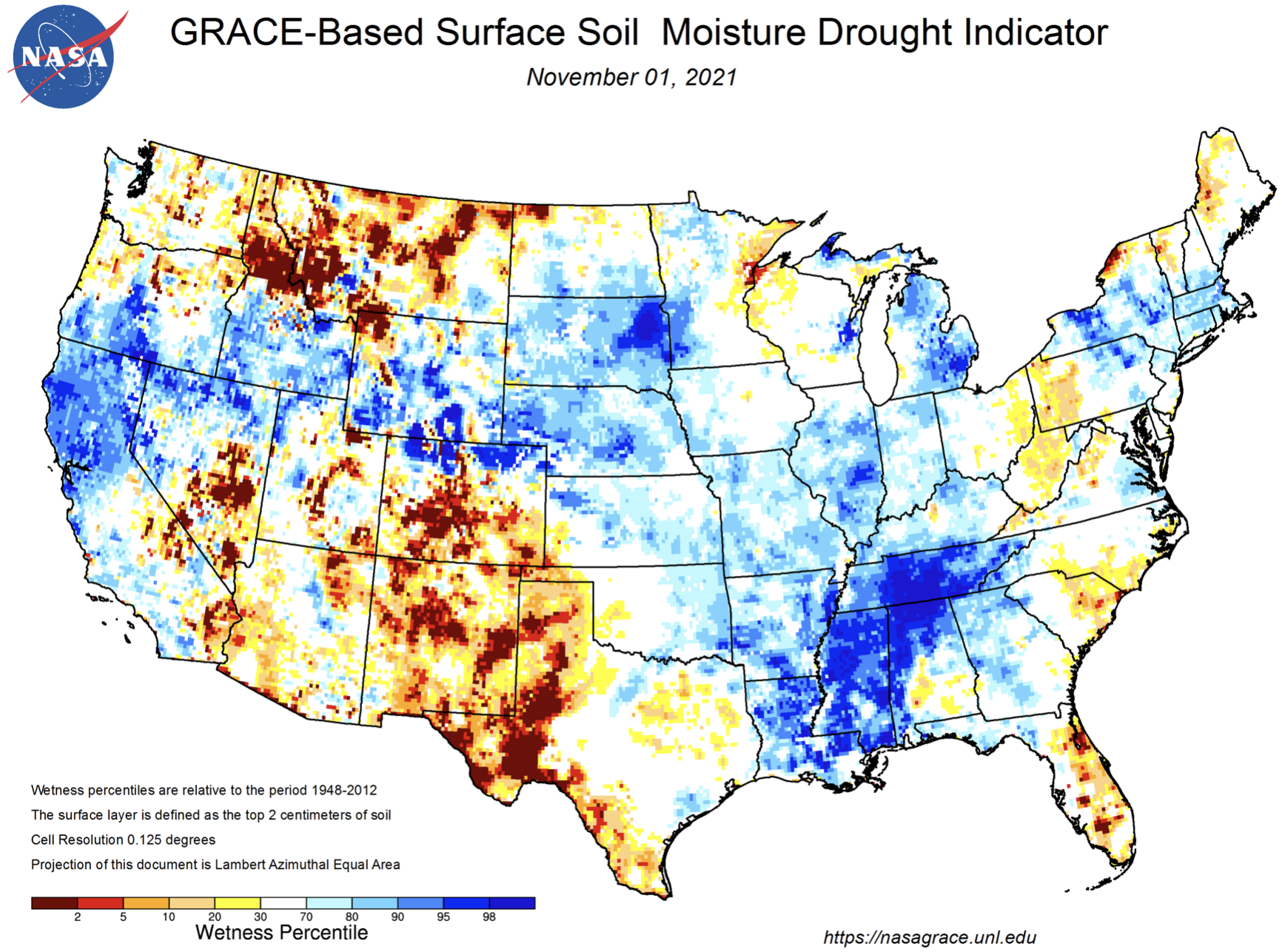
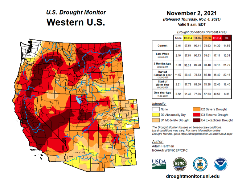
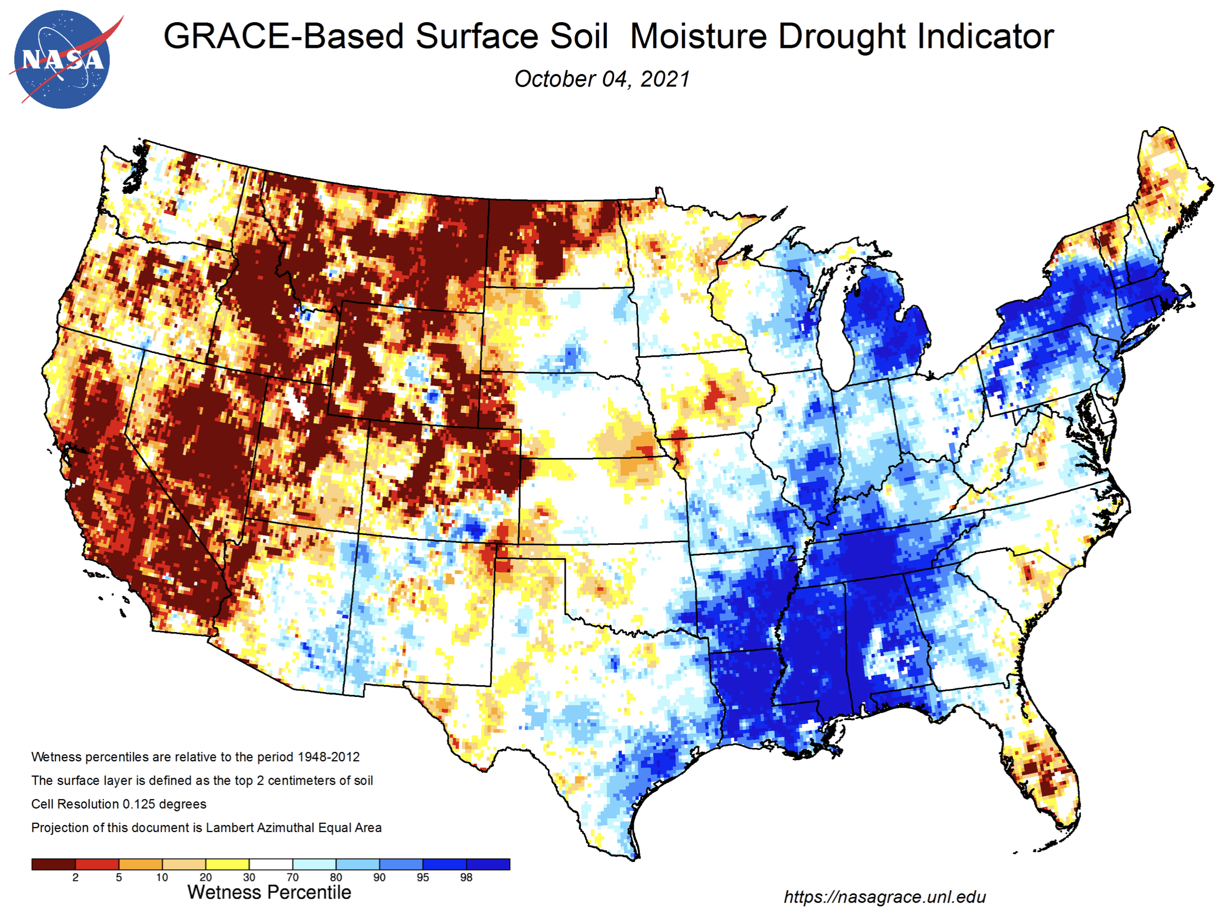
- Moderate drought emerged in eastern Colorado and central Wyoming during October and now covers nearly 90% of the region. Extreme drought conditions expanded in northern Wyoming, but coverage of extreme and exceptional drought in Utah and western Colorado contracted during October. A small area of extreme drought developed in northeastern Colorado. Surface soil moisture conditions improved dramatically over large areas of Utah, Wyoming and northern Colorado.
Image
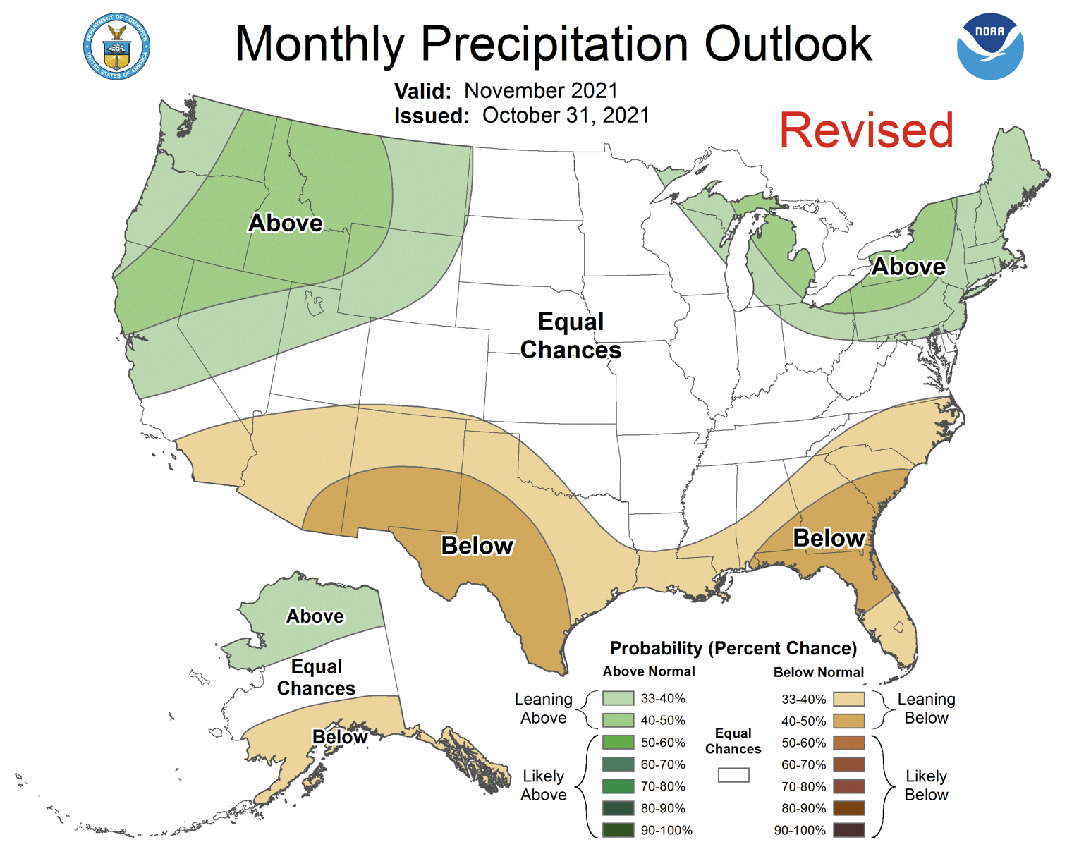
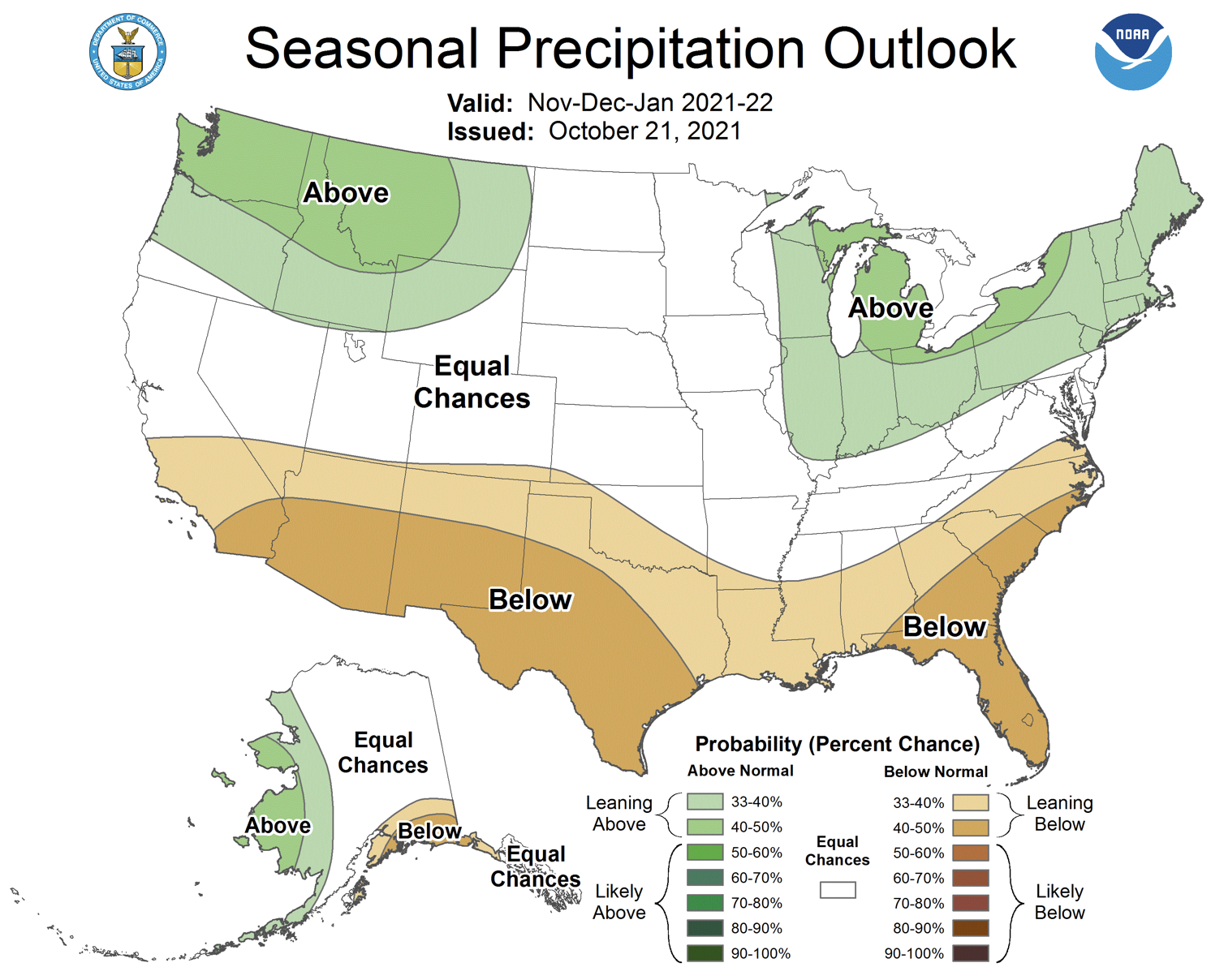
- La Niña conditions currently exist in the eastern Pacific Ocean as sea-surface temperatures are -0.8ºC below normal. There is an 80% probability of La Niña conditions persisting through January and a 60% chance of La Niña continuing through March. The NOAA seasonal forecast projects an increased probability for above average precipitation in northern Utah and Wyoming during November and in Wyoming during November – January. The NOAA seasonal forecast for November projects an increased probability of above average temperatures for the entire region and the November – January seasonal forecast projects an increased probability of above average temperature for Utah and Colorado.
Image
Image
Image
Image

- Significant October weather event. October precipitation was extremely high throughout much of Utah and Wyoming. Cities along the Wasatch Front, including Logan, Ogden, Provo and Salt Lake City observed the 3rd to 5th wettest October. In Wyoming, Lander observed the 3rd wettest October, and it was the 5th wettest October ever in Green River; in Lovell, Pinedale and Worland, October precipitation was in the top ten of all October observations. An important consequence of the wet October was a dramatic wetting of surface soil moisture conditions in Utah, Wyoming and northern Colorado. In northern and western Utah, many locations went from the driest on record to average and above average soil moisture conditions. Except for the Yellowstone Plateau, soil moisture conditions in Wyoming improved from near-record dry to much-above average wetness. Far northern Colorado also saw dramatic improvements to surface soil moisture conditions.
Image
Image