November 10, 2023 - CO, UT, WY
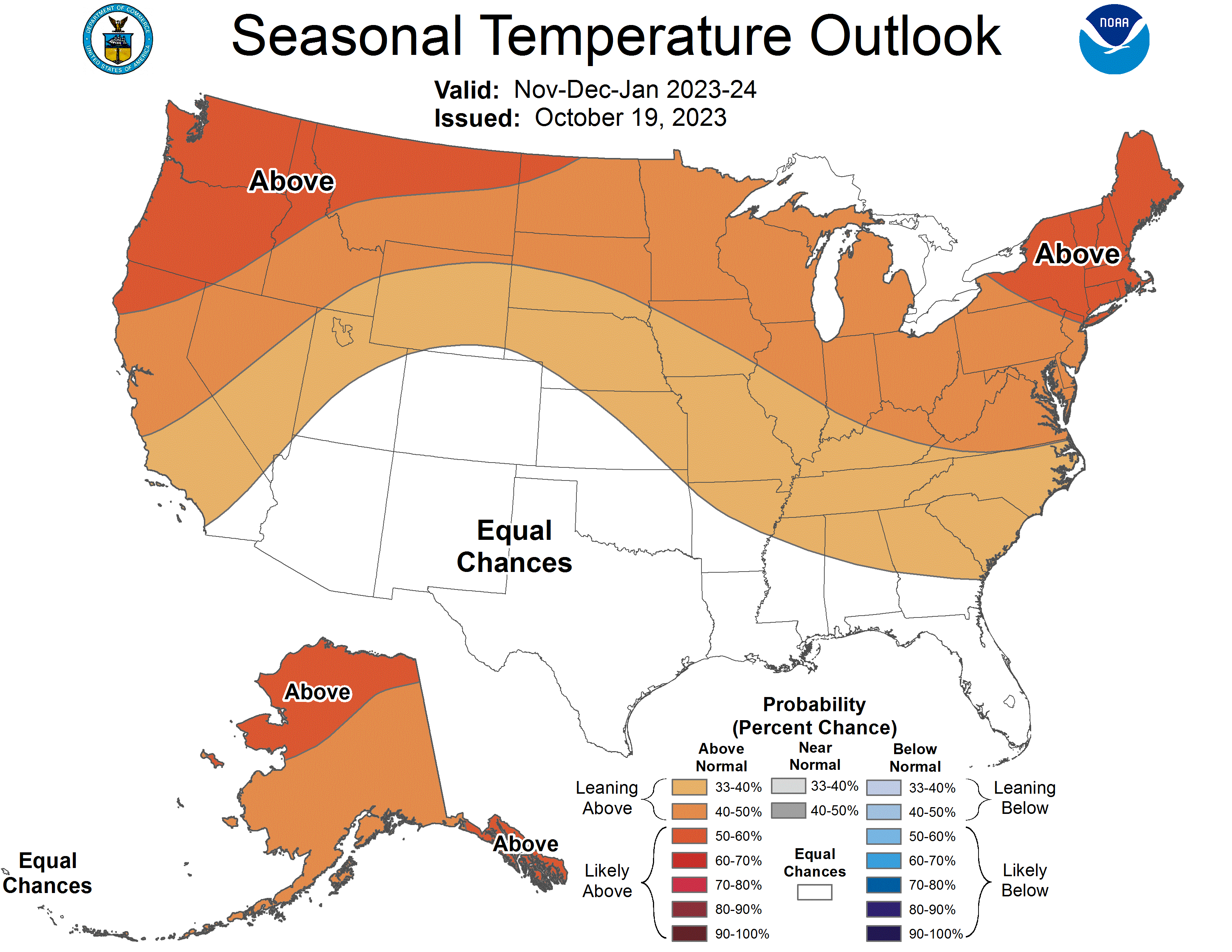
October precipitation varied throughout the region, generally with above normal conditions in Wyoming and below normal conditions in Colorado and Utah. October temperatures were near-normal across the region, leaning towards the warmer side overall. Regional snow-water equivalent (SWE) was mixed, with the greatest variance of much-above to much-below normal SWE in Utah. Drought conditions slightly expanded during October and at the end of the month, drought covered 11% of the region. El Niño conditions persisted during October and are expected to remain through late spring. NOAA seasonal forecasts for November suggest an increased probability of above normal temperatures and equal chances for precipitation for the region.
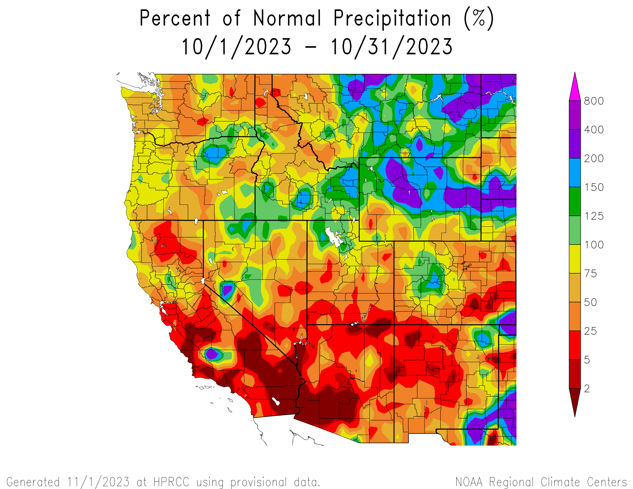
Regional precipitation during October was a mix of conditions, including much-above normal conditions in Wyoming and much-below normal conditions in Colorado and Utah. Greater than 200% of average precipitation was observed in large regions of Wyoming, including Park, Hot Springs, and Fremont Counties in the west and Johnson, Converse, and Niobrara Counties in the east, as well as Baca County in southeastern Colorado. Less than 25% of average precipitation was observed in pockets throughout the region, mainly in southern Utah and southeastern Colorado where pockets of less than 2% of average precipitation were observed. Above and below normal conditions were observed throughout the region, with Wyoming seeing more above normal conditions and Colorado and Utah seeing more below normal conditions overall.
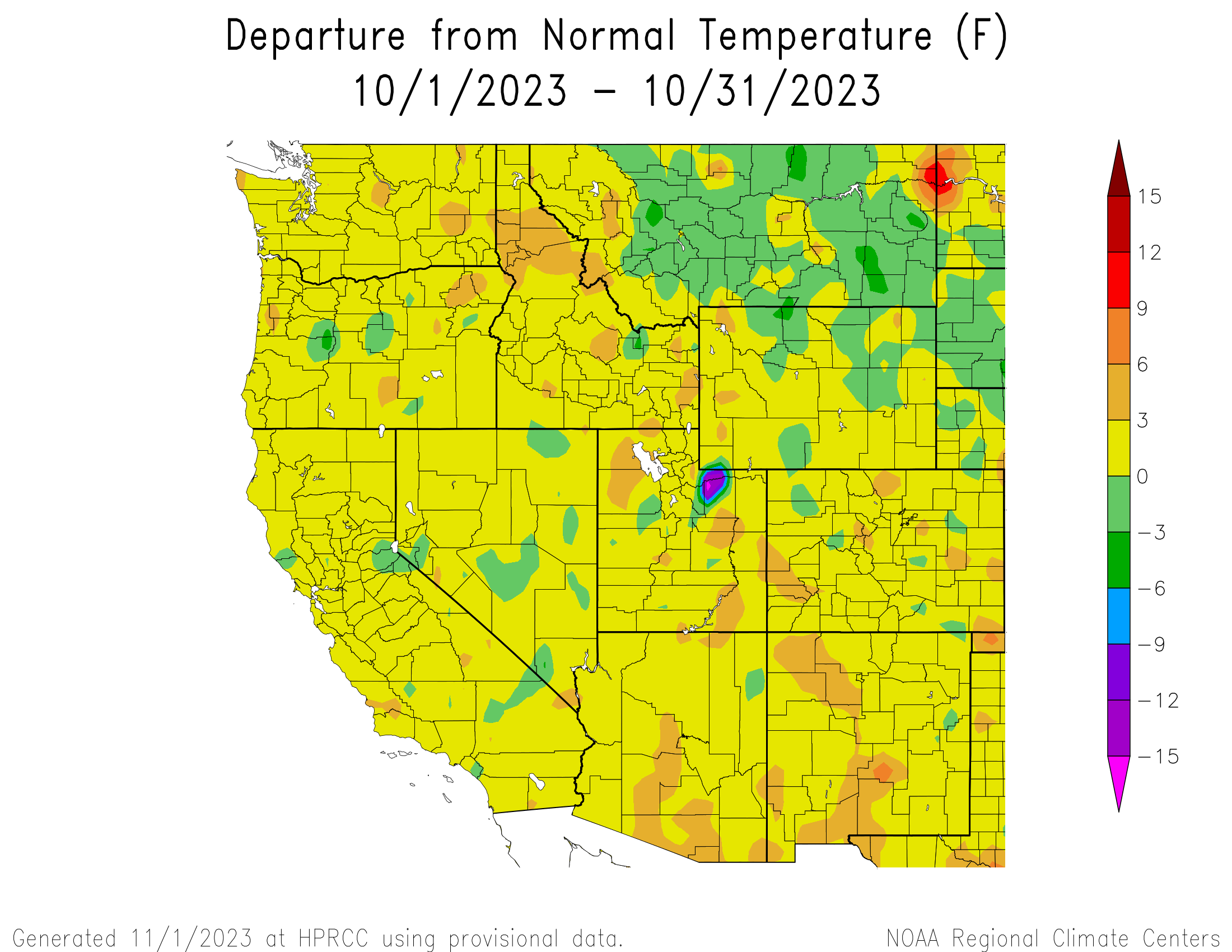
Regional temperatures were near-normal (+/- 3°F of average), mainly leaning slightly-above normal throughout. Many pockets of above normal temperatures (+ 3-6°F of average) were scattered throughout the region, particularly in Colorado and Utah. There was one anomalous pocket of much-below normal temperatures in Duchesne and Summit Counties in Utah, ranging from -9 to -15°F of average and below.
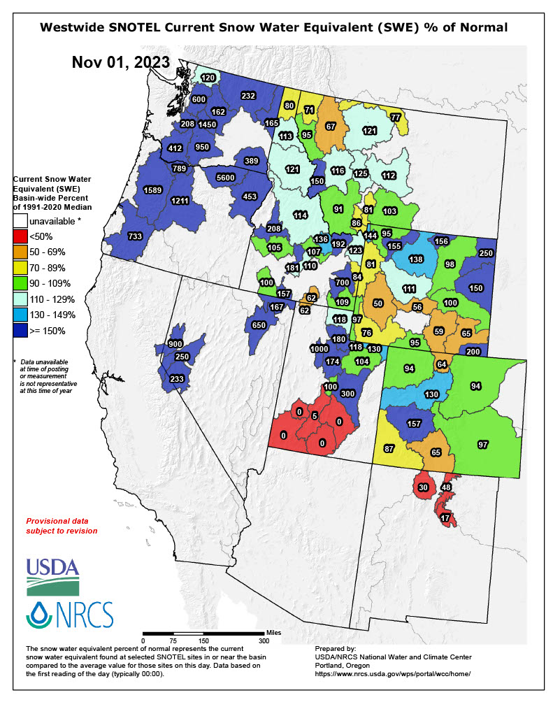
As of November 1, snow-water equivalent (SWE) conditions were mixed for the region, particularly in Utah with much-below normal SWE in the south and much-above normal SWE in the north. SWE was above normal in northern Utah, northern Wyoming, and the West Slope of Colorado, and below normal in southern Utah, southern Wyoming, and southwestern Colorado. In Colorado, most SNOTEL sites reported 1-2" of SWE with a high of 2.8” in Schofield Pass near Maroon Bells. In Utah, most SNOTEL sites reported 0-1" of SWE with a high of 1.4” at the Farmington site. Lastly, in Wyoming, most SNOTEL sites reported 1-4" of SWE with a high of 4.1” at the Blackwater site near Yellowstone Lake.
Note: Current SWE as a percent of normal maps are often skewed at this time of year due to the very low average SWE this early in the season.
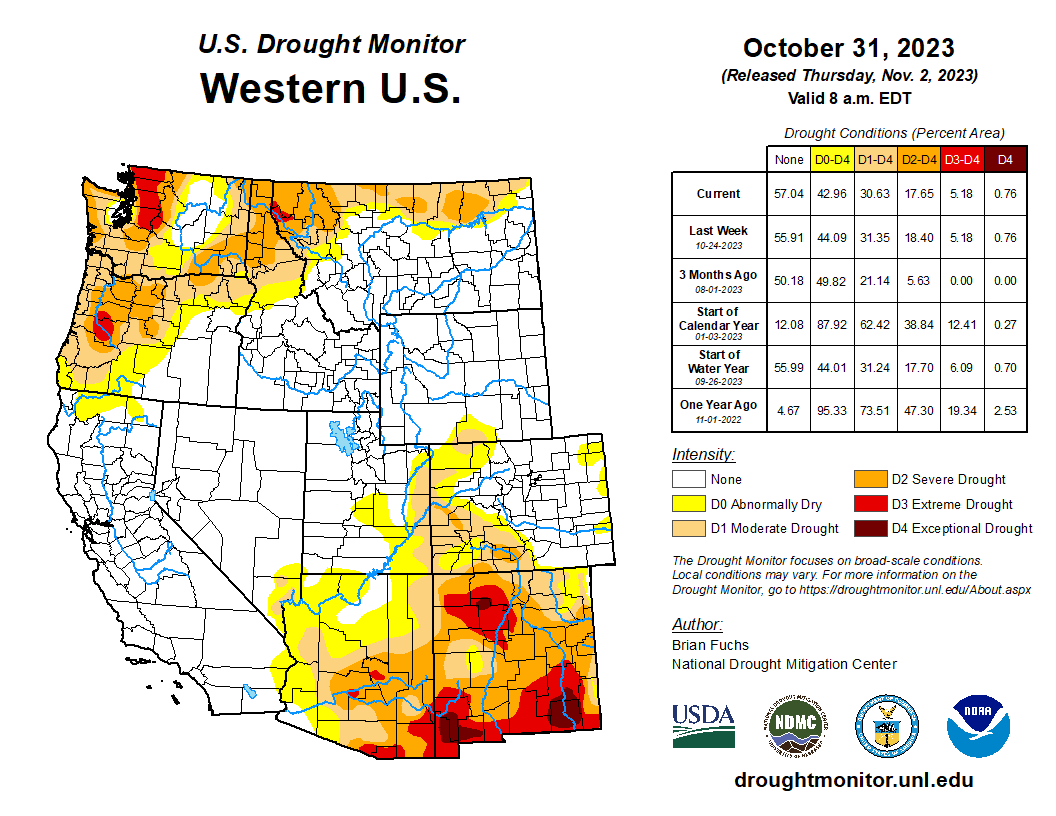
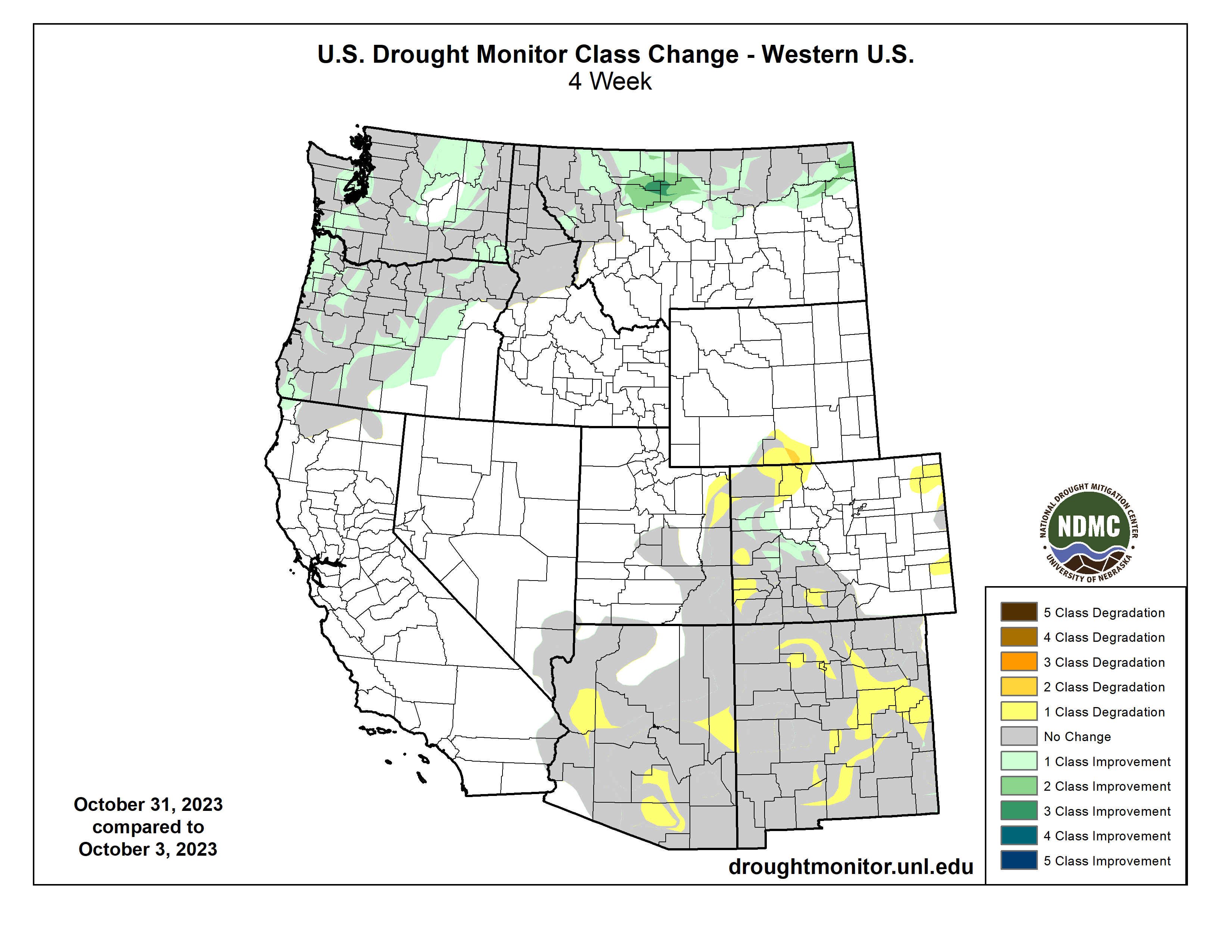
At the end of October, drought covered 11% of the region, a 3% increase from late September. Wyoming is no longer drought-free with D1 moderate drought development in Carbon and Sweetwater Counties. In Utah, there was a 1-category degradation in drought conditions in Uintah County. In Colorado, there was a mix of 1-category degradations in drought conditions in the Eastern Plains and the northwest and southwest, and 1-category improvements on the West Slope.
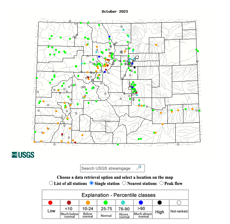
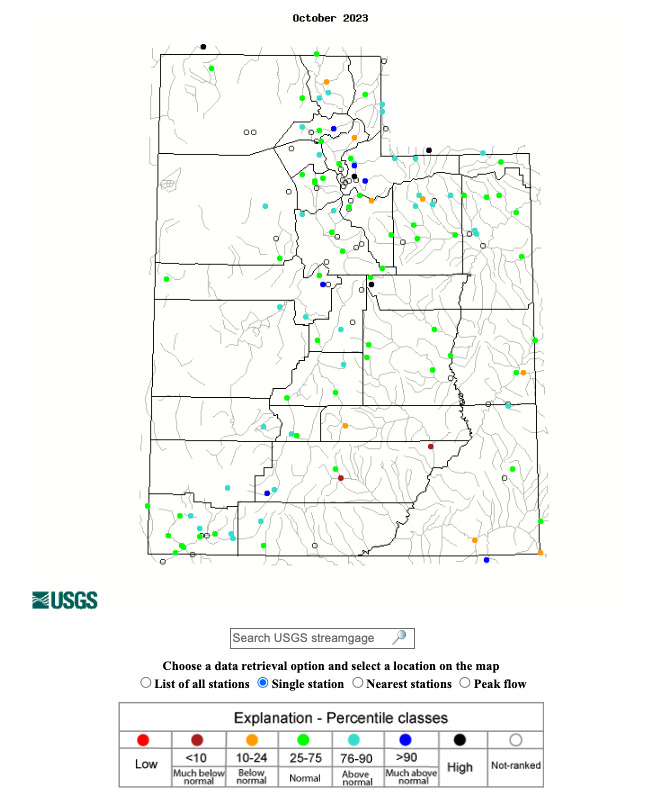
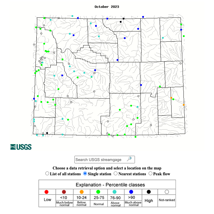
October streamflow conditions in the Upper Colorado River Basin were above normal in the Upper and Lower Green River Basin, near-normal in the White-Yampa River Basin, and below normal in the Colorado River Headwaters, Gunnison, Dolores, and San Juan River Basins. Most locations in the Utah portion of the Great Basin experienced normal to much-above normal streamflow conditions. Rivers in Wyoming also experienced normal to above normal streamflow conditions with much-above normal conditions in the Big Horn, Tongue, and Powder River Basins.
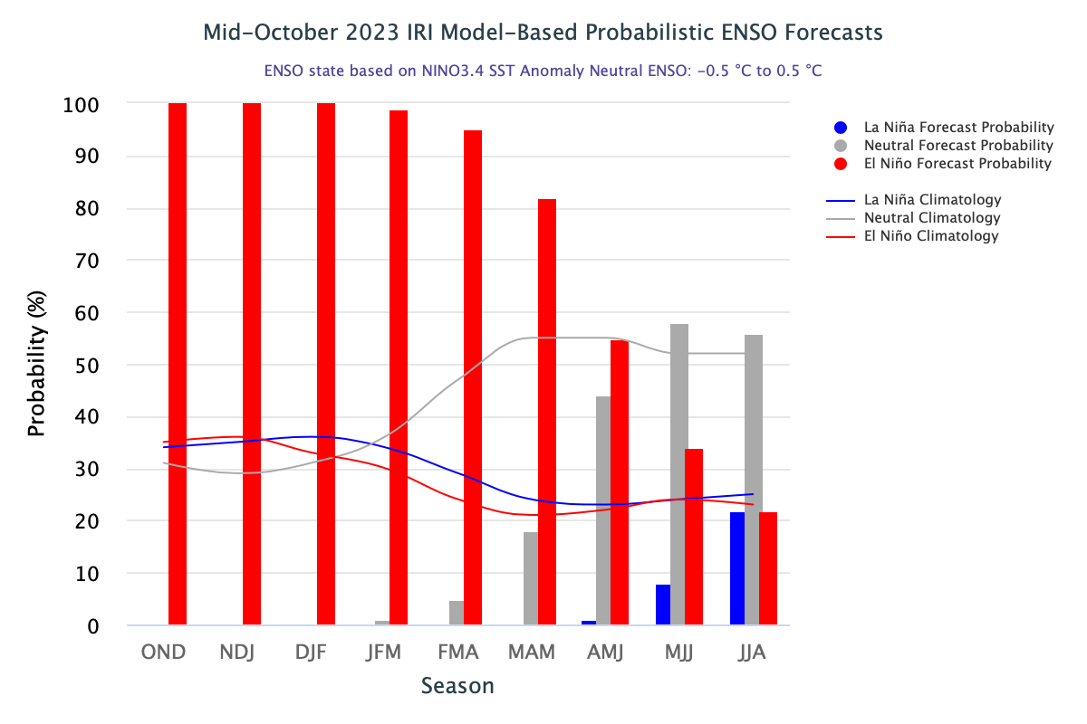
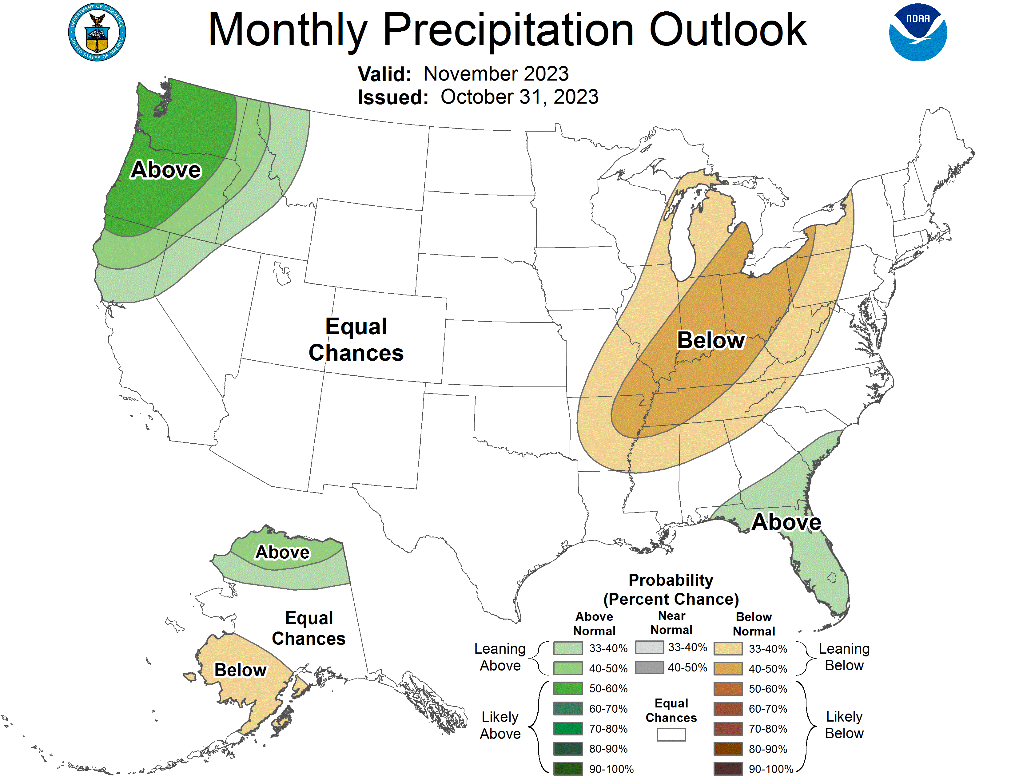
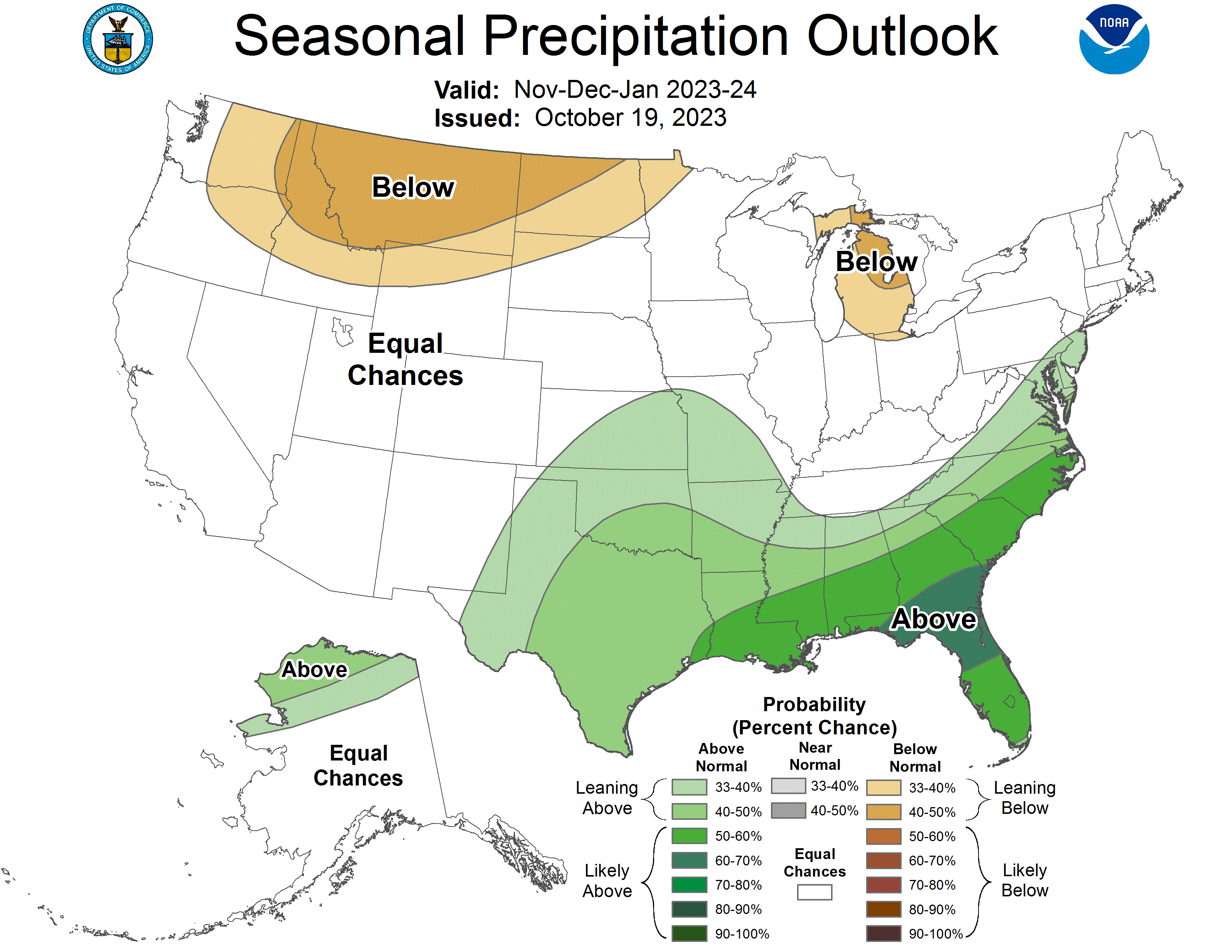
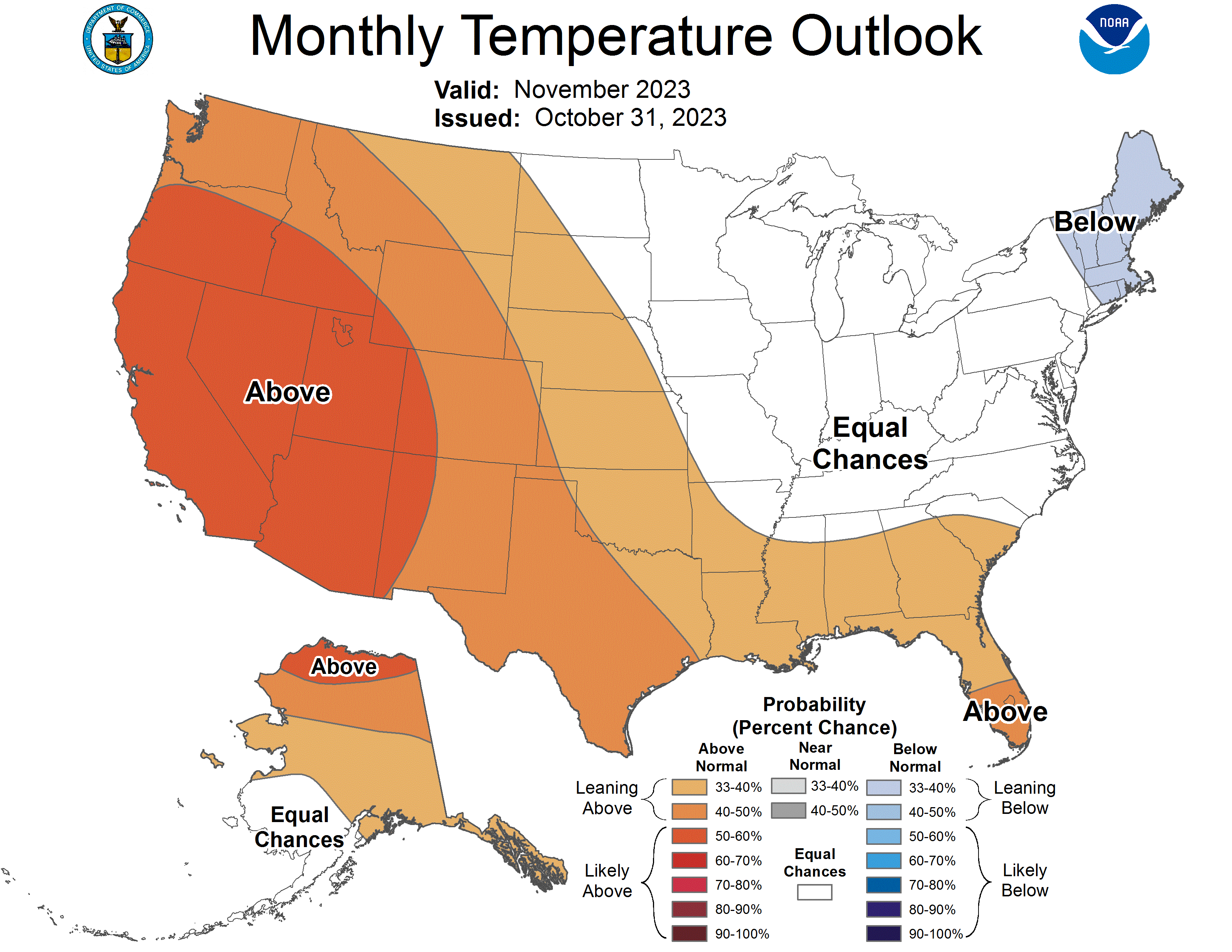
An El Niño advisory remained in place through October as above average sea-surface temperatures occurred across the equatorial Pacific Ocean and temperature anomalies increased in the central and east-central Pacific. El Niño conditions are projected to remain in place through late spring as there is greater than an 80% chance of El Niño conditions continuing through the March-May forecast period. The NOAA monthly temperature outlook for November suggests an increased probability of above average temperatures for the region, with a 40-50% chance of above normal conditions for the majority of Colorado and Wyoming and a 50-60% chance of above normal conditions for all of Utah. The NOAA seasonal precipitation outlook for November-January suggests below normal conditions for northern Wyoming and the seasonal temperature outlook for November-January suggests above normal conditions for northern and western Utah and the majority of Wyoming.
Significant October weather event. Halloween weekend snowstorm. From October 28-29, a stalled jet streak over Colorado coupled with the coldest air of the season caused scattered bands of heavy snow to develop throughout the state. Thanks to this storm, Denver received its first snowfall of the season, with up to 8” of snow. Many areas in the Denver metro area received more than 8” of snow, including Aurora at 10.4”, Englewood at 10.2”, and Cherry Creek Reservoir at 9.5”. Castle Rock received 12.5” of snow and Colorado Springs received 11”. Other locations receiving heavy snow included Eldora with 14”, Estes Park with 13”, and Evergreen with 11.5”. The heaviest snow totals were recorded in the central mountains, with a high of 24” just north of Crested Butte in Gothic. Crested Butte received 19", Copper Mountain received 16.9”, Breckenridge received 16”, and Silverthorne received 15.6”.
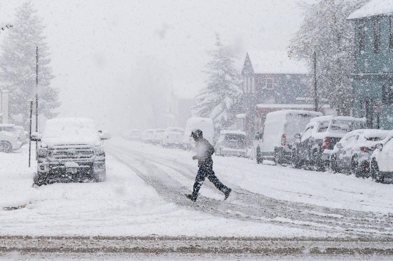
Snow in Leadville. October 28, 2023. Photo credit: Hart Van Denburg/CPR News.