May 9, 2024 - CO, UT, WY
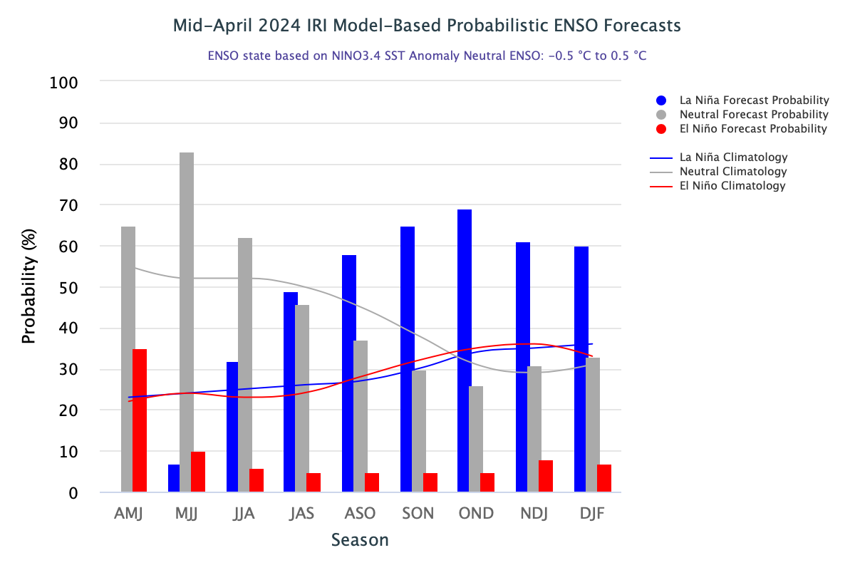
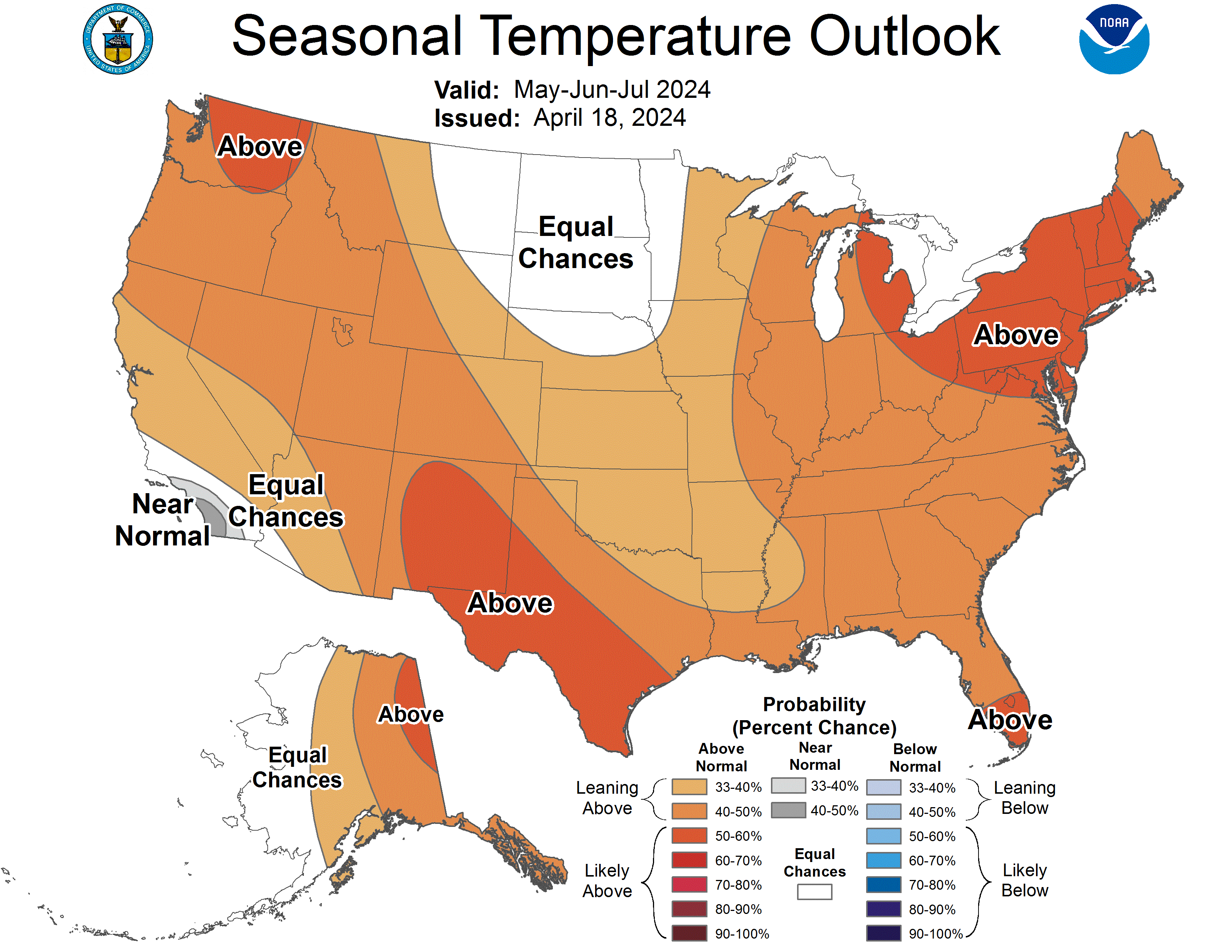
The region experienced generally below normal precipitation and above normal temperatures in April. May 1st snow-water equivalent (SWE) was near-normal in Colorado (92%) and Utah (103%) and slightly below normal in Wyoming (88%). Seasonal streamflow volume forecasts are mostly below to near-normal in the region with above normal forecasts in northern Utah. Regional drought conditions improved and cover 10% of the region. El Niño conditions are transitioning to neutral-ENSO conditions and there is an 83% chance of neutral-ENSO conditions for May-July. The NOAA seasonal temperature outlook for May-July suggests an increased probability of above normal temperatures for the majority of the region.
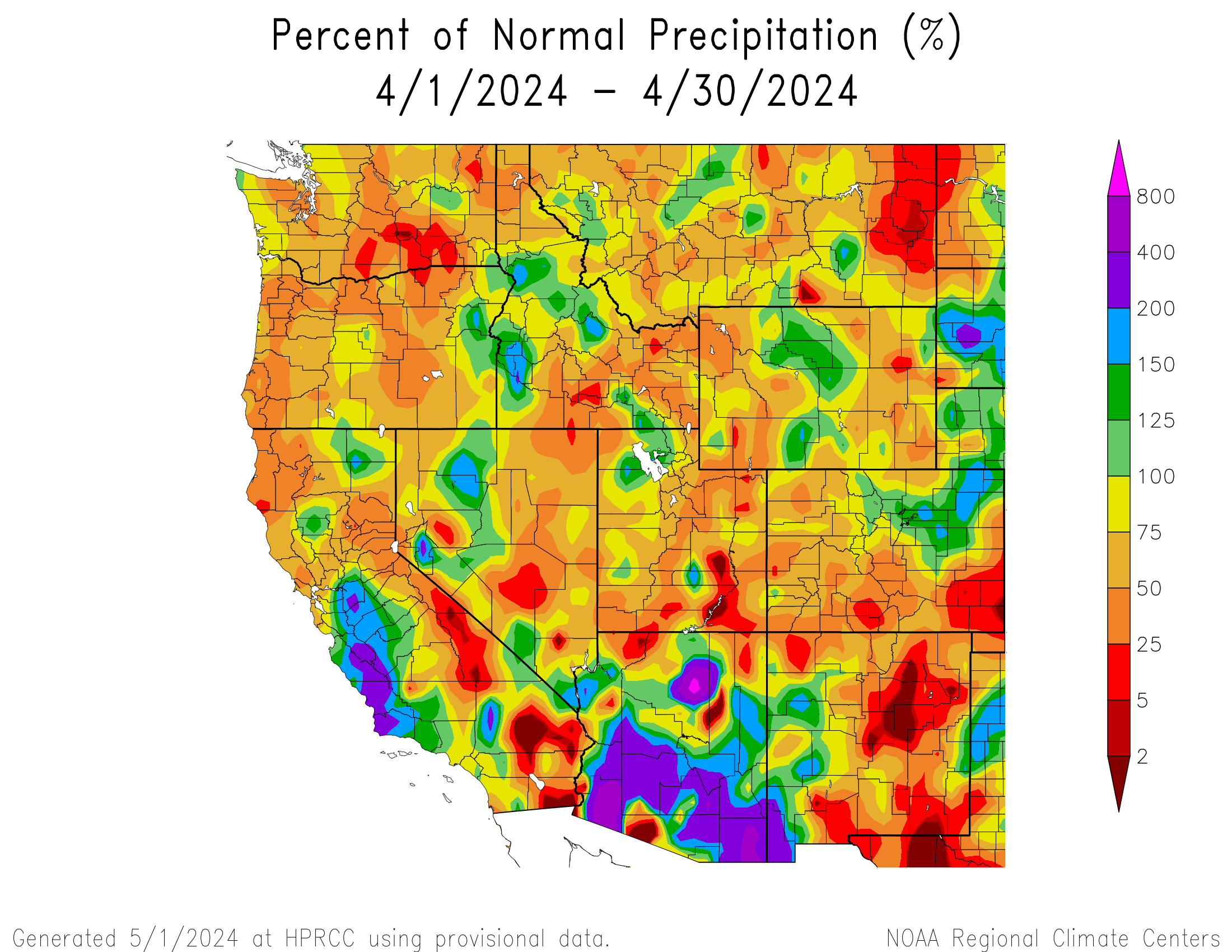
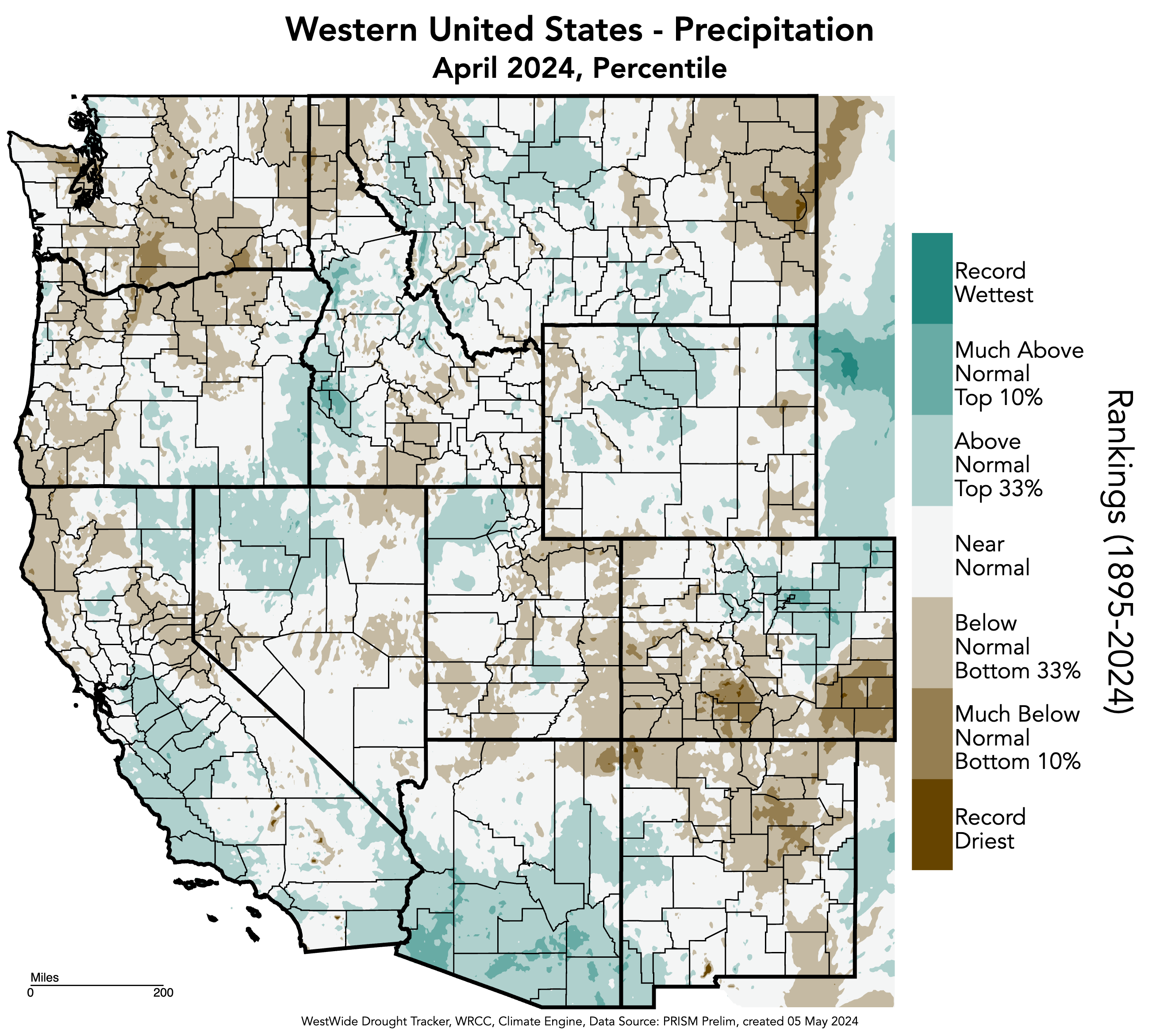
April precipitation was generally below normal across the region with large swathes of above normal precipitation in northern Utah around the Great Salt Lake, north and south-central Wyoming, and from the Front Range to northeastern Colorado. Areas of less than 25% of normal precipitation occurred in southeastern Utah and southeastern Colorado with small pockets of less than 2% of normal precipitation in Emery and Wayne Counties in Utah as well as the northern Lake Powell region, and Baca and Prowers Counties in Colorado. Small pockets of more than 150% of normal precipitation occurred west of the Great Salt Lake and in Wayne County in Utah, east of the Denver Metro in Adams and Elbert Counties in Colorado, and in Sweetwater County in Wyoming. A large area of more than 150% of normal precipitation occurred in northeastern Colorado. Large areas of much-above (top 10%) and small areas of much-below (bottom 10%) normal precipitation for the month of April were observed in Colorado.
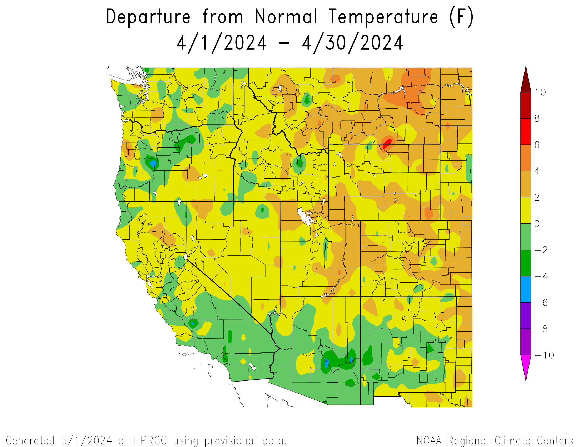
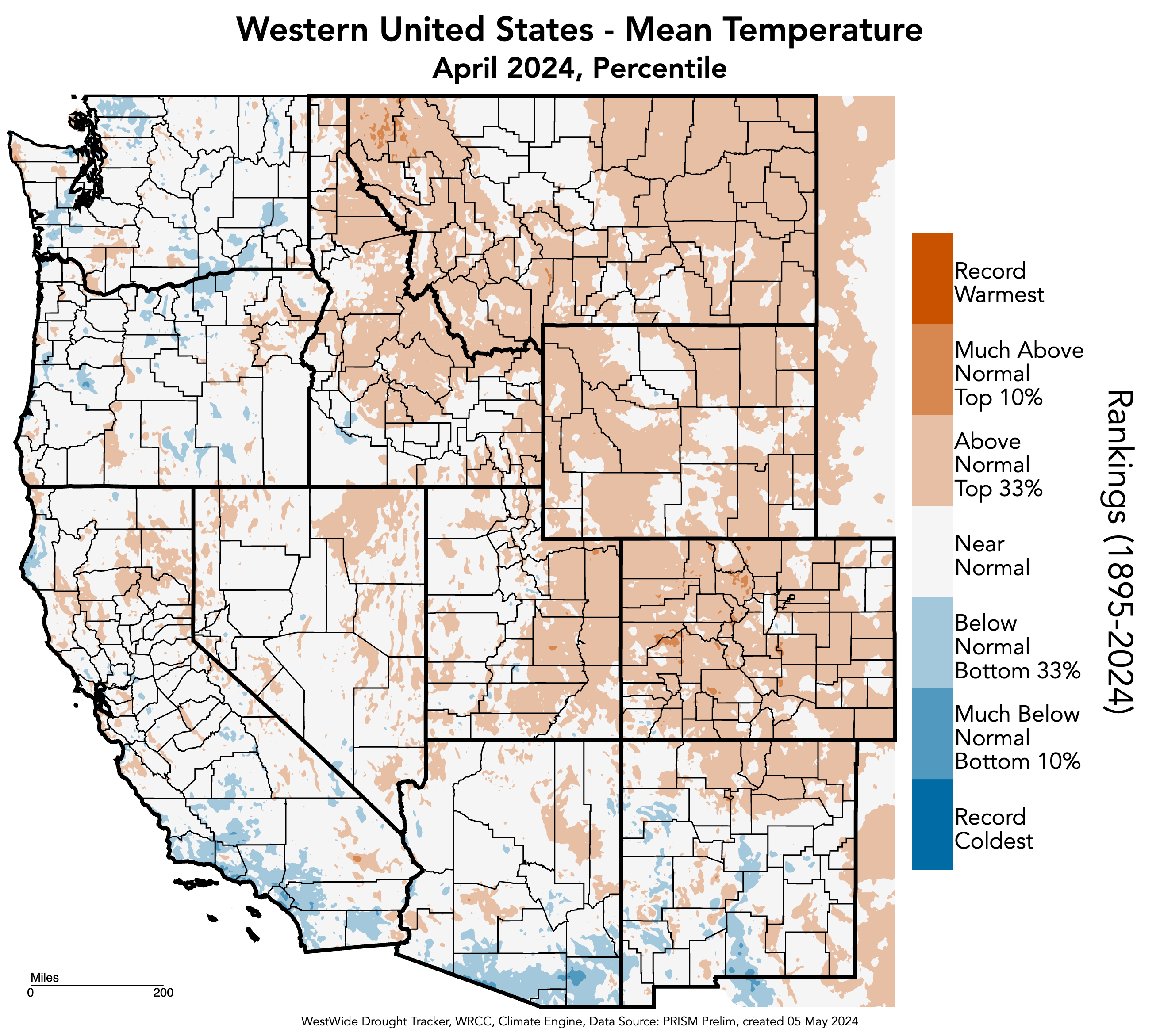
Regional temperatures were slightly above (0 - 2°F) to above (2 - 4°F) normal in April. Small pockets of slightly below (-2 - 0°F) normal temperatures occurred mostly in central Utah and southern Colorado. Small pockets of above (4 - 6°F) normal temperatures occurred in Laramie and Sheridan Counties in Wyoming, with a pocket of 6 - 8°F above normal temperatures in Sheridan County. Small areas of much-above (top 10%) normal temperatures for the month of April were observed in Colorado.
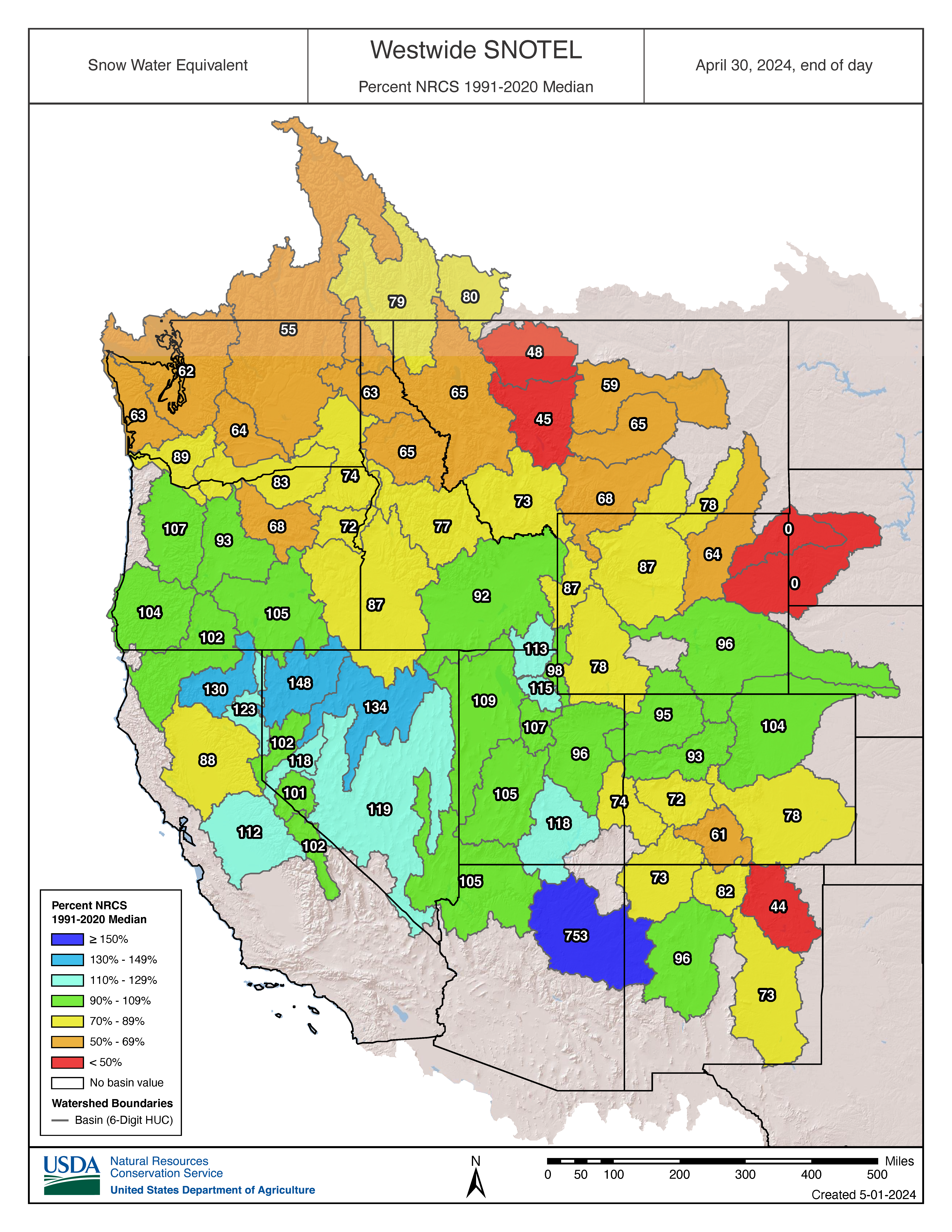
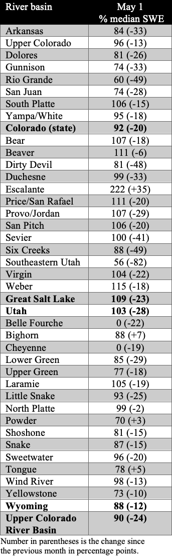
Regional snowpack ranged from much-below (<50%) normal conditions in northeastern Wyoming to above (110-129%) normal conditions in northern and southern Utah. Below normal conditions occurred in northern and western Wyoming and southern Colorado. Near-normal conditions occurred throughout most of Utah, southeastern Wyoming, and northern Colorado. As of May 1st, statewide percent median snow-water equivalent (SWE) was 92% in Colorado, 103% in Utah, and 88% in Wyoming. The Escalante Basin in Utah had the highest percent median SWE at 222% by end of day on April 30. The basins with the lowest percent median SWE were the Belle Fourche and Cheyenne Basins at 0% since they melted out. Peak SWE was observed on April 9 for Colorado (16.7 in), April 2 for Utah (18.8 in), and April 11 for Wyoming (16.2 in).
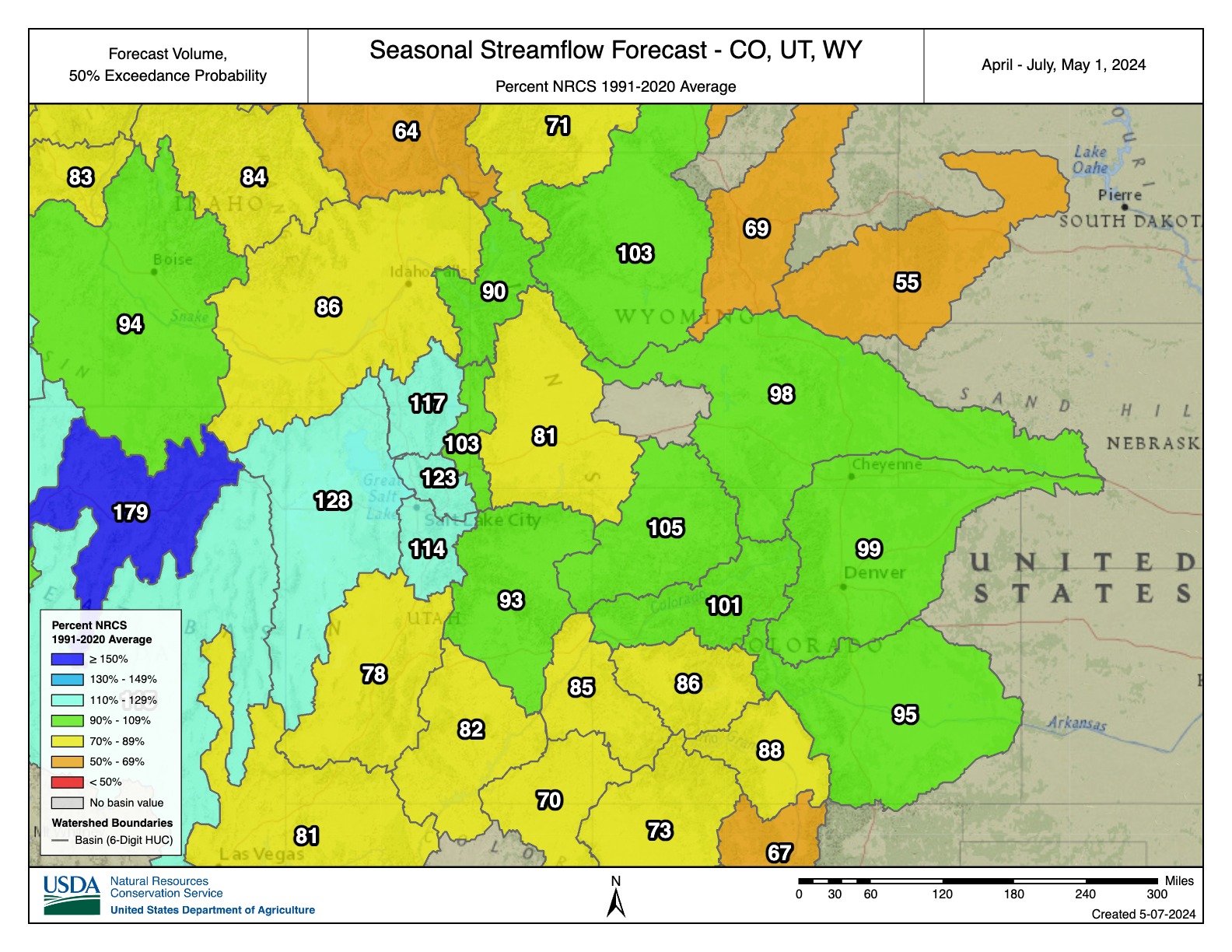
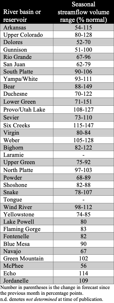
Regional April-July streamflow volume forecasts are mostly below (70-89%) normal to near-normal, with forecasts of 50-69% of normal streamflow in northeastern Wyoming including the Powder and Cheyenne Basins, according to the NRCS, and at many sites in southwestern Colorado including the San Juan, Gunnison, and Upper Colorado-Dolores Basins, according to the CBRFC. There are above (110-129%) normal streamflow forecasts for the basins surrounding the Great Salt Lake, with CBRFC sites forecasting 130-150% of normal streamflow in the Lower Bear, Weber, and Jordan Basins, as well as one site in the Lower Green Basin with a forecast of 150-200% of normal streamflow. The forecast for the inflow to Lake Powell is 80% of average, which is down 9% from the April 1st forecast.

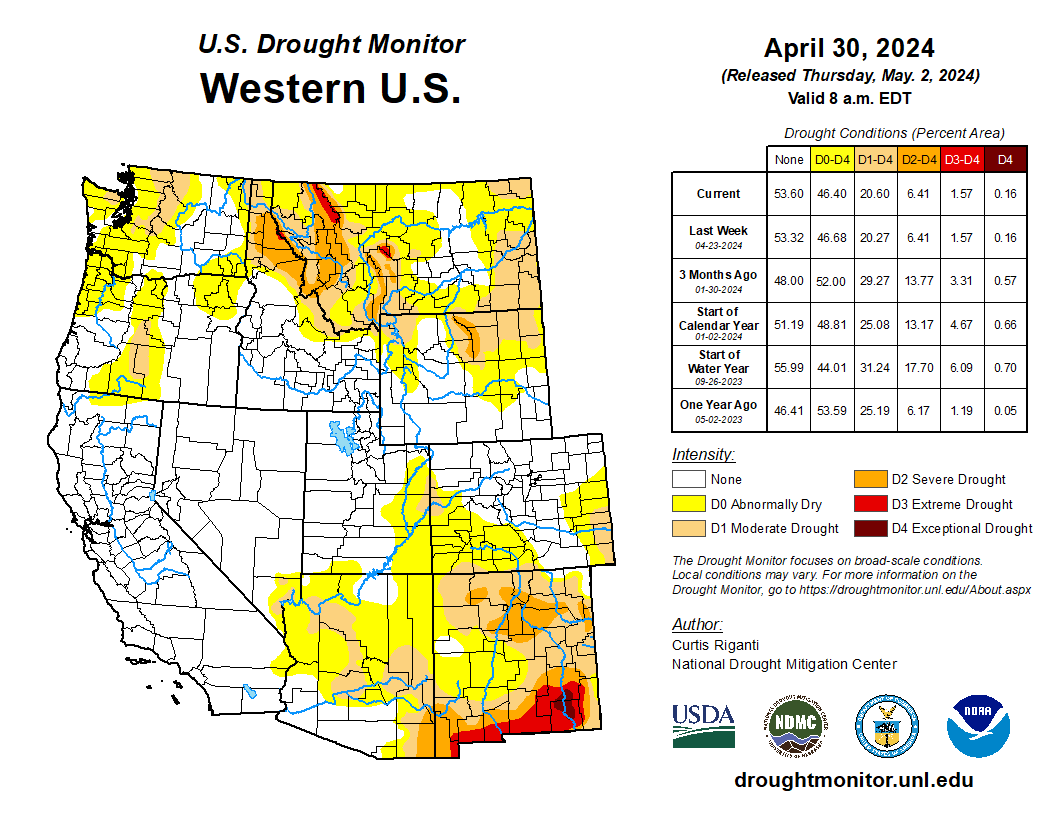
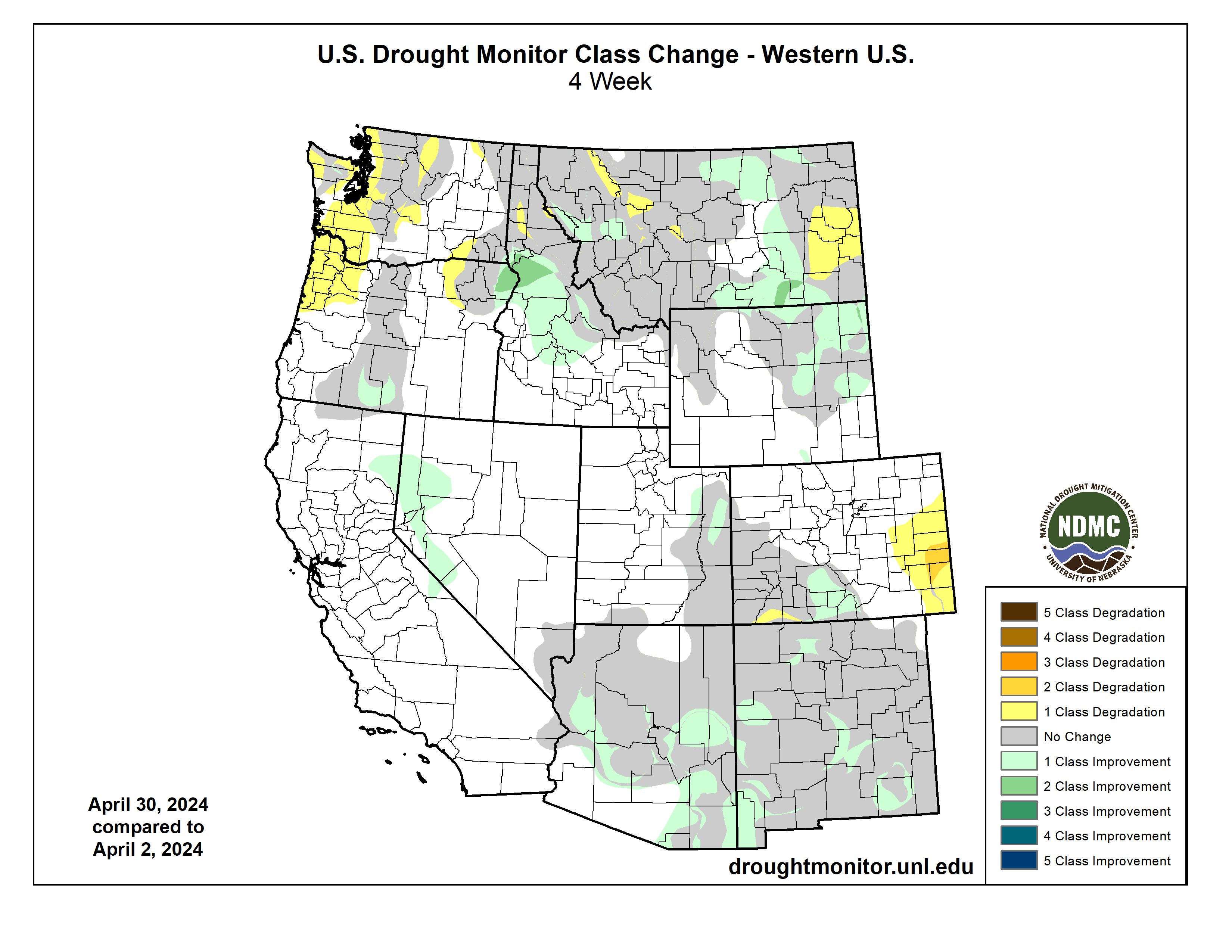
Regional drought conditions improved in April and now cover 10% of the region, a 2% decrease in drought coverage since the end of March. Severe (D2) drought improved in northeastern Wyoming and moderate (D1) drought improved in south-central Colorado, while D1 drought developed in southeastern Colorado.
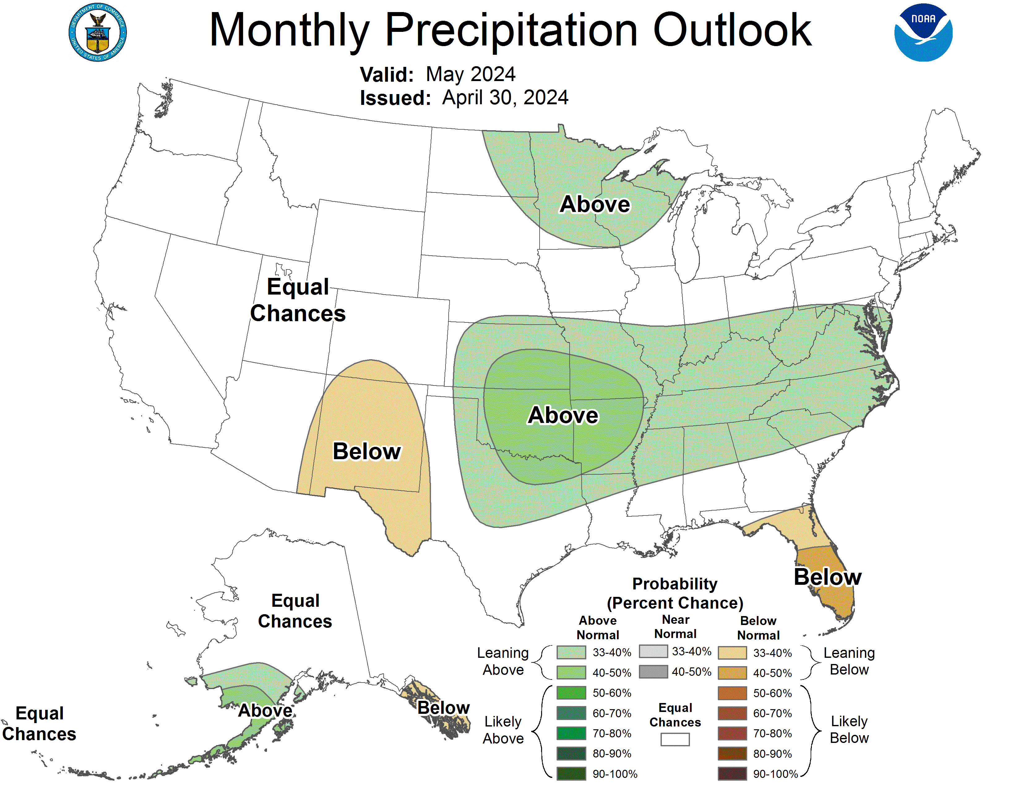
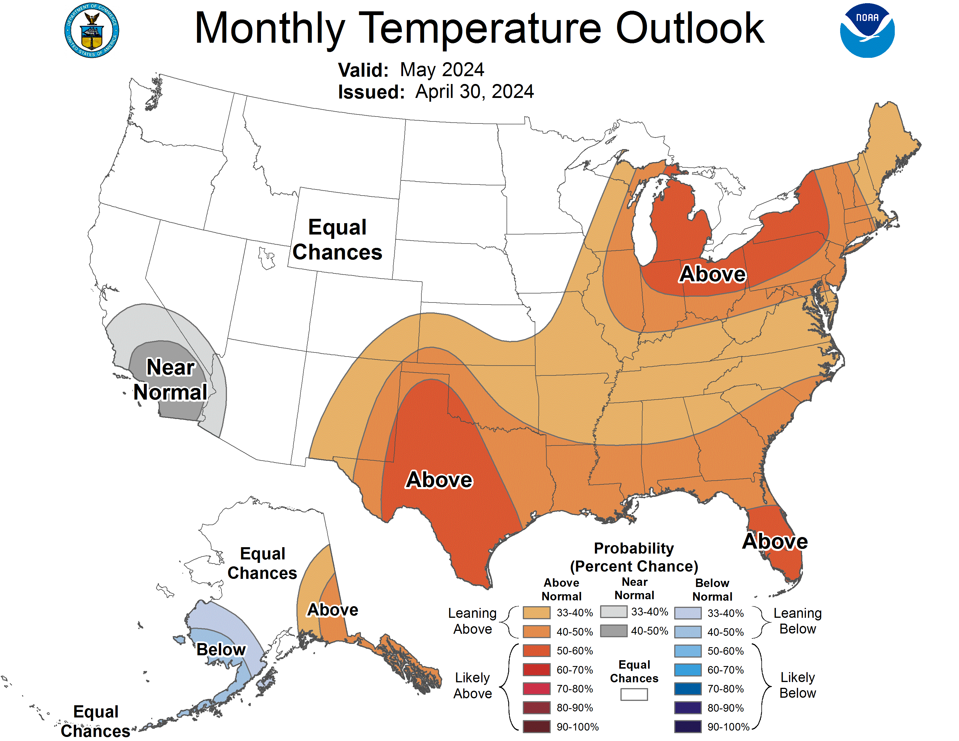
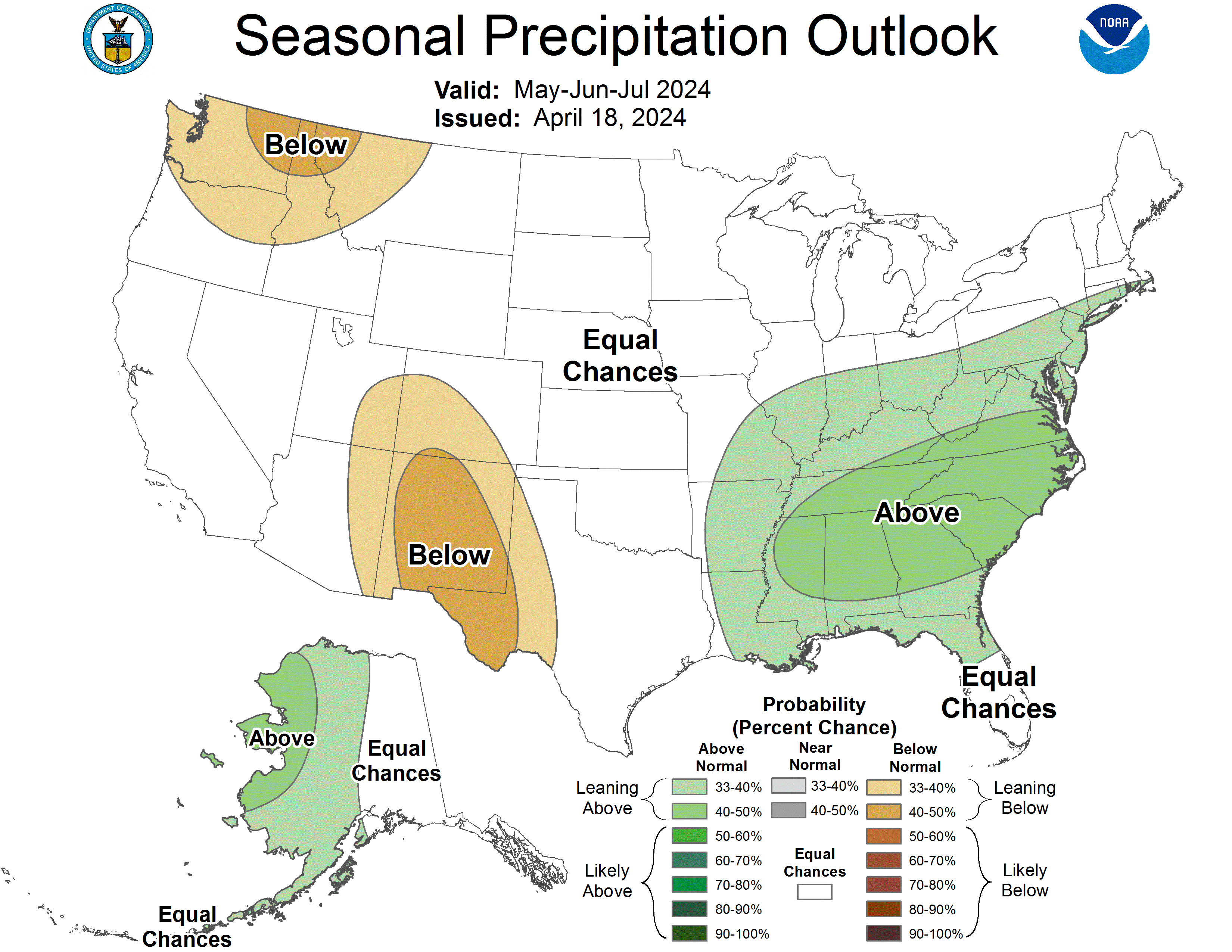
As of mid-April, El Niño conditions are transitioning to neutral-ENSO (El Niño Southern Oscillation) conditions in the Pacific Ocean. There is an 83% chance of neutral-ENSO conditions by May and a 49% chance of La Niña conditions developing by July. The NOAA precipitation and temperature outlooks for May suggest an increased probability of below (33-40%) normal precipitation for southern Colorado and above (33-40%) normal temperatures for southeastern Colorado. The NOAA seasonal precipitation and temperature outlooks for May-July suggest an increased probability of below normal precipitation for southeastern Utah and a majority of western and southern Colorado, and above normal temperatures for almost the entirety of the region with 40-50% above normal conditions for all of Utah, western and southern Wyoming, and western, central, and southern Colorado.
Significant April weather event: Northern Colorado windstorm. An exceptionally strong storm moved through northern Colorado from April 6-7. During this period, strong and destructive winds affected the mountains, foothills, and northeastern plains. Wind speeds in the Front Range mountains and near the foothills peaked between 70 to 95 mph, with the highest recorded gust reaching 97 mph at the NCAR Mesa Lab in Boulder and a close second of 96 mph in Coal Creek Canyon in Jefferson County. Across the northeastern plains, the most intense winds occurred along and north of a line extending from Denver to Fort Morgan to Akron, with wind gusts of 60 to 80 mph. Numerous instances of downed trees, power poles, and minor damage were reported in areas with the strongest winds. Xcel Energy said over 155,000 customers experienced power outages at the height of the storm from a combination of proactive public safety shutoffs and power outages caused by damage from the high winds, with most of these occurring in and around the Denver Metro.
Here are the locations that saw the highest wind gusts from April 6-7, according to NWS:
- NCAR Mesa Lab, Boulder, 97 mph
- Coal Creek Canyon, Jefferson, 96 mph
- 3 NW Marshall, Boulder, 95 mph
- Buckeye, Larimer, 93 mph
- 3 ESE Buckeye, Larimer, 91 mph
- 2 ENE Copper Mountain, Summit, 91 mph
- Rocky Flats Hwy 93 and 72, Jefferson, 90 mph
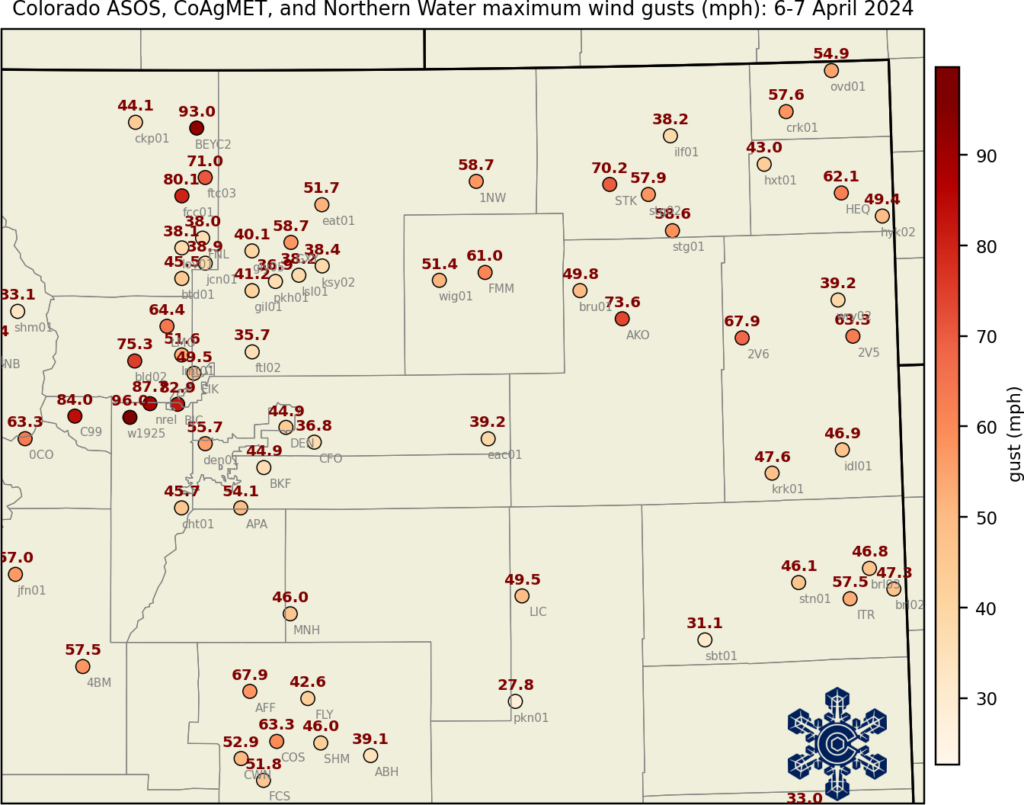
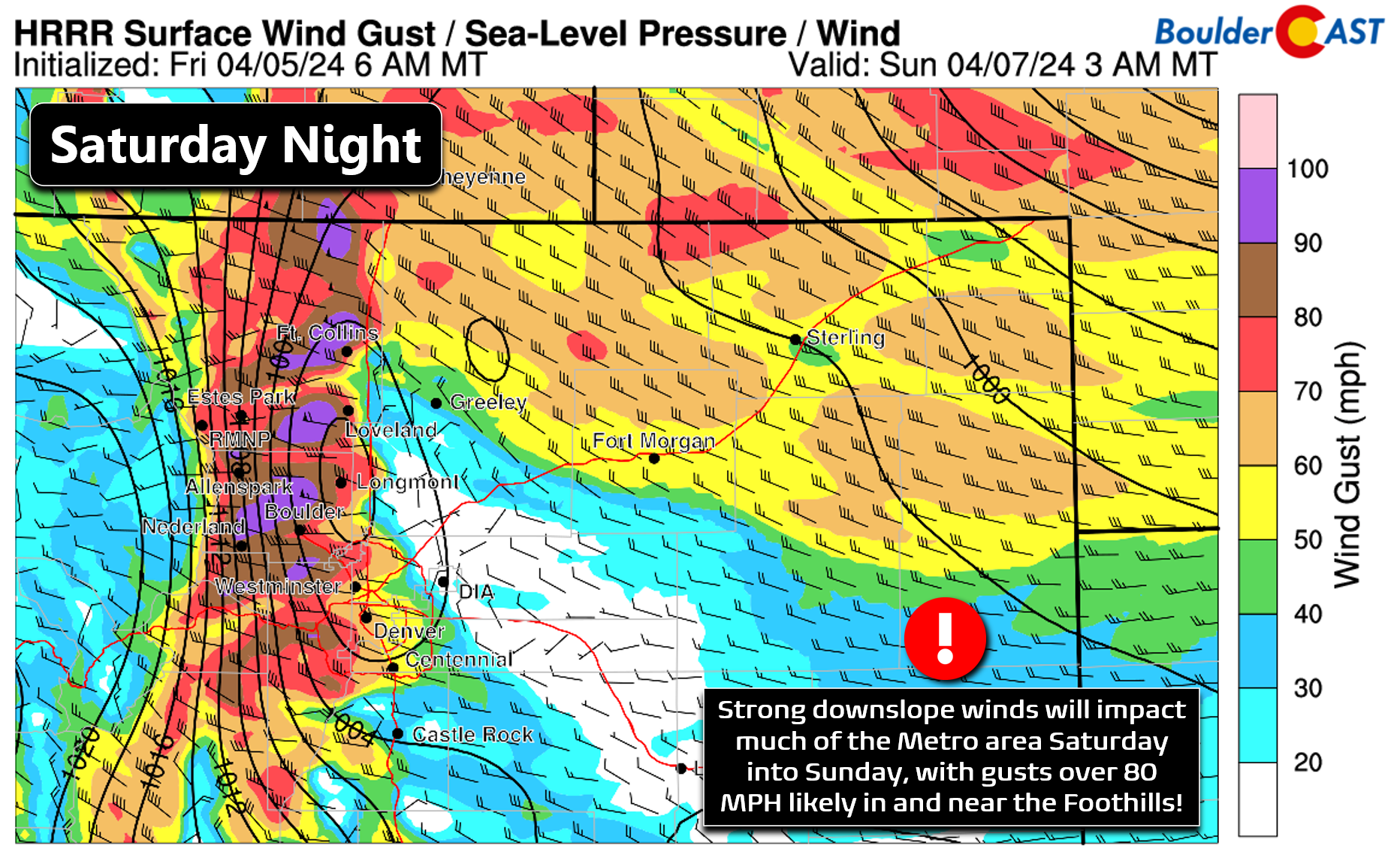
Image credits: (Left) Colorado Climate Center. (Right) BoulderCAST.