March 7, 2025 - CO, UT, WY
Northern Colorado, northern Utah and western Wyoming received above average February precipitation resulting in near average SWE conditions on March 1 for those regions. High temperatures and low precipitation in February led to below average SWE conditions in southern Colorado, southern Utah and northeastern Wyoming. Seasonal streamflow volume forecasts are below to much below average for all Colorado and Great Basin rivers except the headwaters of the Colorado and Yampa Rivers. Regional drought coverage in late February remained at 56% of the region with extreme drought persisting in southwestern Utah, and parts of Wyoming.
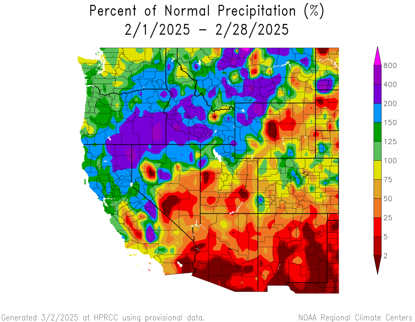
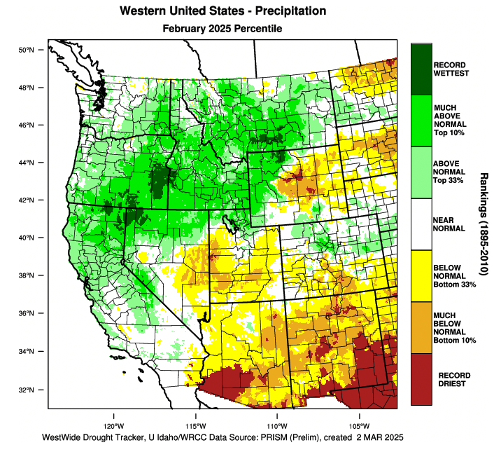
February precipitation was near to above average in northern Utah, western Wyoming and the northern Colorado mountains. The remainder of the region experienced below to much-below average February precipitation with much of central and southern Utah, central Wyoming and parts of southern Colorado seeing less than 50% of average monthly precipitation. Portions of northern Utah and western Wyoming received greater than 150% of average precipitation. Interestingly, isolated areas of northern Wyoming, separated by a mere hundred miles, experienced record wet and record dry February conditions.
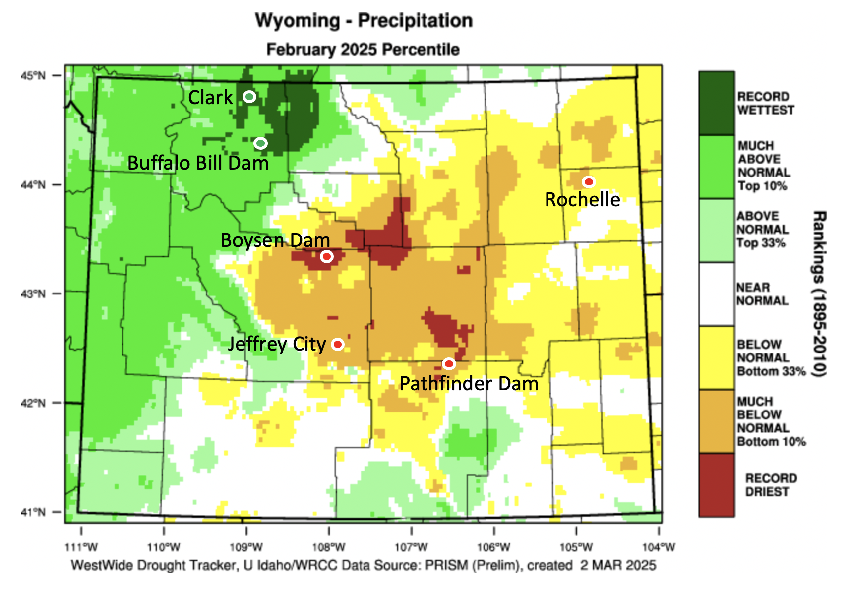
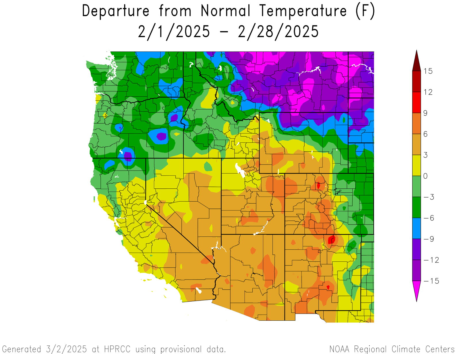
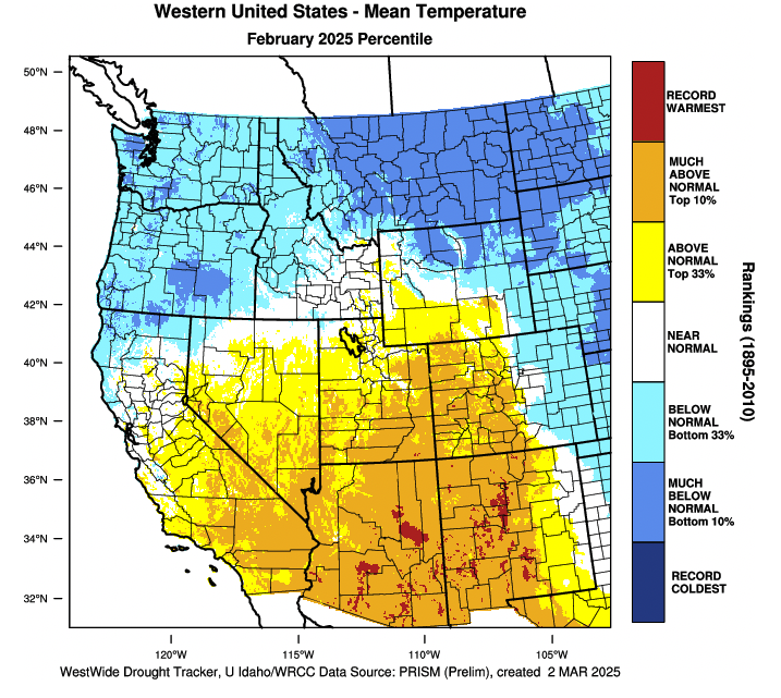
February temperatures were above average in the western portion of the region and below average over the Eastern Plains of Colorado and Wyoming. February temperatures were generally 3-6 degrees above average in Utah and record hot February temperatures were observed in Bullfrog Basin near Lake Powell and in Provo. In Colorado, West Slope February temperatures were 3-9 degrees above average and Alamosa experienced a record hot February. Eastern Colorado temperatures were up to 6 degrees below average. In Wyoming, the southwestern portion of the state experienced temperatures up to 9 degrees above average and northern Wyoming was extremely cold with temperatures 9 to 15 degrees below average. In Afton, Riverton and Shoshoni, February average maximum temperatures were the coldest on record.
Strong storms in early and mid-February led to increases in snow water equivalent (SWE) in Wyoming, northern Colorado and northern Utah where March 1 SWE was near average. Below average February snowfall caused decreases in SWE relative to average in southern Colorado, southern Utah and northeastern Wyoming, further reducing SWE relative to March 1 averages. The largest February increases in SWE relative to average occurred in the Bear, Upper Green, Jordan, Snake and Weber River Basins. The largest February decreases in SWE relative to average occurred in the Arkansas, Belle Fouche and Cheyenne River Basins. SWE conditions remain extremely low in southern Utah and southwestern Colorado. Record low March 1 SWE was observed at 9 Snotel sites in southern Utah and 2 Snotel sites in southern Colorado.
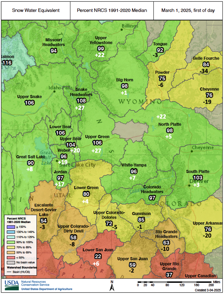
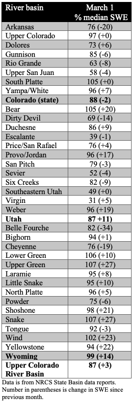
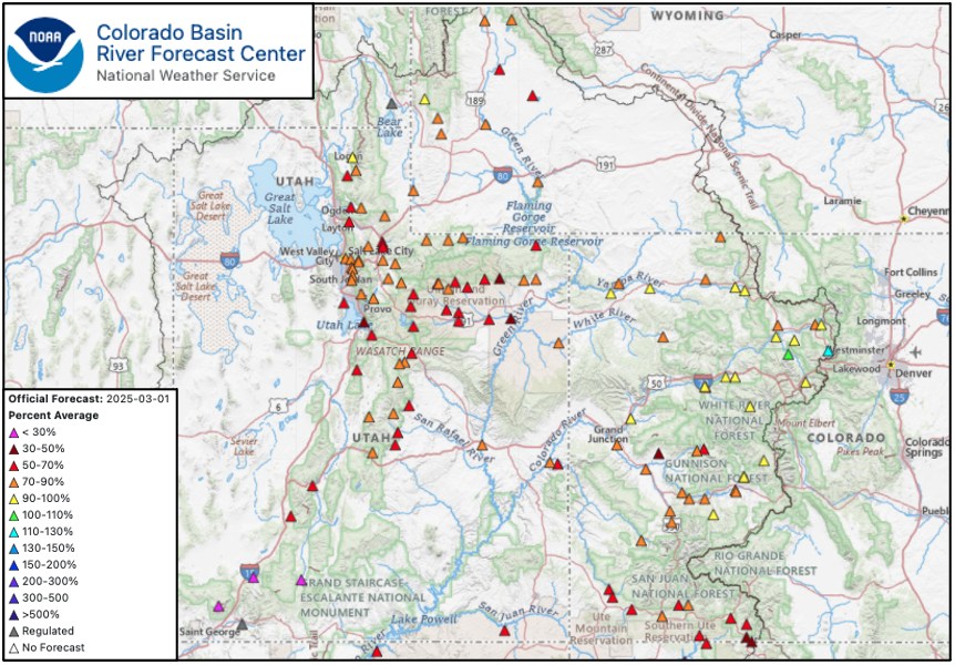
(Left figure: The +/- numbers represent March 1 SWE relative to average and the change since February 1.)
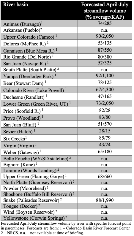
Seasonal streamflow volume forecasts are near average in the headwaters of the Colorado and Yampa Rivers. Below to much below seasonal streamflow volumes are forecasted for all other Colorado and Great Basin rivers. Below average (70-90%) seasonal streamflow volumes are forecasted for the Animas, Bear, Gunnison, Lower Green, Price, Provo and Six Creeks River Basins. Much below average (<70%) seasonal streamflow volumes are forecasted for the Dolores, Duchesne, Upper Green, San Juan and Virgin Rivers. Near record-low streamflow volume is forecasted for the Sevier River.
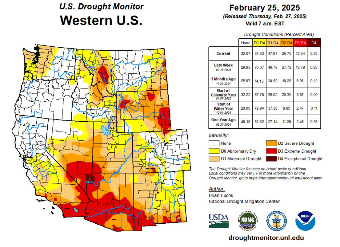
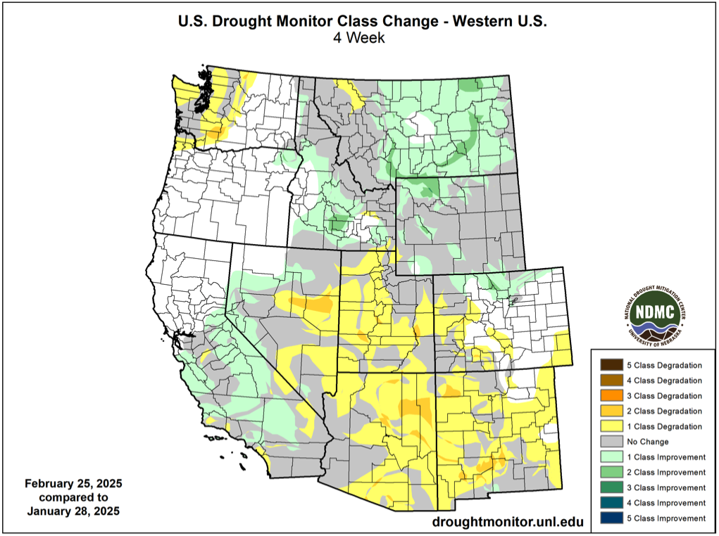
As of February 26, the region was 56% covered by drought, unchanged in total area from early February. During February, there was a reduction in the area covered by moderate, severe and extreme drought in northern and central Wyoming. In central Utah, there was also a reduction in the coverage of moderate drought conditions. In Colorado, moderate drought conditions expanded upstream along the Colorado River and extreme drought conditions developed in the Rio Grande headwaters.
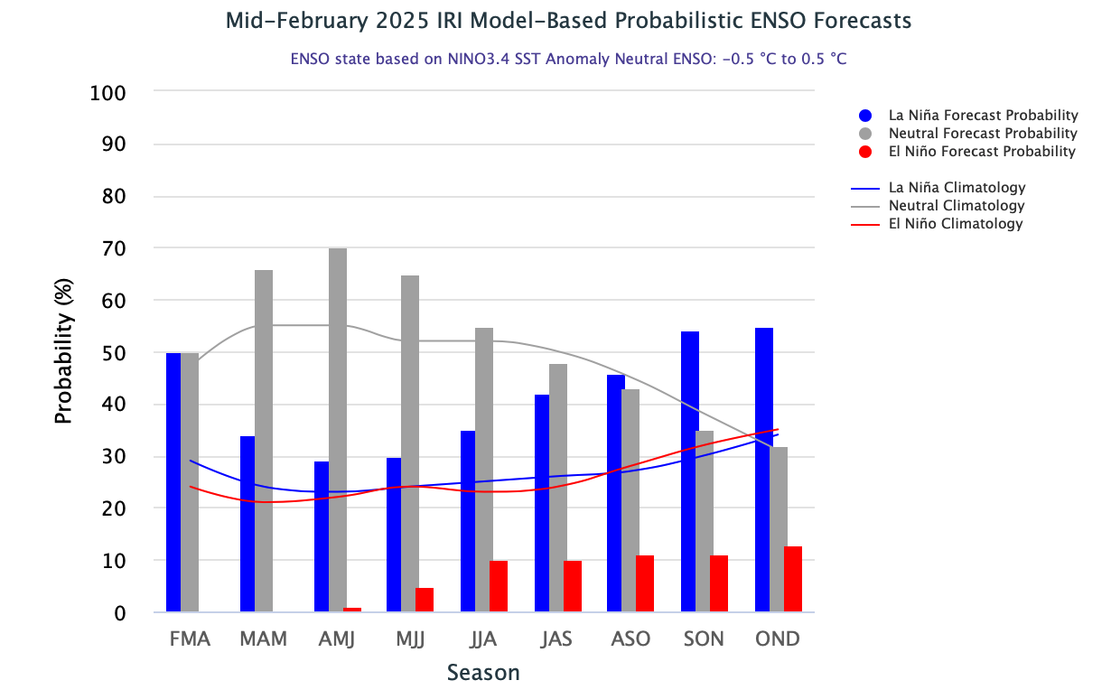
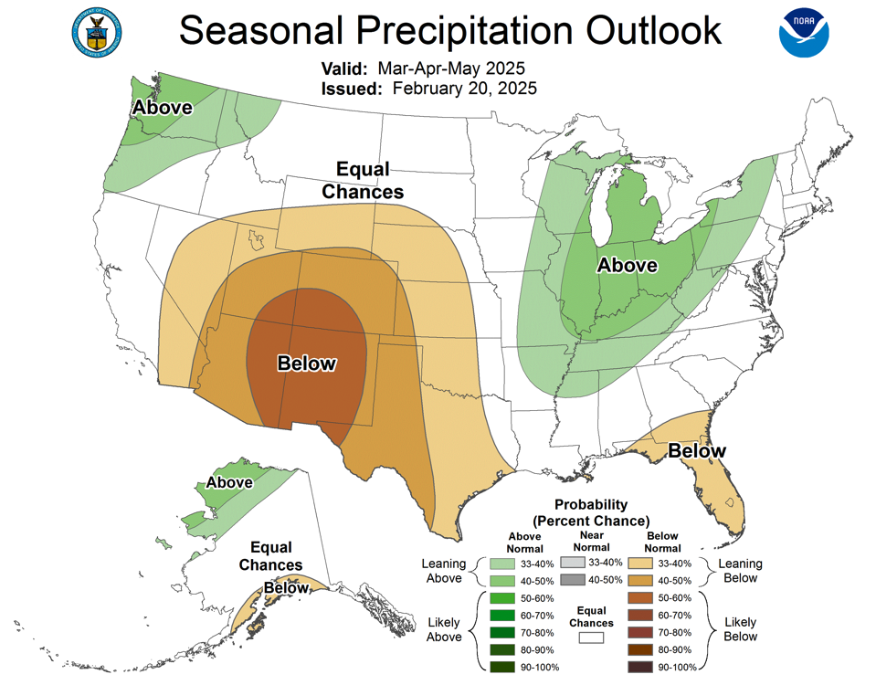
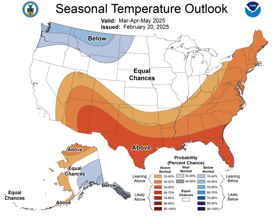
Weak La Niña conditions persisted in February as Pacific Ocean temperatures remained slightly below normal. There is a 50% probability of neutral or La Niña conditions for February-April and a greater than 60% chance of neutral ENSO conditions developing through early summer. NOAA seasonal forecasts suggest equal chances of above or below average precipitation and temperatures for March. In March-May, NOAA seasonal forecasts suggest an increased probability for below average precipitation for the entire region except northern Wyoming with the greatest chance of reduced precipitation in the Four Corners. The NOAA seasonal temperature outlook for March-May suggests an increased probability of above average temperatures for Utah and southwestern Colorado and an increased probability of below average temperatures in northern Wyoming.
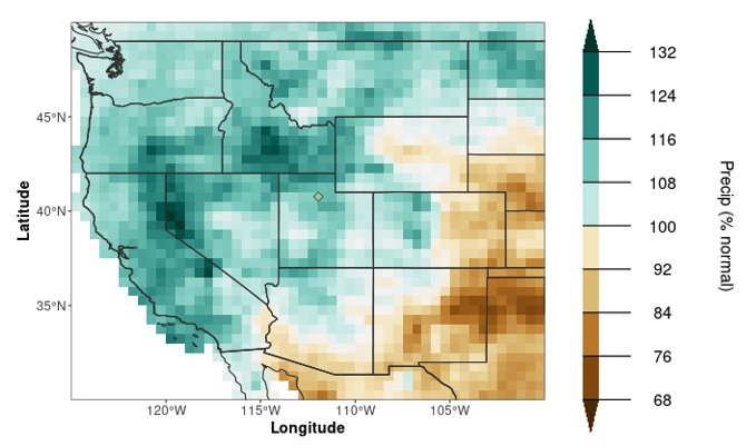
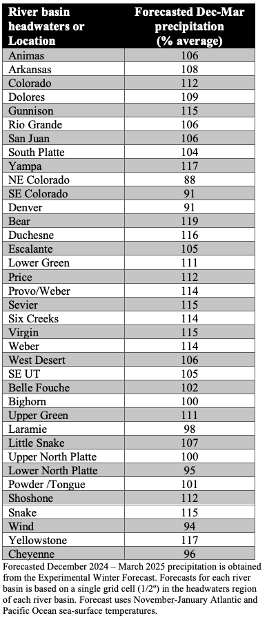
The Experimental Winter Forecast predicts a December-March precipitation pattern typical for a weak La Niña with forecasted above average precipitation forecasted in the Great Basin and the Upper Colorado River Basin and below average precipitation for areas east of the Continental Divide. The current Experimental Winter Precipitation Forecast uses ocean temperatures from November-January.