March 6, 2023 - CO, UT, WY
Despite a dry first half of February, monthly precipitation was near-to-above average for most of the region and regional snowpack conditions remain average to much-above average. February temperatures were below average for the entire region. Seasonal streamflow volume forecasts are generally near-average to above average for the Upper Colorado River and Great Basins. Drought conditions remain in place for 55% of the region, but improved slightly during February, especially in Utah. The current La Niña ended during February, neutral ENSO conditions currently exist and are projected to continue through the summer. There is an increased probability of above average precipitation and below average temperatures during March for much of the region.
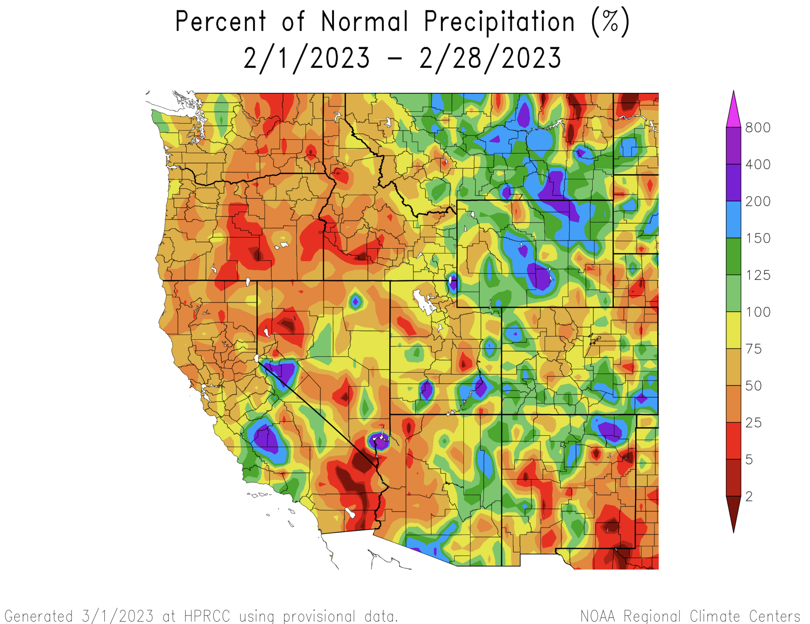
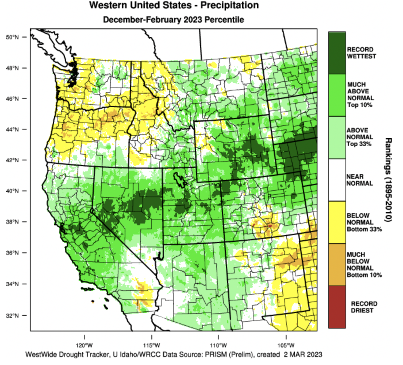
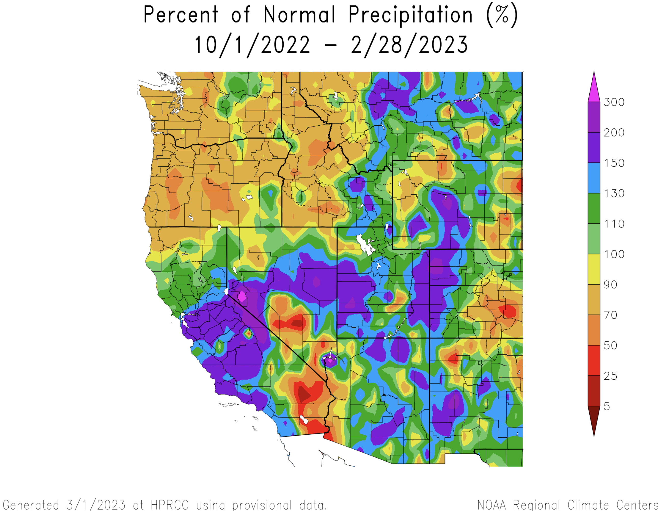
The region was relatively dry during the first half of February, but a very active weather pattern returned for the last two weeks of the month. Overall, precipitation during February was a mix of above and below average. The wettest February conditions occurred in Wyoming where most portions of the state received above average precipitation. February precipitation was slightly above average in western and southern Colorado, but drier in central portions of the state. In Utah, February precipitation was below normal except for portions of southern Utah and near Bear Lake. December through February precipitation was the wettest on record for parts of northwestern Colorado, central Utah and central Wyoming. Water-year precipitation remains above to much-above average for much of the region.
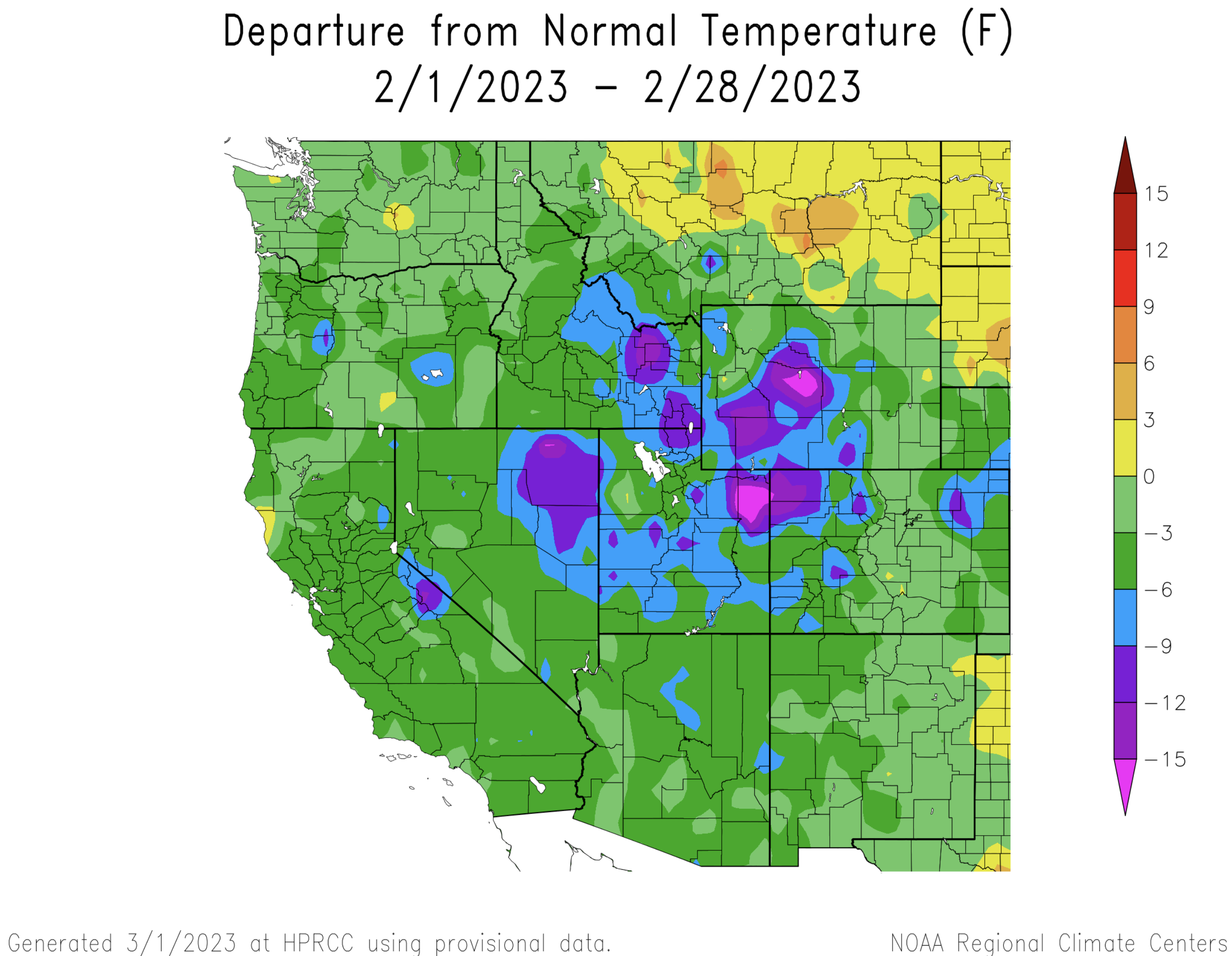
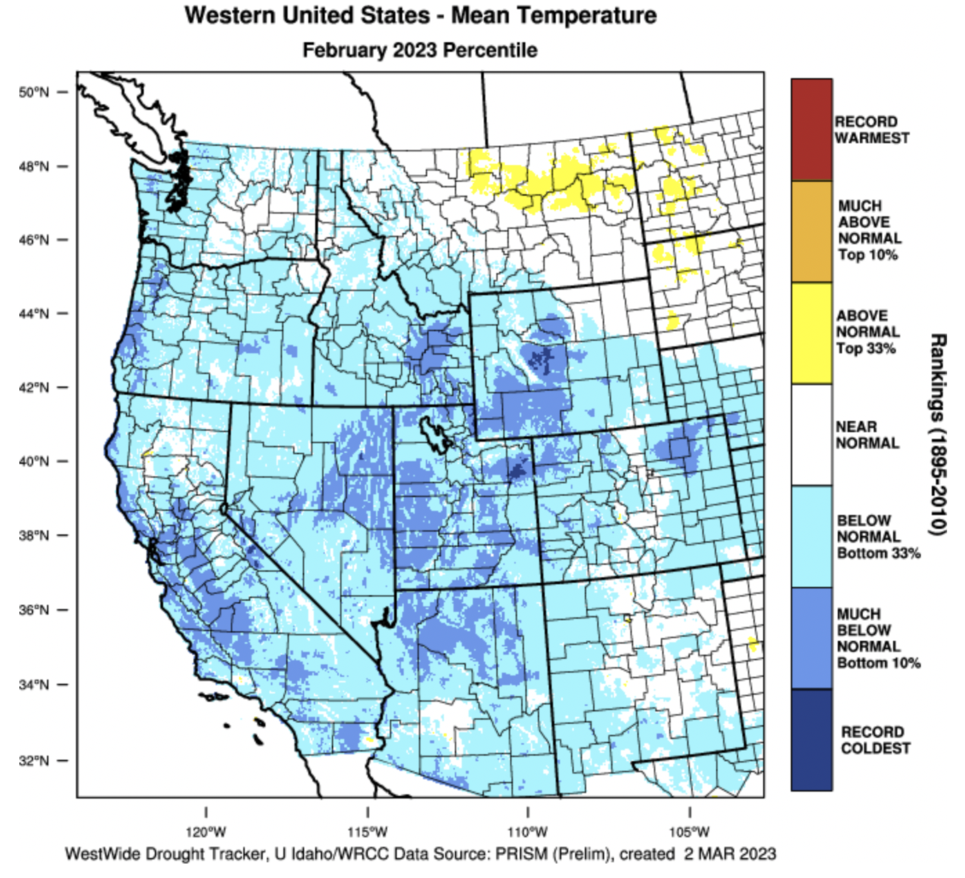
February temperatures were below average for the entire region and up to 6 degrees below normal for large areas of the region. The coldest regional temperatures were 9 to 15 degrees below normal in northwestern Colorado, northeastern Utah and southwestern Wyoming. Regional temperatures since the beginning of the water year have been below normal.
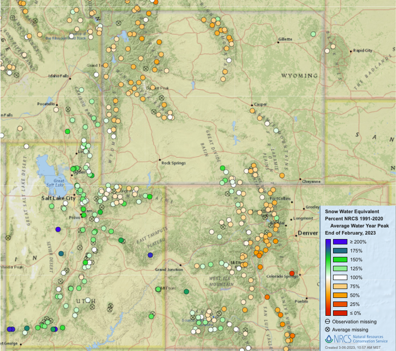
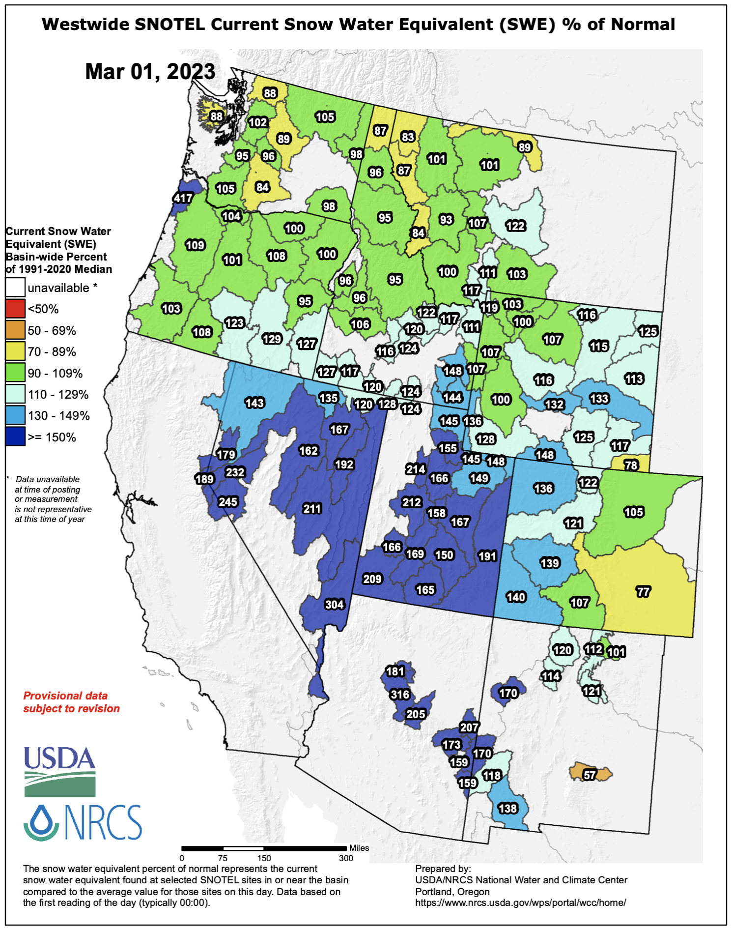
Despite below normal February precipitation for some of the region, regional snow water equivalent (SWE) remains above average for the entire region except the lower Arkansas River Basin. Percent normal SWE remains highest in Utah, ranging from 145-215% of normal. In Colorado, SWE is 120-140% of average on the West Slope, near-average in the South Platte and Rio Grande River Basins, but below average in the Arkansas River Basin. SWE in Wyoming ranges from 100-150% of normal.

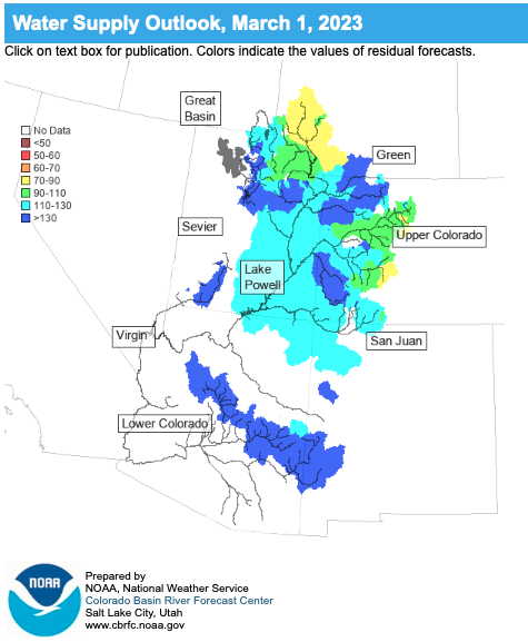
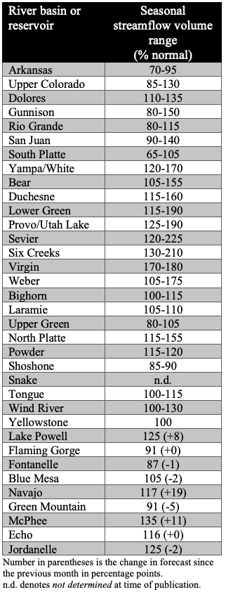
Seasonal streamflow volume forecasts are near-average to much-above average for most regional river basins. Streamflow forecasts are highest in the Great Basin where forecasted volumes are 105-225% of average. In the Upper Colorado River Basin, seasonal streamflow forecasts range from 80-170% of average with the largest streamflow volumes forecasted for the Duchesne and Yampa River Basins. The Upper Green River Basin is forecasted to have slightly-below average to near-average streamflow conditions. Below average seasonal streamflow volumes are forecasted for much of the Arkansas and South Platte River Basins.
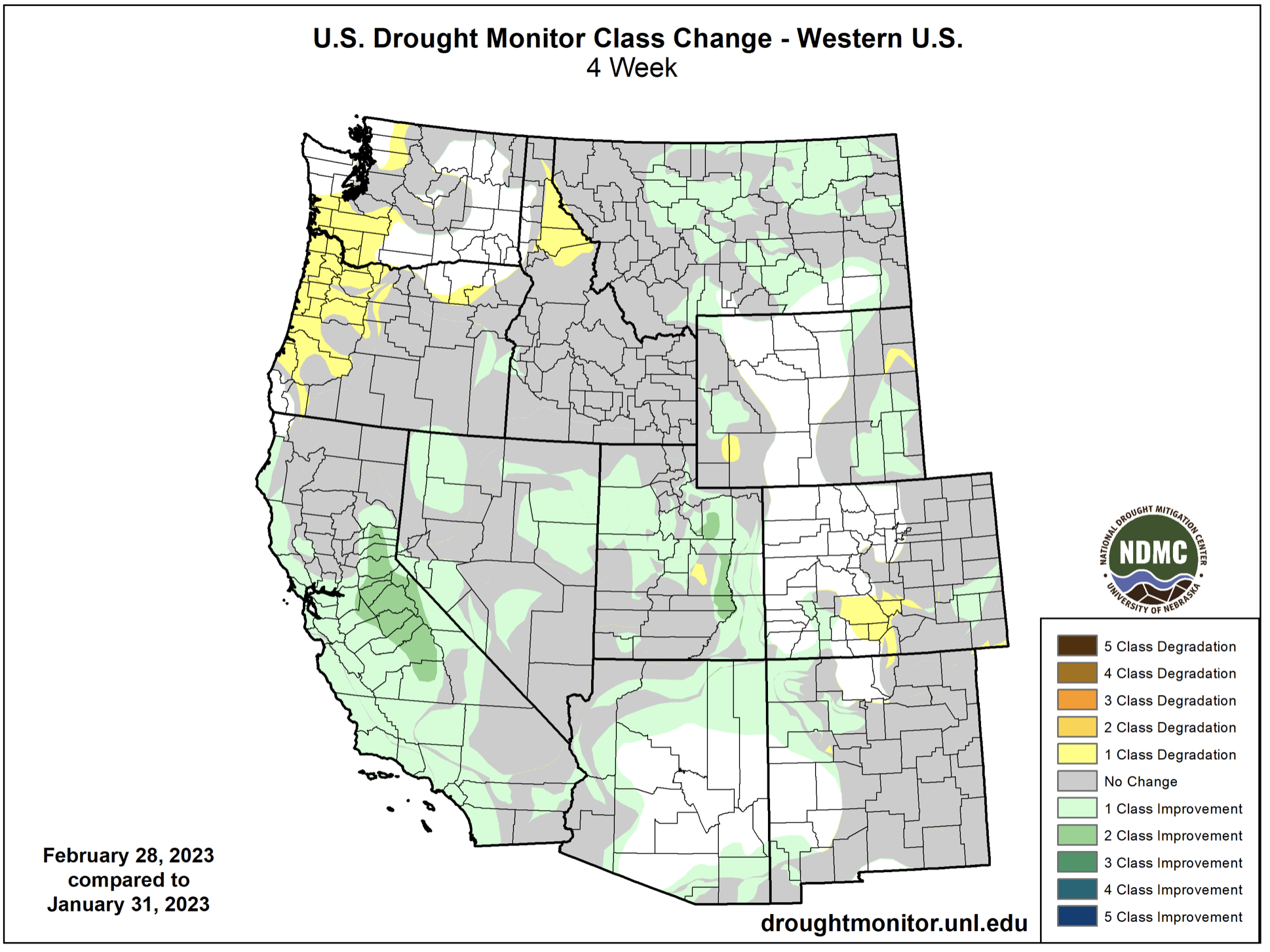
Regional drought conditions improved slightly during February; drought now covers 55% of the region, down slightly from the end of January. Most notably, there was a 1-2 category improvement in drought conditions over large areas of central Utah. In Utah, extreme (D3) drought was removed from Carbon, Duchesne, Juab, Sanpete, Tooele, Utah and Wasatch Counties. In Colorado, drought conditions worsened by 1 category in parts of the Rio Grande and Arkansas River Basins. The persistence of regional drought, especially in Utah, considering the near-record snowfall highlights the extremely dry conditions created by the last three years of drought and the need for multiple years of above average precipitation to fully recover.

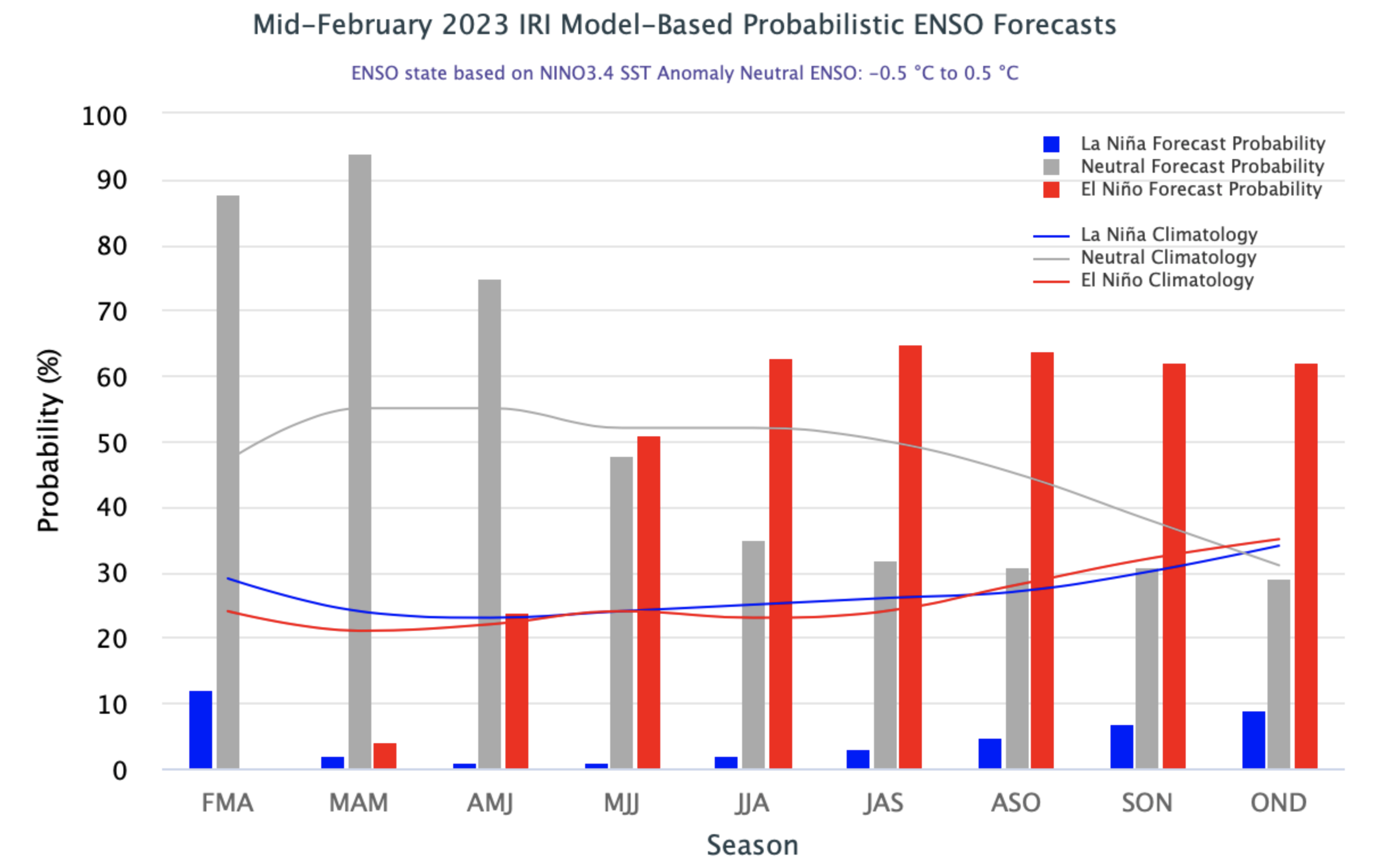
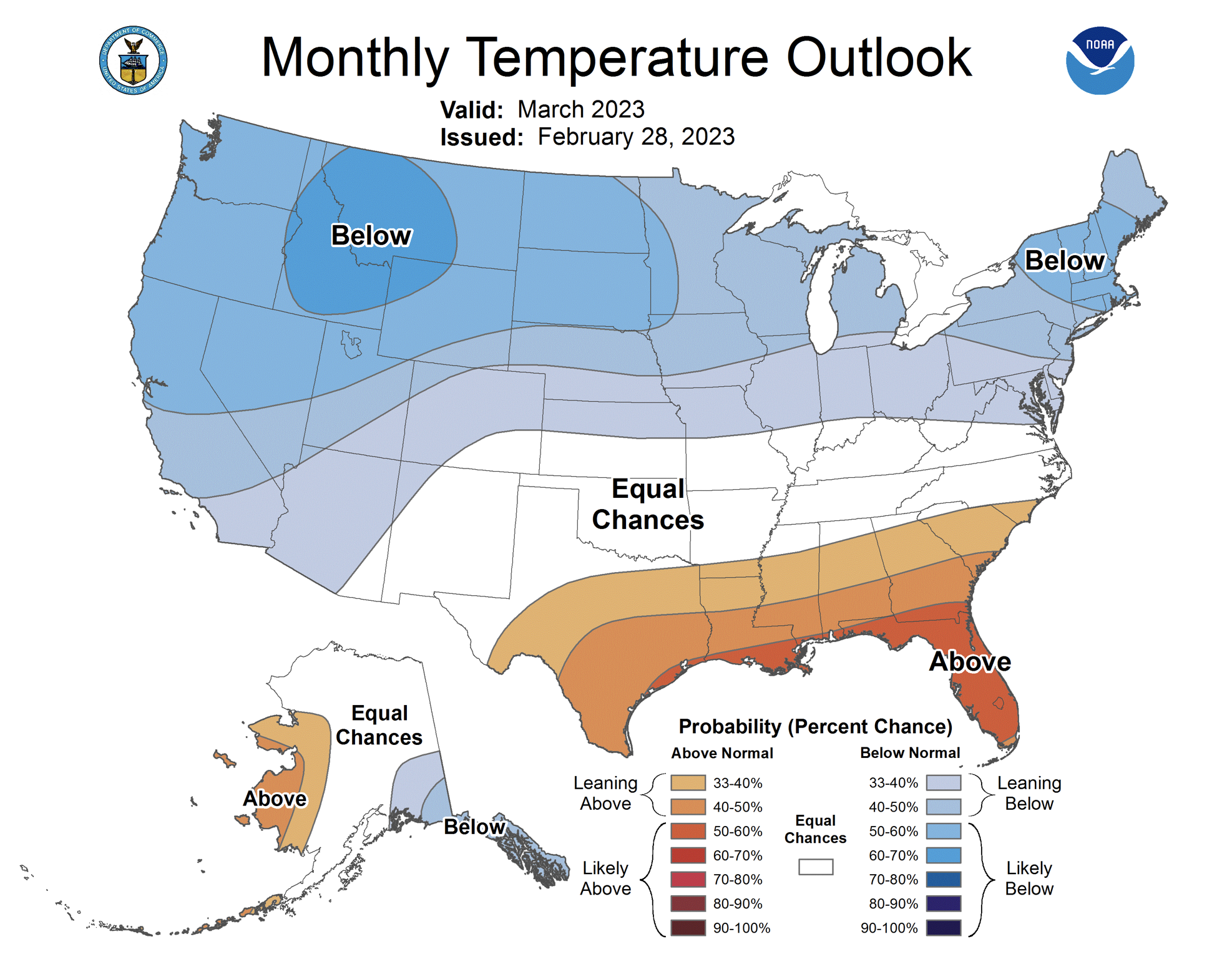
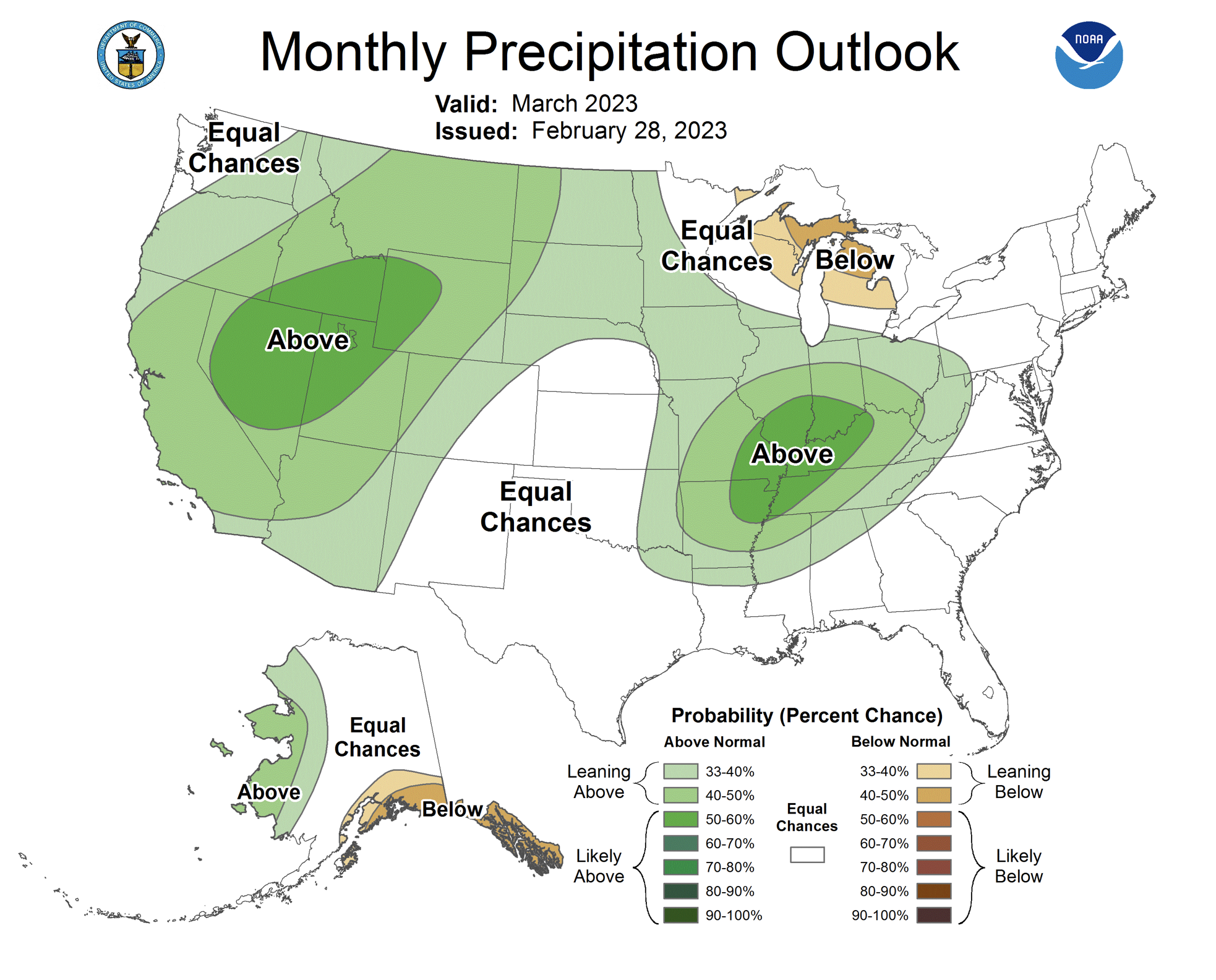
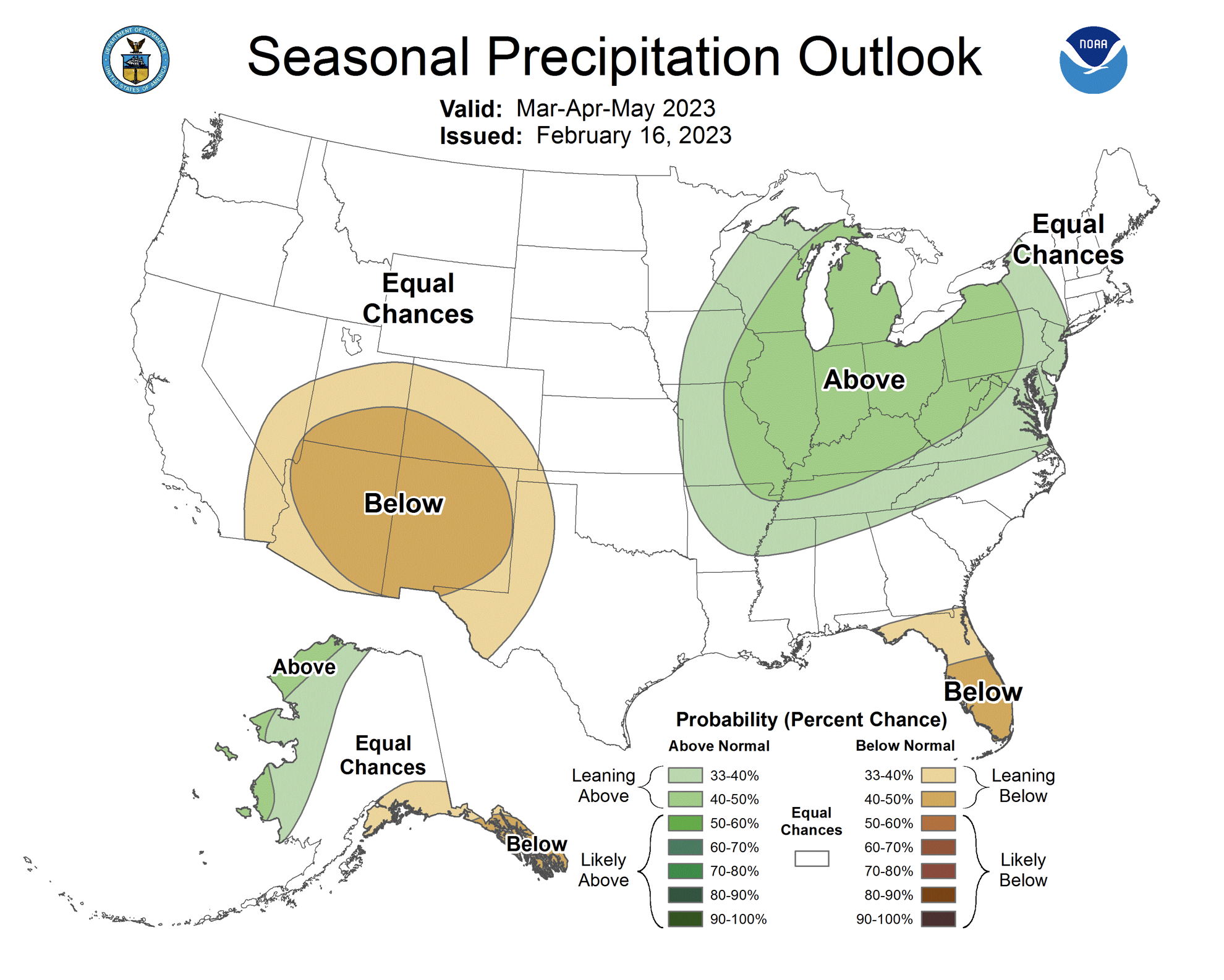
By the end of February, eastern Pacific Ocean temperatures warmed and the current La Niña ended. Neutral ENSO conditions exist as of March 1st and there is a 75-95% chance of neutral conditions persisting into summer. During late summer and fall 2023, there is above a 50% probability of El Niño conditions developing. The NOAA Monthly Outlook for March suggests an increased probability of above average precipitation and below average temperatures for the entire region except southeastern Colorado. The NOAA Seasonal Outlook for March-May suggests an increased probability of below average precipitation for much of Colorado and Utah, especially around the Four Corners and an increased probability of above average temperatures for southern Colorado and Utah.

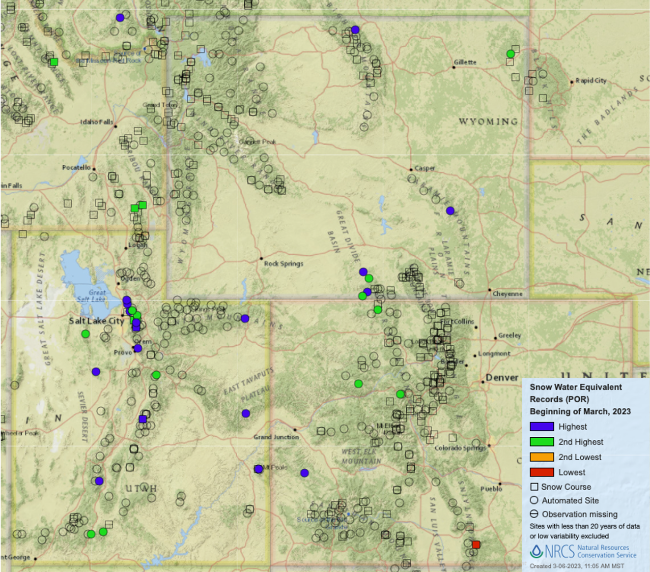
Significant February weather event. Still snowing… Despite a dry first half of February, regional monthly precipitation ended up near-average to above average at many mountain locations. March 1st SWE conditions were average to much-above average for nearly all regional river basins. With 30-45 days before the time of typical peak snowpack, most SNOTEL sites in Utah (83%) and many sites in western Colorado and southwestern Wyoming have already exceeded average peak SWE accumulation. Twelve Utah snow monitoring sites have observed record amounts of SWE and an additional 8 sites recorded the second-highest SWE total as of March 1st. Snowpack conditions in Colorado and Wyoming are not as deep as in Utah, but four sites and Wyoming and one site in Colorado observed record SWE amounts as of March 1st. Although most snow monitoring locations in Utah are no longer on pace to break snowfall and SWE records, the 2023 water year consistently ranks among the highest SWE accumulation years since snow and SWE observations began.