March 11, 2024 - CO, UT, WY
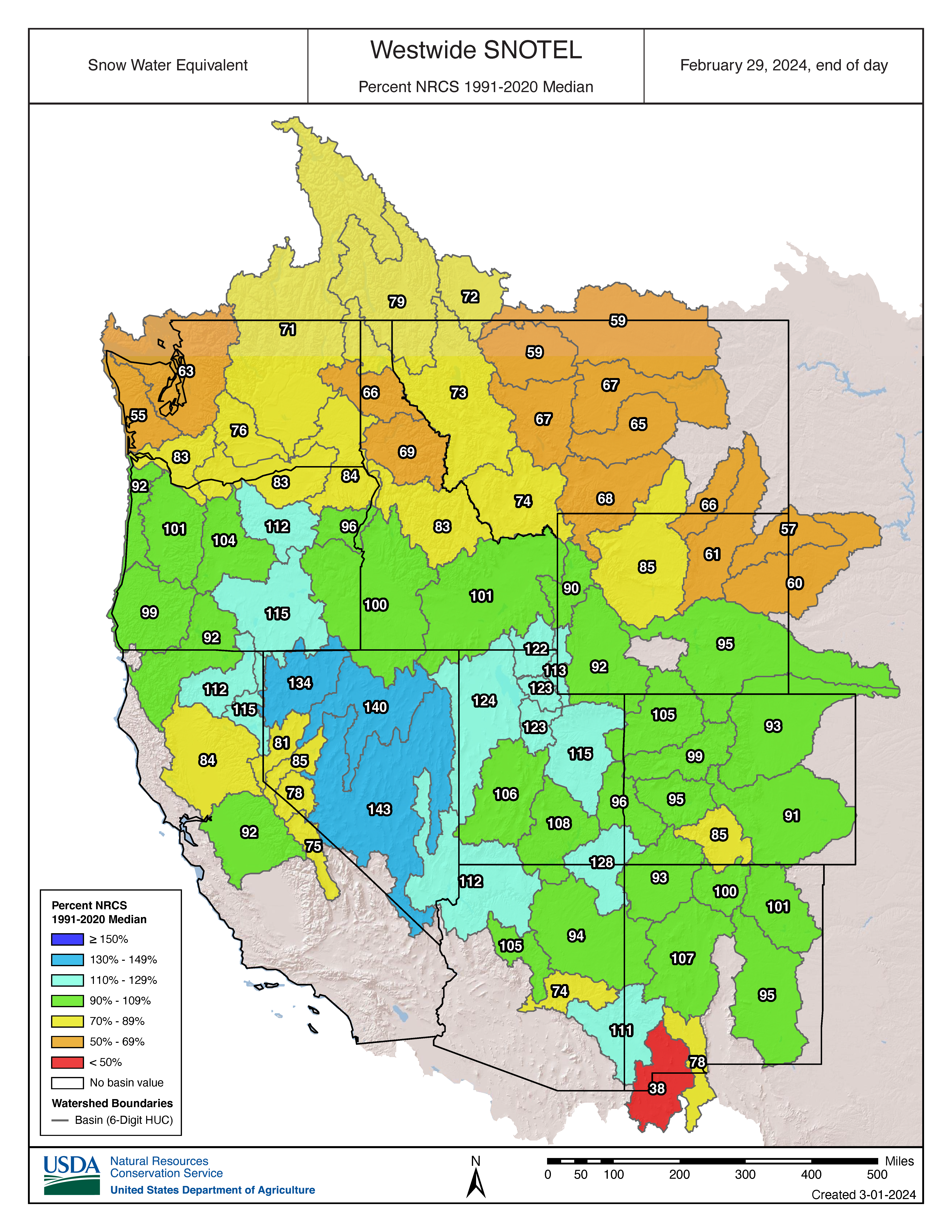
February was warmer and much wetter than normal across the majority of the region. Snowpack conditions improved and are above normal in Utah (119%), near-normal in Colorado (97%), and slightly-below normal in Wyoming (88%). Seasonal streamflow volume forecasts are below normal to near-normal for the majority of the region, except for northern Utah in the Great Salt Lake region where forecasts are above normal. Regional drought coverage slightly improved and now covers 13% of the region. There is a 70% chance of ENSO-neutral conditions starting in April-June. The NOAA precipitation outlook for the region in March suggests an increased probability of above normal precipitation.
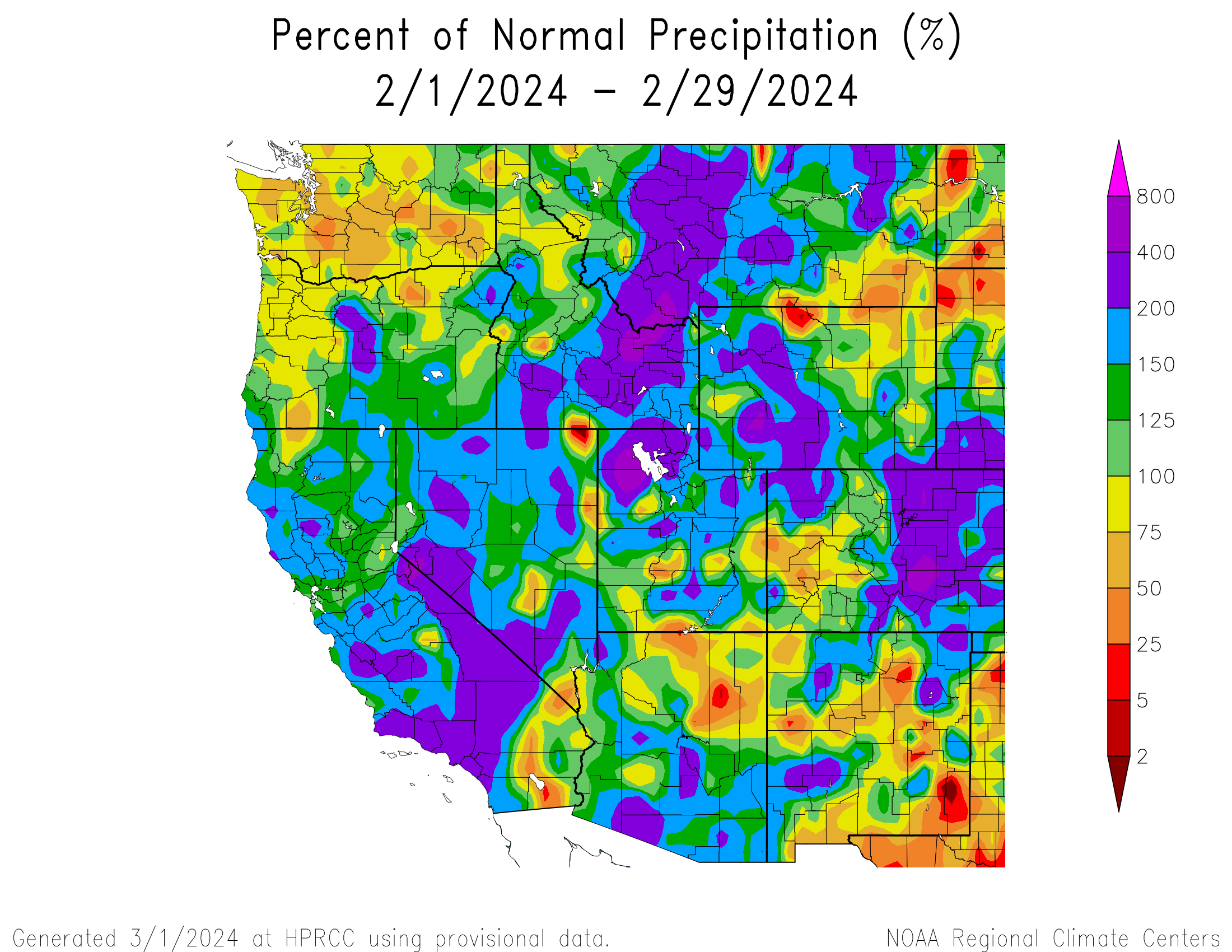
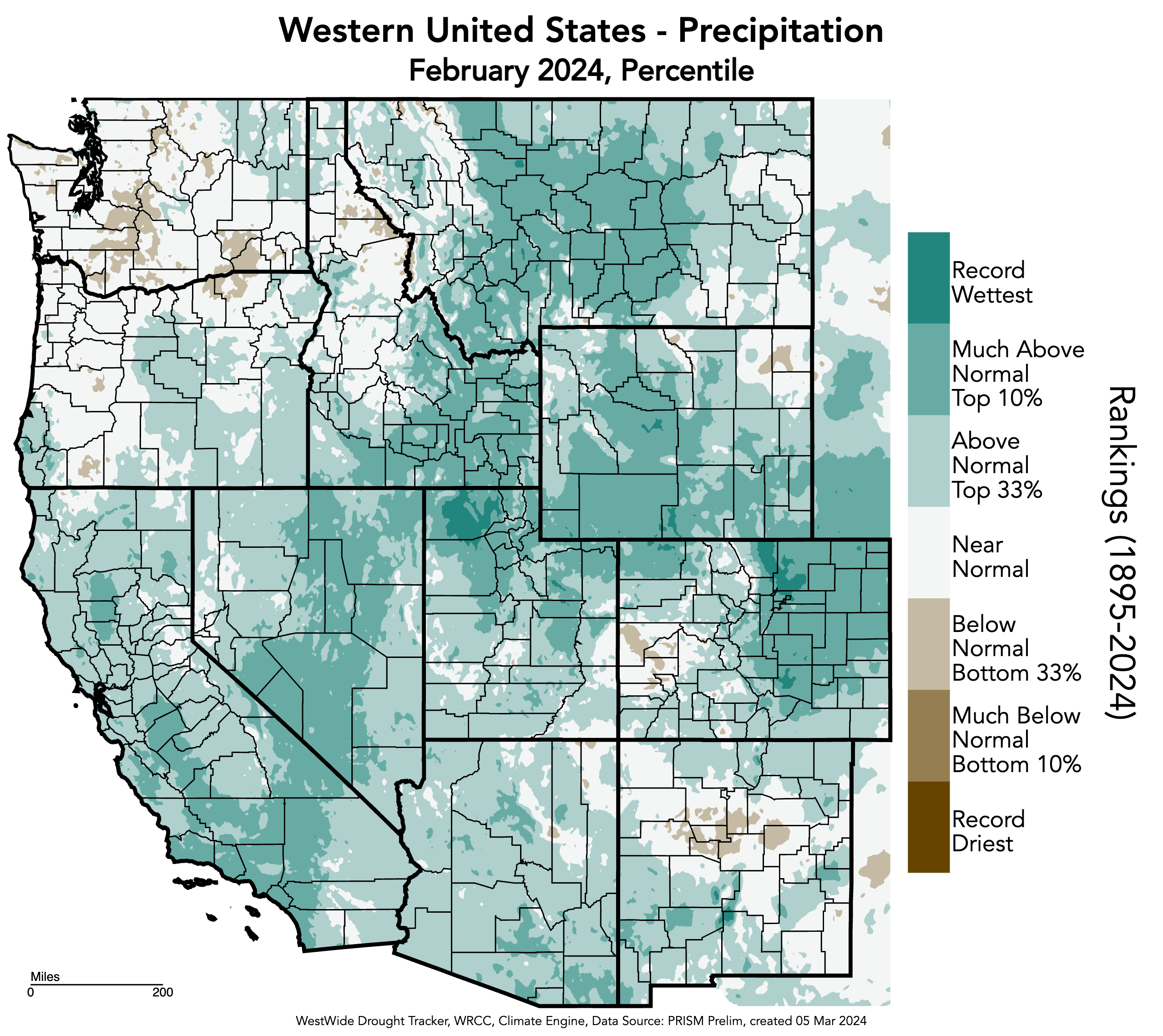
February precipitation was above to much-above normal for the majority of the region, with pockets of below normal conditions on the West Slope of Colorado, southern Utah, and northeastern Wyoming. Areas of 200% or more of normal precipitation occurred throughout the majority of the Front Range, eastern and northwestern Colorado, western Wyoming, and northern Utah in the Great Salt Lake region with pockets scattered throughout the state. Areas of 400% or more of normal precipitation occurred in El Paso and Pueblo Counties in Colorado, Box Elder and Tooele Counties in Utah, and Sweetwater County in Wyoming. Record-wet conditions occurred in each state, with particularly large record-wet areas in Larimer, Weld, and Pueblo Counties in Colorado, and Box Elder County in Utah.
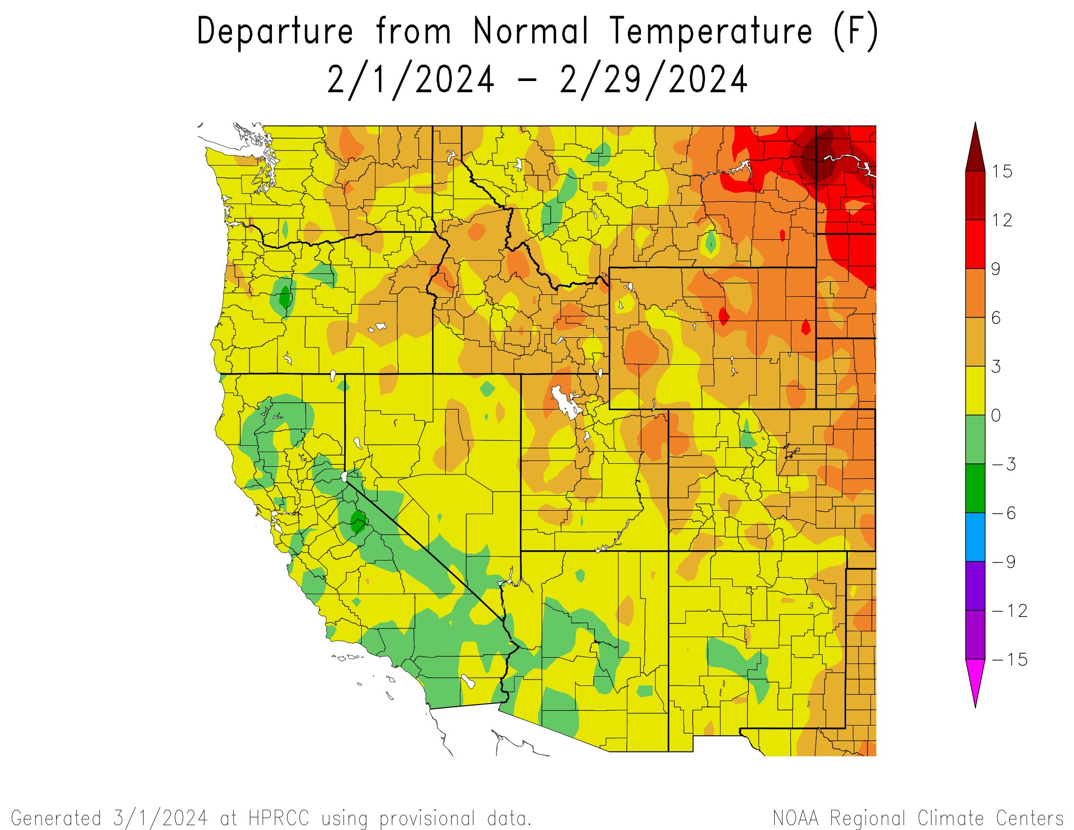
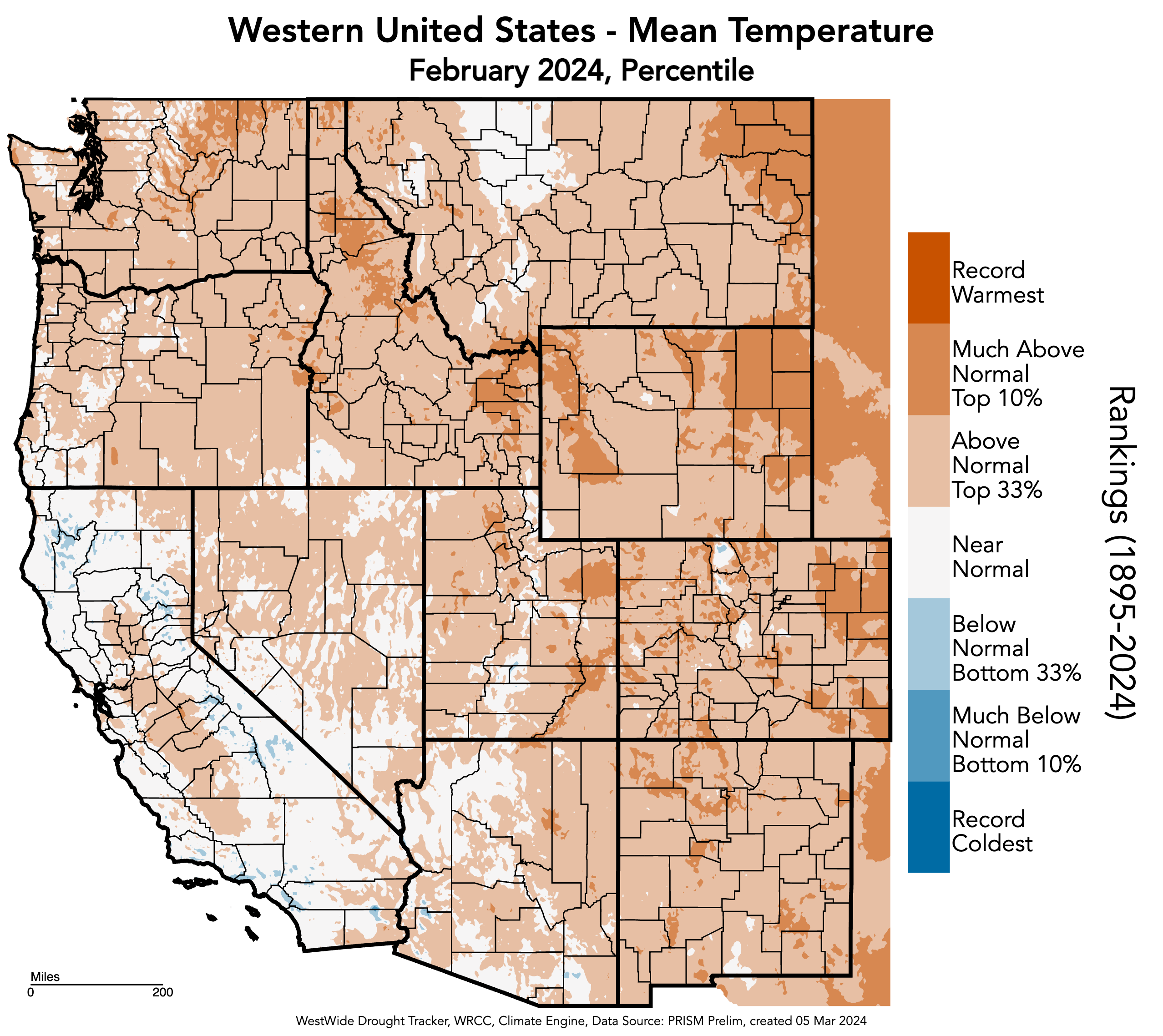
Regional temperatures were slightly-above to above normal in February. The majority of the region experienced 0-3°F or 3-6°F above normal temperatures with large areas of 6-9°F above normal temperatures in northeastern Colorado and northeastern Wyoming. Pockets of 6-9°F above normal temperatures occurred in southeastern and northwestern Colorado, northeastern and northwestern Utah, and southeastern and western Wyoming. Temperature percentile rankings for February were above normal (top 33%) to much-above normal (top 10%) throughout almost the entirety of the region.
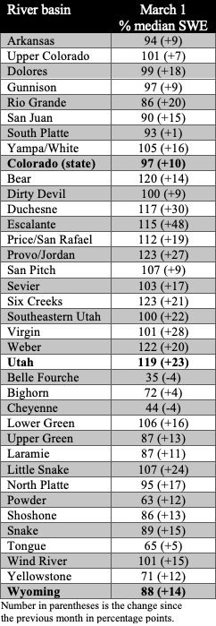
Regional snowpack ranged from below normal conditions in northern Wyoming to above normal conditions in Utah with near-normal conditions prevalent in southern Wyoming, southern Utah, and most of Colorado. As of March 1st, statewide percent median snow-water equivalent (SWE) was 97% in Colorado, 119% in Utah, and 88% in Wyoming. The Belle Fourche Basin in Wyoming had the lowest percent median SWE (57%) and the Lower San Juan Basin in Utah and Colorado had the highest percent median SWE (128%) by the end of the day on February 29th.
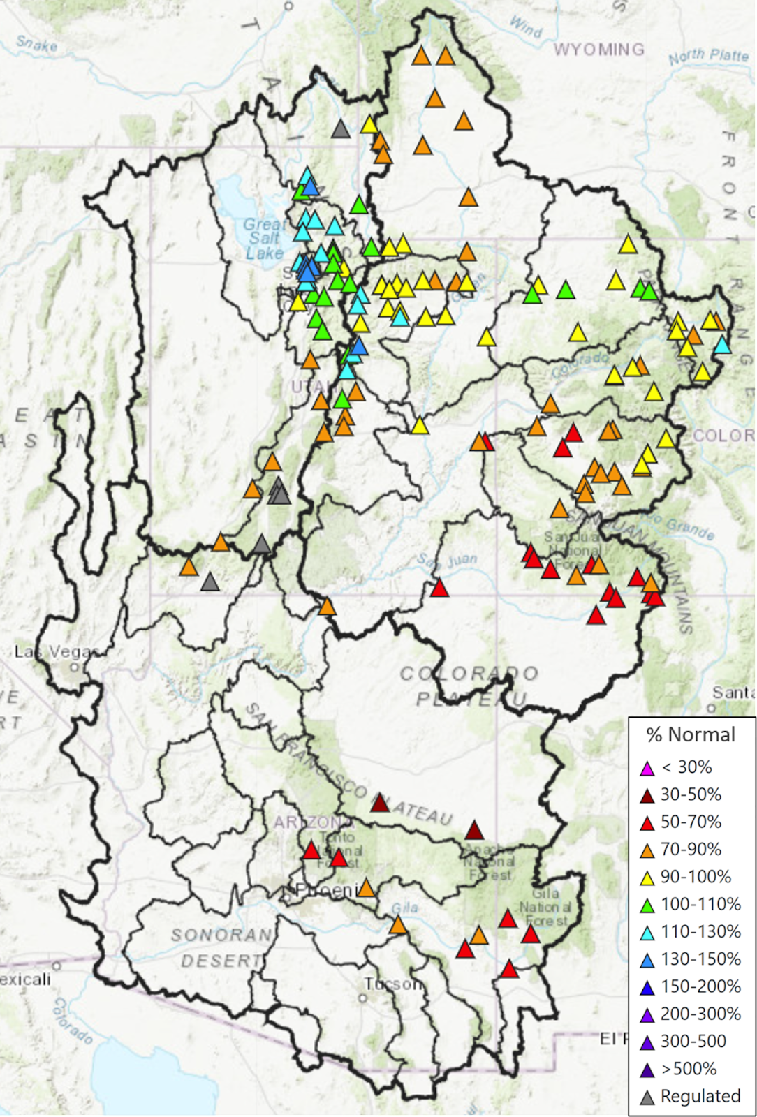
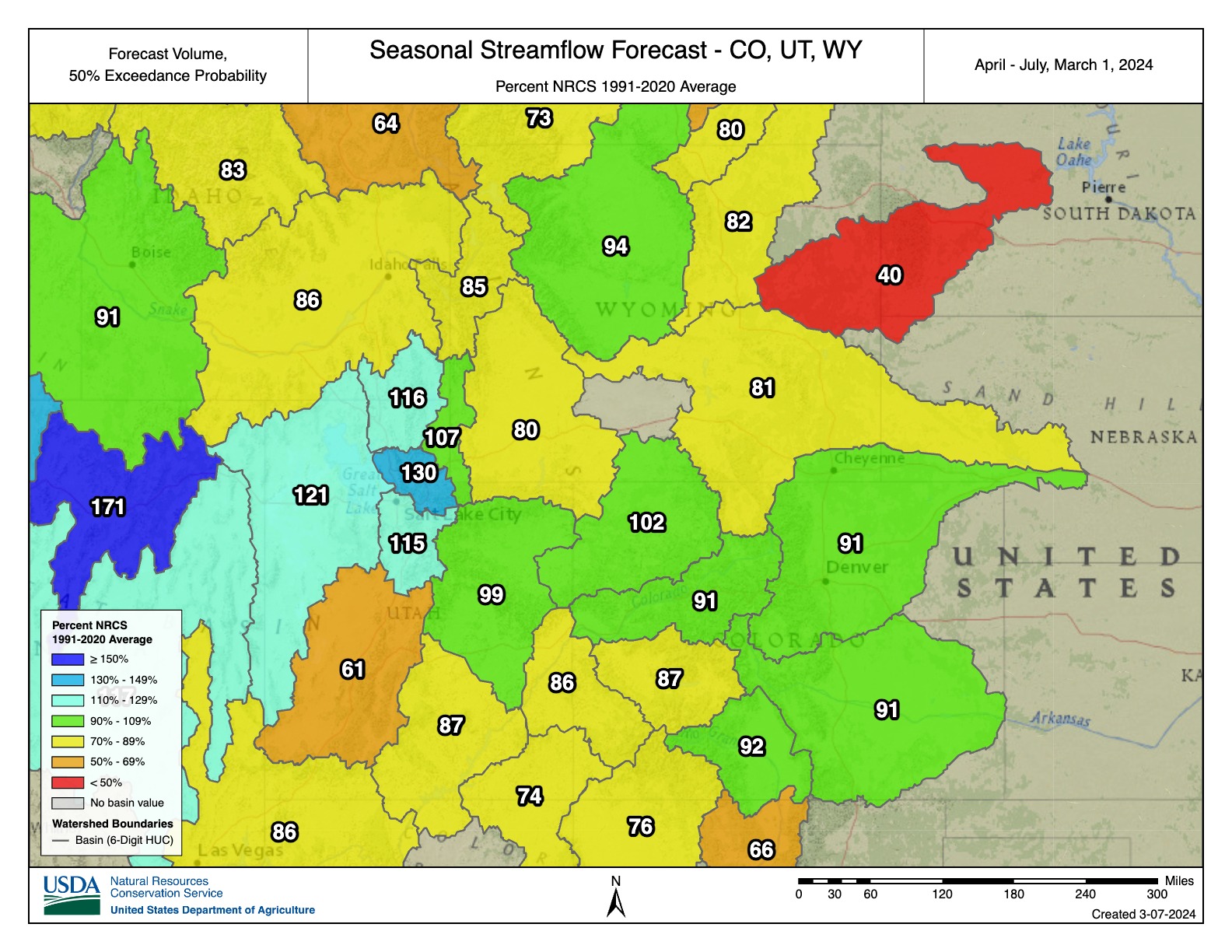
Regional April-July streamflow volume forecasts are mostly below normal (70-90%) to near-normal (90-110%), with much-below normal (<50-70%) forecasts for the Escalante Desert-Sevier Lake River Basin in Utah and the Cheyenne River Basin in Wyoming. However, there are above normal (110-130%) streamflow forecasts for basins surrounding the Great Salt Lake, including the Great Salt Lake, Lower Bear, Jordan, and Weber River Basins. In most locations, forecasted streamflow volume increased compared to the February 1st forecast. The forecast for the inflow to Lake Powell is 78% of average, up 4% from the February 1st forecast and up 12% from the January 1st forecast.
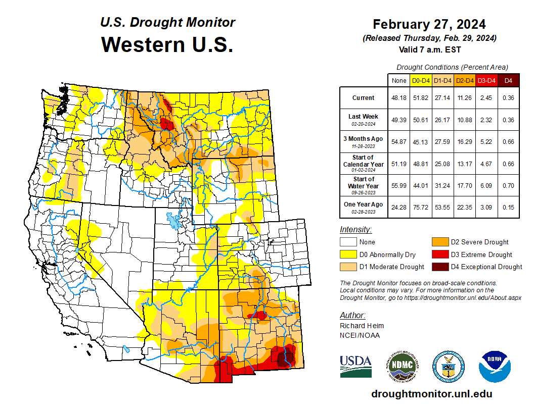
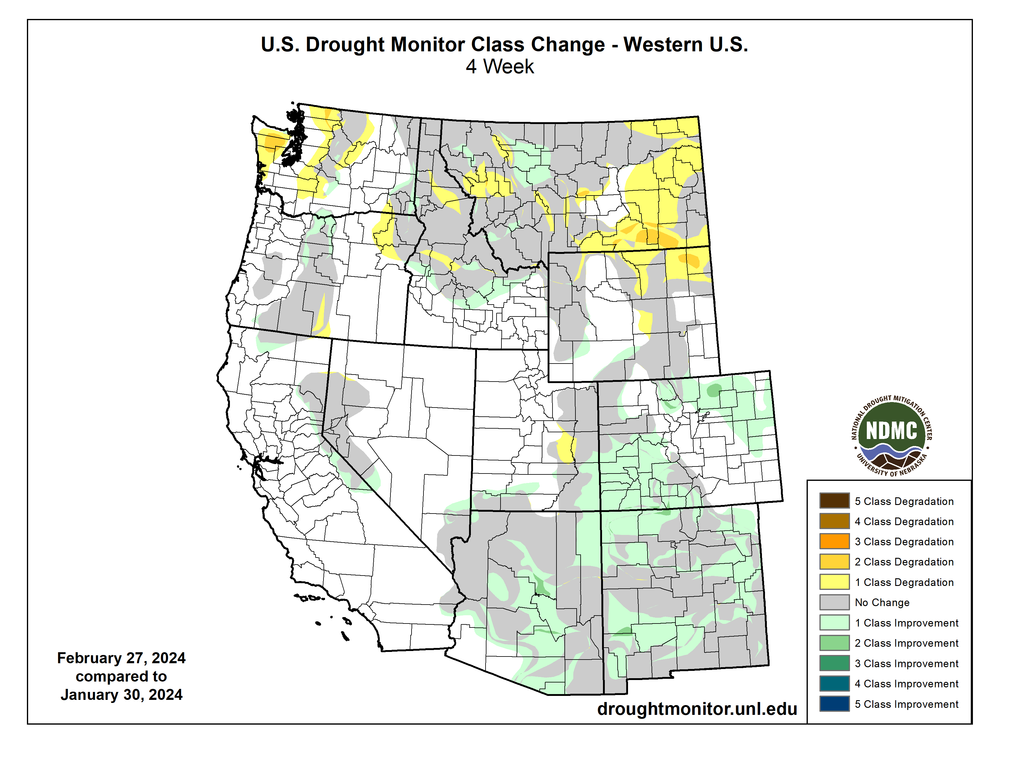
Regional drought conditions improved in February and now cover 13% of the region, a 5% decrease in drought coverage since the end of January. Severe (D2) drought developed in north-central and northeastern Wyoming while extreme (D3) drought improved in south-central Colorado and moderate (D1) drought improved in southwestern Colorado and southeastern Utah.
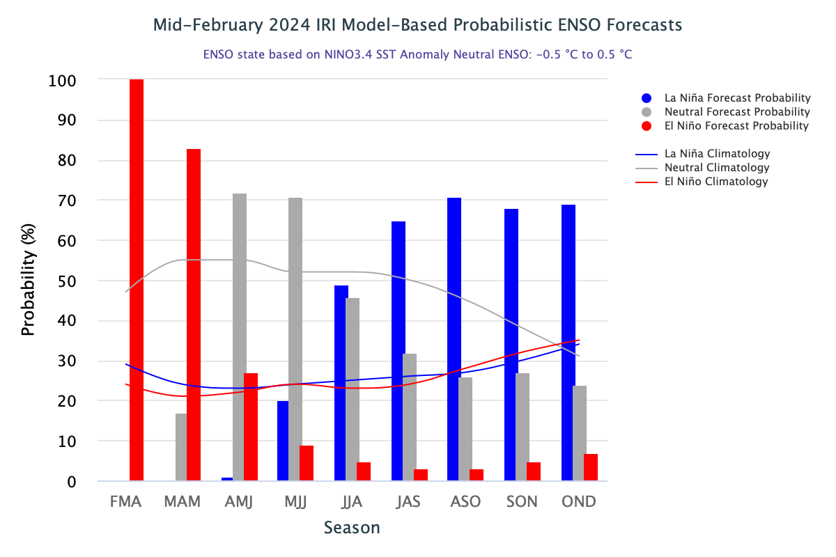
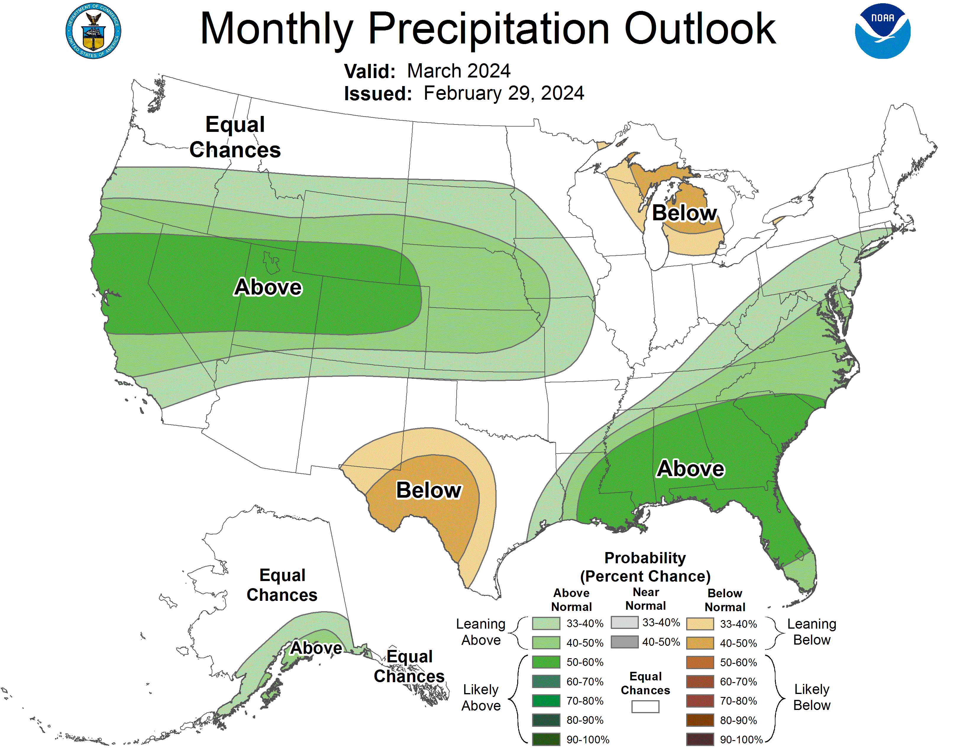
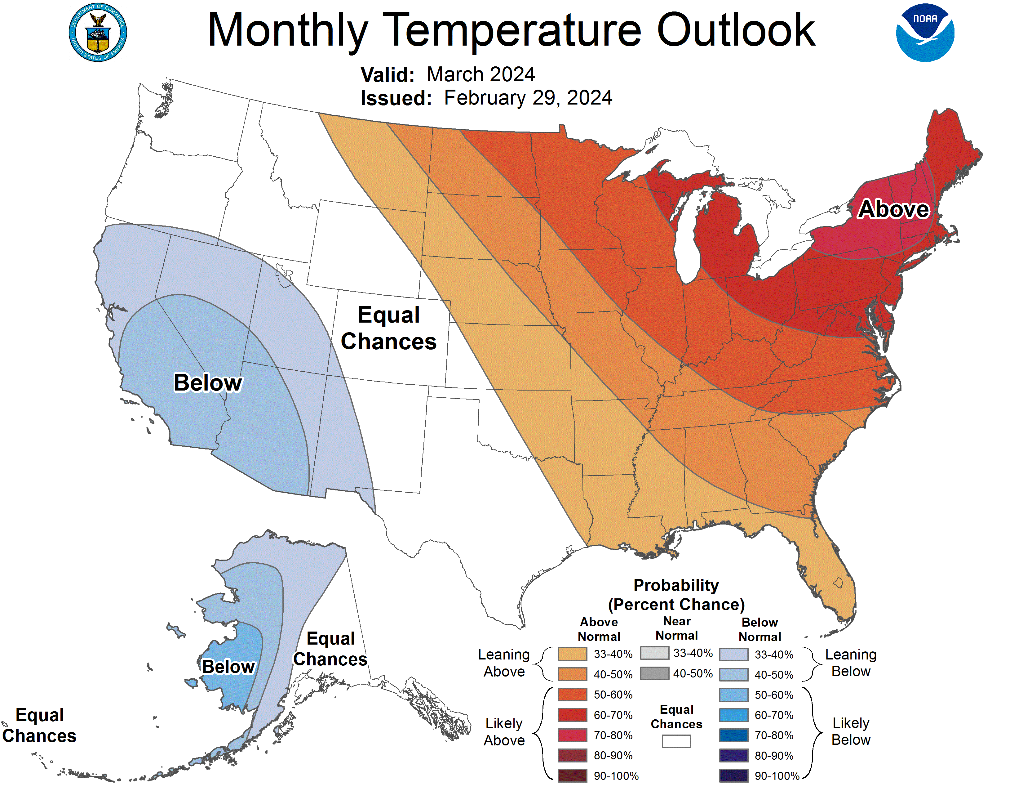
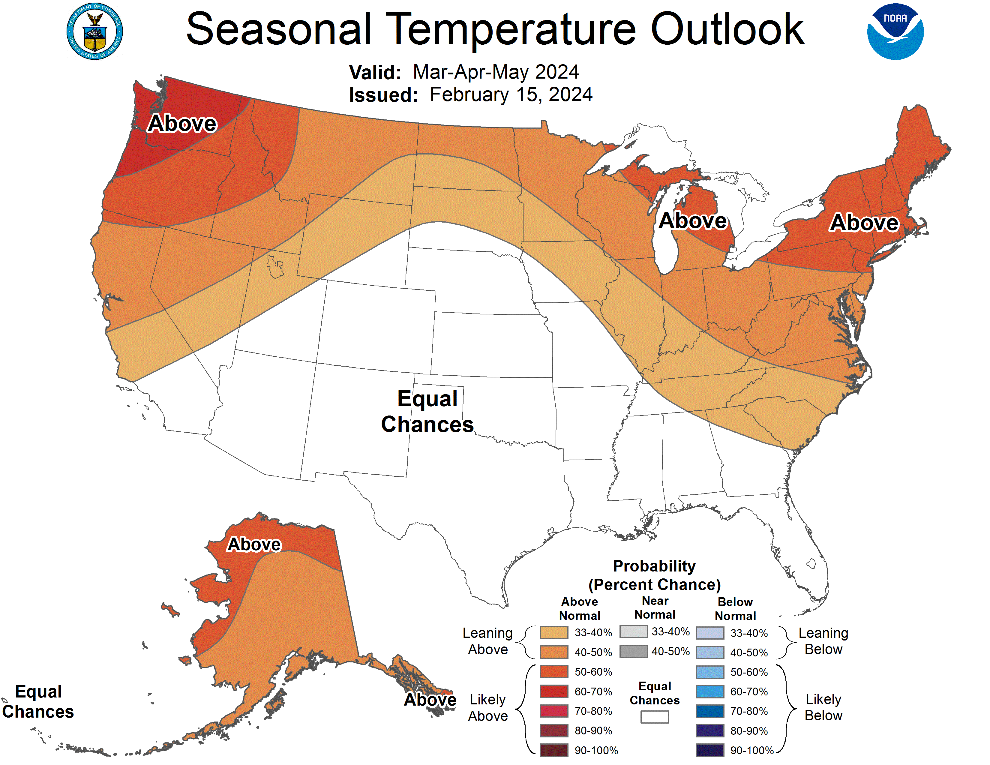
El Niño conditions continued during February and there is an 80% chance of these conditions continuing during March. However, there is a 70% chance of El Niño conditions transitioning to ENSO-neutral conditions during April-June. The NOAA precipitation outlook for March suggests an increased probability of above normal precipitation for the entire region with likely above normal precipitation (50-60% chance) throughout most of Colorado, Utah, and southern Wyoming. The NOAA temperature outlook for March suggests an increased probability of above normal temperatures in northeastern Wyoming and below normal temperatures throughout the majority of Utah, particularly in the southwest. The NOAA seasonal temperature outlook for March-May suggests an increased probability of above normal temperatures throughout the northern, central, and western regions of Wyoming and the northern and western regions of Utah.
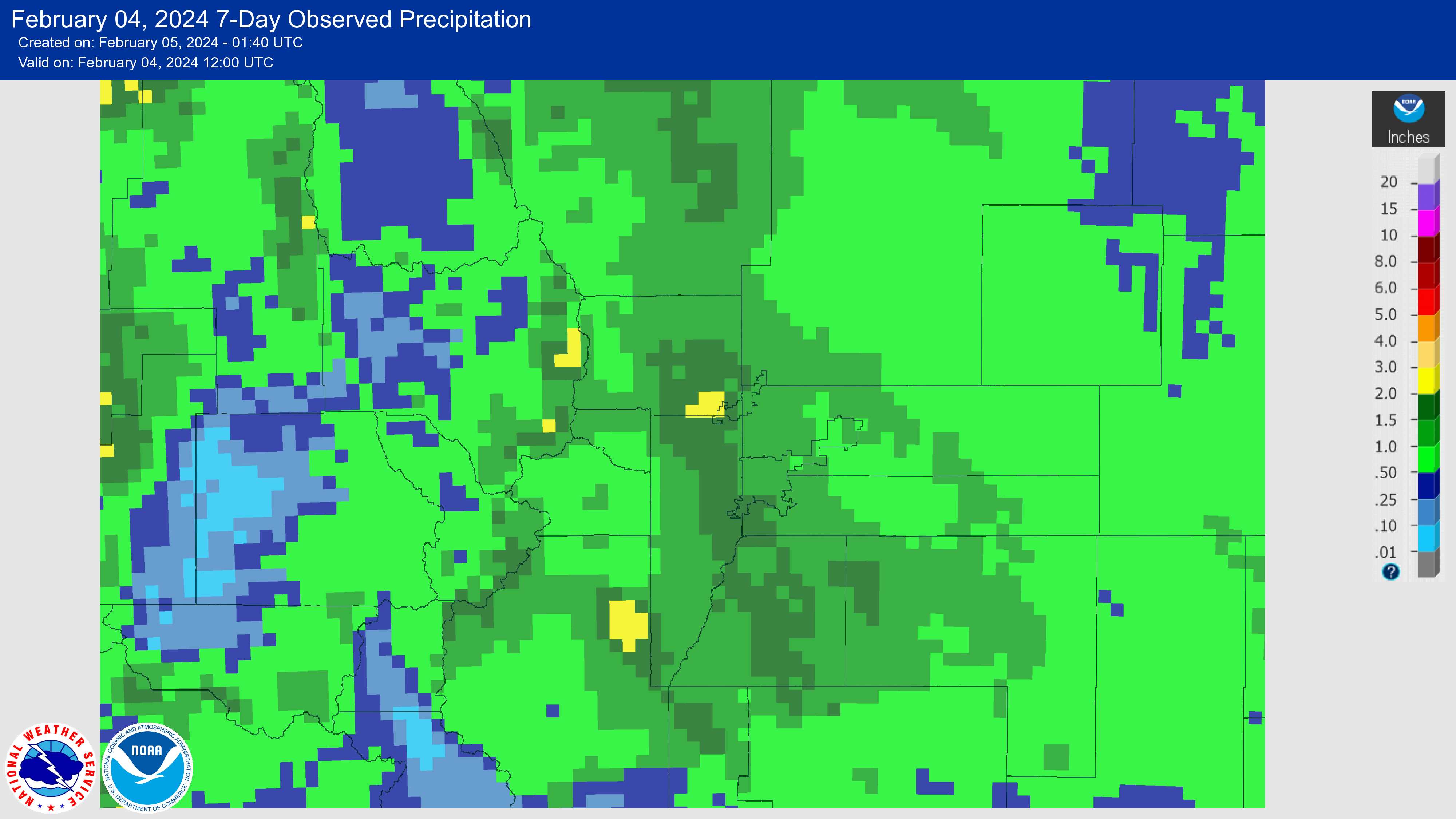
February significant weather event: Record-wet snowstorm in the Front Range. From February 2-3, the Front Range experienced an intense 18-hour precipitation deluge, with some areas receiving over 2 inches of liquid equivalent (rain and melted snow water), surpassing the total precipitation of the previous two months. A southern-track low-pressure system originating in southeastern Colorado was responsible for this substantial moisture. The storm brought heavy upslope precipitation—rain and heavy snow—to northern Colorado. Boulder received a record-breaking 1.74 inches of precipitation, making it the all-time wettest February storm since recordkeeping began in 1897 and surpassing the previous record of 1.41 inches from February 3-4, 2012. Boulder received 9.1 inches of snow, Denver received 5.5 inches, and the lower foothills received a maximum of 20.3 inches. The storm's unique characteristics, including the lack of a cold air mass and the presence of a large-scale low-pressure system that pulled in moisture and warmth from a Pacific Ocean atmospheric river and from the Gulf of Mexico, made the storm one of rain instead of snow to start. The warmer air caused snowflakes falling from a sub-freezing cloud layer to melt and turn to rain before they hit the ground, which eventually cooled the air to the point of freezing, finally allowing for snowfall and accumulation. These factors and many more created significant forecasting uncertainty as to how much snow, or precipitation in general, would fall across northern Colorado. Weather models were highly volatile days in advance to hours before the storm due to the many different atmospheric variables in this storm’s setup. This weather event highlights the evolving nature of warmer winter storms in a warming climate.