June 7, 2024 - CO, UT, WY
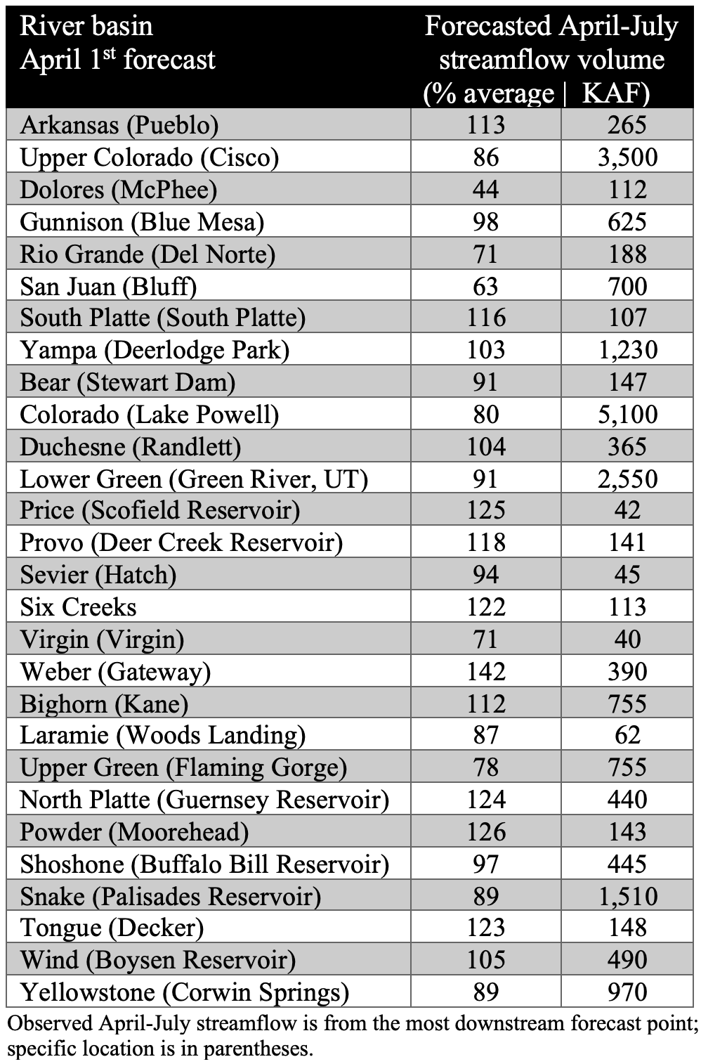
Cool May temperatures coupled with continued snowpack accumulation in some mountain areas slowed snowmelt, leading to above average seasonal streamflow volume forecasts for many river basins including the Arkansas, Gunnison, North Platte, Powder, Provo, Six Creeks, Weber and Yampa. Regional drought conditions contracted to cover 8% of the region, driven largely by drought removal in northern Wyoming. NOAA seasonal outlooks predict an increased probability of above average temperatures and below average precipitation for June-August.
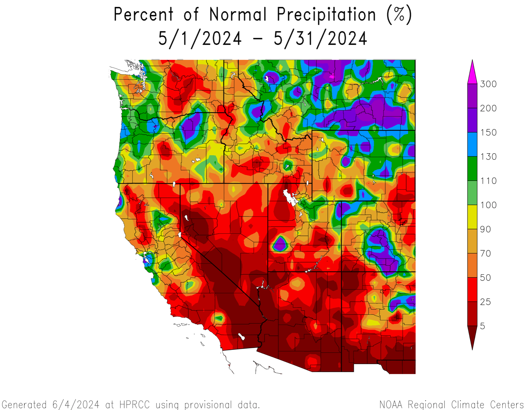
Regional May precipitation was a mix of above and below average conditions. Average to much-above average (150-200%) precipitation fell in northwestern and central Colorado and northern Wyoming. In Utah, the central Wasatch and western Uinta Mountains received near-average precipitation during May. Locations in western and southern Utah, southwestern and northeastern Colorado and southeastern Wyoming received less than 50% of average May precipitation. Isolated locations in Larimer and La Plata Counties in Colorado and Washington County in Utah received record low May precipitation. In Boulder, CO, total May precipitation was only 0.44”, the driest May in 50 years and the second driest on record.

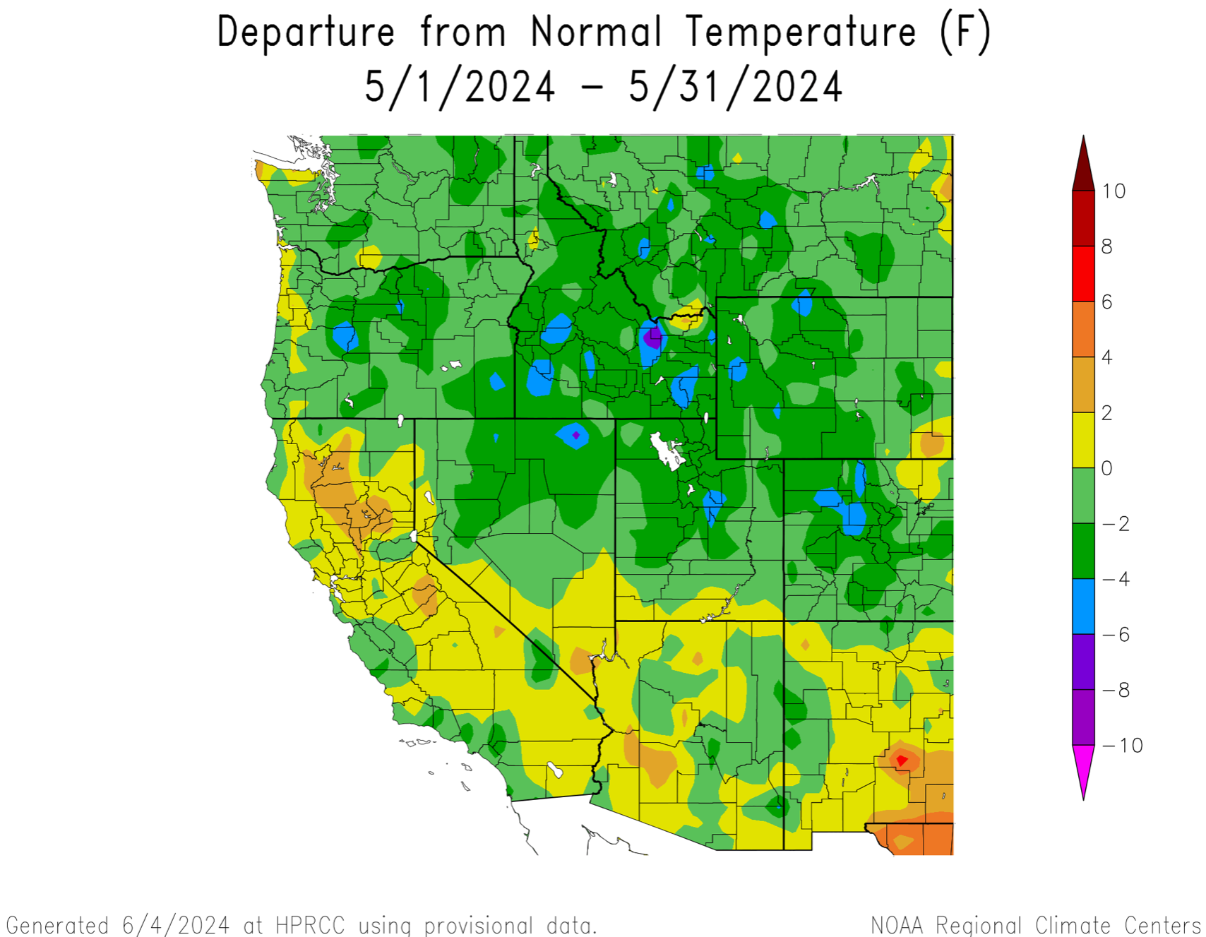
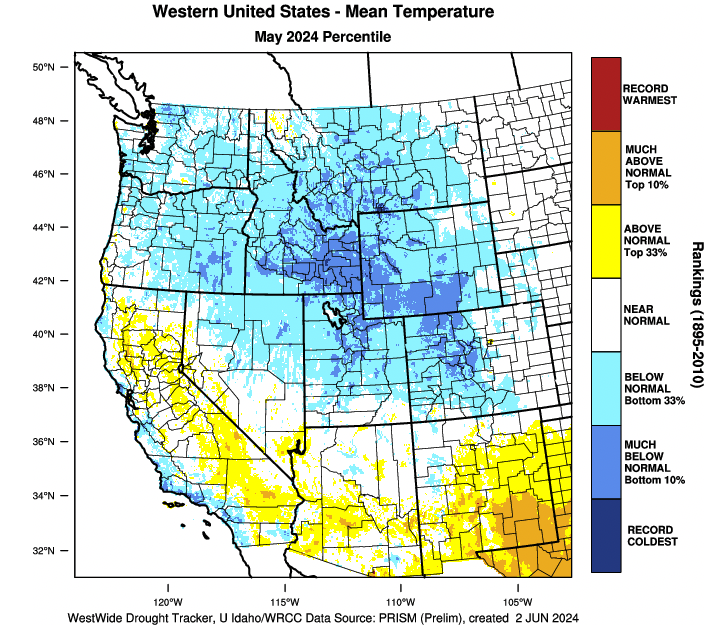
May temperatures were below average for nearly the entire region. In central Colorado, northern Utah and western Wyoming, temperatures were 2-4ºF below average. Region-wide (CO, UT, WY), May 2024 was the coldest since May 2019.
Despite below average May precipitation across much of the region, cool May temperatures preserved existing snowpack and regional snow water equivalent (SWE) is above-to-much-above average in most river basins. SWE is highest relative to average in Utah where SWE is 585% of average in the Weber River Basin and 225% of average in the Provo-Jordan River Basin. On a statewide basis, SWE is 136% of average in Colorado, 196% of average in Utah and 125% of average in Wyoming. Snow is completely melted in the Rio Grande River Basin and nearly melted in the Dolores and San Juan watersheds. Significant May snow accumulation occurred in Wyoming’s Bighorn Mountains and in parts of the Colorado Rockies.


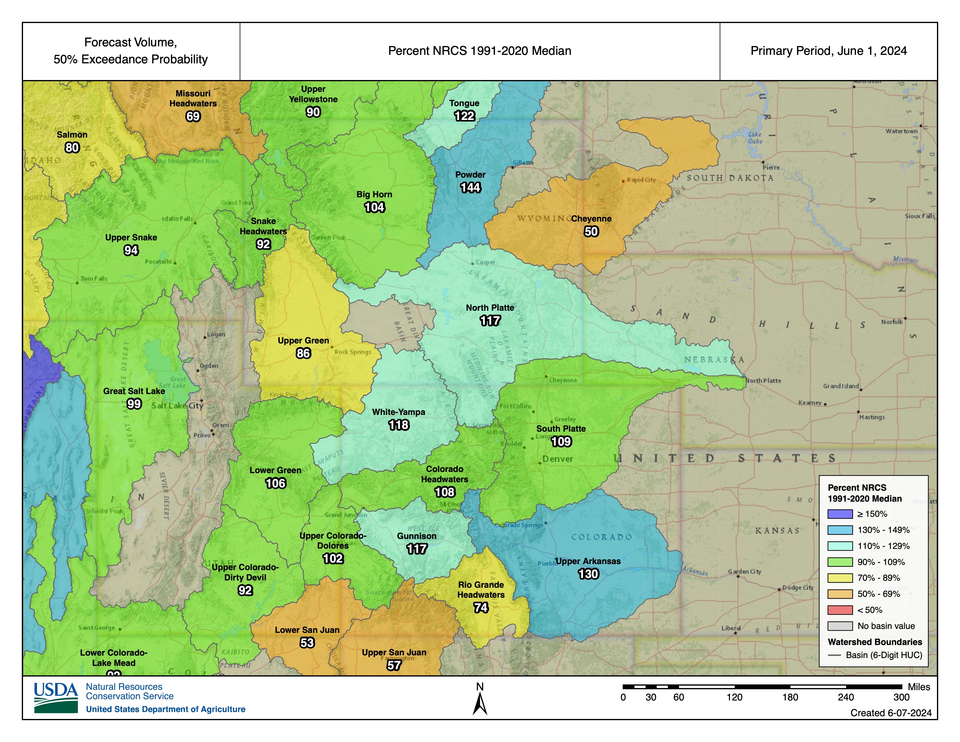
Seasonal streamflow volume forecasts on June 1 are generally average to slightly above average except for below average streamflow forecasts in the Cheyenne, Upper Green, Rio Grande and San Juan River Basins. Snowpack accumulation continued in some mountain regions during May and cool May temperatures slowed snowmelt for much of the month. Relative to average, the highest streamflow volumes are forecasted in northern Utah, particularly the Provo, Six Creeks and Weber River Basins. Significant increases in streamflow volume forecasts compared to May 1 were observed in the Arkansas, Gunnison, North Platte, Powder and Tongue River Basins. The lowest streamflow volumes relative to average are forecasted for the Dolores (44%) and San Juan Rivers (64%). The inflow volume forecast for Lake Powell is 80% of average (5.1 million acre-feet).
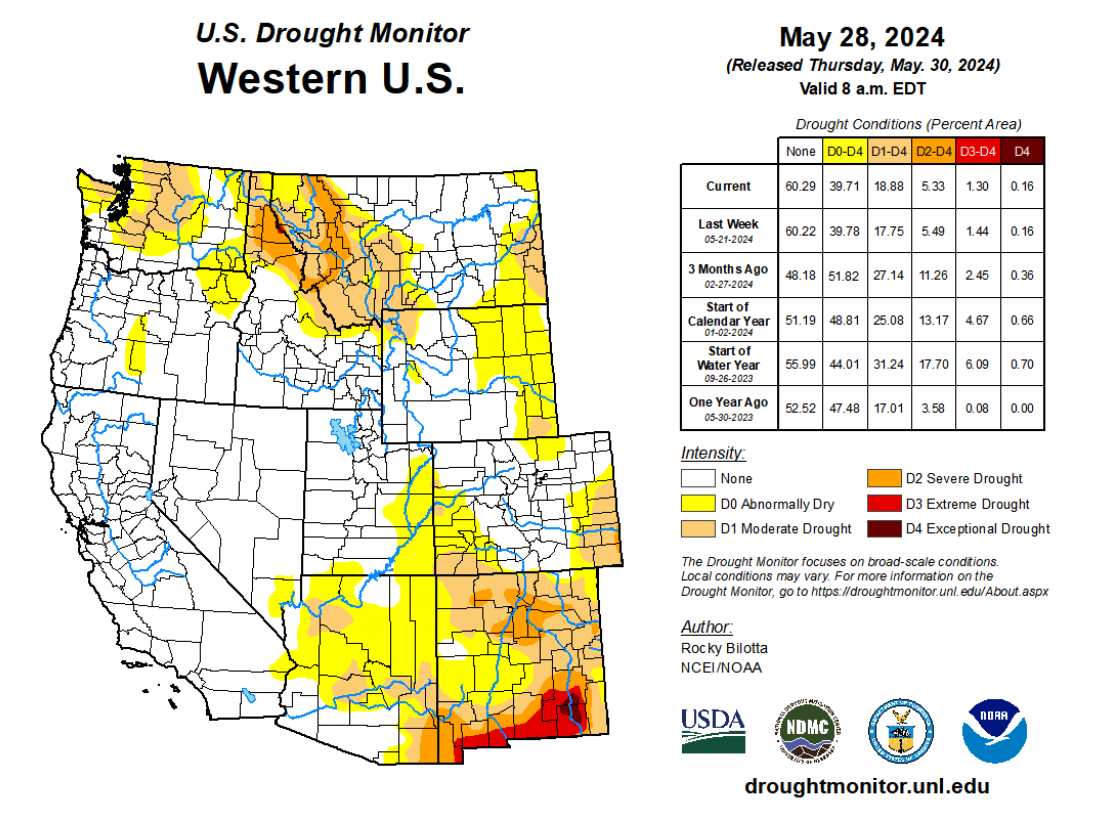
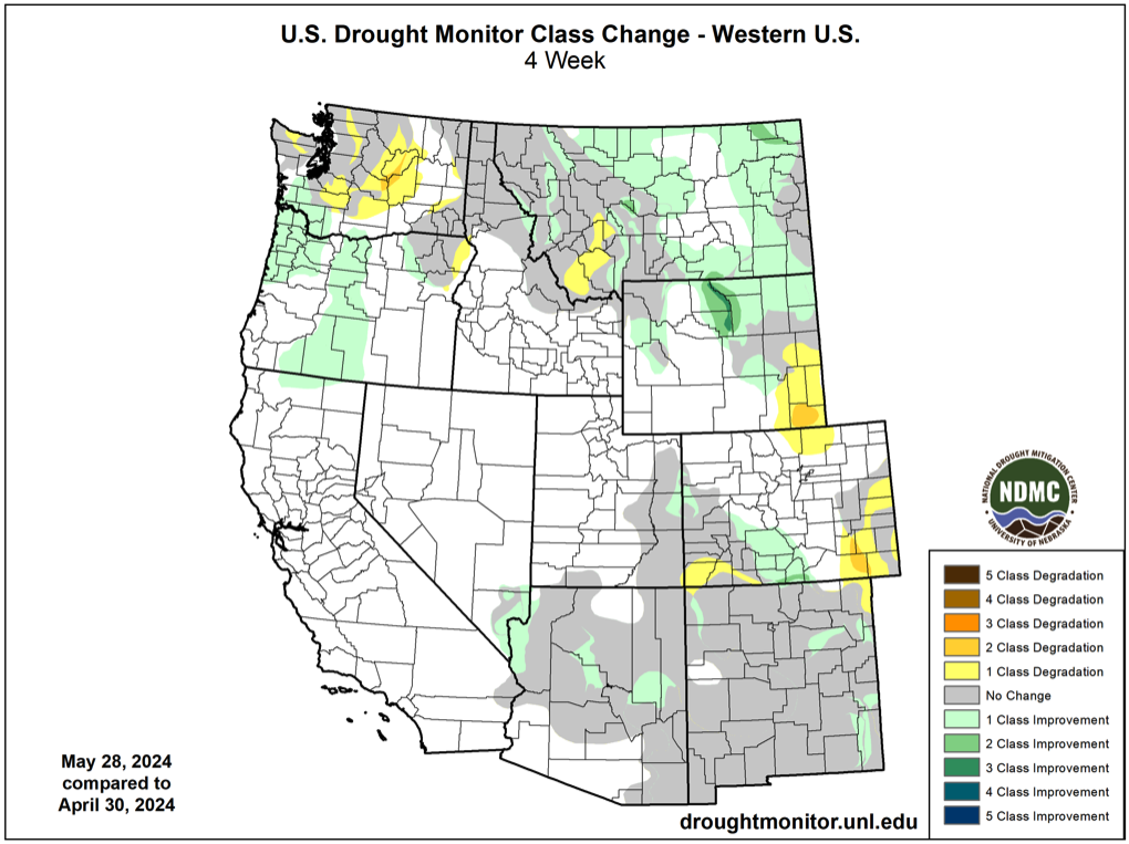
Regional drought conditions improved during May and now cover 8% of the region, compared to 10% at the end of April. Much-above average precipitation in northern Wyoming caused the removal of D1 and D2 drought conditions. Drought was entirely removed from Utah during May and the area of D1 drought contracted in western Colorado. Dry conditions in other parts of the region caused drought emergence in southeastern Wyoming, severe (D2) drought emergence in southeastern Colorado and a slight expansion of D1 drought conditions in southwestern Colorado.
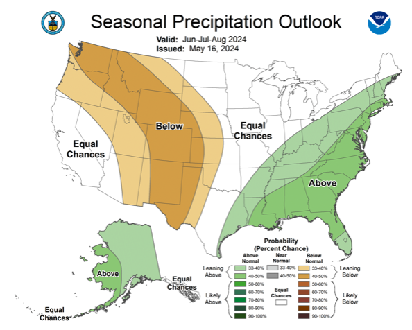
The strong El Niño event of 2023-2024 ended during May and Pacific Ocean temperatures are near average and ENSO-neutral conditions exist. There is at least a 70% probability of ENSO-neutral conditions remaining through summer, but by fall, there is a 50-60% probability of La Niña conditions forming. The NOAA Monthly Precipitation Outlook suggests an increased probability of below average June precipitation in northern Utah and above average June precipitation for southeastern Colorado. The NOAA Seasonal Outlook for June-August forecasts an increased probability of below average precipitation and above average temperatures for the entire region.


May significant weather event: Front Range severe thunderstorms. On May 30, two supercell thunderstorms rapidly formed over the Front Range and caused severe hail damage in the northern Denver metro area. Very large hail fell on the north side of Denver with hail covering roads and reaching up to 2” in diameter. (BoulderCast, Denver Hailstorm Recap, https://bouldercast.com/denver-hailstorm-recap-unexpected-nocturnal-supercells-pummeled-parts-of-the-denver-area-with-up-to-baseball-sized-hail-thursday-night/) Rainfall amounts from these thunderstorms were only a quarter to a half inch in the Denver area, but storms lingered to the northeast of Denver where up to 1.3” of rain fell in Akron on 5/30-5/31.

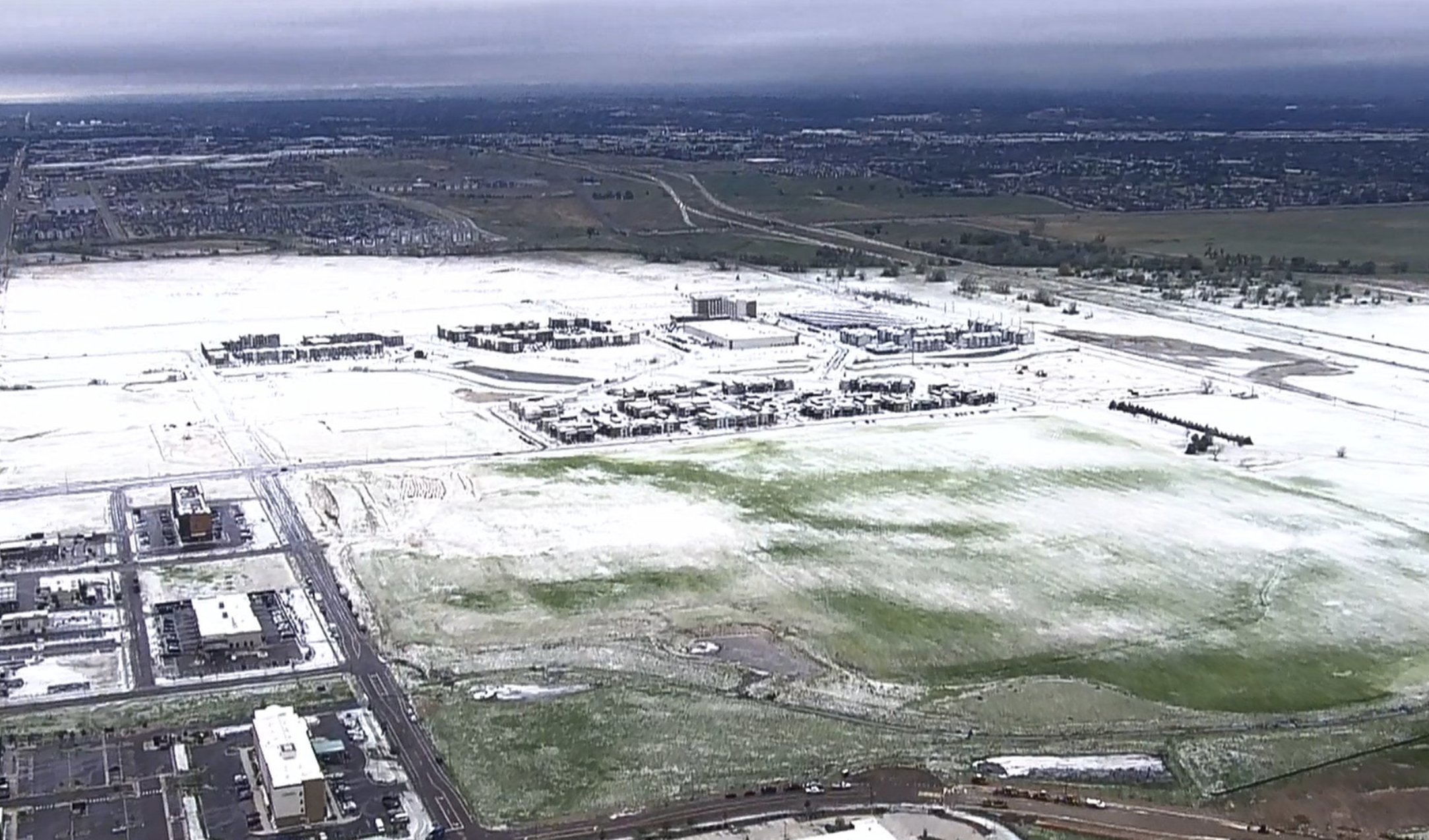
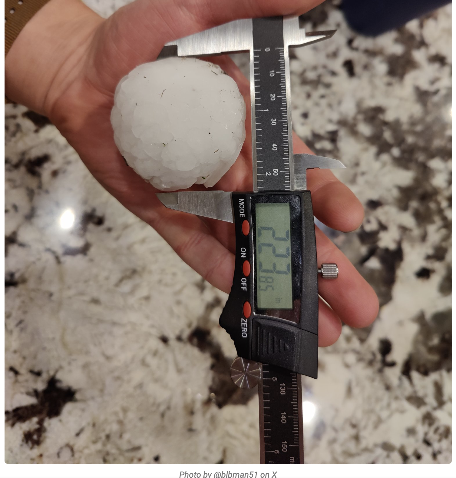
Hail images from Jayson Luber on X @Denver7Traffic.