June 6, 2023 - CO, UT, WY
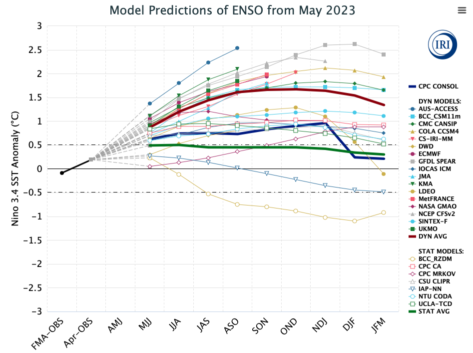
Drought conditions in eastern Colorado improved significantly after heavy rainfall during mid-May. Elsewhere in the region, May precipitation was generally below normal. May temperatures were above normal in northern Wyoming and near-normal in much of Colorado and Utah. Snowpack has melted out at many locations, but remains above normal in Utah and western Colorado. Pacific Ocean temperatures warmed significantly since winter and an El Niño watch is in effect, and there is over a 70% chance of El Niño continuing through mid-winter 2024.
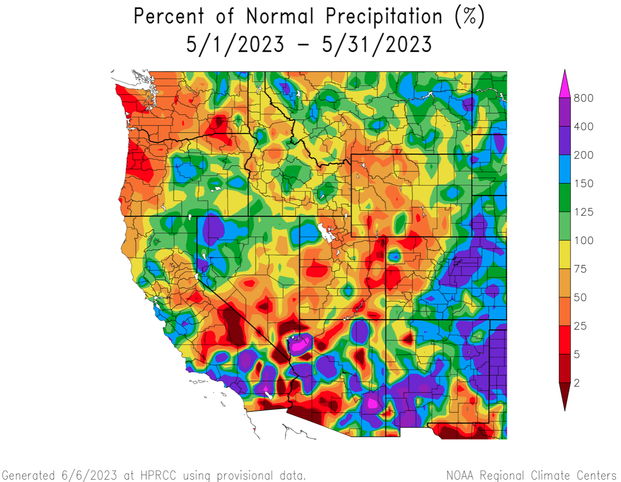
Below normal precipitation fell across much of the region during May. Eastern Colorado and southeastern Wyoming received above-to-much-above normal precipitation during May. Portions of northeastern Utah saw record-wet May conditions. Above normal precipitation also fell in isolated pockets in Utah and northwestern Colorado, likely driven by intense rainfall during thunderstorms.
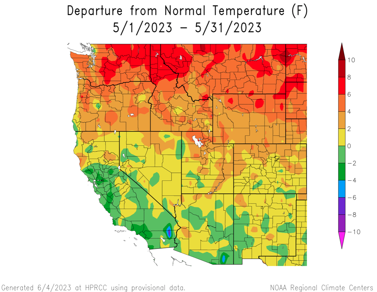
May temperatures were near-normal for the southern half of the region and above normal in the North. In southern Colorado and southern and western Utah, May temperatures were within 2 degrees of average. In Wyoming, northern Colorado, and northern Utah, temperatures were 2-6 degrees above normal with the hottest May temperatures relative to average in northern Wyoming.
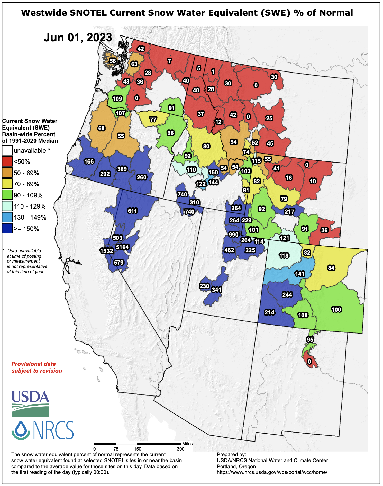
First of May snowpack conditions reflect a similar pattern to winter snowfall. Utah snow-water equivalent (SWE) is much above normal. May 1st SWE in western Colorado and southwestern Wyoming is above normal. Near-to-slightly below normal SWE conditions exist in Colorado east of the Continental Divide and in western Wyoming. Much below May 1st snowpack in northern Wyoming is the result of above average May temperatures and lower peak snowpack accumulation compared with the rest of the region.
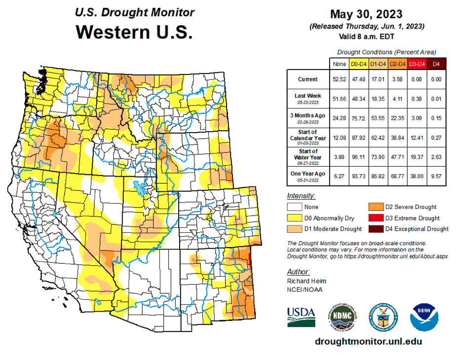
Intermountain West drought conditions improved or did not change for all locations except northwestern Wyoming where D1 drought developed. As of May 30, drought covered 14% of the region, down from 32% at the end of April. Drought conditions improved most significantly in eastern Colorado where a slow-moving storm during mid-May resulted in two to nine inches of rainfall. In Utah, D2 drought conditions were removed in central Utah and D1 drought was removed in Carbon, Tooele, Utah, and Wasatch Counties. In Wyoming, drought conditions were removed in the southwestern portion of the state and drought improved in eastern Wyoming.
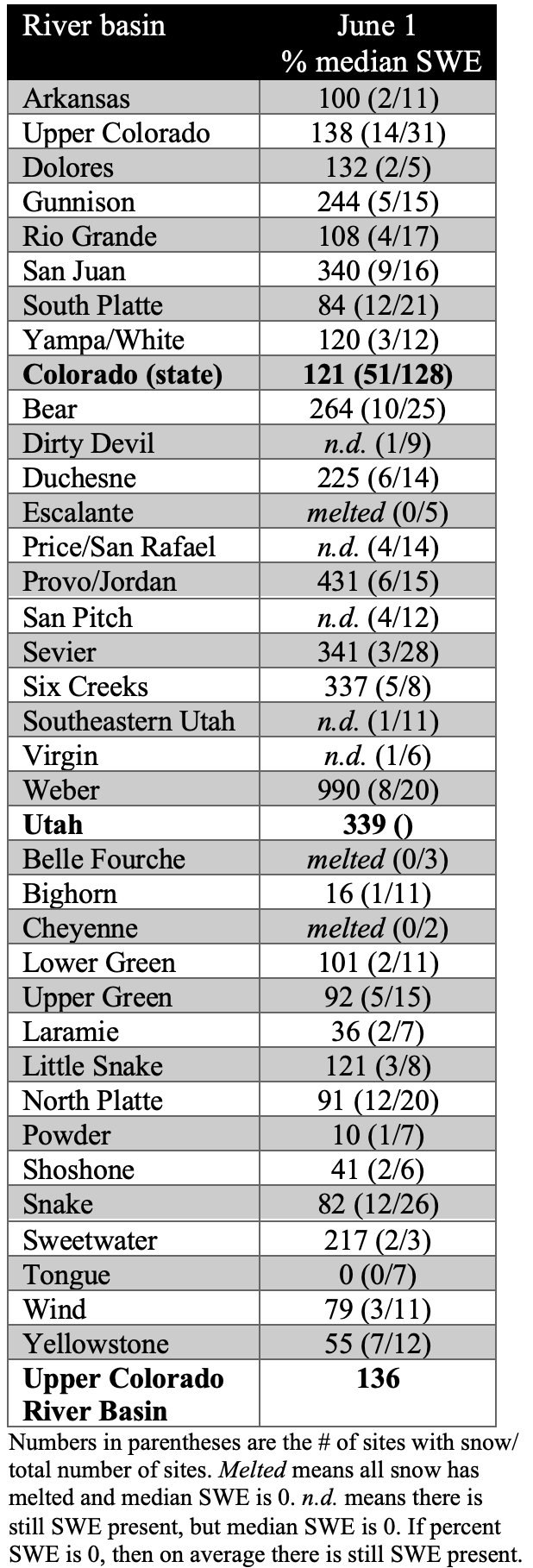
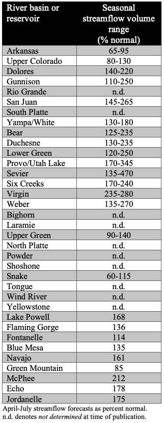
Seasonal streamflow forecasts are above to much-above average for nearly all portions of the Upper Colorado River and Great Basins and forecasts changed little since May 1. Seasonal streamflow forecasts are highest in Great Basin rivers, and the Dolores, Lower Green, and San Juan River basins. The inflow to major regional reservoirs is forecasted to be above-to-much-above average, except for Green Mountain Reservoir; the inflow to Lake Powell is forecasted to be 168% of average.
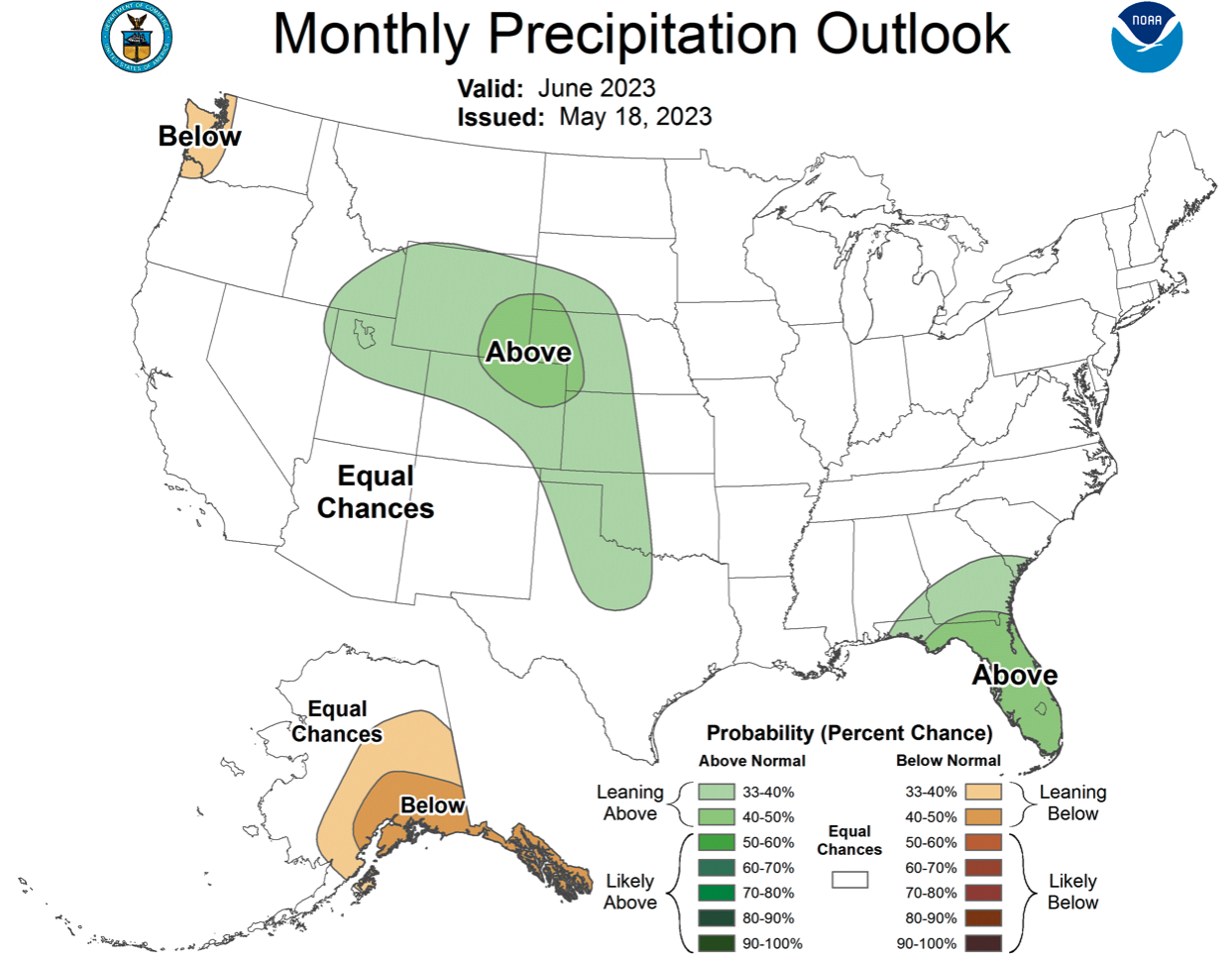
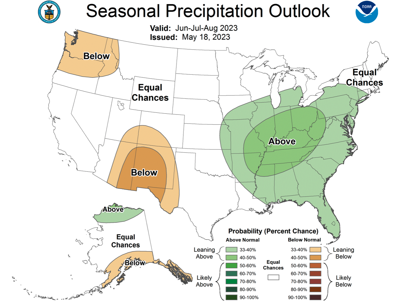
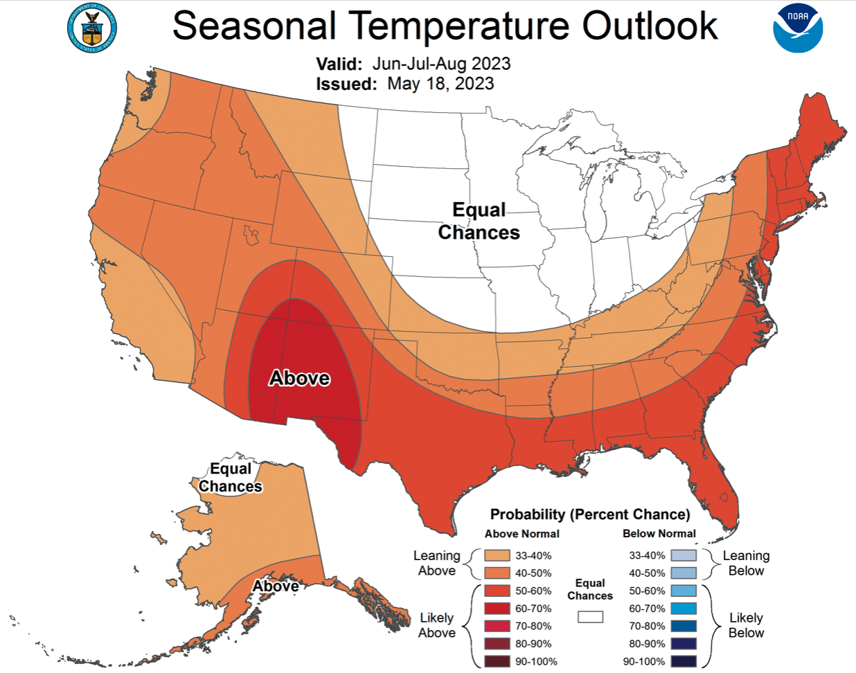
An El Niño watch was in effect during May in anticipation of El Niño conditions soon forming. Pacific Ocean sea-surface temperatures were a mix of near-average to above average temperatures but not yet over the 0.5 degree Celsius warmer-than-average threshold for El Niño. Mid-May ocean-temperature models indicate an 80% probability for El Niño conditions during May-July and the probability of El Niño conditions remains above 70% through mid-winter 2024. There is an increased probability of above average June precipitation for Wyoming, most of Colorado, and northern Utah. NOAA seasonal forecasts suggest an increased probability for below average precipitation during June-August for southeastern Utah and southwestern Colorado, suggesting a delayed or below average summer monsoon. There is an increased probability of above average temperatures during June-August for the entire region, especially around the Four Corners.
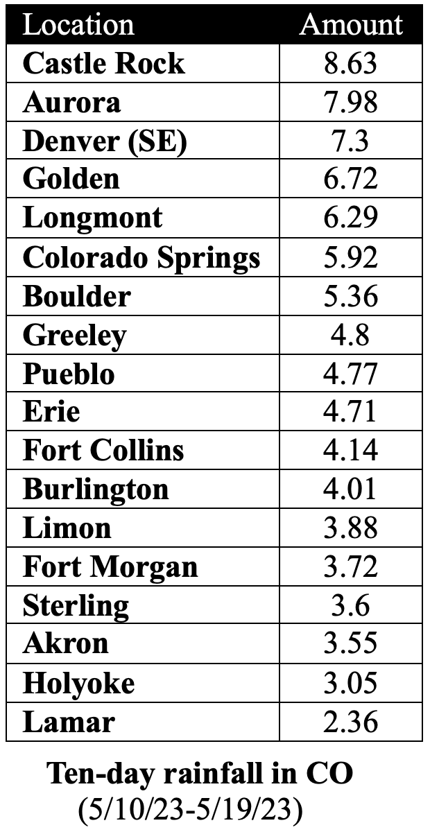
May significant weather event. Drought-busting rainfall in eastern Colorado. A slow-moving storm system that combined elements of both winter and summer weather patterns brought ten days of rain to the Front Range and Eastern Plains of Colorado. From May 10-19, two to nine inches of rain fell in Colorado east of the Continental Divide. The highest ten-day rainfall totals occurred from Colorado Springs to Longmont (5.9-8.6”). The Eastern Plains, suffering from D1-D4 drought, received two to five inches of rain. Consequently, drought conditions significantly improved; coverage of drought in Colorado dropped from 33% of the state to 11% of the state following the prolonged storm. A record amount of rain fell from May 10-19 in Akron, Castle Rock, Denver, Fort Morgan, Limon, and Longmont. On May 10, 27 sites with at least 50 years of weather data saw record rainfall totals, and 26 sites received record rainfall on May 11, including 3.18 inches in Colorado Springs (5/10), 4” in Palmer Lake (5/11), 3.55” in Castle Rock (5/11), and 3.32” in Denver-Central Park (5/11). Less rain fell in far southeastern Colorado, but drought conditions still improved by one category.