June 5, 2022 - CO, UT, WY
La Niña continued to influence regional weather during May with cooler than average temperatures throughout most of the region and above average precipitation for northern Wyoming. June 1st SWE was much above normal in much of Wyoming, near normal in northern Colorado and east of the Continental Divide and generally below normal or completely melted in Utah. June 1st seasonal streamflow forecasts were below to much-below normal for the Upper Colorado River and Great Basins. While drought remains present in 92% of the region, drought conditions significantly improved in northern Wyoming, but worsened in Utah and southern Colorado.
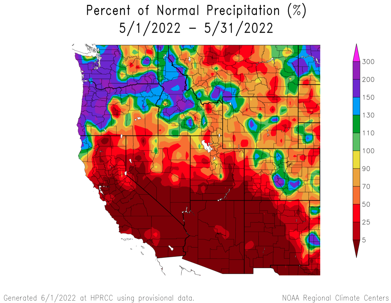
May precipitation was generally below normal in the Intermountain West. The driest conditions were observed in southern Utah and southwest Colorado where many locations saw no measurable precipitation. May precipitation was above normal in northwestern Wyoming, central Wyoming and locations along the Continental Divide in Colorado. Due to mostly below normal May temperatures, many mid-to-high elevation locations saw significant snowfall.
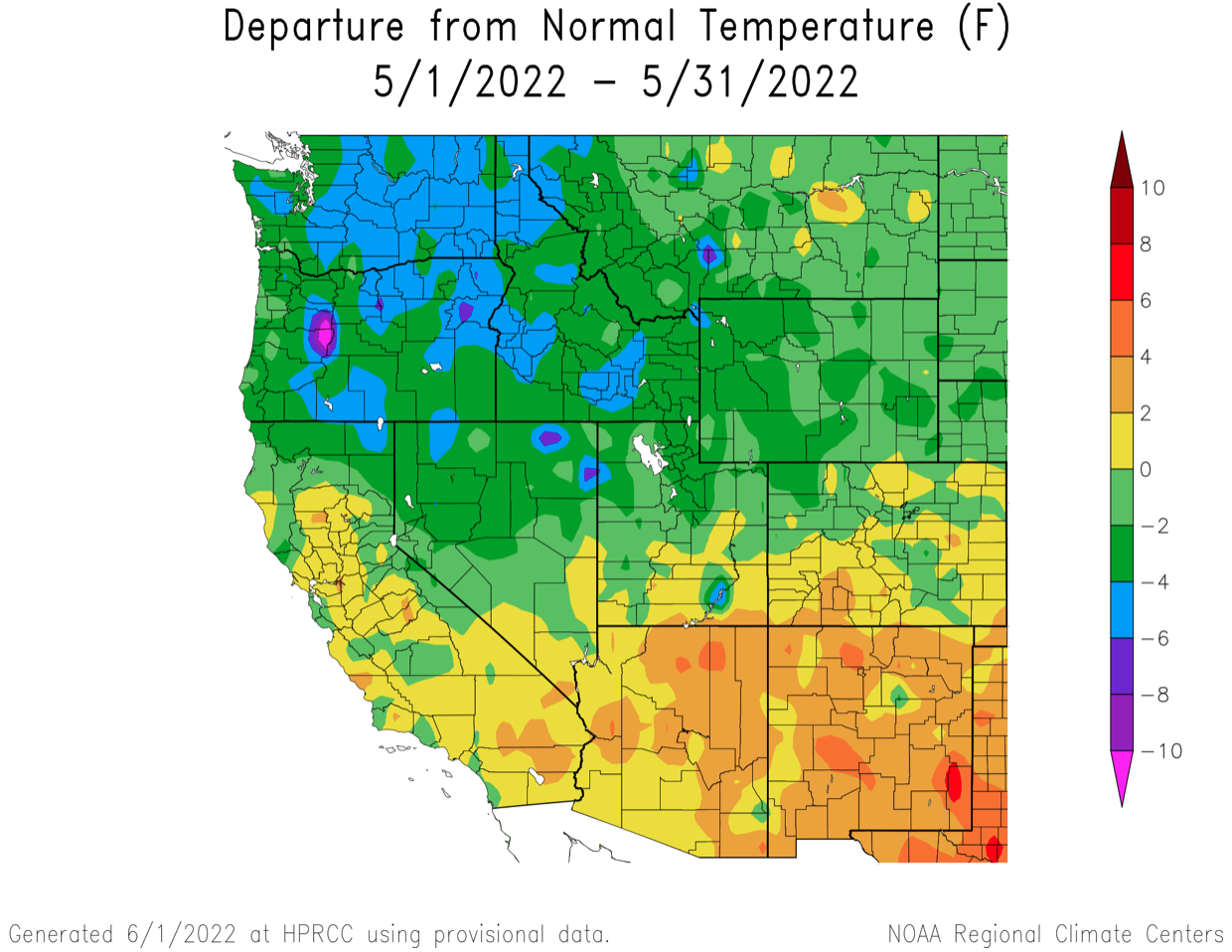
Regional temperatures were near-to-below normal during May. In northern Utah, northwestern Colorado and western Wyoming, temperatures were 2-4 degrees below normal.
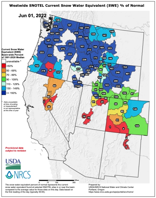
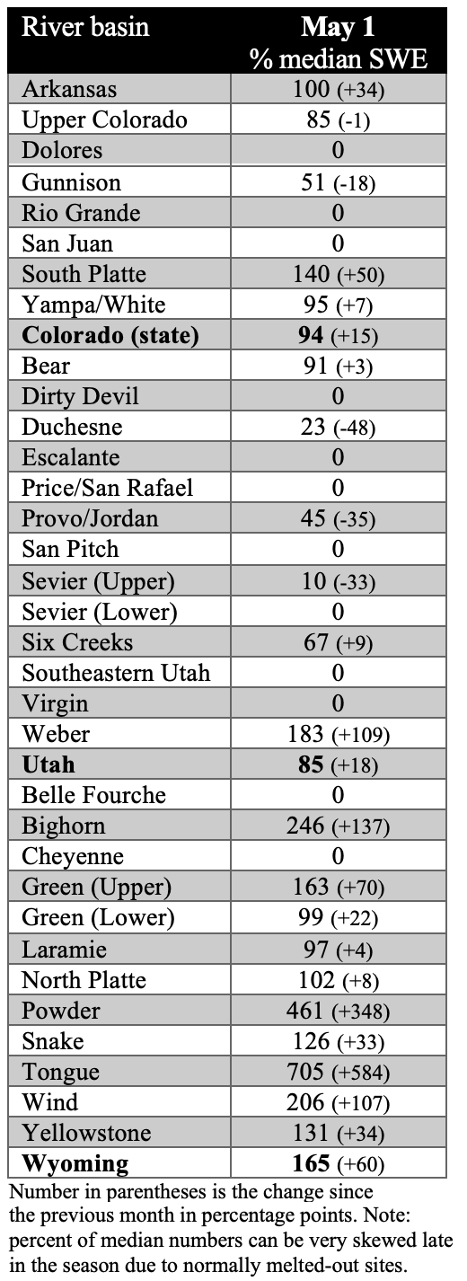
June 1st snow water equivalent (SWE) was generally above normal in the northern portion of the region and completely melted out or below normal in southwestern Colorado and southern Utah. Near normal June 1st SWE was observed in northern Colorado, northern Utah and southern Wyoming despite below average May 1st SWE in many of these locations. In much of Wyoming, June 1st SWE conditions ranged from 126% - 705% of normal. Improvements in June SWE conditions compared to May1st SWE conditions were due to below normal temperatures and areas of much above average precipitation.
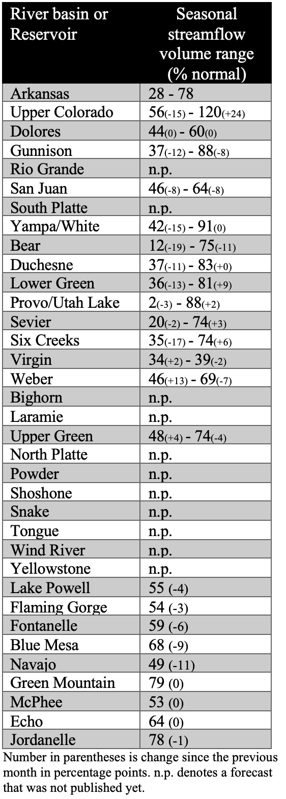
June 1st seasonal streamflow forecasts are below to much-below normal in the Upper Colorado River and Great Basins. Seasonal runoff forecasts were highest, but still below normal, for the Upper Colorado, Upper Gunnison, and Upper Yampa River basins. Seasonal runoff forecasts are much-below normal for all other river basins. Many locations in Utah and western Colorado, where temperatures were near normal and precipitation was below normal, dust storms caused significant dust accumulation on snowpack and speeded melt. Inflow forecasts for all major regional reservoirs are much-below normal with Green Mountain (79% normal) and Blue Mesa (68%) Reservoirs faring best and Lake Powell, Flaming Gorge, McPhee and Navajo Reservoirs are forecasted to have less than 55% normal inflow volumes.

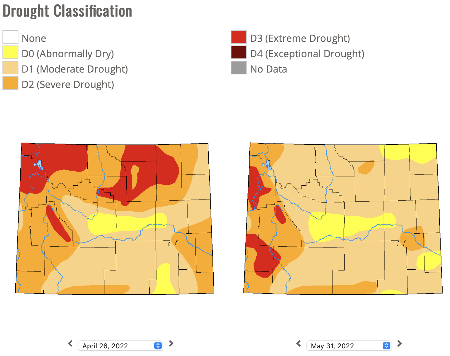
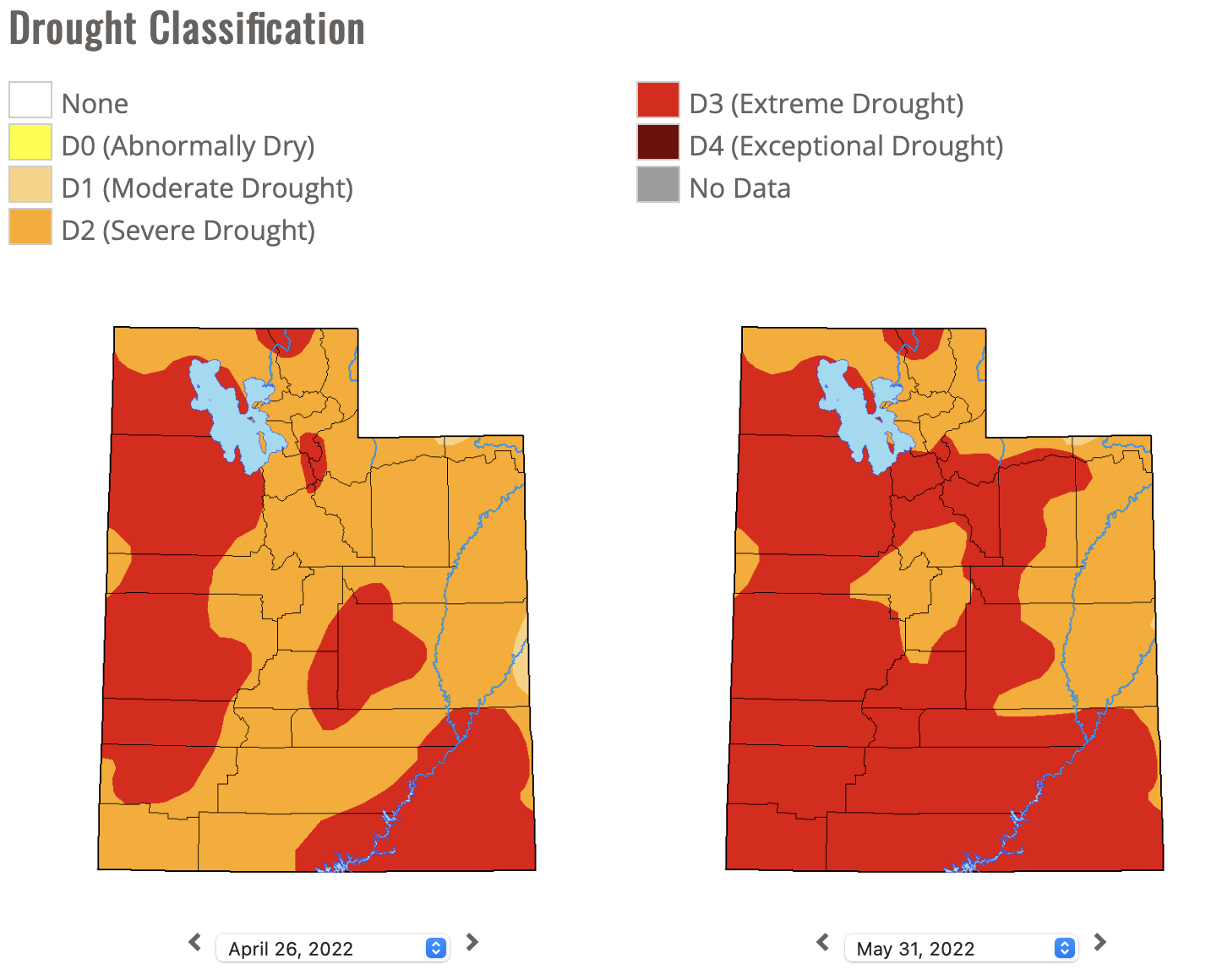
Drought conditions continue across 92% of the region. Overall, drought conditions improved in the northern portion of the region and deteriorated in the south. Cooler and wetter conditions led to a two-category improvement of drought conditions in northern Wyoming and a large decrease in the coverage of extreme (D3) drought. D3 drought developed in southwestern Wyoming during May. Drought conditions worsened in western Colorado with the emergence of D1 drought along the Colorado River and expansion of D2 and D3 drought. Drought was removed in portions of Larimer and Routt Counties in northern Colorado. In Utah, D3 drought emerged over large areas of the state, now covering 72% of its area.

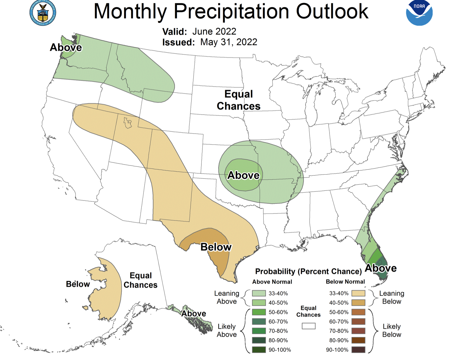
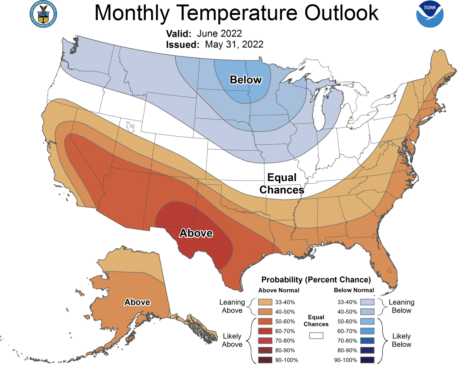
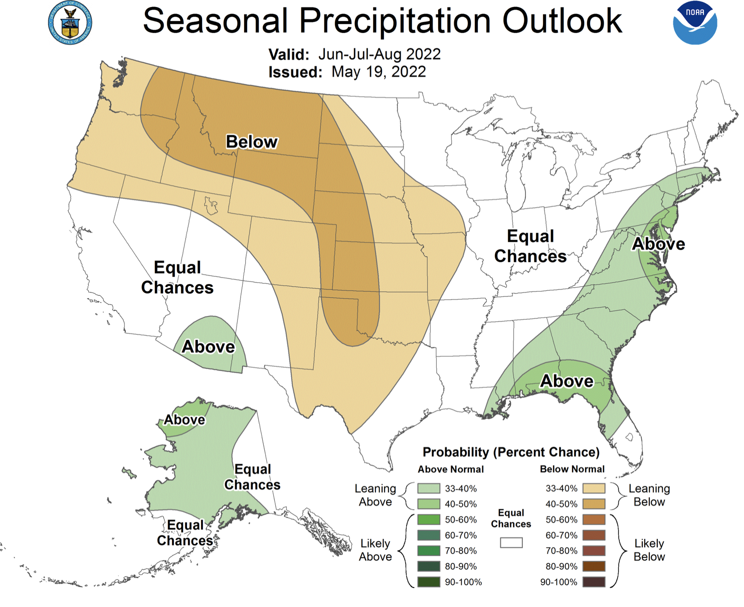
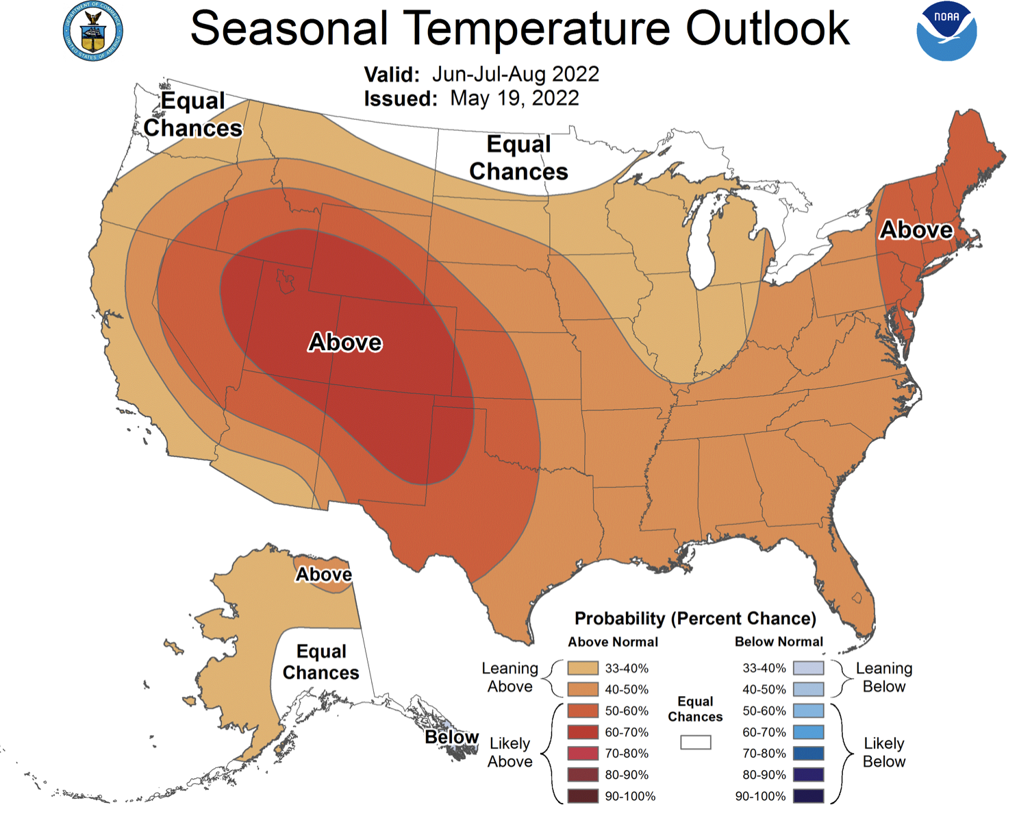
La Niña conditions continued during May with eastern Pacific Ocean temperatures averaging 1ºC below normal. La Niña conditions are expected to persist at least through June and there is a greater than 50% probability of La Niña continuing through early winter. A typical La Niña weather pattern is forecasted to continue during June with a higher probability of wetter and cooler than normal conditions for northern Wyoming. The NOAA seasonal forecast for June-August predicts a 60-70% probability of above average temperatures for most of the region and an increased probability of below normal precipitation for Wyoming, most of Colorado and northern Utah. There is an increased probability of above average summer precipitation in southern Arizona, suggesting the possibility of a stronger than normal monsoon.