July 7, 2023 - CO, UT, WY
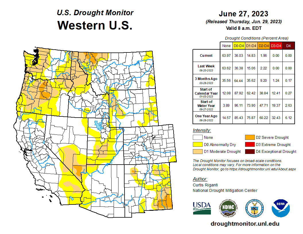
Heavy rainfall continued through June, breaking precipitation records in Colorado and Wyoming and completely removing drought from Colorado. June temperatures were below normal throughout most of the region, particularly in Colorado and Utah. Snowpack has melted out across the region, except for some high-elevation areas not captured by the SNOTEL network. Most streamflow gauges recorded normal to above normal flows throughout the region. Regional drought conditions continued to improve in June. El Niño conditions continued in June and are expected to persist and strengthen through winter.
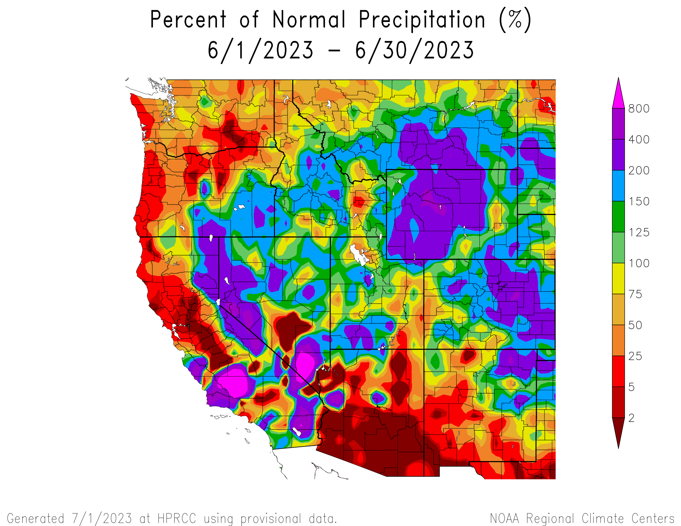
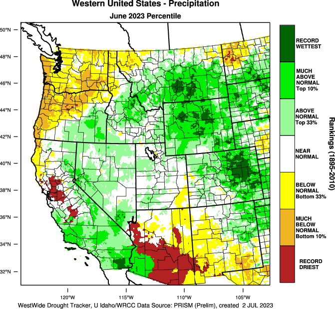
June precipitation was above to much-above normal for most of the region. 200-400% of normal precipitation occurred in the majority of Wyoming, eastern Colorado, and pockets in southwestern and central Utah, with 400-800% of normal precipitation in Arapahoe and Elbert Counties in Colorado and Park, Hot Springs, and Fremont Counties in Wyoming. Record-wettest conditions occurred throughout much of the Front Range and eastern Colorado, and central and southeastern Wyoming. Areas of below normal precipitation occurred as well, particularly in the Great Salt Lake region, southeastern Utah, and southwestern Colorado.
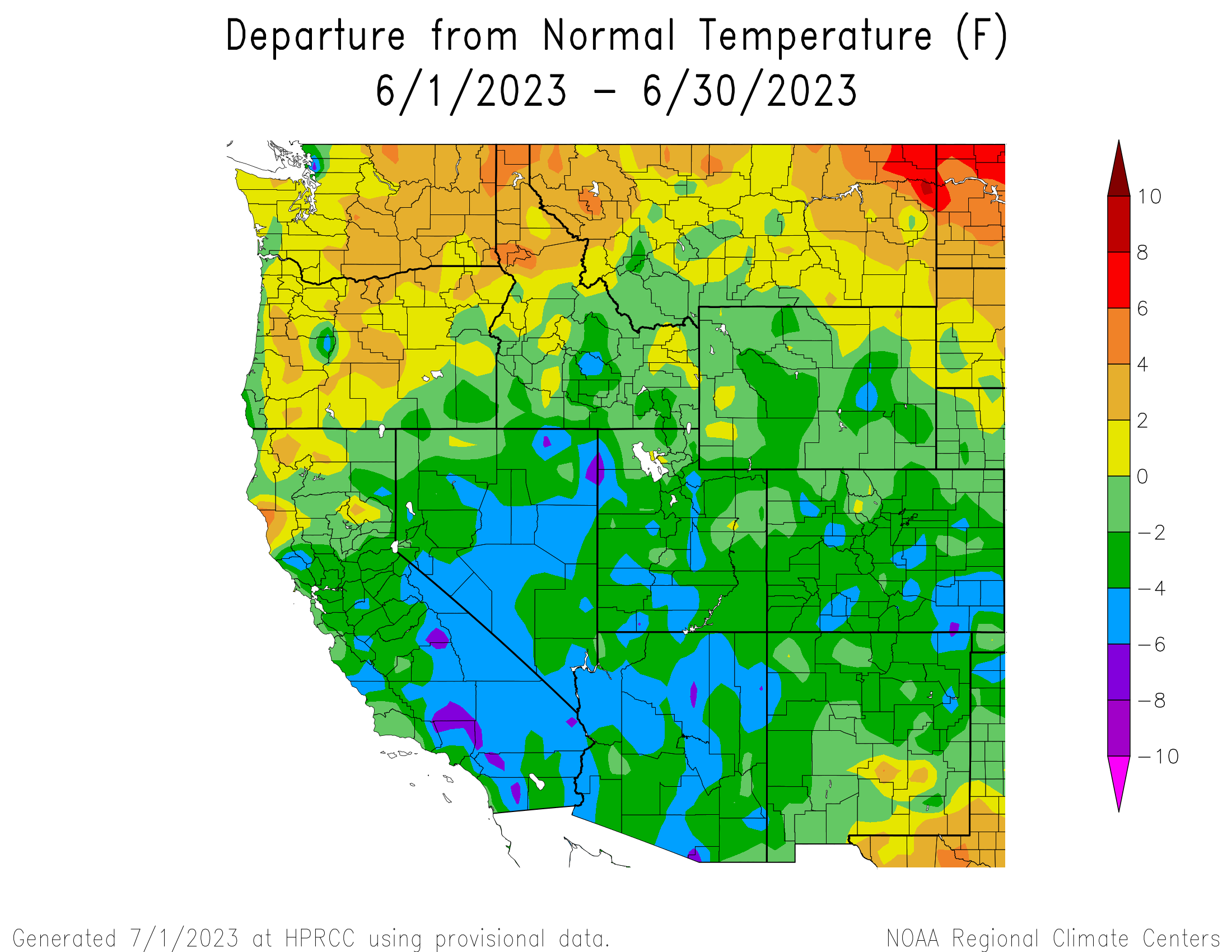
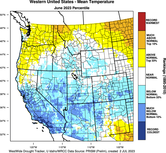
Regional temperatures were near normal to much-below normal. Temperatures of four to six degrees below normal were scattered throughout Utah and Colorado, with pockets of six to eight degrees below normal in Las Animas County in Colorado and Box Elder and Tooele Counties in Utah. In northeastern Wyoming, slightly above normal June temperatures were observed.
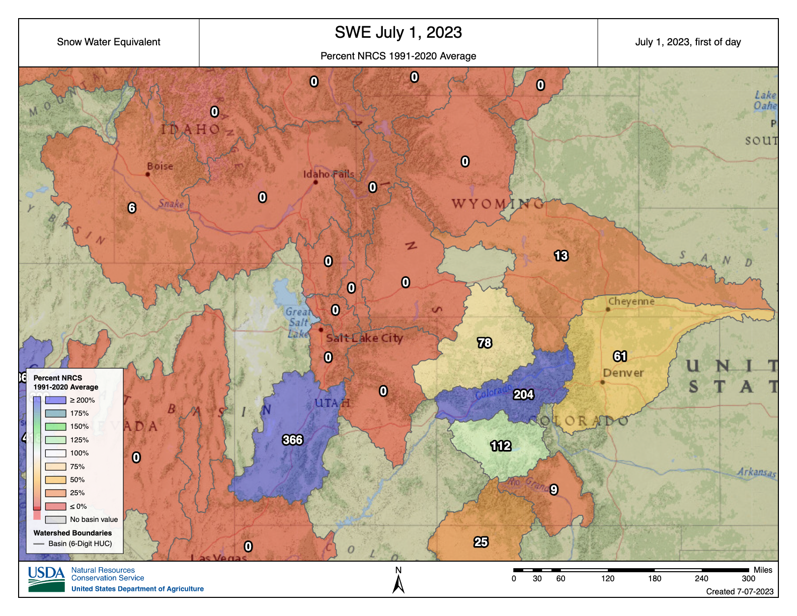
Snowpack has completely melted out at all SNOTEL sites across the region, except for the Gunnison, Colorado Headwaters, White-Yampa, and Escalante Desert-Sevier Lake Basins. As of July 5 and averaged across all the SNOTEL sites in the remaining basins in the region, snow melted out 12 days later in Utah and four days later in Colorado. In Wyoming, snow melted out four days earlier than average. Regionally, snow melted out five days later than average.
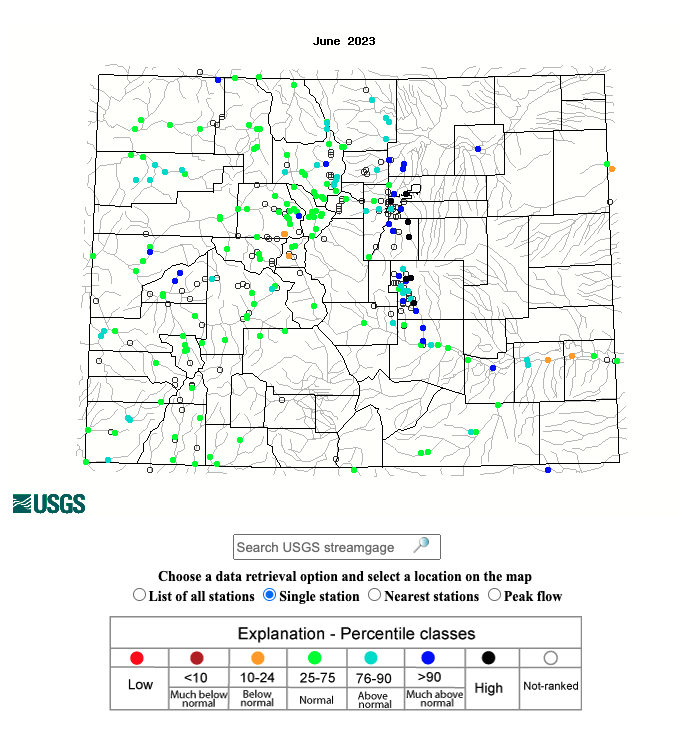
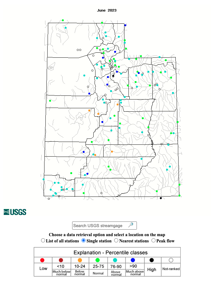
Regional streamflows were normal to much-above normal in June, with only a few sites recording below normal streamflows. Notably high streamflows, 96-98th percentile, were observed in the Provo River near Charleston, Utah, and many sites along the Front Range in Colorado, including Cherry Creek in Denver, Cottonwood Creek in Colorado Springs, and Jimmy Camp Creek in Fountain.
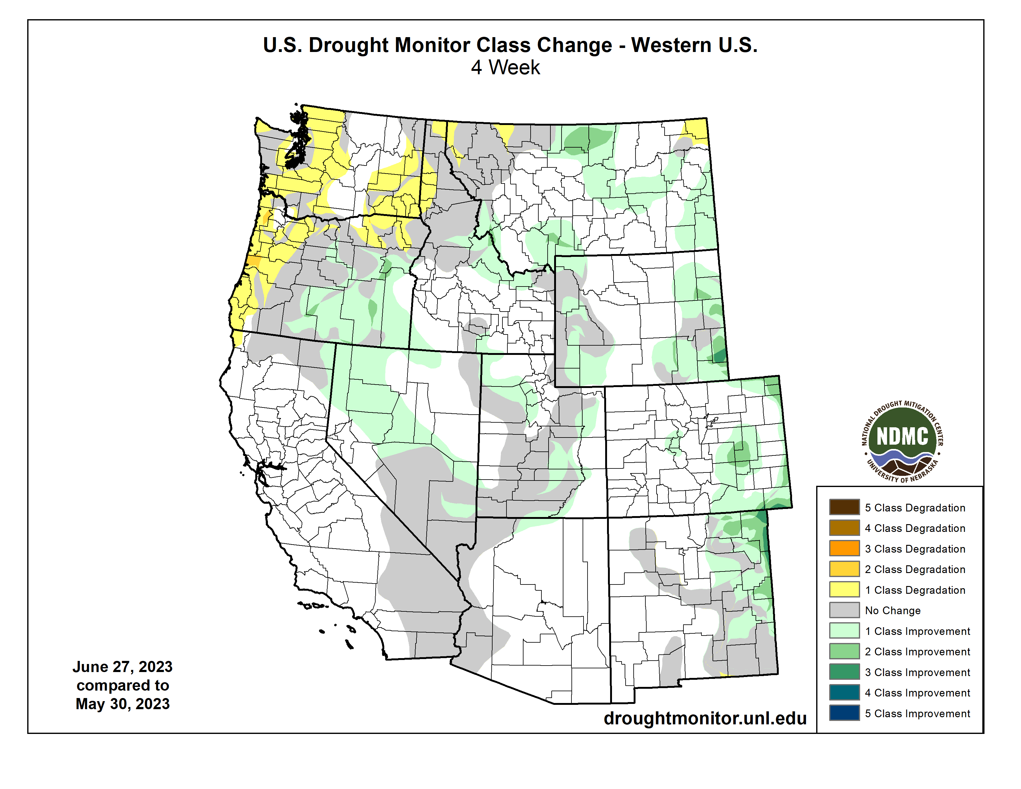
Regional drought conditions improved or did not change for all locations. As of June 27, drought covered 6% of the region, down from 14% at the end of May. Above normal precipitation throughout the majority of the region in June significantly improved drought conditions, particularly in Wyoming and Colorado. D2-D4 drought was removed from several counties in Wyoming, particularly Teton, Sublette, and Goshen Counties. On June 20, D1-D4 drought was removed in Colorado and as of June 27, the state continues to be drought-free.
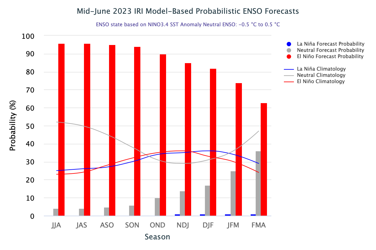
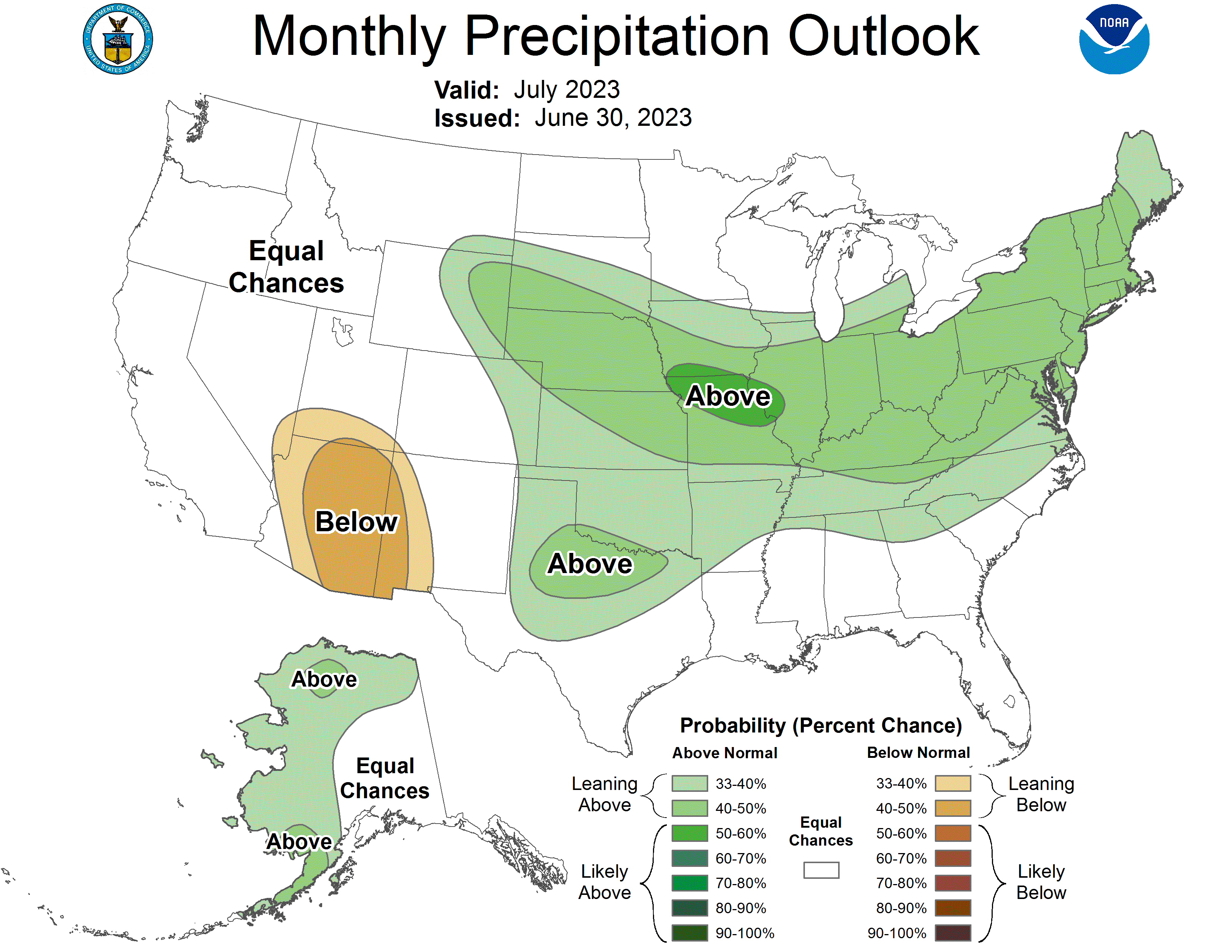
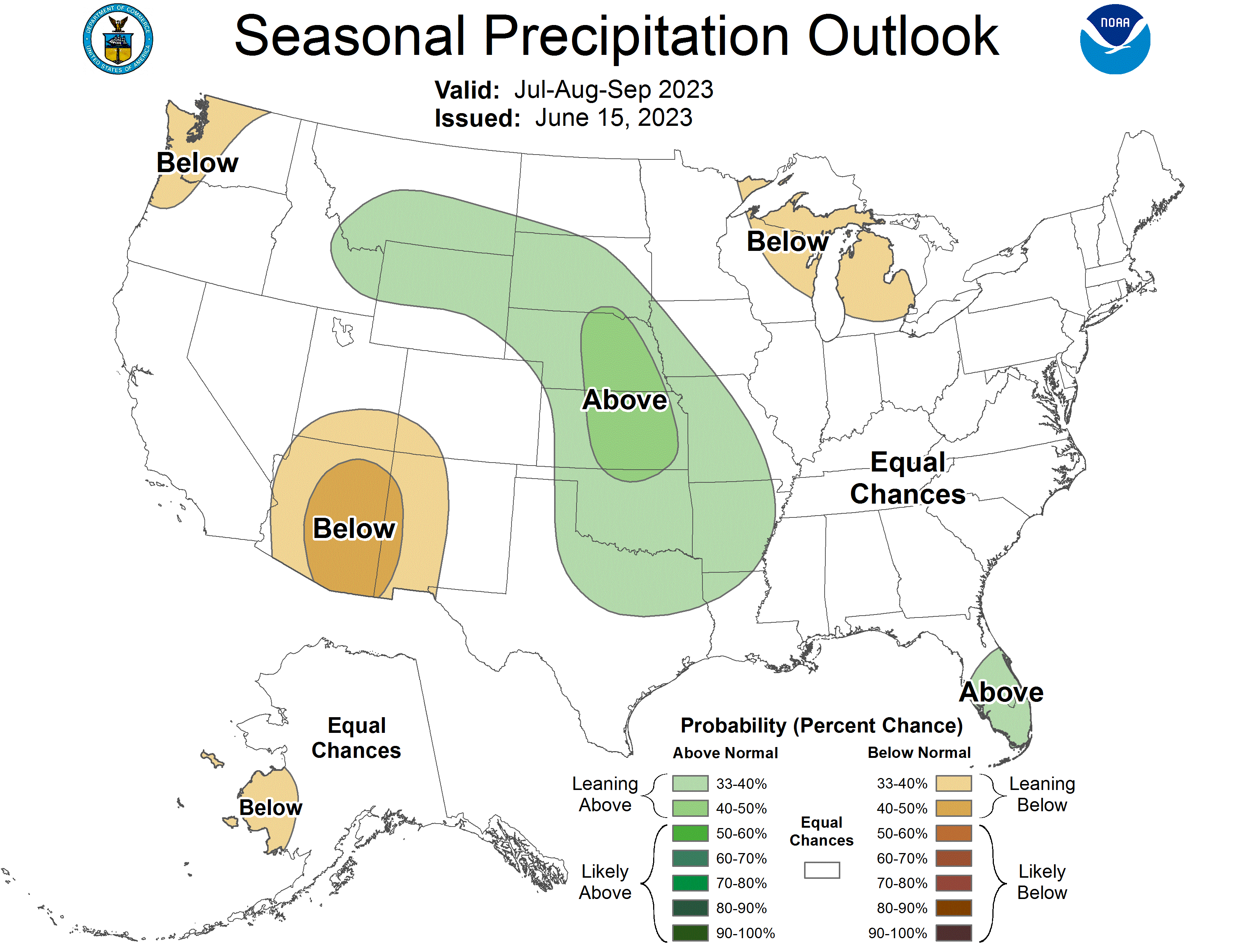
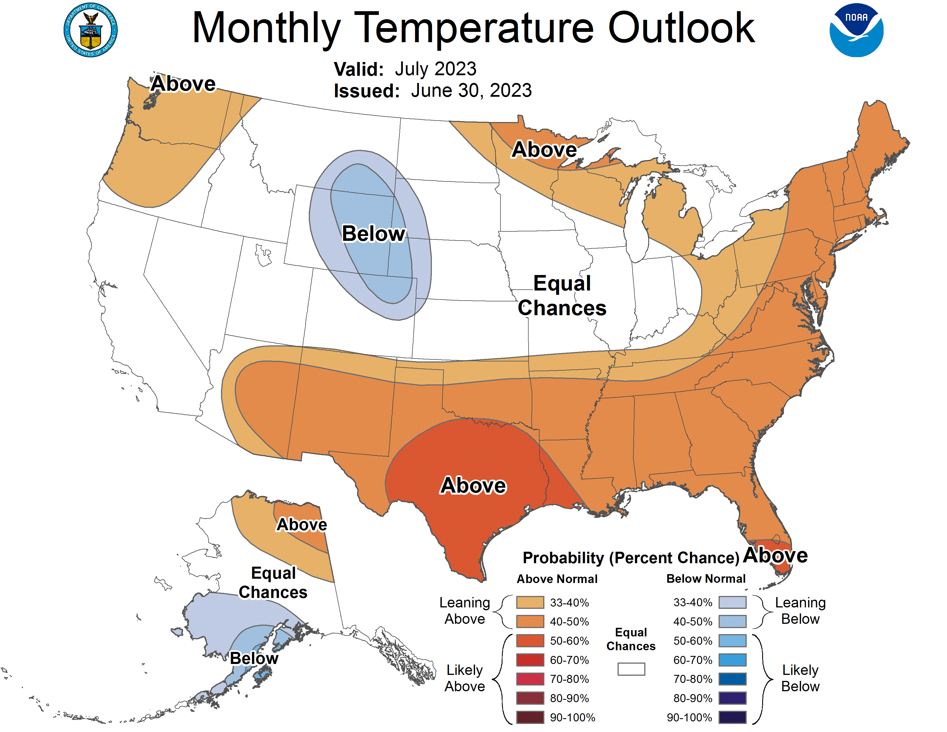
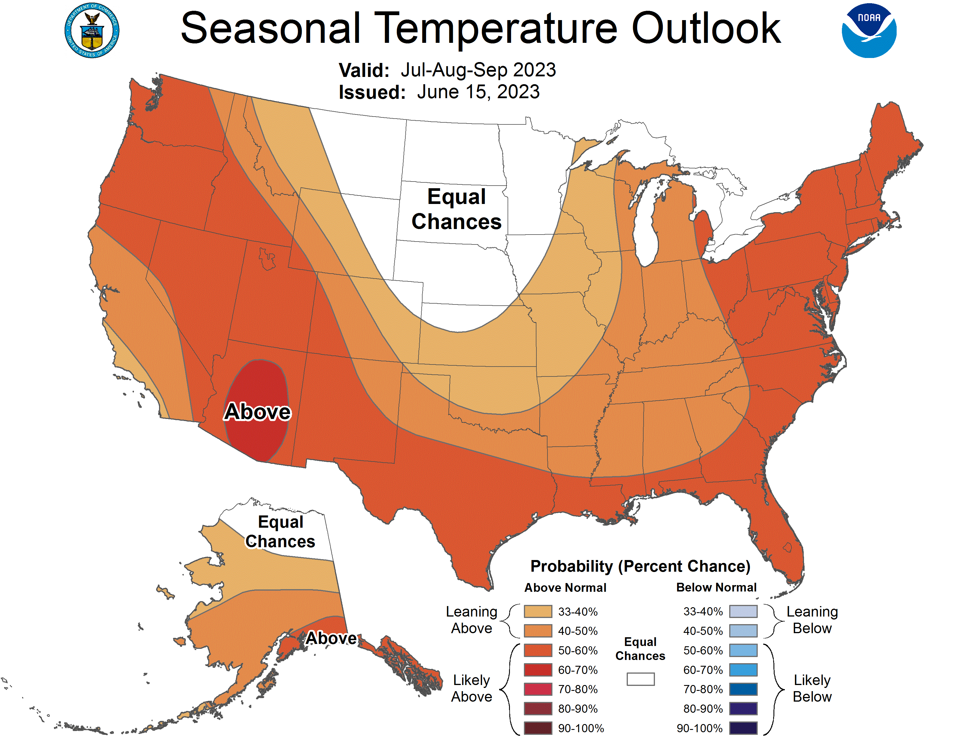
El Niño conditions continued to develop during June and are expected to strengthen into the winter. Pacific Ocean sea-surface temperatures were above normal in June, with anomalies of more than 1 degree Celsius. Mid-June ENSO forecasts indicate at least a 90% probability of El Niño conditions persisting July-November. NOAA monthly forecasts suggest an increased probability of above average July precipitation in eastern Wyoming and eastern Colorado, and below average precipitation in southern Utah. NOAA seasonal forecasts suggest an increased probability of above average precipitation in northern Wyoming and below average precipitation in southern Utah and southwestern Colorado. There is an increased probability of below average temperatures in the majority of Wyoming and northern Colorado during July, and an increased probability of above average seasonal temperatures during July-September throughout most of the region, particularly in Utah.
June significant weather event: Record-breaking rainfall in Colorado. A near-stationary, persistent ridge of high-pressure air east of Colorado, coupled with a continuous low-pressure system to the west and moisture from the Pacific Ocean and Gulf of Mexico, has caused significant precipitation in the state in June. Denver broke June's record rainfall with 6.10”, significantly surpassing the old record of 4.96” set in 1882. Denver also experienced the 6th wettest month of all time since weather records began in 1872. 11.63” of rainfall was recorded at DIA between May and June, which is 7.53” above the combined average for the two months and around 75% of normal annual precipitation. A daily maximum record of 1.85” of rain fell on June 21, significantly surpassing the old record of 0.85” set in 1947. Over five inches of rain fell in Boulder for the second month in a row, making June the 4th wettest on record since 1897. According to the Colorado Climate Center, June 2023 ranks as the 4th wettest June on record for Colorado (Figure 1), and many pockets of eastern Colorado had the wettest month of all time out of 1,542 months on record (Figure 2).