July 6, 2022 - CO, UT, WY
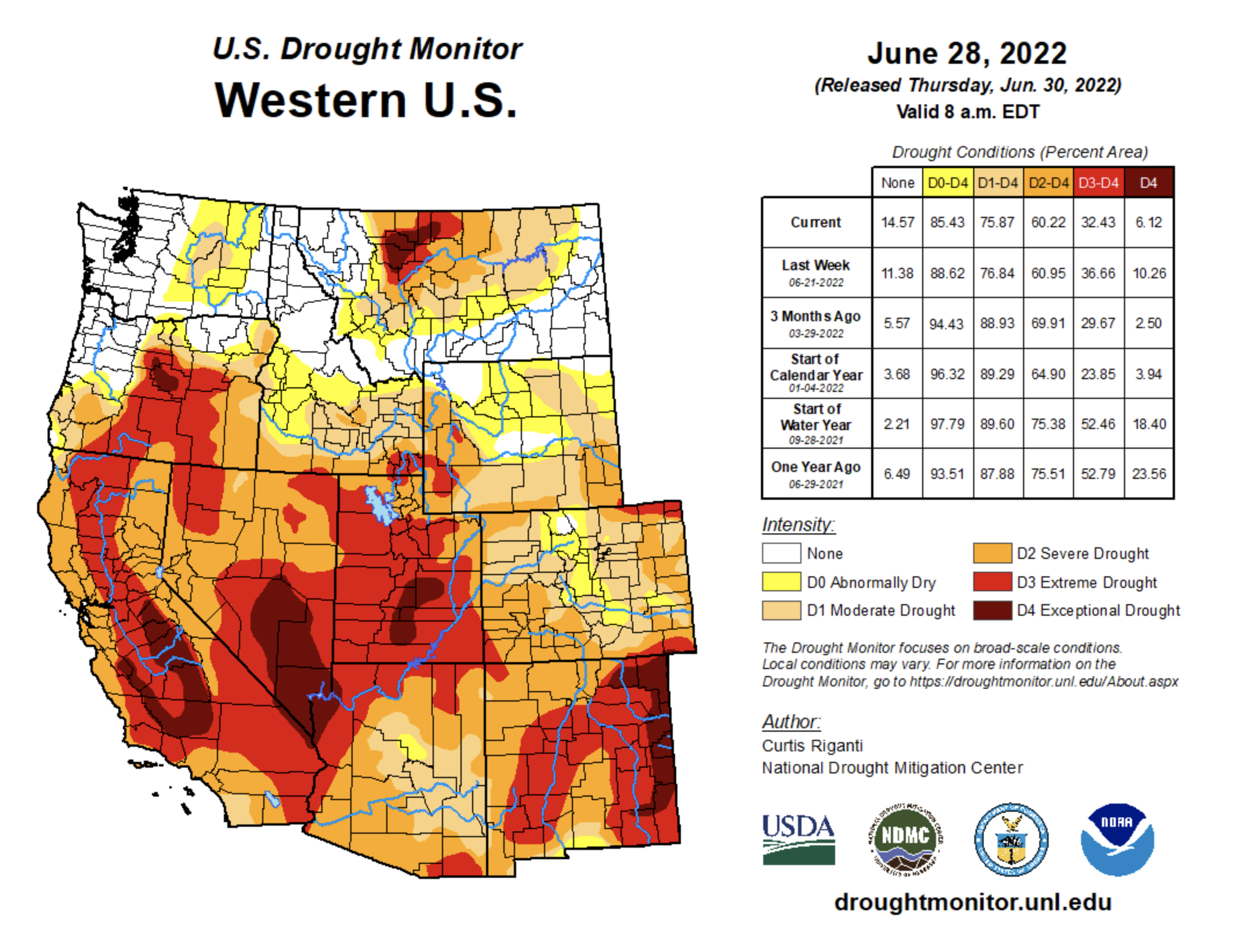
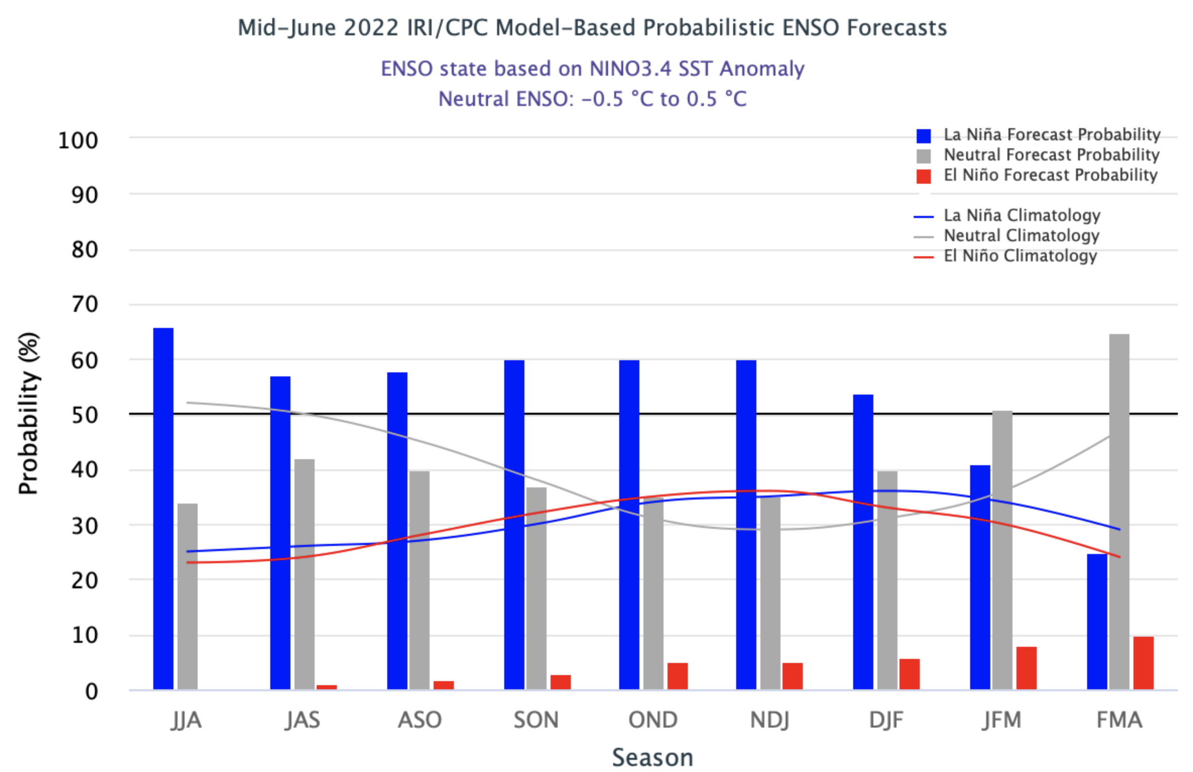
The region experienced a wide range of precipitation conditions during June. An atmospheric river and rapid snowmelt in northwest Wyoming produced record floods in Montana, early onset of the North American Monsoon caused much-above average precipitation in southern Colorado and Utah and much of Utah and Wyoming saw less than 1” of rainfall. Snow entirely melted out during June; melt was nearly ten days early in Colorado and Utah. Regional drought coverage decreased to 81% during June. Drought was completely removed in northern Wyoming and improvements to drought conditions occurred in southern Colorado, southern and eastern Utah and the Upper Snake River Basin. There is a 50-60% probability that mild La Niña conditions will persist through winter.
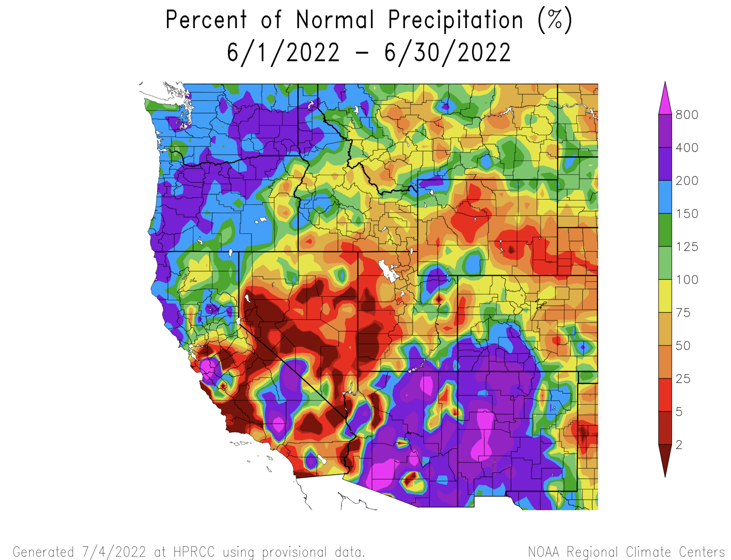
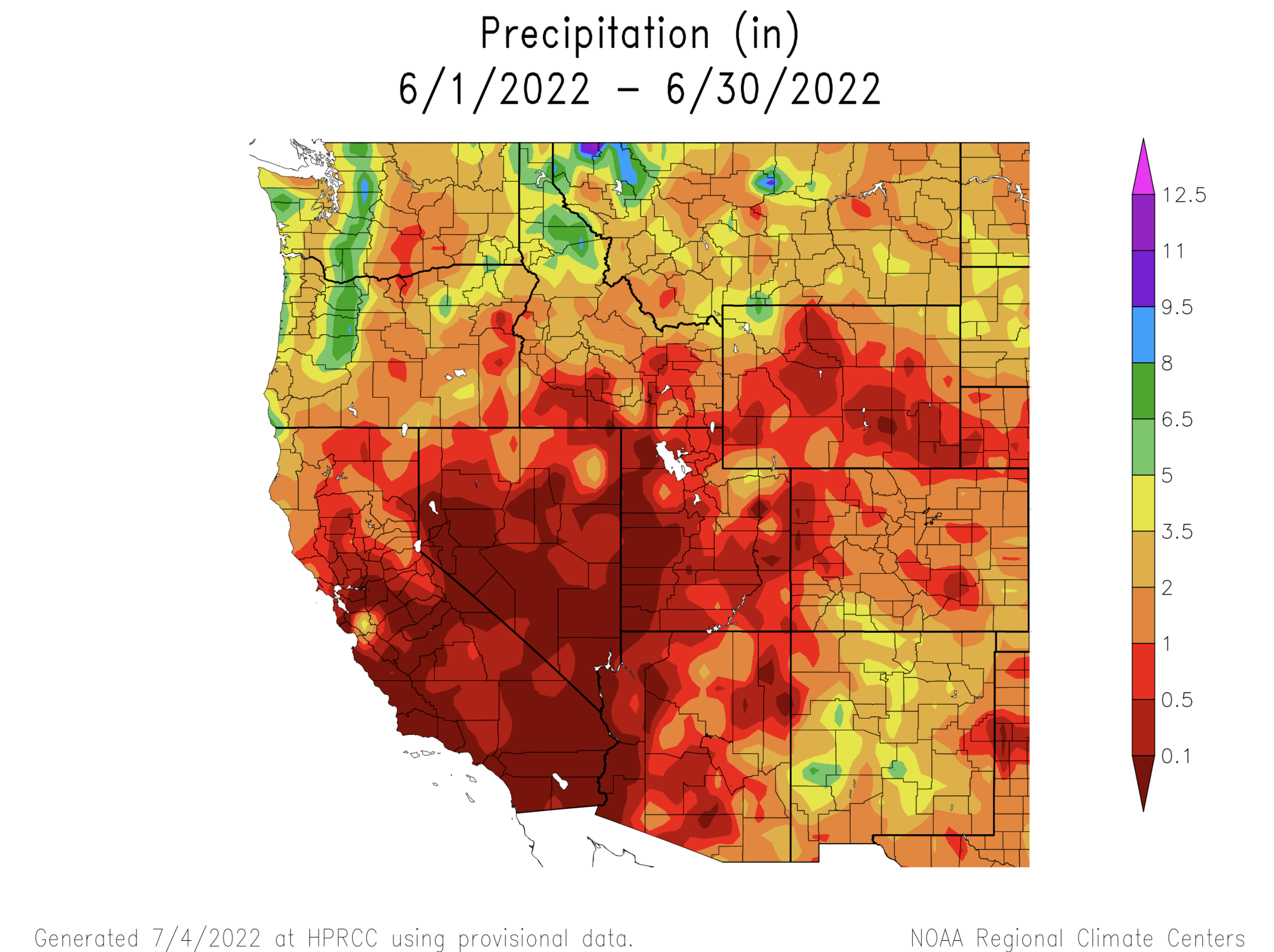
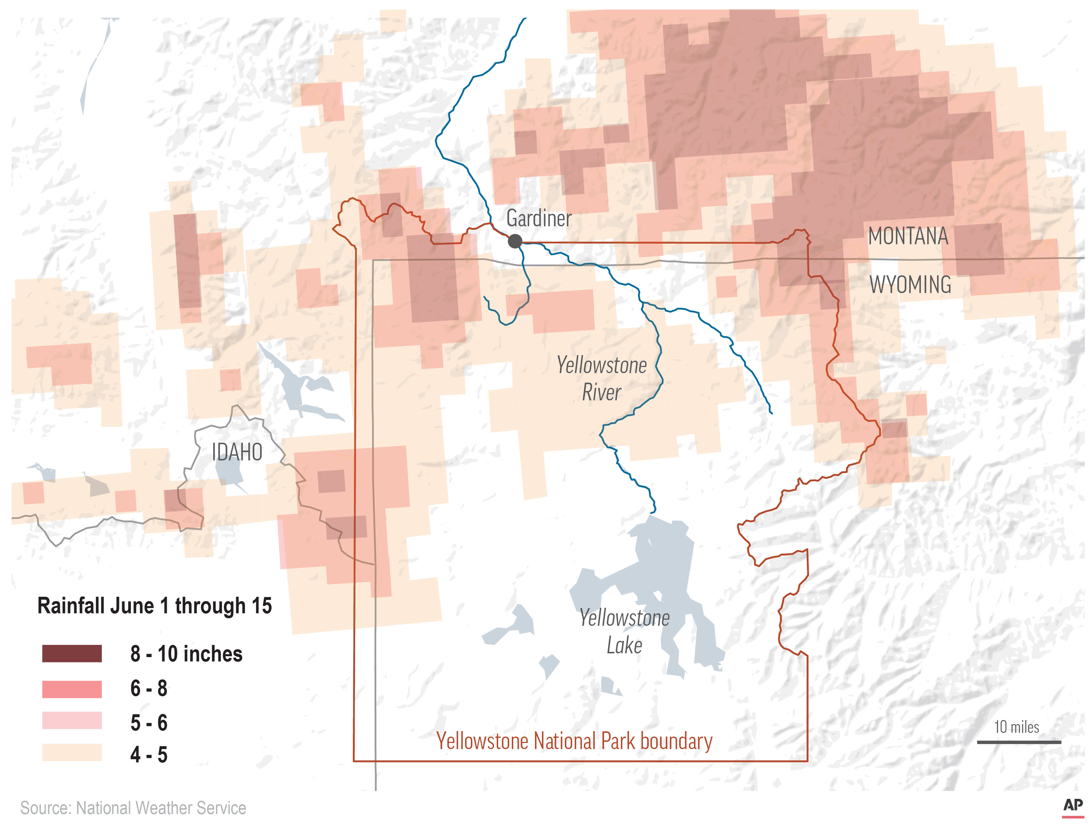
June precipitation was dominated by an early surge of monsoonal moisture in the southern portion of the region and an atmospheric river-type event in northwestern Wyoming. Southern Colorado and southeastern Utah received 200-800% of normal June precipitation due to the formation of the North American Monsoon. Monsoonal precipitation also produced above average precipitation in the Uinta Mountains of Utah. A strong atmospheric river event produced 2-5” of rain in northwestern Wyoming during early June; the combination of heavy rainfall and snowmelt caused extreme flooding in Yellowstone National Park and southwestern Montana. June precipitation was less than 50% of average in most of Utah and Wyoming with large areas of both states receiving less than 1” of rain.
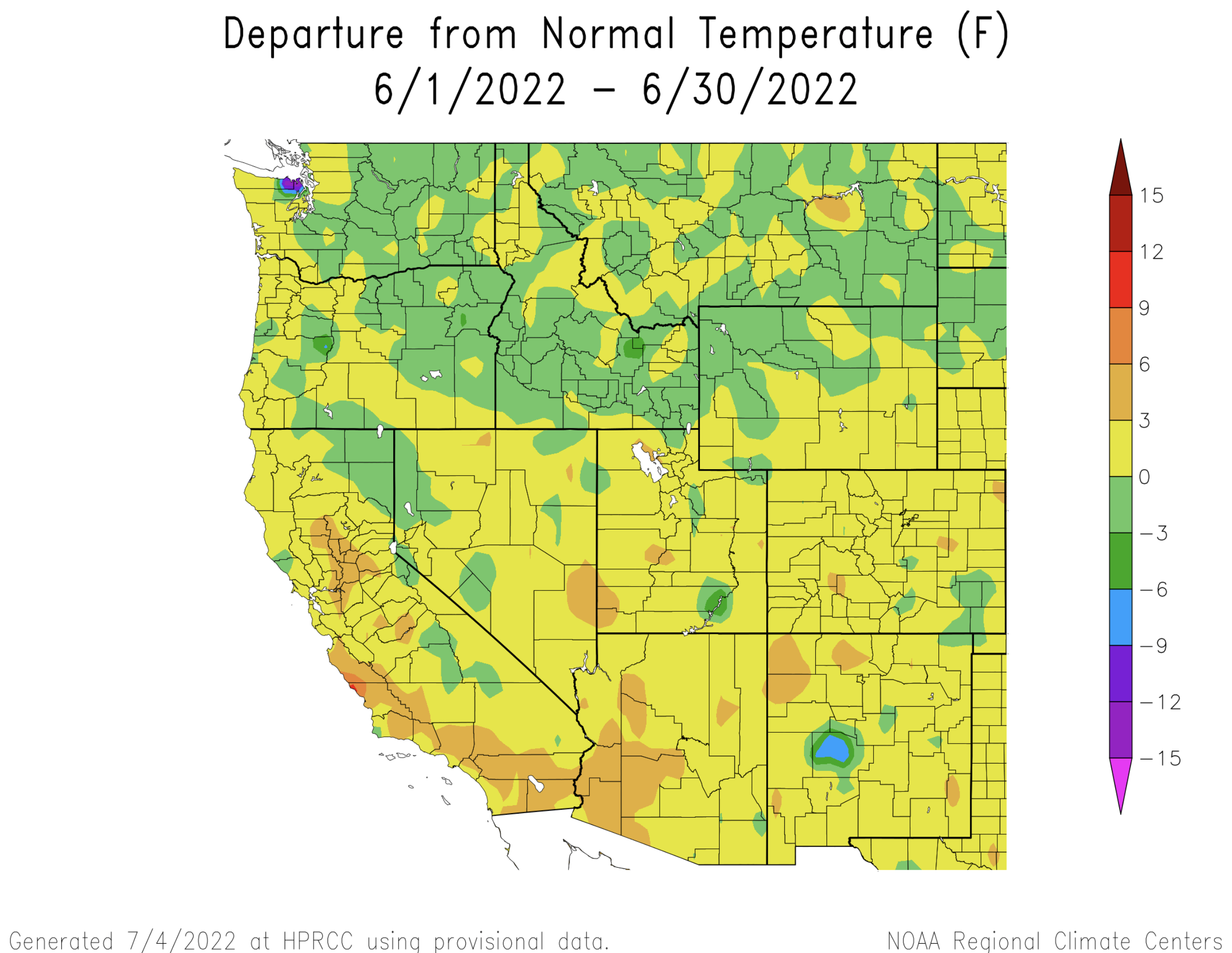
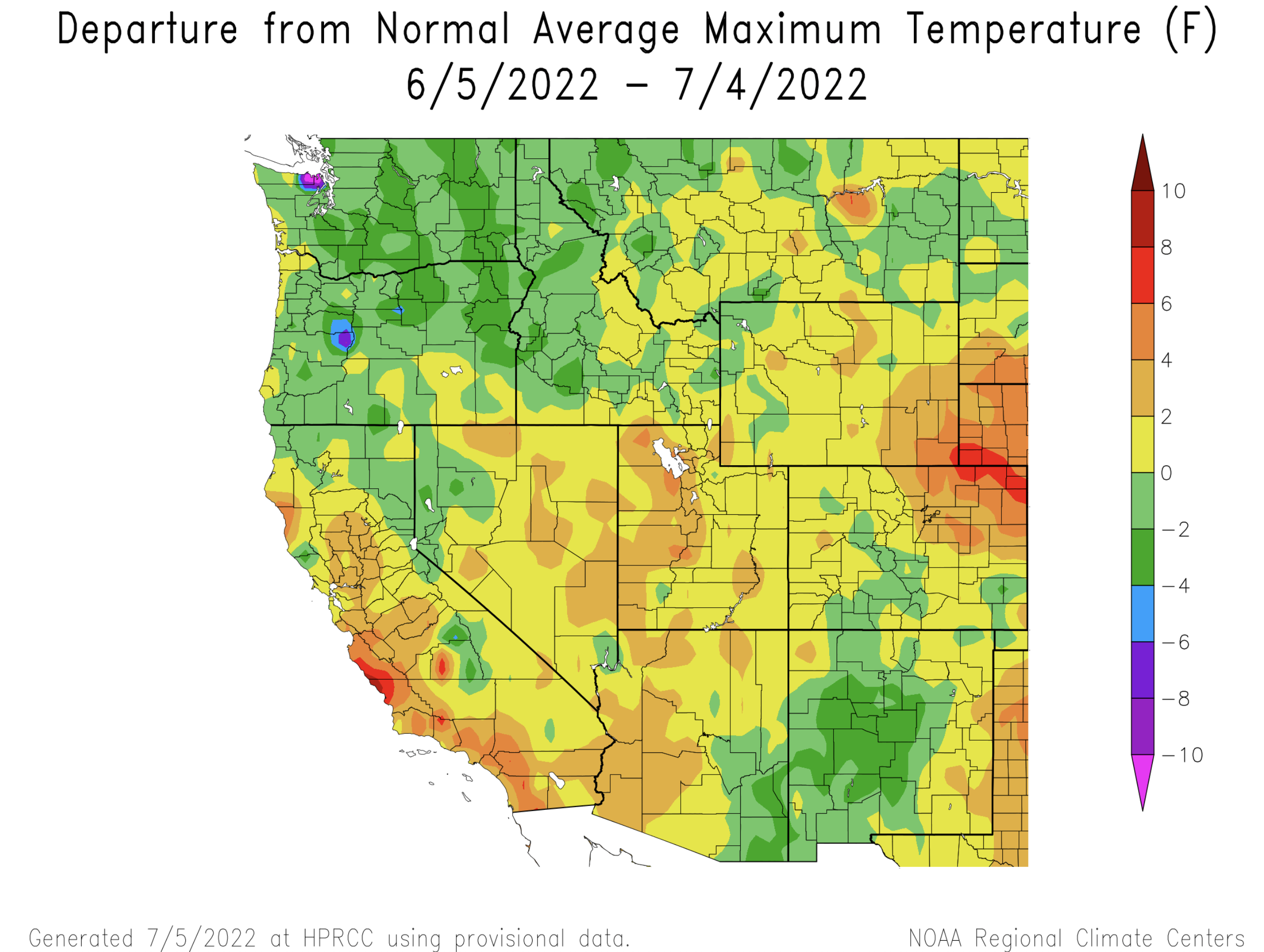
Regional temperatures were slightly above normal during June for most of Colorado, Utah and Wyoming. June temperatures were slightly below normal in northwestern Wyoming. Daily maximum temperatures were up to 8 degrees above normal in northeastern Colorado during June.
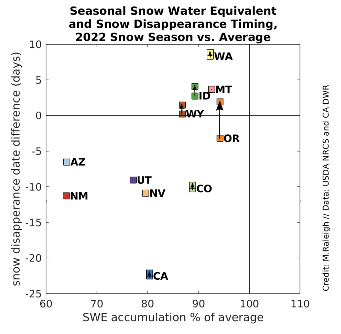
Snowpack completely melted out at all snotel sites in Colorado, Utah and Wyoming. Averaged across all snotel sites, snow melted out 10 days earlier than average in Colorado and 9 days early in Utah. In Wyoming, snow melted out 2 days later than average.
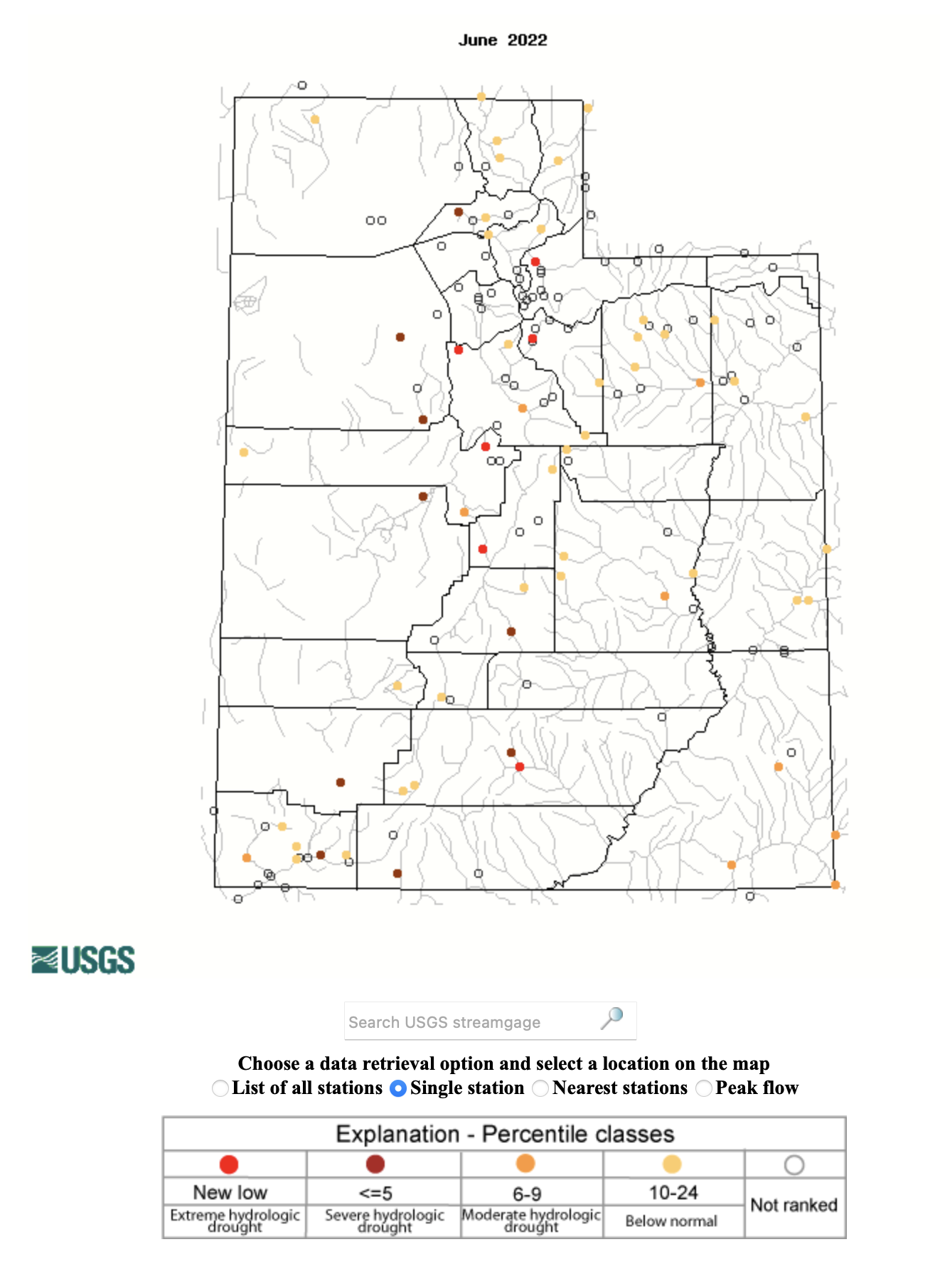
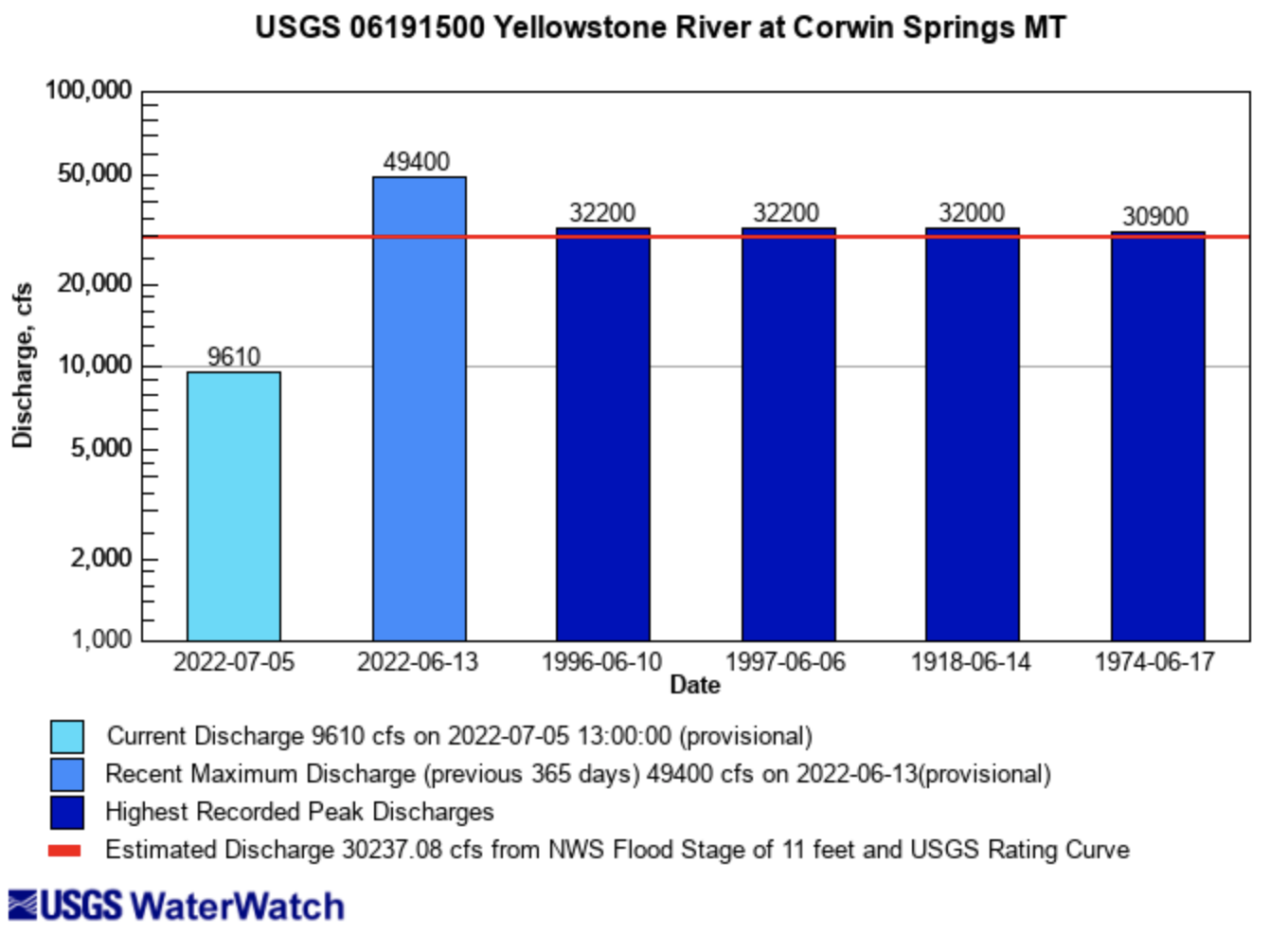
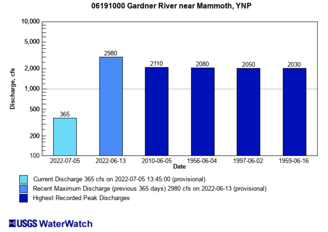
Record-high flows were observed on the Clarks Fork of the Yellowstone, Gardner, Lamar and Yellowstone Rivers after an atmospheric river combined with rapid snowmelt. Record-low flows were observed on the Escalante, Sevier and Weber Rivers in Utah and the Purgatoire River in southeastern Colorado. Regional streamflow volume forecasts for July 1st were not published at the time of this briefing. Check back early next week for July streamflow forecast information.
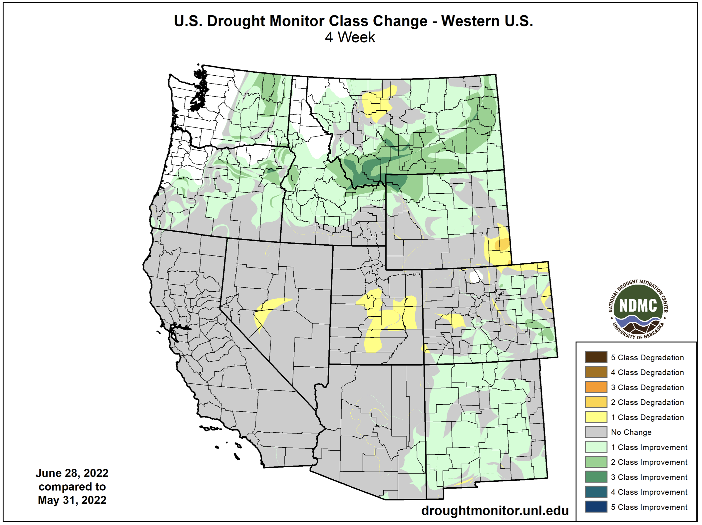
Drought continues in the Intermountain West, but the coverage of drought decreased from 92% on June 1st to 81% on July 1st. Moisture from the early June atmospheric river in Wyoming caused the complete removal of drought conditions in northern and central Wyoming and the removal of D3 drought conditions from the Upper Snake River Basin. Above average precipitation from monsoonal moisture led to the removal of D4 drought in southern Utah and D3 drought in southern Colorado and central to eastern Utah. In northeastern Colorado, D3 drought was removed from Washington County, but emerged to the north in Weld, Logan and Sedgwick Counties. Drought continues to impact Utah most severely with 82% of the state in extreme (D3) drought conditions.
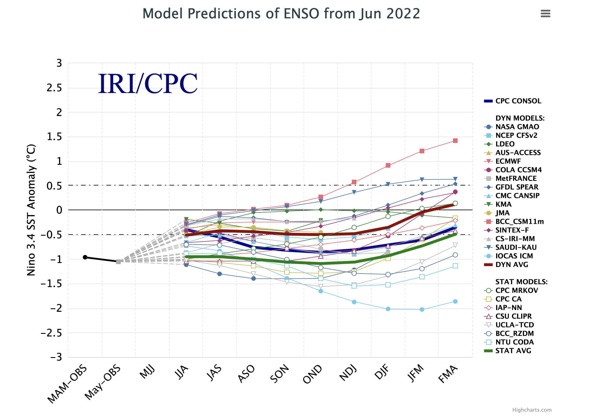
La Niña conditions continue in the eastern Pacific Ocean with sea surface temperatures 0.5 to 1.5 degrees Celsius below normal. La Niña influenced weather patterns during the first half of June with above normal precipitation and cooler temperatures in Wyoming and drier, warmer conditions to the south. There is a 55-65% probability of La Niña conditions continuing through mid-winter 2023. The average of sea surface temperature models project that ocean temperatures remain at least 0.5 degrees Celsius below normal through late-winter 2023.
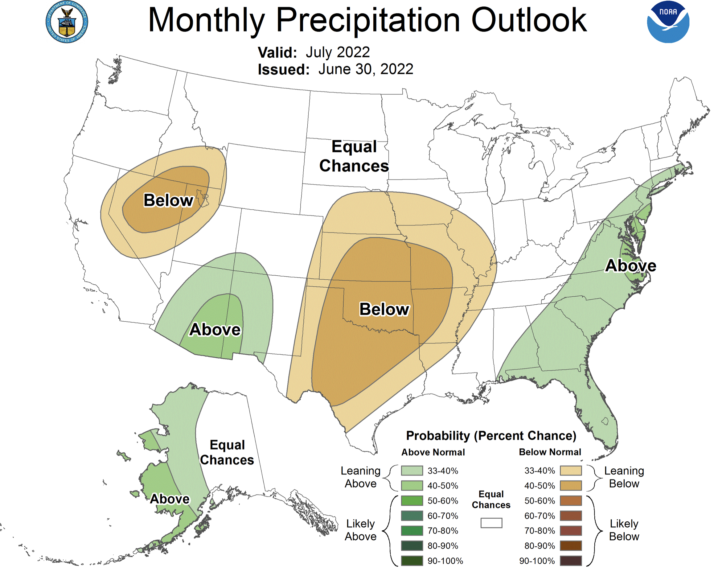
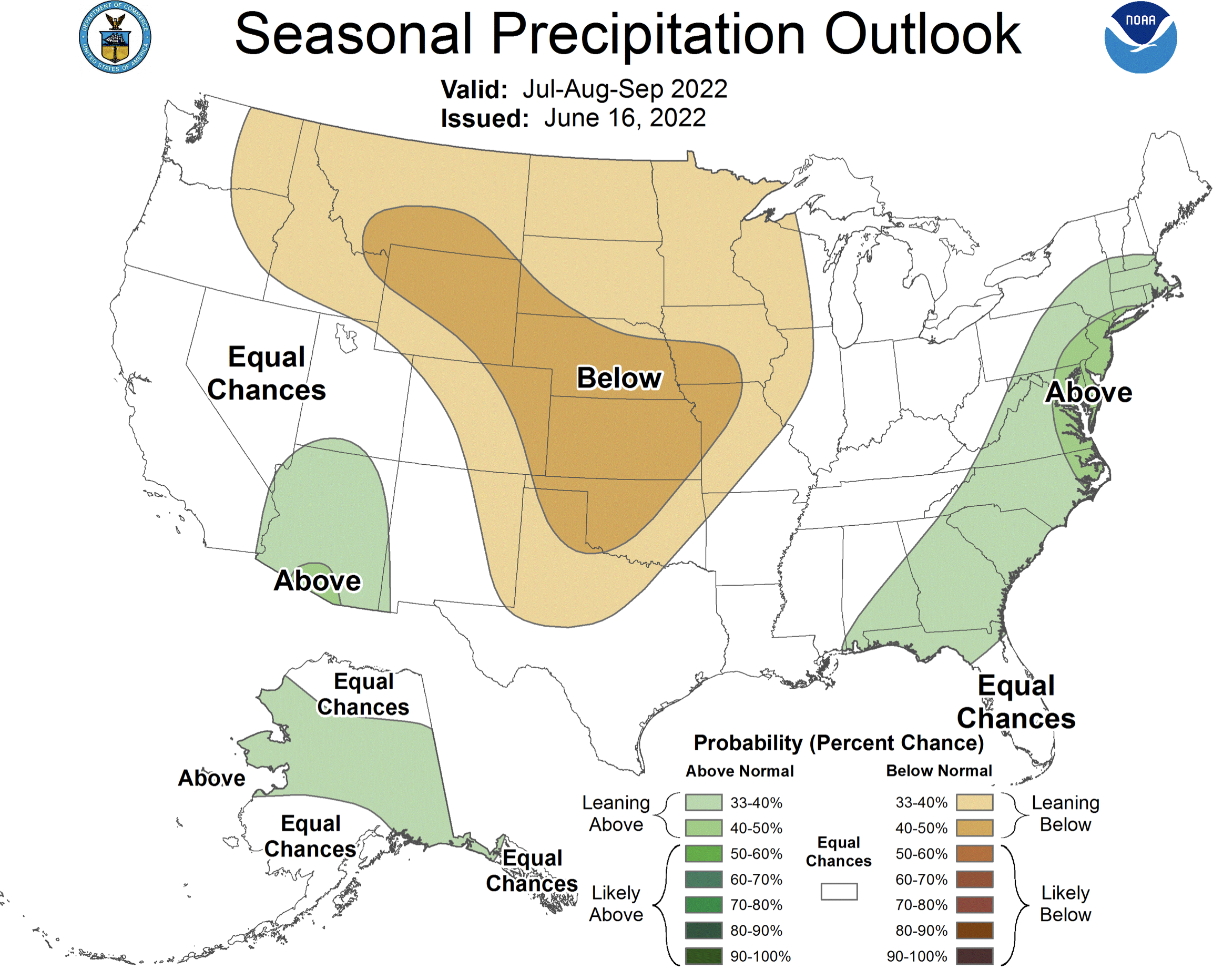
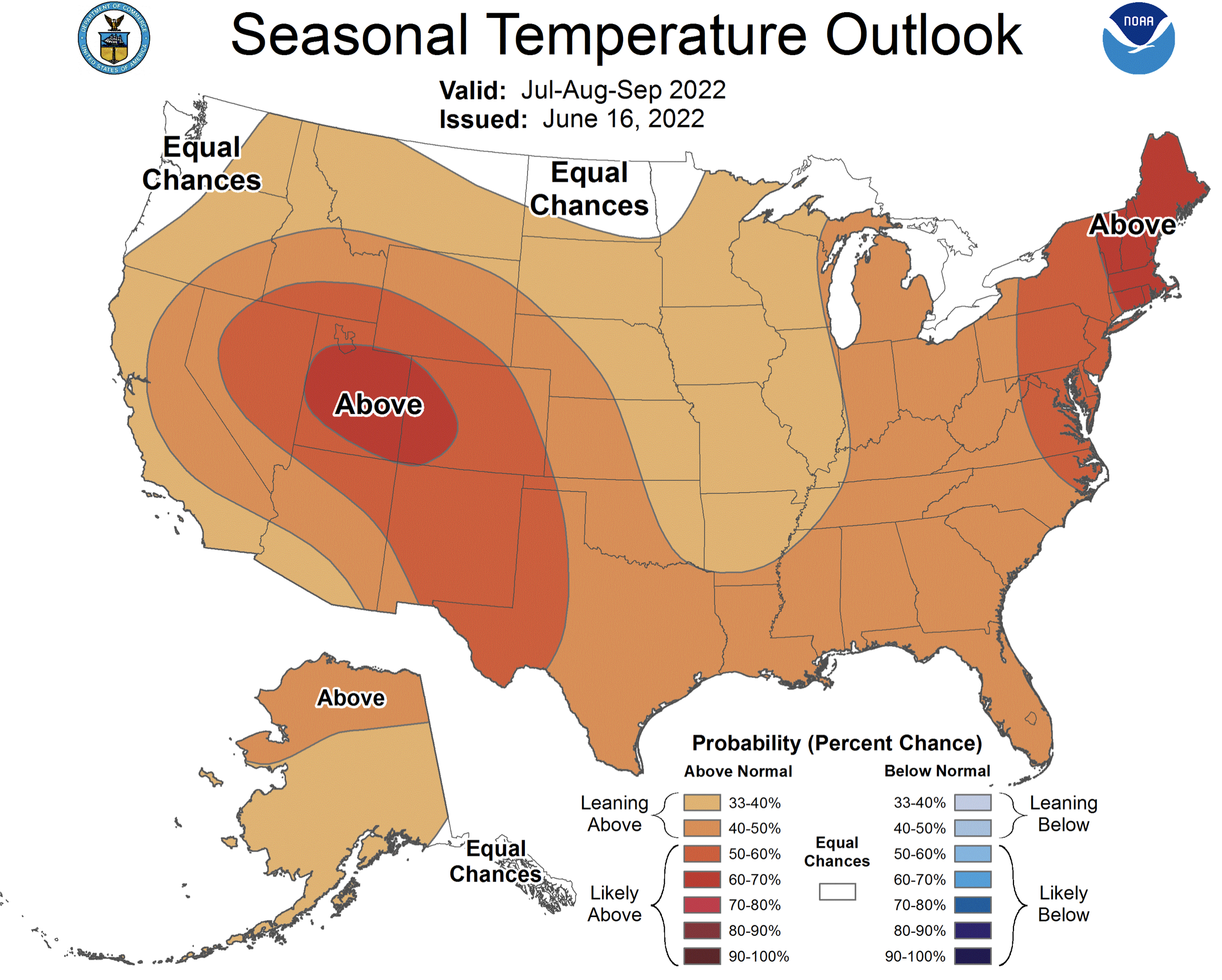
The NOAA precipitation outlook for July suggests there is an increased probability of above average precipitation for southwestern Colorado and southeastern Utah and an increased probability for below average precipitation in northwestern Utah. The seasonal precipitation outlook for July – August predicts an increased probability of above average precipitation for southern Utah, suggesting that a stronger than average monsoon continues, and below average precipitation for much of Colorado and Wyoming. There is up to a 70% probability of above average temperatures for the entire region; Utah and western Colorado are most likely to see high temperatures.
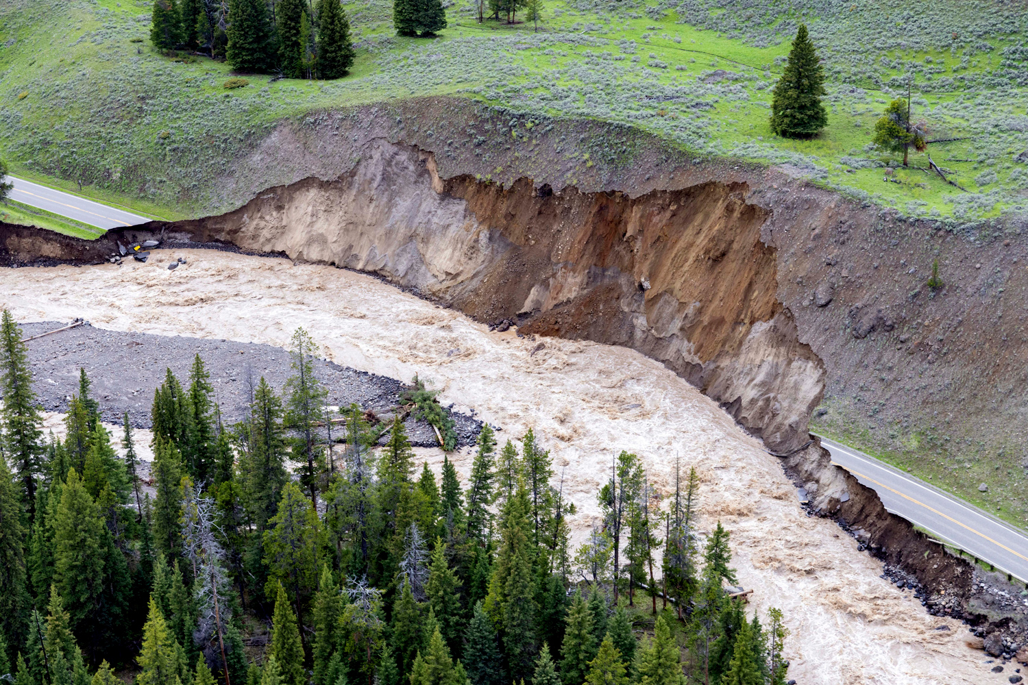
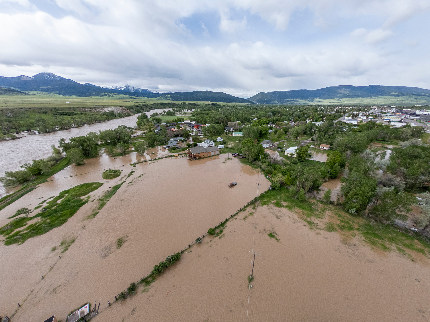
Significant June weather event. Major flooding in Yellowstone National Park (YNP). From June 12-13, a warm atmospheric river-type storm dumped 2-4” of rain in northwestern Wyoming. Snowpack was much-above average in YNP during June and heavy rainfall combined with an estimated 5.5” of snowmelt to produce record-high flows on the Gardner, Lamar, Yellowstone and Clarks Fork of the Yellowstone Rivers. The Yellowstone River (Corwin Springs, MT) peaked at 49,400 cfs on June 14th, shattering the previous record of 32,200 cfs in 1996. Extensive damage was caused by flooding on the Gardner and Yellowstone Rivers in southwestern Montana and along Rock Creek in Red Lodge, MT. The Gardner River peaked at 2,980 cfs, 40% higher than the previous maximum flow, destroying several sections of the road from the North Entrance of Yellowstone to Mammoth Hot Springs. Yellowstone National Park was completely closed for 9 days and the North and Northeast Entrances are expected to remain closed until at least fall 2022.
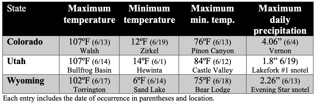
June 2022 Weather Almanac