January 10, 2024 - CO, UT, WY
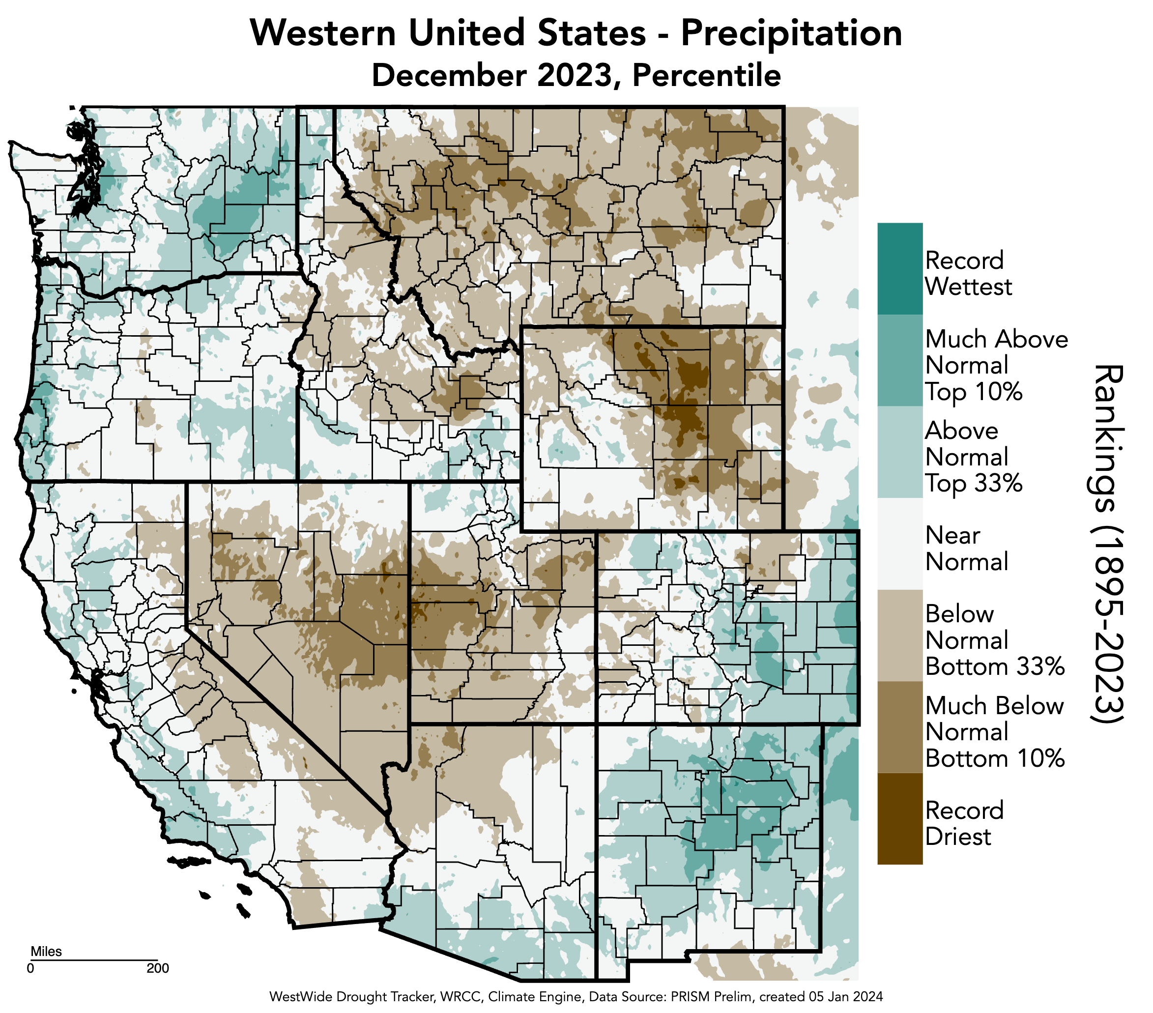
In December, Utah and Wyoming experienced below to much-below normal precipitation, with record-dry conditions in western Utah and north-central Wyoming. Meanwhile, southern and eastern Colorado saw above to much-above normal precipitation. Regional temperatures were above to much-above normal with record-warm December temperatures recorded in western and northeastern Wyoming. Snowpack conditions were below to much-below normal across all river basins, and January 1st seasonal streamflow forecasts were below to much-below normal. Drought conditions slightly expanded, covering 15% of the region, and severe to extreme drought persists in southwestern Colorado. El Niño conditions continued during December and have a high probability of persisting through spring. The NOAA outlooks for January suggest an increased probability of above average precipitation and below average temperatures.
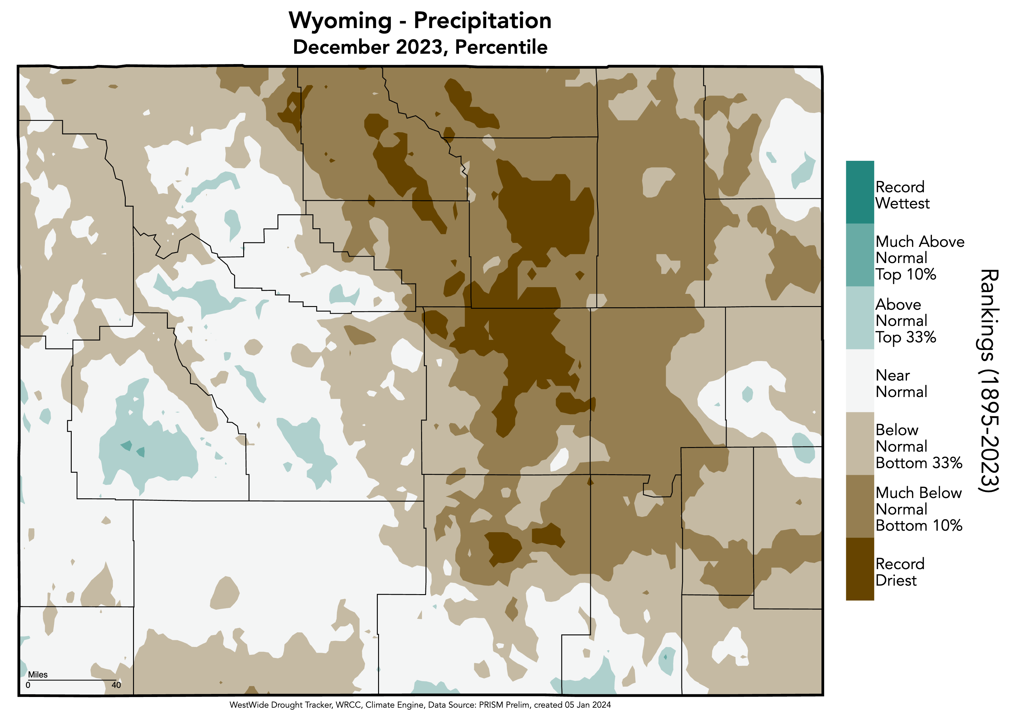
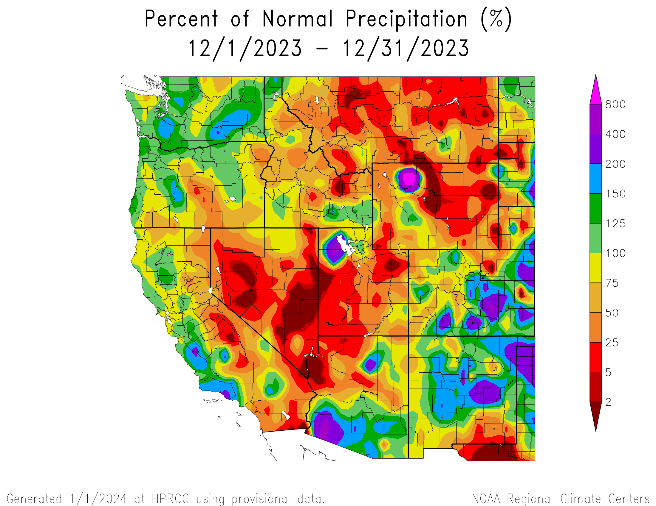
December precipitation was below to much-below normal for the majority of Utah and Wyoming. In Colorado, December precipitation was a mix of above and below average precipitation. In large areas of western Utah and north-central Wyoming along the Bighorn Range, almost no precipitation was recorded during December. Pockets of much-below normal precipitation occurred in northeastern Utah, eastern Wyoming, and eastern Colorado. Large areas of 200% or more of normal precipitation occurred throughout southern and eastern Colorado. Record-dry conditions occurred throughout the central corridor of Wyoming, which we will discuss below.
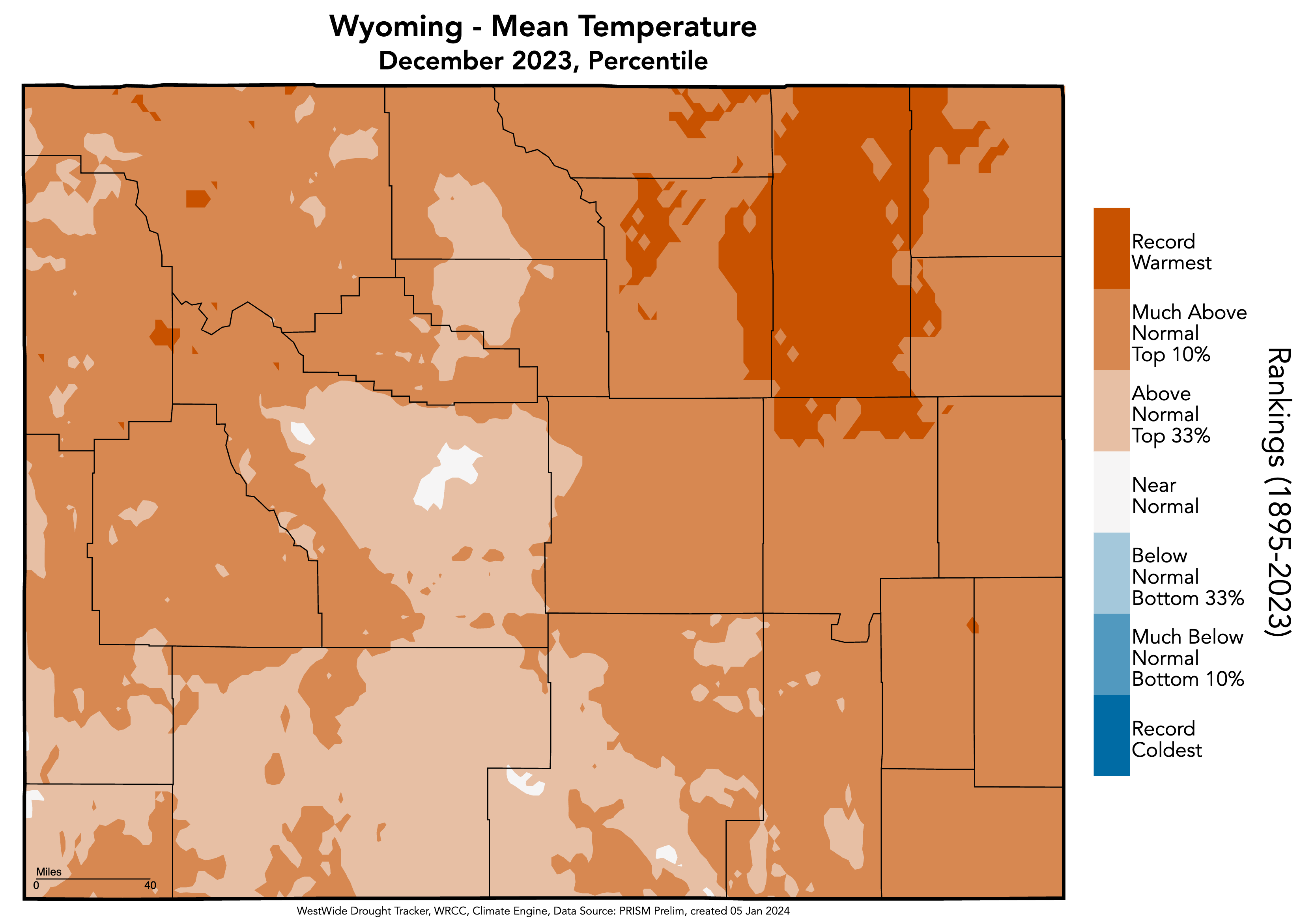
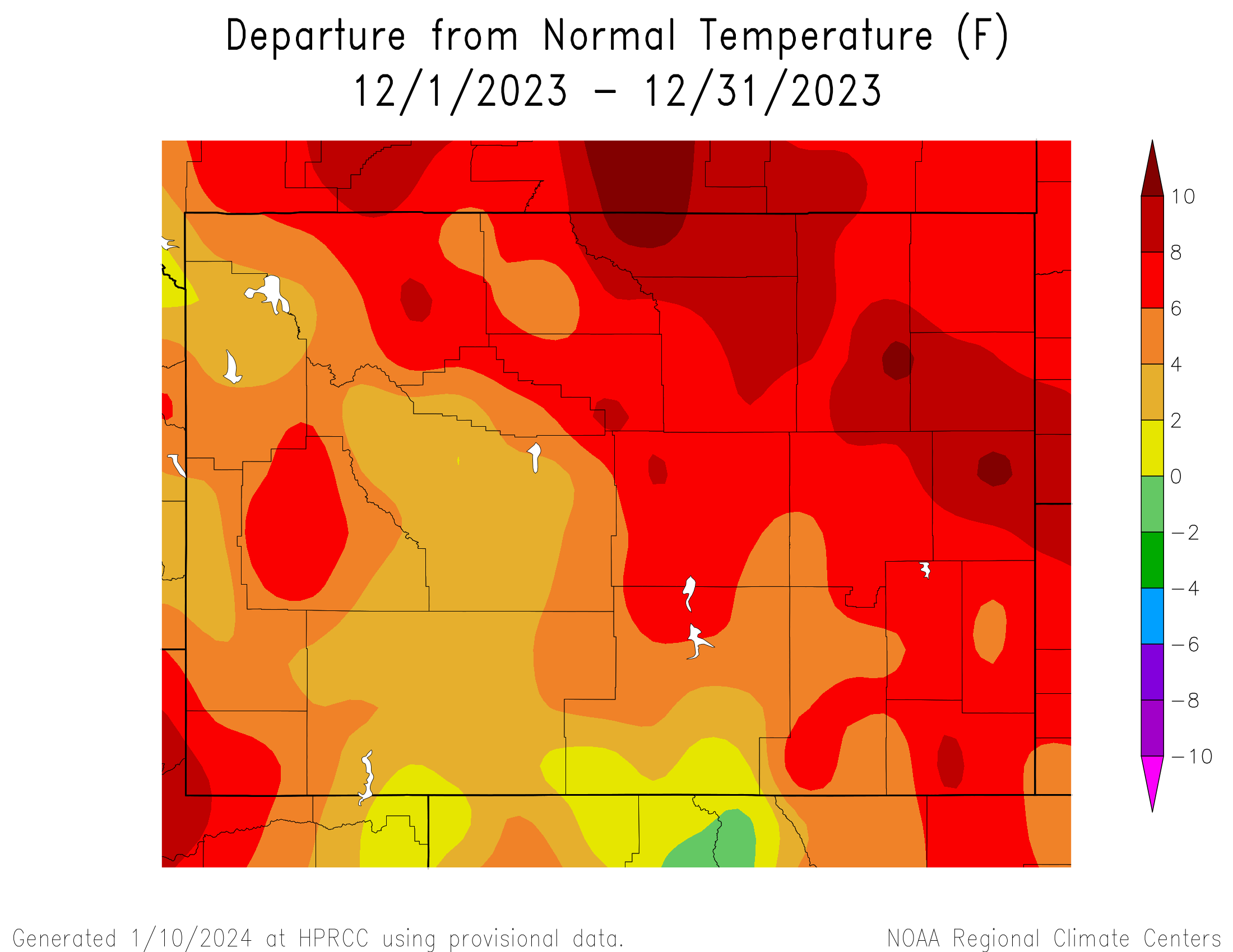
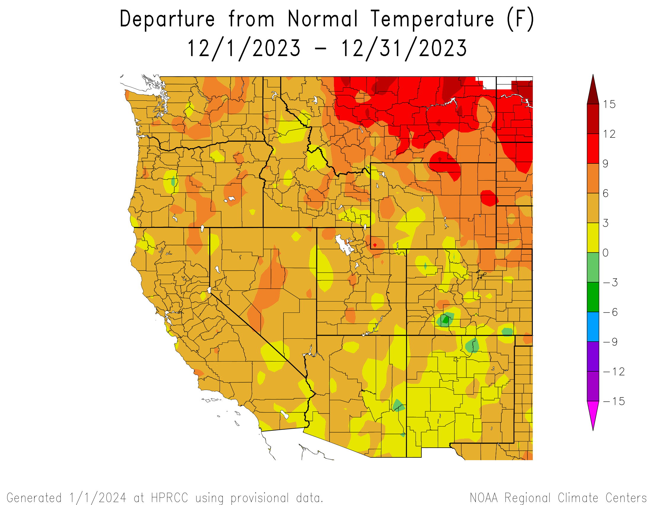
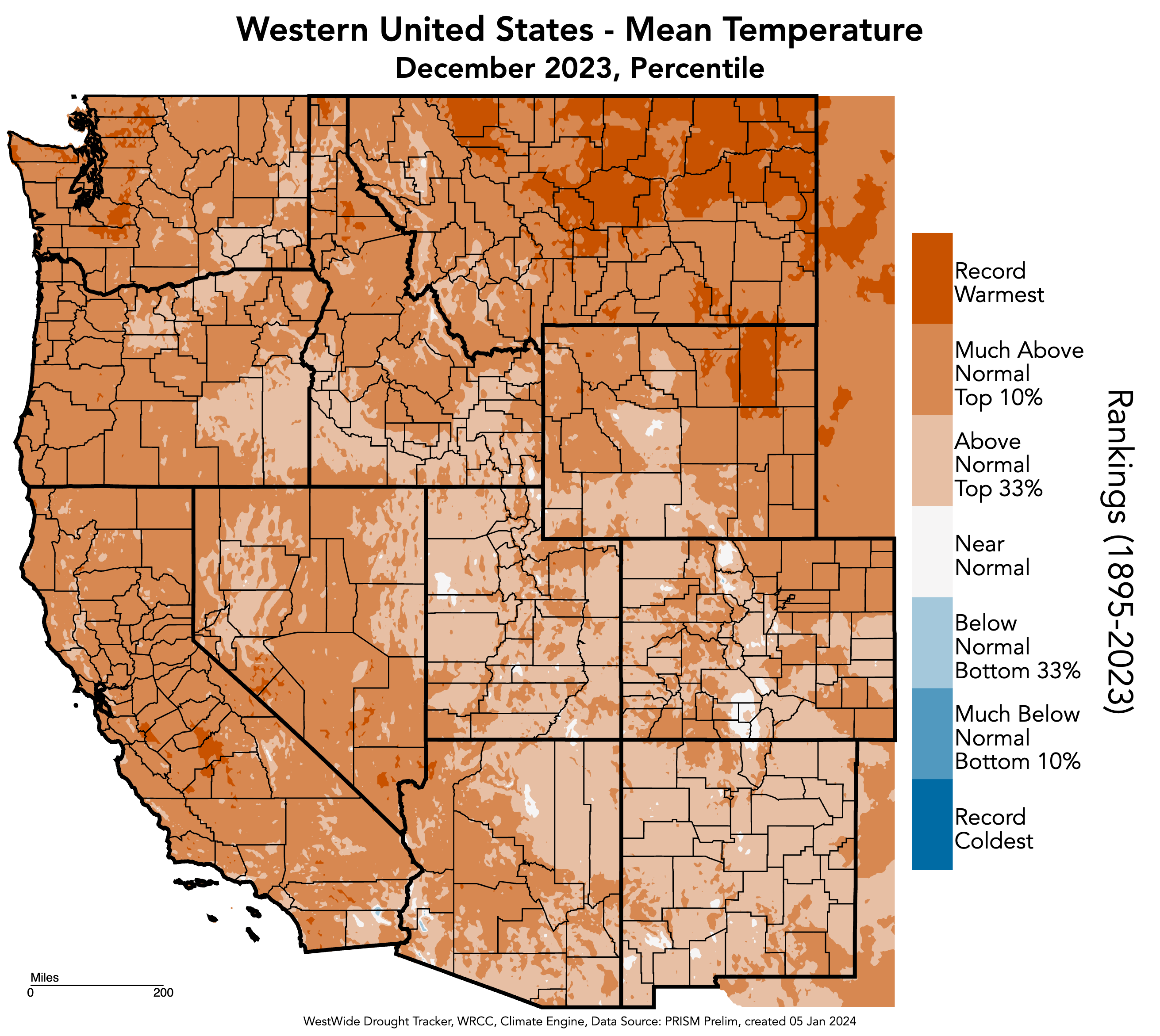
Regional temperatures were above normal during December. The majority of the region experienced 3-6°F above normal temperatures while northern and eastern Wyoming experienced mostly 6-9°F above normal temperatures. Temperatures of 9-12°F above normal occurred in Sheridan, Johnson, Weston, and Niobrara Counties in Wyoming. Record-warm temperatures occurred in northeastern Wyoming which we will discuss below.
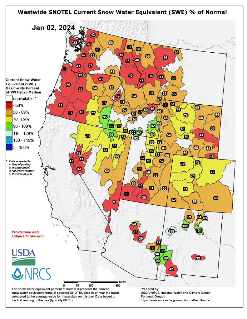
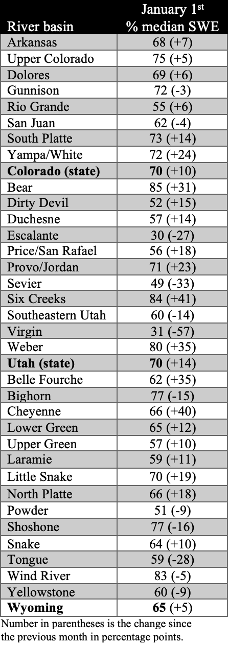
Regional snowpack was below to much-below normal for all river basins. As of January 1st, statewide percent median snow-water equivalent (SWE) was 70% for Colorado and Utah and 65% for Wyoming. Utah experienced the highest and lowest SWE percentages in the region with 85% SWE in the Bear River Basin and 30% in the Escalante River Basin. Much-below normal SWE was observed in southwestern Utah and southeastern Wyoming.
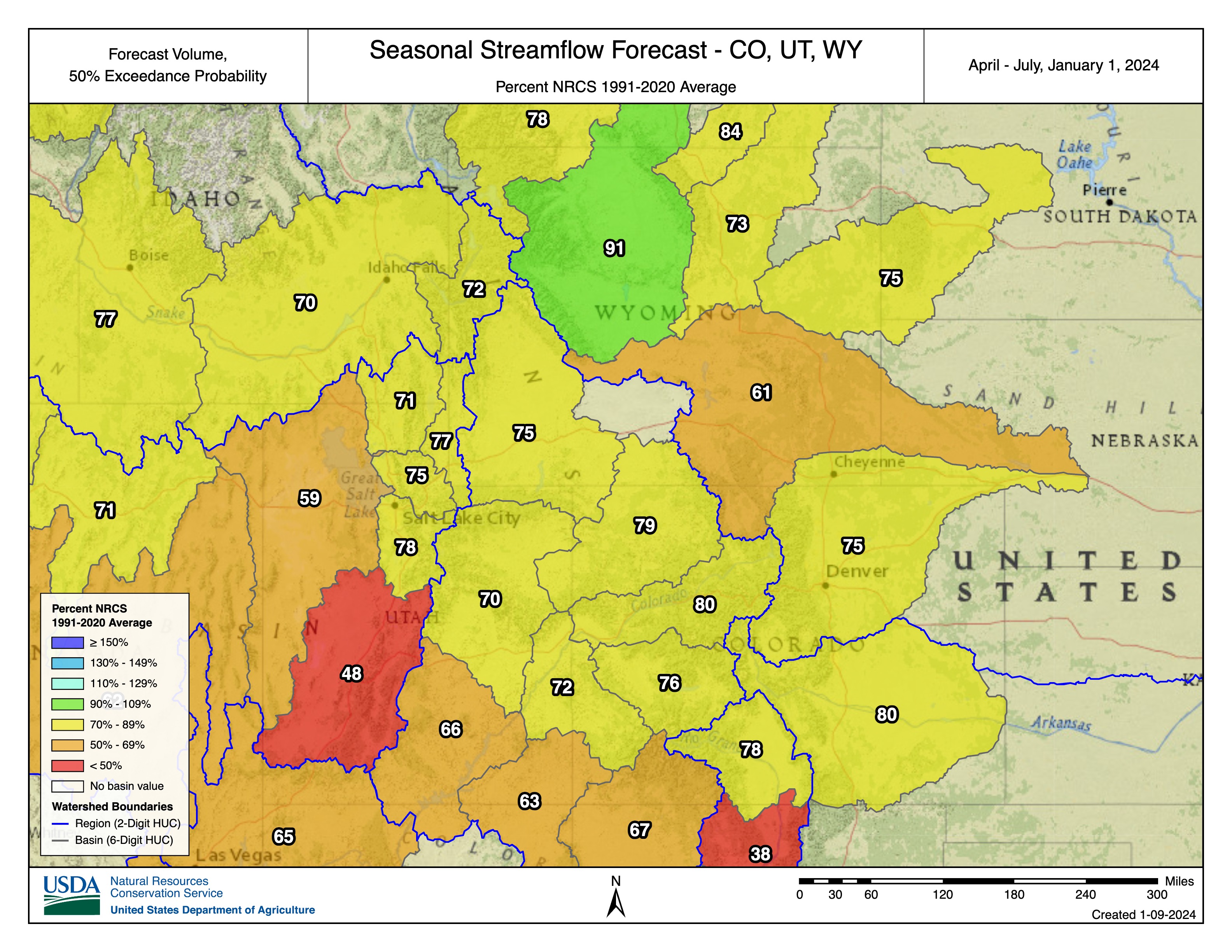
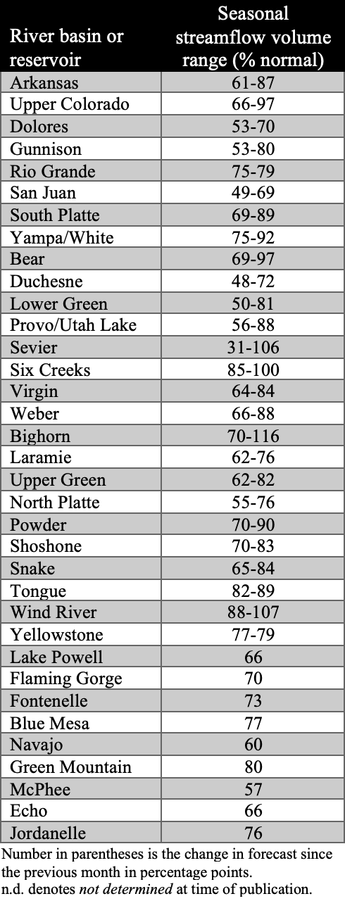
January 1st seasonal streamflow forecasts in the Upper Colorado River and Great Basins are below to much-below normal. Below normal (70-90%) seasonal streamflow volumes are forecasted for the Arkansas, Upper Colorado, Gunnison, Rio Grande, South Platte, White-Yampa, Bear, Utah Lake, Virgin, Weber, Laramie, Upper Green, Powder, Shoshone, Snake, and Tongue Basins. Much-below normal (<50-70%) seasonal streamflow volumes are forecasted for the Dolores, San Juan, Duchesne, Lower Green, Sevier, and North Platte Basins. The Big Horn, Six Creeks, and Wind River Basins have near-normal (90-110%) forecasts. Seasonal streamflow forecasts for all large Upper Colorado River Basin reservoirs are below to much-below normal and Lake Powell’s inflow forecast is 66% of normal. It is important to note that there are still three months left of the snow accumulation season and January 1st streamflow forecasts contain significant uncertainty.
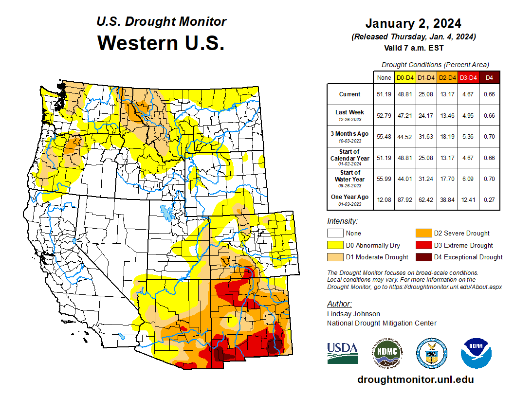
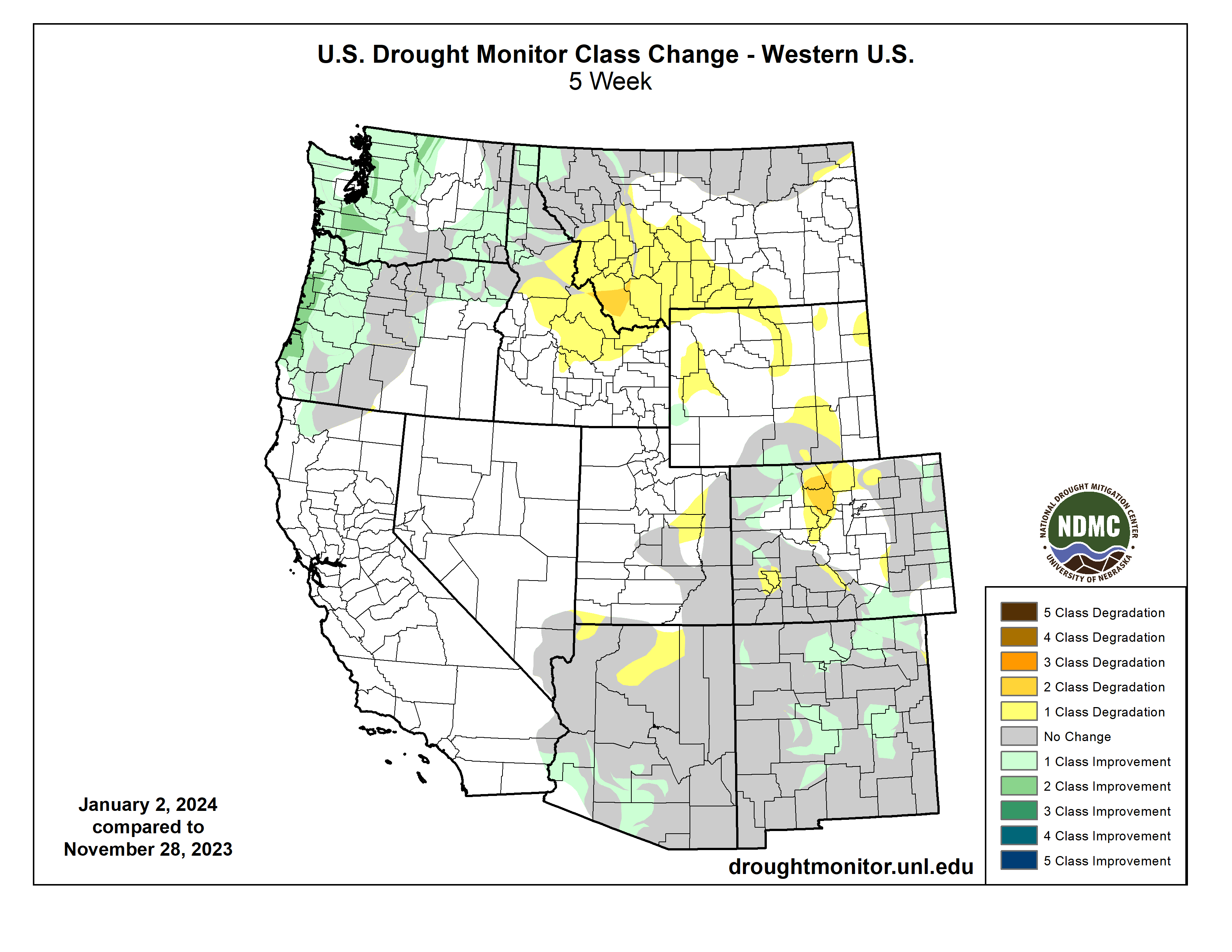
Regional drought conditions slightly expanded in December and now cover 15% of the region, less than a 1% increase from late November. Drought expanded by 3% in Colorado, improved by 2% in Wyoming, and remained the same in Utah. Severe (D2) drought conditions remain in southwestern Colorado as well as a pocket of extreme (D3) drought in Rio Grande, Alamosa, Conejos, and Costilla Counties. 2-class drought degradation occurred in Jackson, Larimer, Grand, and Summit Counties in Colorado.
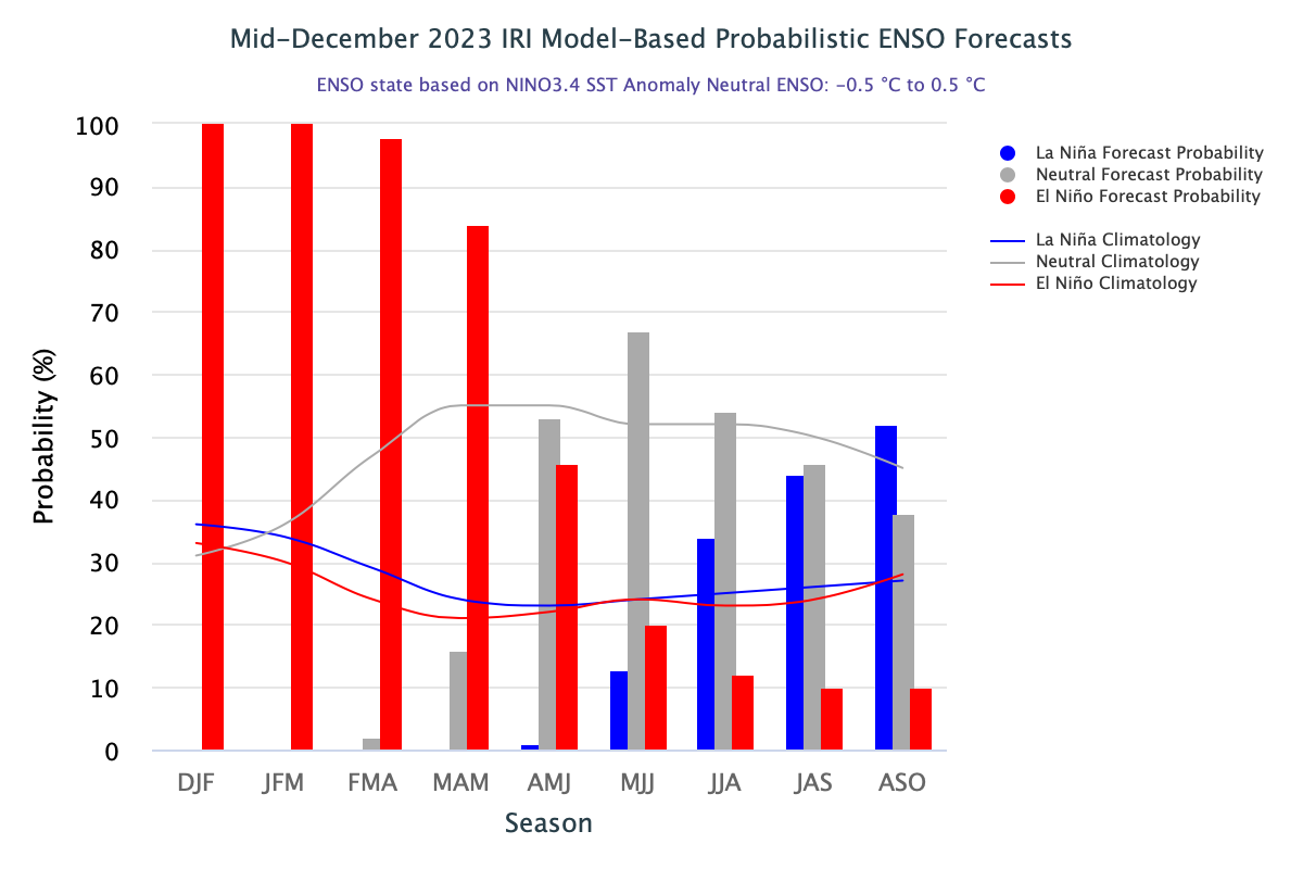
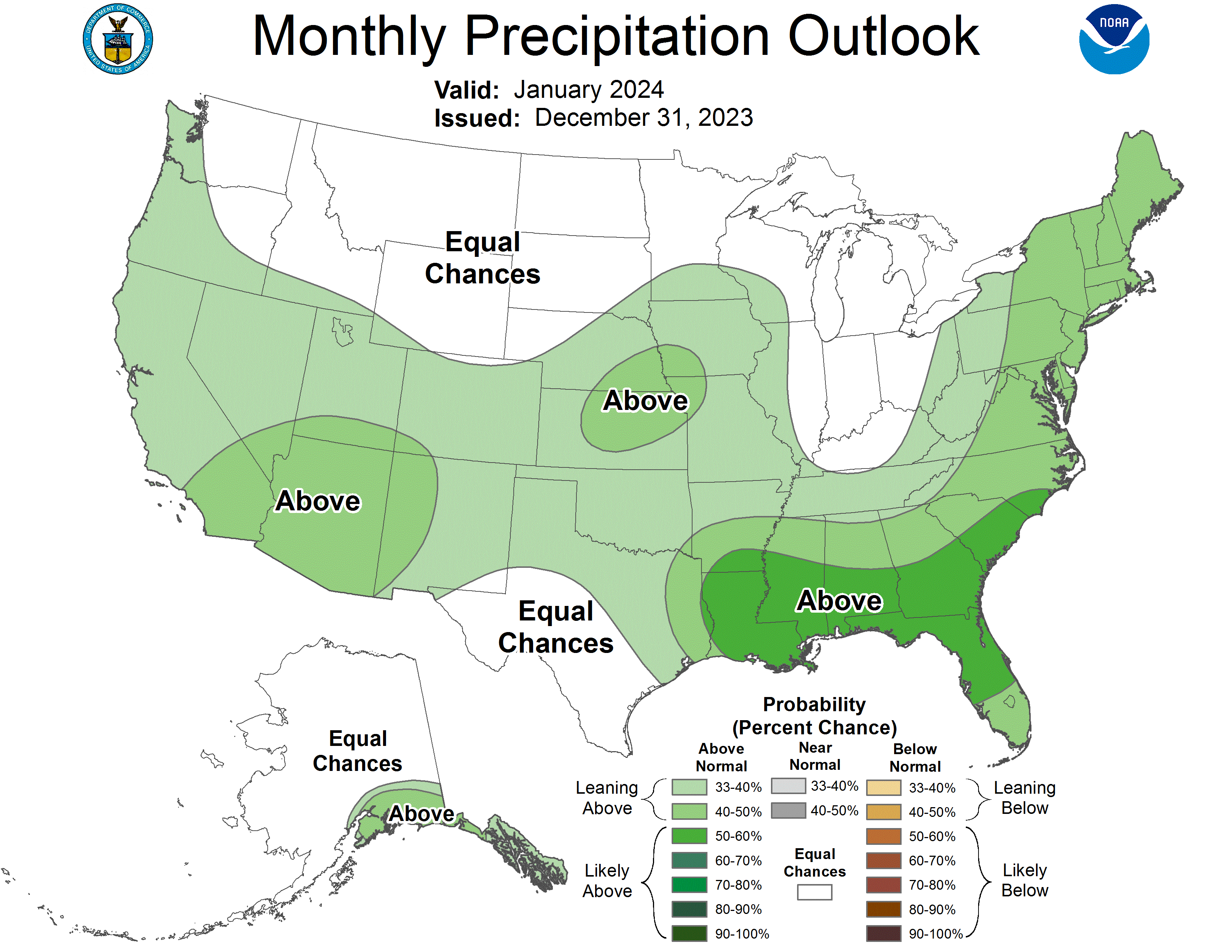
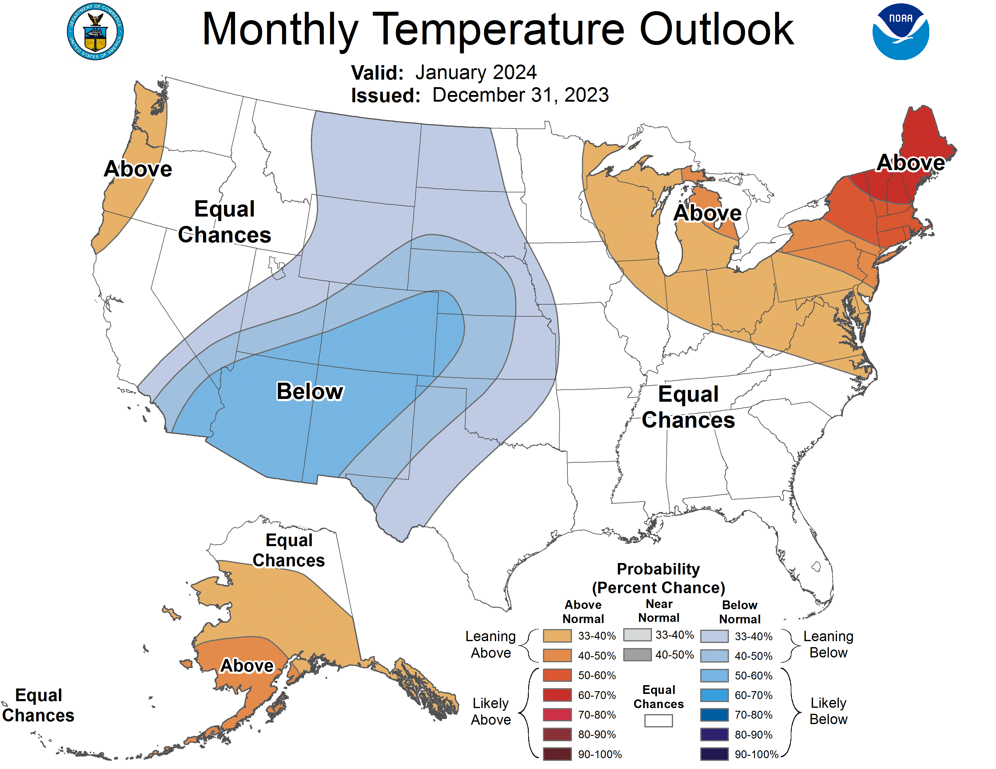
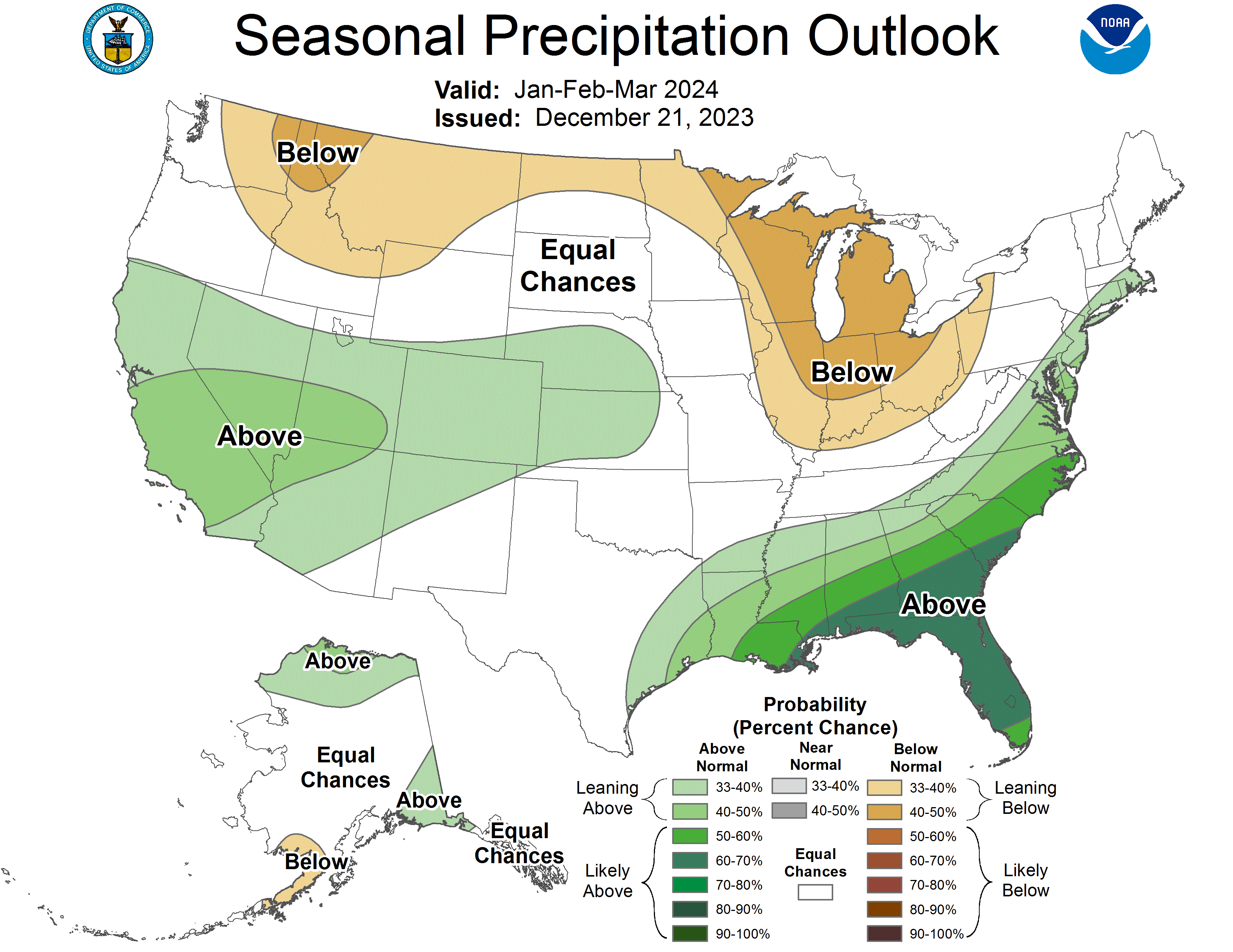
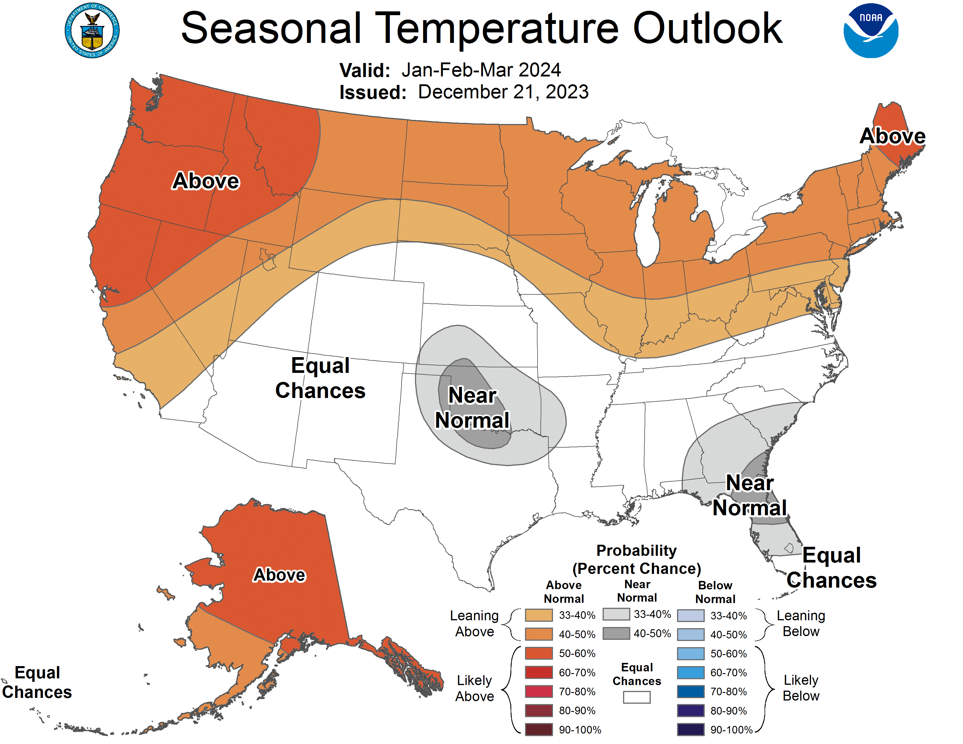
El Niño conditions continued during December and Pacific Ocean temperatures are consistent with a strong El Niño. There is an 80% probability of El Niño conditions persisting through spring and over a 50% probability of transitioning to neutral conditions starting in April-June. The NOAA precipitation outlook for January suggests an increased probability of above average precipitation for all of Utah, most of Colorado, and southwestern Wyoming. The NOAA temperature outlook for January suggests an increased probability of below average temperatures for almost the entirety of the region. Most of southern, central, and eastern Colorado and southeastern Utah have an increased probability of likely below average temperatures (50-60% chance) in January. The NOAA seasonal outlooks for January-March suggest an increased probability of above average precipitation for all of Colorado, most of Utah (particularly the southern region), and southern Wyoming, and an increased probability of above average temperatures throughout the northern, central, and western regions of Utah and Wyoming.
Significant climate event. Regionally, December was warm and dry; this was particularly the case for Wyoming. Record-warm conditions were observed in almost all of Campbell County, as well as large areas of Sheridan, Johnson, Crook, and Weston Counties, including temperatures greater than +10°F in Sheridan, Campbell, and Niobrara Counties. Small pockets of record-warm conditions occurred in northwestern and southeastern Wyoming as well. Many of the aforementioned areas in Wyoming experienced record-warm 1-month mean average temperatures, including Black Mountain (34.5°F), Burgess Junction (27.8°F), Dillinger (34.1°F), Leiter (33.7°F), Redbird (34.7°F), and Ten Sleep (28.9°F), as well as the majority of SNOTEL sites in the state. Nearly the entire eastern half of the state, and much of the western half, experienced much-above normal (top 10%) temperatures. Wyoming also experienced record-dry conditions throughout much of the central corridor of the state, from Big Horn County to Carbon County. Johnson and Natrona Counties experienced the largest areas of record-dry conditions. Almost the entire eastern half of the state experienced below to much-below normal (bottom 10%) precipitation. The occurrence of record-warm and record-dry conditions throughout eastern Wyoming, particularly in Johnson County, made December 2023 an unfortunate start to the winter for the state.