January 10, 2023 - CO, UT, WY
Lots of snow and favorable water supply forecasts are the December climate headliner. Snowpack is above average for nearly the entire region with statewide SWE ranging from 116% normal in Colorado to 132% in Wyoming to 155% in Utah. Regional precipitation was generally above average and temperatures were below average during December. January 1st seasonal streamflow forecasts are near-to-above average except for the river basins east of the Continental Divide in Colorado, where forecasts are below average. Neutral ENSO conditions are expected to form by late winter and there is an increased probability of above average January precipitation throughout the region.
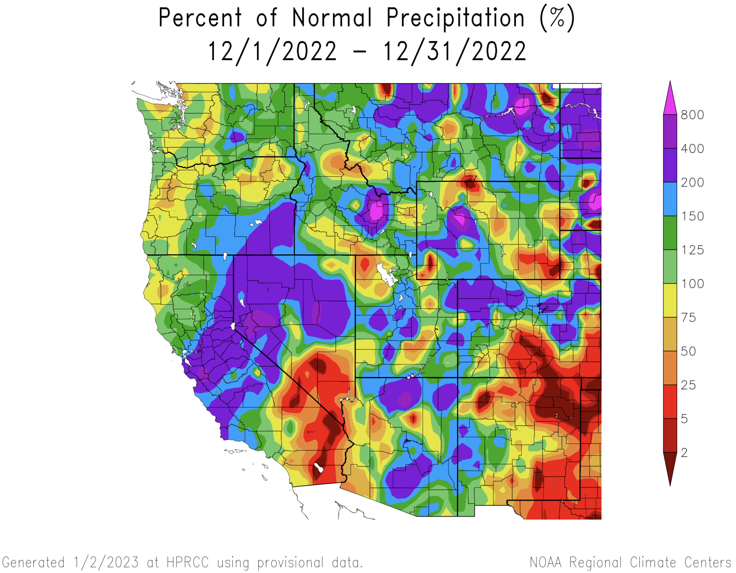
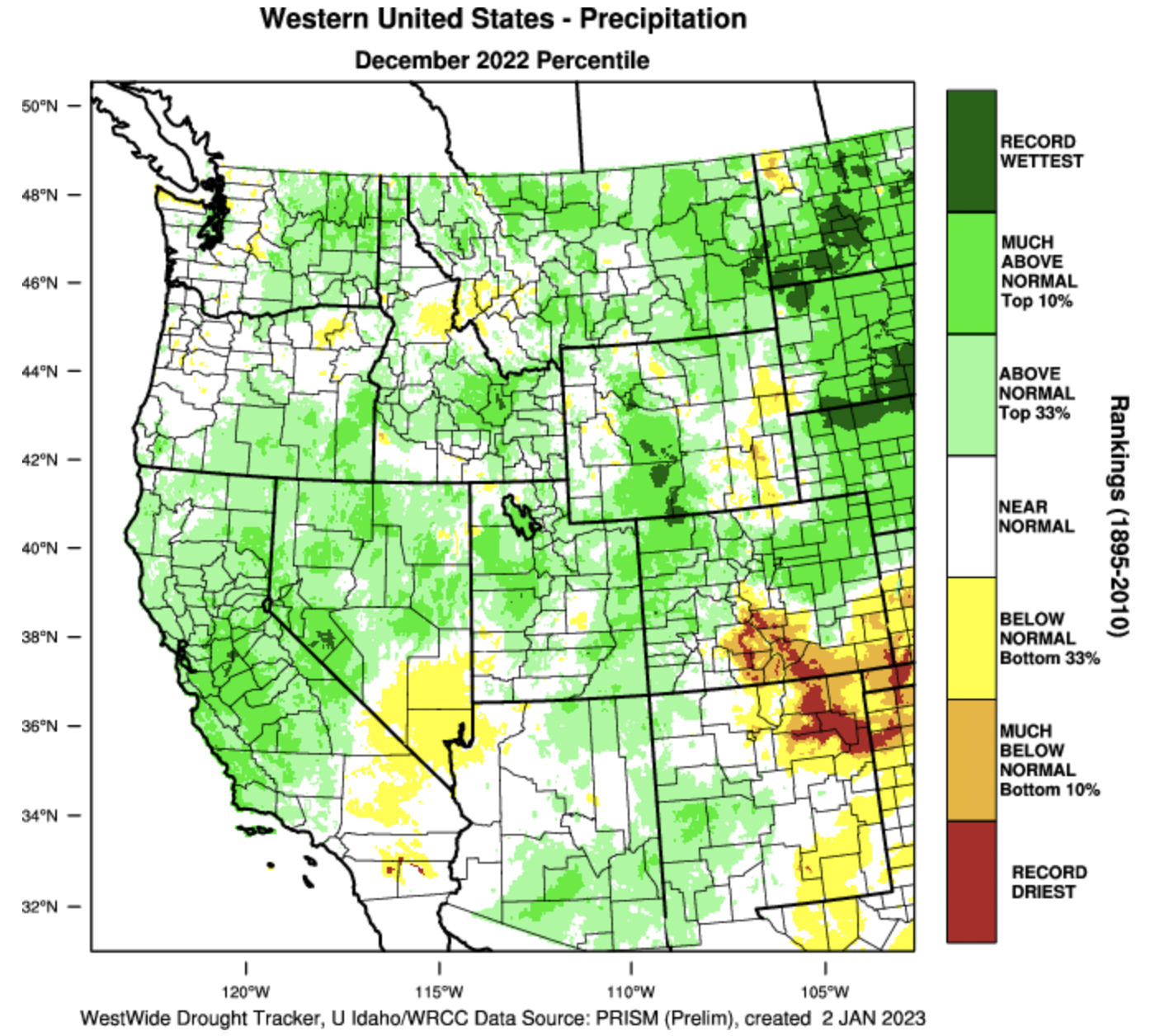
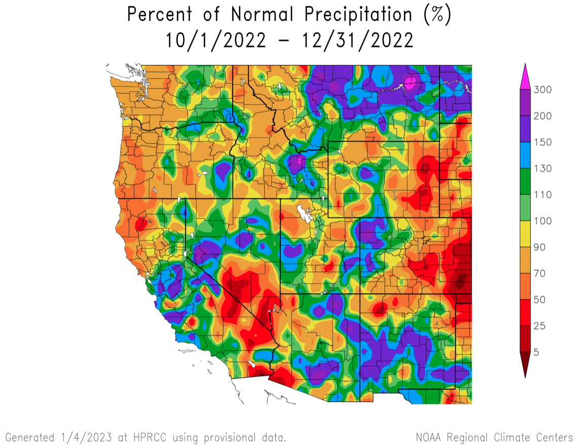
Precipitation was above to much-above average for much of the Intermountain West during December. Large areas of Colorado, Utah and western Wyoming received greater than 150% of average December precipitation. Some locations in south-central Wyoming experienced the wettest December on record. Southeastern Colorado, northwestern Utah and southeastern Wyoming received below average precipitation. Precipitation from strong atmospheric rivers comprised the majority of December precipitation at many locations. For most regional mountain locations, water year precipitation is near-to-above normal.
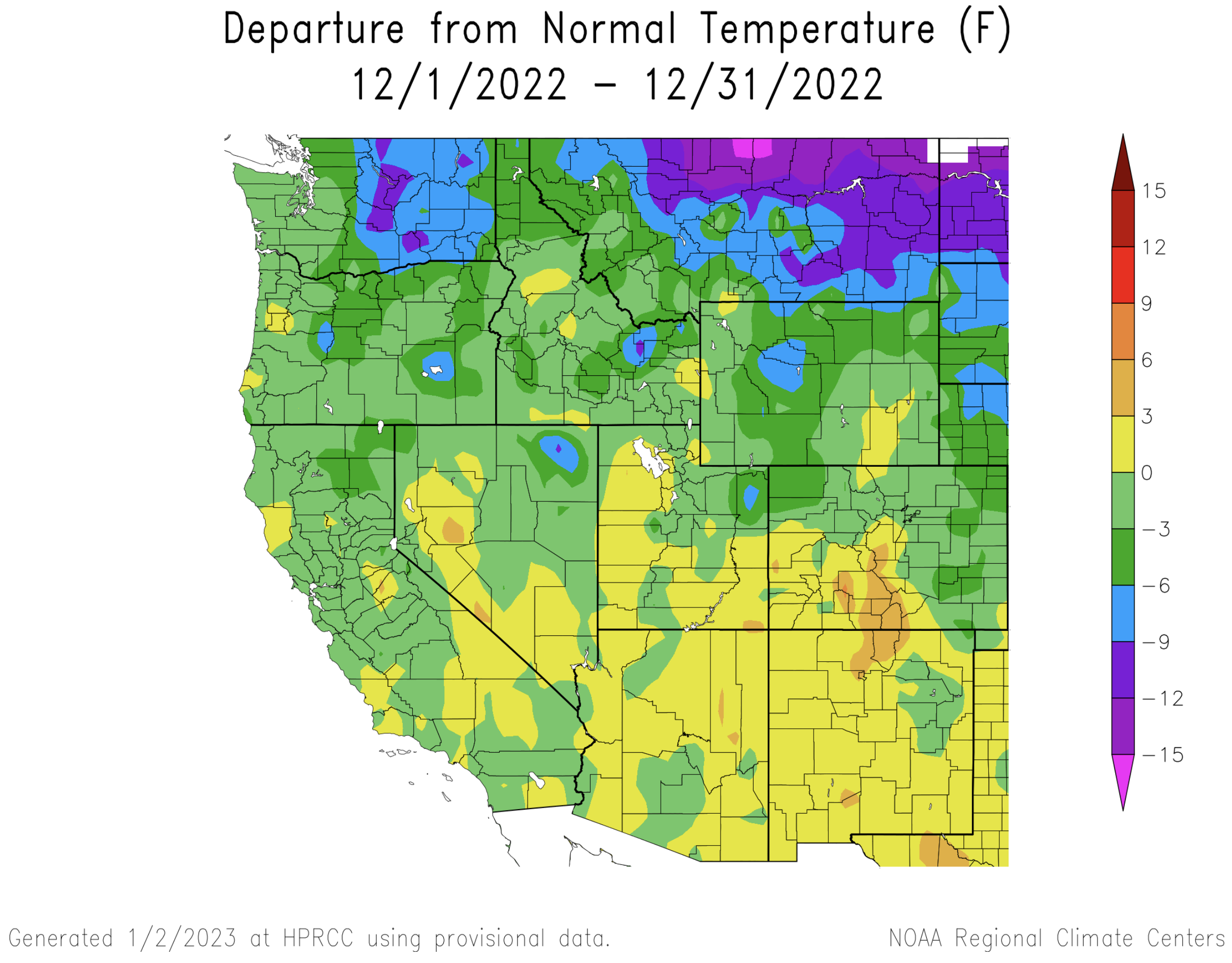
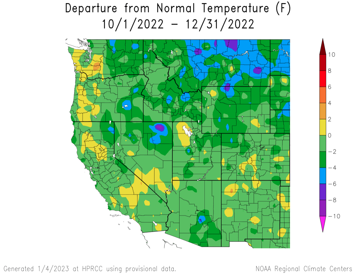
For the third month in a row, regional temperatures were mostly below average. December temperatures below normal in Wyoming and slightly below normal in northern Colorado and northern Utah. Southern Colorado and southern Utah experienced slightly above normal temperatures. Below normal temperatures were observed in the first three months of the water year (October-December) in the entire region for the first time since 2019.
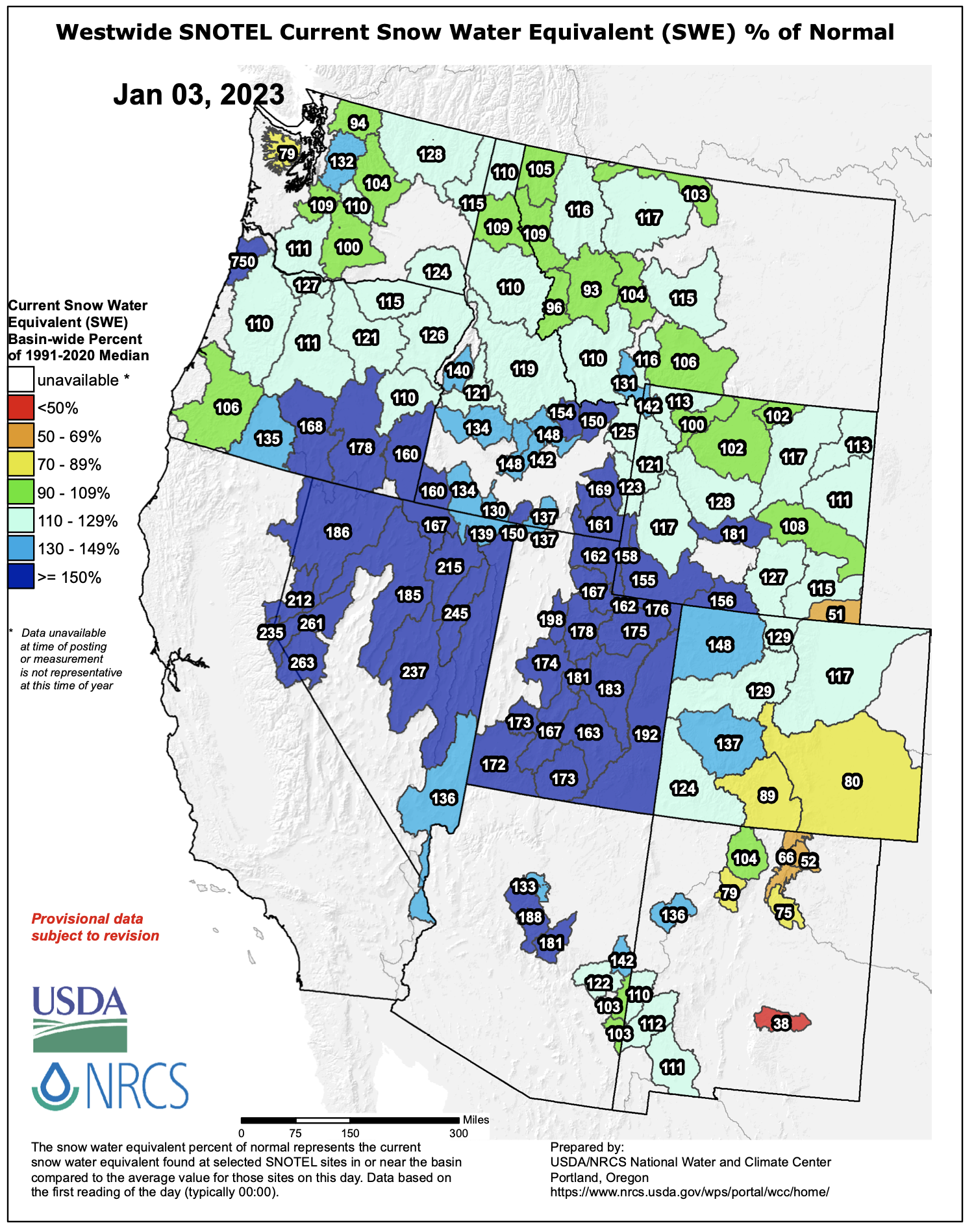
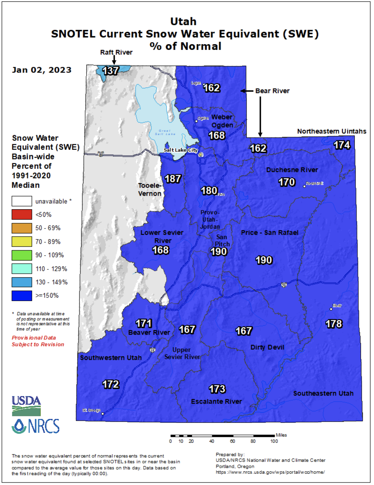
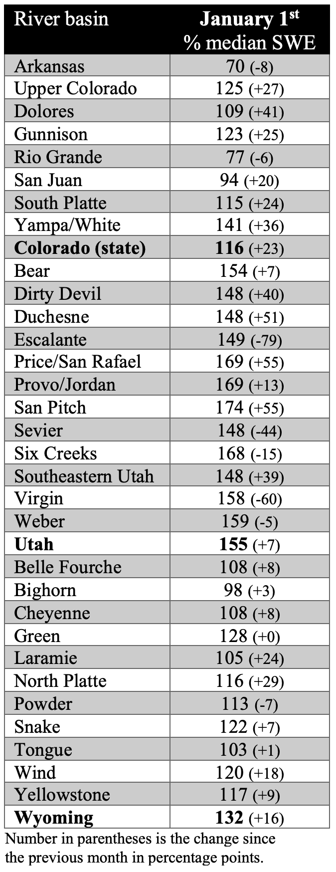
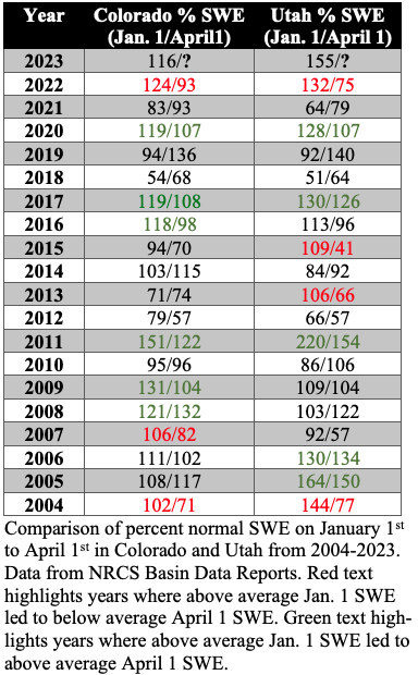
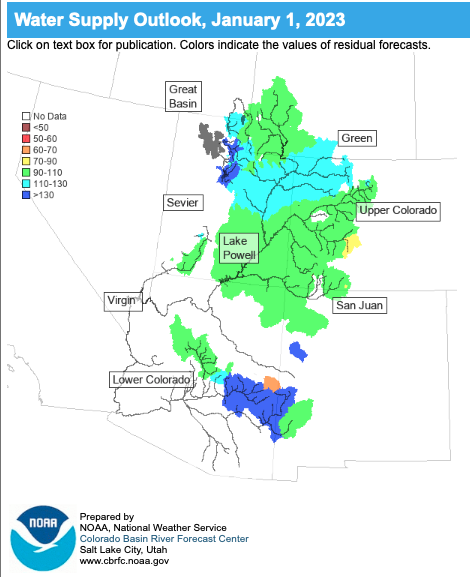
Regional snowpack was above to much-above average for all river basins except the Arkansas (70%) and Rio Grande (77%). As of January 1st, statewide snow water equivalent was highest in Utah (155%) and much above average in Wyoming (132%) and above average in Colorado (116%). Over the last 20 years in Utah, January 1st percent normal SWE was higher only in 2005 and 2011; both of these water years ended with SWE at greater than 150% of normal. Significant snowfall during the first three days of January led to higher percent normal SWE values in the westwide snotel map from 1/3/23 compared to the SWE by basin table. Notably, the Arkansas (80%) and Rio Grande (89%) River basins crept closer to average by January 3rd.
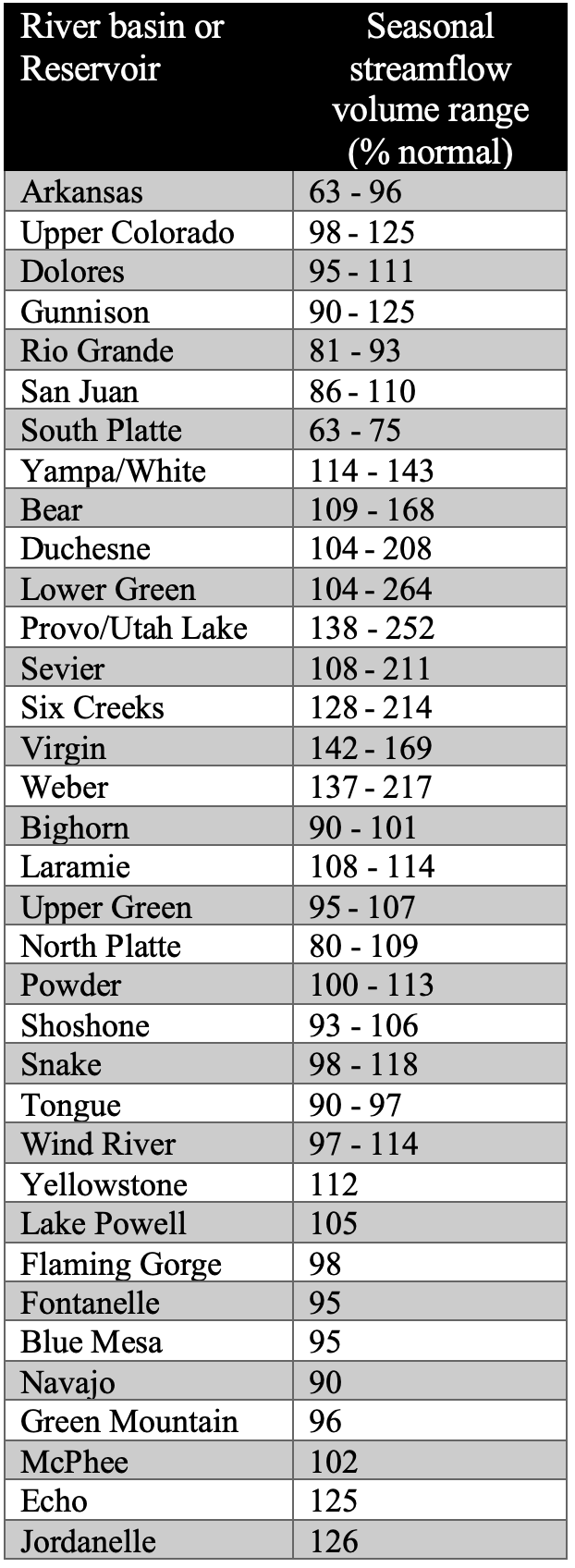
January 1st seasonal streamflow forecasts in the Upper Colorado River and Great Basins are near-to-above normal. Near-normal seasonal streamflow volumes (90-110%) are forecasted for the Upper Bear, Colorado, Dolores, Upper Green, Gunnison, San Juan, Sevier and Virgin Rivers. Above normal seasonal streamflow (110-120%) is forecasted for the Lower Bear, Lower Green, White and Yampa River basins. Much-above normal seasonal streamflow (>130%) is forecasted for the Provo River, Weber River and Six Creeks basins. Seasonal streamflow forecasts for all large Upper Colorado River Basin reservoirs are near normal and Lake Powell’s inflow forecast is 105% of normal. East of the Continental Divide in Colorado, seasonal streamflow forecasts are below normal for the Arkansas and Rio Grande Rivers and much-below normal for the South Platte River. Wyoming seasonal streamflow forecasts near-to-slightly above normal for all river basins. While late fall soil moisture remained below normal for much of the region, above normal precipitation and below normal temperatures since October 1st led to favorable streamflow forecasts. It is important to note that there is still three months of the snow accumulation season left and January 1st streamflow forecasts contain significant uncertainty. As observed in 2022, water supply conditions can change dramatically from January to April.
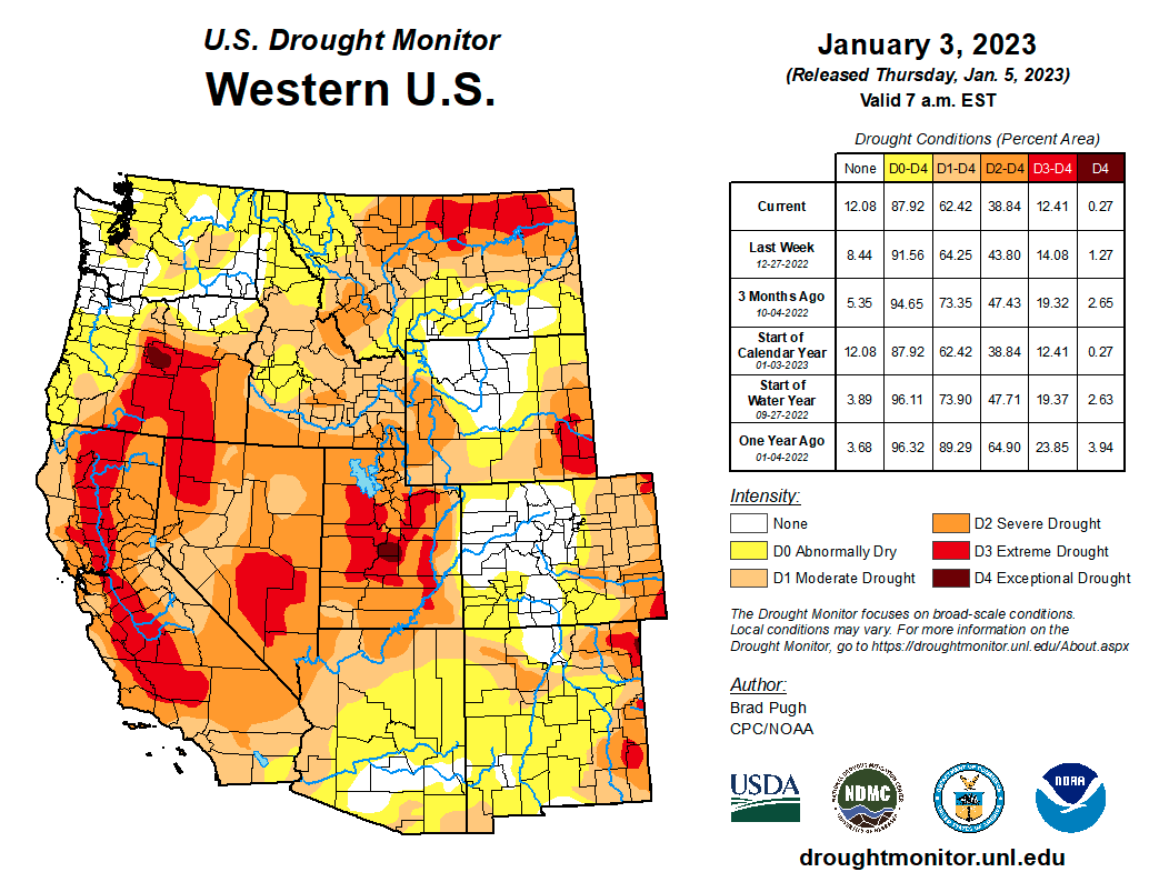
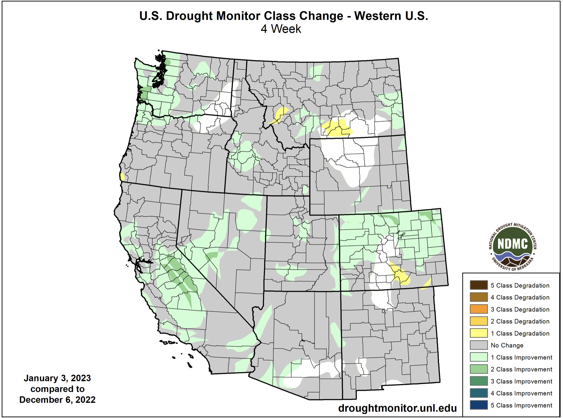
Regional drought conditions improved slightly during December. On January 3rd, drought covered 58% of Colorado, Utah and Wyoming, down from 66% in late November. Drought remains across all of Utah, but significant removal of extreme drought conditions occurred during December. Extreme drought coverage in Utah decreased from 50% in late November to 27% on January 3rd. Drought conditions remain in about 50% of Colorado and Wyoming, but some portions of extreme drought were removed in eastern Colorado and there was a one category improvement in drought conditions across the northern half of Colorado.
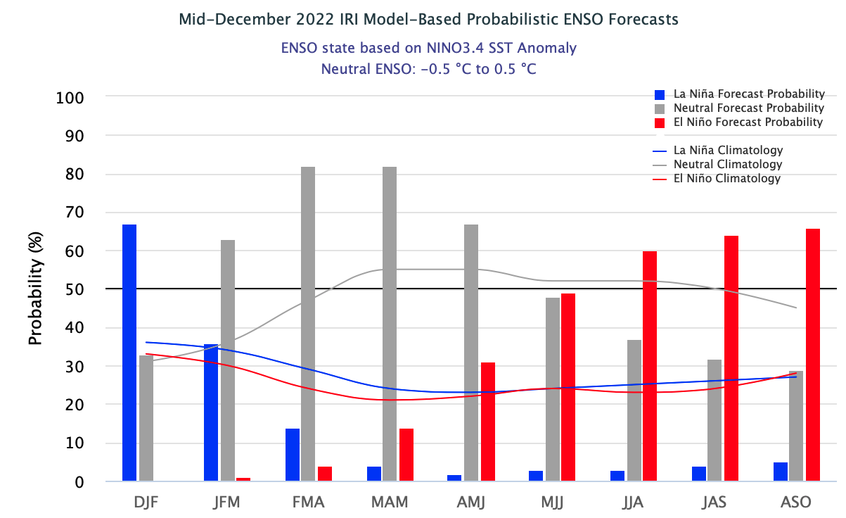
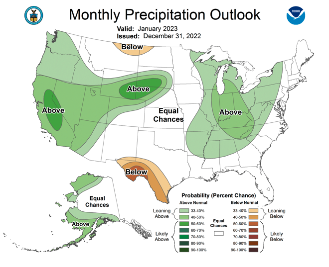
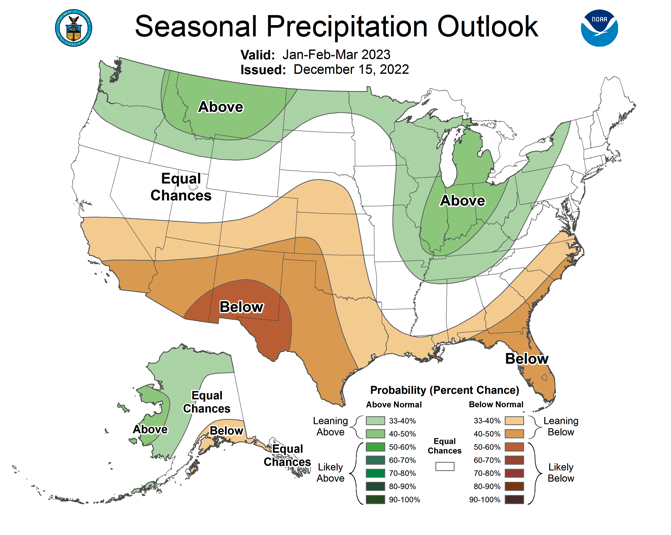
La Niña conditions persisted during December, but all ocean temperature models forecast warming waters in the eastern Pacific Ocean. There is a 65% probability of La Niña conditions continuing through February, but neutral ENSO conditions are forecasted for spring and summer (60-80% probability). There are some signs that El Niño conditions may form during fall 2023. The NOAA January precipitation outlook suggests an increased probability of above average precipitation for most of the region, especially in eastern Wyoming. The NOAA seasonal outlook for January-March suggests an increased probability of above average precipitation for northern Wyoming and below normal precipitation for southern Utah and much of Colorado. There are equal chances of above or below normal temperatures for most of the region from January to March.

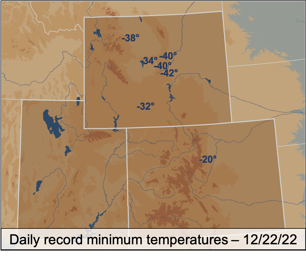
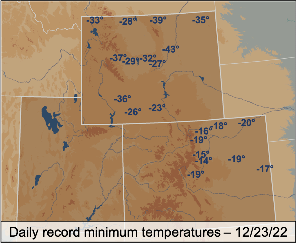
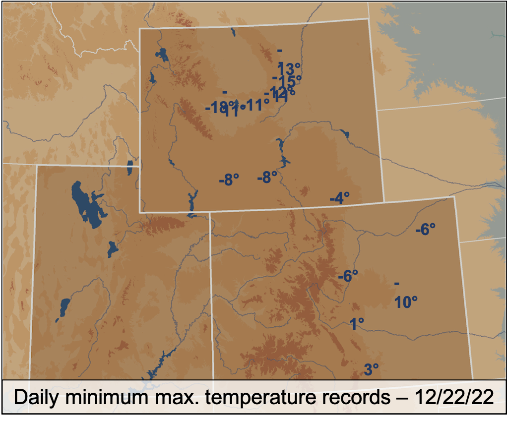
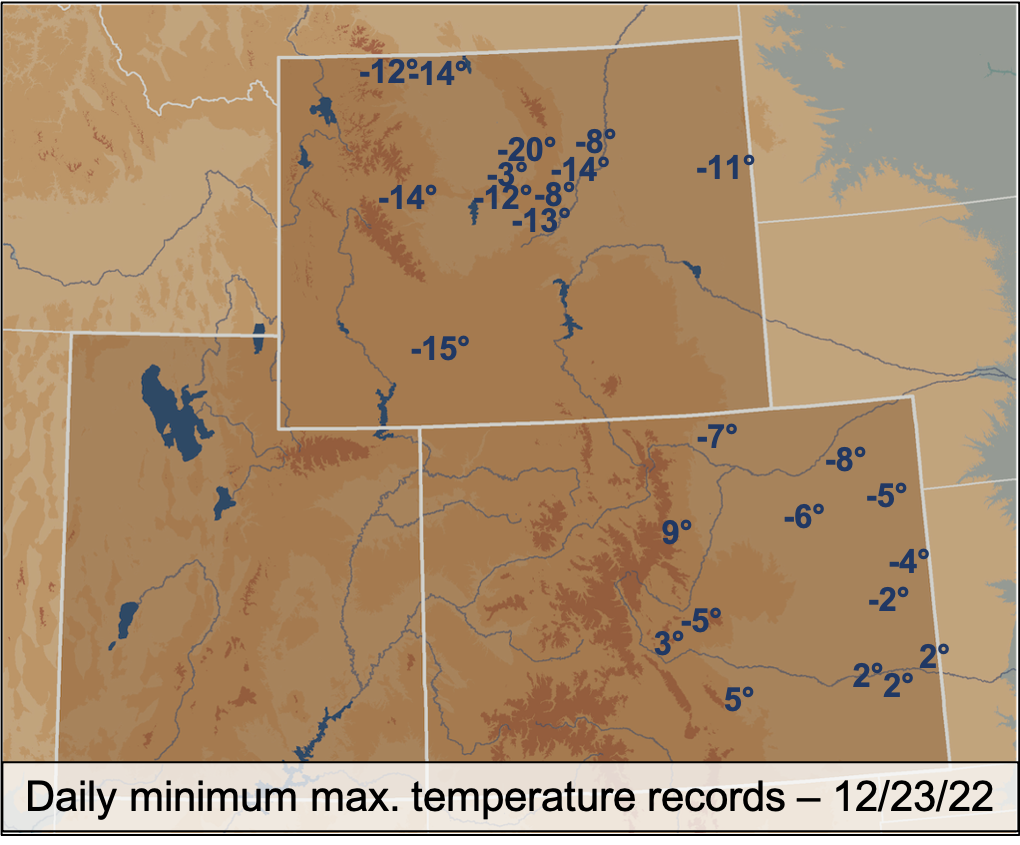
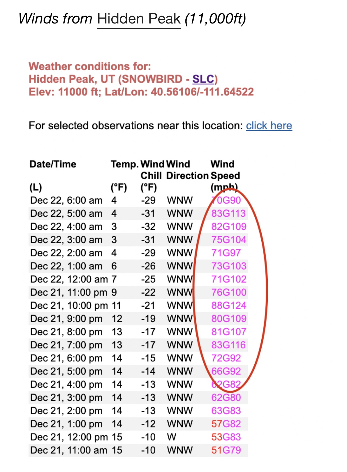
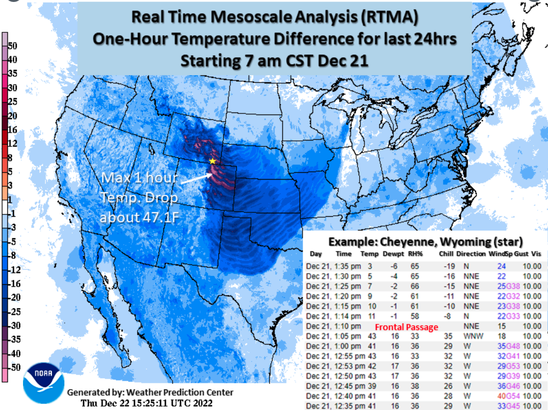
Significant December weather event. Severe cold wave. A strong Arctic cold front brought extreme winds, cold temperatures and record-hourly temperature decreases to the region on 12/21-12/23. Extremely high pre-frontal winds battered the Wasatch Mountains. At 11,000 feet on Hidden Peak, east of Salt Lake City, winds blew above hurricane force for 14 hours with peak hourly wind speeds of 88 mph, gusting to 124 mph. Elsewhere in the Wasatch Mountains, winds peaked at 80-100 mph. Further east, the intense Arctic cold front caused record hourly temperature decreases. Record hourly temperature decreases occurred with frontal passage in Cheyenne (40ºF), Denver (37º.1F) and Fort Collins (42.3ºF). In Cheyenne, the temperature dropped 32ºF in 9 minutes and 51ºF in 2 hours. Intense snow squalls associated with the cold front created blizzard conditions and closed highways along the Front Range and in eastern Wyoming.
Daily record low temperatures and daily record low maximum temperatures were observed in Colorado and Wyoming on 12/22-12/23. In Wyoming, all-time minimum temperature records were set in Atlantic City (-36ºF), Casper (-42ºF), Midwest (-42ºF) and Powder River (-40ºF). All-time low maximum temperature records were set in Atlantic City (-15ºF), Powder River (-13ºF), Shoshoni (-12ºF) and Worland (-20F), Wyoming. Limón, CO set an all-time low maximum temperature of -10ºF on 12/23. Daly record minimum and minimum maximum temperatures were set across Colorado and Wyoming on 12/22 (22 records) and 12/23 (47 records). Only locations with at least 60 years of weather data were considered for this analysis.