February 9, 2022 (CO, UT, WY)
January was very dry throughout most of the region; snowpack and streamflow forecasts that were much above average on January 1st dwindled to near-to-below average conditions by February 1st. Drought conditions remain over nearly the entire region and continued La Niña conditions are projected to bring below average precipitation and above average temperatures to Colorado and Utah for the remainder of winter.
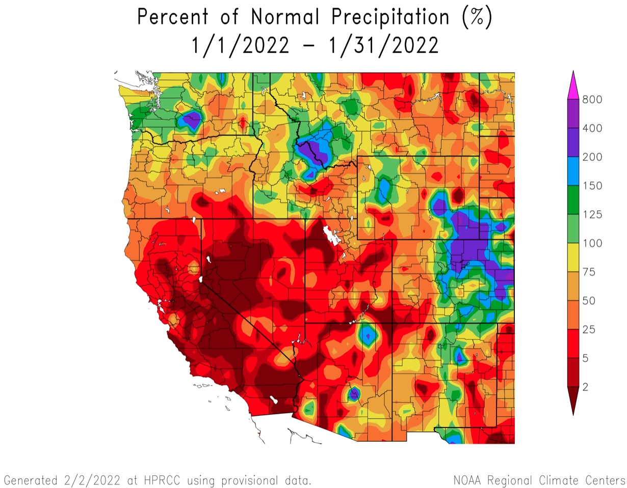
January precipitation was below average for much of the region, especially in Utah where large portions of the state received less than 50% of normal precipitation. In Colorado, January precipitation was below average west of the Continental Divide and above average east of the Divide, especially in the eastern Plains. Much above average precipitation as observed in southeastern Wyoming and in the Wind River Range.
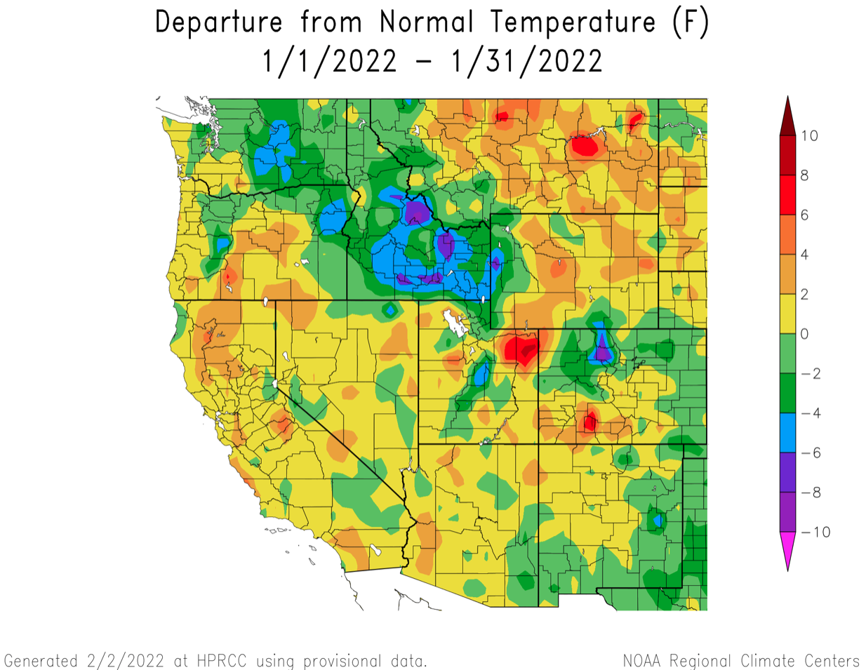
Temperatures were near average (+/- 2 degrees) for much of the region. Warmer than average January temperatures were observed in the Uintah Basin in Utah and west-central Wyoming. Below average temperatures were observed in western Wyoming, northern Colorado and eastern Colorado.
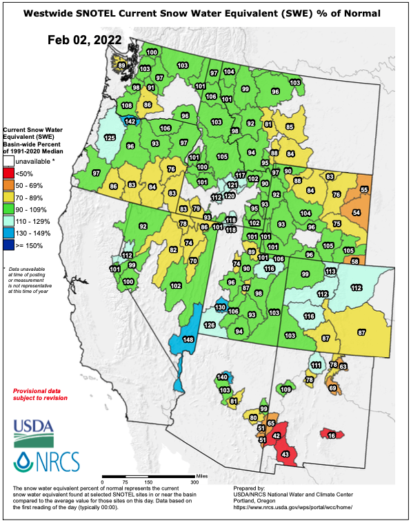
Despite a dry January, regional snowpack remains near average in most river basins of the Intermountain West. Snowpack declined relative to average in all river basins in Utah and Colorado, except for the South Platte River Basin. In Colorado, snowpack remains above average in the North Platte, South Platte and Gunnison River Basins, but is below average in the Rio Grande and Arkansas River Basins. Snowpack is below average in northeastern Wyoming, but near average in the remainder of the state.
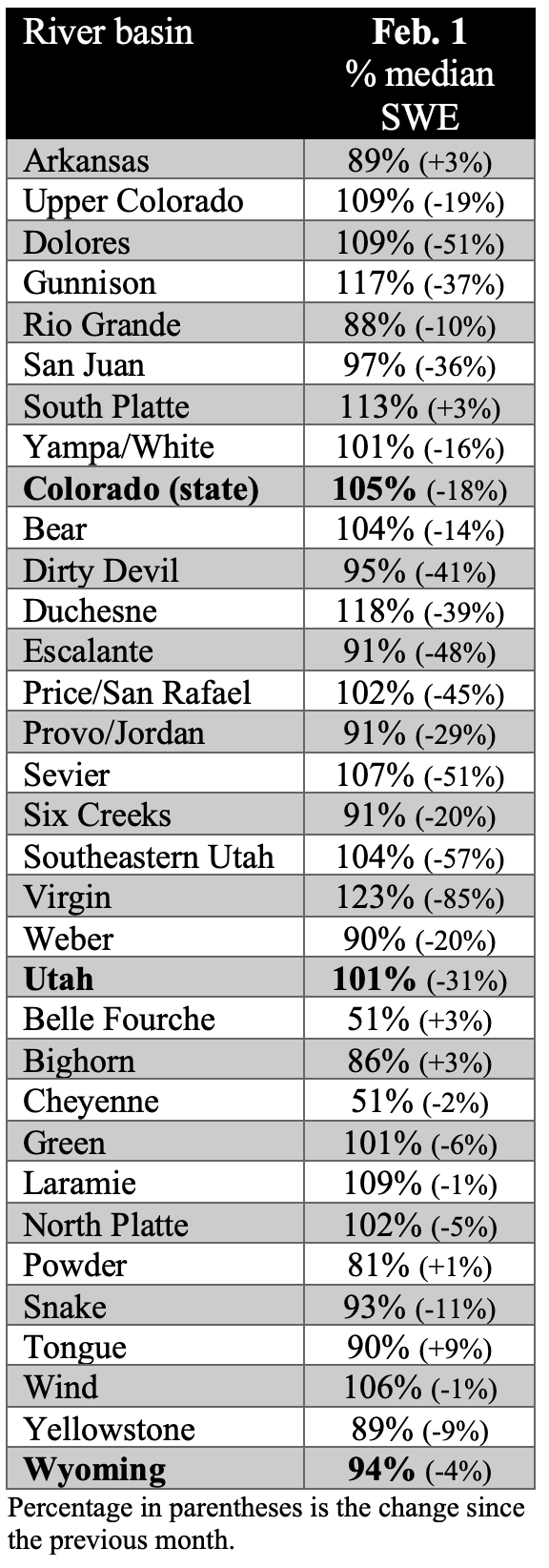
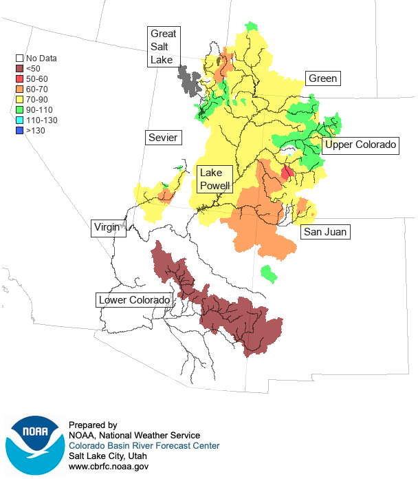
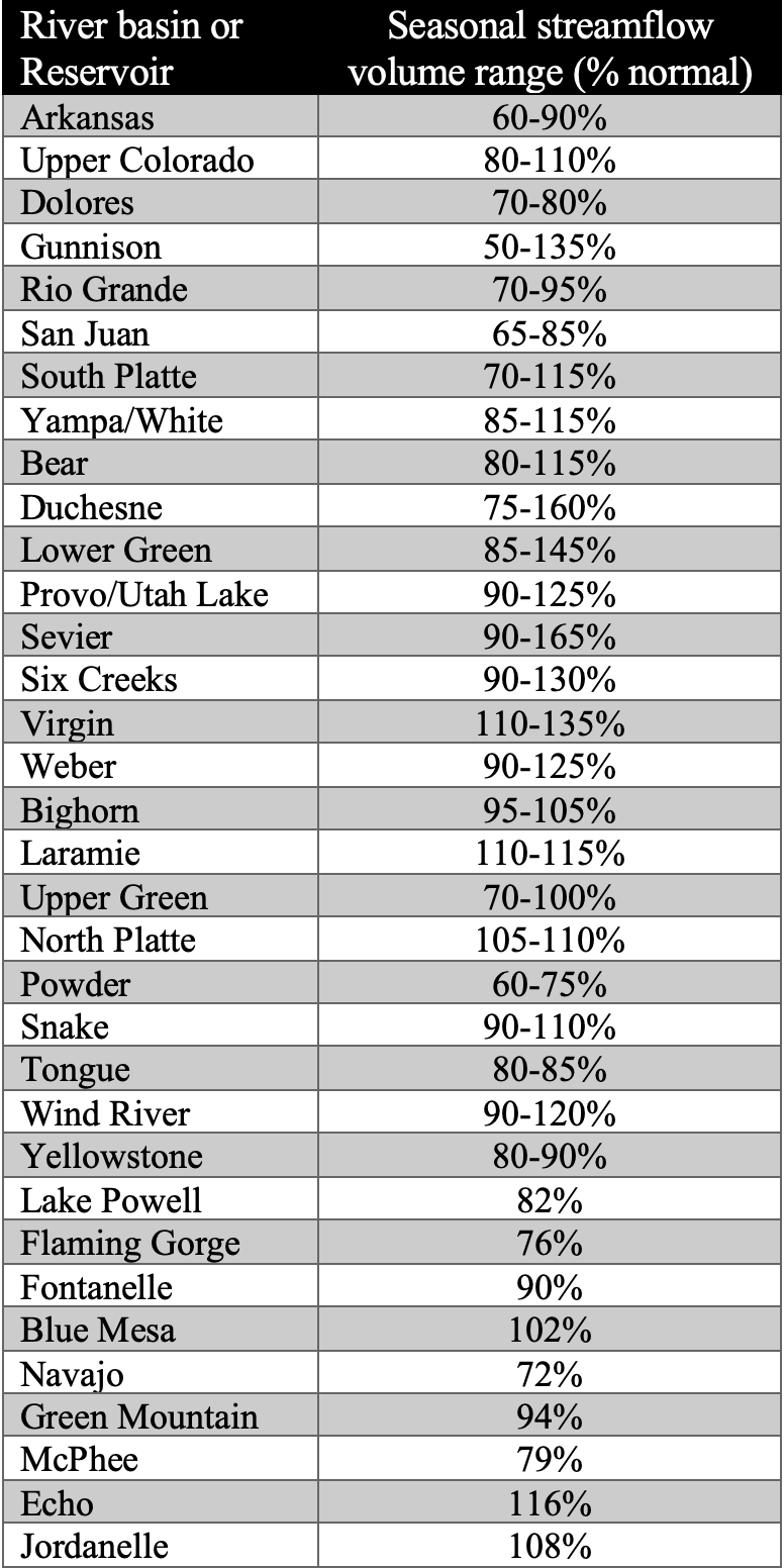
Dry conditions during January resulted in a decrease in seasonal streamflow forecasts relative to average except in the Bear, Upper Green, South Platte and Wind River Basins. Near-average streamflow volumes are forecasted for the Mainstem of the Colorado, Laramie, North Platte, Provo, Six Creeks, Upper Snake, South Platte, Weber and Upper Yampa River Basins. Above average streamflow is forecasted for the Virgin River Basin. Most other regional river basins are forecasted to see below normal seasonal streamflow volumes, with the Arkansas, Dolores, Powder and San Juan River Basins forecasted to see the lowest flows.
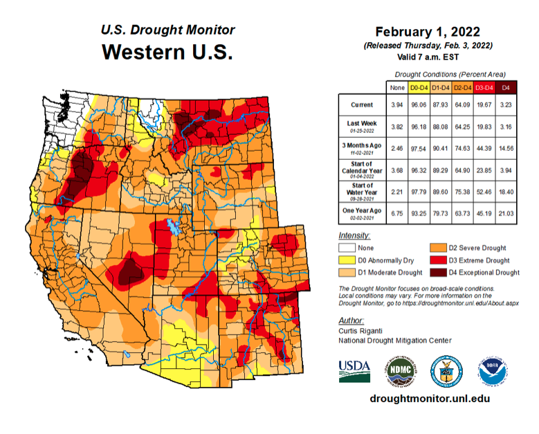
Drought conditions remain in place over 94% Colorado, Utah and Wyoming. Despite a dry last three weeks of January, drought conditions improved in parts of the region. Along the mainstem of the Colorado River in western Colorado and in central Utah, there was a one category improvement in drought conditions. Regionally, the area of extreme (D3) drought decreased, but still covers 18% of the region, including 32% of Utah.
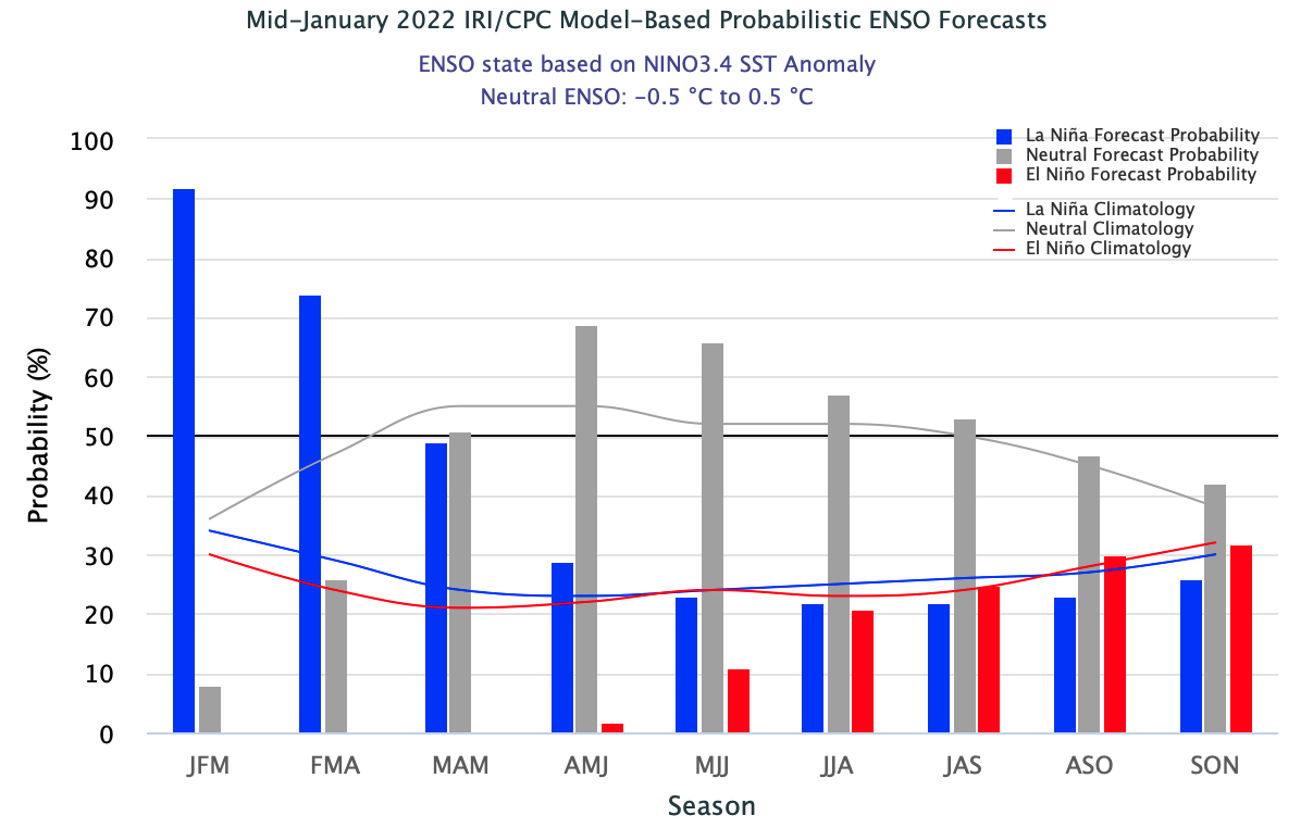
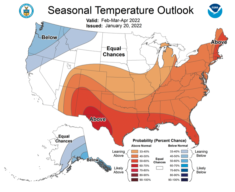
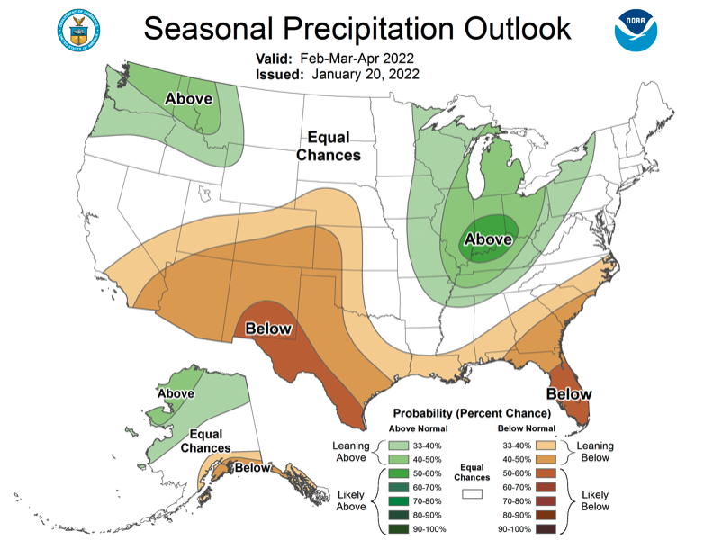
La Niña conditions remain in place over the eastern Pacific Ocean with ocean temperatures running 0.5-1º C below normal. La Niña conditions are expected to continue through April-May. A typical La Niña weather pattern, with wetter and cooler weather in the Northwest and warmer and drier weather in the Southwest, is forecasted to dominate the western United States through April. NOAA seasonal forecasts for February-April forecast an increased probability of above average temperature and below average precipitation for much of Colorado and Utah.
Significant January weather event. Severe or prolonged storm cycles and periods of drought have characterized the 2022 water year. After a very wet and snowy October left most regional river basins with much above average snowpack, few storms impacted the Intermountain West during November and most of December. Beginning on December 23rd, a series of atmospheric river events impacted the region bringing significant snowfall to nearly the entire region until January 7th. Regional snowpack was much-above normal in early January. Over a 16-day period from December 23rd to January 7th, regional snowpack increased dramatically. In Utah, statewide snow water equivalent (SWE) went from 69% to 141% of normal. In Colorado, SWE increased from 67% to 131% of normal and Wyoming SWE increased from 73% to 118% of normal. Dry conditions returned to most of the region during the remainder of January except for southeastern Wyoming and east of the Continental Divide in Colorado. As of February 1st, statewide SWE as a percent of normal fell to near-normal conditions in Utah (97%), Colorado (107%) and Wyoming (93%). Dry conditions remained in place over the first week of February and are forecasted to remain dry until at least the middle of the month. Without significant snowfall during the last half of February, regional snowpack and streamflow forecasts will continue to decline relative to normal.