December 6, 2023 - CO, UT, WY
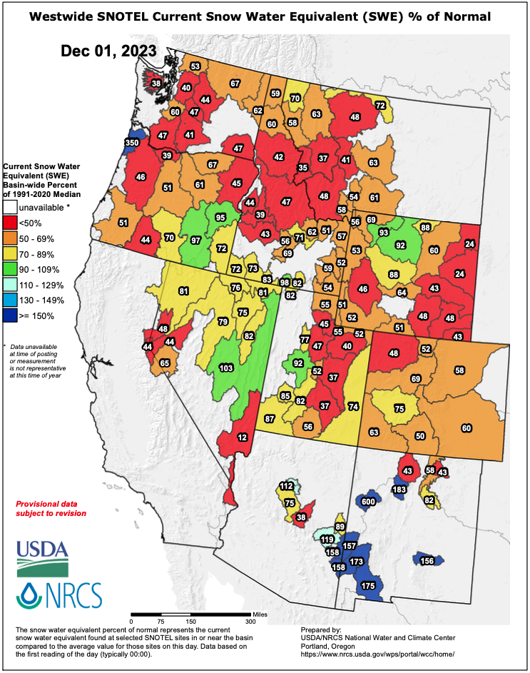
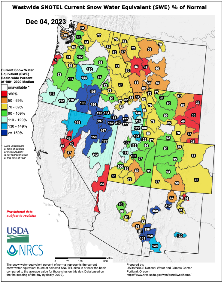
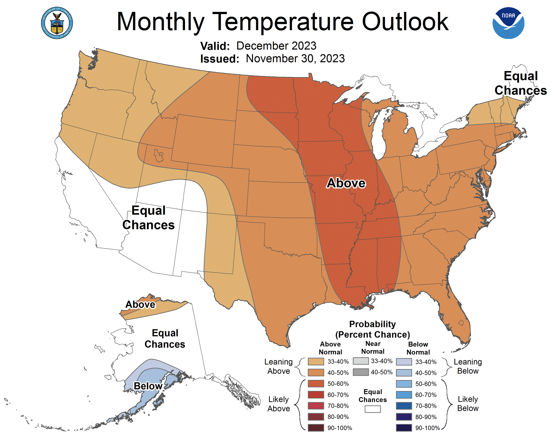
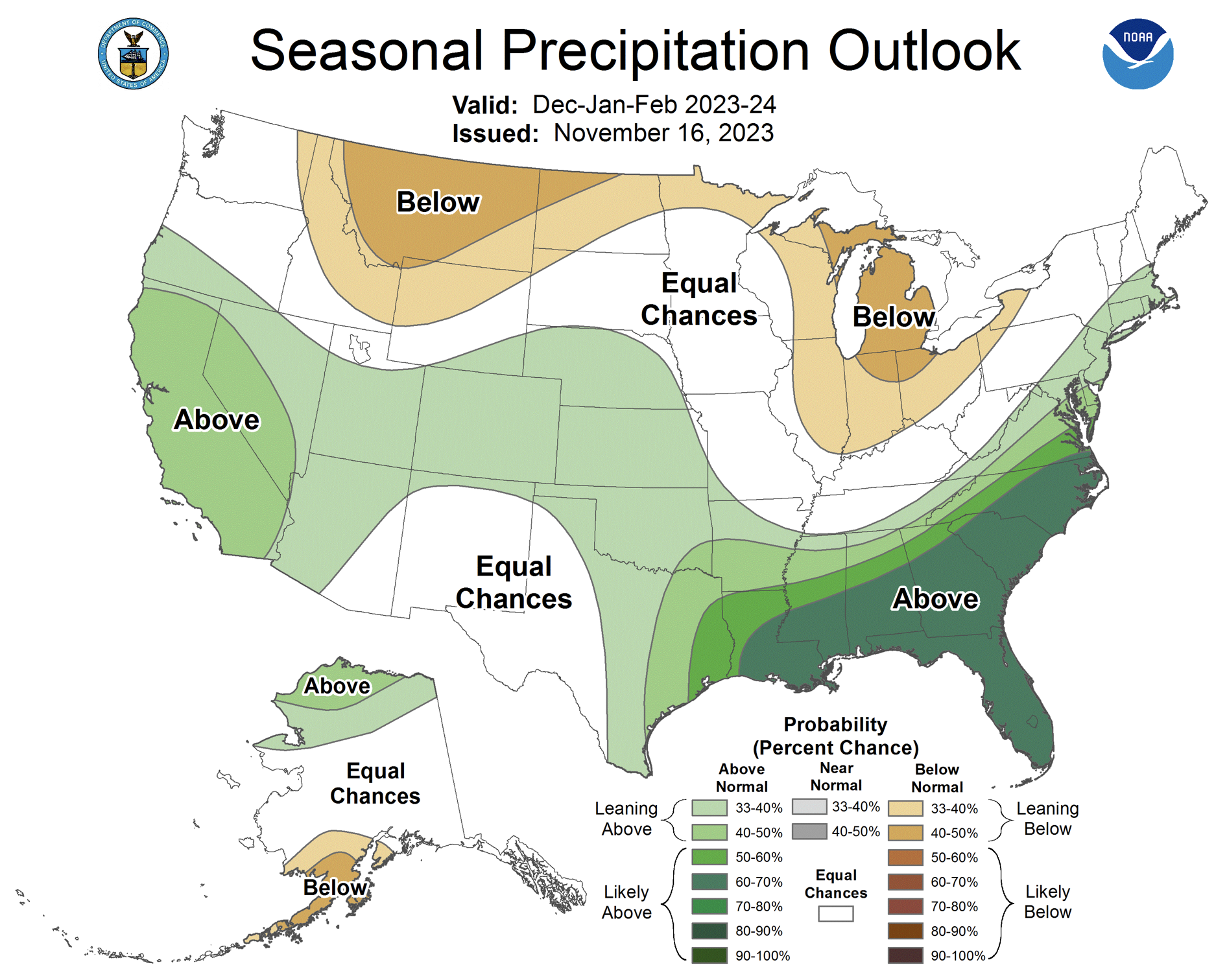
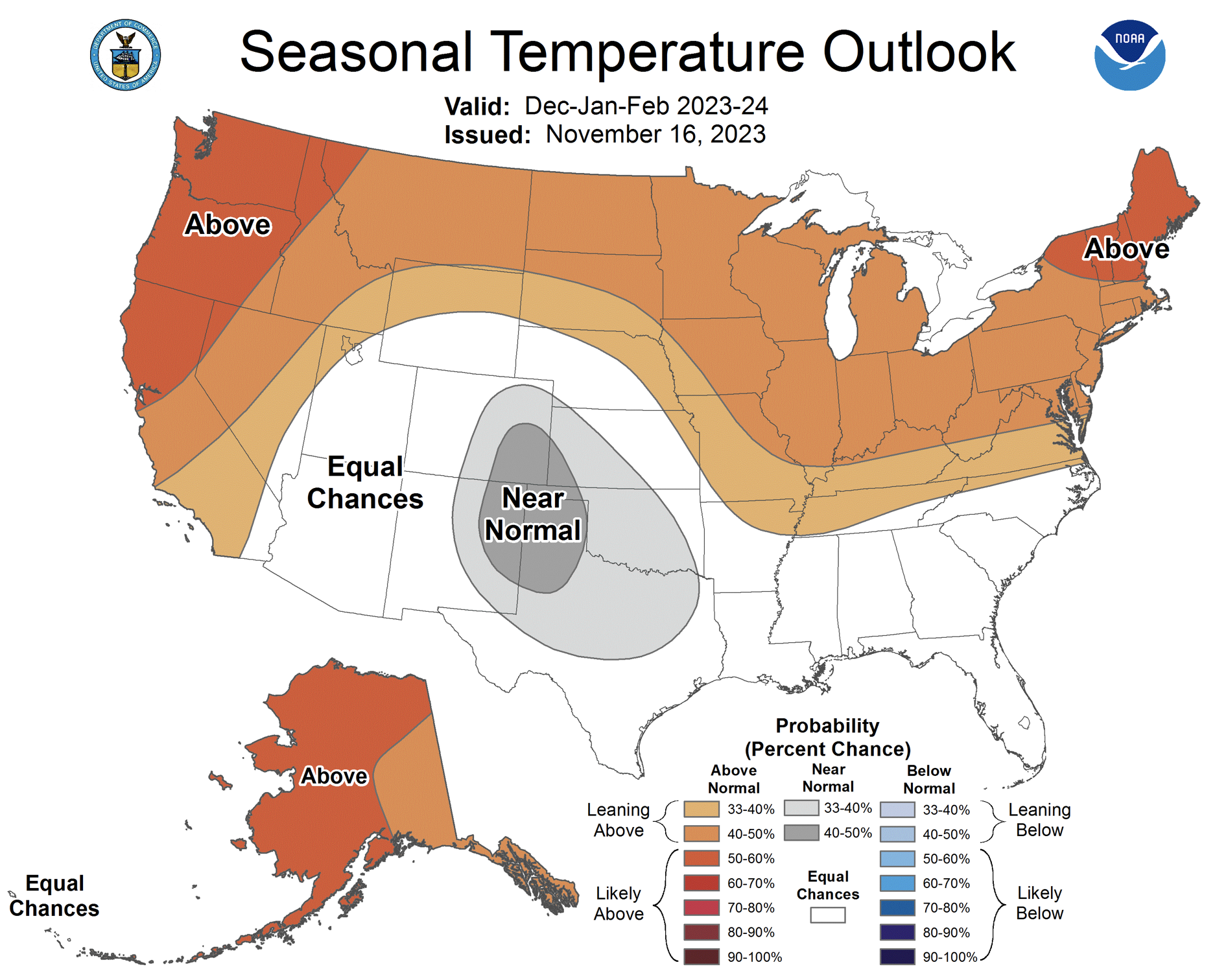
November was generally drier and warmer than average across the region. Regional snowfall was also below average during November and the month ended with Colorado at 54% snow water equivalent (SWE) statewide and Utah at 60% of average SWE. Drought conditions expanded slightly to cover 14% of the region with the most severe conditions in western Colorado. Strong El Niño conditions currently exist and there is an 80% chance that El Niño conditions continue through spring. NOAA seasonal forecasts suggest an increased probability of above average December–February precipitation for much of Colorado and Utah and an increased probability of below average precipitation for northern Wyoming.
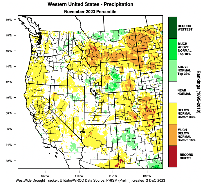
November precipitation was below normal for much of the region, especially in Colorado and eastern Wyoming where large areas received less than 50% of average monthly precipitation. A few locations in southern Colorado received record-low November precipitation. Locations in southwestern and central Wyoming received average to above average precipitation. In Utah, November precipitation was a mix of below and above average conditions.
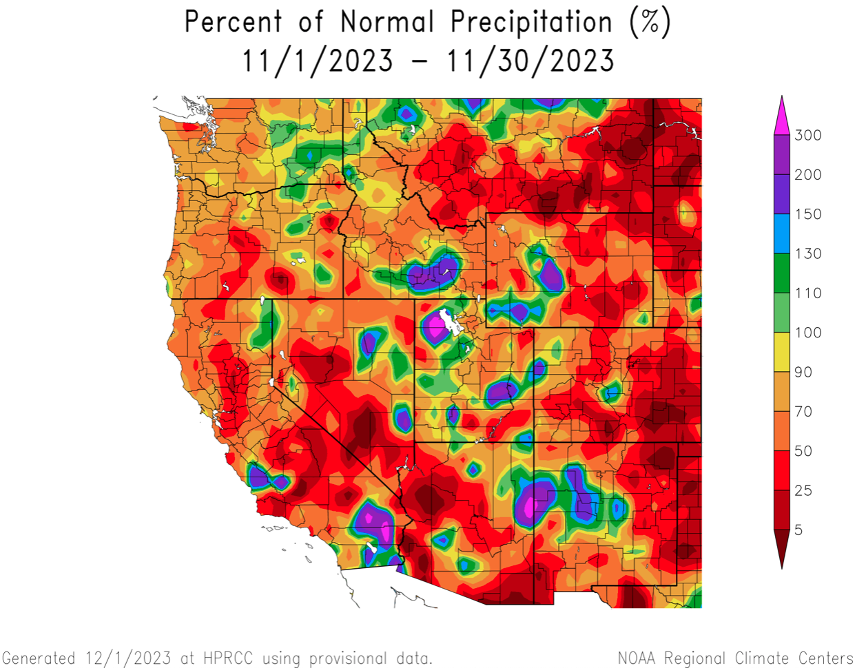
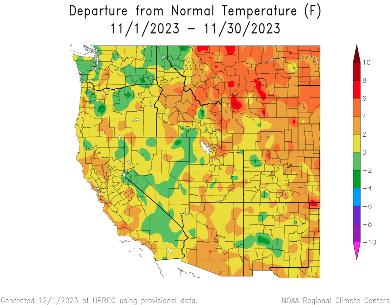
Regional temperatures were above average during November. In Utah, western Colorado and southwestern Wyoming, November temperatures were slightly above average. In eastern Colorado and much of Wyoming, temperatures were generally 2-4 degrees above average.
November snowfall was below average across the region. As of December 1, snow water equivalent was below to much-below average for all river basins; statewide SWE was 60% of average in Colorado and 54% of average in Utah. A prolonged winter storm affected the region on December 1-3, significantly improving snowpack conditions across most of Utah, western Colorado and parts of Wyoming.
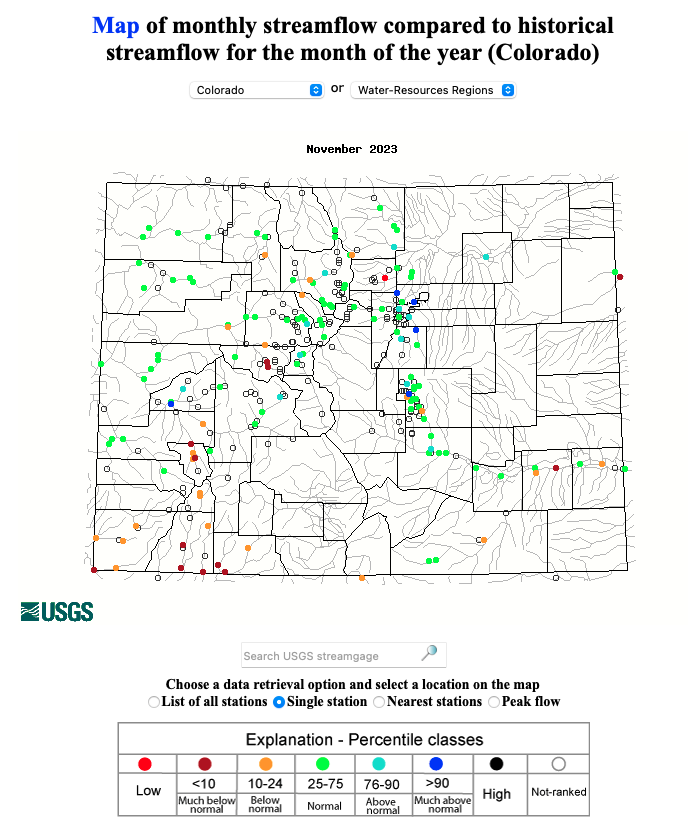
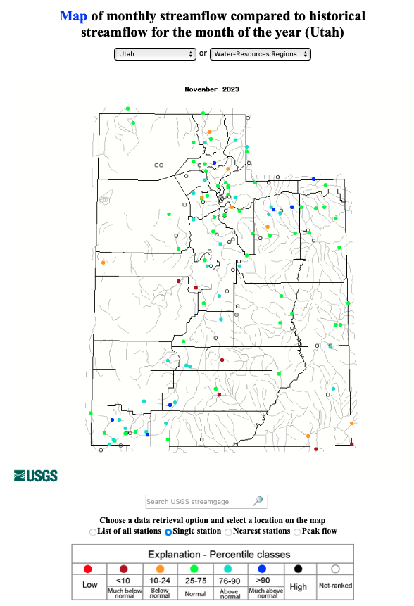
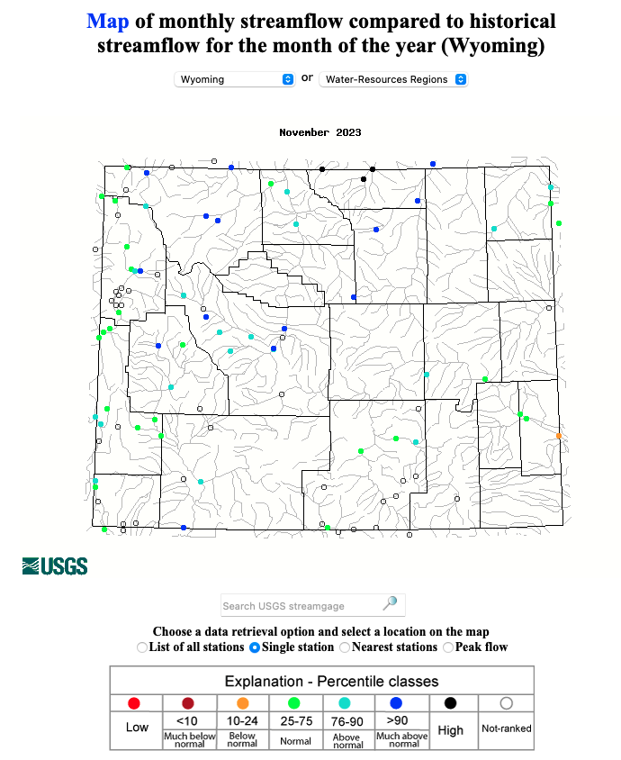
Monthly streamflow during November was lowest relative to the average in Colorado where many sites along the Arkansas, Rio Grande and San Juan Rivers reported below to much-below average streamflow, coinciding with regions experiencing the worst drought conditions. November streamflow in Utah was near-average at most streamflow gauges except for a few drier sites in central and southeastern Utah. In Wyoming, November streamflow was average across most of the state except for northern Wyoming where November streamflow was above average. The Colorado Basin River Forecast Center will issue its first water supply forecast of the season by December 13.
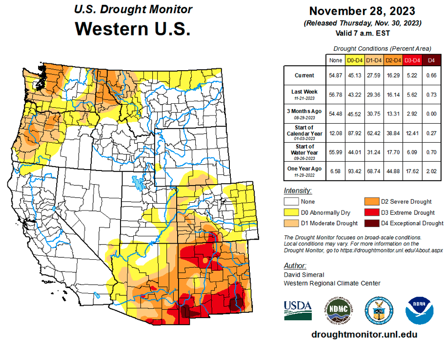
Regional drought conditions expanded slightly during November and now cover 14% of the region, a 3% increase from late October. Drought conditions remained largely unchanged in Utah and Wyoming, but expanded in Colorado. By late November, most of western Colorado was in drought and extreme (D3) drought developed in the Rio Grande River Basin.
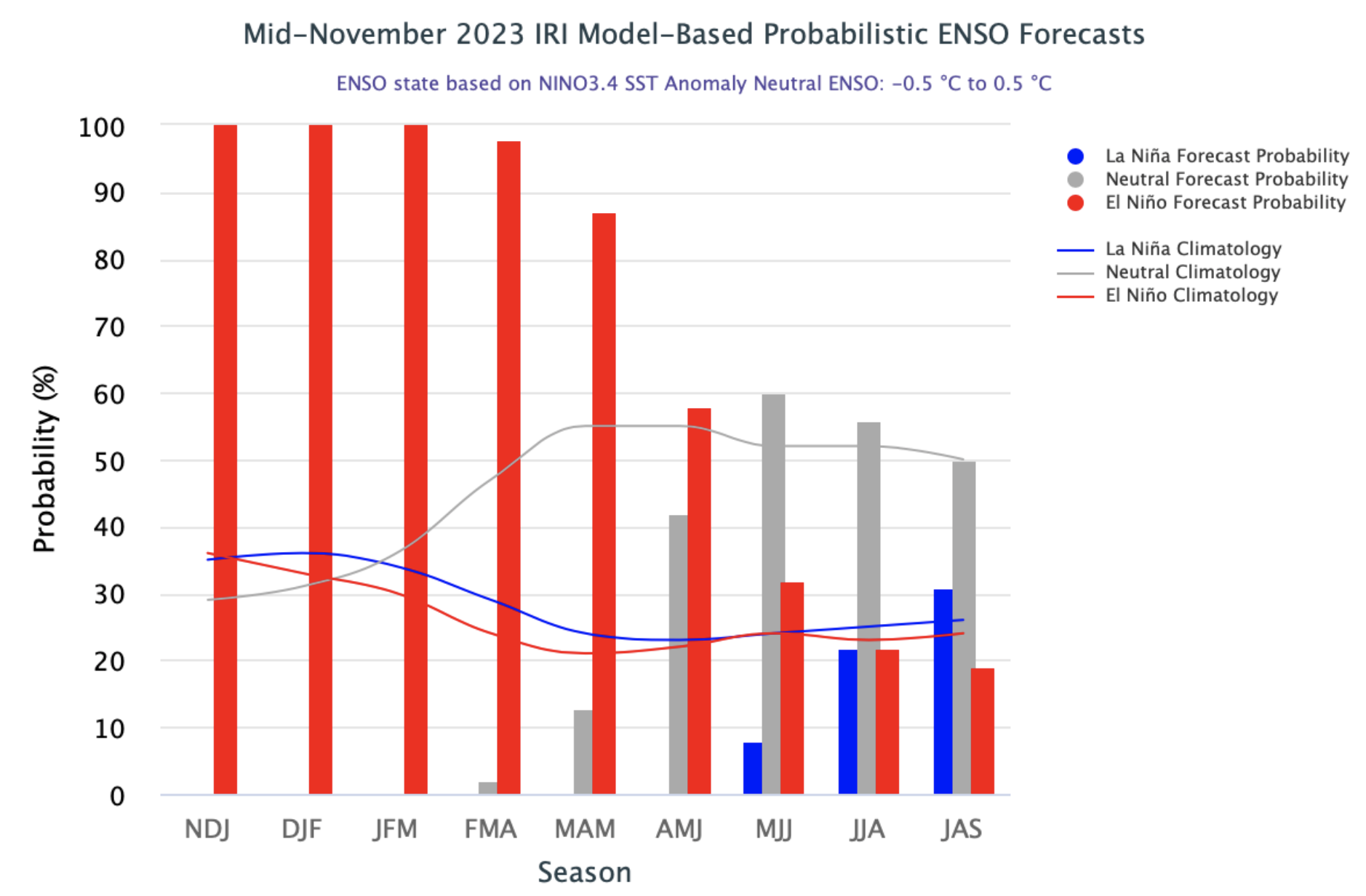
El Niño conditions continued during November and Pacific Ocean temperatures are consistent with a strong El Niño. There is over an 80% probability of El Niño conditions persisting through spring and a 55% chance of a strong El Niño continuing through mid-winter. The NOAA temperature outlook for December suggests an increased probability of above average temperatures for much of the region. The NOAA seasonal forecast for December–February suggests an increased probability of above average precipitation for much of Utah and Colorado and an increased probability for below average precipitation across much of Wyoming. In northern Wyoming, there is an increased probability of above average temperatures from December–February.
Significant weather event. December 1-3 winter storm. November was a relatively quiet month for regional weather, but December began with a very powerful winter storm impacting most of Utah, northern Colorado and western Wyoming. The three-day storm began very cold with snowfall across all elevations, but warmed significantly during the second half of the storm. Utah saw the most significant snowfall and statewide SWE improved from 60% of average before the storm to 113% of average after the storm. Colorado’s statewide SWE improved from 54% to 85% following the storm. While early season snowpack as a percentage of average can change dramatically with single storms, snowfall, especially in northern Utah, was significant. Snowfall and SWE totals from the storm included: 38” of snow (6.6” SWE) at Tony Grove Lake near Logan, 50” of snow (6.6” SWE) at Ben Lomond SNOTEL near Ogden and 51” of snow (4.7” SWE) at Alta. The storm also brought prolonged periods of very strong winds with peak gusts approaching 110 mph at 11,000 feet in the central Wasatch Mountains.
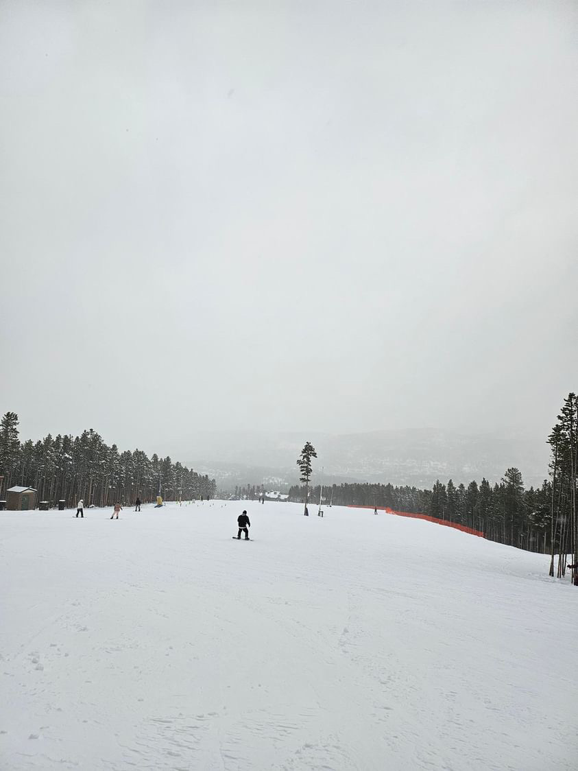
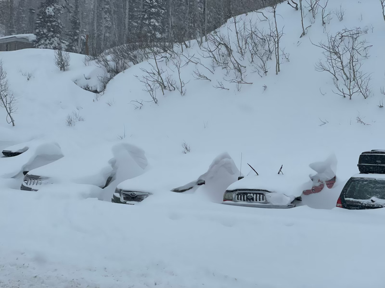
(Left) Breckenridge, CO. December 2. Photo credit: Ethan Knight. (Right) Little Cottonwood Canyon, UT. December 3. Photo credit: Seth Arens.