August 4, 2022 - CO, UT, WY
Climatological highlights from July 2022 include a strong monsoon that brought above average precipitation to parts of southern Utah and Colorado, dry and very hot conditions in much Utah that caused the persistence of drought and a forecast for continued above average monsoonal precipitation in Utah and parts of Colorado and Wyoming.
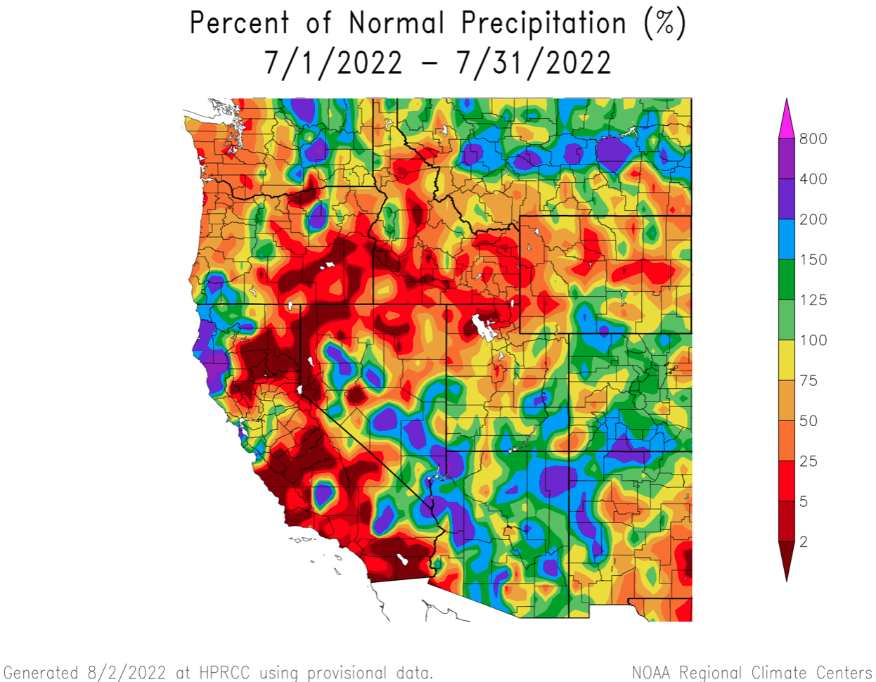
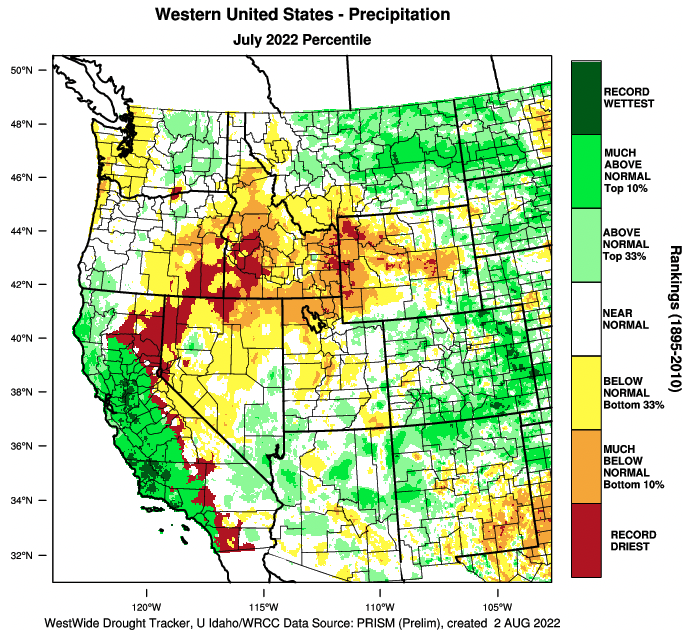
July precipitation was generally below normal in the northern and western portions of the region and above normal in the southern and eastern portions of the region. A strong monsoonal weather pattern during July brought average to above average precipitation to most of Colorado, southern Utah and southern Wyoming. Northern Utah and western and northern Wyoming received below average July precipitation.
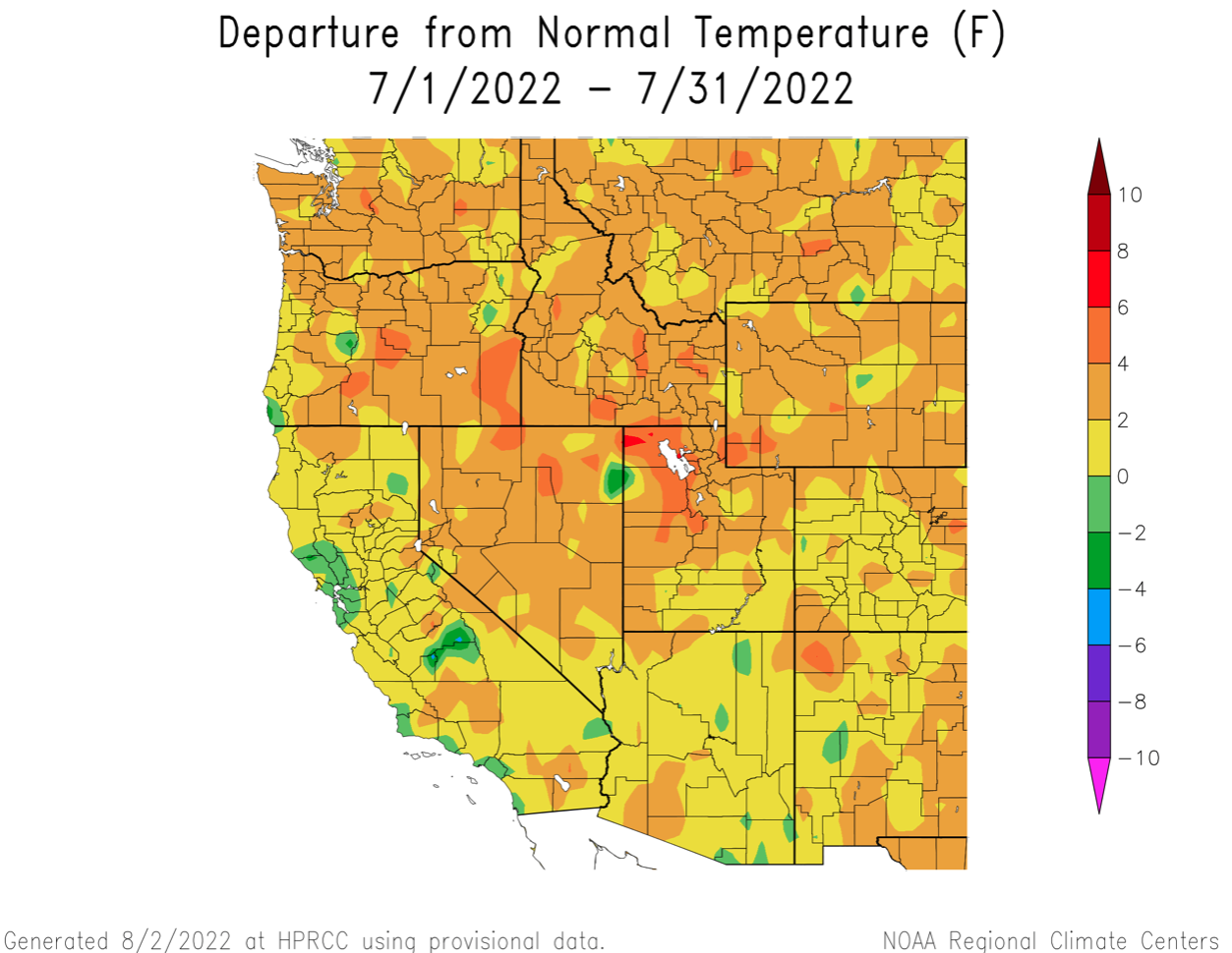
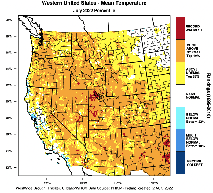
Temperatures were above average during July for the entire region. The hottest temperatures were observed in the Great Salt Lake Basin in Utah where July temperatures were 4 to 6 degrees above normal and both Salt Lake City and Ogden recorded the hottest July on record. In Salt Lake City, the average July high temperature was 99.7ºF and there were 18 days with a maximum temperature exceeding 100ºF. July temperatures in most of Utah, Wyoming and northern Colorado were 2 to 4 degrees above normal.
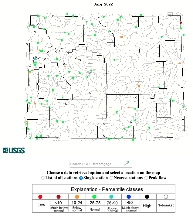
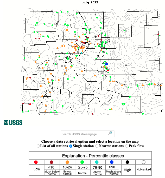
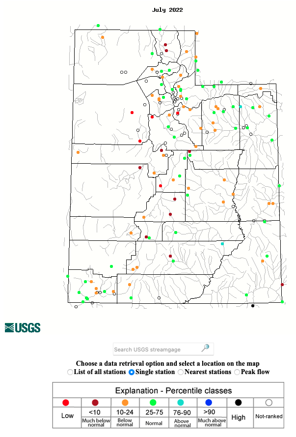
Regional rivers were flowing at a mix of near average to below average levels during July. In Wyoming, streamflow in nearly all rivers was near average. Streamflow in Colorado rivers was generally below average on the West Slope and near average in northern Colorado and in the Arkansas River basin. Utah rivers were typically flowing at below average levels, but some rivers influenced by monsoonal rains experienced near-average July streamflow.
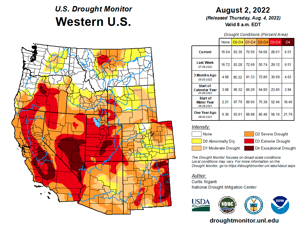
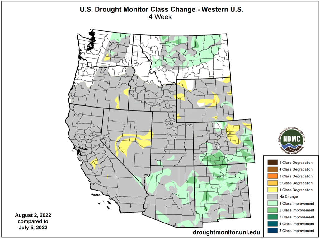
Overall, regional drought conditions improved during July. As of August 2nd, 73% of the region was in drought, compared to 81% on July 1st and 92% on June 1st. Utah remains at the center of the current drought and drought conditions changed little during July. The entire state of Utah is experiencing at least severe drought conditions and 77% of the state is in extreme (D3) drought and 7% is in exceptional (D4) drought. Drought conditions did improve by one category in a small area of eastern Washington County. The majority of northern Wyoming is either drought-free or abnormally dry (D0) and drought conditions improved over a large area of central and southern Colorado during July. Drought conditions are forecasted to improve over most of the region and drought removal is forecasted for portions of southern Wyoming and western Colorado.

La Niña conditions remain present in the eastern Pacific Ocean and there is a 55-75% probability for La Niña conditions to persist through early winter. There is an extremely low probability of El Niño emergence in the next year. Current model projections suggest that neutral ENSO conditions will emerge by early 2023.

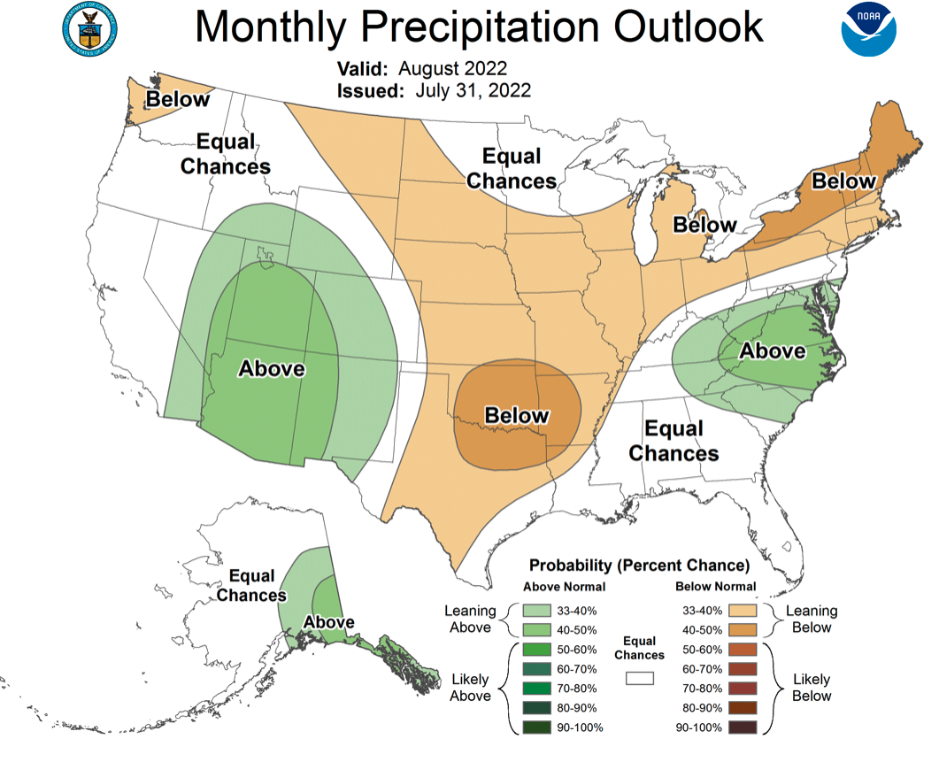
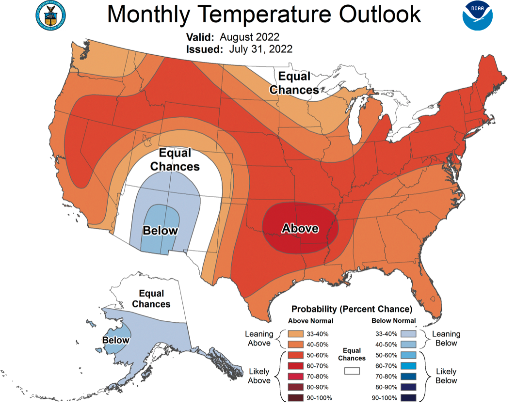
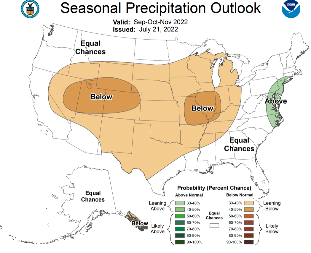
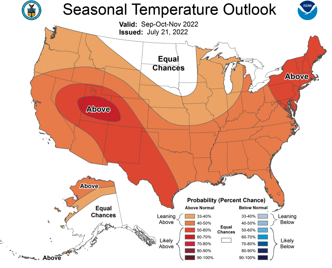
The North American Monsoon is expected to remain active during August and is forecasted to push further north into Utah, western Colorado and southwestern Wyoming. The NOAA precipitation outlook for August suggests an increased probability of above precipitation for Utah, western Colorado and southwestern Wyoming. The presence of additional precipitation and cloud cover likely explains the increased probability of below average temperatures in the Four Corners during August. There is an increased probability for below average precipitation and above average temperature for the entire region during September-November.