August 3, 2023 - CO, UT, WY
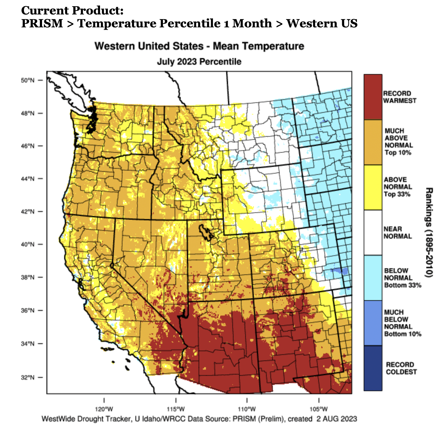
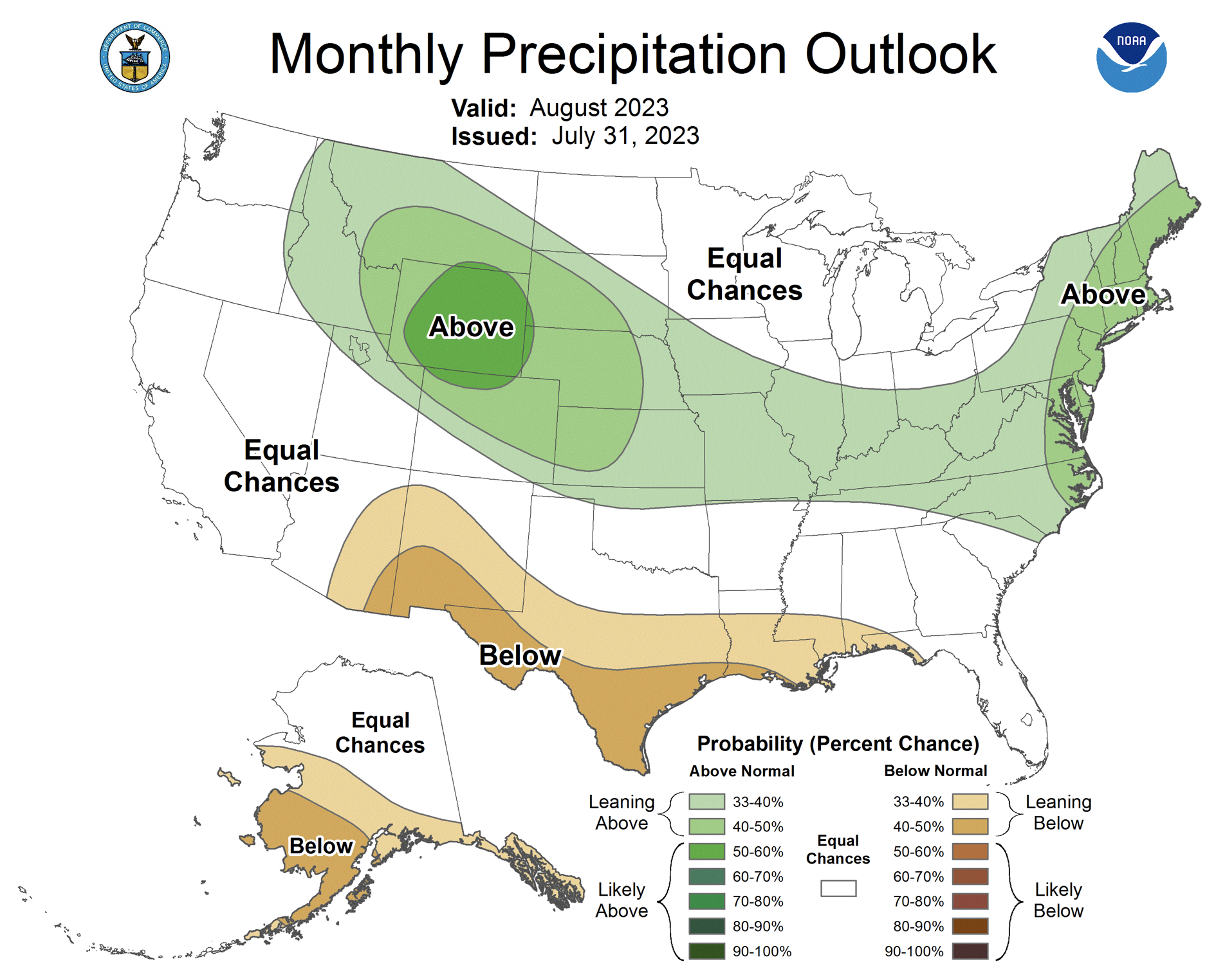
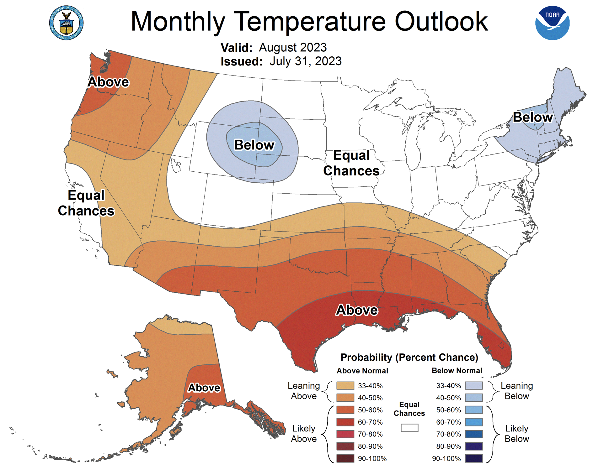
While national headlines told of record heat waves in the Southwest, July temperatures in most of the Intermountain West were near-normal, but temperatures were 2-4 degrees above normal in much of Utah and southwestern Colorado. A moderate El Niño has formed in the Pacific Ocean and is expected to continue through winter. Much of Wyoming saw above average July precipitation while parts of eastern Utah and western Colorado experienced the driest July on record. NOAA seasonal forecasts for August suggest an increased probability of above average precipitation for much of the region and below average temperatures in Wyoming. Most of the region is drought-free, with only 7% of the Intermountain West covered by D1 drought. With seasonal snowmelt completed, most regional rivers were flowing near-to-above average during July.
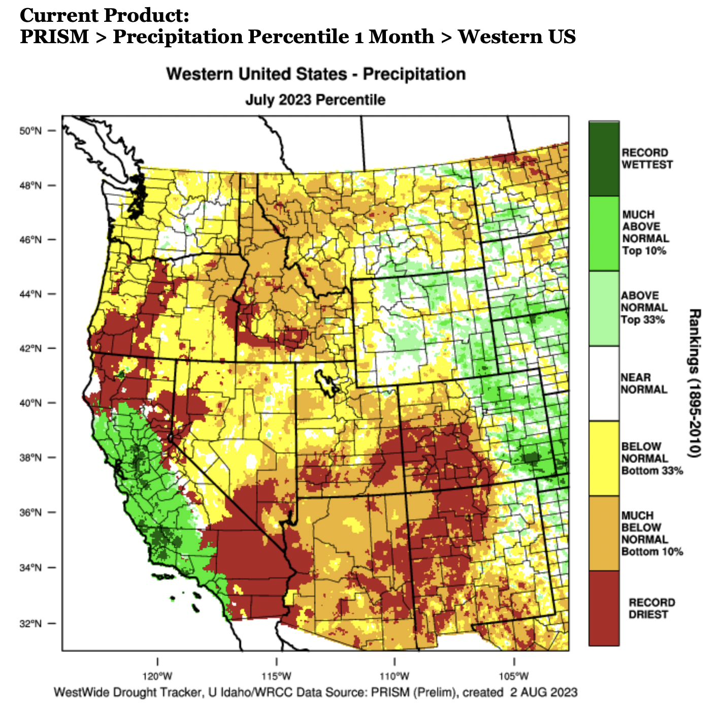
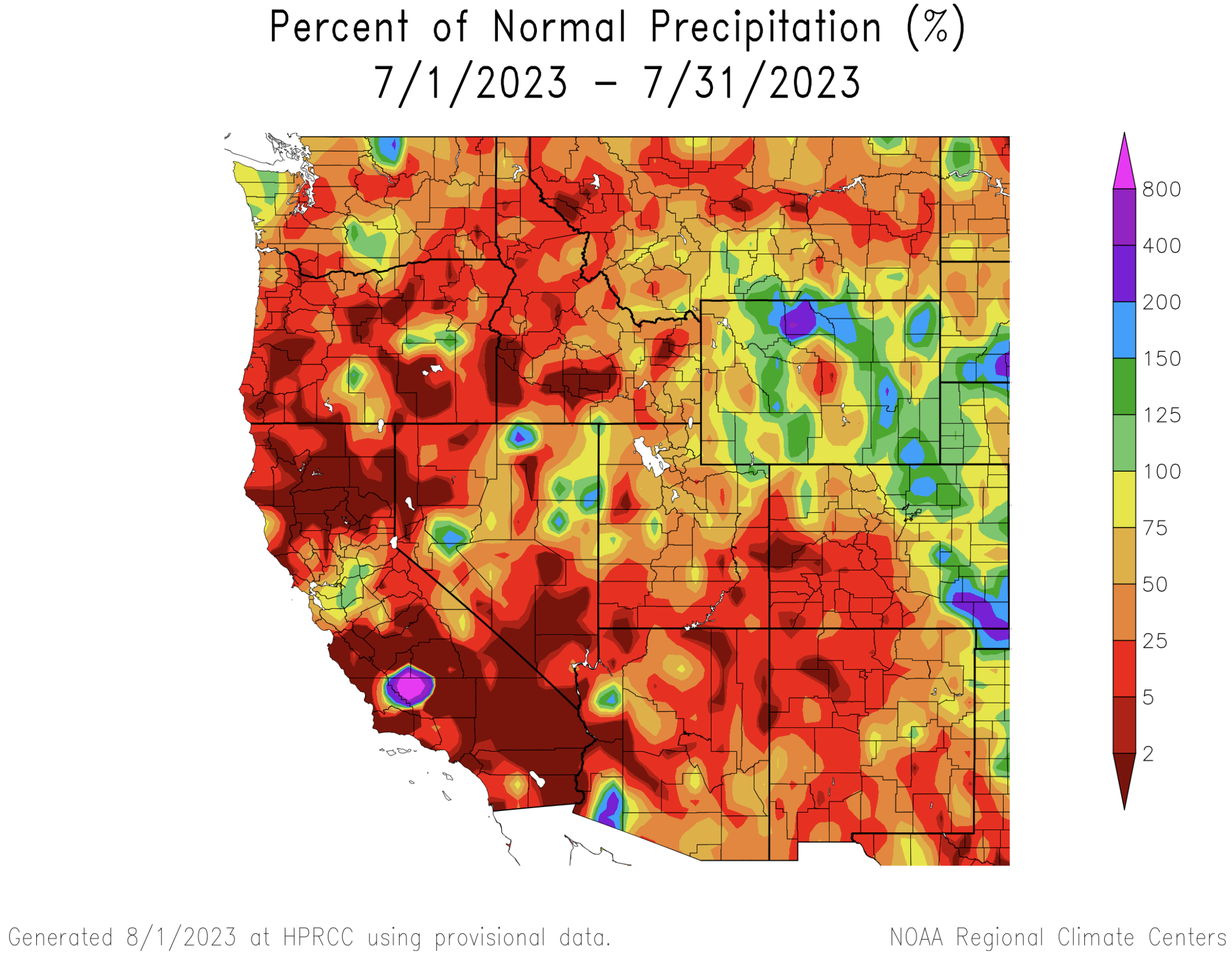
July precipitation was generally below average in the southwestern portion of the region and near-to-above average in the northeastern portion of the region. In Wyoming, July precipitation was mostly above average, except for some locations in western and central Wyoming. A mix of above and below normal July precipitation fell in Colorado with wet conditions continuing in the eastern plains and very dry conditions in western Colorado. Utah received below normal July precipitation with especially dry conditions in southern Utah. Large areas of southwest Colorado and southern Utah recorded the driest July conditions on record.
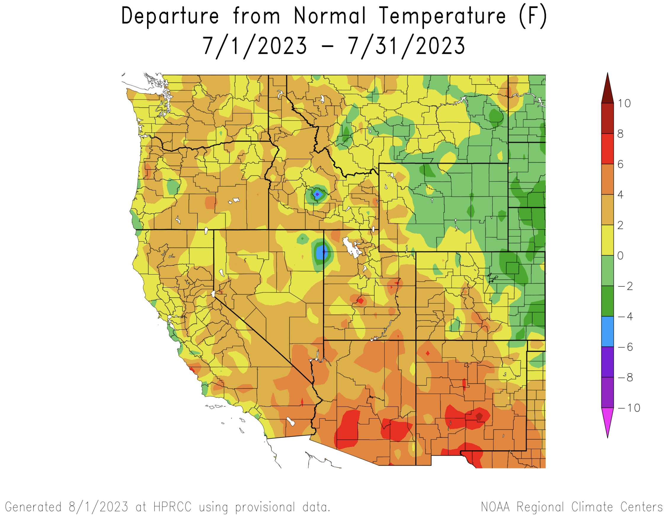
Despite record high temperatures globally and in much of the southern United States, temperatures in the Intermountain West were more moderate during July. Regional temperatures during July followed a geographic pattern similar to precipitation. Near-normal July temperatures (+/- 2 degrees) were observed in Wyoming and much of Colorado. In southwestern Colorado and much of Utah, July temperatures were 2-4 degrees above average.
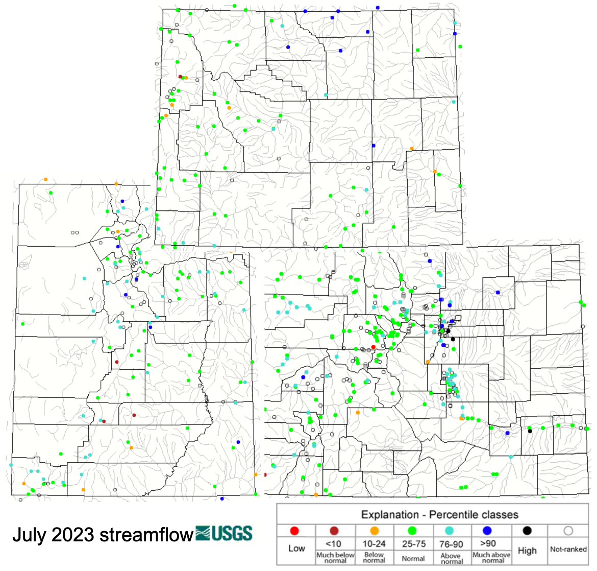
As seasonal runoff dwindles and rivers slowly approach baseflow conditions, July streamflow in most regional rivers was near-normal. Above normal July streamflow was observed in portions of the Arkansas, Colorado, Duchesne, Gunnison, Logan, Price and White River Basins. Much above normal July streamflow was observed in the Bighorn, North Platte, South Platte and Wind River Basins. In general, drought conditions were not observed in the streamflow of regional rivers, but the Upper Snake River and the Sevier and Fremont Rivers in Utah had July streamflow that was below the 5th percentile of observed July streamflow.
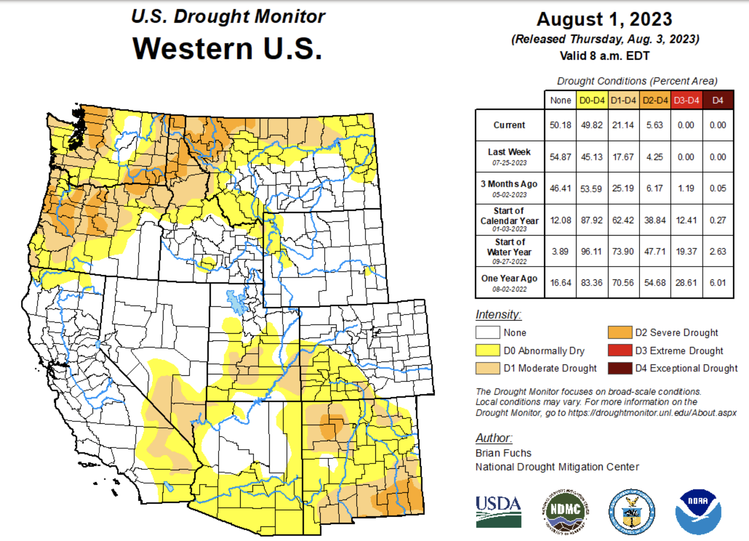
Regional drought coverage increased slightly to cover 7% of the region, but shifted in location. Improvement in drought conditions in Wyoming caused the removal of most areas of D1 Drought. Last month, Colorado was drought-free, but D1 drought conditions developed in south-central and southwestern Colorado during July. D1 drought also developed in eastern Utah during July.
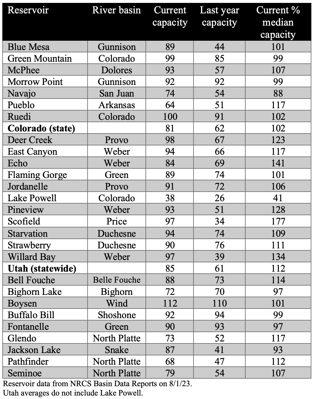
After much-above average seasonal runoff, most regional reservoirs filled, nearly filled or have above average capacity. Reservoirs along the Wasatch Front in the Weber and Provo River Basin are all filled and currently at 120% of normal capacity. Statewide, Utah reservoirs are 85% full and 112% of normal capacity. Last year, Utah reservoirs were 61% full and at 80% of normal capacity. Reservoirs in Colorado are also storing significantly more water than last year and are currently 81% full which is 101% of normal capacity. The notable exception to reservoir drought recovery is Lake Powell, which remains only 40% full despite 170% of normal Lake Powell inflow and a 65-foot rise in reservoir elevation. Navajo Reservoir on the San Juan River significantly recovered in 2023 but is currently 76% full and at 88% of median capacity.
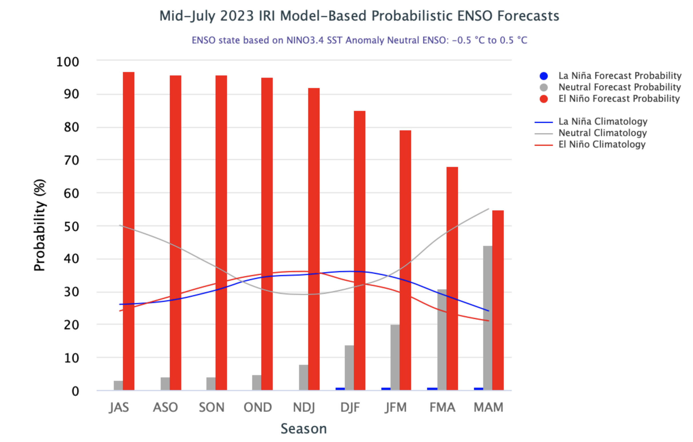
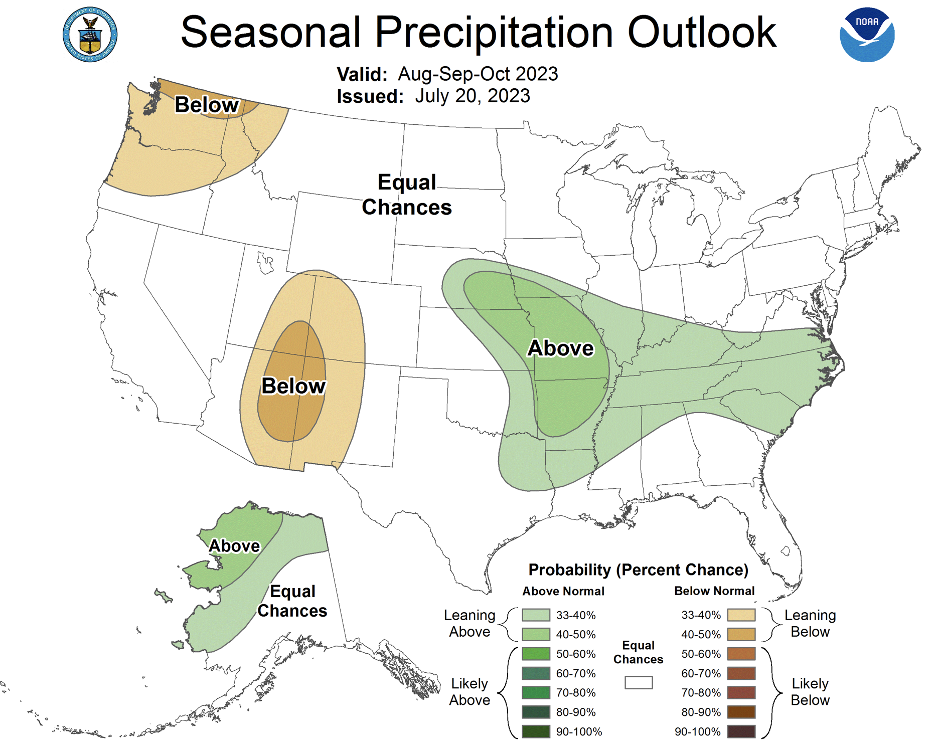
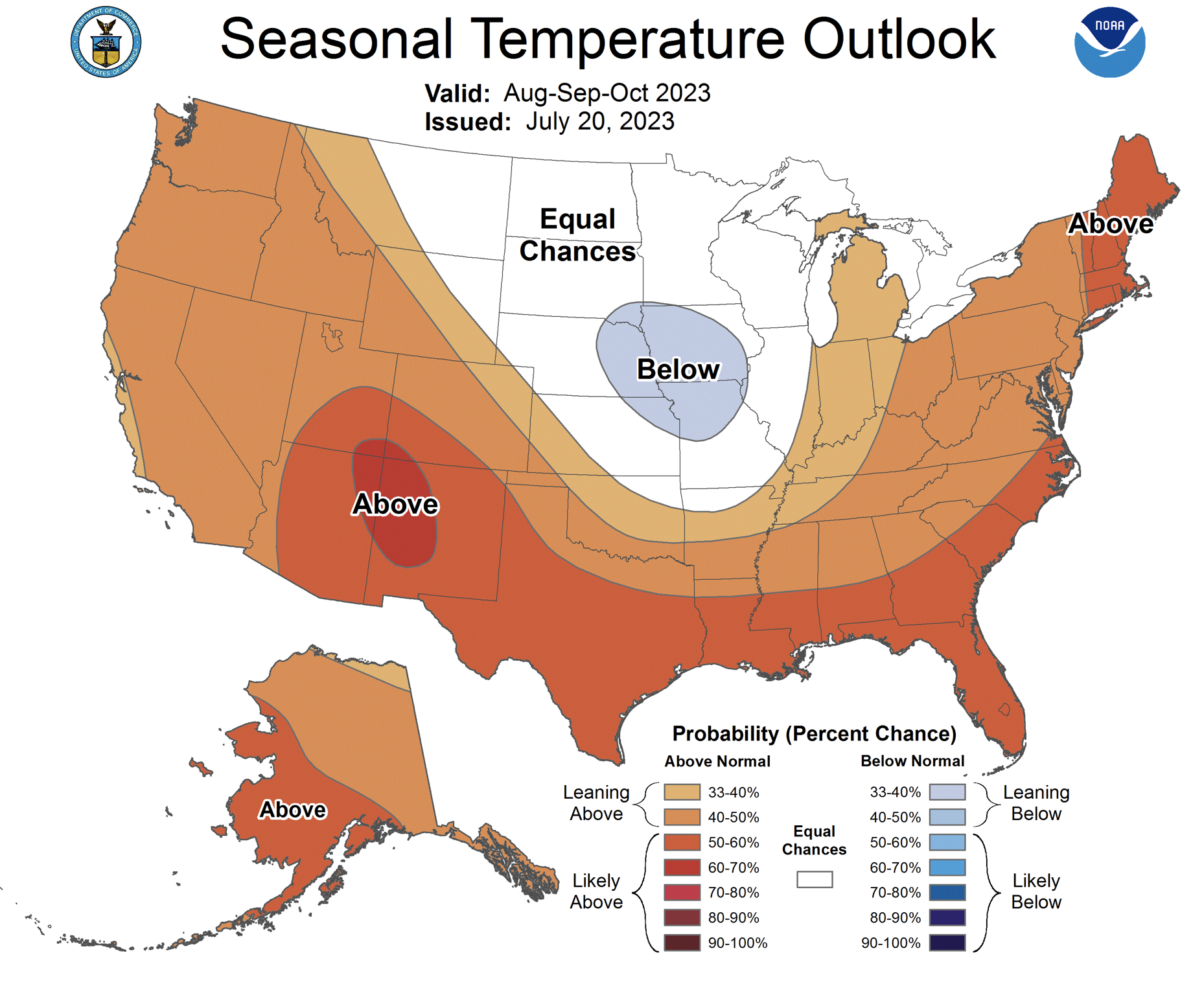
Moderate El Niño conditions currently exist with eastern Pacific Ocean temperatures about 1ºC above average. It is extremely likely that El Niño conditions persist through winter with over a 90% probability of El Niño persistence through January and an 80% chance of it continuing through March. By May, there are nearly 50/50 odds of El Niño or neutral conditions. NOAA seasonal forecasts predict an increased probability of above average August precipitation for Wyoming, much of Colorado and northern Utah and below average temperatures for Wyoming. During August-October, NOAA seasonal forecasts predict an increased probability of below average precipitation for eastern Utah and western Colorado and above average temperatures for much of the region.
Significant July weather event. Drought emerges in the Four Corners. After a record winter snowpack at many locations in eastern Utah and western Colorado, hot and dry conditions have caused the emergence of drought. July was the driest on record for a large area of southwest Colorado and southern Utah, including Grand Junction, Alamosa, Fort Lewis, Fruita, Mesa Verde and Montrose in Colorado and Blanding, Duchesne, La Verkin, Bryce and Canyonlands in Utah. Record hot July temperatures were observed in a few Colorado locations including Alamosa and Montrose, and Grand Junction tied its all-time record high of 107ºF. Dry July conditions in the Four Corners region were predicted by NOAA seasonal forecasts which suggested a late-arriving monsoon. Monsoonal precipitation has recently developed in the region, but may or may not alleviate emerging drought conditions.