Monthly Maps of Significant Weather Events in Colorado, Utah, and Wyoming
NOAA’s National Center for Environmental Information (NCEI) Storm Events Database records the occurrence of storms and other significant weather phenomena having sufficient intensity to cause loss of life, injuries, significant property damage, and/or disruption to commerce. All event data in the Storm Events Database were entered by NOAA National Weather Service forecast offices.
For the years 1950–1954, the database only includes data on tornadoes. For 1955–1995, the database includes tornadoes, hail events, and thunderstorm wind events. From 1996 to present, the database includes all 48 event types recorded by the National Weather Service.
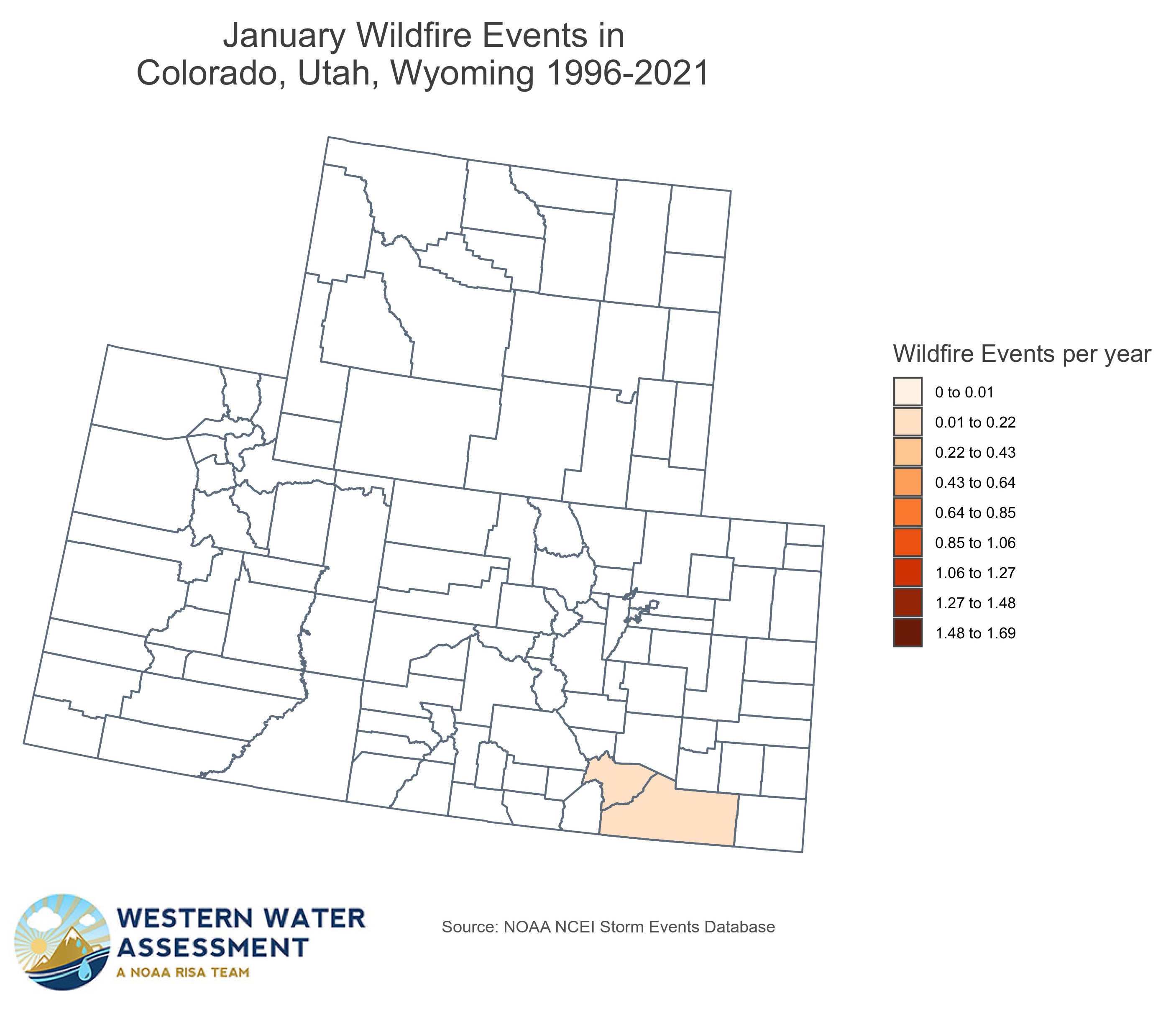
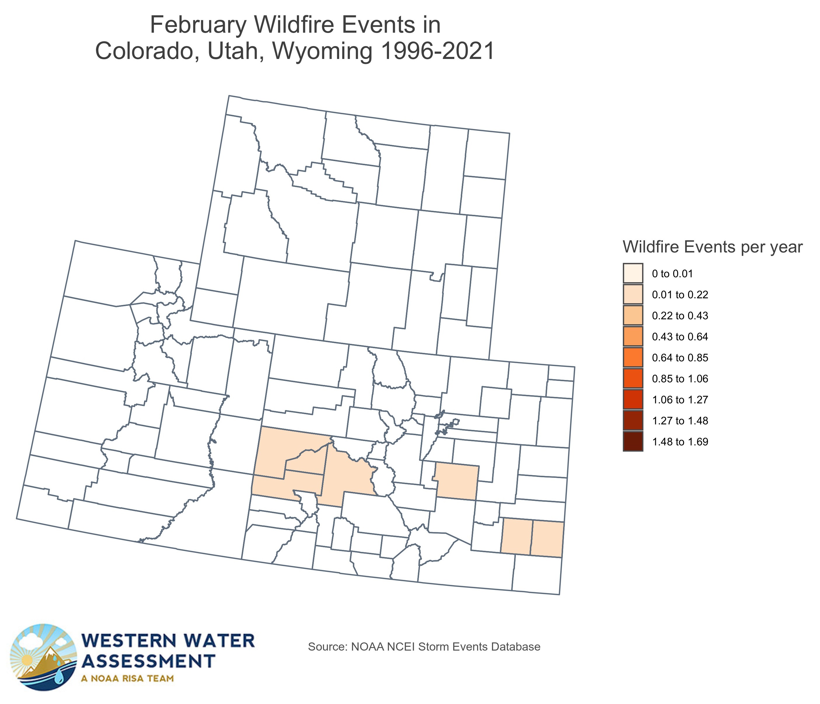
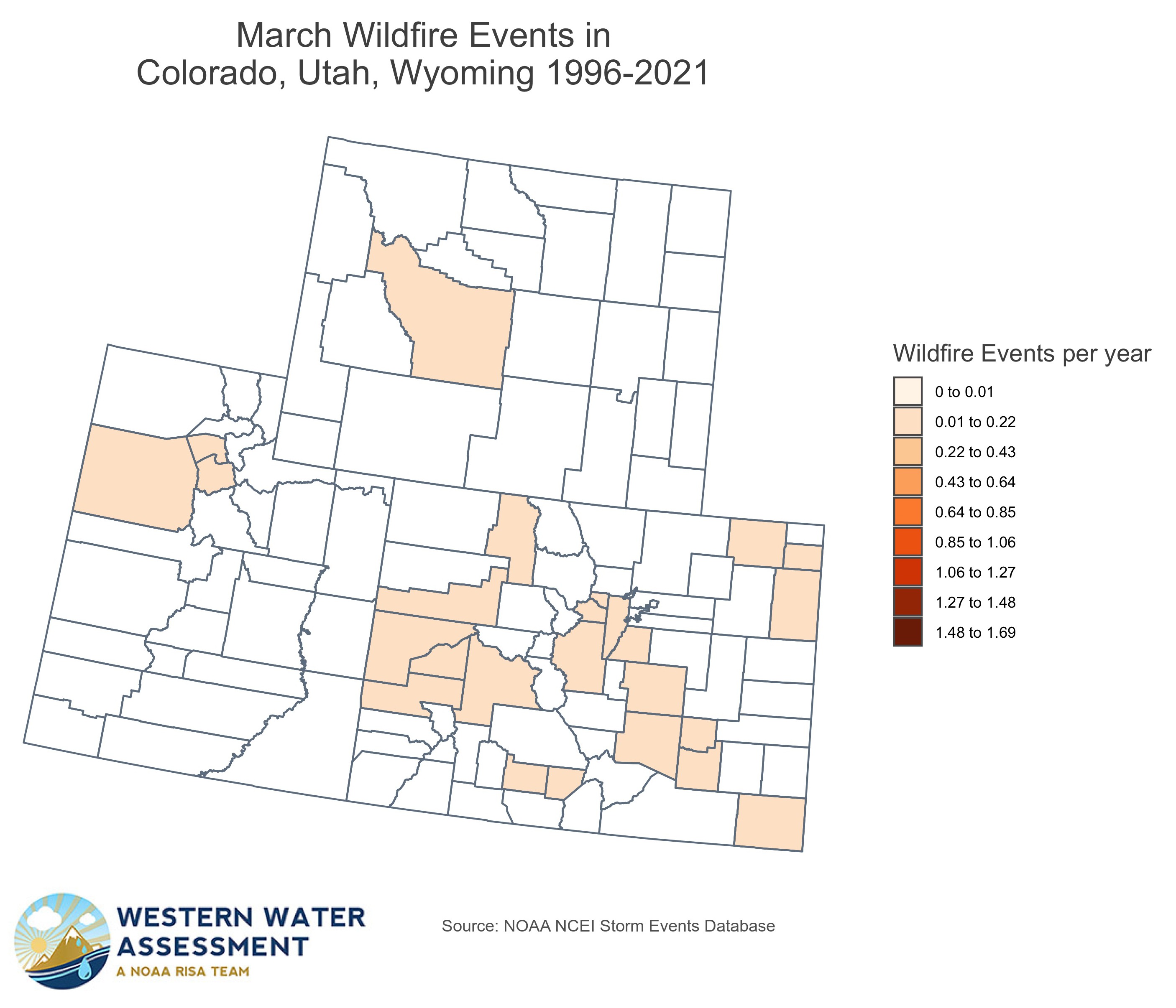
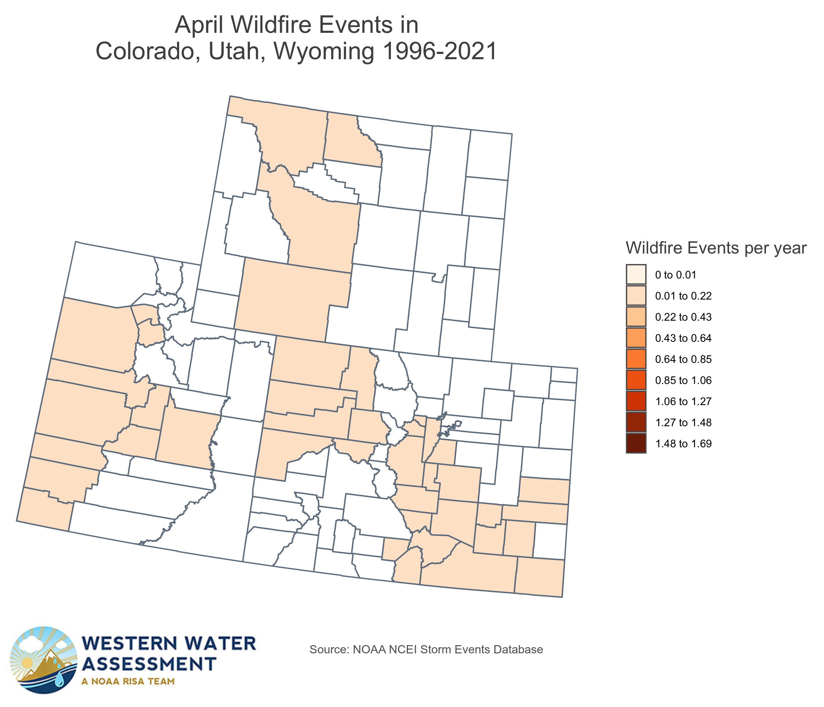
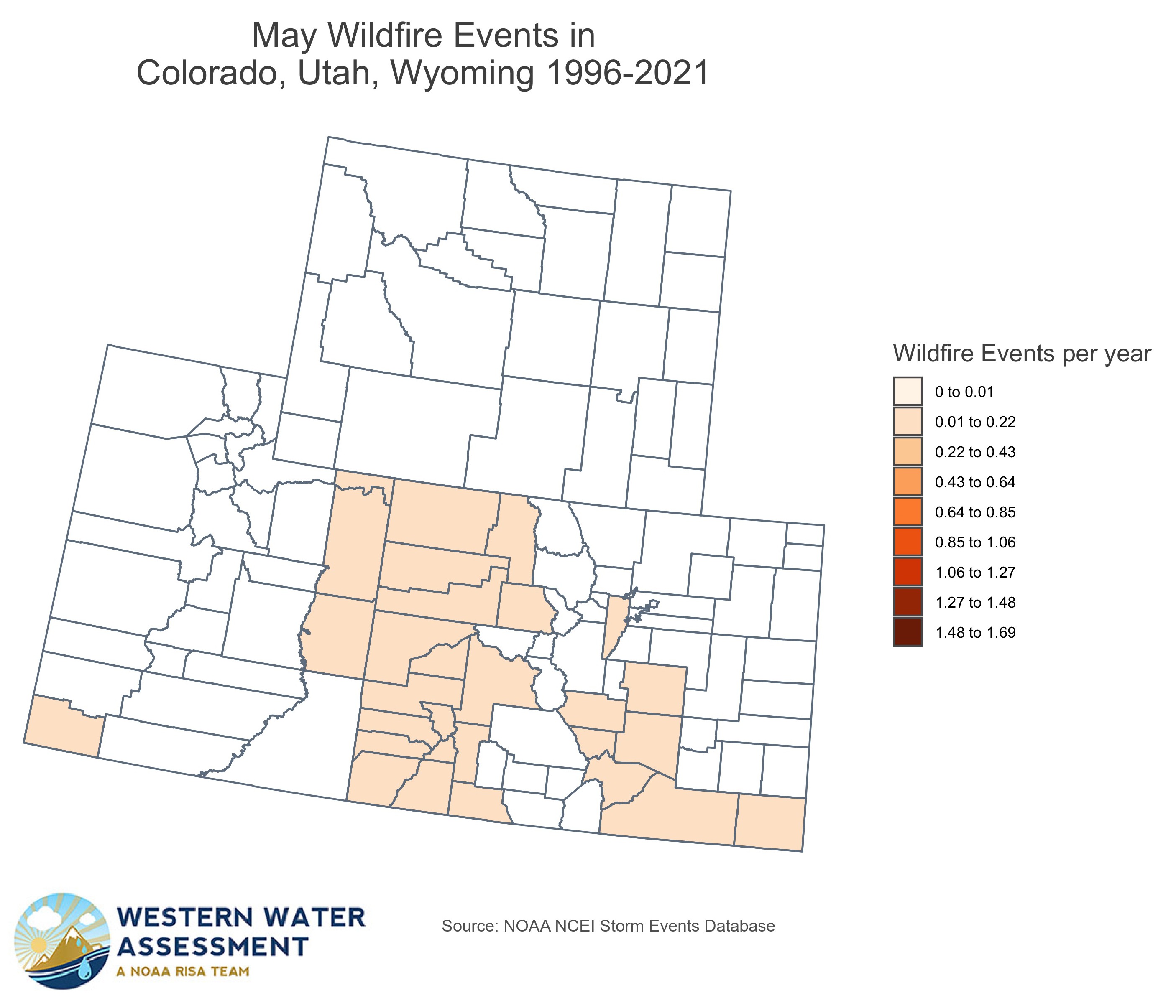
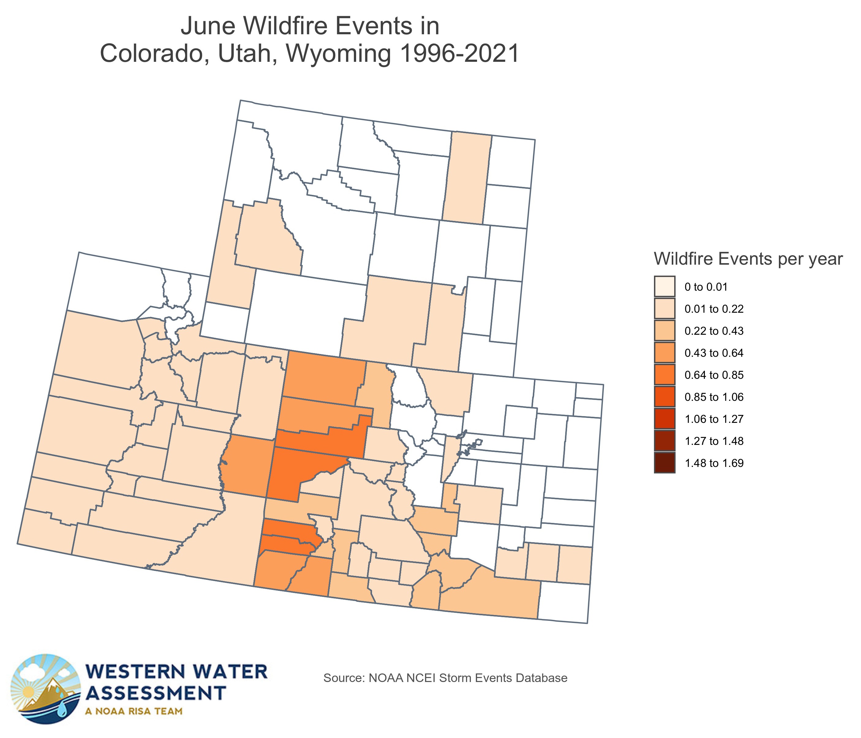
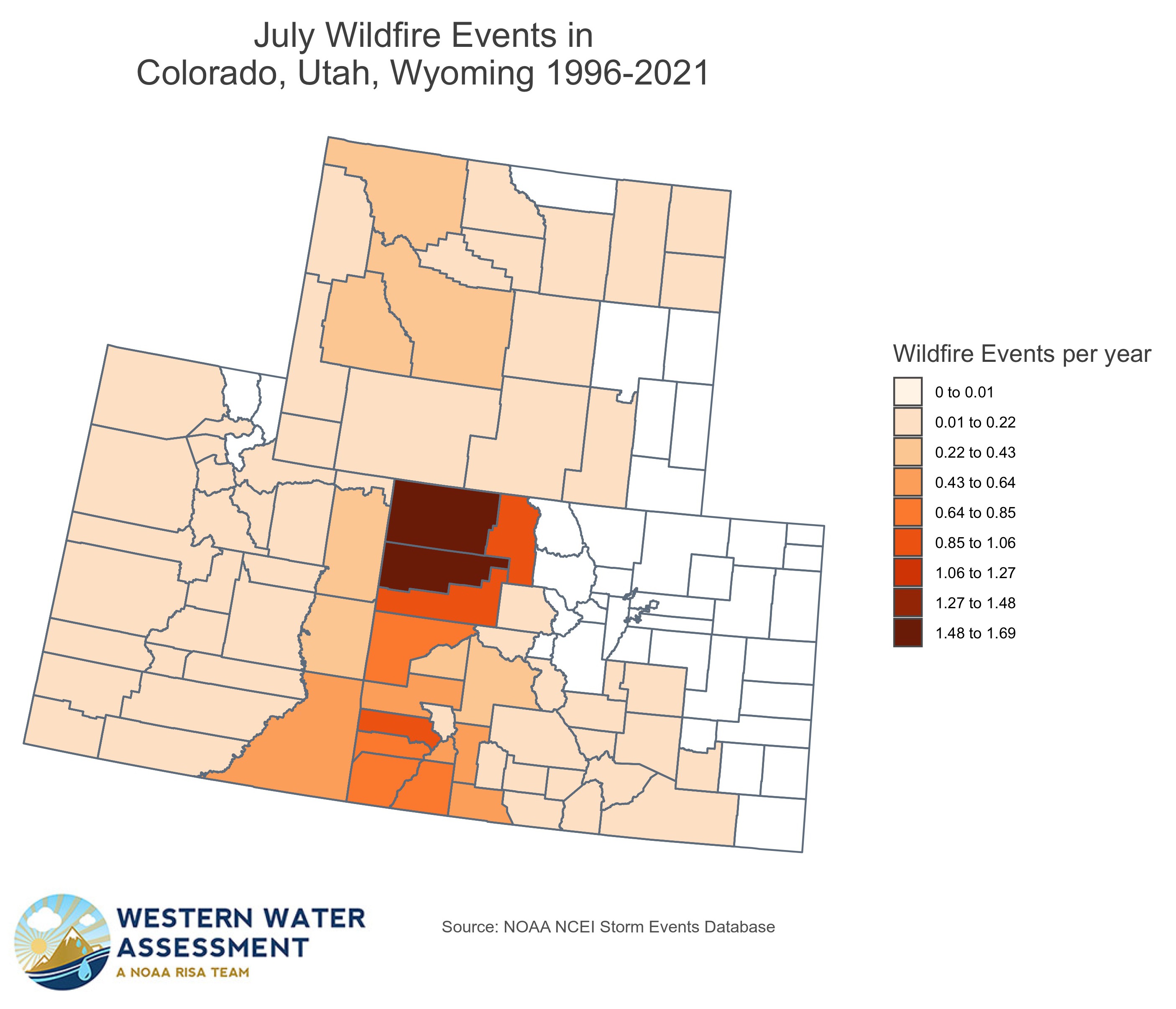
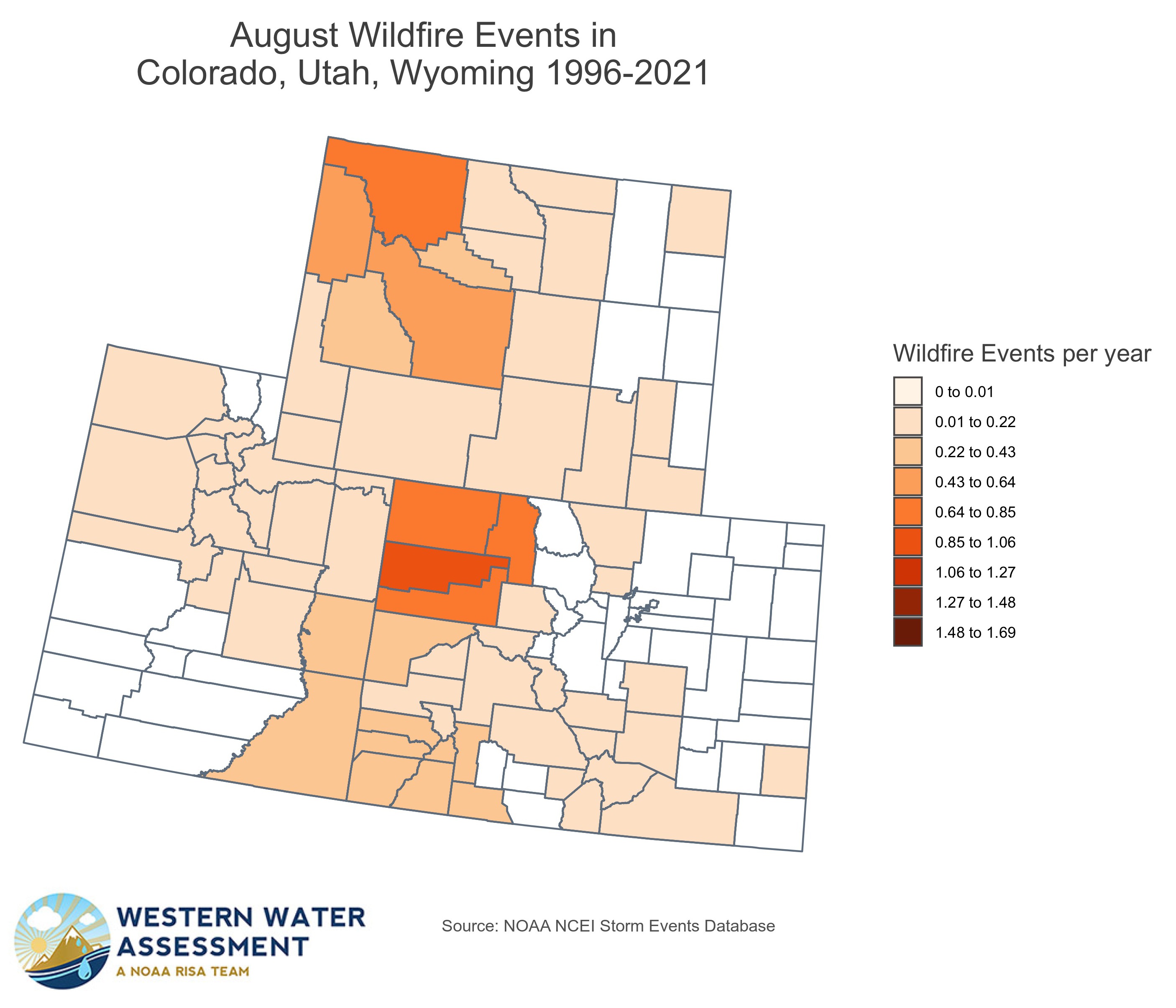
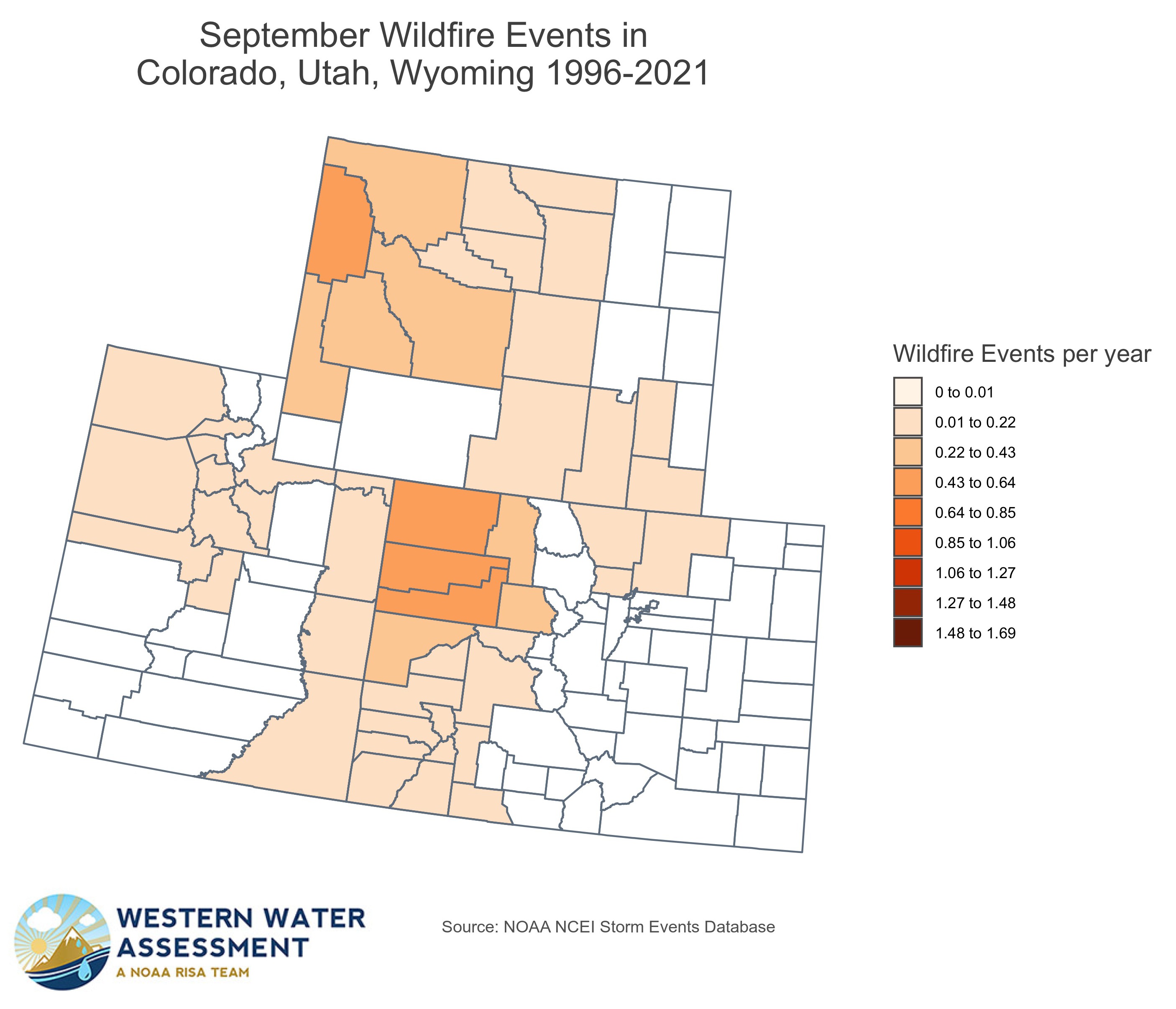
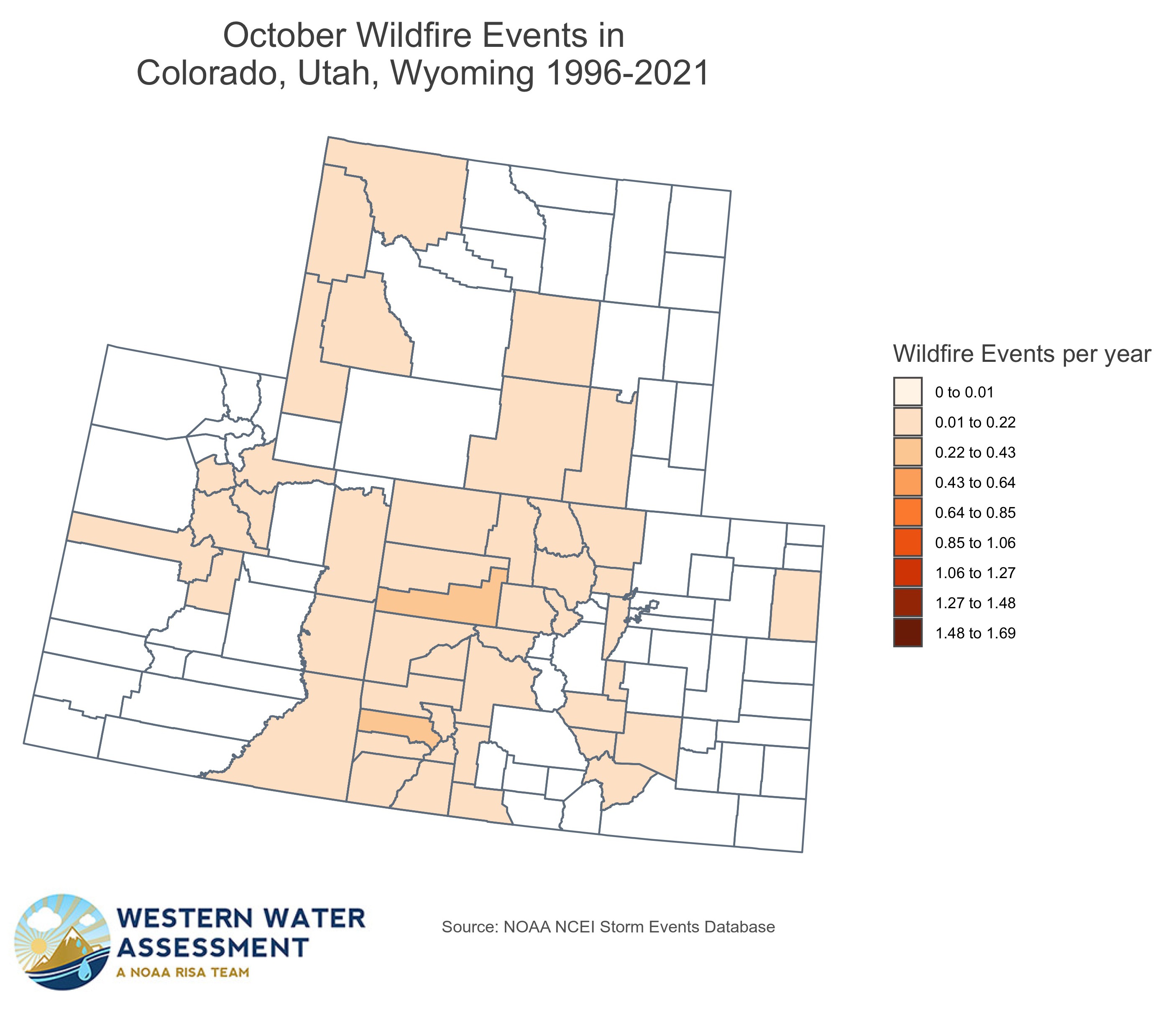
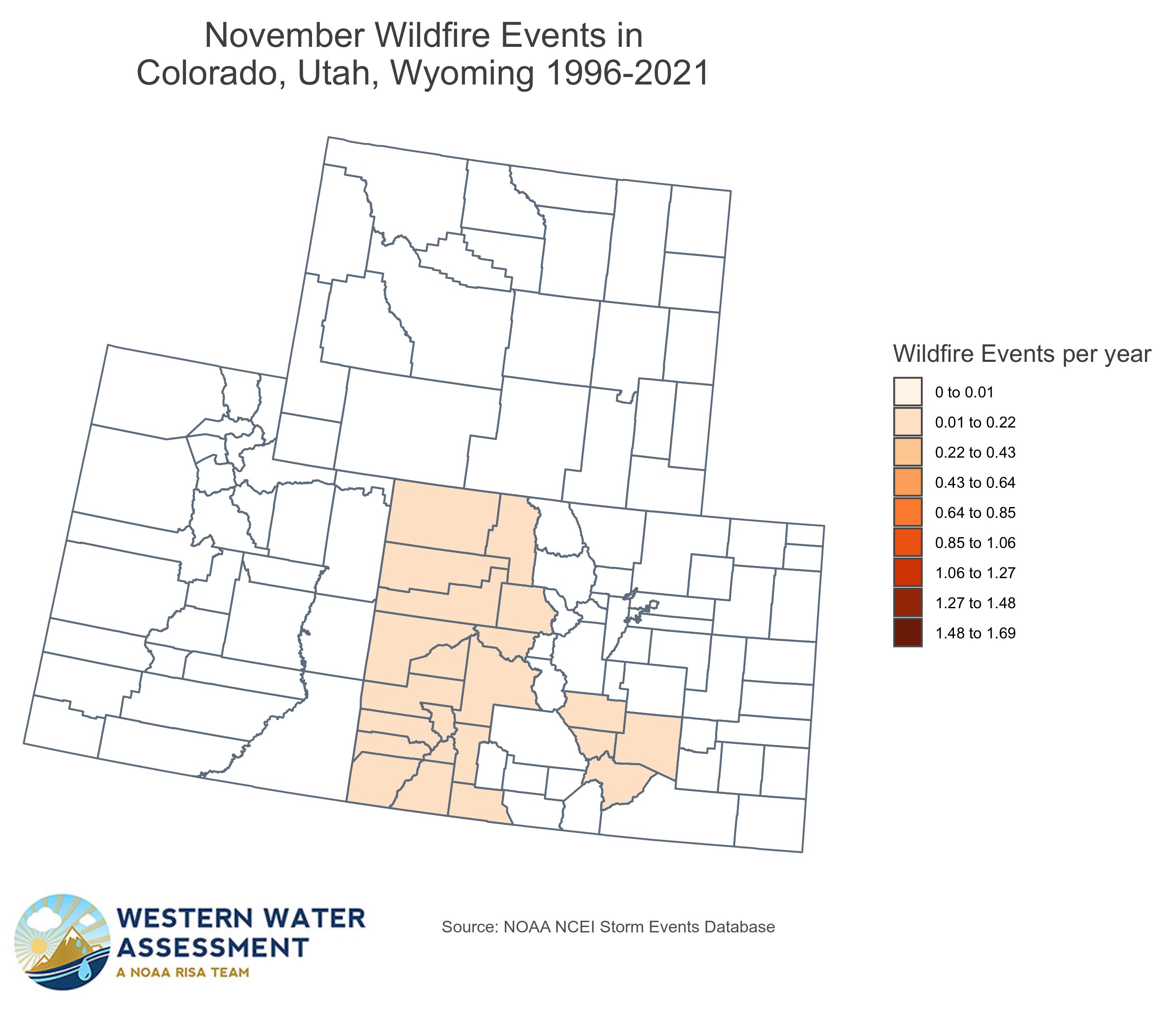
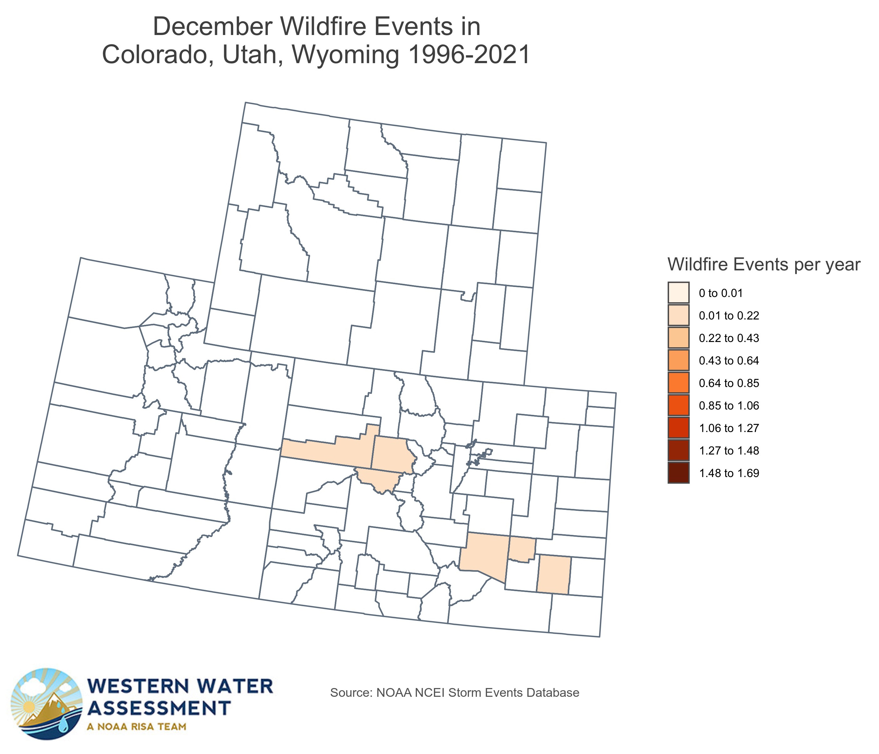
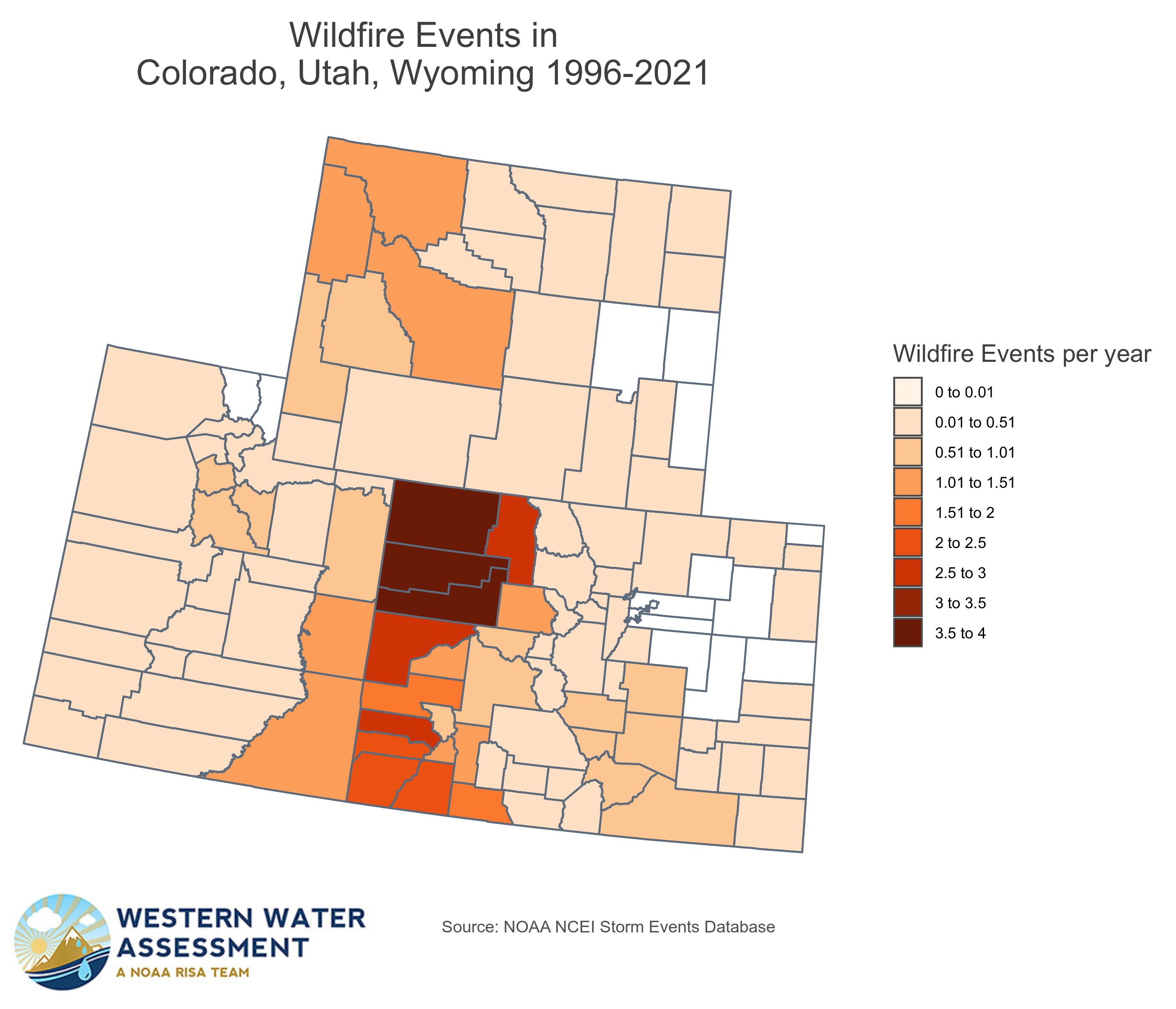
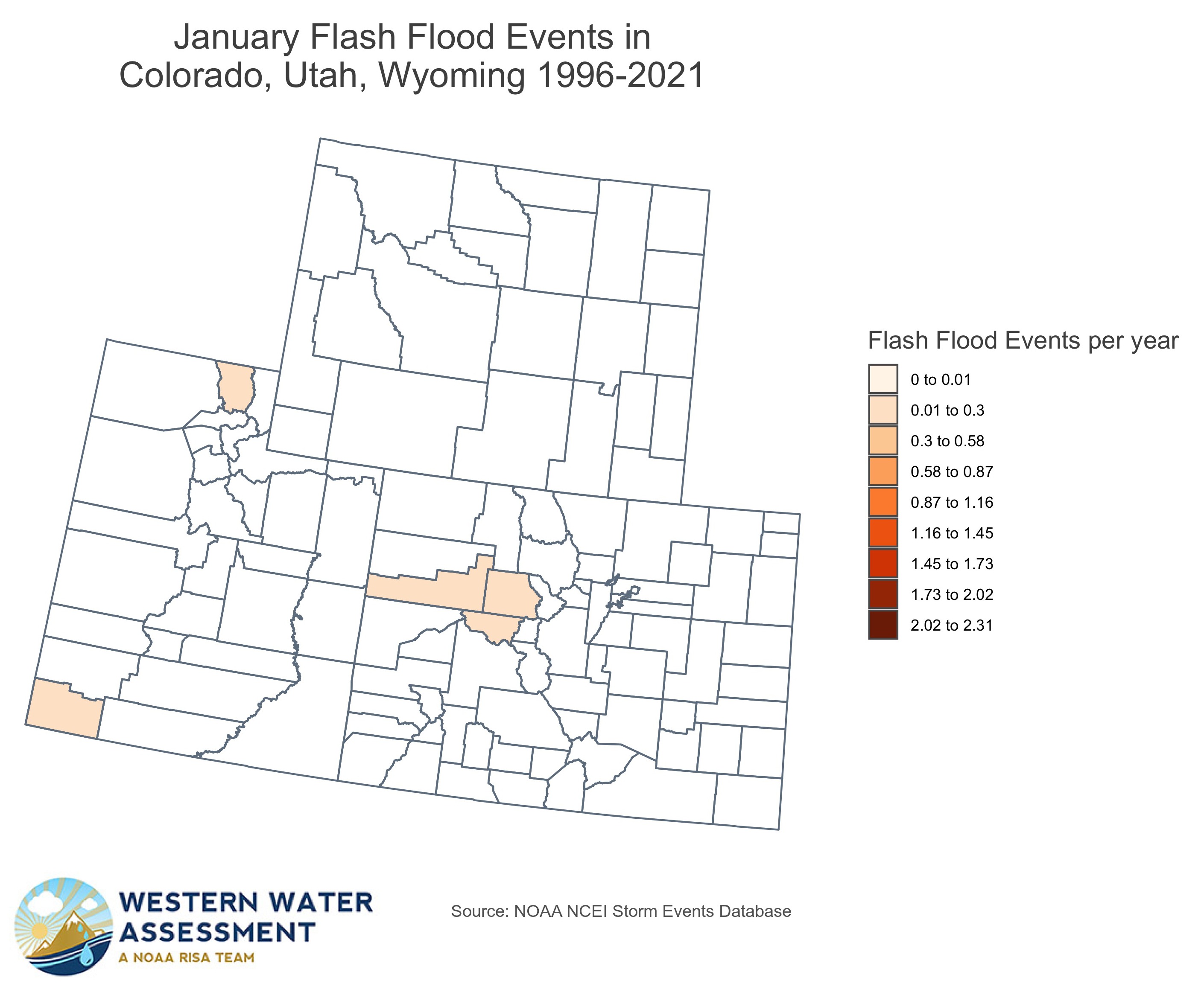
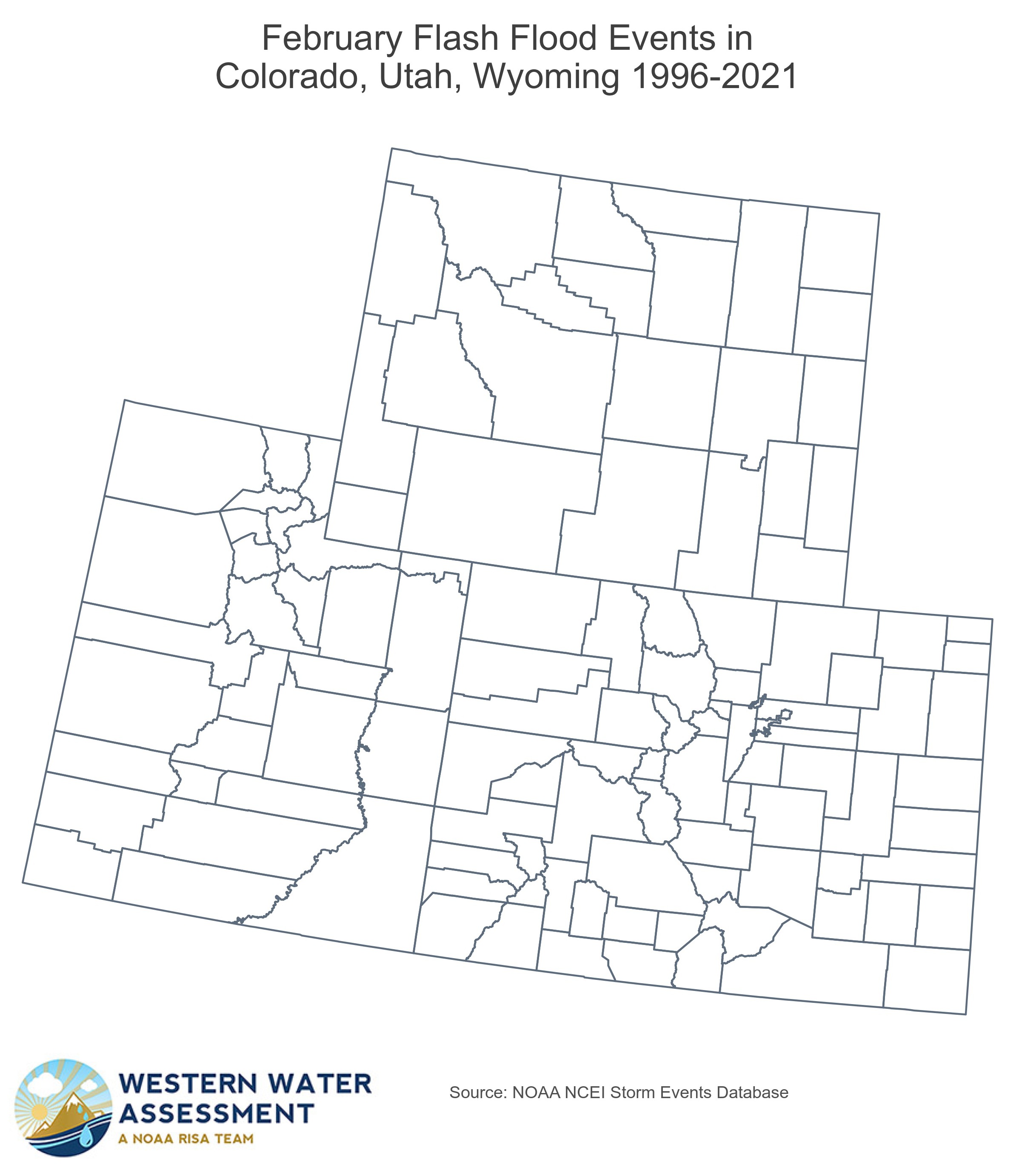
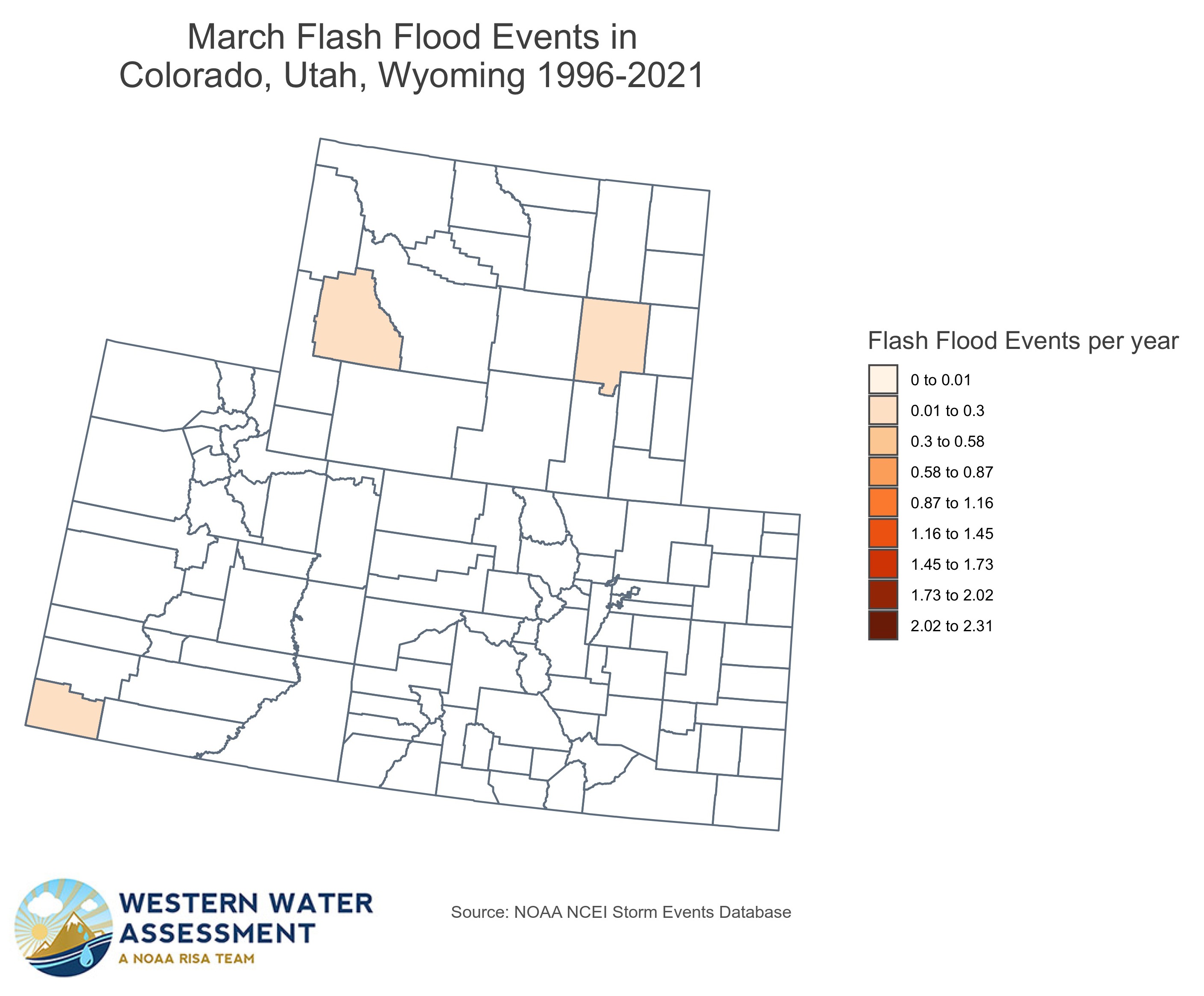
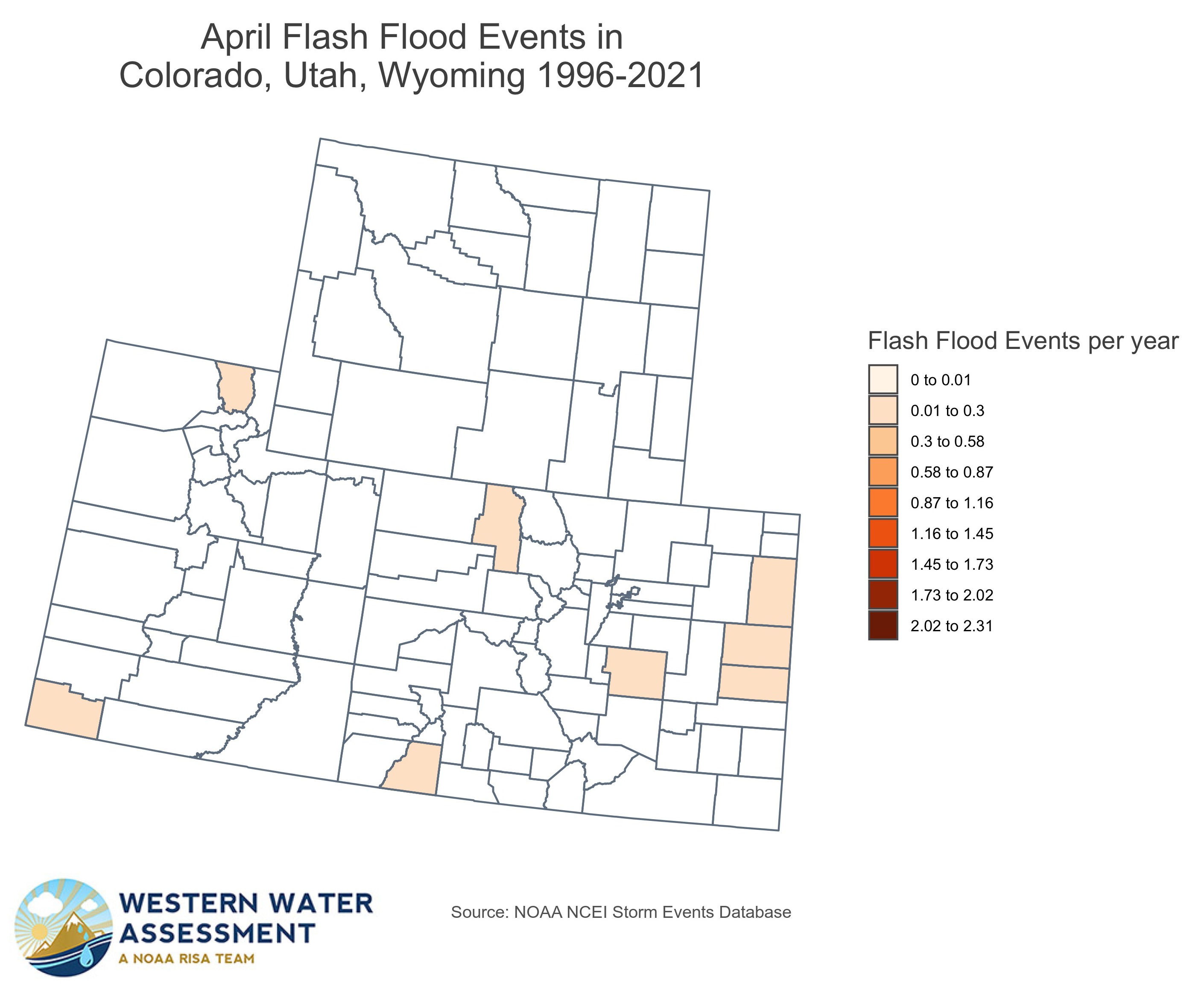
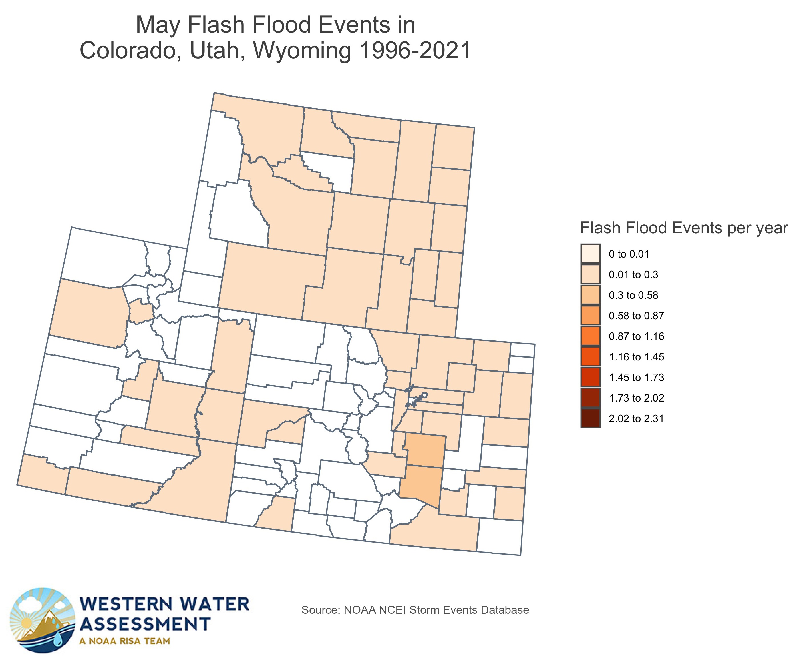
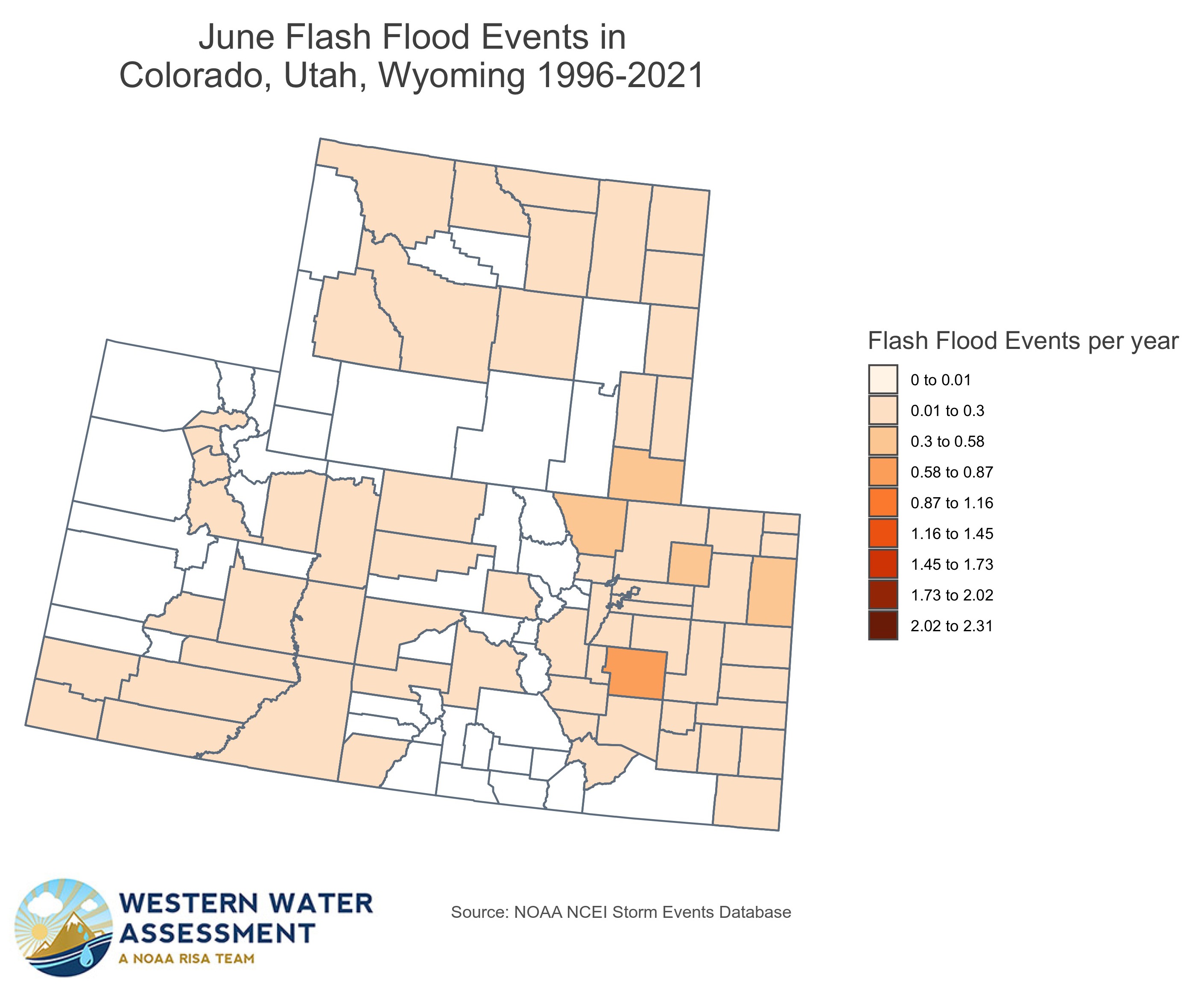
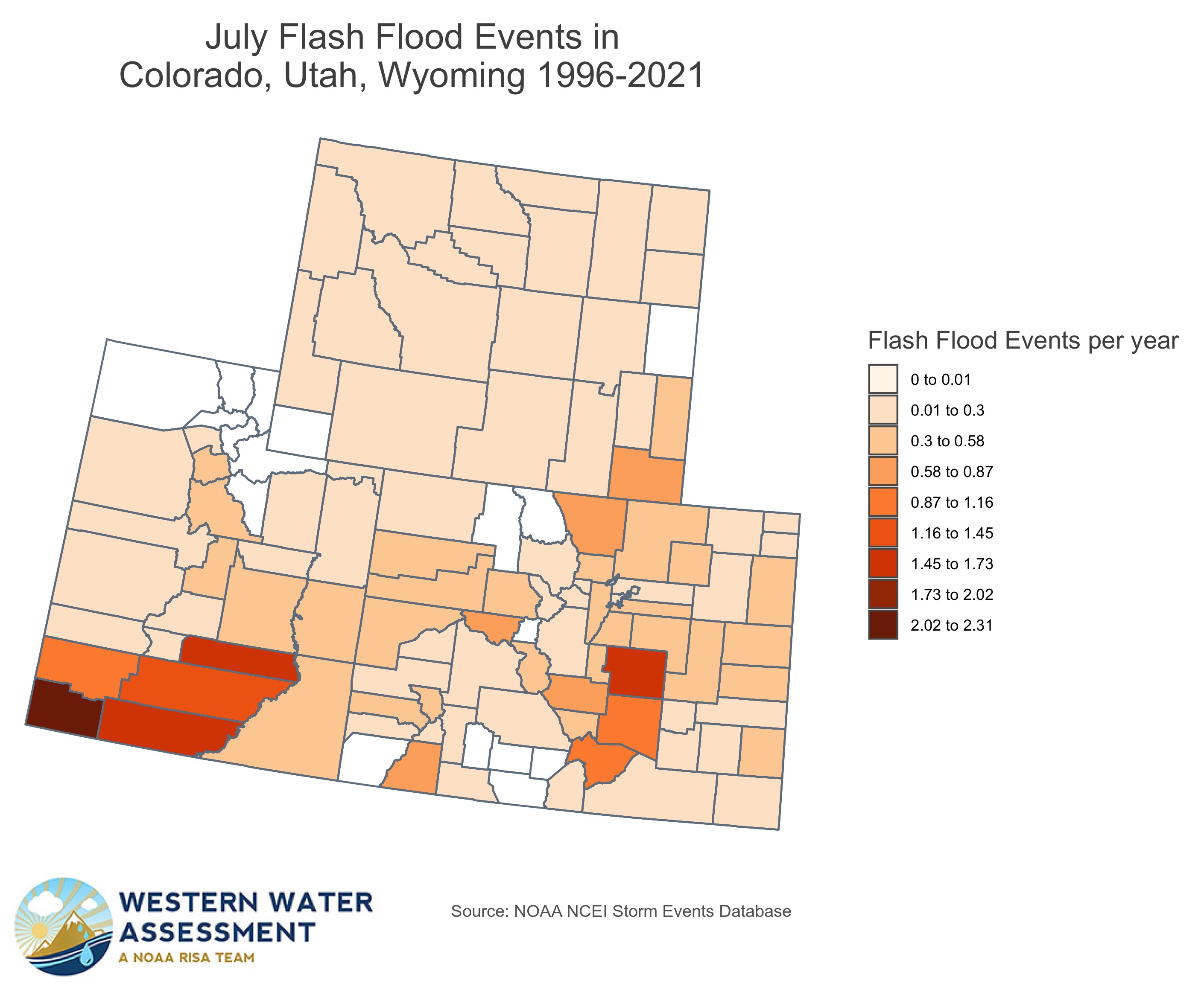
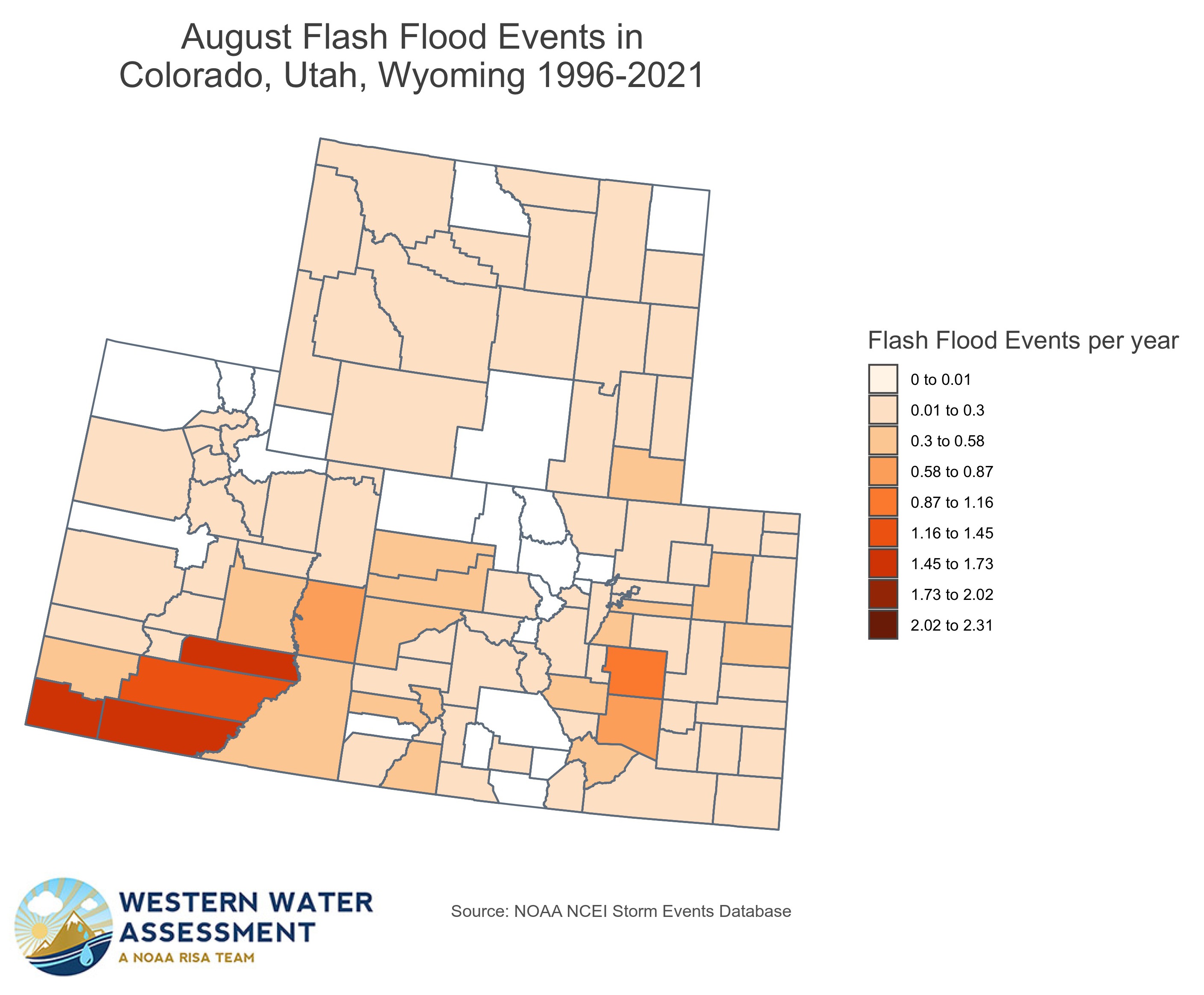
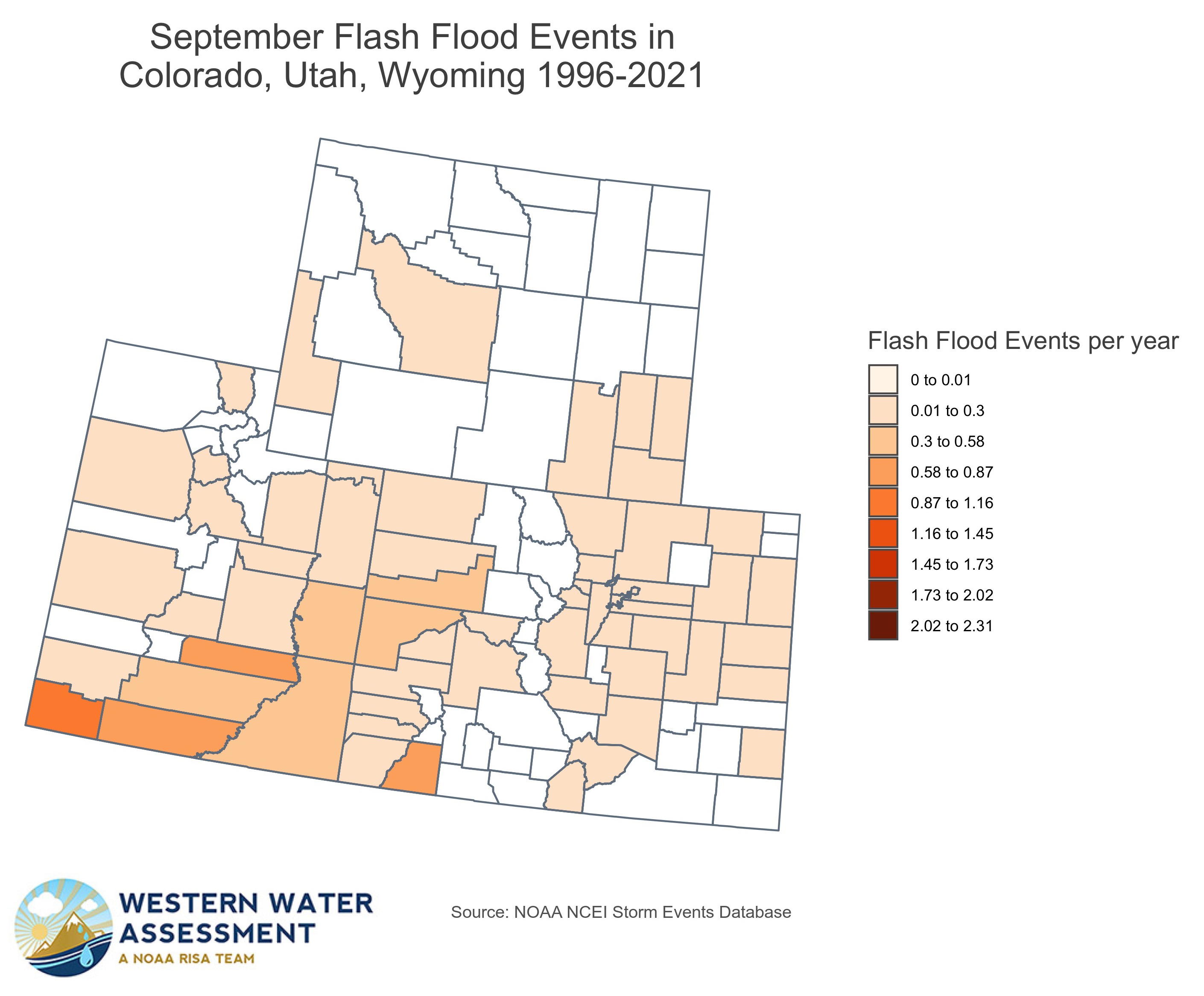
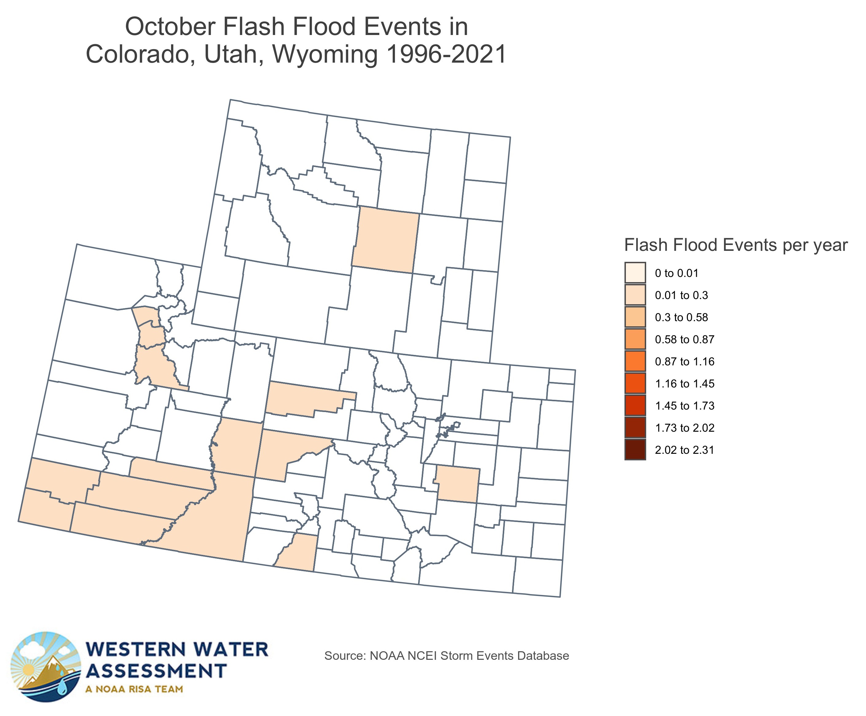
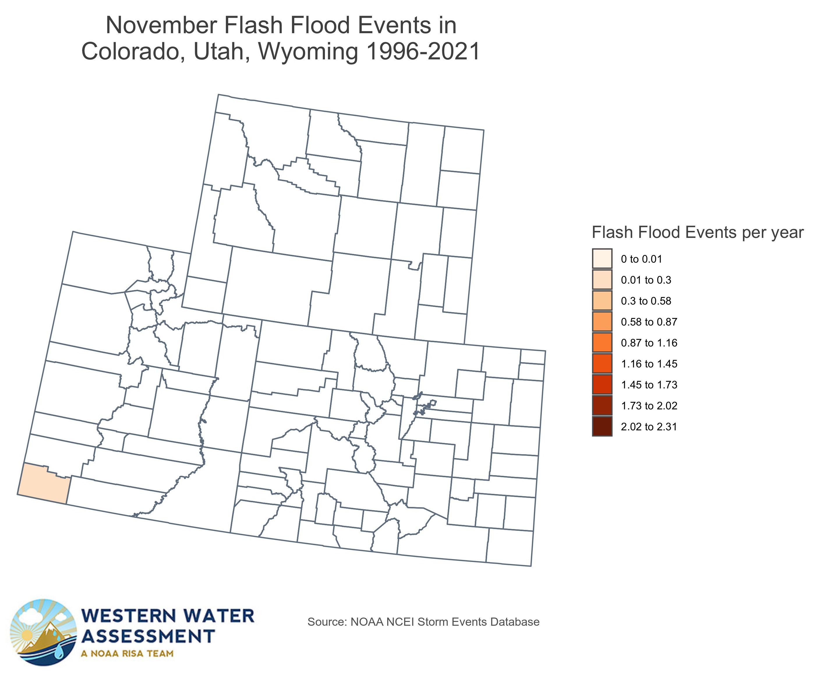
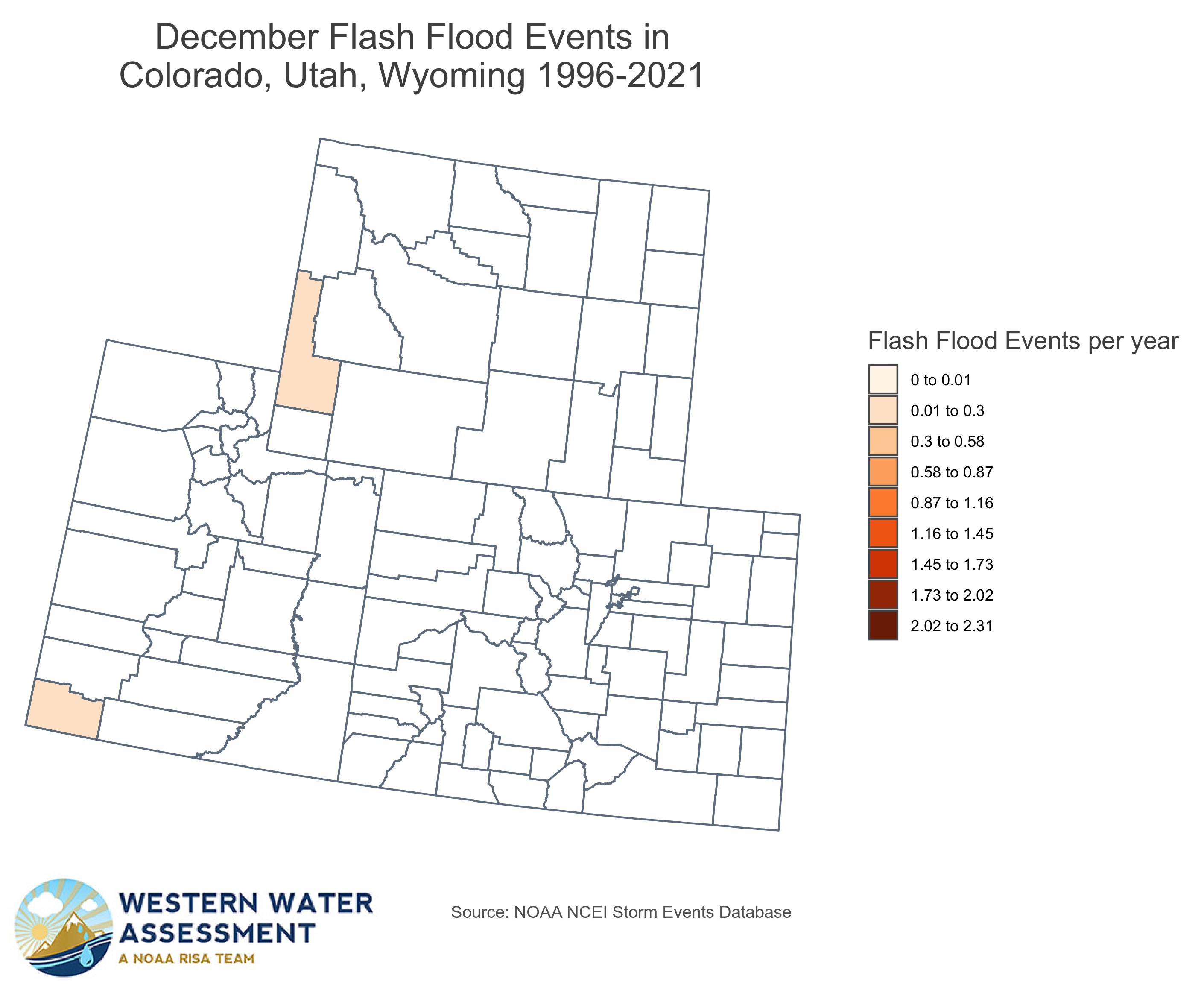
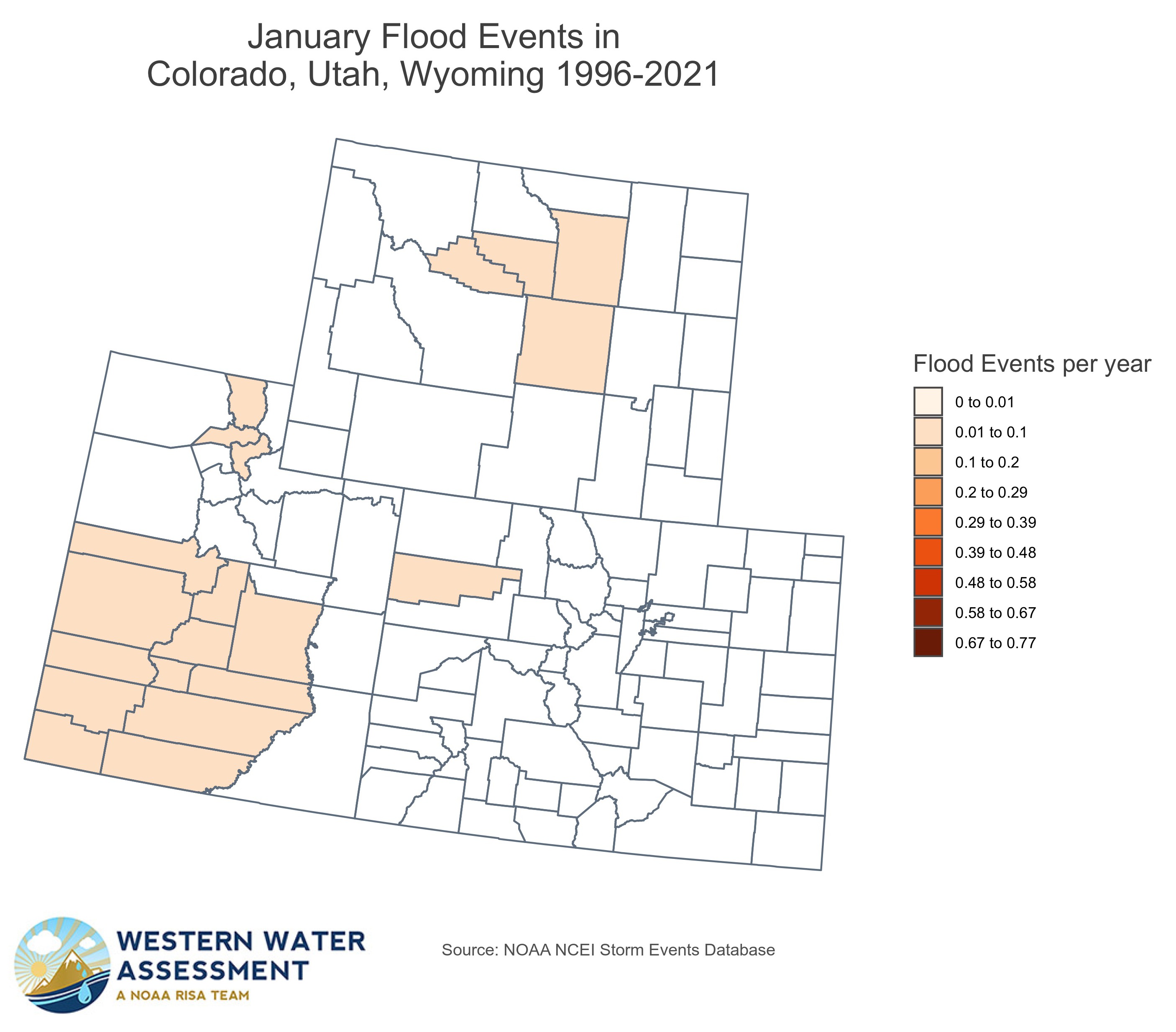
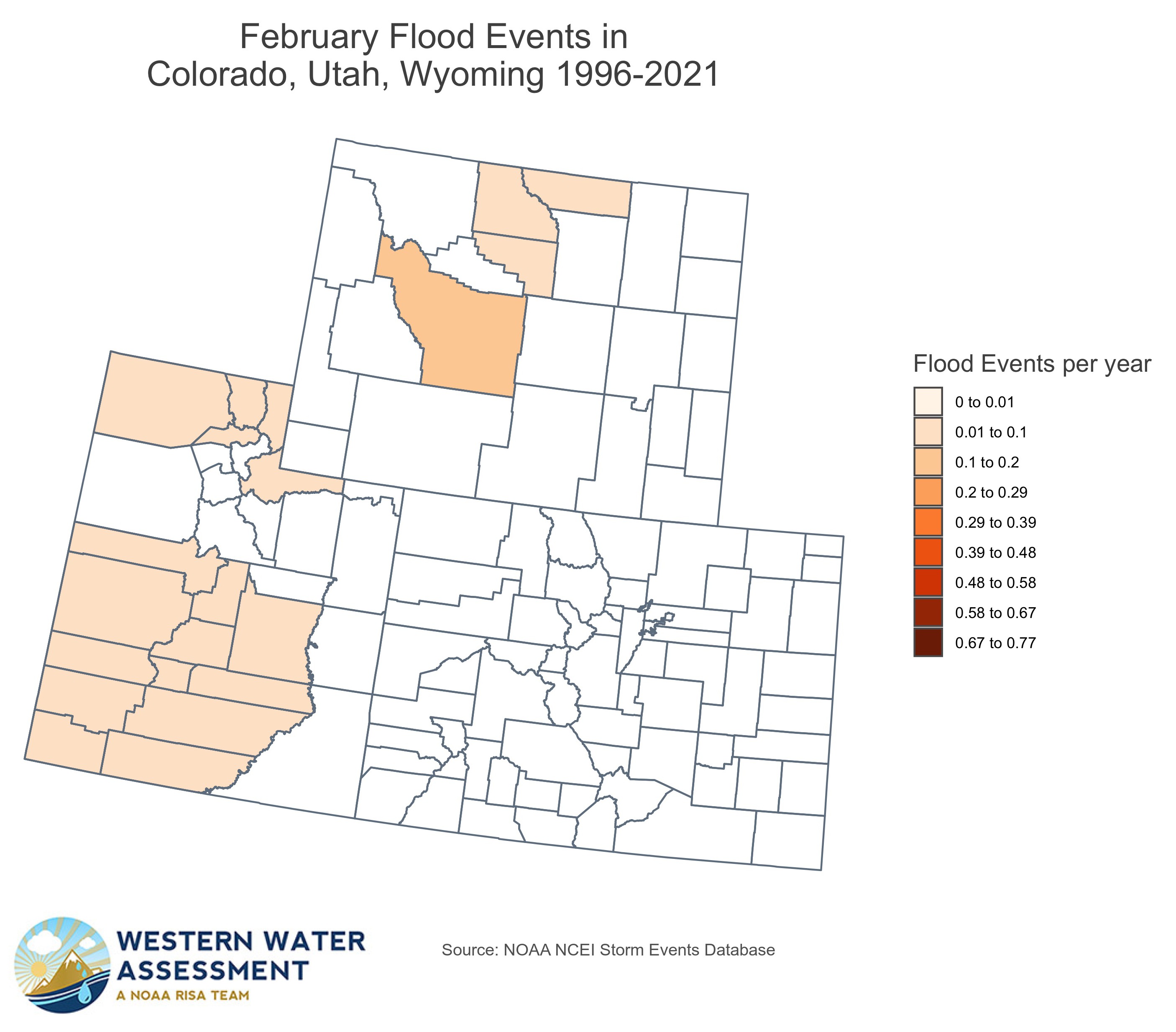
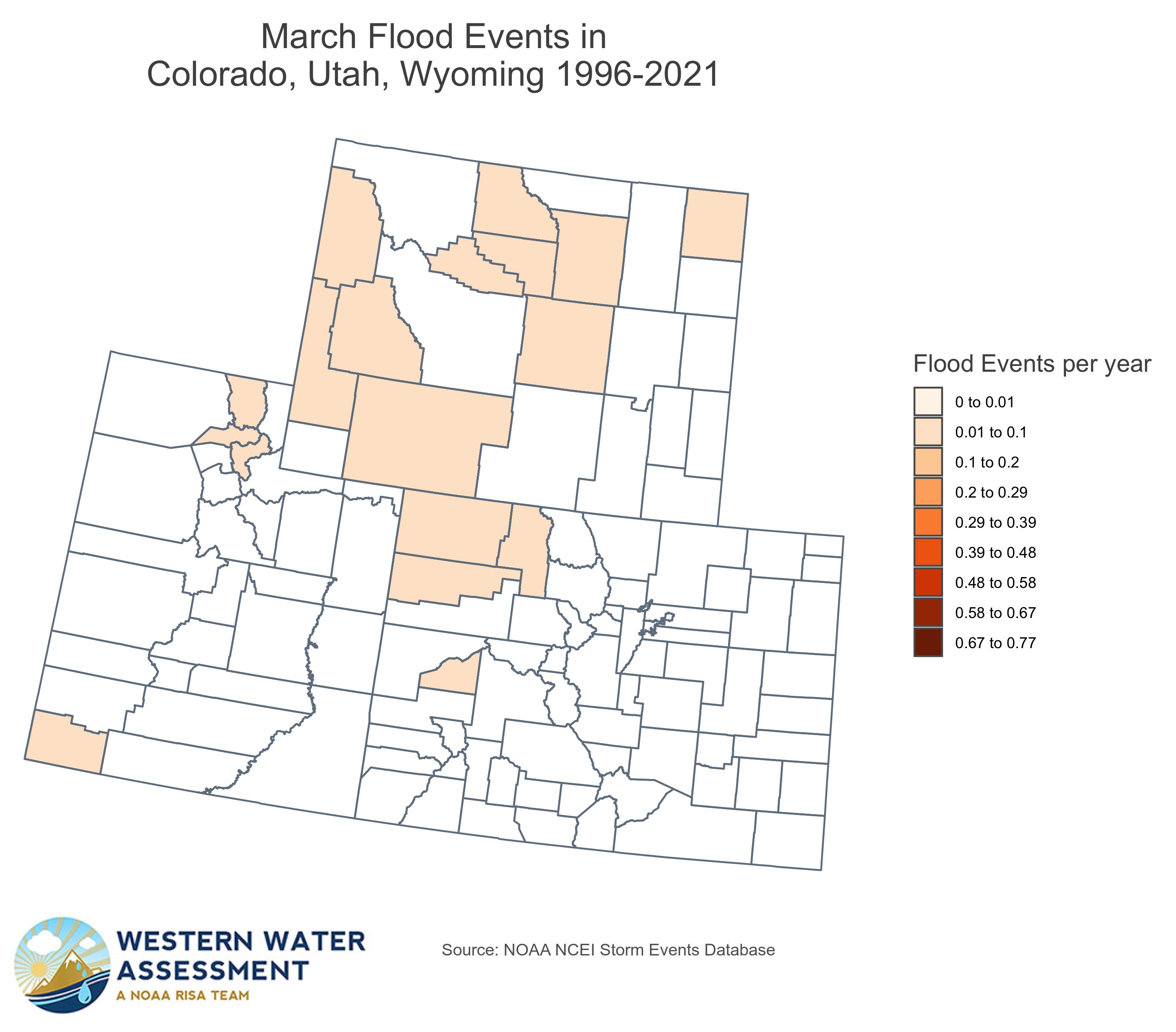
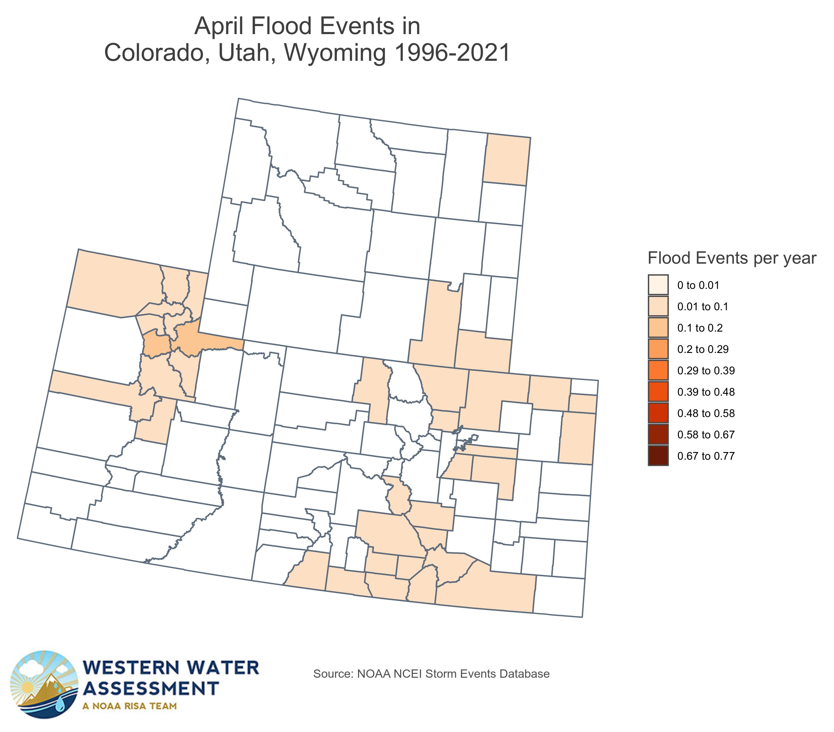
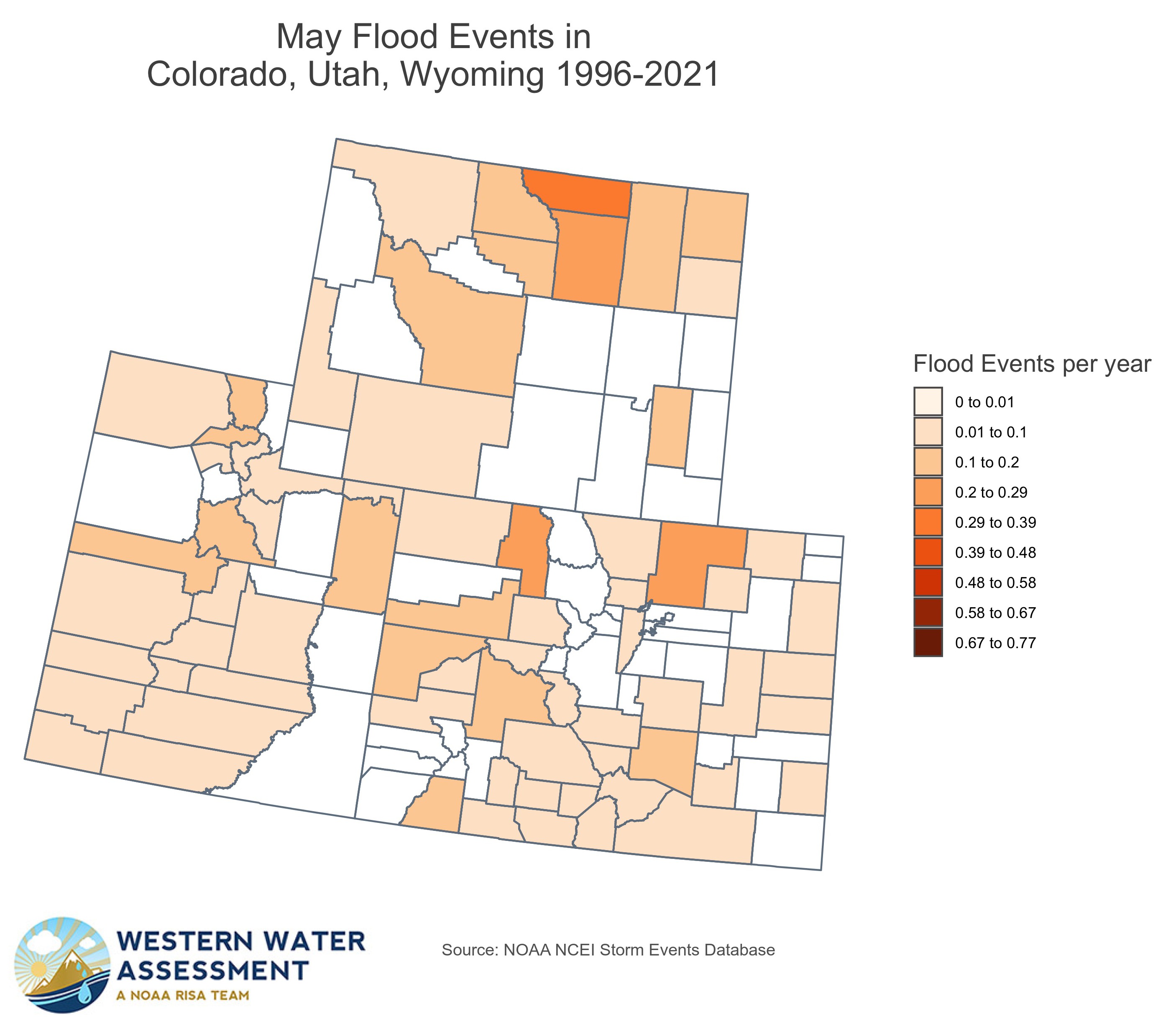
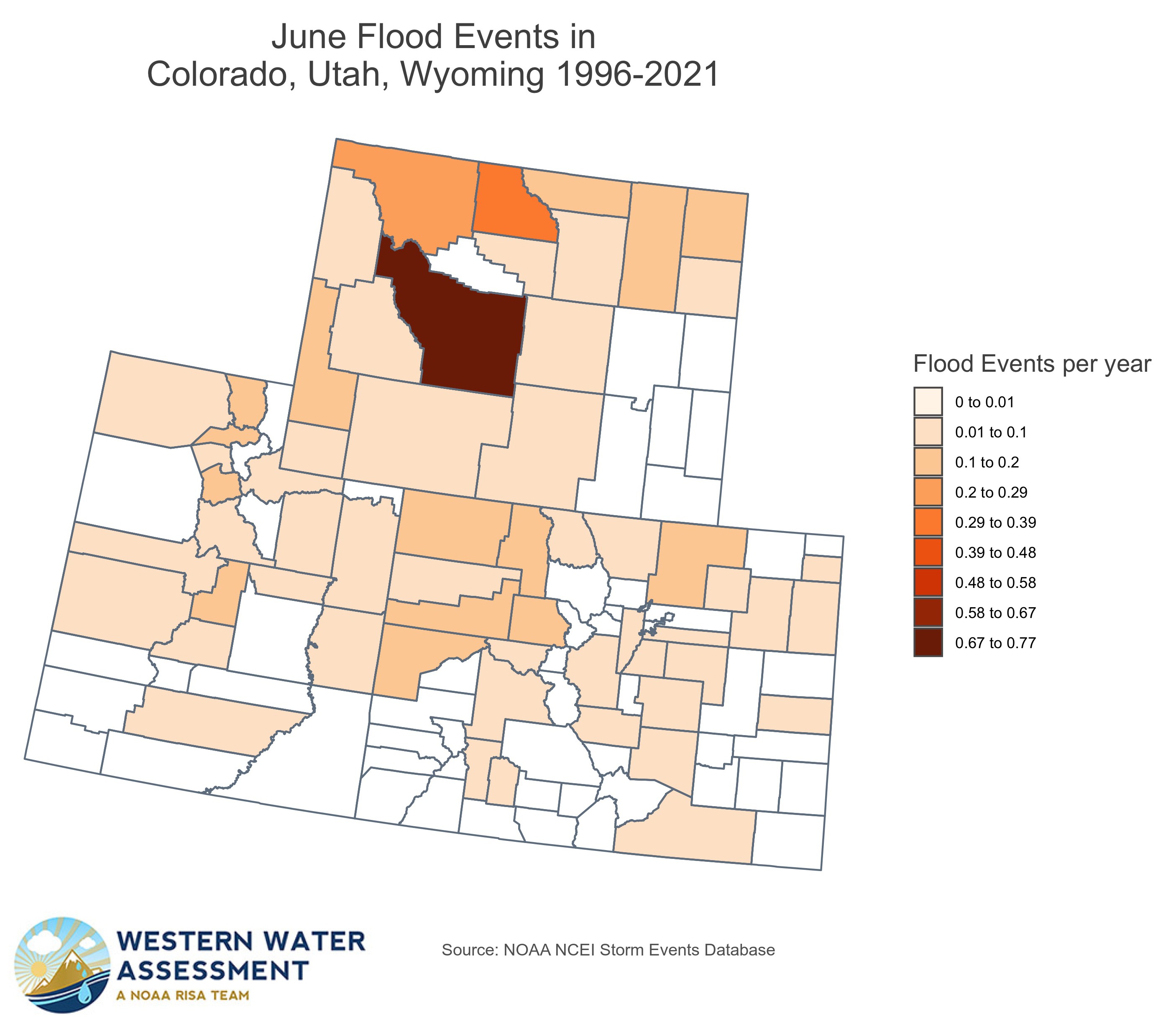
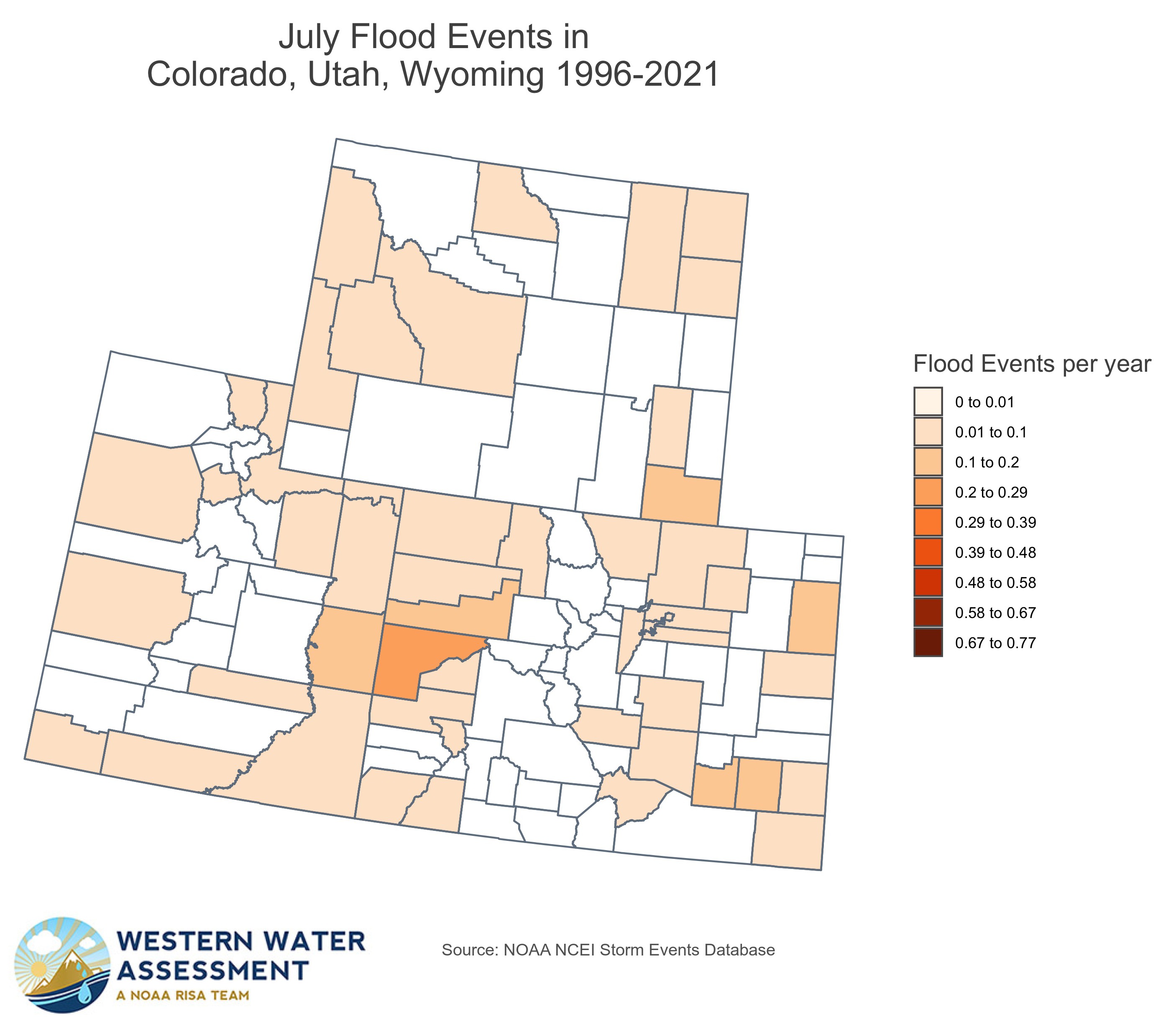
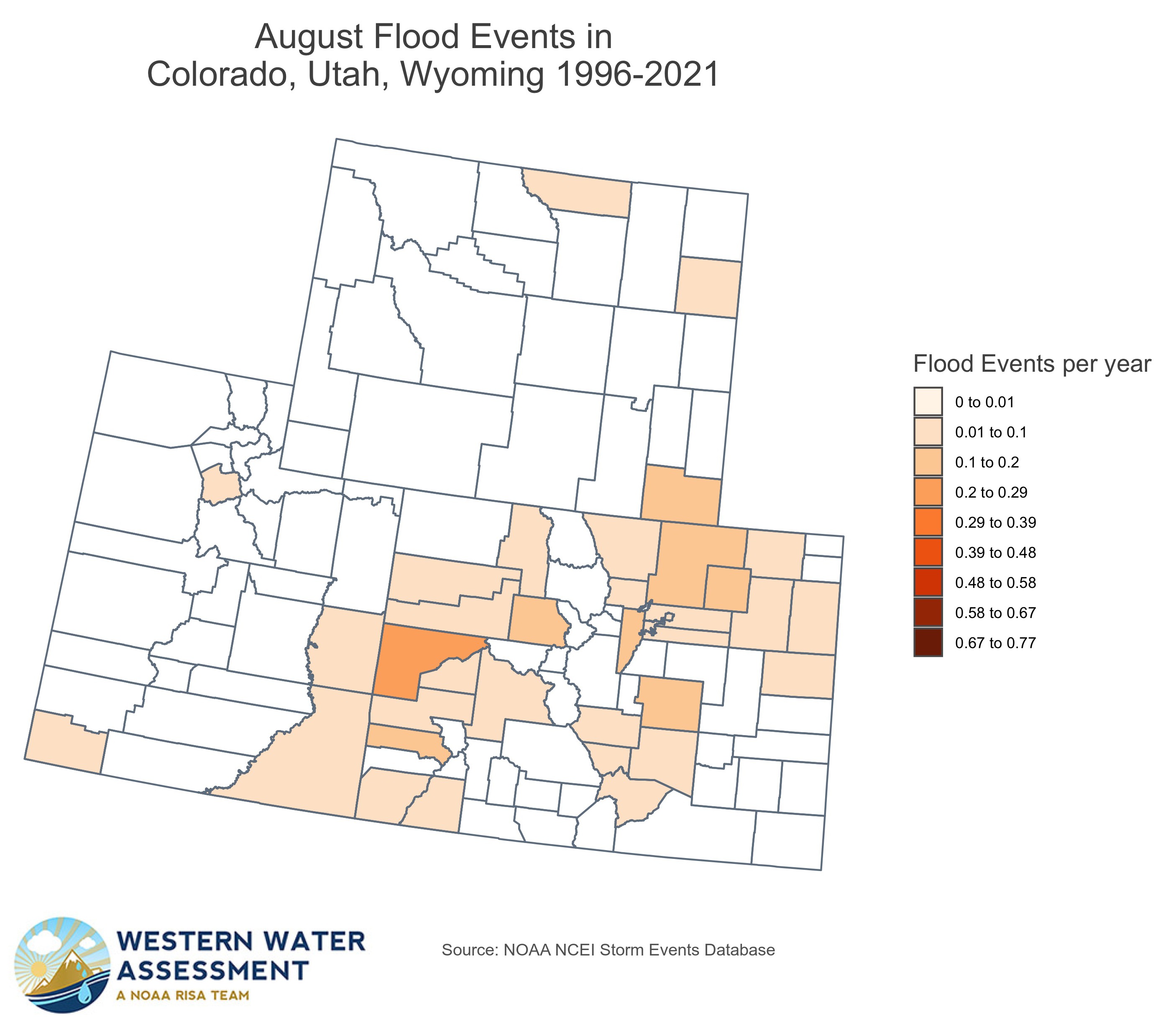
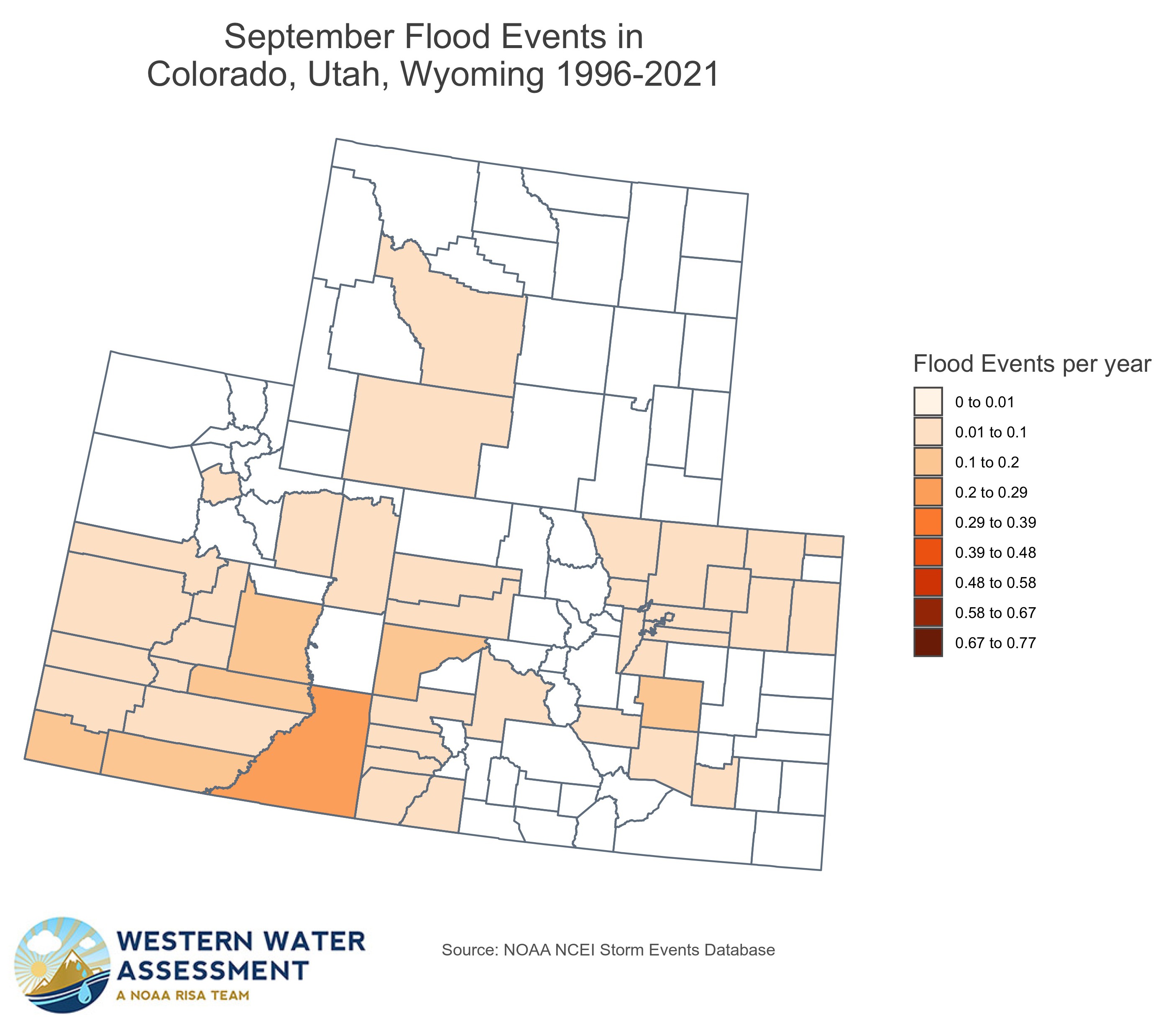
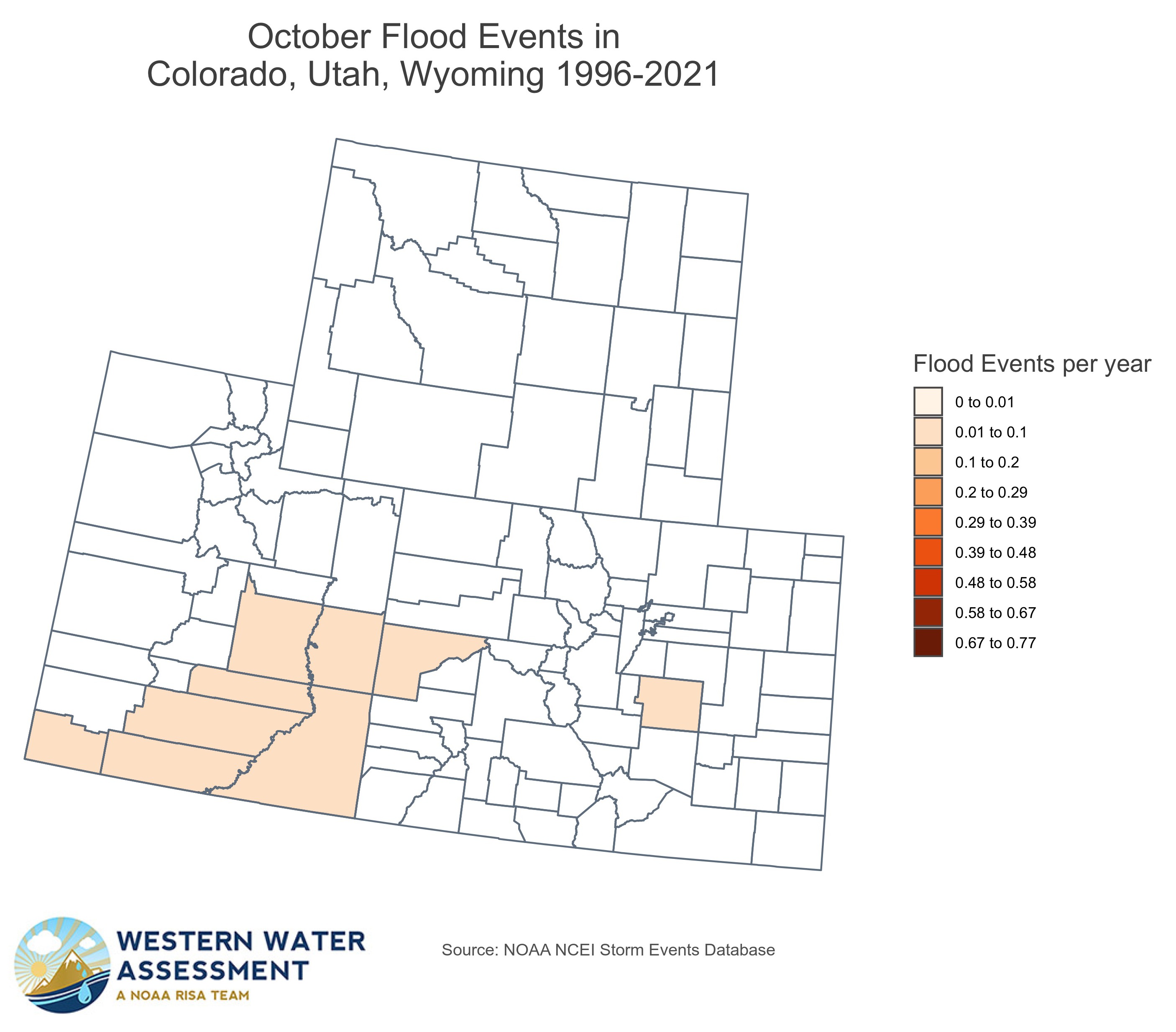
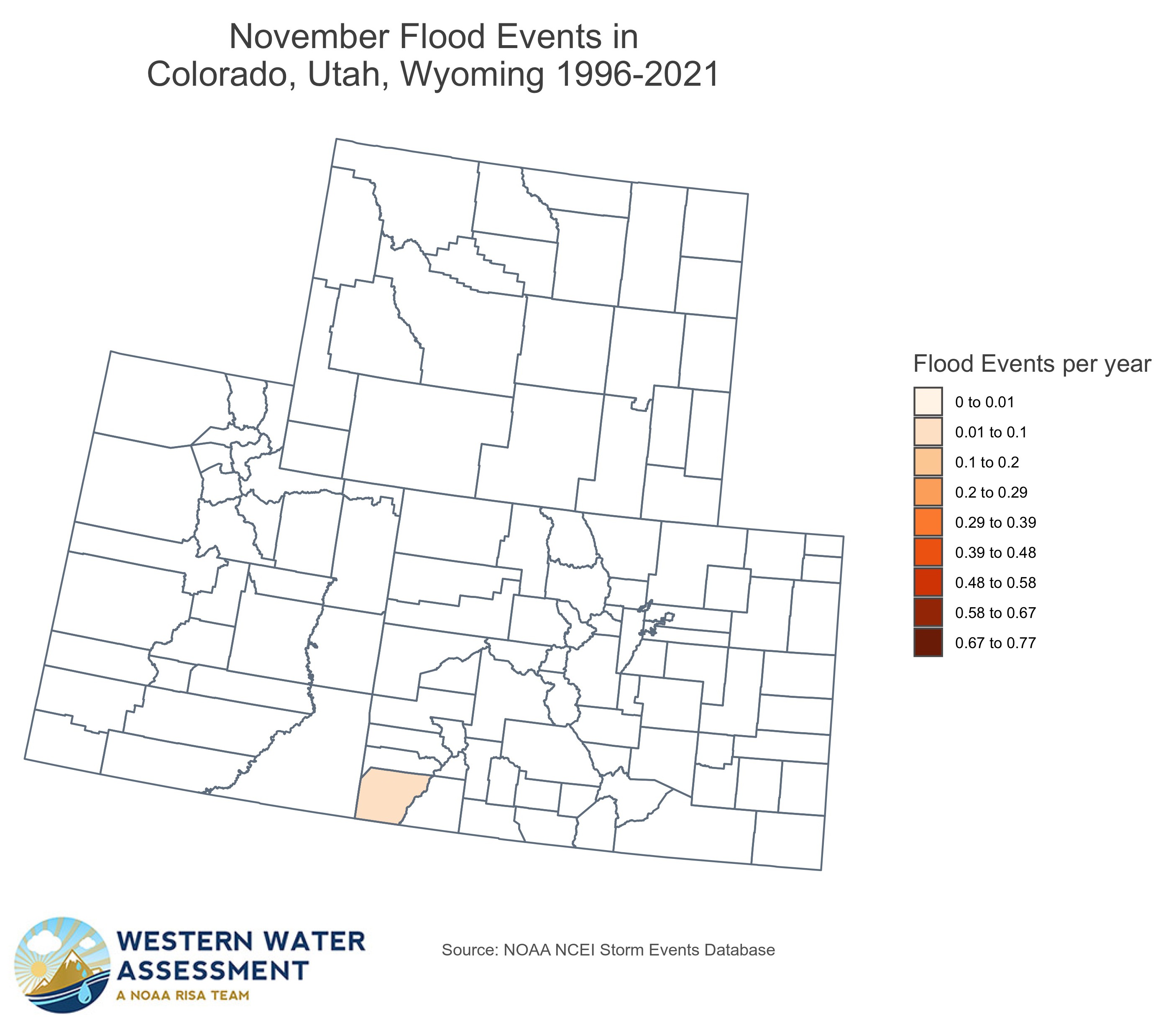
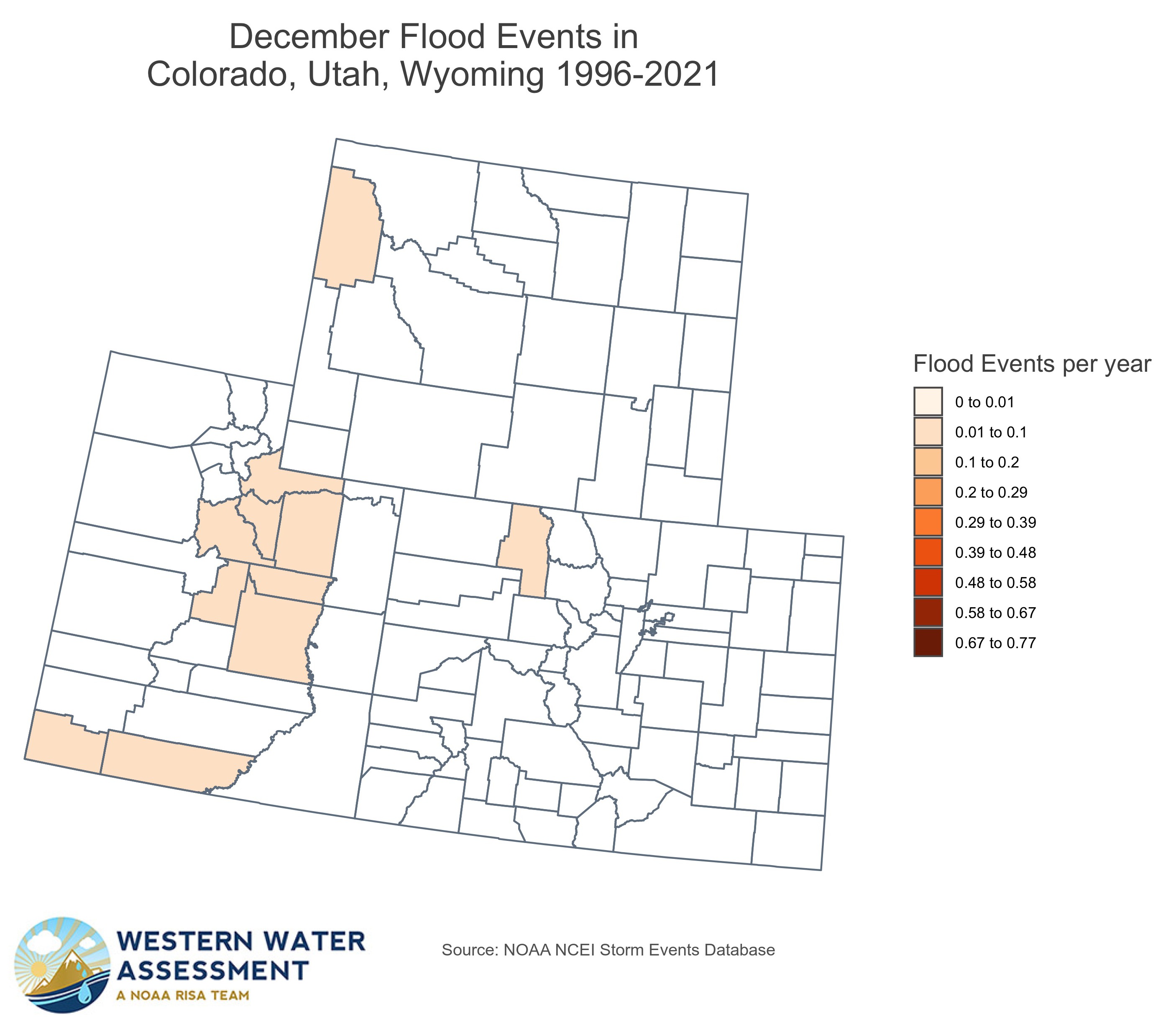
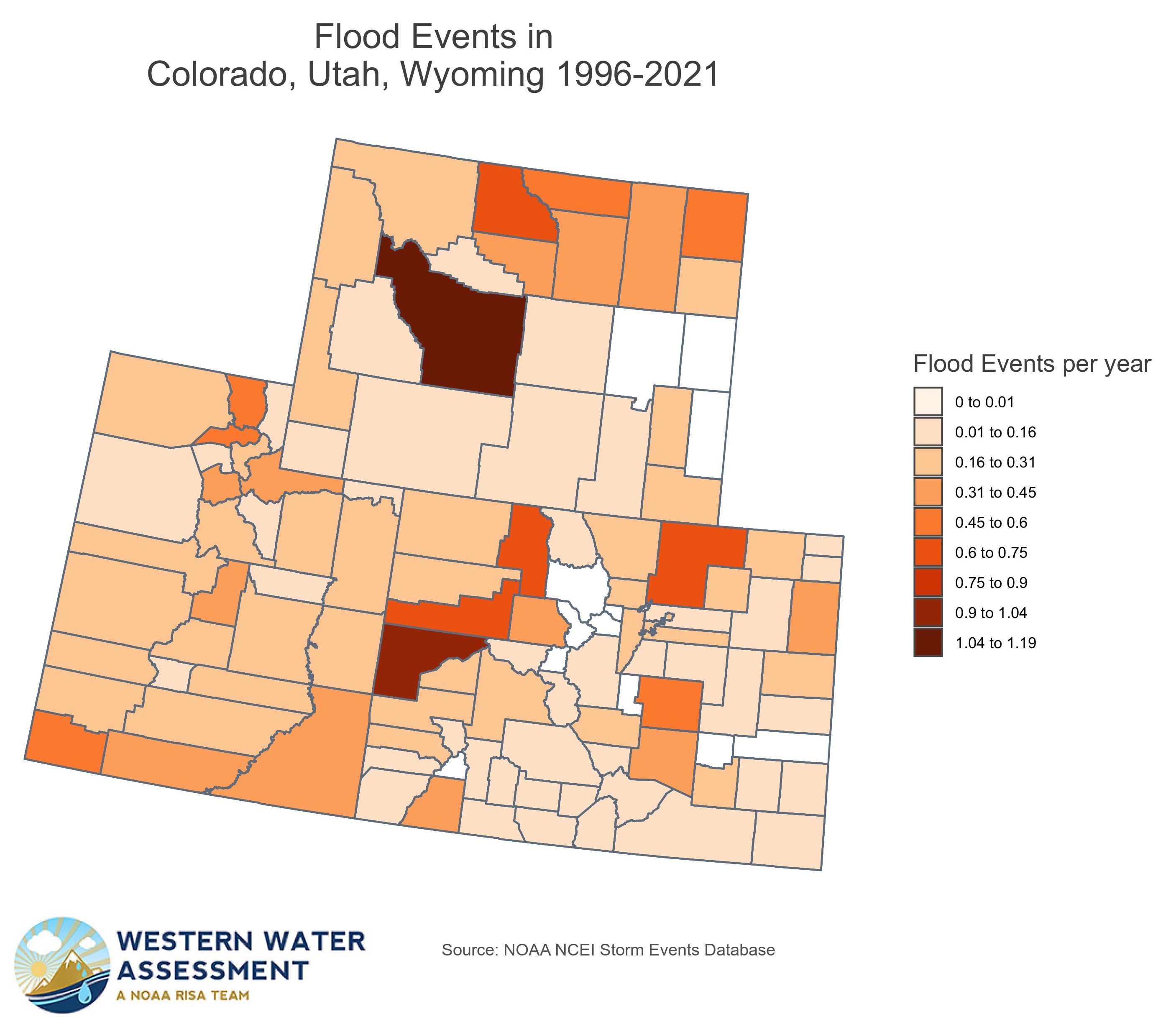
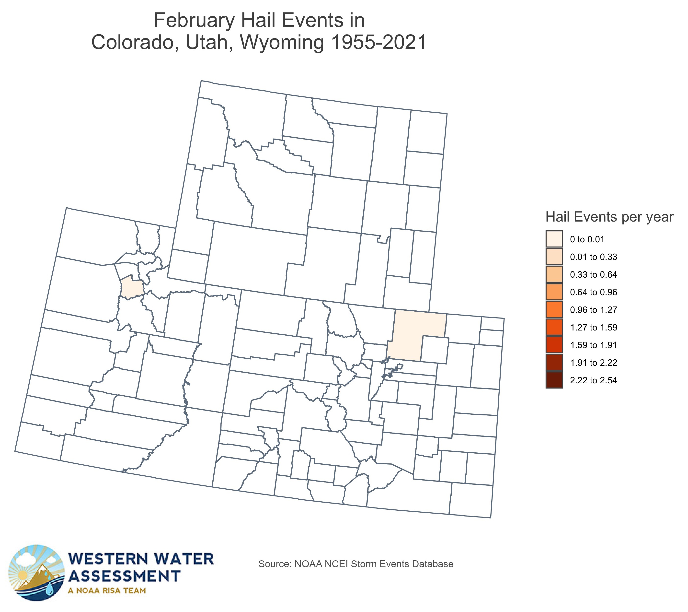
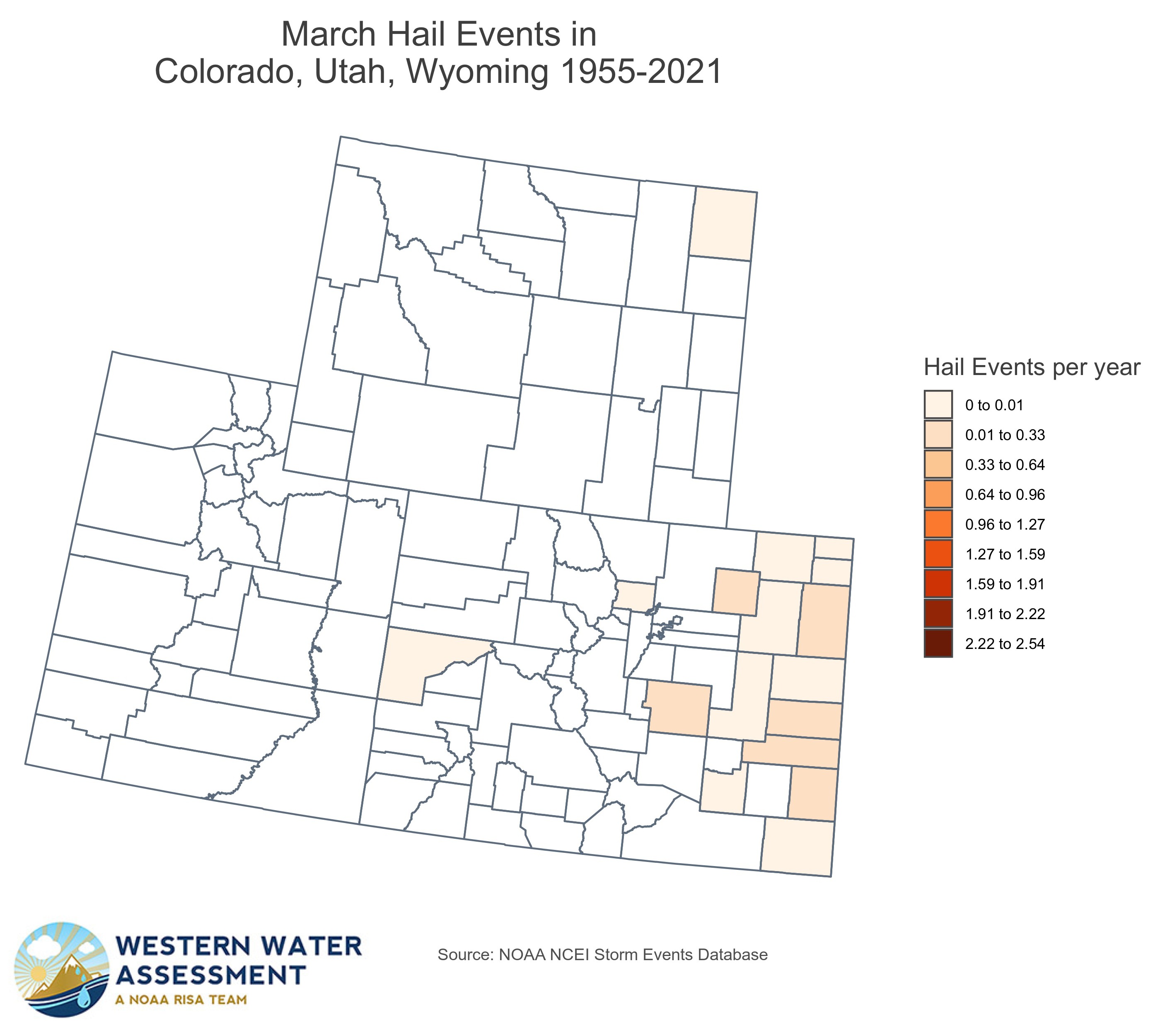
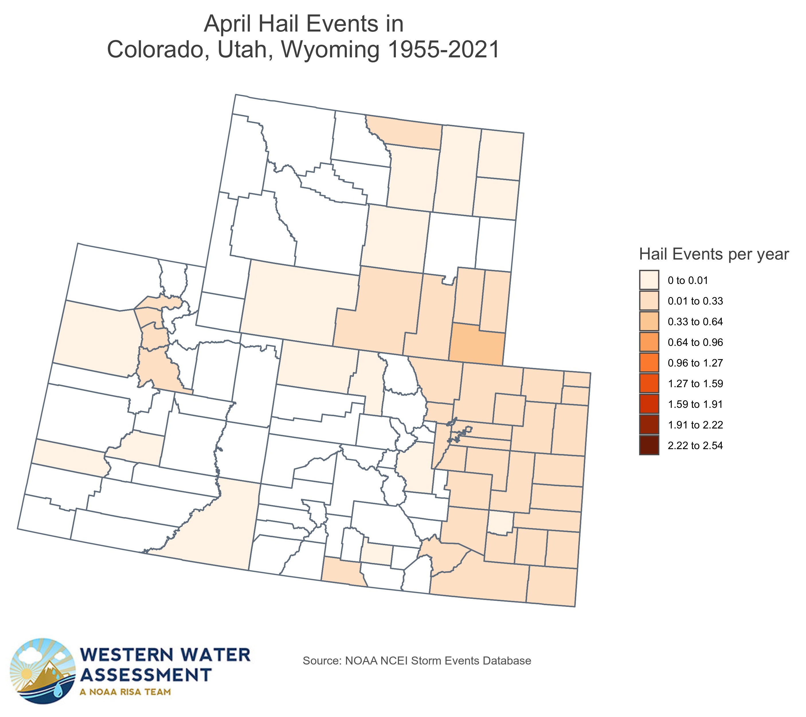
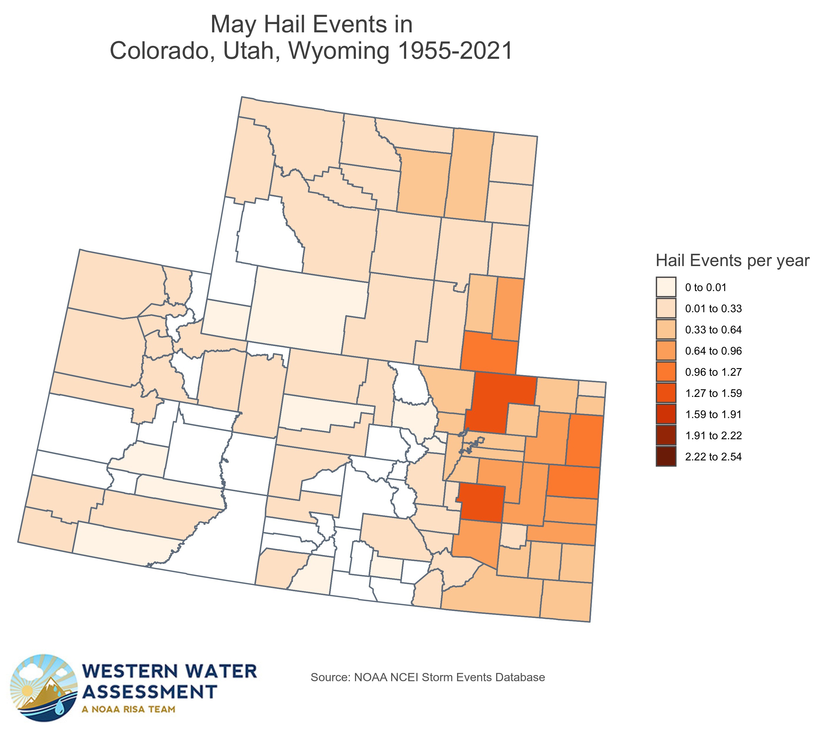
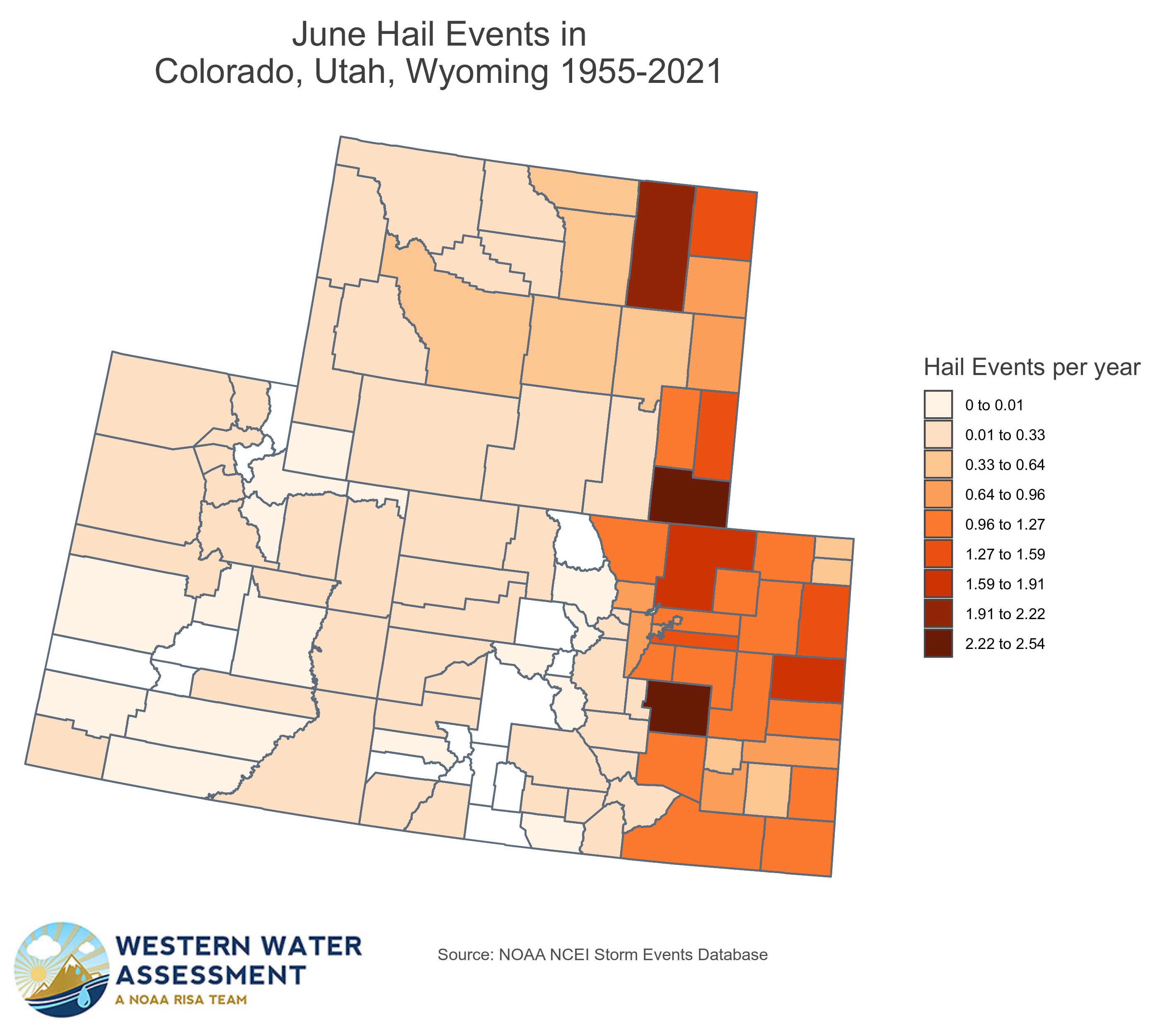
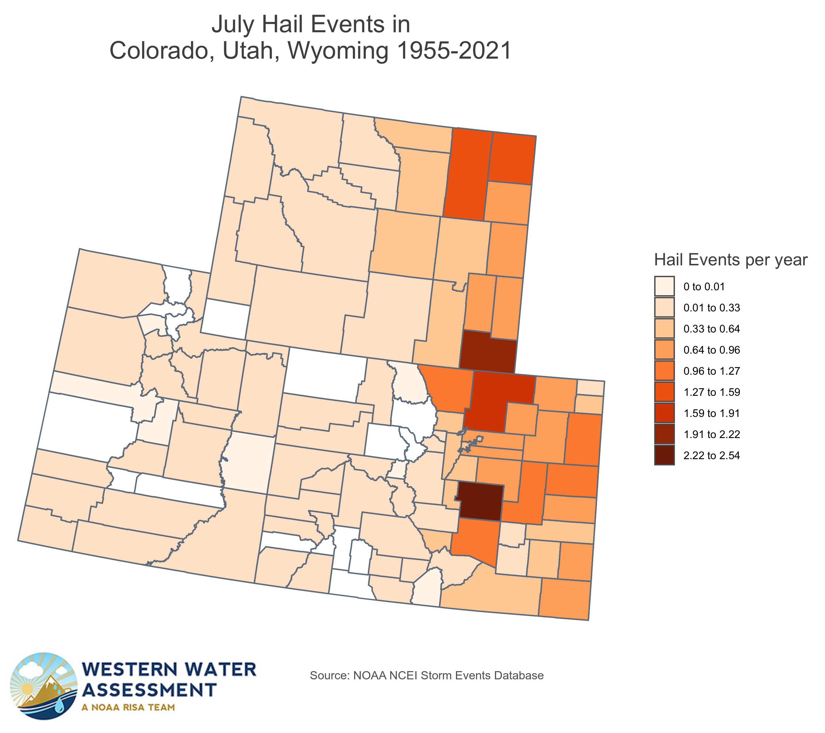
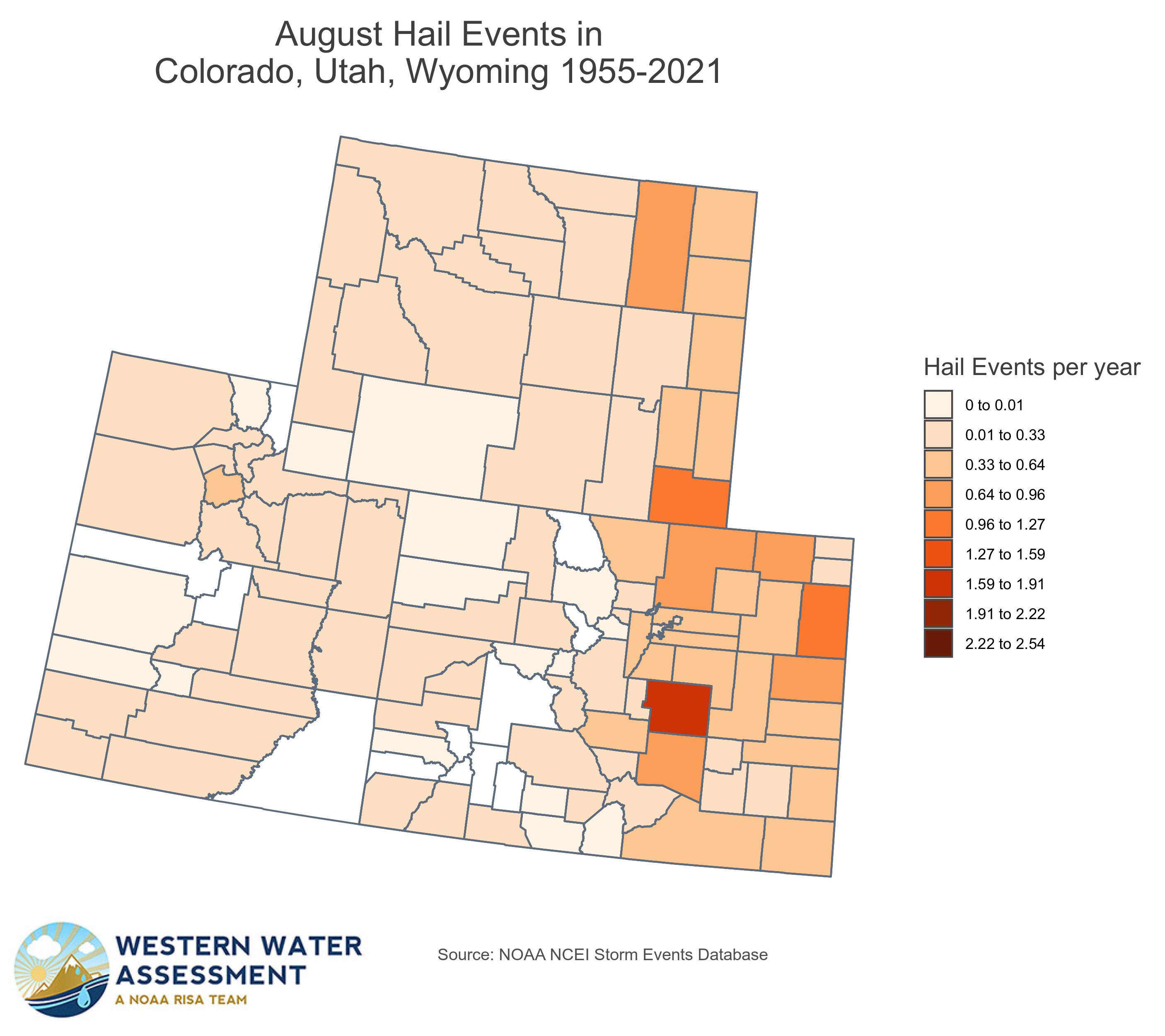
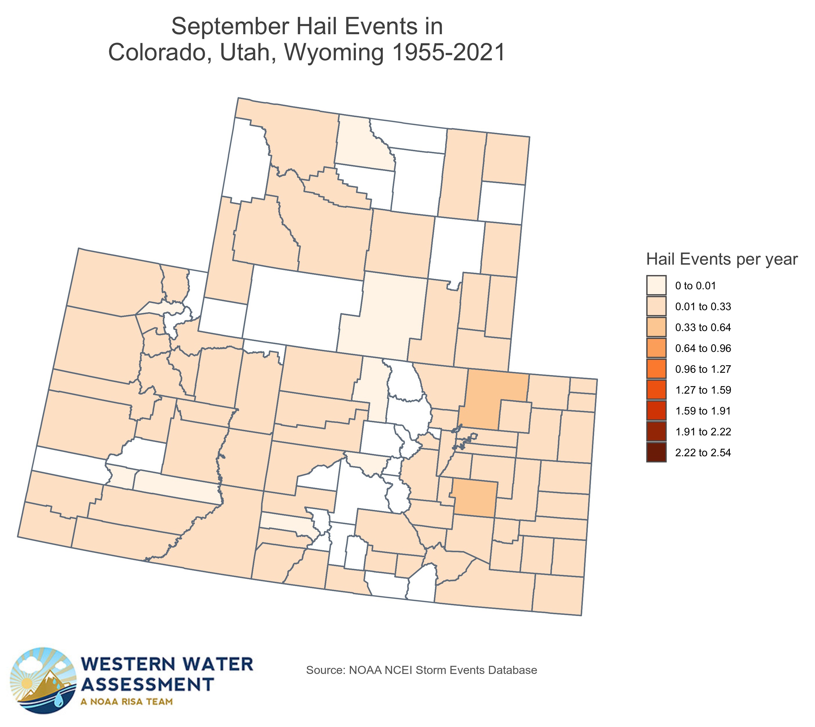
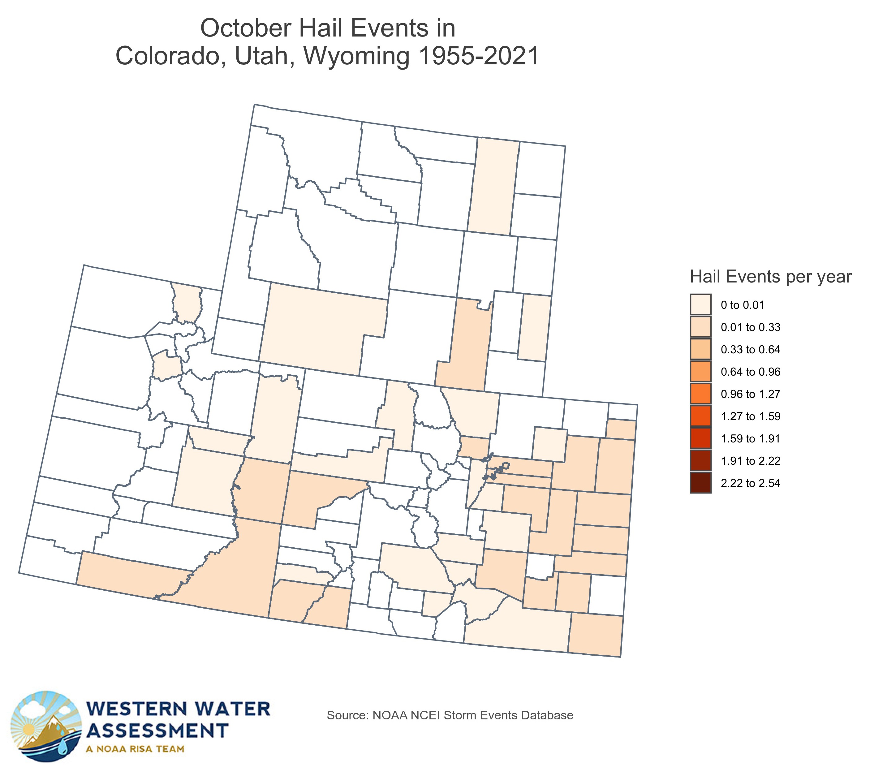
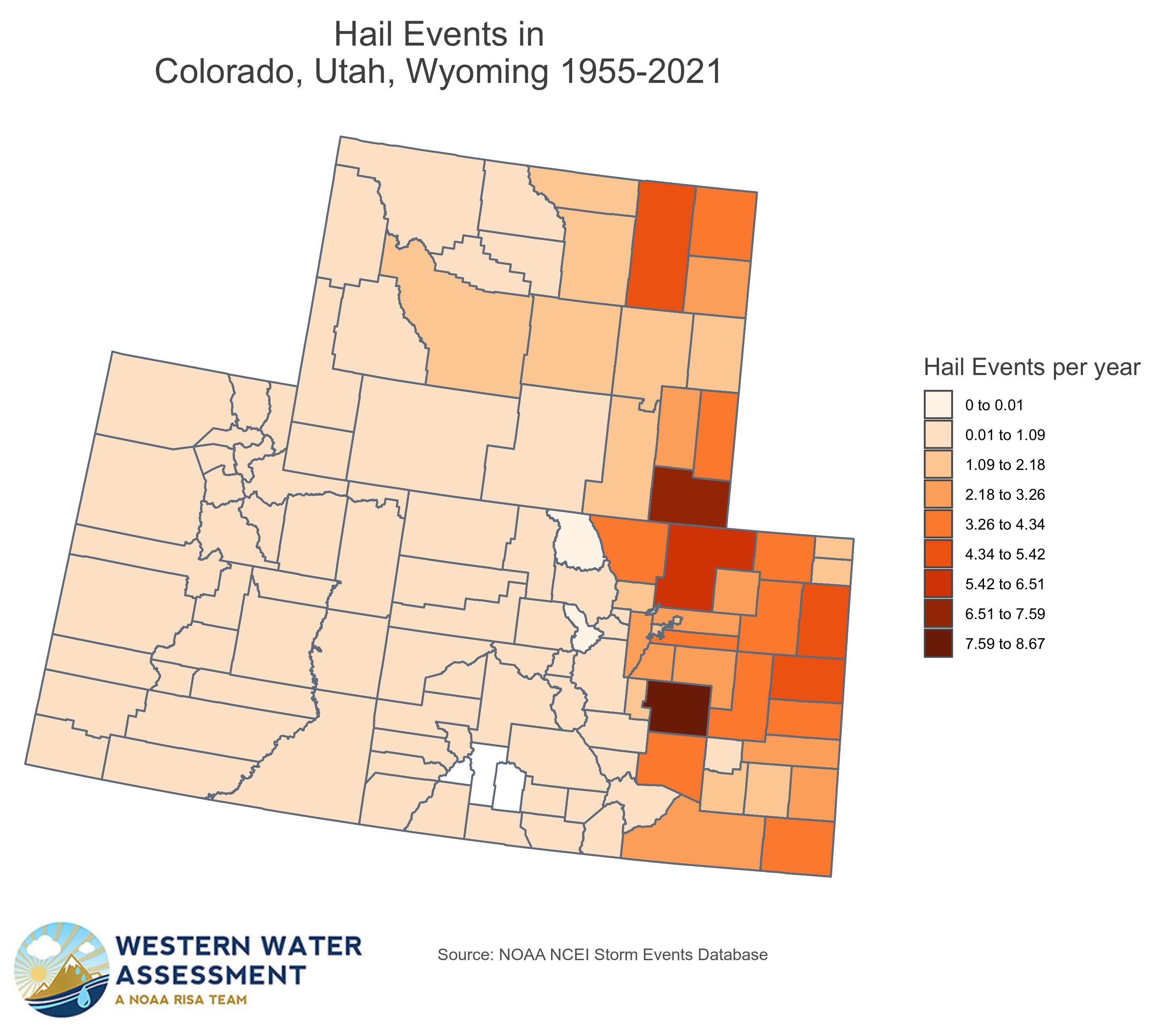
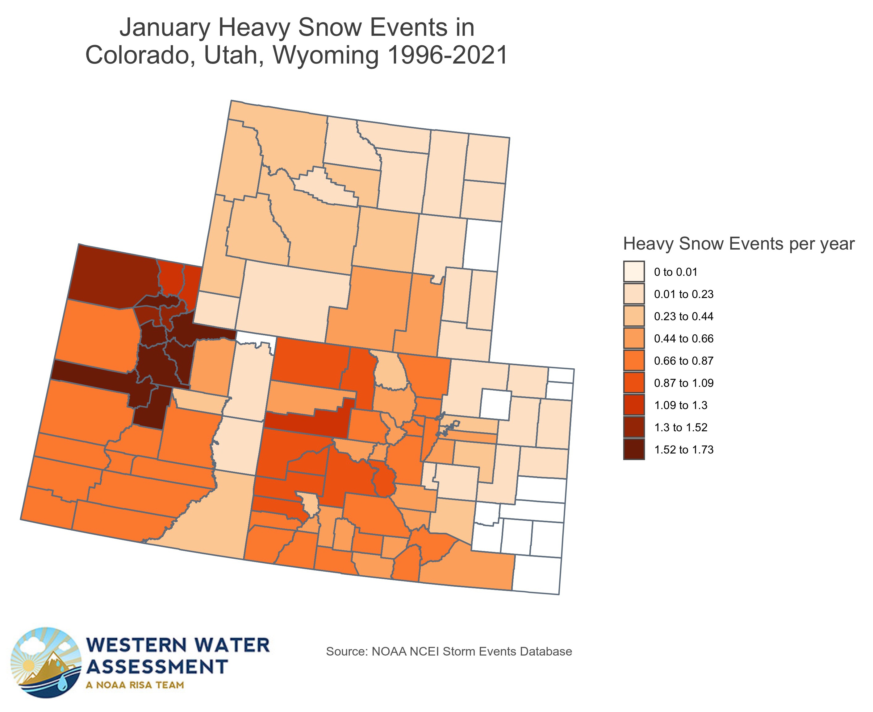
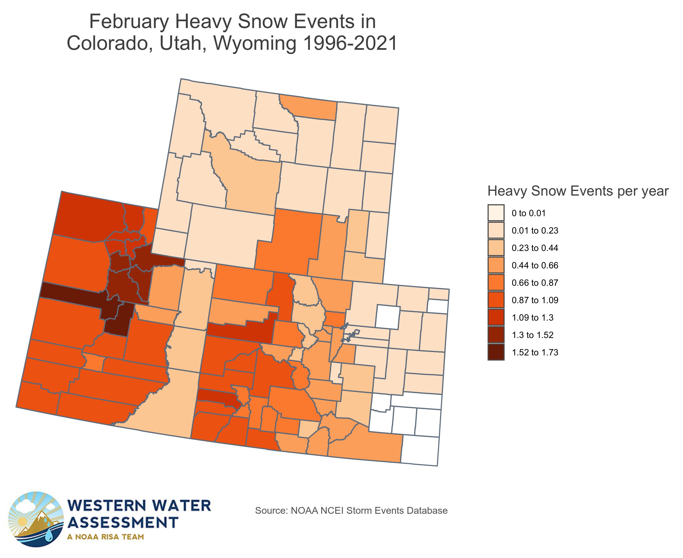
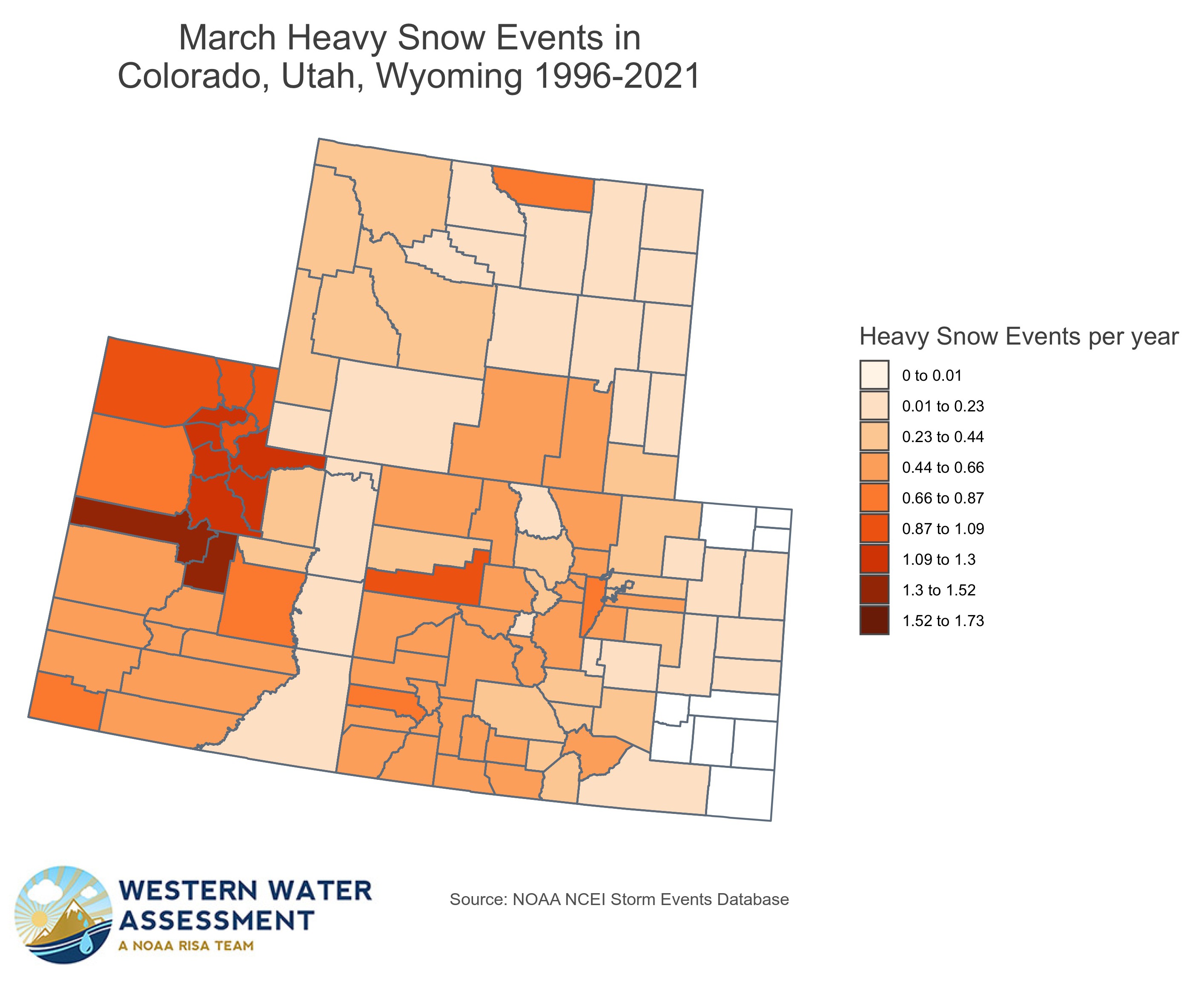
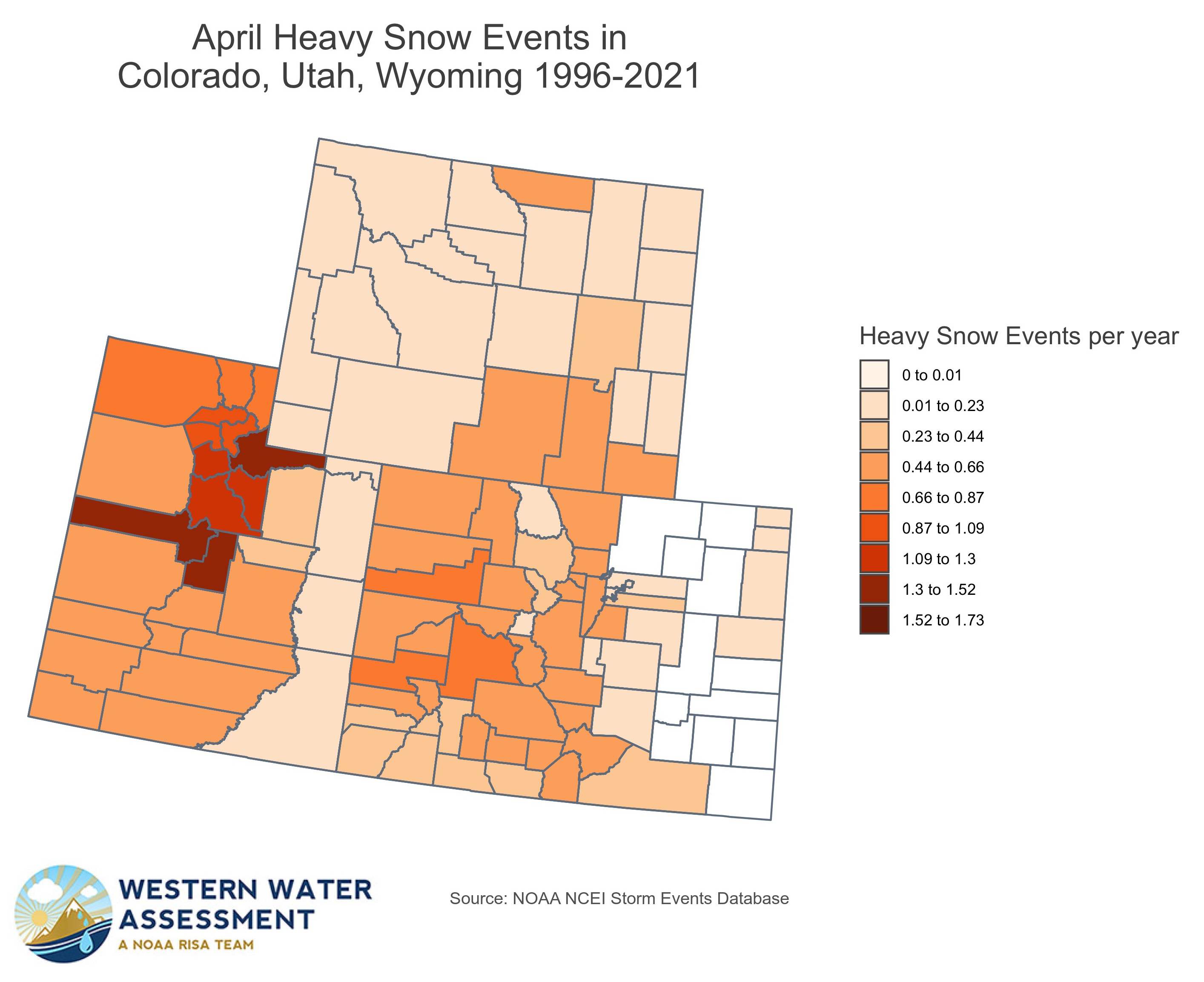
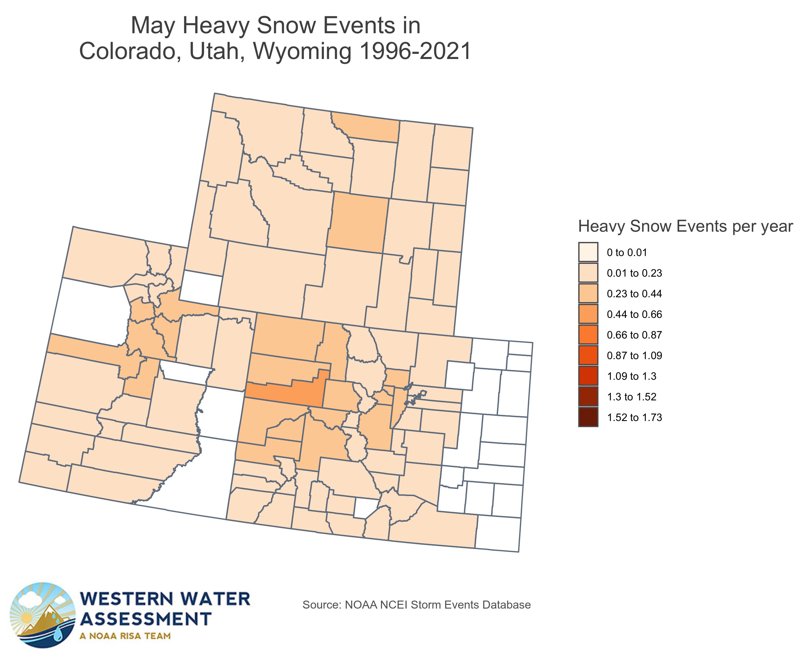
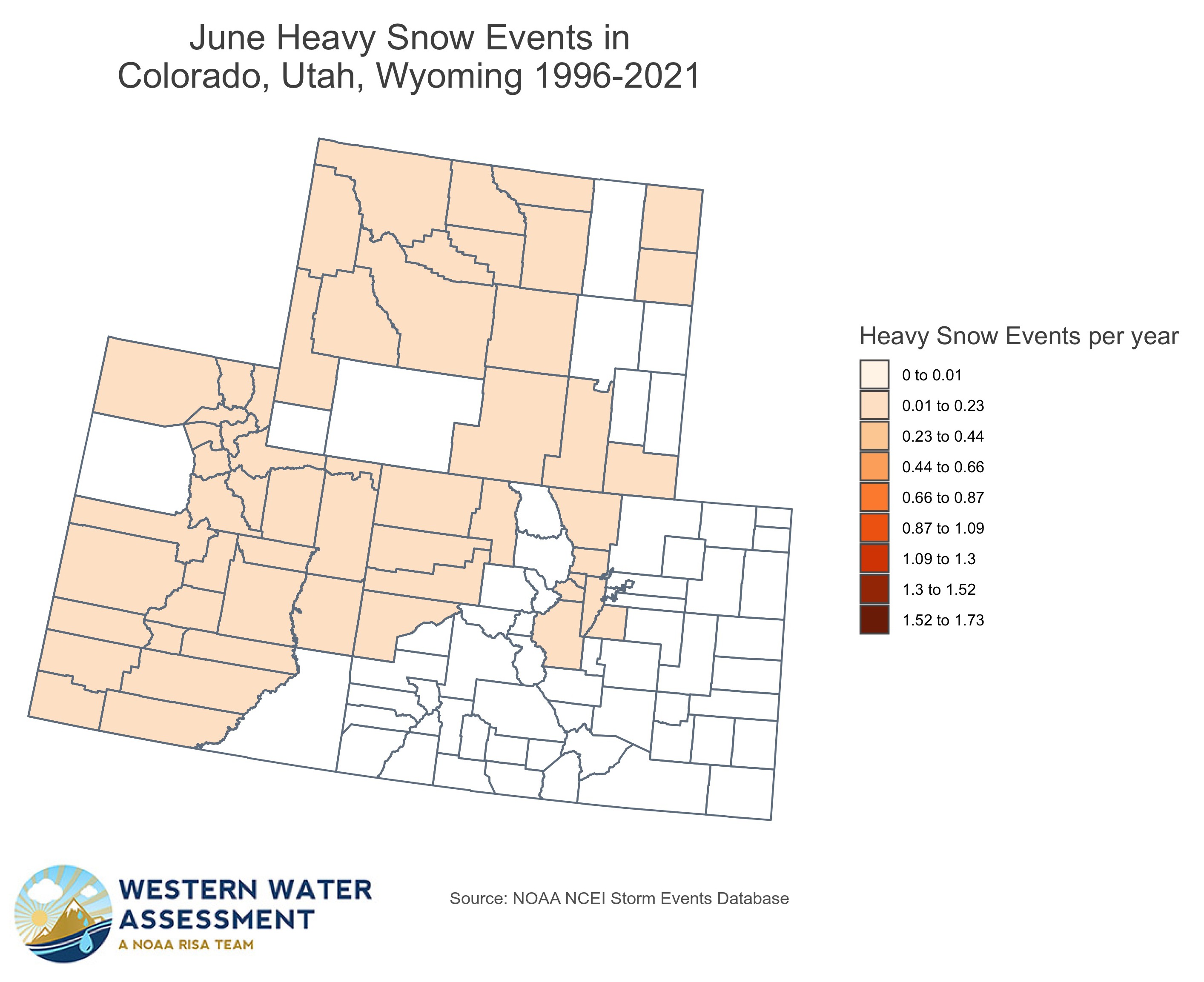
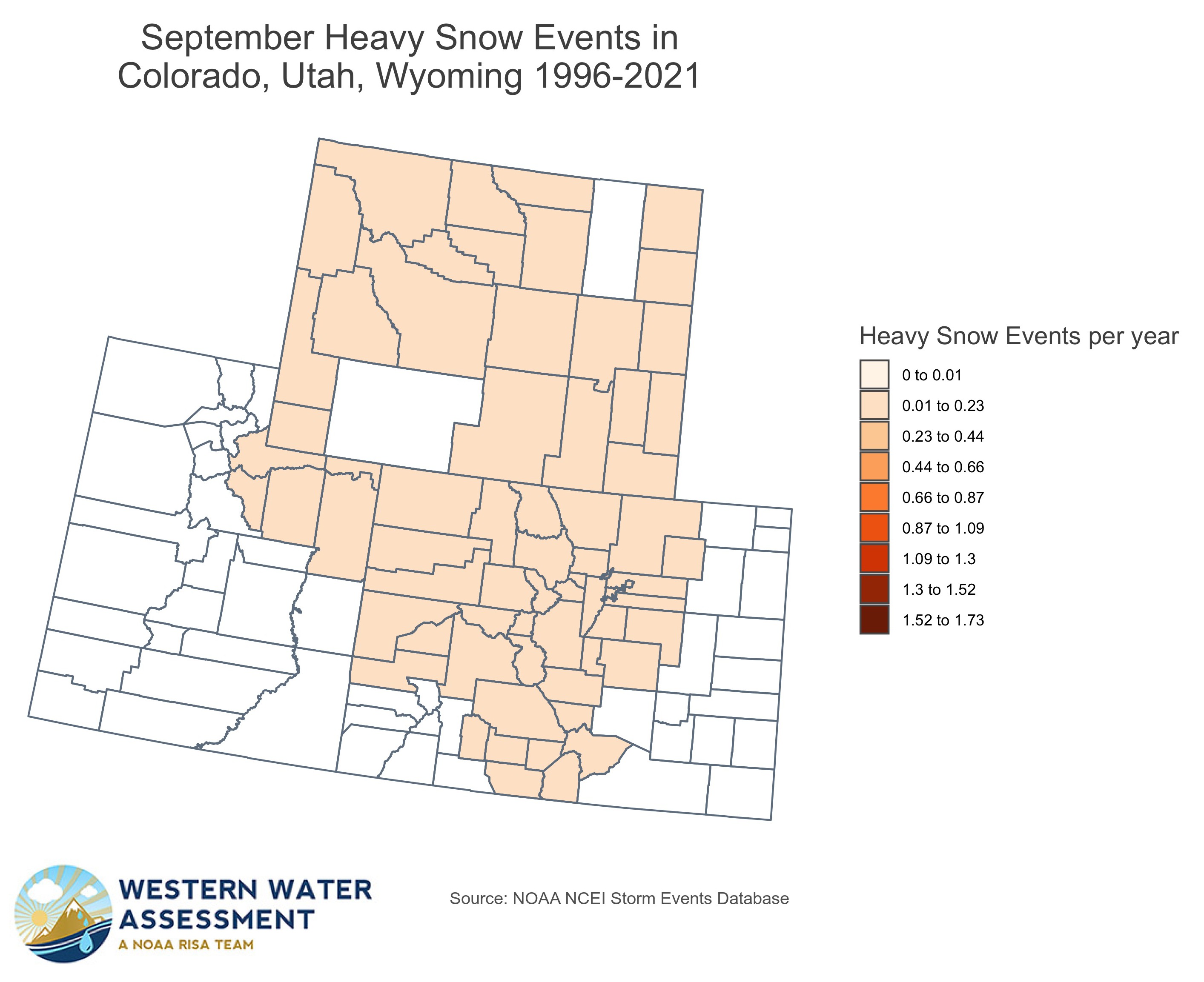
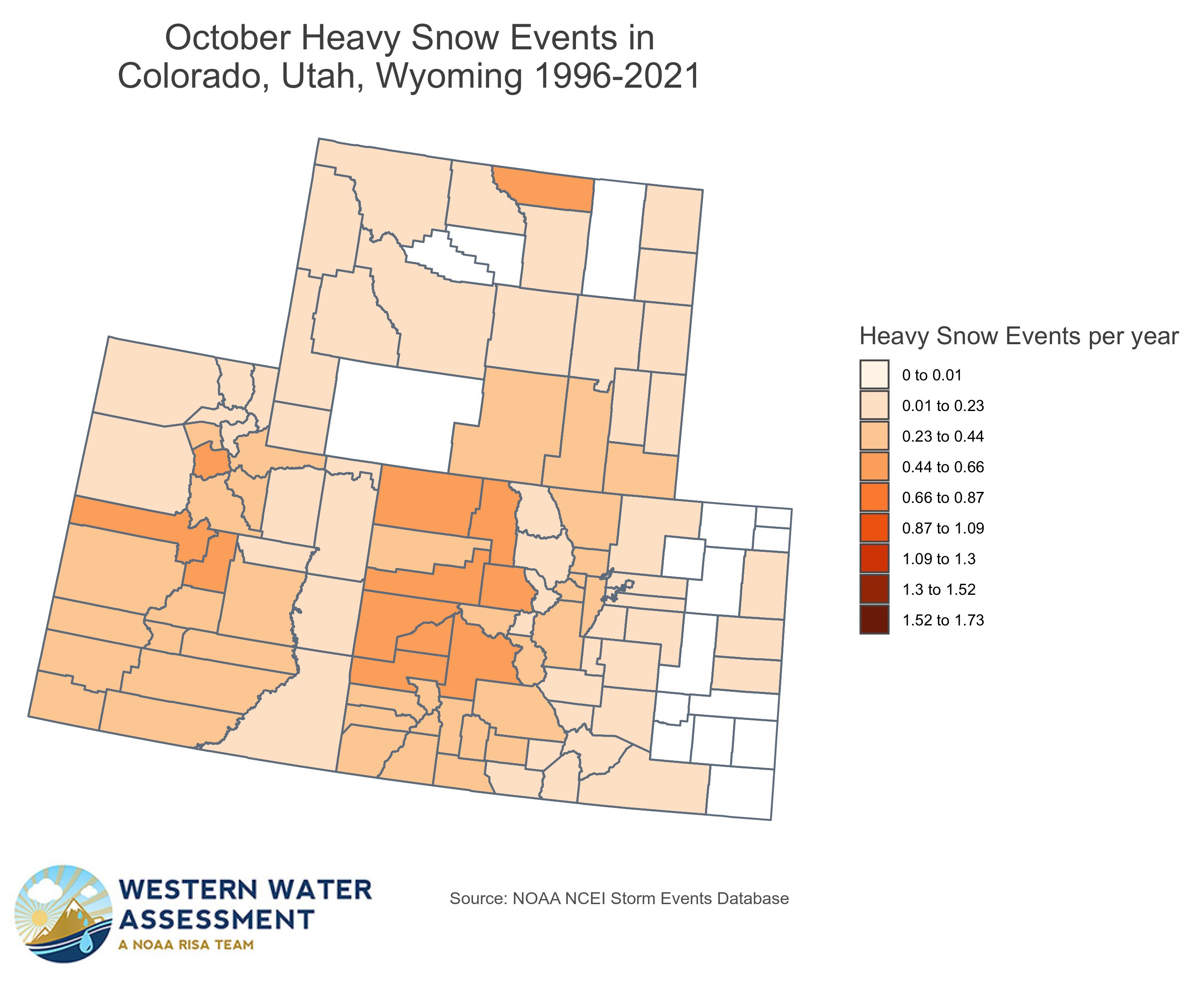
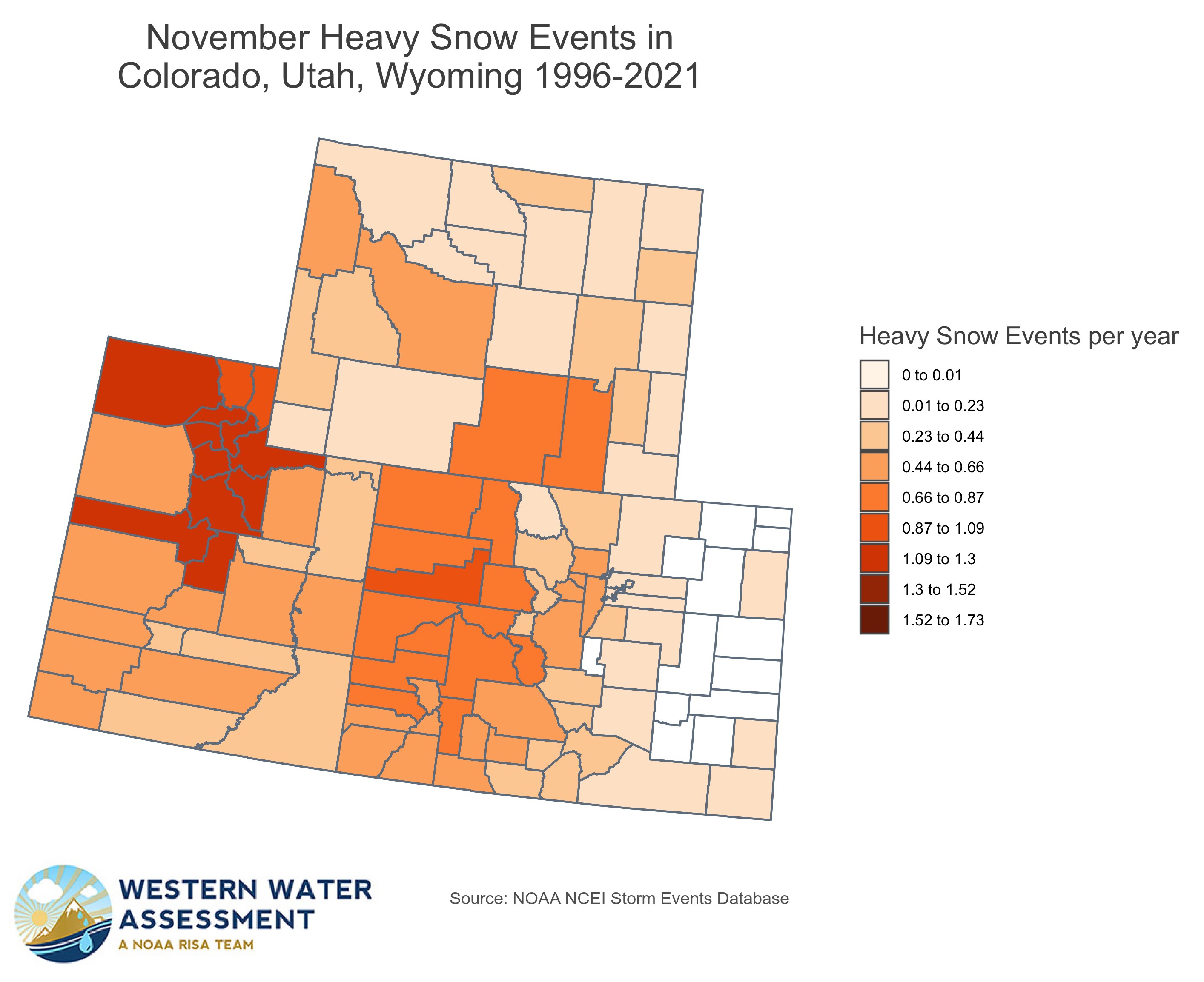
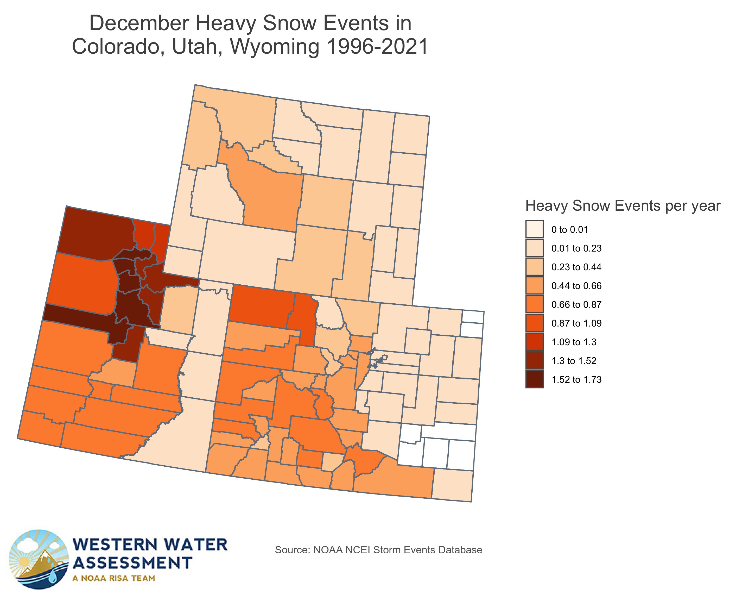
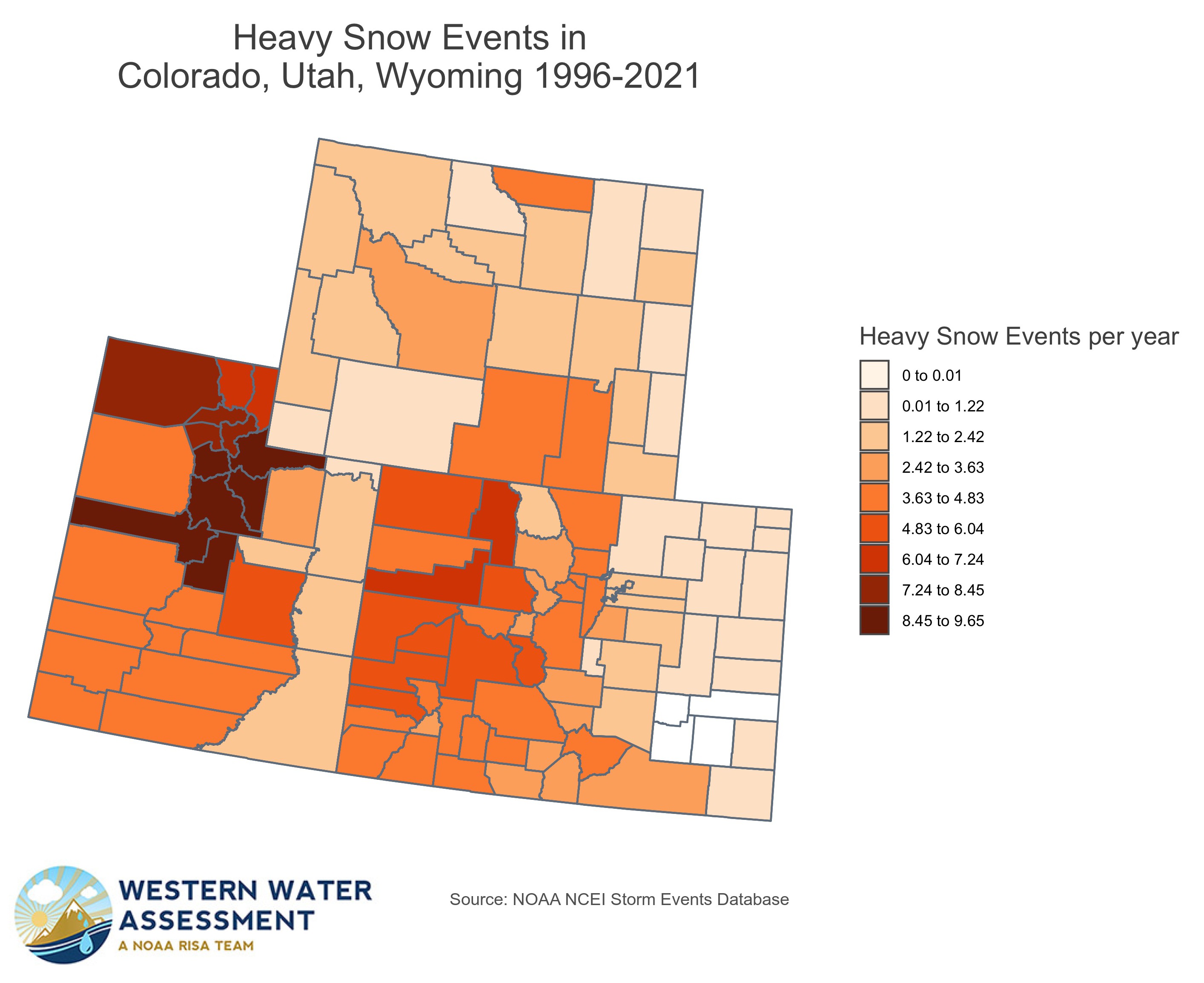
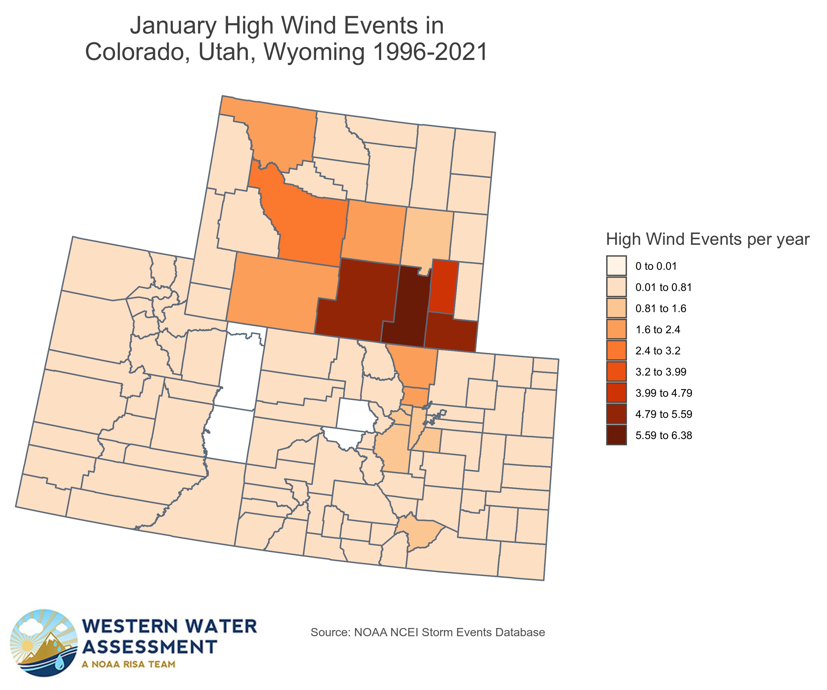
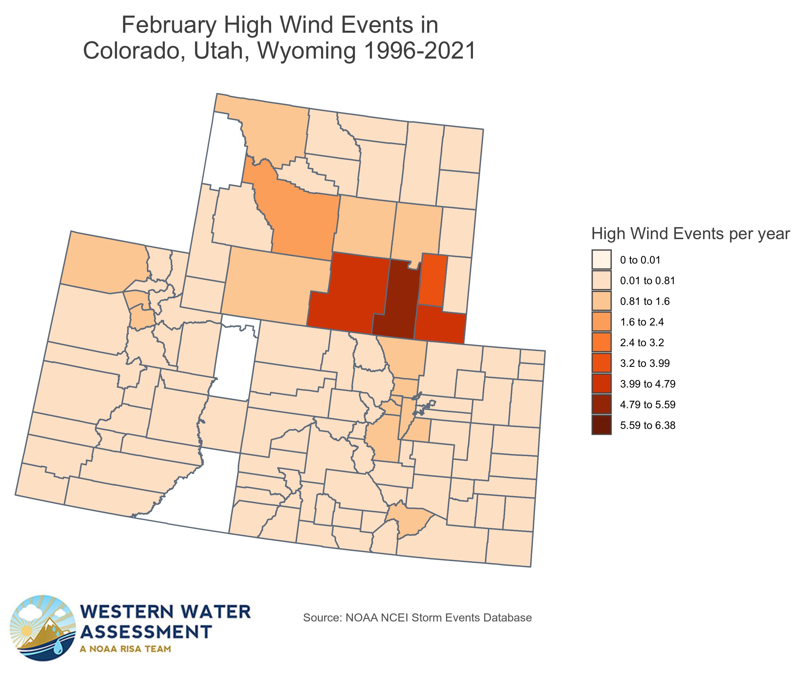
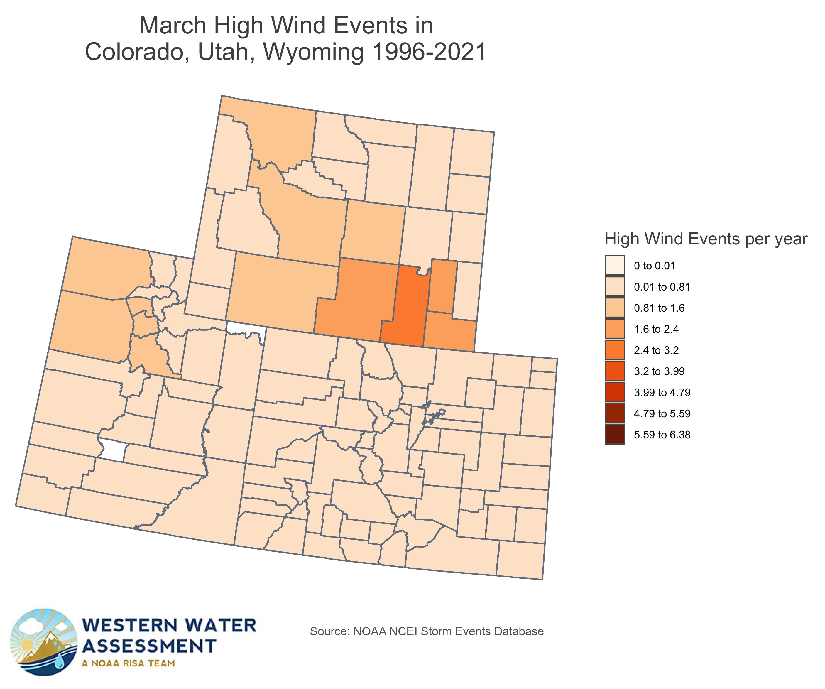
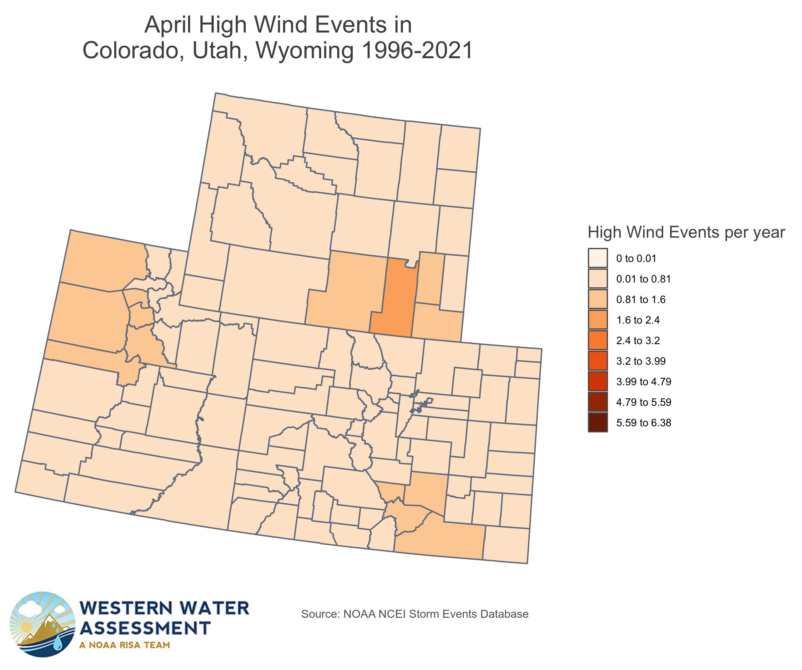
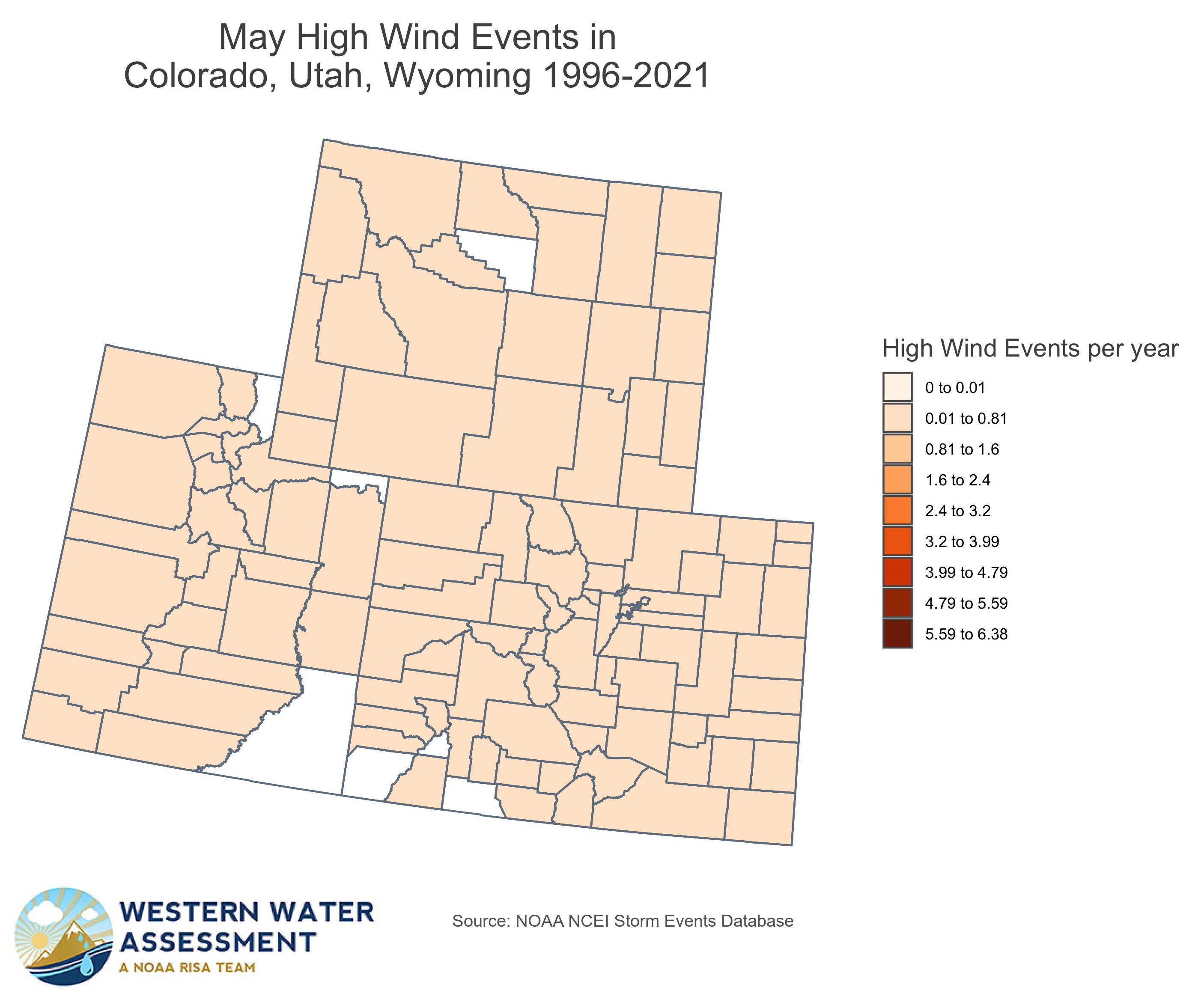
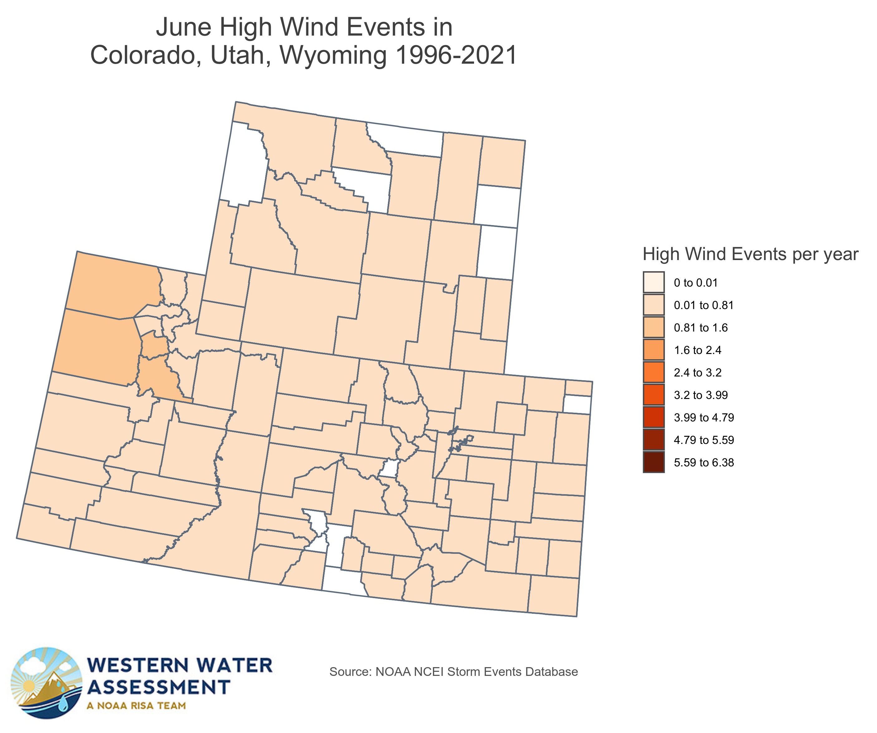
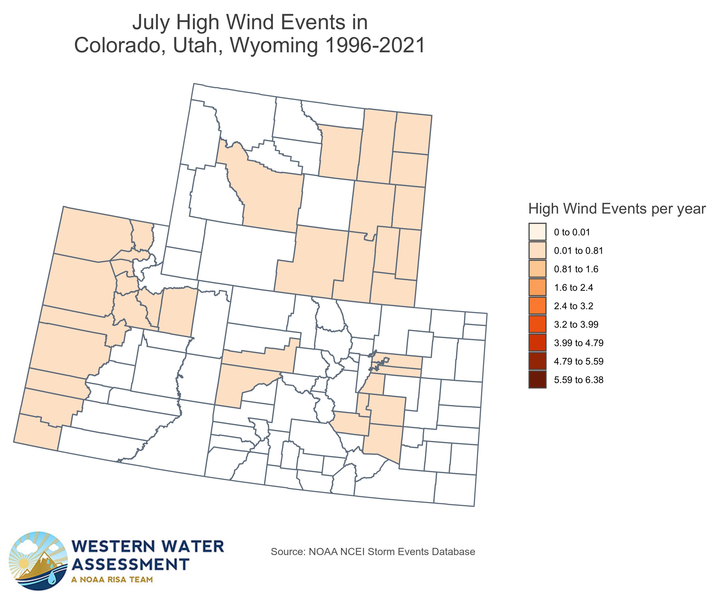
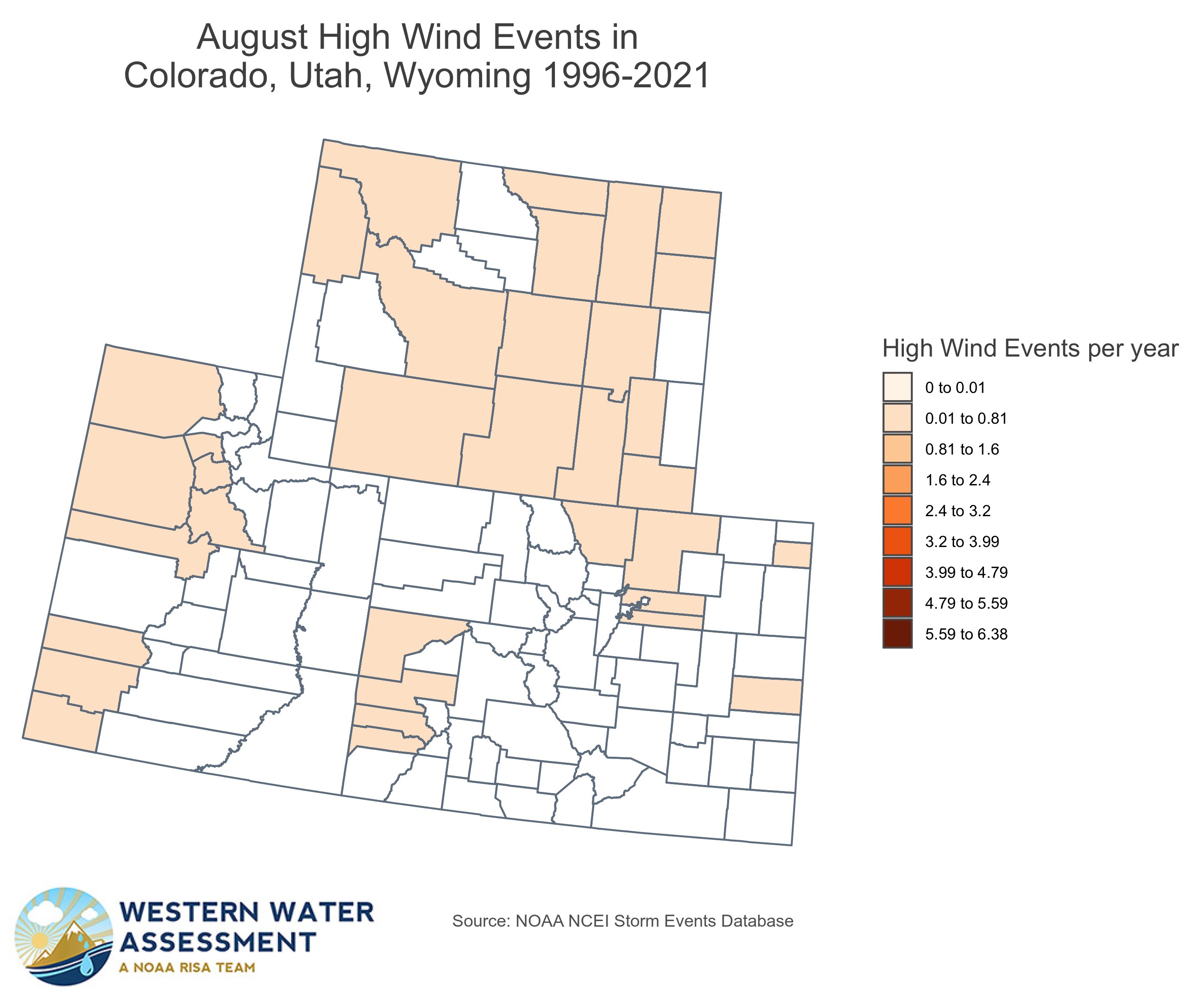
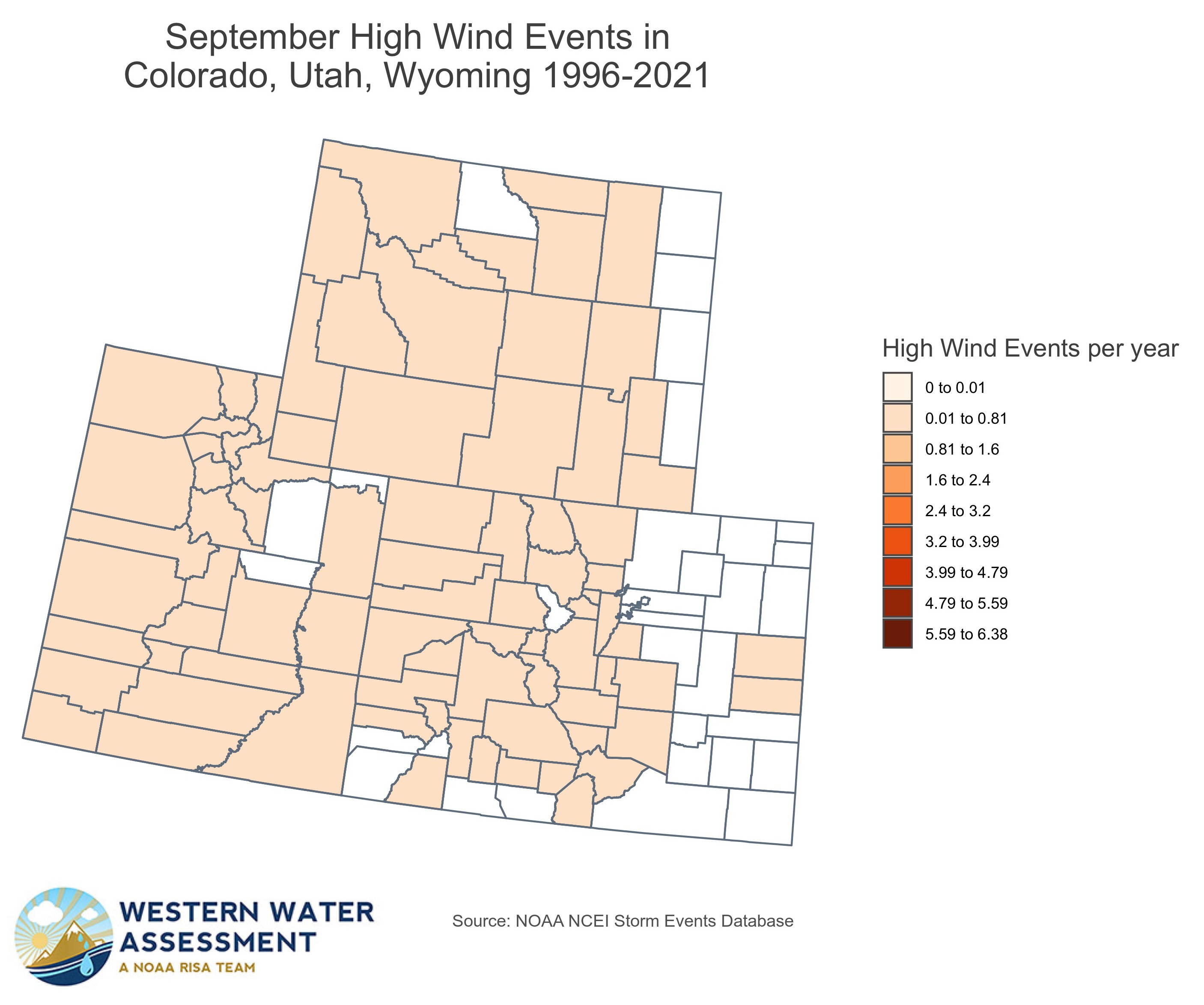
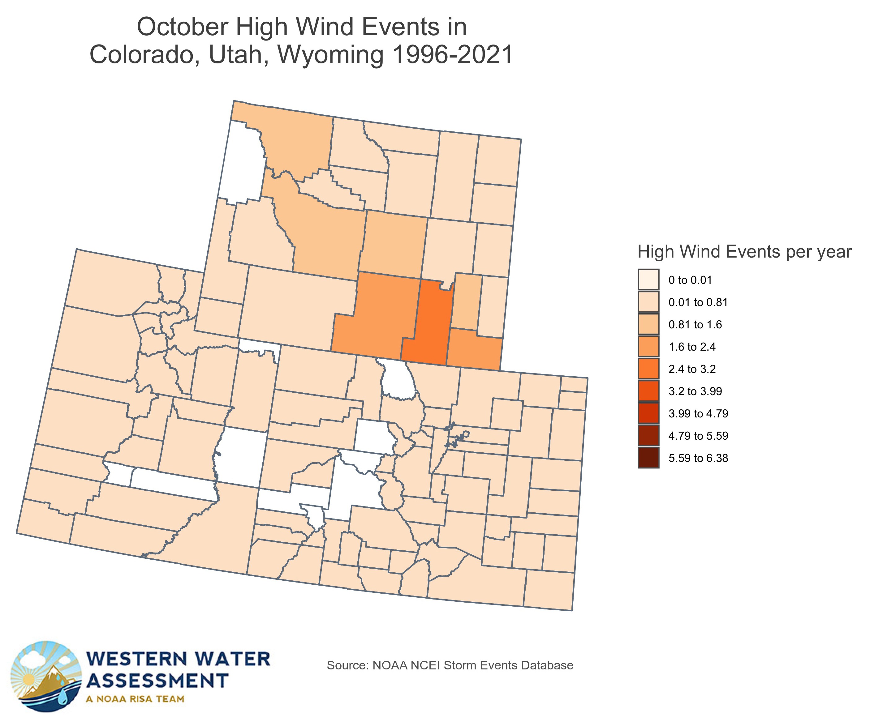
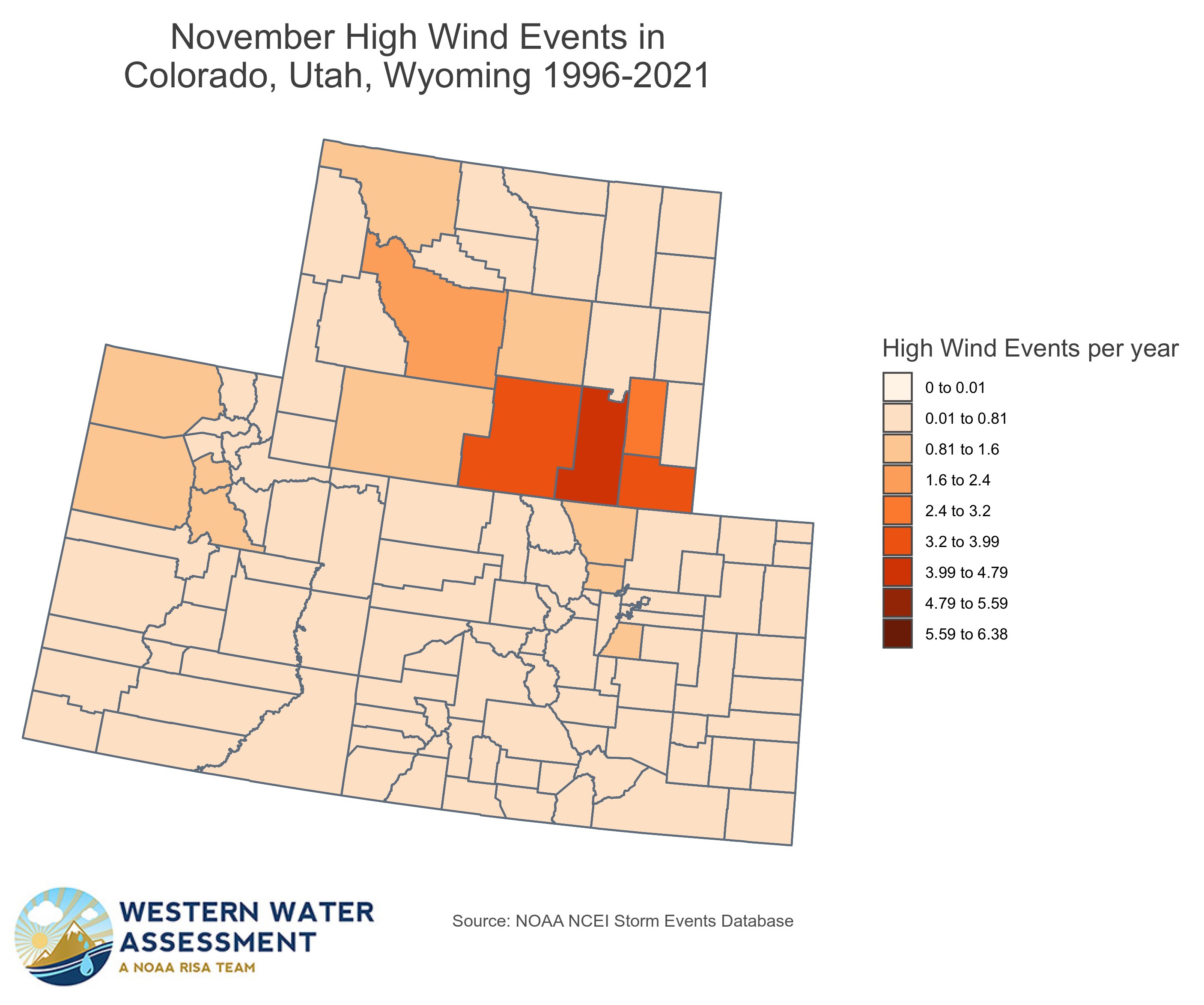
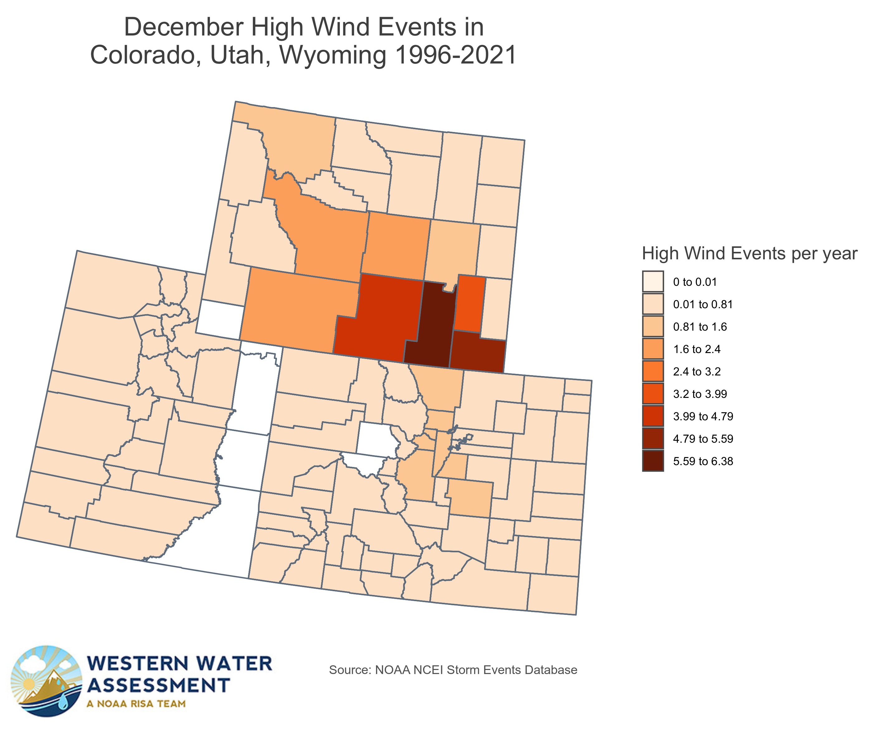
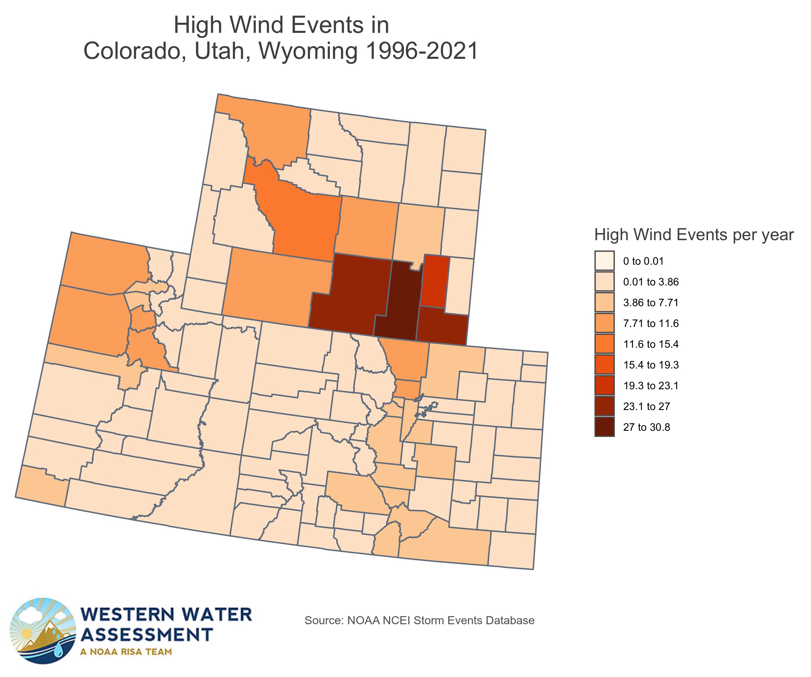
To better understand the spatial and seasonal patterns in event occurrence for six event types that are common in our region, we created a set of monthly maps using the Storm Events Database, showing the number of events per year in that month, by county, for the period of record available for that event type.
Note to users: This resource is still in development. We welcome your feedback so that we can make it more useful.
Flash Flood

Flood
Hail

Heavy Snow
High Wind
Wildfire