September 14, 2026 - CO, UT, WY
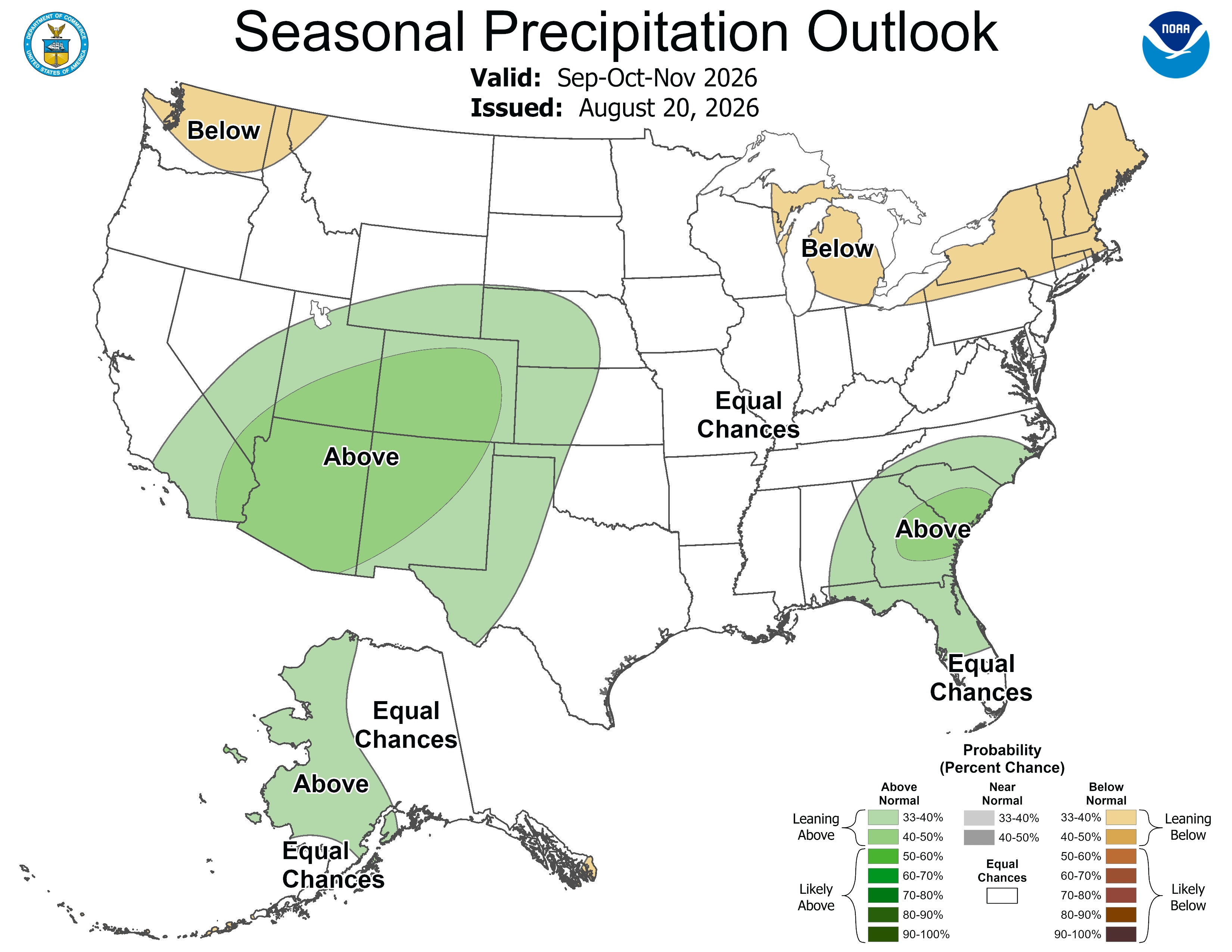
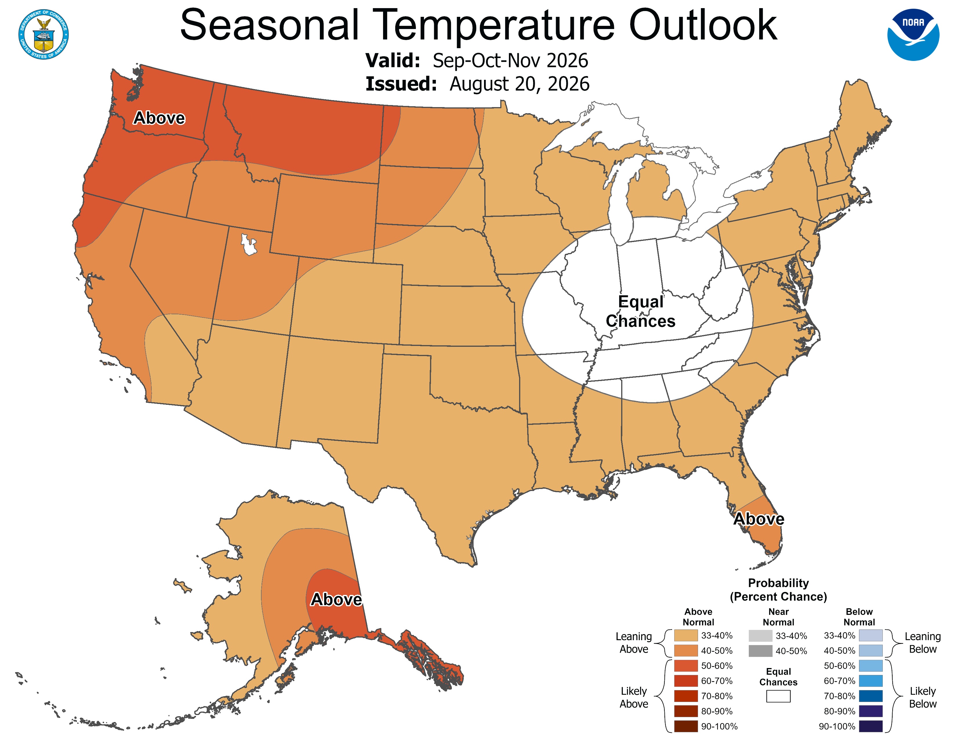
August precipitation varied across the region due to scattered monsoonal thunderstorms. Regional temperatures were above average in August, and Colorado experienced its warmest August on record, while Utah experienced its second warmest on record. Streamflow conditions were below average for most regional rivers, especially in Colorado and Utah, where many streamflow gages observed record-low daily streamflows. Regional drought coverage changed little from the beginning of August to September and is at 96%. El Niño conditions persist, and there is a greater than 90% probability of a very strong El Niño event during fall and winter 2026-27. NOAA seasonal forecasts indicate an increased probability of above average temperatures for the region, and above average precipitation for Colorado, Utah, and southern Wyoming during September–November.
August precipitation varied across the region, from below average precipitation in southern Colorado, southeastern Utah, and northeastern Wyoming, to above average precipitation in northern and eastern Colorado and much of Utah and Wyoming. Monsoonal thunderstorms caused high variability of precipitation in each state. For example, parts of Emery and adjacent Wayne counties in southeastern Utah experienced below 25% of average conditions, while most counties north and west of there experienced above 150–200% of average conditions.

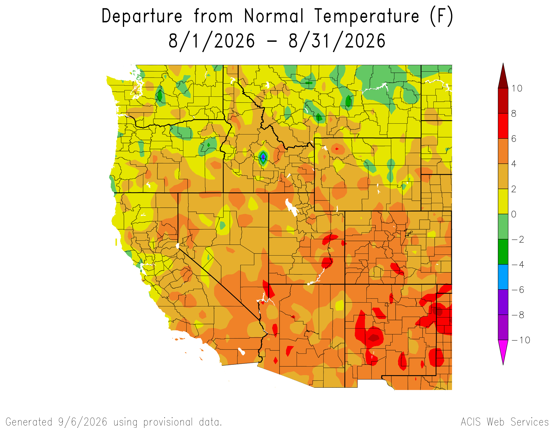
Regional temperatures were above average in August, with near average temperatures in northern Wyoming. August temperatures were generally 2–4°F above average, but temperatures for much of western Colorado and eastern Utah were 4–6°F above average. Small pockets of 6–8°F above average temperatures occurred in south-central Colorado and southeastern Utah. It was the warmest August on record for Colorado, the second warmest on record for Utah, and the seventh warmest on record for Wyoming. It was the warmest meteorological summer (June–August) on record for Colorado and Utah, and the sixth warmest on record for Wyoming.
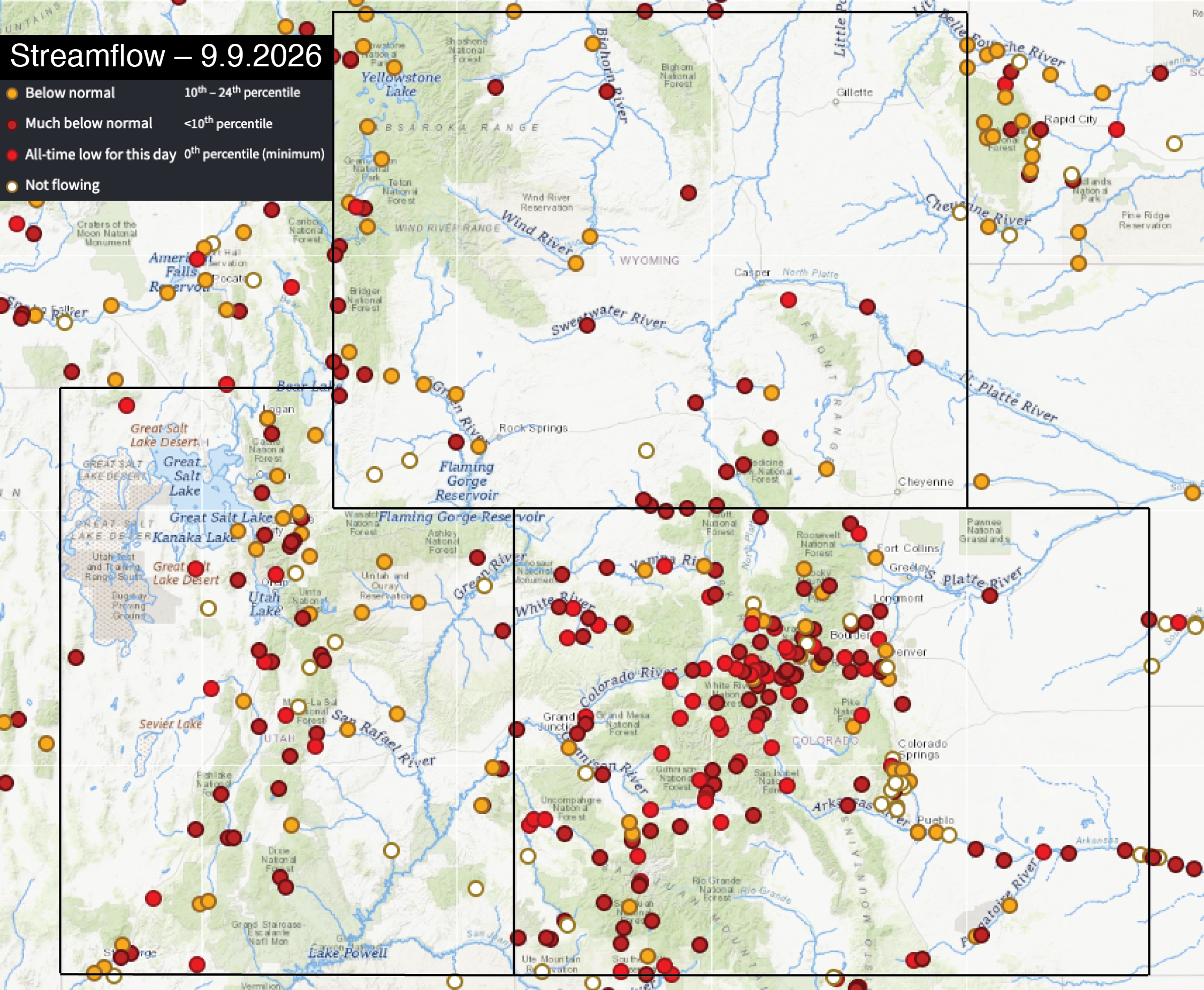
At the beginning of September, streamflow was below average for most regional rivers, especially in Colorado and Utah. On September 9, record-low daily streamflow was recorded at 30 or more sites in Colorado, 10 sites in Utah, and two in Wyoming. Western Colorado streamflows are particularly below average, with most rivers experiencing record-low or bottom 10th percentile daily streamflow observations.
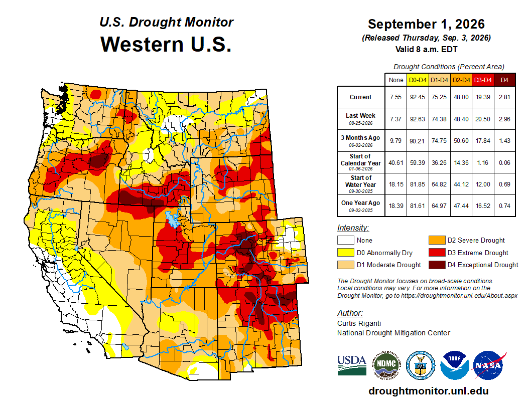
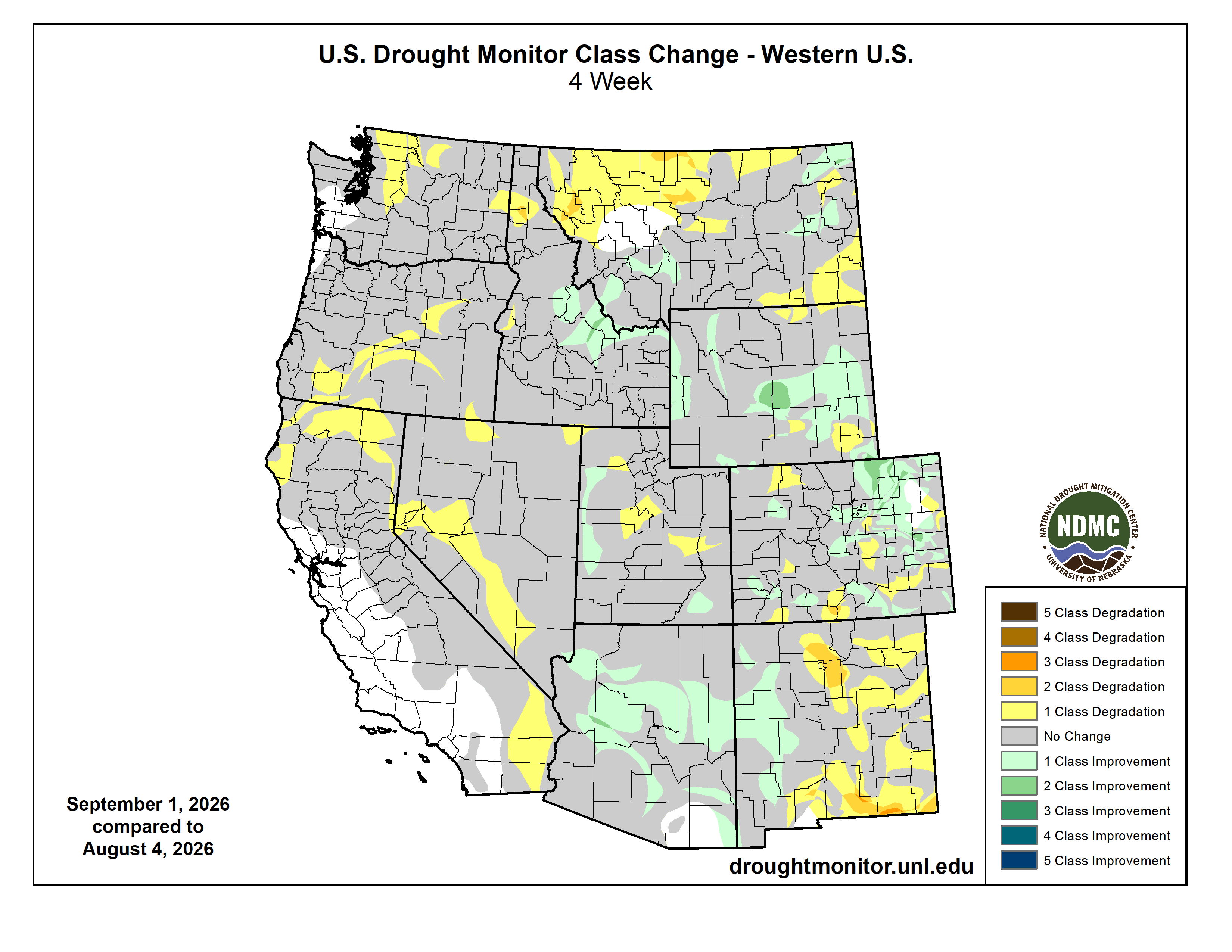
By September 1, regional drought coverage was at 96%. Similar to the beginning of August, drought covered the entire region except for a portion of northeastern Colorado, where monsoonal thunderstorms have continued to help relieve the area of drought conditions. Coverage of moderate (D1) drought conditions decreased slightly to 89% in Colorado, remained at 100% in Utah, and increased slightly in Wyoming to cover 100% of the state. Coverage of exceptional (D4) drought conditions decreased to 12% in Colorado, and extreme (D3) drought conditions remained at 35% in Utah and decreased to 29% in Wyoming, a 15% improvement from the beginning of August.
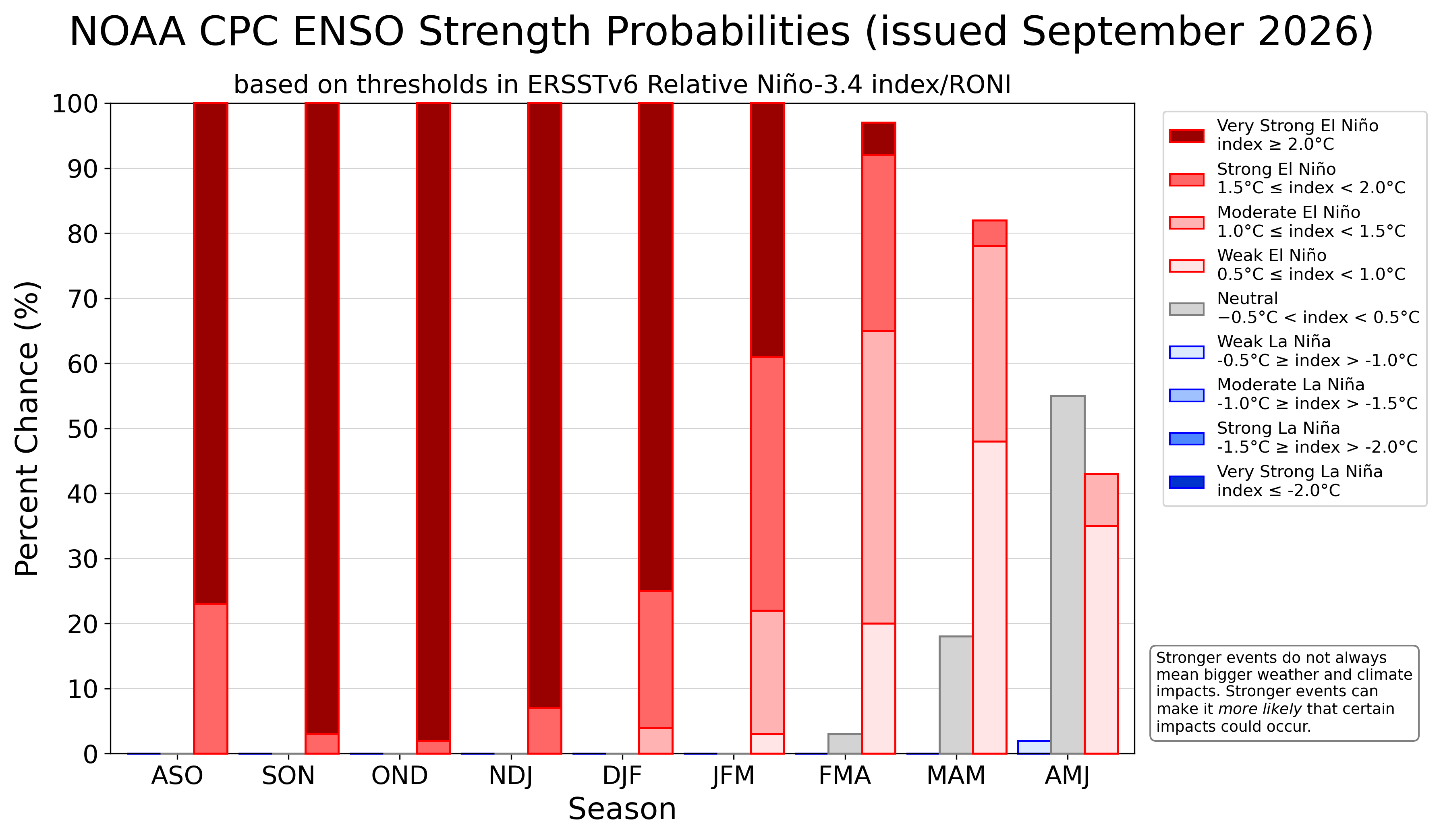
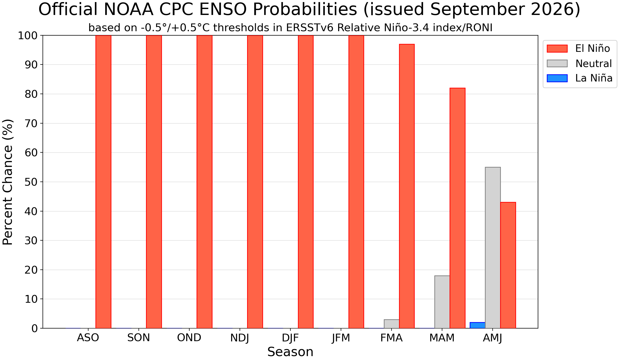
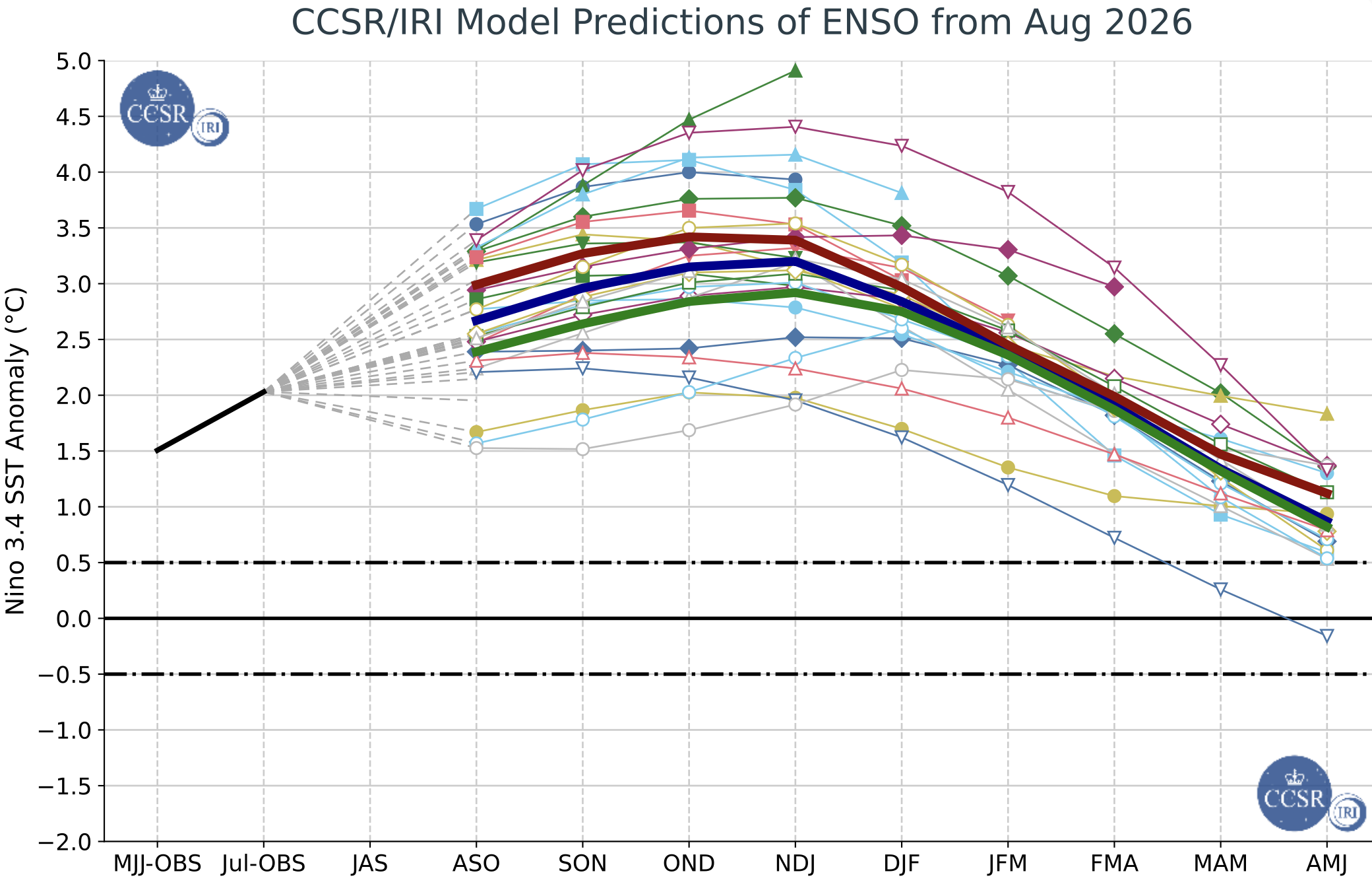
El Niño conditions persist in the eastern Pacific Ocean, with sea surface temperature anomalies running 1.8ºC above average in the Niño-3.4 index. There is a greater than 90% probability of a very strong El Niño event during fall and winter 2026-27, with as high as a 98% probability of a very strong event from October–December. Current forecasts of peak Pacific Ocean temperatures are 3–3.5ºC above average, indicating what could be the strongest El Niño on record. There is a 100% probability of El Niño conditions continuing at least through January–March 2027. NOAA seasonal forecasts indicate an increased probability of above average temperatures for the region, and above average precipitation for Colorado, Utah, and southern Wyoming during September–November, suggesting an active monsoon and the possibility of tropical storm remnants for the remainder of the season.
Significant weather event: Aspen Acres burn scar flooding. On July 28 and 29, severe thunderstorms brought intense rainfall and caused debris flow flooding in the community of Beulah, Colorado. The floodwaters damaged homes, washed out roads, and blocked bridges with debris. The Beulah Fire Protection and Ambulance District prompted emergency evacuations for residents and those along Highway 78. Rainfall rates were 1–3 inches per hour, and the muddy floodwaters carried rocks, burned trees, propane tanks, and other debris downstream. Highways 78 and 165, and other critical roads, were closed, limiting Beulah Valley access to essential and emergency services. Between Beulah and other nearby communities such as San Isabel and Wetmore, at least 11 homes were damaged by flooding, and many roads and culverts required emergency repairs.
On August 16, in about 1.5 hours, 1–1.5 inches of rain fell on the same burn scar in Beulah, triggering another major flash flood and resulting in the death of an 80-year-old resident who was swept away downstream by floodwaters. On August 23, Colorado Governor Jared Polis officially requested a Major Disaster Declaration (MDD) from the President and the Federal Emergency Management Agency (FEMA) to support recovery from the Aspen Acres and Gold Mountain Fires, and the post-wildfire flooding and debris flows on both burn scars.

Flash flooding in Beulah, Colorado on July 29, 2026. Credit: Pueblo County Sheriff's Office.