August 11, 2026 - CO, UT, WY
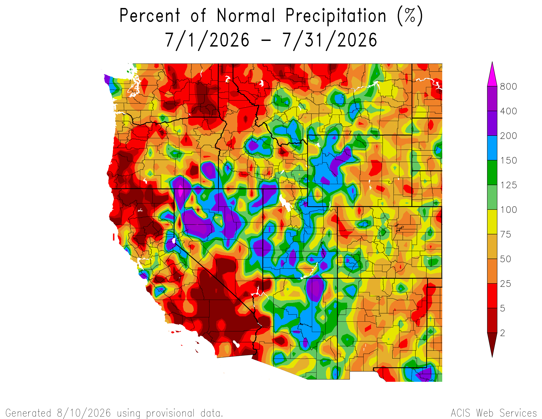
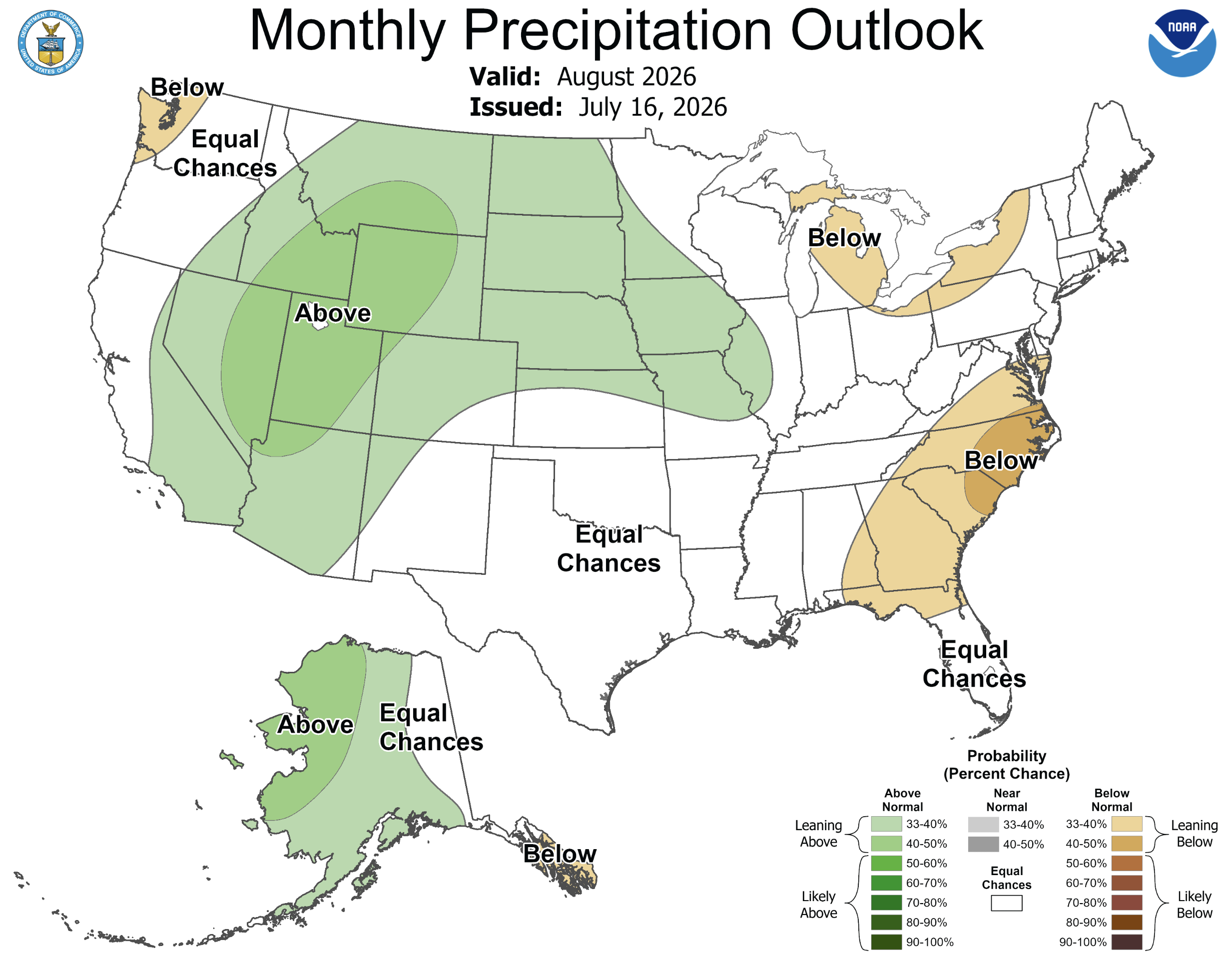
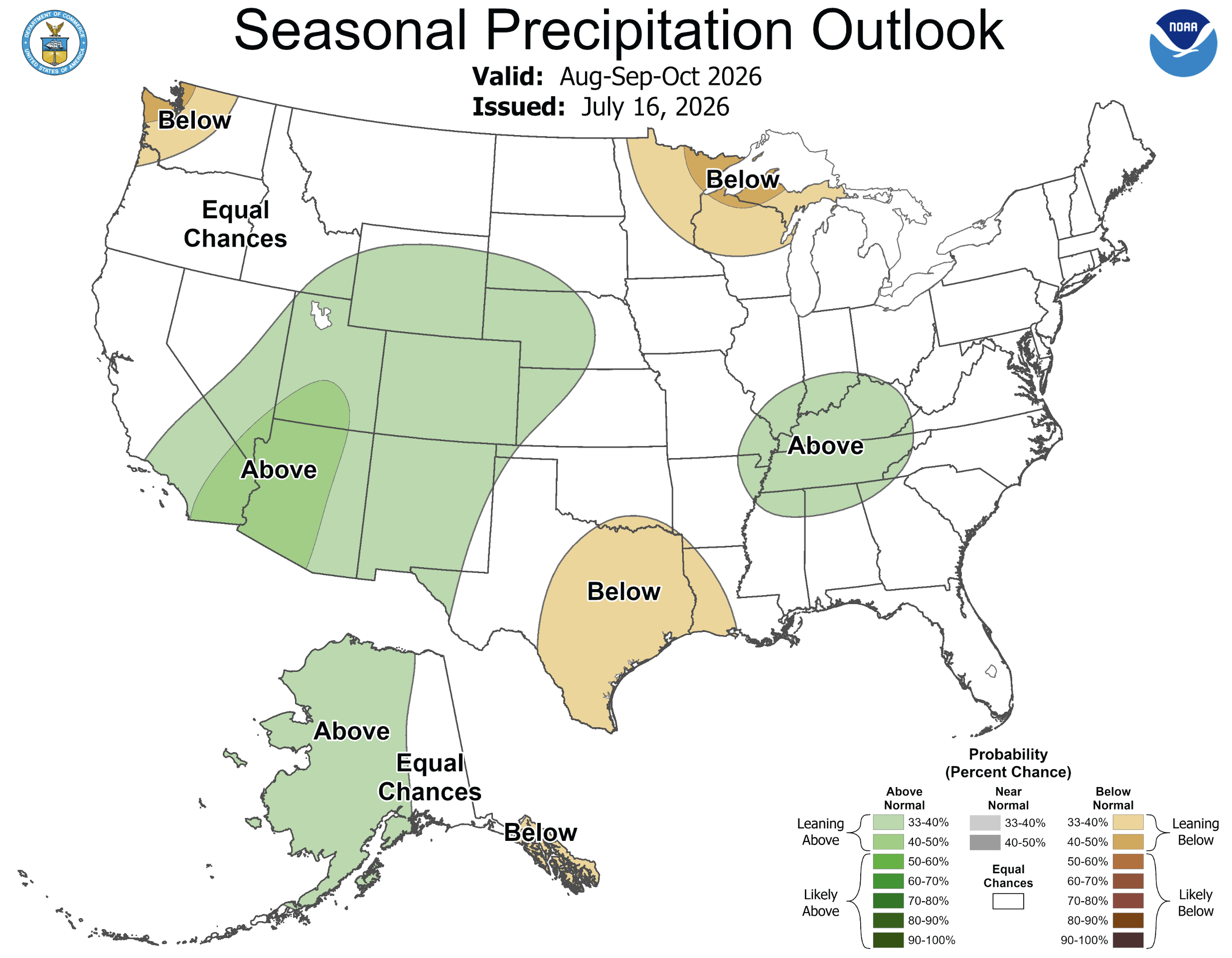
July precipitation was above average across much of Utah, western Colorado and western Wyoming, while below average precipitation fell in eastern Wyoming and much of Colorado. Regional temperatures were above to much above average across the region, and all-time daily maximum temperatures were set across all three states. Drought conditions prevail with 97% of the region covered by drought, and extreme or exceptional drought covered 35-45% of Colorado, Utah and Wyoming. Seasonal NOAA forecasts suggest active monsoonal precipitation and an increased probability of above average precipitation for the next three months. Monsoonal thunderstorms were responsible for six fatalities in Utah during July; a family of five drowned in a flash flood near Bicknell, UT and a hiker was killed by lightning in the Wasatch Mountains near Salt Lake City.
July precipitation was near-to-above average in most of Utah, southwestern Colorado and western Wyoming. Monsoonal precipitation did not reach the eastern portion of the region, and below average precipitation fell in much of Colorado and eastern Wyoming. Tragically, monsoonal thunderstorms were responsible for six fatalities in Utah during July. Heavy rainfall also caused severe flooding and damage to 200 homes due to debris flows from the Cottonwood Fire burn scar near Beaver, Utah.
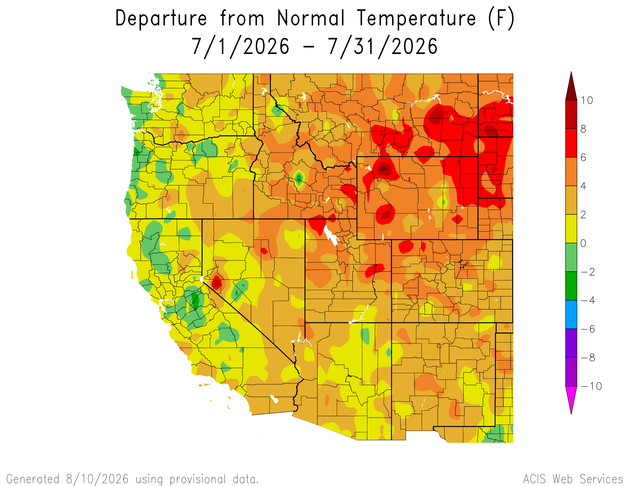
July temperatures were above average (+2-4ºF) for the entire region with much above average temperatures (+4-8ºF) across much of Wyoming, northern Colorado and northeastern Utah. All-time record high temperatures were set at many locations during July, including Provo (105ºF) and Salt Lake City (109ºF) in Utah, and Brighton (105ºF) and Burlington (113ºF) in Colorado. During a July 12-13 heatwave in Wyoming, 17 sites set all-time record high temperatures, including Worland (111ºF), Sheridan (109ºF), Thermopolis (109ºF), Cody (106ºF), Riverton (106ºF), Lander (102ºF), Moran (94ºF) and Yellowstone Lake (88ºF). All-time record high temperatures were also recorded in Laramie (94ºF) and Rock Springs (98°F) during July.
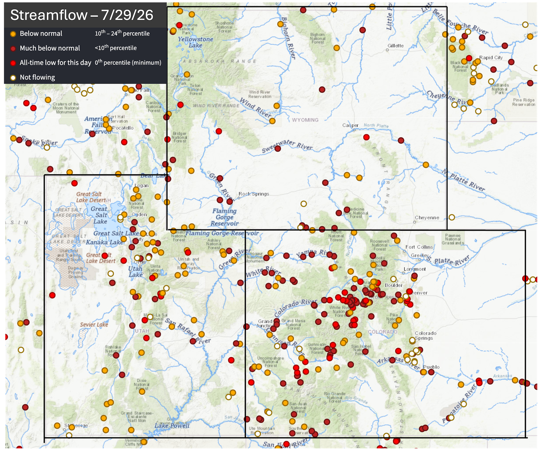
At the end of July, streamflow was below average for most regional rivers, especially in Colorado and Utah. On July 29, record low daily streamflow was recorded at 29 sites in Colorado, ten sites in Utah and four in Wyoming, including the Arkansas, Dolores, Eagle, Roaring Fork, South Platte, Uncompahgre and Yampa Rivers. Streamflow on the western slope of Colorado and along the Arkansas and South Platte Rivers was generally flowing at levels in the lowest 10% of all observations.
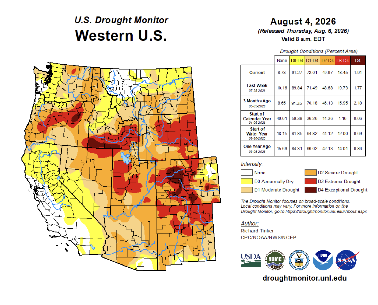
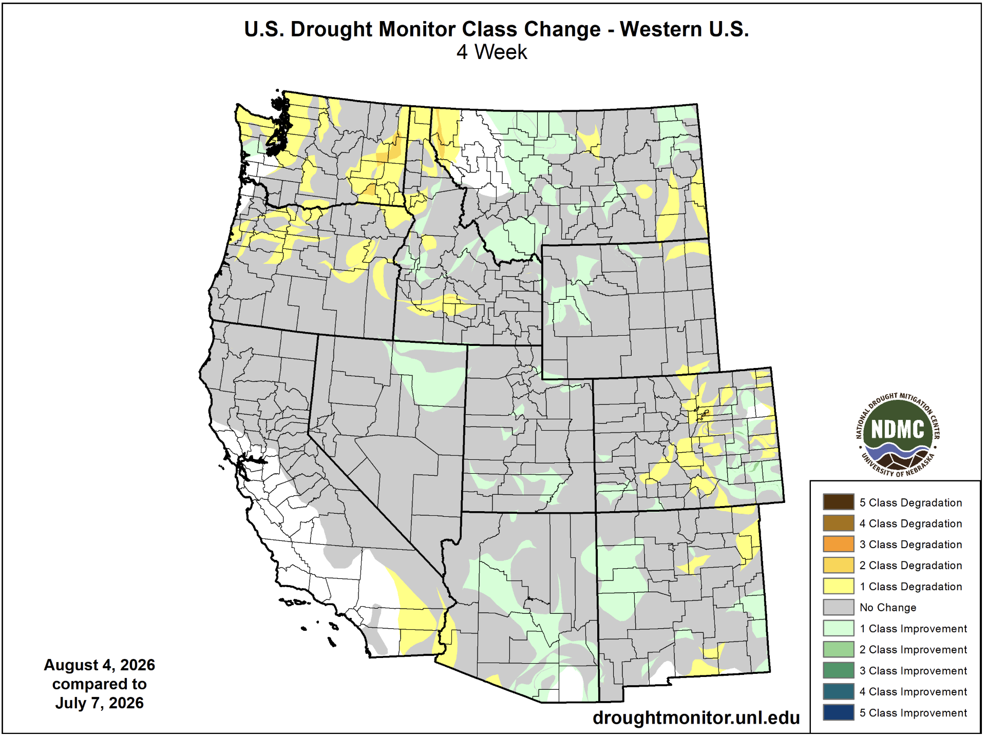
In late July, regional drought coverage remained at 97%. Drought covered the entire region except for a portion of northeastern Colorado where a small area of drought was removed during July. Coverage of exceptional drought conditions in the Colorado River Headwaters expanded in July.
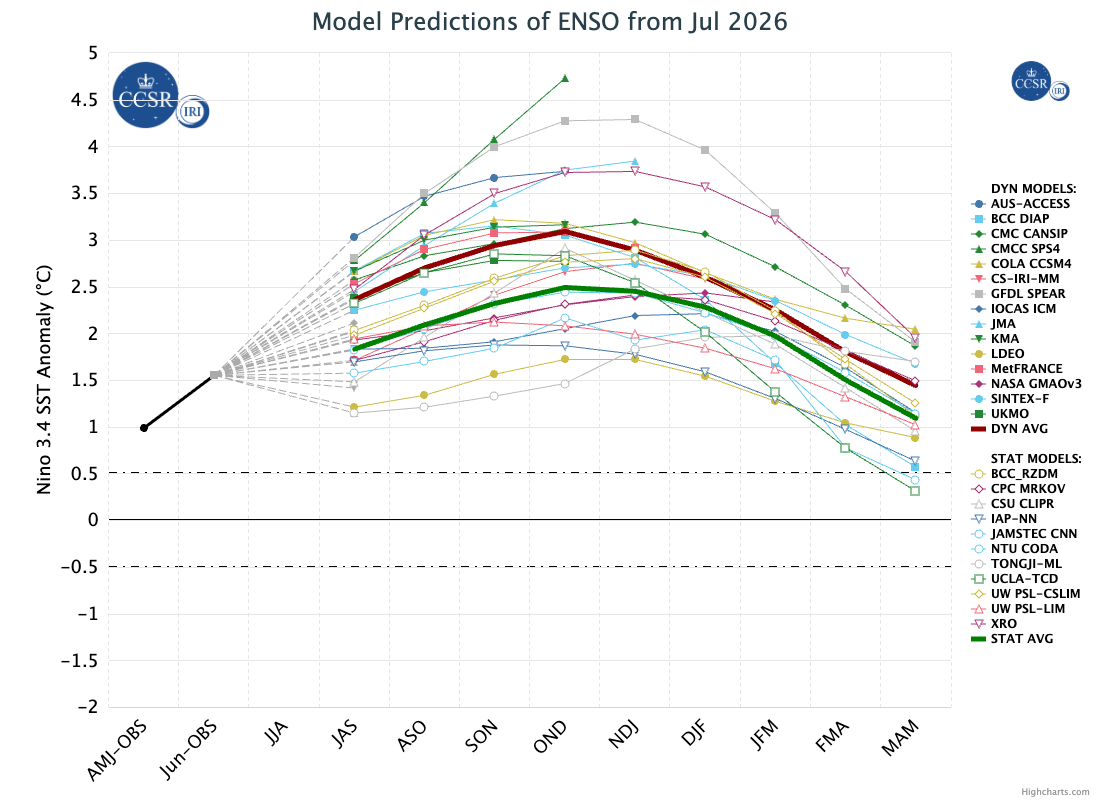
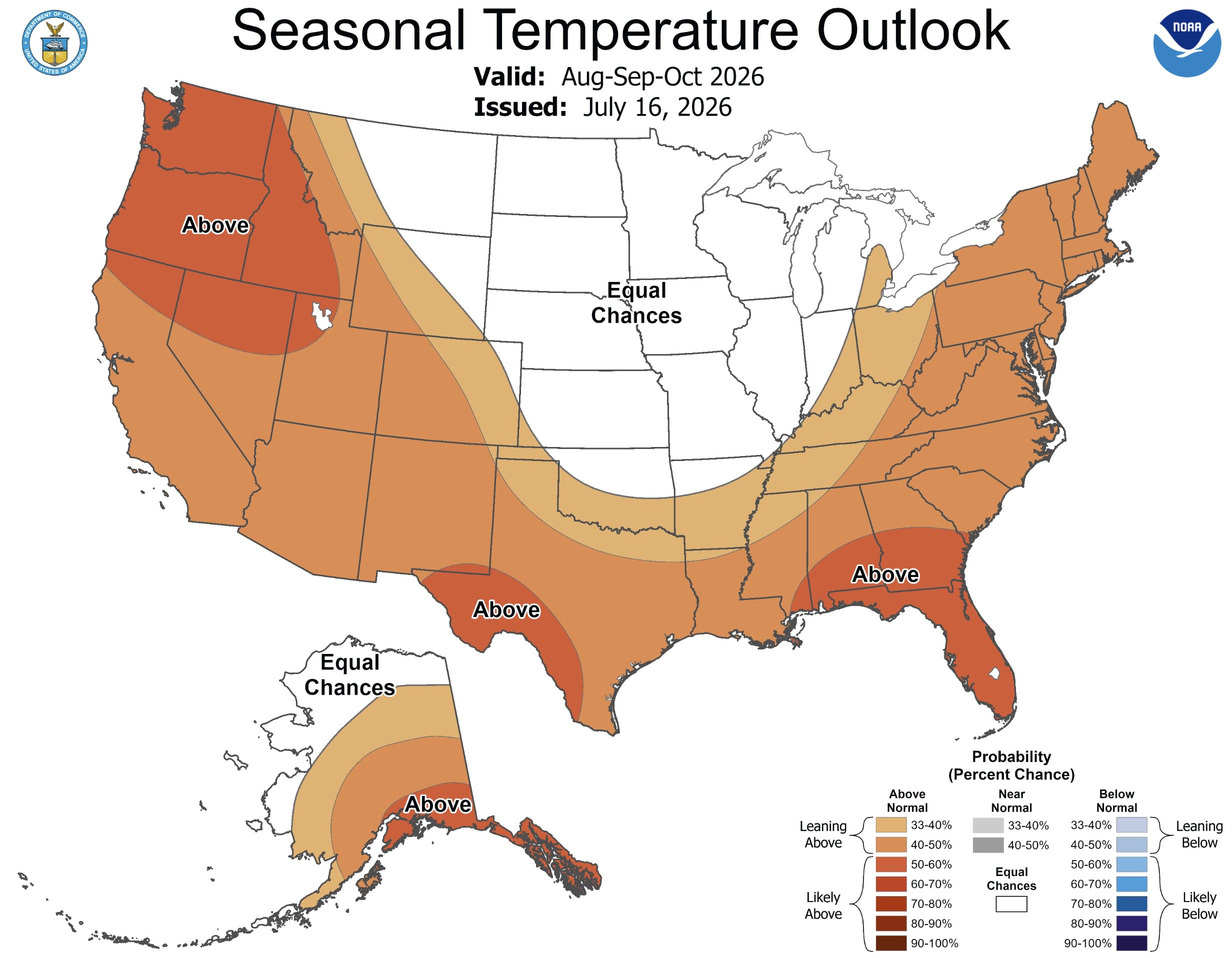
El Niño conditions are present in the eastern Pacific Ocean with ocean temperatures running 1.5ºC above average. Current forecasts of peak Pacific Ocean temperatures of 2.5-3ºC above average indicate the formation of a very strong El Niño during the 2027 water year, an event that could be the strongest on record. There is a 100% probability of El Niño conditions continuing at least through December to February. NOAA seasonal forecasts indicate an increased probability of above average precipitation for the region during August to October, suggesting an active monsoon for the remainder of the season. Notably, the temperature forecast for August indicates equal chances of above or below average regional temperatures, but there is an increased probability for above average temperatures over the August to October period.
Significant weather event: Monsoonal thunderstorms lead to six fatalities in Utah. On July 17, an isolated thunderstorm near Bicknell, Utah caused flash flooding in a narrow canyon and swept a family of five to their deaths. The family from Provo, UT left for hiking and canyoneering in a slot canyon near Sunglow Campground around noon on 7/17. Sadly, bodies of all five family members were found deceased by the following morning. No precipitation from the storm was recorded at nearby weather stations in Loa, Torrey and Capitol Reef National Park.
On July 18, a 59-year-old man was killed by lightning while hiking in the Wasatch Mountains. The man and his brother were hiking along the exposed ridgeline of American Fork Twin Peaks near Snowbird Ski Area when the localized thunderstorm struck. The storm was very small, producing no rain at nearby sites and three lightning strikes were recorded in the vicinity during that hour.
The Cottonwood Fire burned 97,000 acres during June and July in the Tushar Mountains east of Beaver, Utah. On 7/20, nearly 1.6” of rain fell near Eagle Pointe Ski Area in upper portions of the Beaver River watershed. The ensuing debris flow flood severely damaged five miles of SR 153 which connects Beaver to Eagle Pointe ski area, damaged 80-200 homes and contaminated drinking water for Beaver and four rural communities. Residents from the Grove neighborhood in Beaver were evacuated and suffered the greatest residential home damage.

Flash flooding in Bicknell, Utah. Credit: Matthew Johnson/KSL News.