September 3, 2025 - CO, UT, WY
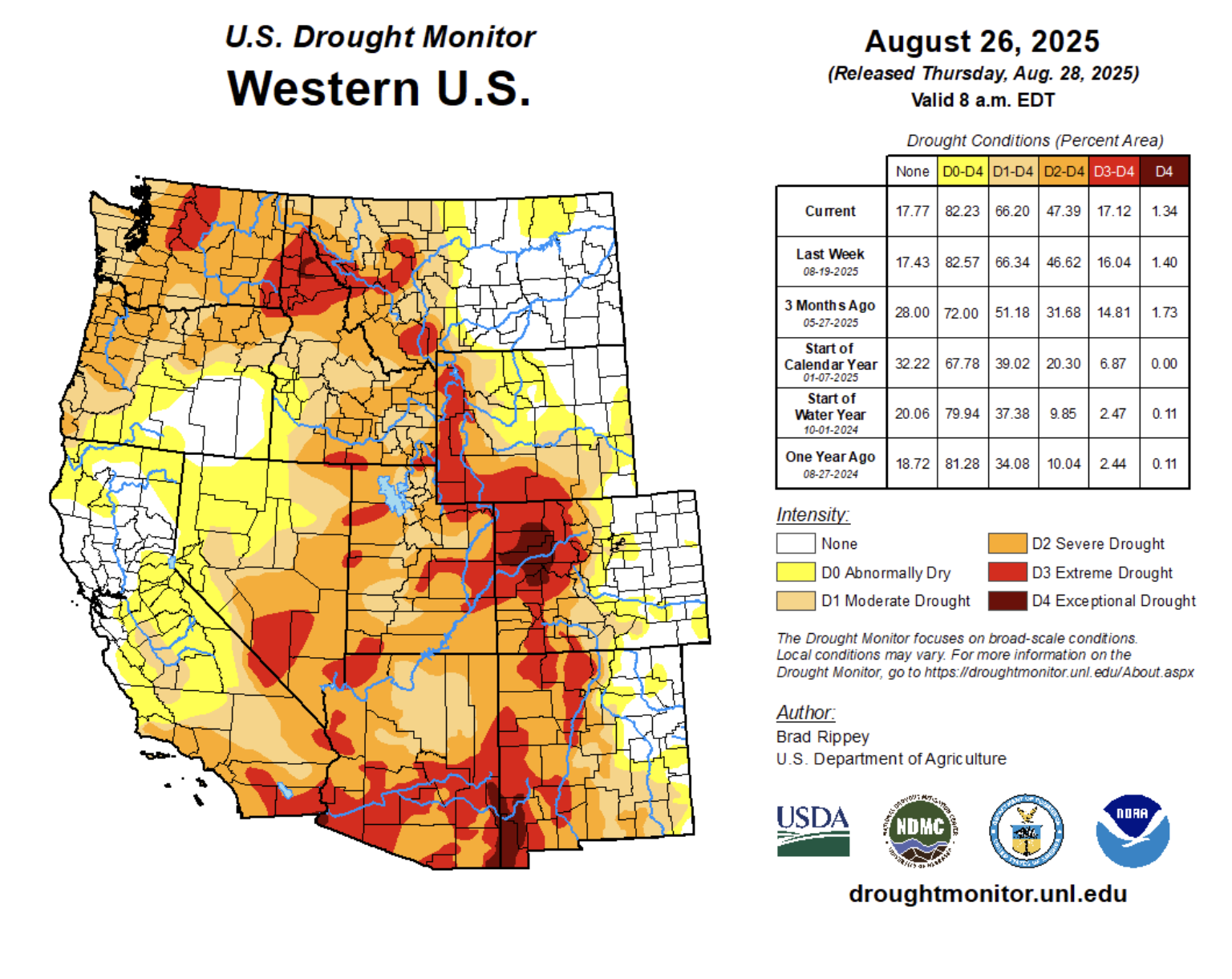
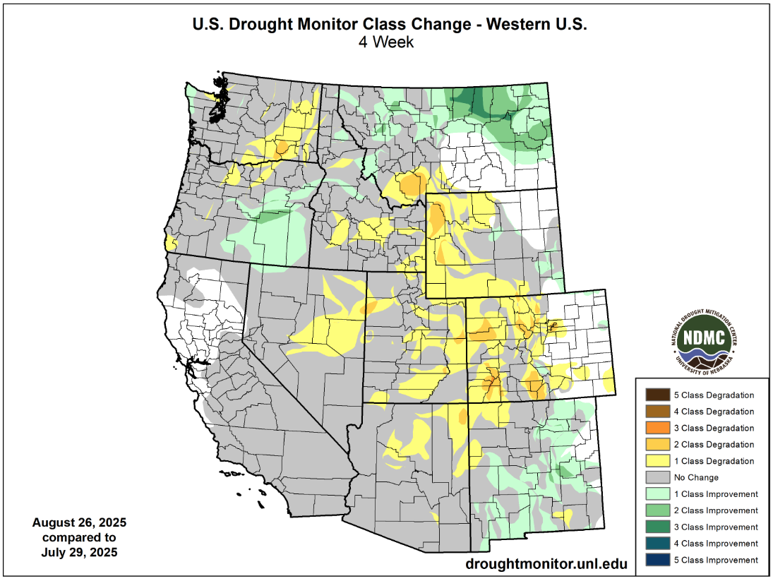
Regional drought conditions expanded and worsened, especially near the Colorado-Utah border and western Wyoming, where extreme (D3) drought conditions now cover 23% of the region. The development of exceptional (D4) drought conditions contributed to the ignition and explosive growth of the 138,844-acre Lee Fire near Meeker, Colorado. Despite the degradation of drought conditions, portions of northern Utah, eastern Colorado and Wyoming received near to much above average August precipitation, and regional temperatures were generally above average with only a few isolated locations of record heat.
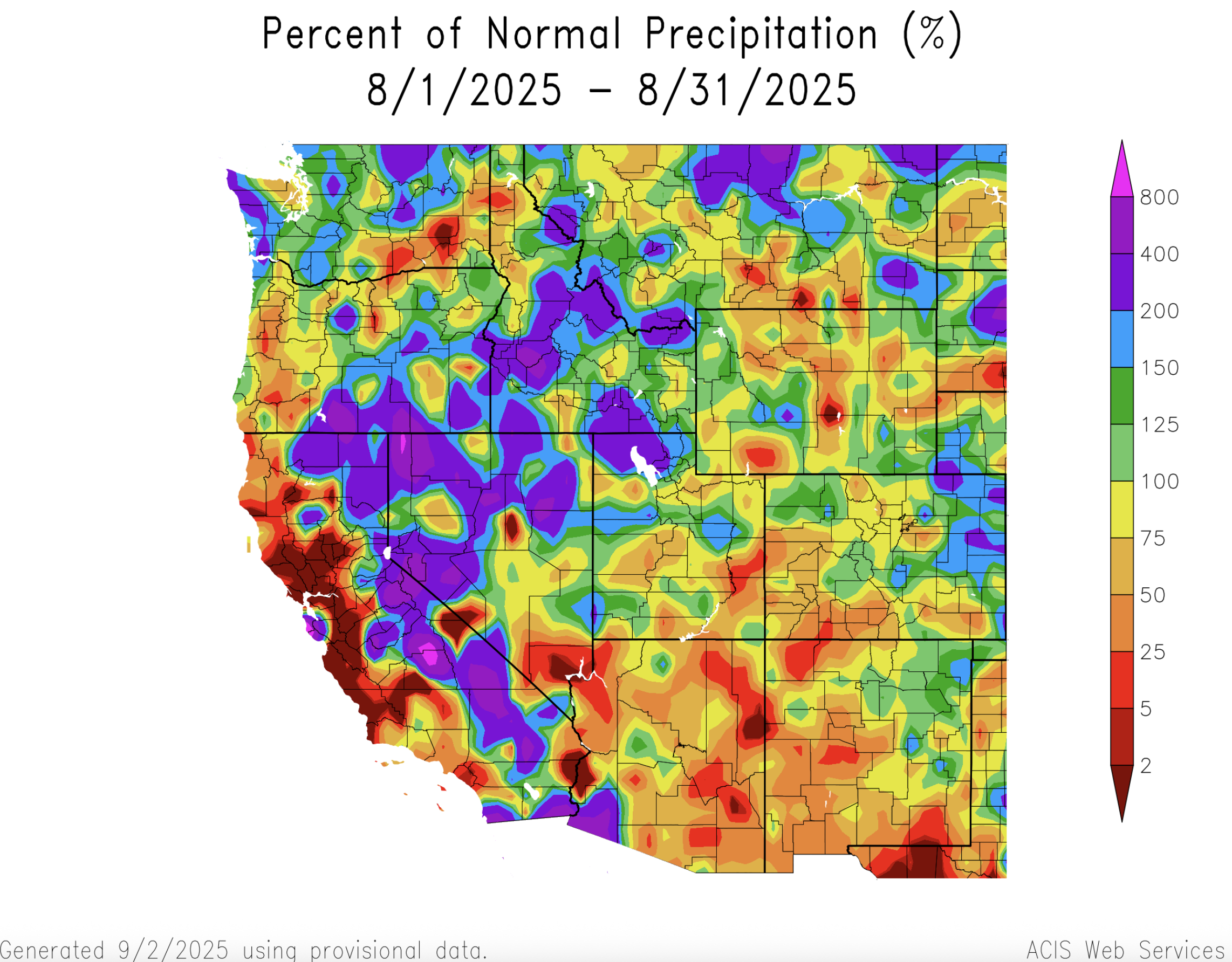
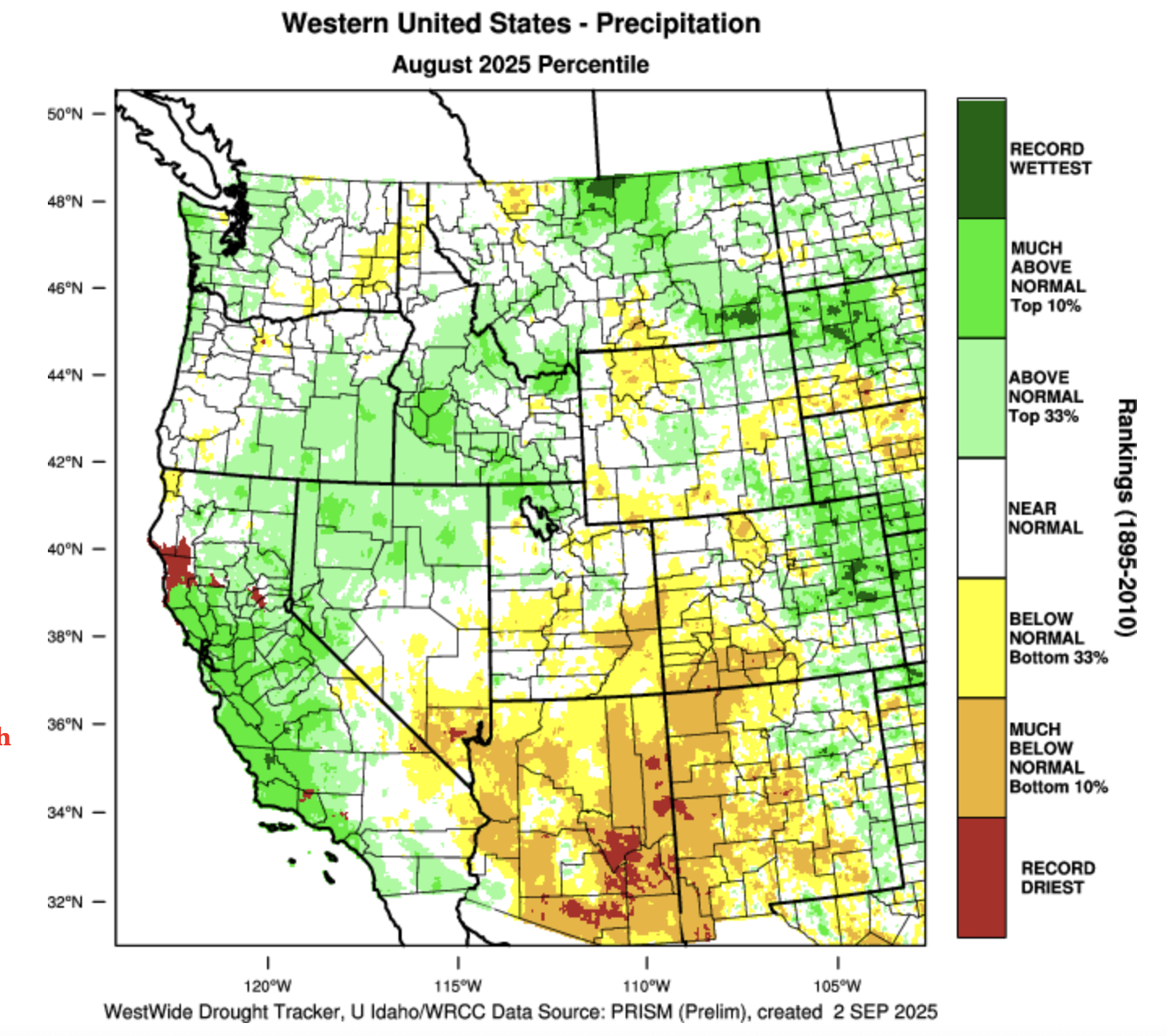
After an extremely dry July, August was somewhat wetter with monthly precipitation near to above average for many regional locations. Portions of eastern Colorado and northern Utah received greater than 150% of average August precipitation while portions of Wyoming received up to 150% of average August rainfall. The Four Corners region of Colorado and Utah remained dry with August precipitation at less than 75% of average.
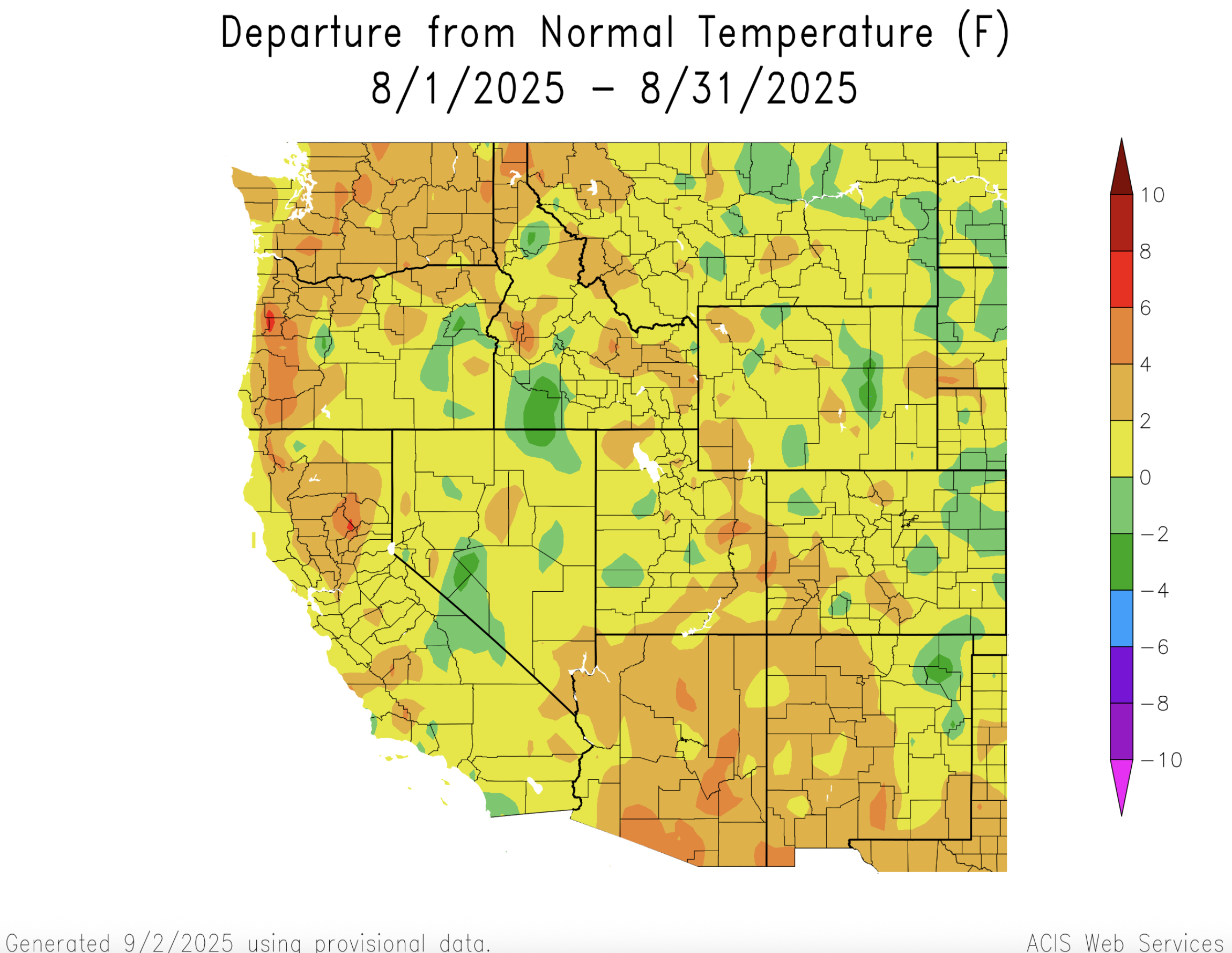
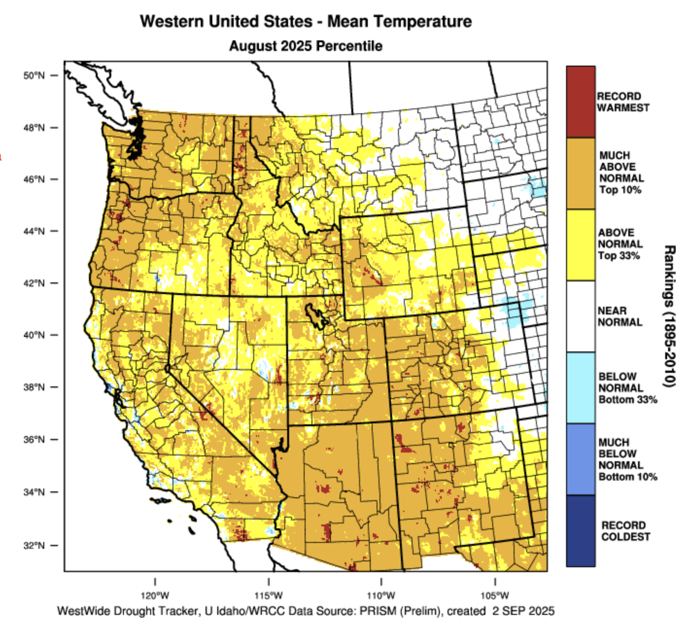
August temperatures were generally warmer than average with large parts of the region observing temperatures up to two degrees (F) above average. Southwestern Colorado and southern and eastern Utah experienced temperatures that were up to four degrees above average. Isolated locations in western Colorado and southern Utah observed the hottest August temperatures on record. Scattered locations across all three states observed slightly cooler than average August temperatures.
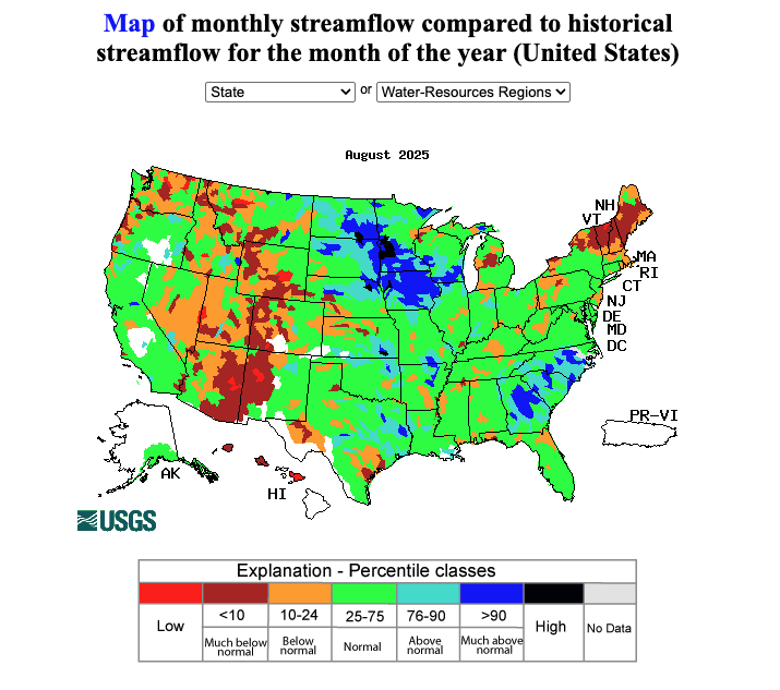
Monthly streamflow conditions were below to much below normal across large parts of the region during August. Most river basins in Colorado and Utah experienced below to much below average streamflow for August, with record-low monthly streamflow observed in the Piedra River and at four streamflow gauges on the White River. Streamflow conditions were slightly better in Wyoming, but record-low monthly streamflow was also recorded along the Gardiner, Upper Green, and Wind Rivers.
Drought conditions worsened in Colorado, Utah and Wyoming west of the Continental Divide while drought is mostly absent east of the Divide. Overall coverage of drought expanded to cover 67% of the region (up from 62% on 7/29); the entirety of Utah remains in drought, and drought coverage expanded in both Colorado and Wyoming. The headline drought story during August was the expansion of extreme (D3) drought conditions in western Colorado, eastern Utah and western Wyoming, and the emergence of exceptional (D4) drought in western Colorado. Portions of western Colorado and western Wyoming observed a two-category degradation of drought conditions during August.
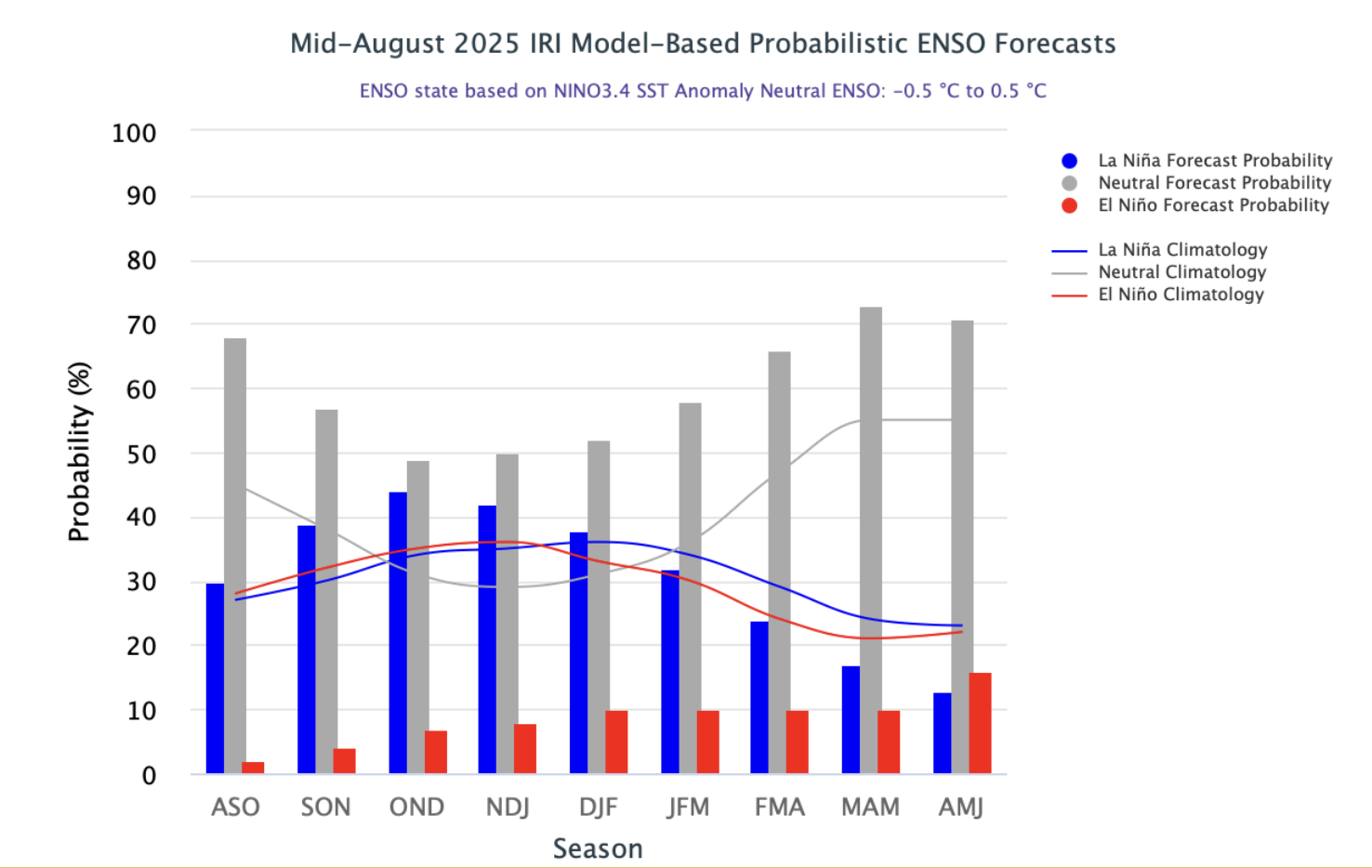
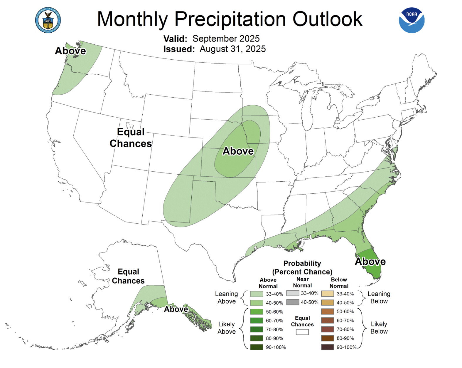
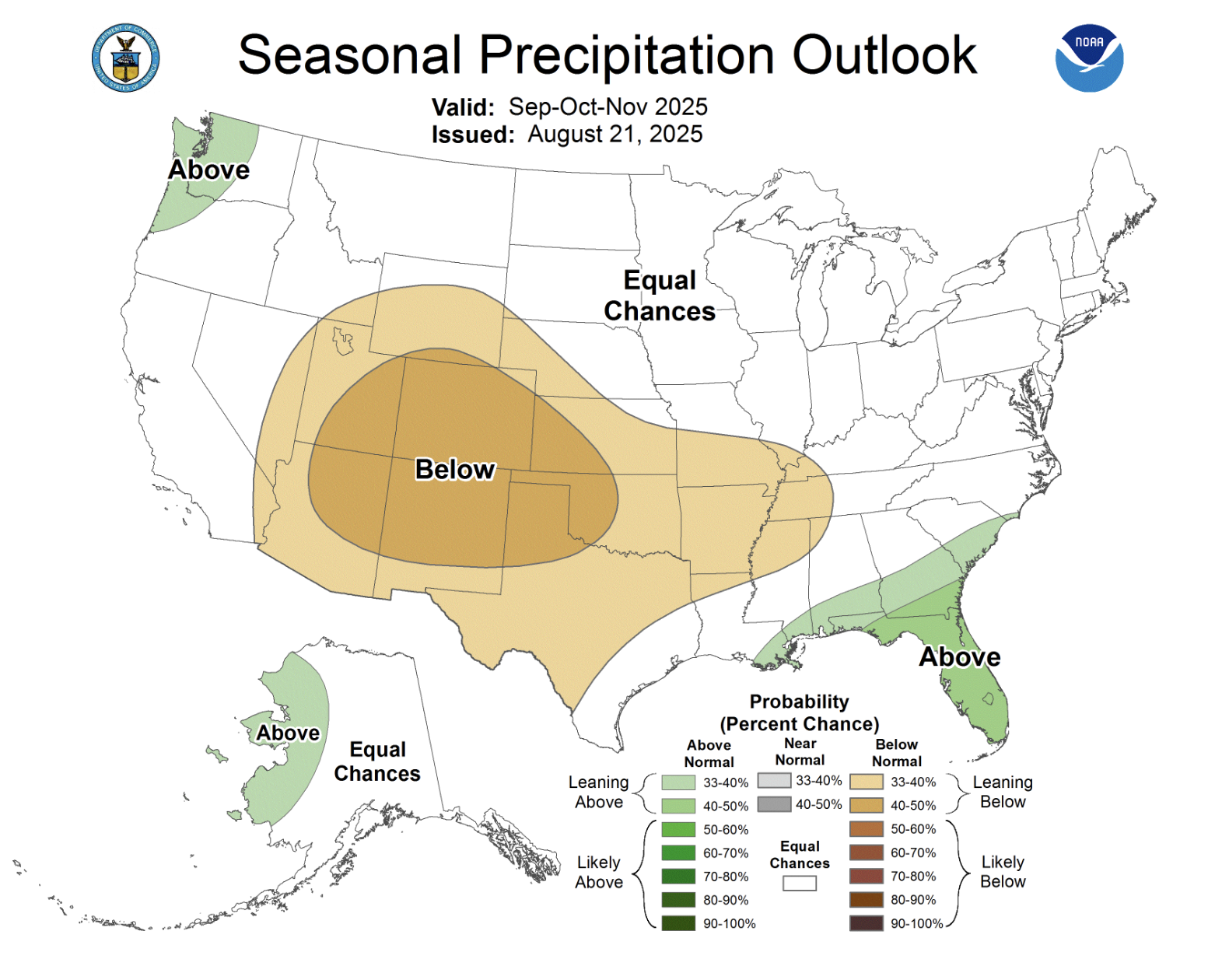
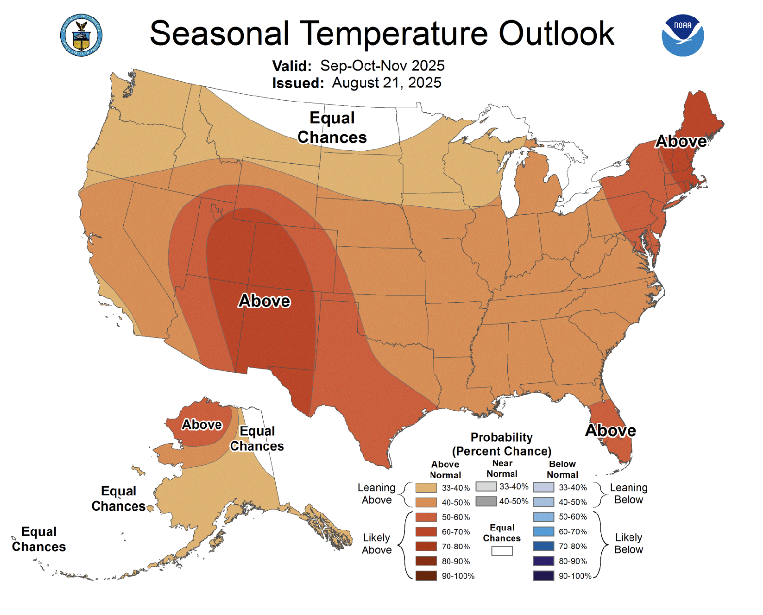
Current eastern Pacific Ocean temperatures are near average, and ENSO remains in a neutral condition. ENSO-neutral conditions are the most likely outcome for the beginning of the 2026 water year and through winter 2026. The probability of La Niña conditions increases to 40% in late fall to early winter, but the probability of La Niña decreases for the remainder of winter 2026. The NOAA Monthly Precipitation Outlook suggests equal chances for above or below average precipitation for September except in southeastern Colorado where there is an increased probability of above average precipitation. The NOAA Seasonal Outlooks for September-November suggest and increased probability of below average precipitation and above average temperatures for the entire region.
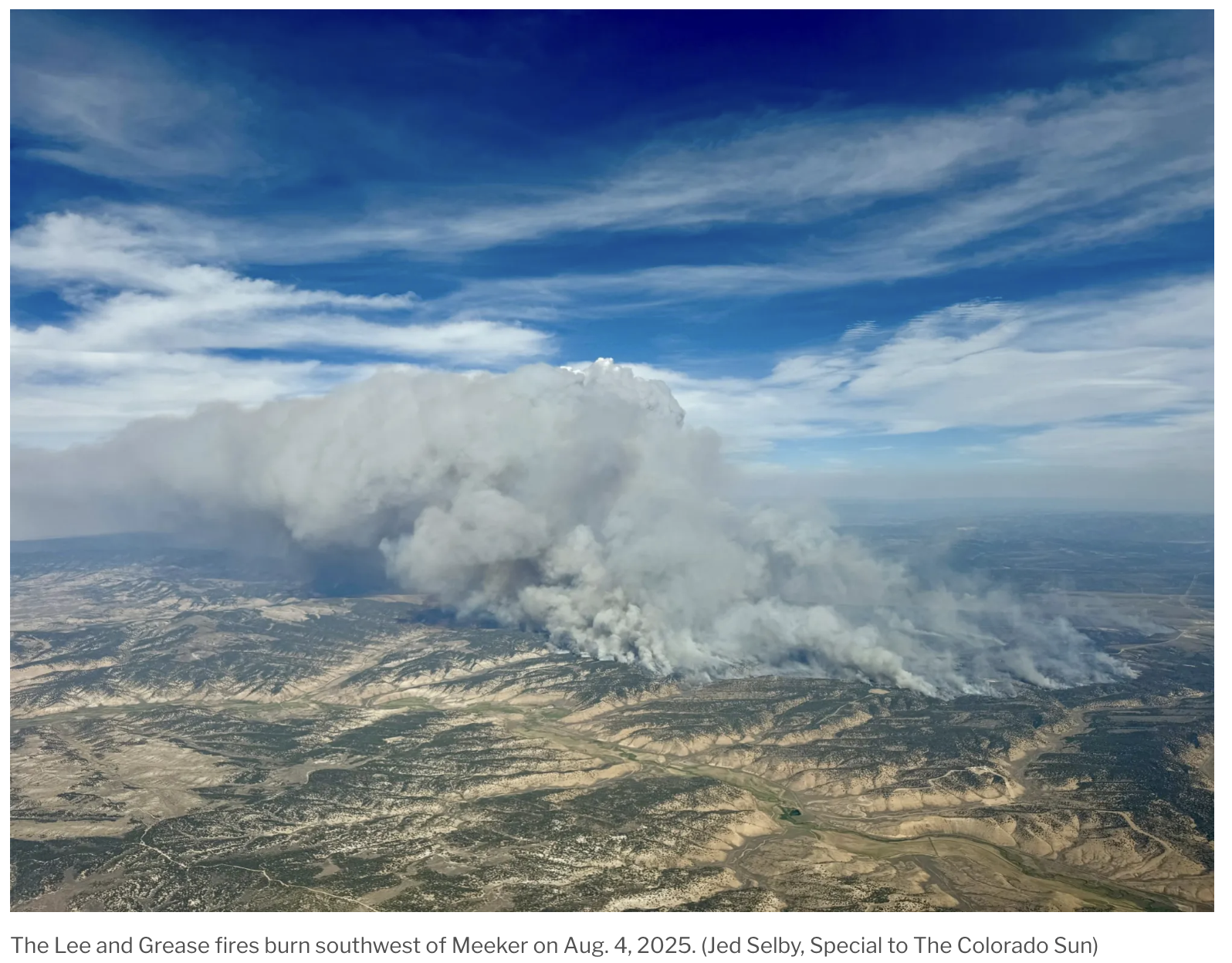
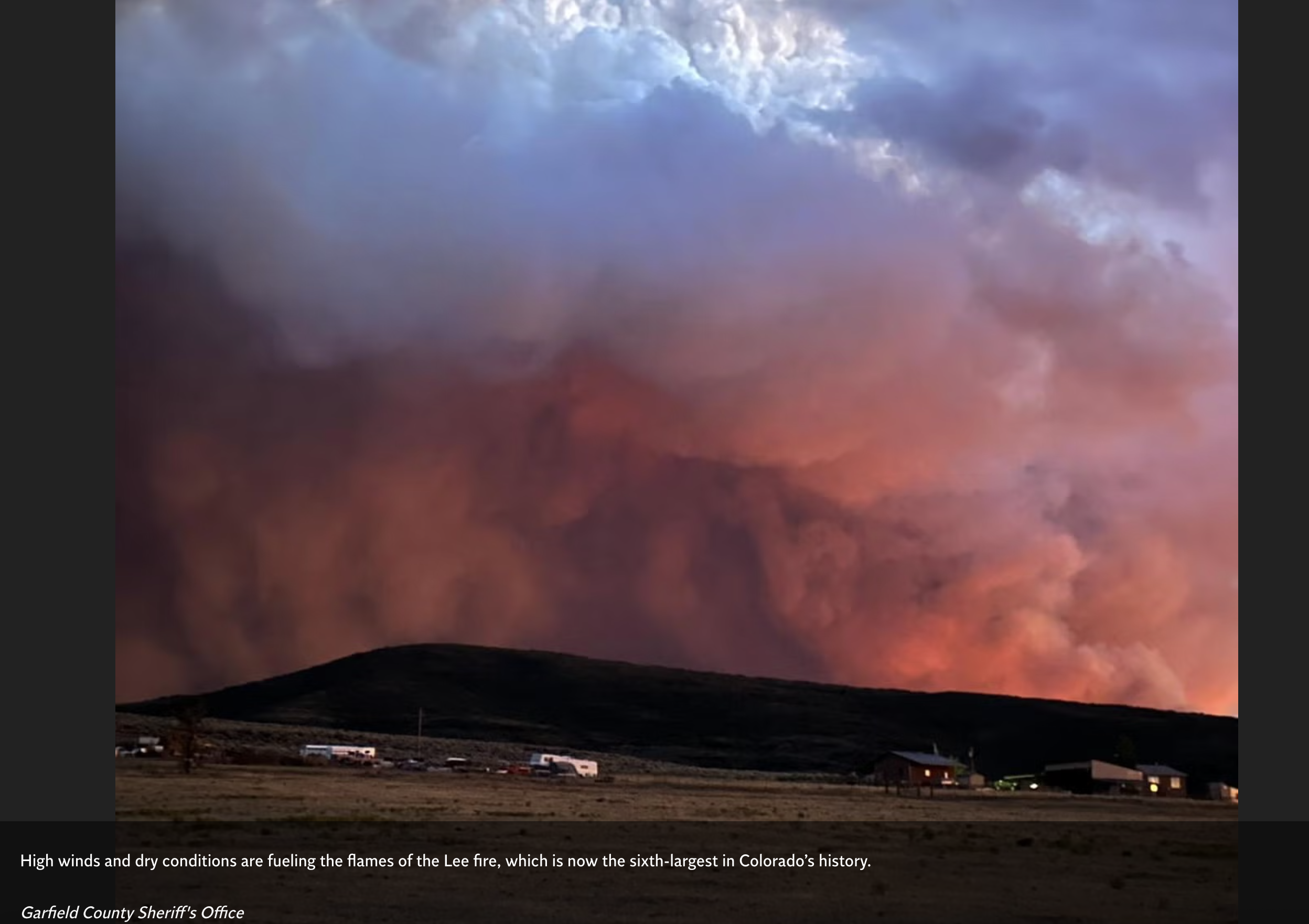
Significant weather event: Extreme wet and dry conditions straddle the Continental Divide in Colorado. On the west side of the Divide, the emergence of exceptional drought conditions fueled the rapid growth of the 139,000-acre Lee Fire near Meeker, Colorado while extreme rainfall in Denver broke a daily record on August 10 with nearly 1.5” of rain and dropped nearly 3” in Limon. The Lee Fire ignited on August 2 from a lightning strike, experienced explosive growth and grew to 138,844 acres, making it the fifth largest wildfire in state history and the largest since the record-breaking 2020 fire season. As of September 3, the fire was 99% contained after burning three homes and 12 outbuildings. On the west side of the Divide, thunderstorms on August 10 brought extreme rainfall to the Denver area with 1.43” of rain at the Denver International Airport, breaking a 32-year-old record. A long-standing rainfall record was also broken in Limon with 1.34” and another site in Limon reported 2.95” of precipitation.