October 8, 2026 - CO, UT, WY
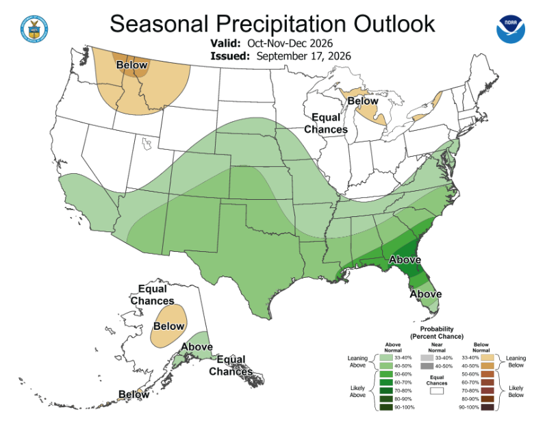
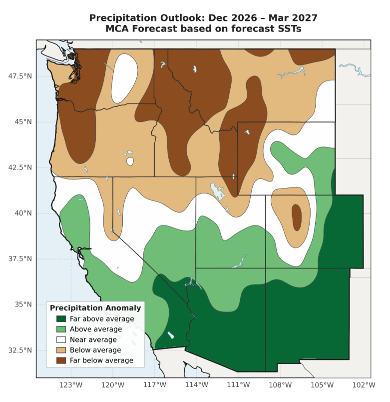
Above average precipitation during September improved drought conditions for parts of Colorado, Utah and Wyoming. Temperatures were three to six degrees above average for much of the region and September temperatures were among the ten warmest for Colorado (2nd), Utah (7th) and Wyoming (6th). Regional reservoir storage decreased from one year ago with conditions most dire in Colorado (reservoirs at 37% capacity) and two of the Upper Colorado Basin’s largest reservoirs, Blue Mesa and Lake Powell. A strong El Niño is in progress as Pacific Ocean temperatures were 2.5ºC above average in July-September. Seasonal forecasts suggest an increased probability of above average precipitation for southern Utah, much of Colorado and southeastern Wyoming and below average precipitation for northern Utah and western Wyoming.
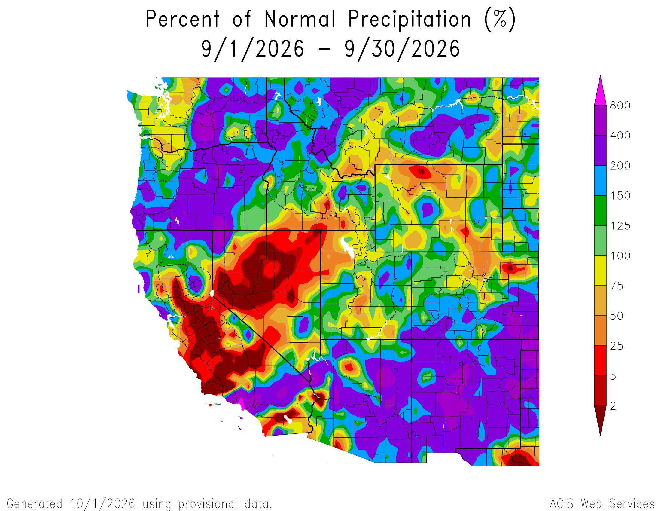
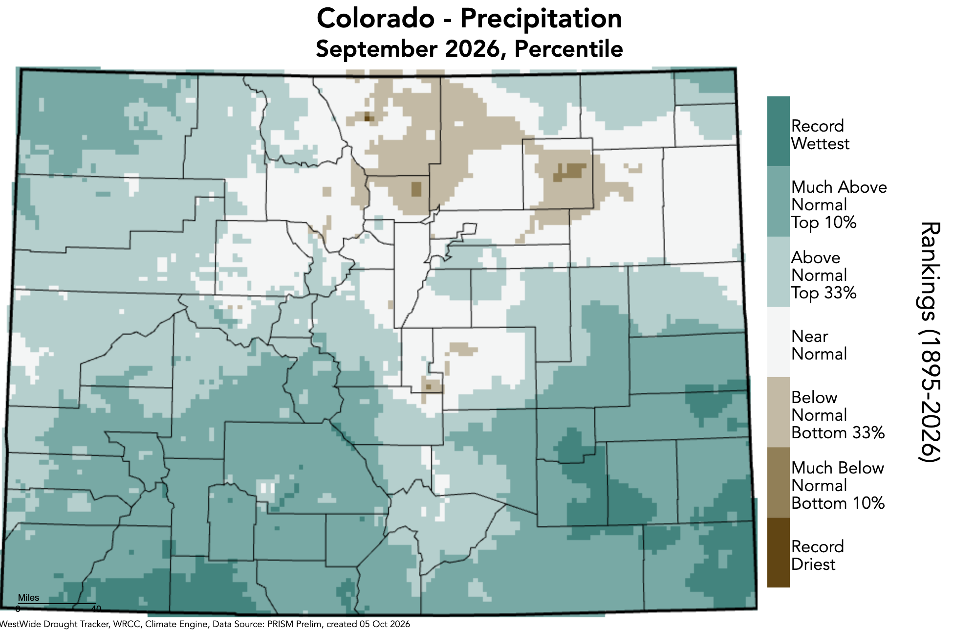
September was relatively wet across the region as precipitation was above average across a broad swath of Colorado, Utah and Wyoming. Portions of northern Colorado, central and northwestern Utah and northern Wyoming received less than 75% of average September precipitation. Record wet conditions were observed in the southwestern Colorado towns of Cortez and Fort Lewis and in southeastern Colorado at La Junta, Rocky Ford and Walsh.
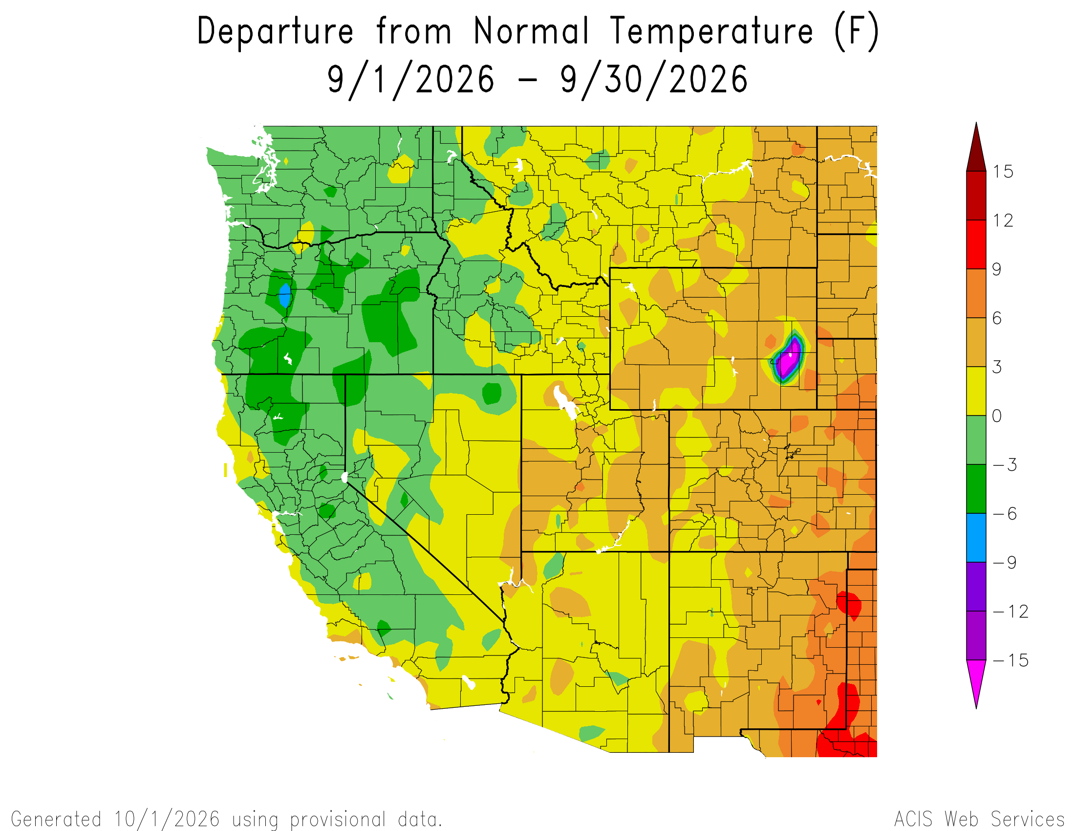
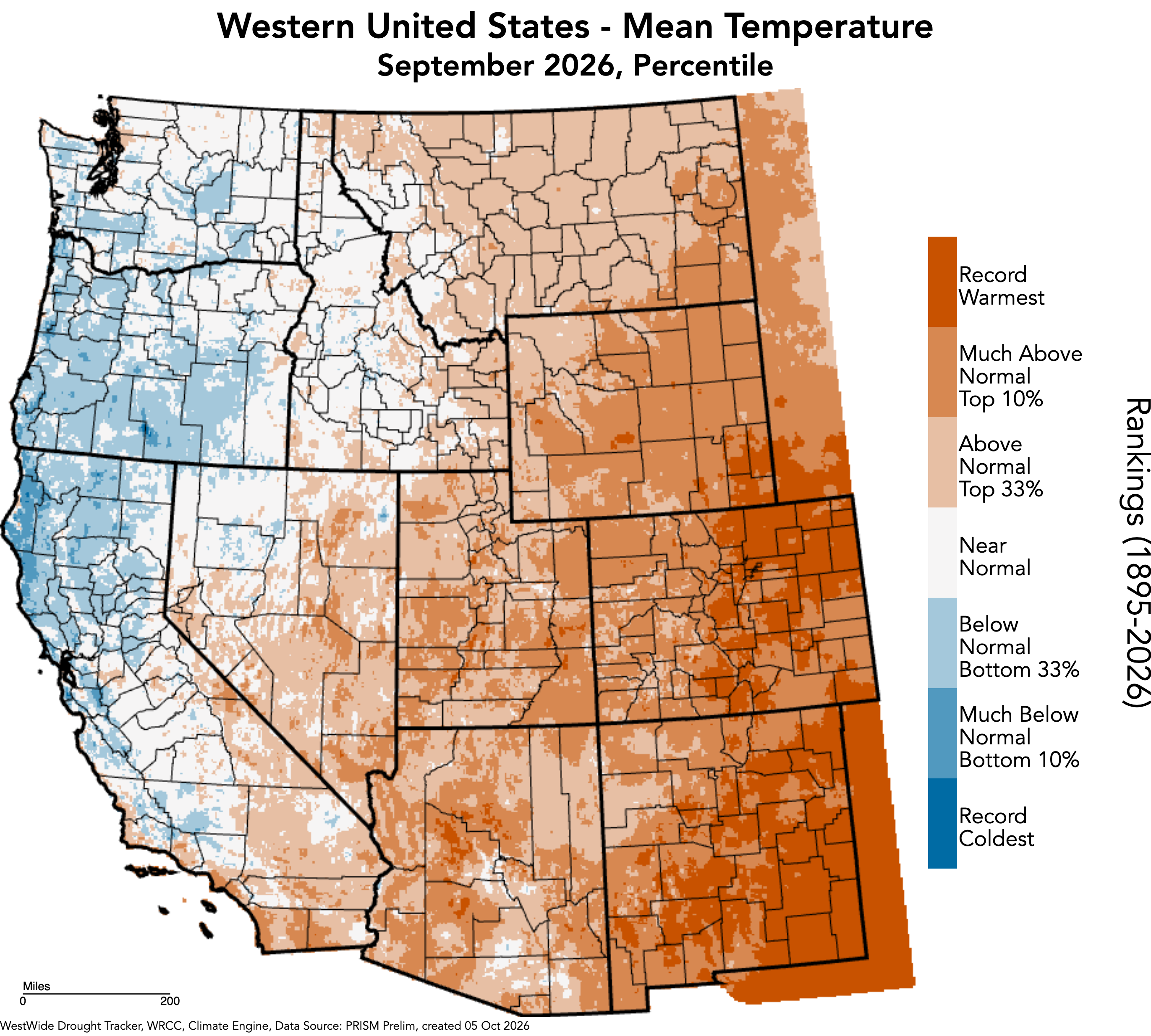
Temperatures were above average during September with portions of Utah and most of Colorado and Wyoming running three to six degrees above average. Record hot temperatures were observed at 25 locations in central and eastern Colorado, including Akron, Denver, Estes Park, Fort Collins, Greeley and Limon. Colorado experienced its second warmest September on record while Utah and Wyoming temperatures ranked among the ten warmest Septembers on record.
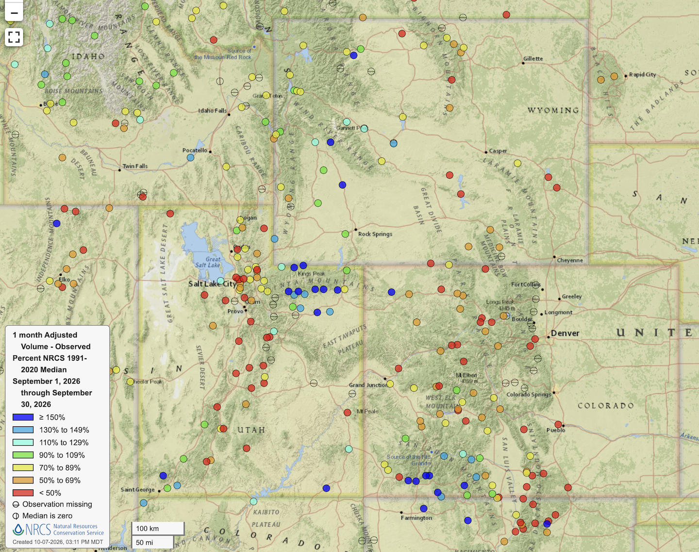
Regional streamflow during September reflected both long-term drought conditions and above average precipitation that fell across some of the region. September streamflow volume was less than 70% of median for large areas of Colorado, Utah and eastern Wyoming. Greater than 130% of median streamflow volume was observed in the Virgin River basin, rivers flowing out of the Uinta Mountains in Utah, rivers flowing from the San Juan Mountains in Colorado and in the Upper Green River basin.
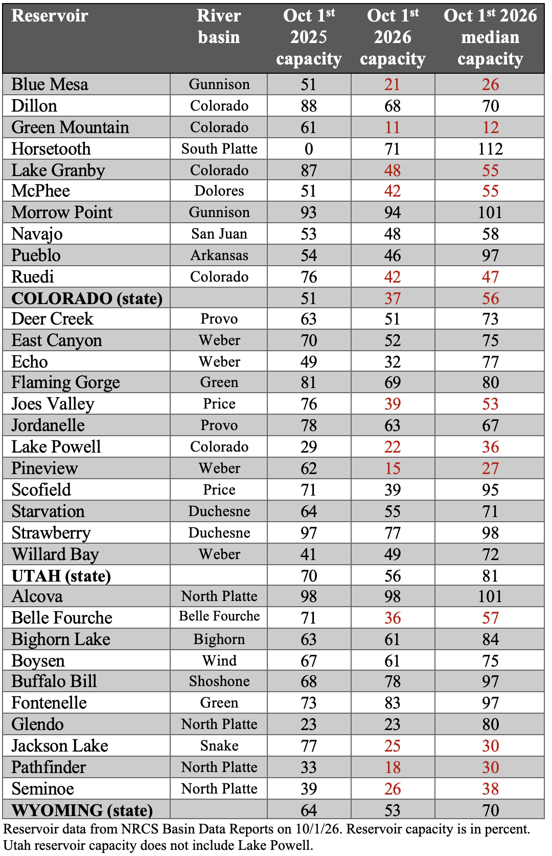
Storage in most regional reservoirs decreased relative to storage one year ago. On a statewide basis, Colorado’s reservoirs are at 37% of capacity, Utah’s at 56% and Wyoming at 53% of capacity. Of large reservoirs, Blue Mesa and Lake Powell are lowest at 26% and 22% of capacity. A record wet September in parts of the San Juan River basin increased storage in Navajo Reservoir by 60,000 acre-feet (af) and in Lake Powell by 130,000 af. Interestingly, the 2.4-foot increase in Lake Powell elevation during September was greater than the 1.9-foot increase in Lake Powell elevation due to 2026 snowmelt runoff.
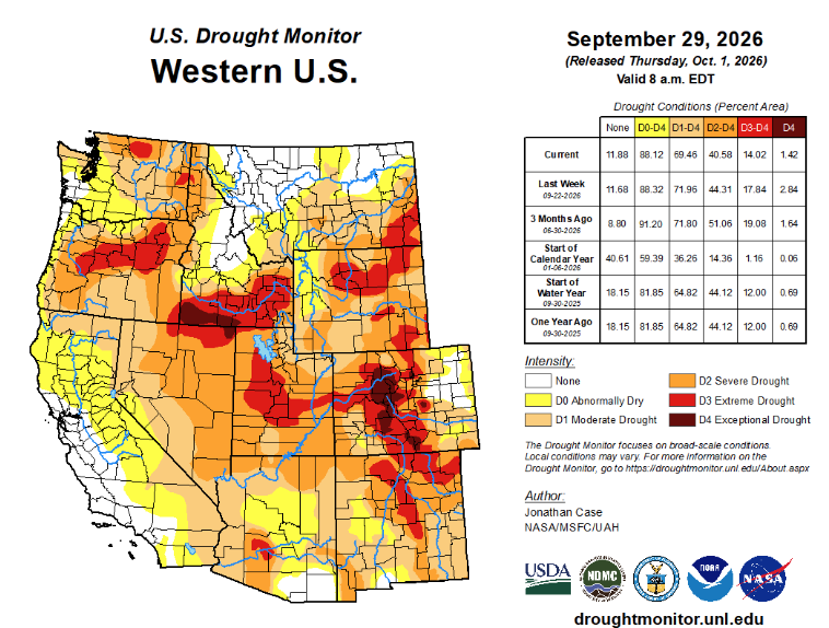
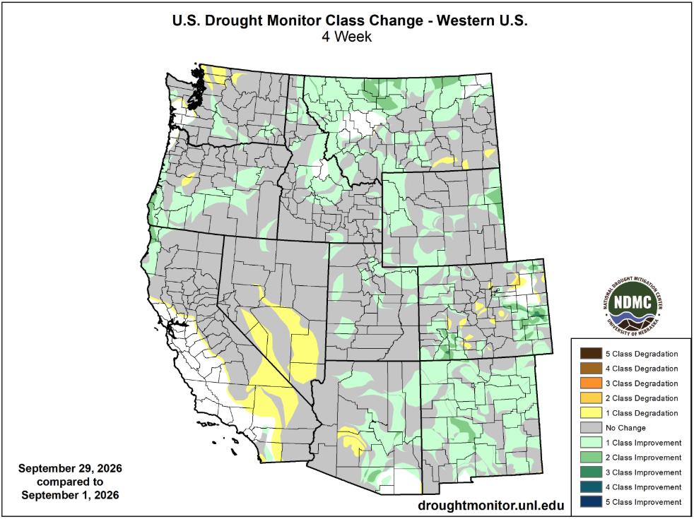
Regional drought extent decreased from 96% coverage of Colorado, Utah and Wyoming to 90% coverage during September. September rainfall removed drought from a small portion of southwestern and southeastern Colorado and northwestern Wyoming. In eastern Colorado, drought conditions improved by one to three categories of drought during September. Coverage of extreme and exceptional drought conditions also decreased across all three states during September.
A strong El Niño event is occurring and July-September sea surface temperatures (SST) in the eastern Pacific (Niño3.4) were 2.5ºC above average, already making the event one of the warmest on record. It is very likely that strong El Niño conditions (SST >2ºC above average) continue through early winter and El Niño conditions continue through early summer. Impacts from the strong El Niño are already being felt; Kelvin waves, caused by a switch of trade wind direction caused by strong El Niños, are causing sea level rise of 6 to 18 inches from Peru up the Pacific coast to southern California and down the coast to Chile.
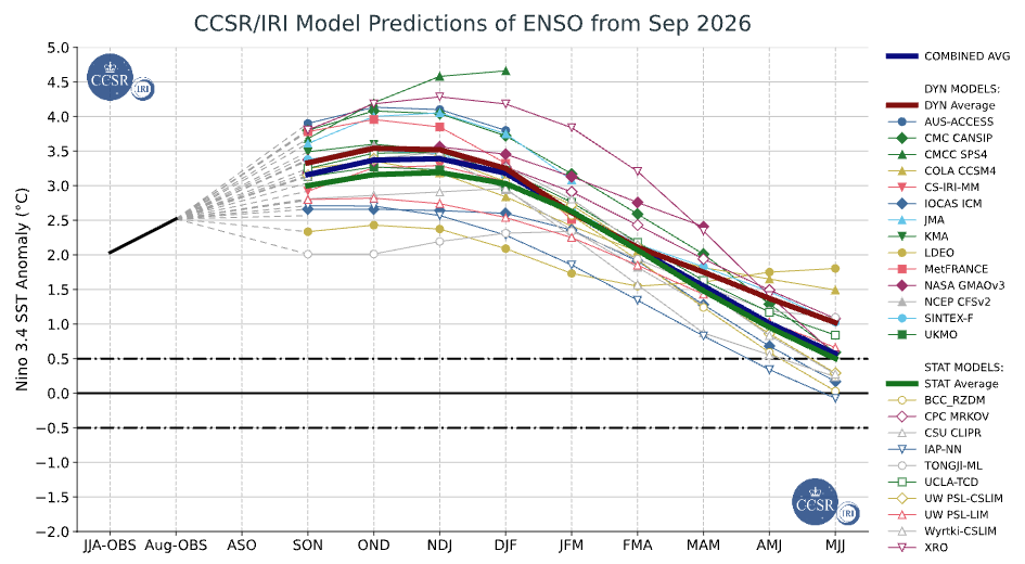
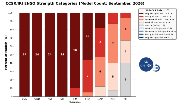
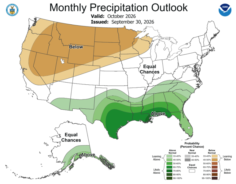
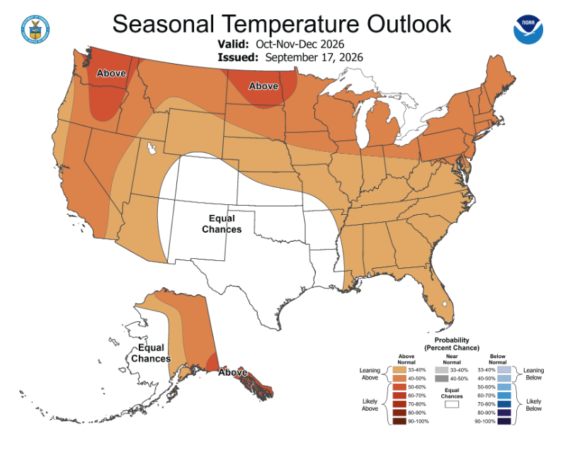
Seasonal forecasts for precipitation and temperature in 2026-2027 are strongly influenced by strong El Niño conditions. NOAA seasonal forecasts for precipitation suggest and increased probability for below average precipitation in October for Utah, Wyoming and northwestern Colorado and suggest an increased probability of above average precipitation in October to December for Colorado, southeastern Utah and southeastern Wyoming. Correspondingly, NOAA seasonal forecasts indicate an increase probability of above average temperatures in October through December for Utah and Wyoming. A new experimental winter precipitation forecast that uses both Pacific and Atlantic Ocean temperatures to forecasts December through March precipitation suggests below average winter precipitation in northern Utah and western Wyoming. Above average winter precipitation is forecasted for southern Utah, southeastern Wyoming and a large portion of Colorado.