November 10, 2025 - CO, UT, WY
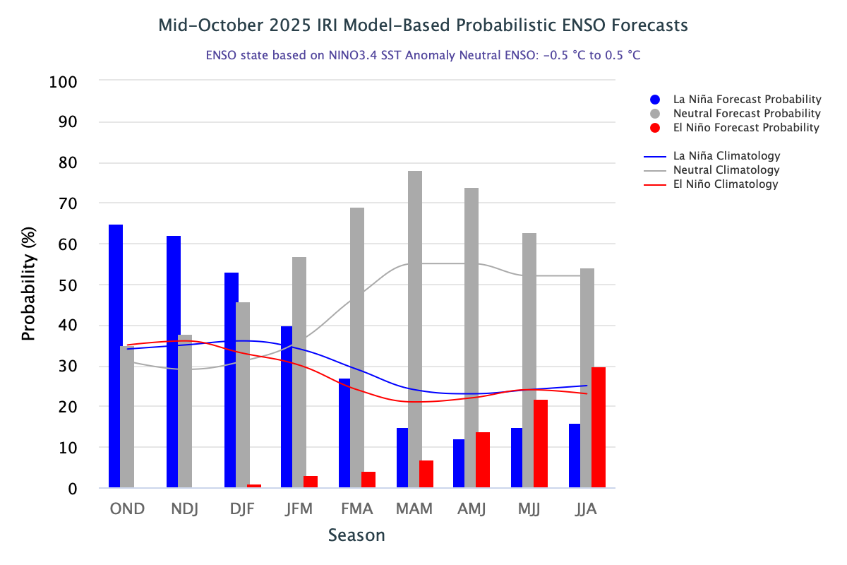
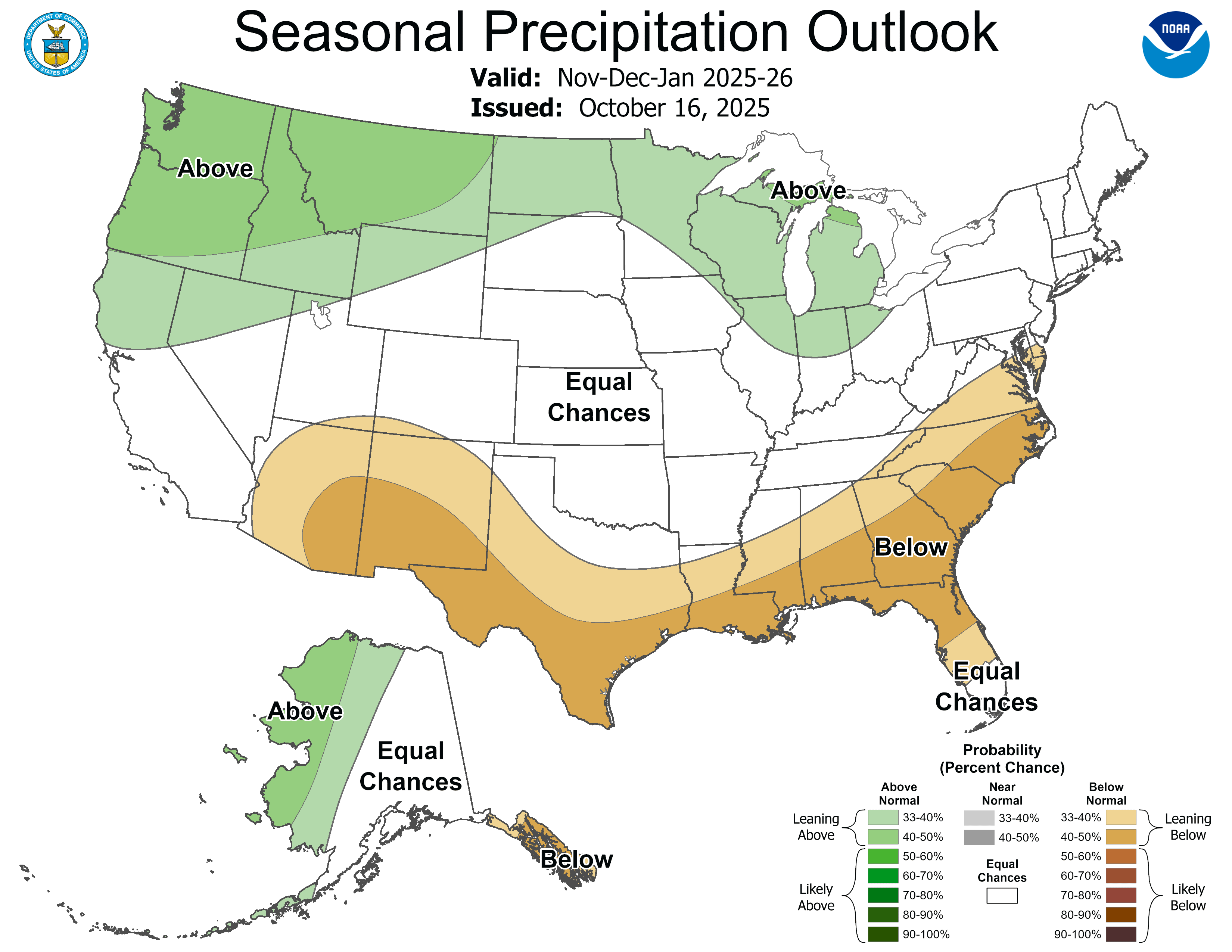
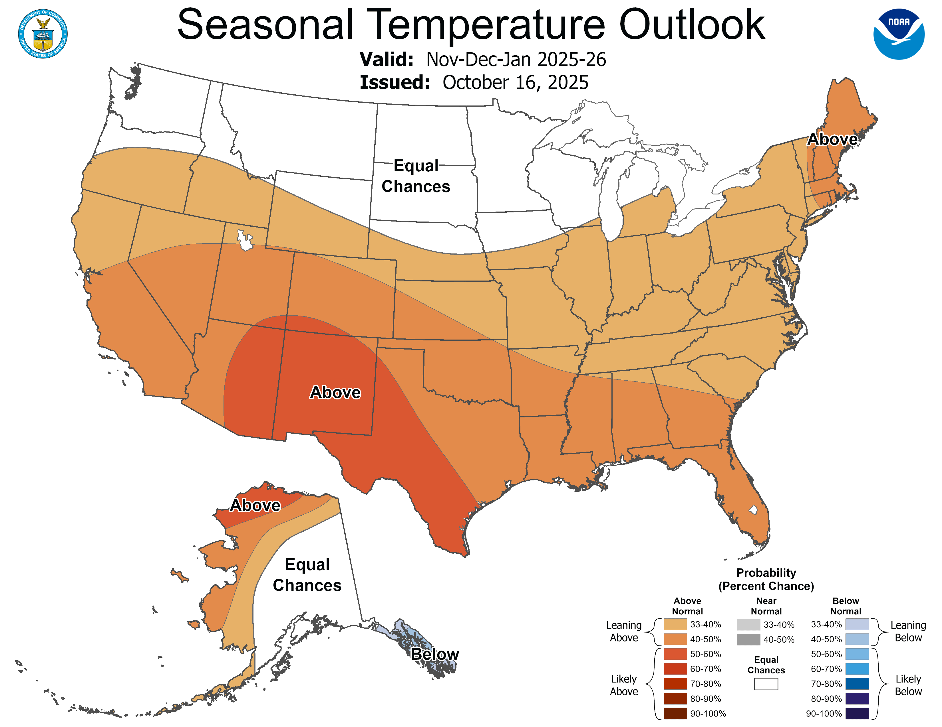
Much of the region received above average October precipitation, except for eastern Colorado and southeastern Wyoming where below average precipitation fell. October temperatures were near to above normal throughout the region. Regional snow-water equivalent (SWE) was variable, with statewide SWE levels at 0.3 inches in Colorado, 0.3 inches in Utah, and 0.9 inches in Wyoming as of November 1. By the end of October, regional drought coverage was 51%, a 10% improvement since the end of September. Streamflow conditions were generally near normal in Colorado and Wyoming, and below normal in Utah, with the highest streamflow conditions seen in southwestern Colorado. La Niña conditions continued during October and will likely shift to ENSO-neutral conditions by late winter. The NOAA seasonal outlook for November-January suggests an increased probability of above average precipitation for northern Wyoming, and above average temperatures in Colorado, Utah, and southern Wyoming.
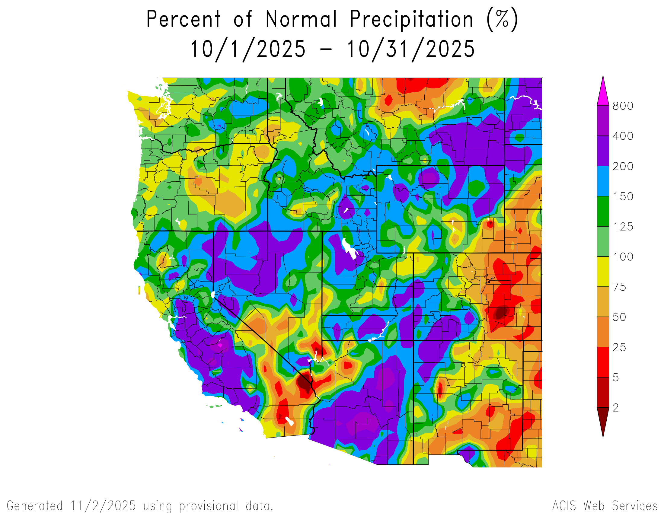
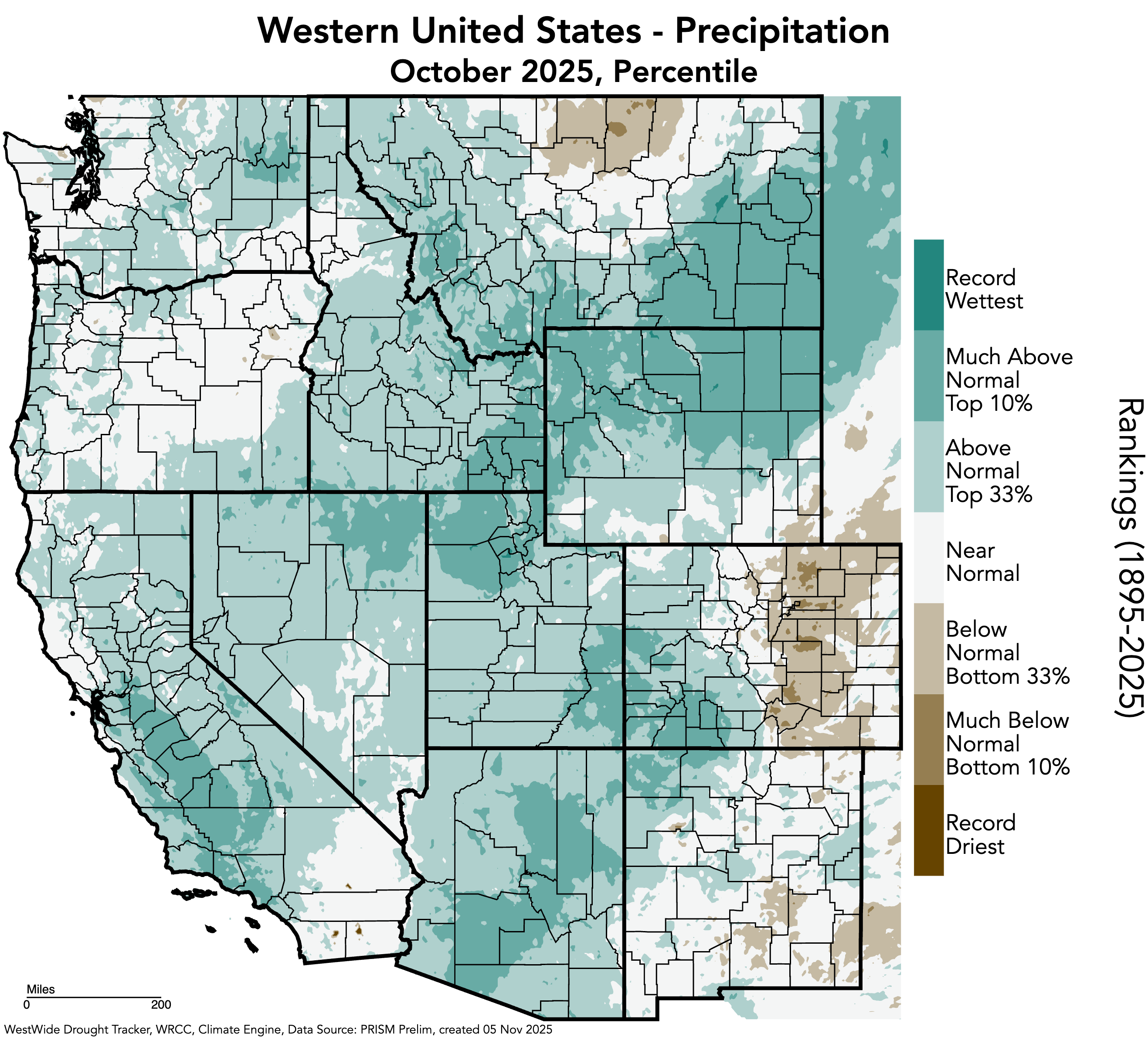
Utah, most of Wyoming, and western Colorado received above to much above average precipitation during October. Large areas of the region received 150-200% of normal precipitation, with some locations in northern Utah, southeastern Utah, northern Wyoming, and southwestern Colorado receiving 200-400% of normal precipitation. One pocket of 400-800% of normal precipitation was observed in Big Horn County in northern Wyoming. A rainfall event in Salt Lake City, UT on October 4 nearly broke the all-time daily rainfall record of 2.64” when 2.47” fell. In contrast, the majority of eastern Colorado experienced 25-50% of normal precipitation, with a swath of 5-25% of normal precipitation along the Front Range and eastern slope, from Weld County in the north to Las Animas County in the south. One pocket of 2% or less of normal precipitation occurred in Pueblo County in southern Colorado.
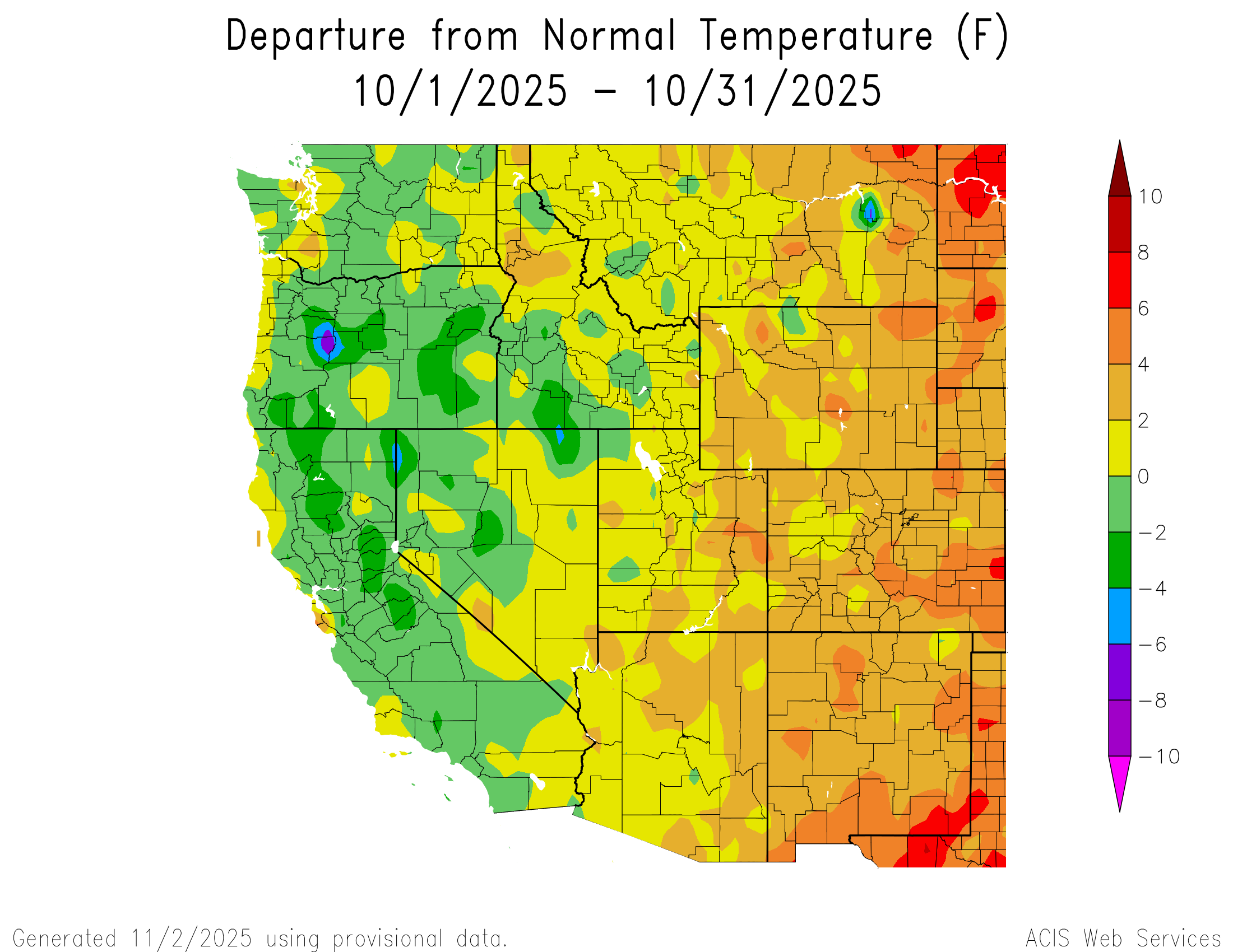
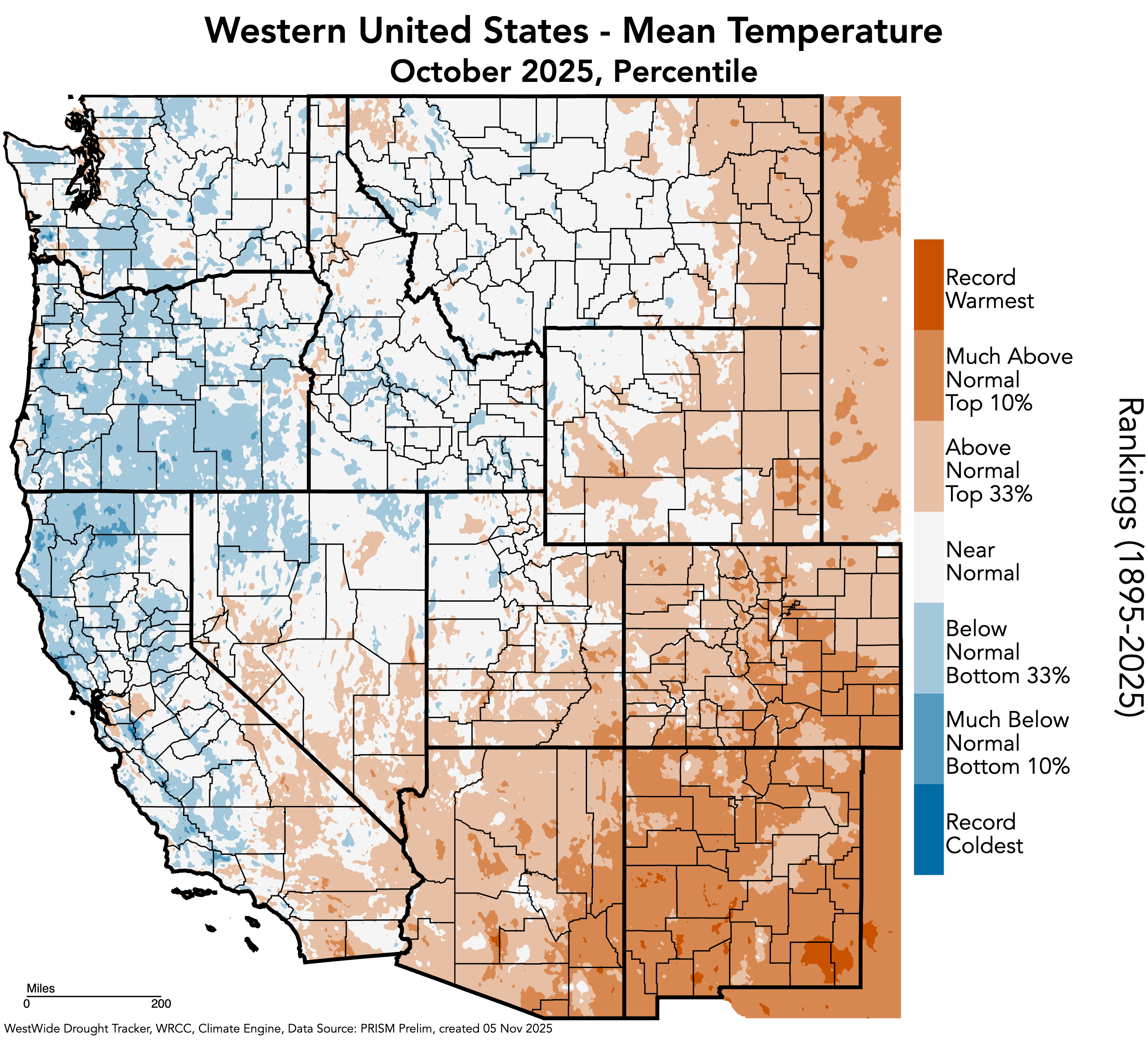
Regional temperatures were near to above normal in October. Temperatures were 2-4°F above normal throughout most of Colorado, Wyoming, and eastern Utah, with scattered pockets of 4-6°F above normal temperatures throughout. A swath of 4-6°F above normal temperatures occurred in southeastern Colorado, with a pocket of 6-8°F above normal temperatures in Cheyenne and Kiowa Counties. The majority of western Utah experienced near normal temperatures.
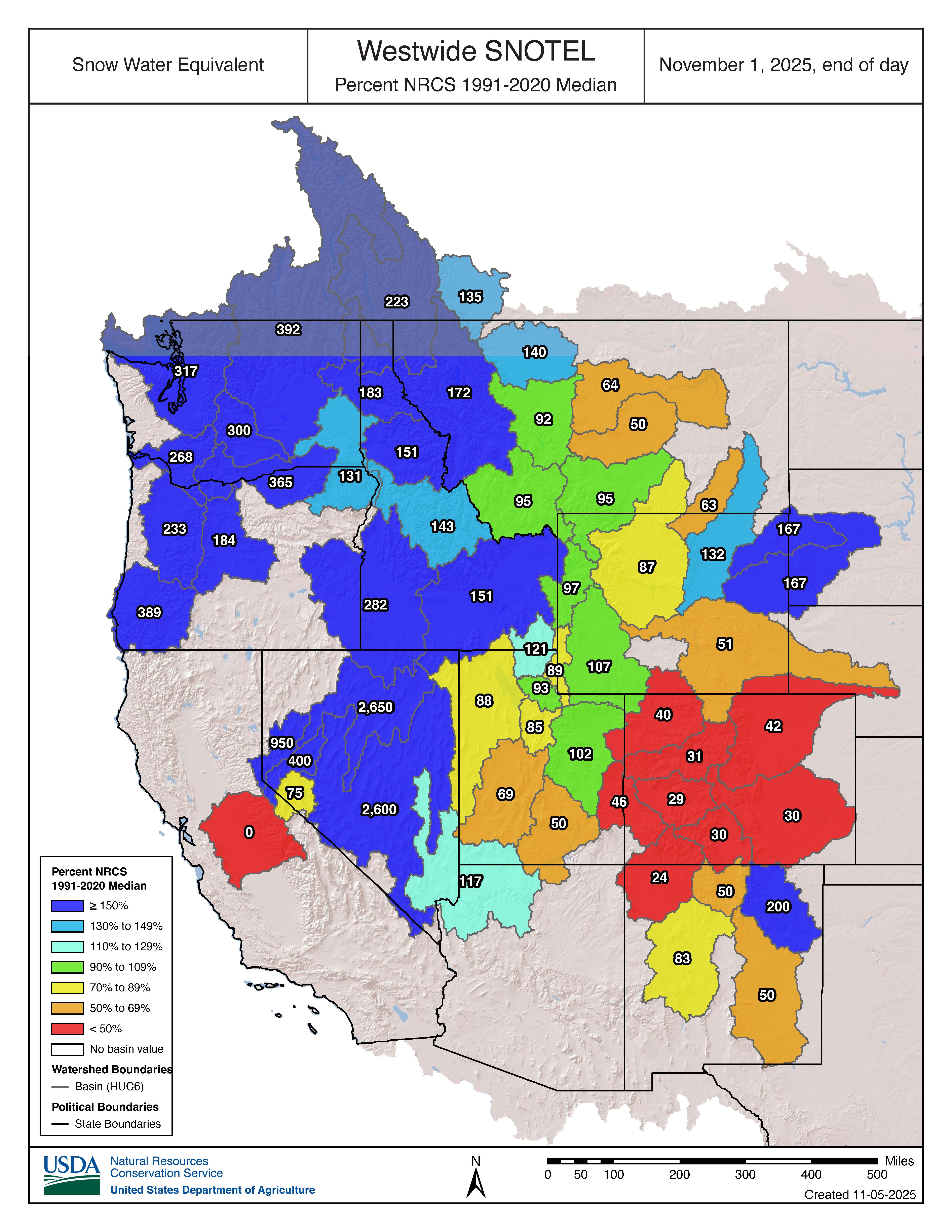
As of November 1, snow-water equivalent (SWE) was variable across the region. SWE was much below normal for Colorado, from 46% of normal SWE in the Upper Colorado-Dolores basin to as low as 24% of normal SWE in the Upper San Juan basin. SWE was much above normal in the Cheyenne (167%) and Belle Fourche (167%) basins in Wyoming. Basins with above normal SWE include the Powder (132%) in Wyoming, and the Lower Colorado-Lake Mead (127%) and Lower Bear (121%) in Utah. Basins with below normal SWE include the Tongue (63%) and North Platte (51%) in Wyoming, and the Escalante Desert-Sevier Lake (69%) and Upper Colorado-Dirty Devil (50%) in Utah. Statewide SWE levels are 0.3 inches in Colorado, 0.3 inches in Utah, and 0.9 inches in Wyoming.
Note: Current SWE as a percent of normal maps are often skewed at this time of year due to the very low average SWE this early in the season.
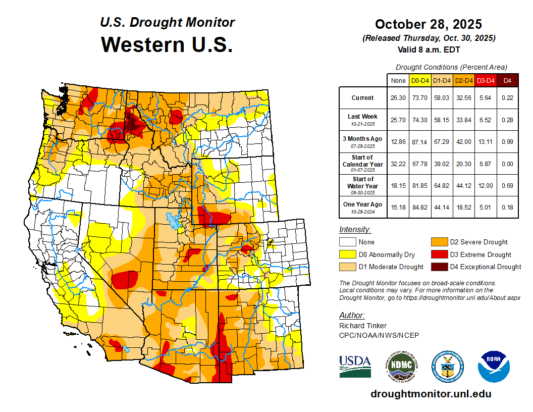
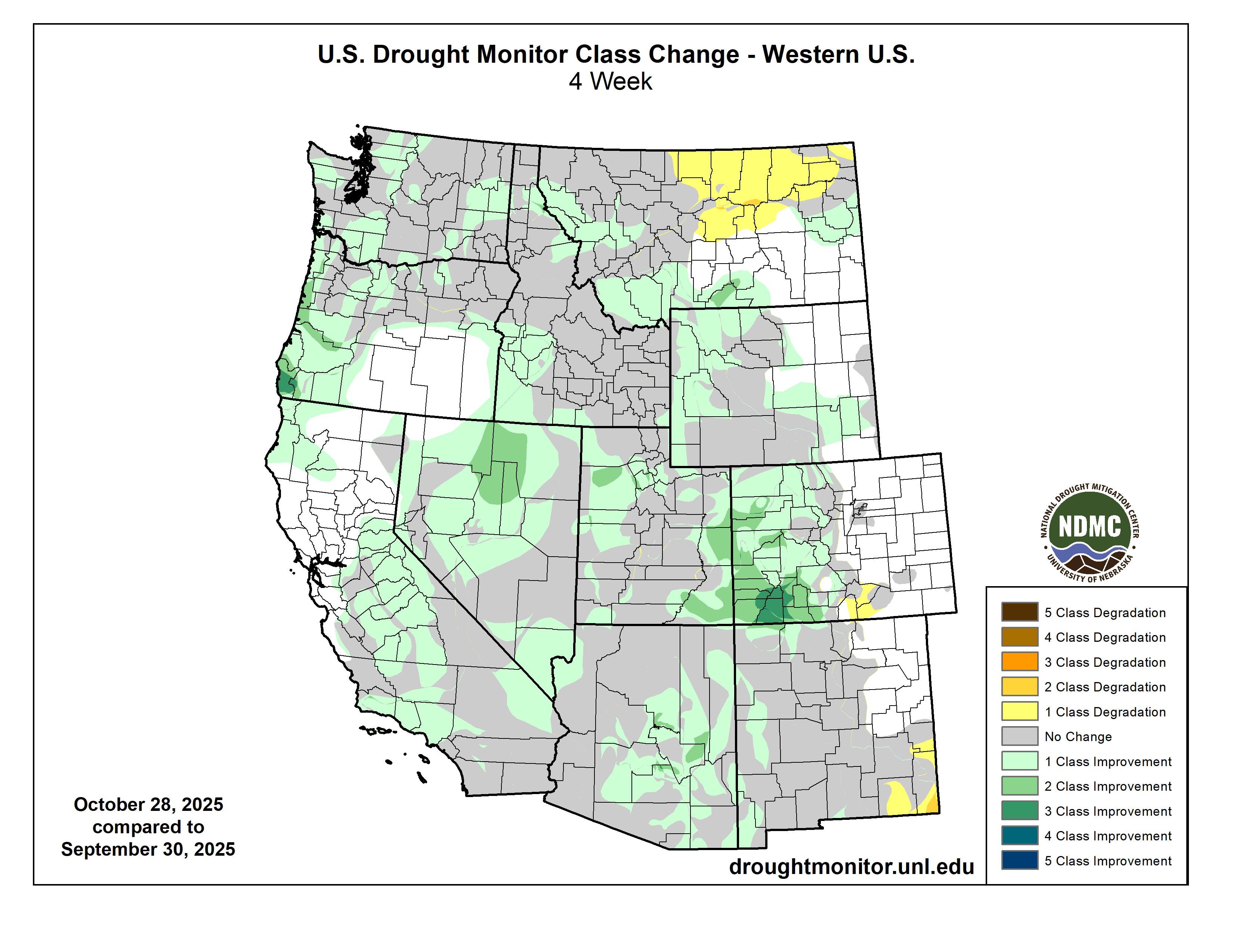
Regional drought conditions significantly improved during October. By October 28, regional drought coverage was 51%, a 10% improvement since the end of September. Moderate (D1) drought coverage decreased by 16% in Colorado, 6% in Utah, and 6% in Wyoming. Severe (D2) drought coverage decreased by 22% in Colorado, 32% in Utah, and 5% in Wyoming. Extreme (D3) drought coverage decreased by 13% in Colorado, 10% in Utah, and 8% in Wyoming. The most significant improvement in drought conditions occurred in southwestern Colorado, with a 2 to 3 class improvement.
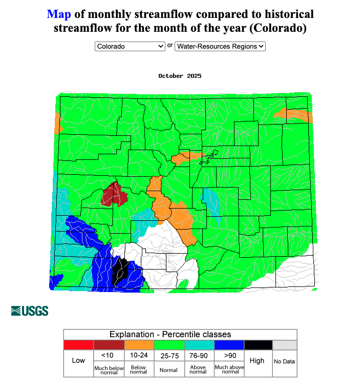
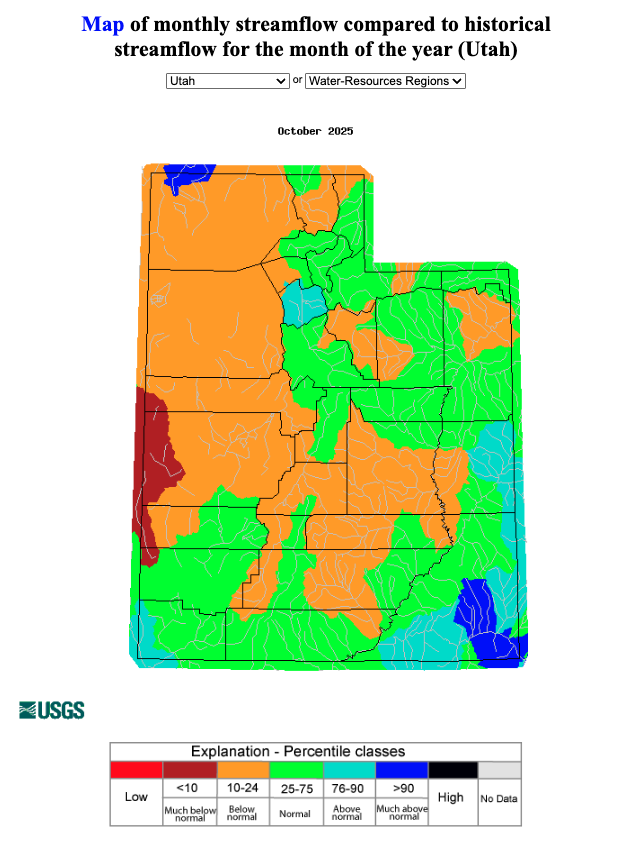
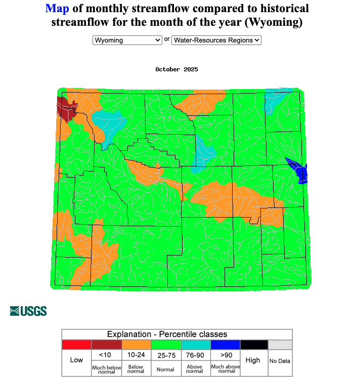
Regional streamflow conditions were generally near normal in Colorado and Wyoming, and below normal in Utah. Much below normal streamflow conditions occurred in the North Fork Gunnison River basin in western Colorado, the Hamlin-Snake Valleys River basin in western Utah, and the Madison River basin in northwestern Wyoming. However, some regional basins experienced above to much above normal streamflow conditions, particularly in southwestern Colorado and southeastern Utah. Much above normal streamflow conditions occurred in the San Miguel, Animas, and Upper San Juan River basins in southwestern Colorado, the Lower San Juan-Four Corners River basin in southeastern Utah and Raft River basin in northern Utah, and the Angostura Reservoir region of the Cheyenne River basin in eastern Wyoming. The Piedra River basin in southwestern Colorado experienced streamflow conditions in the highest percentile.
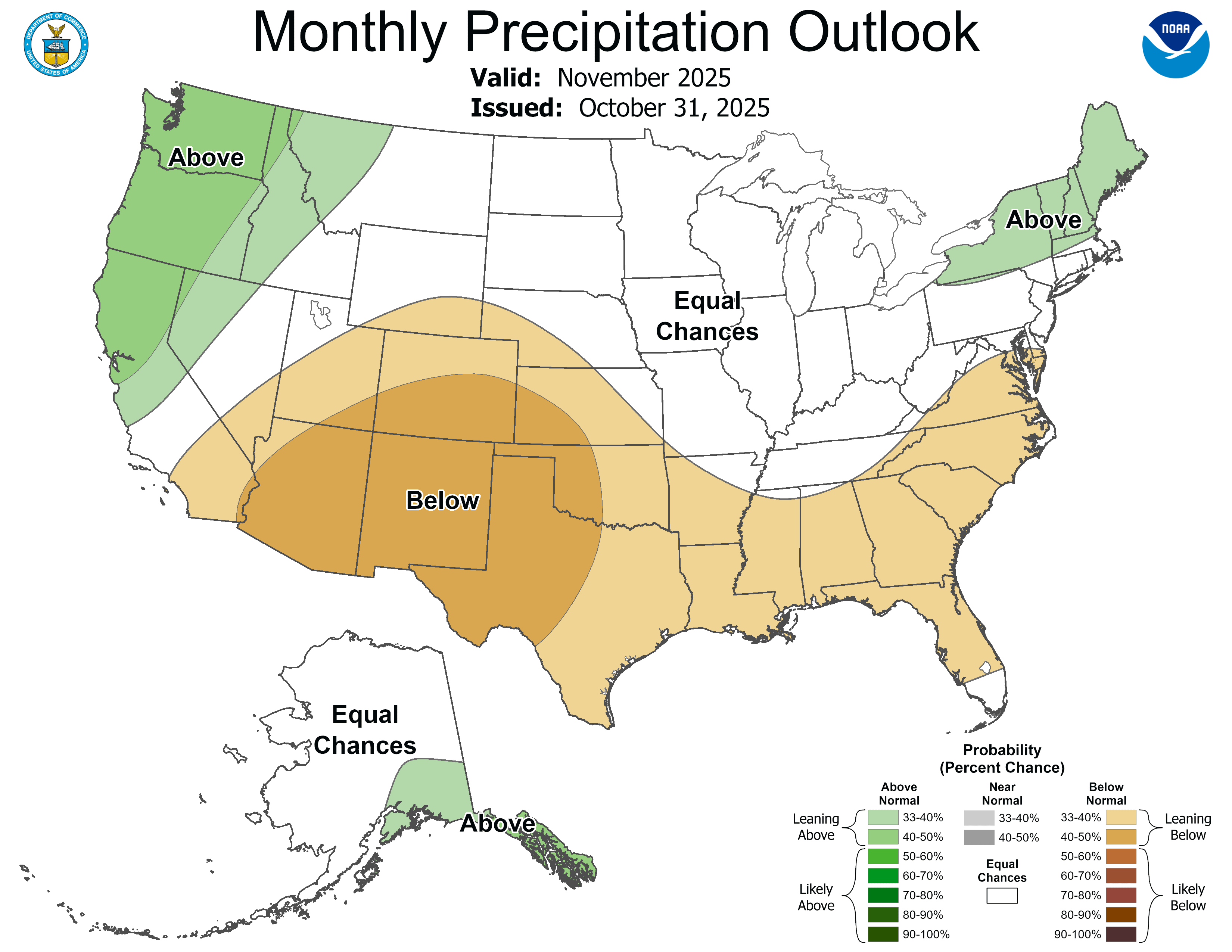
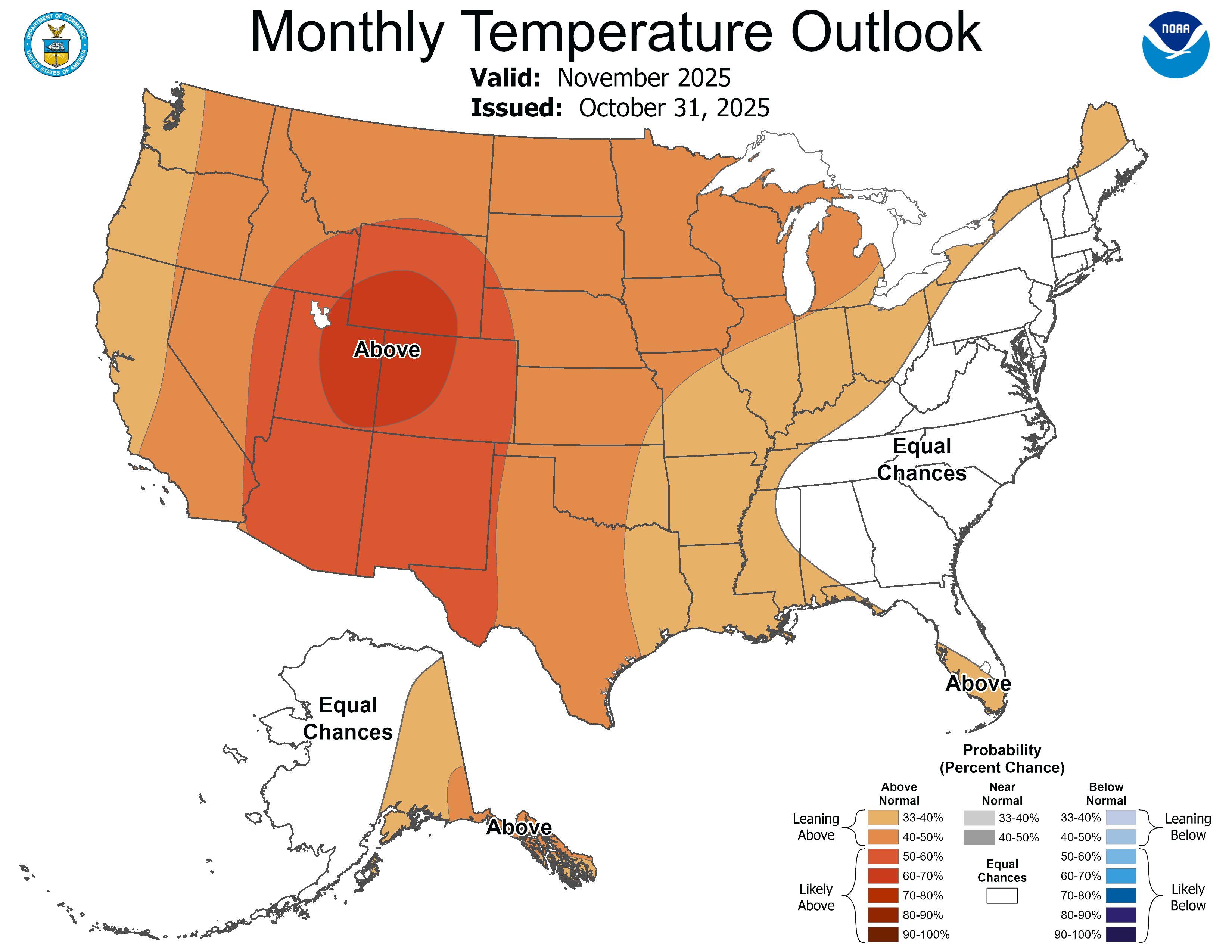
La Niña conditions continued in October and are expected to persist through early winter, followed by a 55% probability of returning to ENSO-neutral conditions by late winter. The NOAA Monthly Precipitation Outlook suggests an increased probability of below average precipitation for Colorado, Utah, and southern Wyoming in November. The NOAA Monthly Temperature Outlook suggests an increased probability of above average temperatures for the entire region in November. The NOAA Seasonal Precipitation Outlook for November-January suggests an increased probability of above average precipitation in northern Wyoming and part of northern Utah, and below average precipitation in southwestern Colorado and southeastern Utah. The NOAA Seasonal Temperature Outlook for November-January suggests an increased probability of above average temperatures in Colorado, Utah, and southern Wyoming.
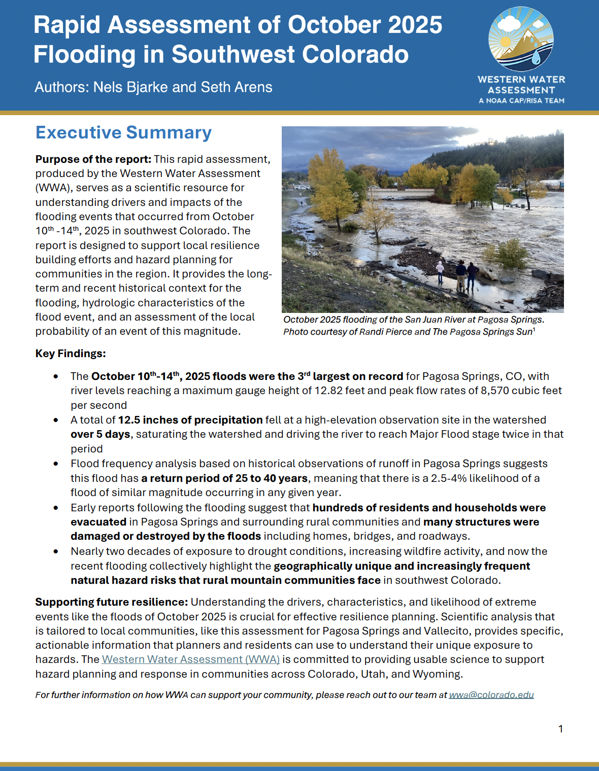
Significant weather event: Flooding in southwestern Colorado. WWA produced a rapid assessment of the flooding in southwestern Colorado from October 10th-14th to serve as a scientific resource for understanding the drivers and impacts of the flooding events. The report is designed to support local resilience-building efforts and hazard planning for communities in the region. It provides the long-term and recent historical context for the flooding, hydrologic characteristics of the flood event, and an assessment of the local probability of an event of this magnitude.
Key Findings:
- The October 10th-14th, 2025 floods were the 3rd largest on record for Pagosa Springs, CO, with river levels reaching a maximum gauge height of 12.82 feet and peak flow rates of 8,570 cubic feet per second.
- A total of 12.5 inches of precipitation fell at a high-elevation observation site in the watershed over 5 days, saturating the watershed and driving the river to reach Major Flood stage twice in that period.
- Flood frequency analysis based on historical observations of runoff in Pagosa Springs suggests this flood has a return period of 25 to 40 years, meaning that there is a 2.5-4% likelihood of a flood of similar magnitude occurring in any given year.
- Early reports following the flooding suggest that hundreds of residents and households were evacuated in Pagosa Springs and surrounding rural communities and many structures were damaged or destroyed by the floods including homes, bridges, and roadways.
- Nearly two decades of exposure to drought conditions, increasing wildfire activity, and now the recent flooding collectively highlight the geographically unique and increasingly frequent natural hazard risks that rural mountain communities face in southwest Colorado.
Learn more: https://wwa.colorado.edu/resources/hazard-assessments