June 10, 2025 - CO, UT, WY
In May, regional precipitation was a mix of above and below normal conditions, with below normal precipitation occurring mainly in western Colorado, northern Utah, and western Wyoming, and above normal precipitation in southern Colorado and southwestern Utah. Temperatures were a mix of above, near, and below normal conditions, generally with warmer than normal temperatures in Utah and Wyoming and cooler than normal temperatures in much of Colorado. As of June 1, statewide percent median SWE was 54% in Colorado, 29% in Utah, and 62% in Wyoming. Seasonal streamflow volume forecasts are all below to much below average for the region. Regional drought coverage in late May was 53%, with extreme drought expanding in western Colorado, and persisting in southeastern Wyoming and southwestern Utah. ENSO-neutral conditions are expected to continue through early fall. The NOAA seasonal outlook for June-August suggests an increased probability of below average precipitation and above average temperatures in the region.
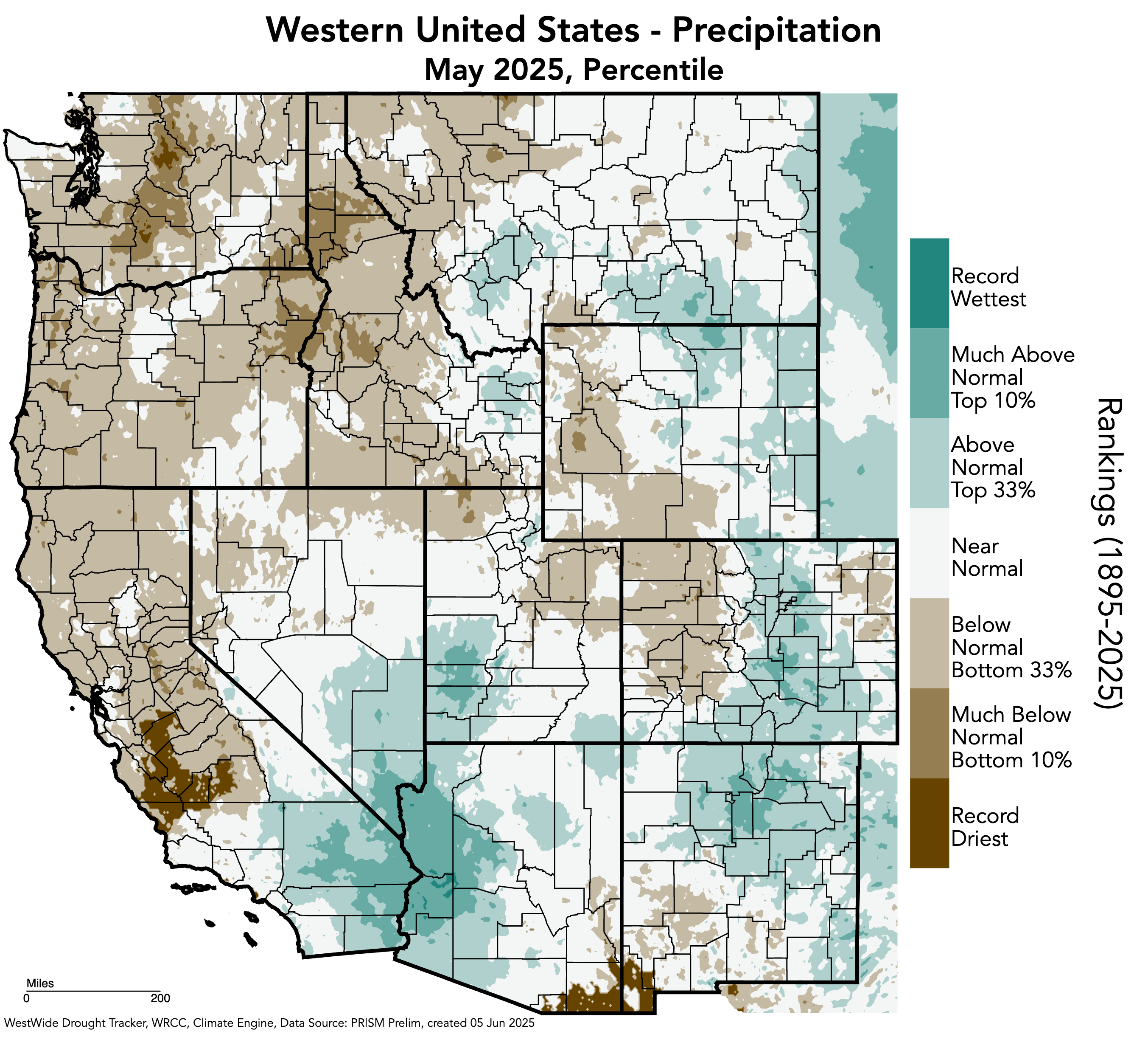
Regional May precipitation was a mix of above and below normal conditions. Below normal precipitation occurred mainly in western Colorado, northern Utah, and western Wyoming, with large swaths of 25-75% of normal conditions and a large pocket of 5-25% of normal conditions from Moffat County, Colorado, to Sweetwater County, Wyoming. Above normal precipitation occurred mainly in eastern and southern Colorado and southwestern Utah, with large swaths of 125-200% of normal conditions and several pockets of 200-400% of normal conditions, with the largest pocket over Rio Grande, Alamosa, Conejos, and Costilla Counties in Colorado.

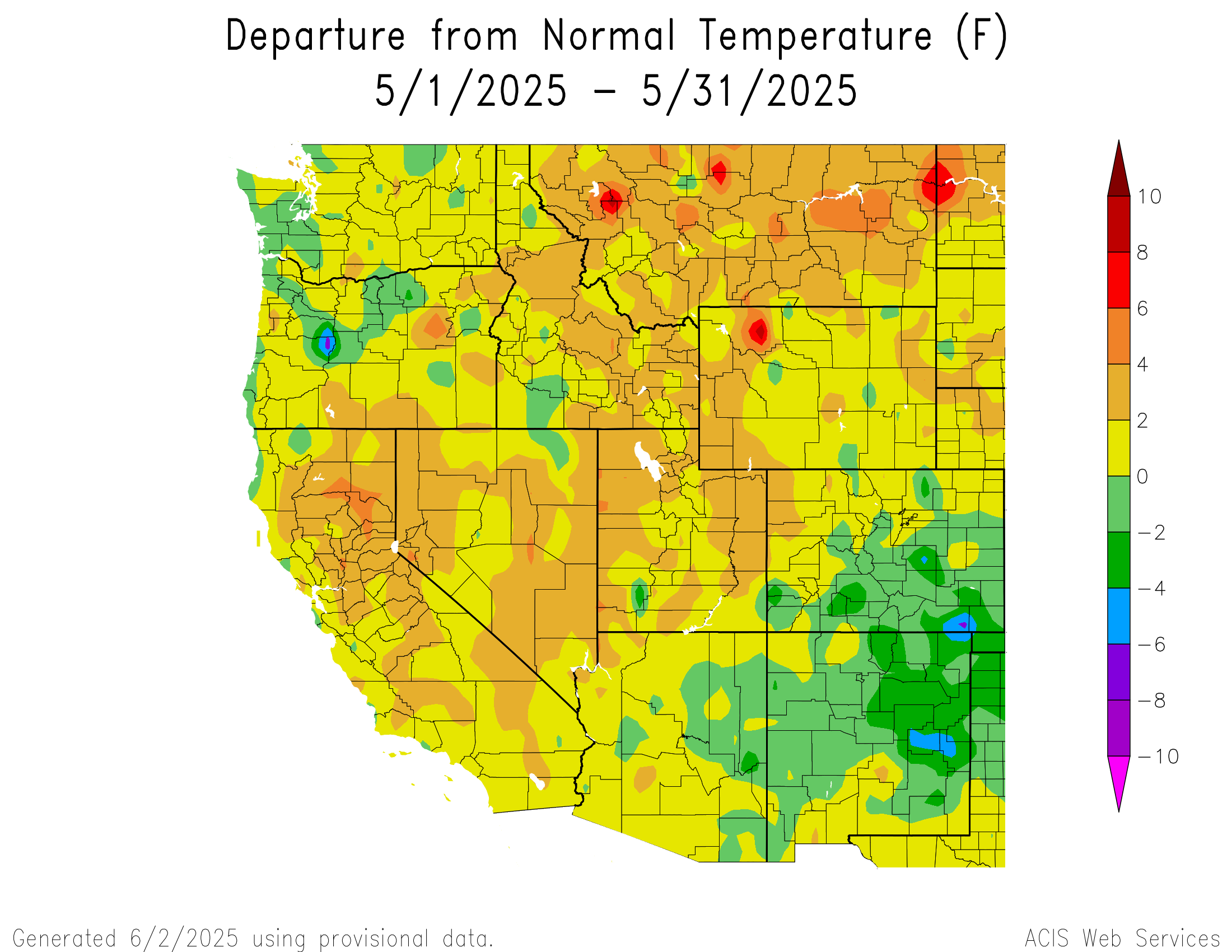
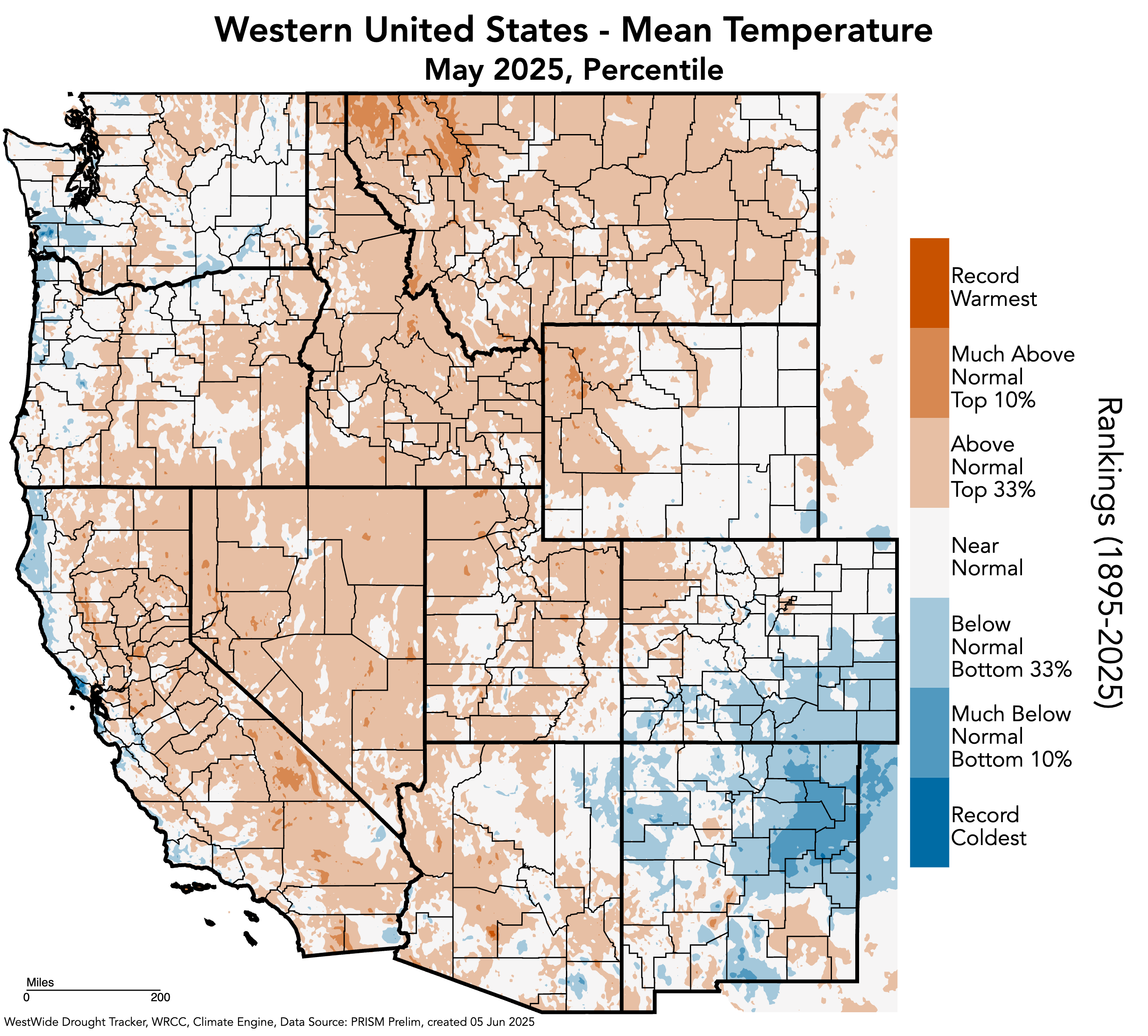
Regional May temperatures were a mix of above, near, and below normal conditions. Much of Wyoming, central and southern Utah, and northern and western Colorado experienced two degrees above normal temperatures, while much of southern and eastern Colorado experienced two degrees below normal temperatures. Two to four degrees above normal temperatures occurred in much of Utah and western Wyoming, with pockets in eastern Wyoming and northwestern Colorado, while large pockets of two to four degrees below normal temperatures occurred in southern and eastern Colorado. One small pocket ranging from four to ten degrees above normal temperatures occurred in Park County, Wyoming, and one small pocket ranging from four to eight degrees below normal temperatures occurred in Las Animas County, Colorado.
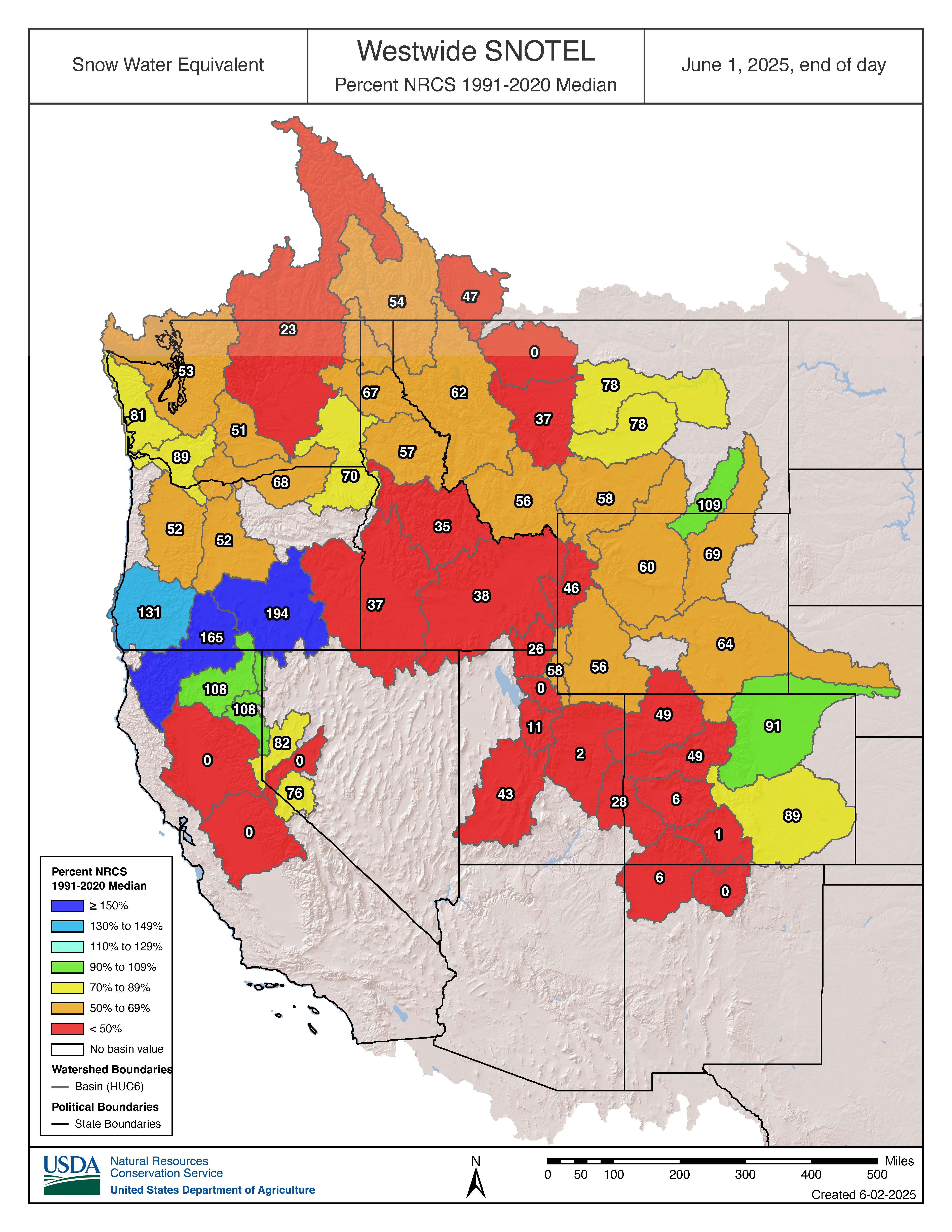
June 1 snow-water equivalent (SWE) was below to much below normal for the majority of the region, with 50-69% of median conditions throughout most of Wyoming and less than 50% of median conditions across Utah and western Colorado. A few basins experienced near normal conditions, including the Tongue (118%), Bighorn (105%), and Arkansas (93%) River Basins. As of June 1, statewide percent median SWE was 54% in Colorado, 29% in Utah, and 62% in Wyoming.

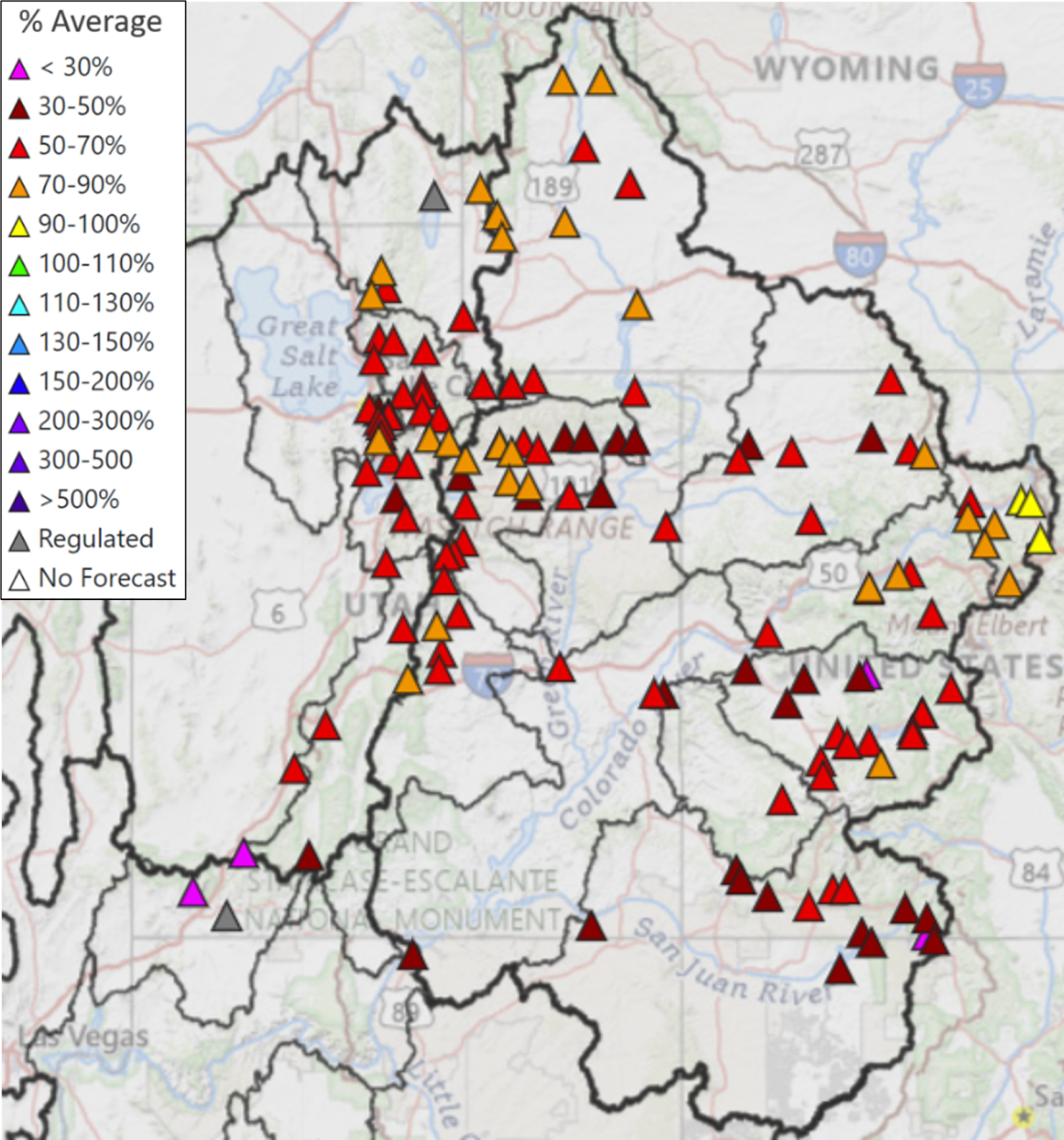
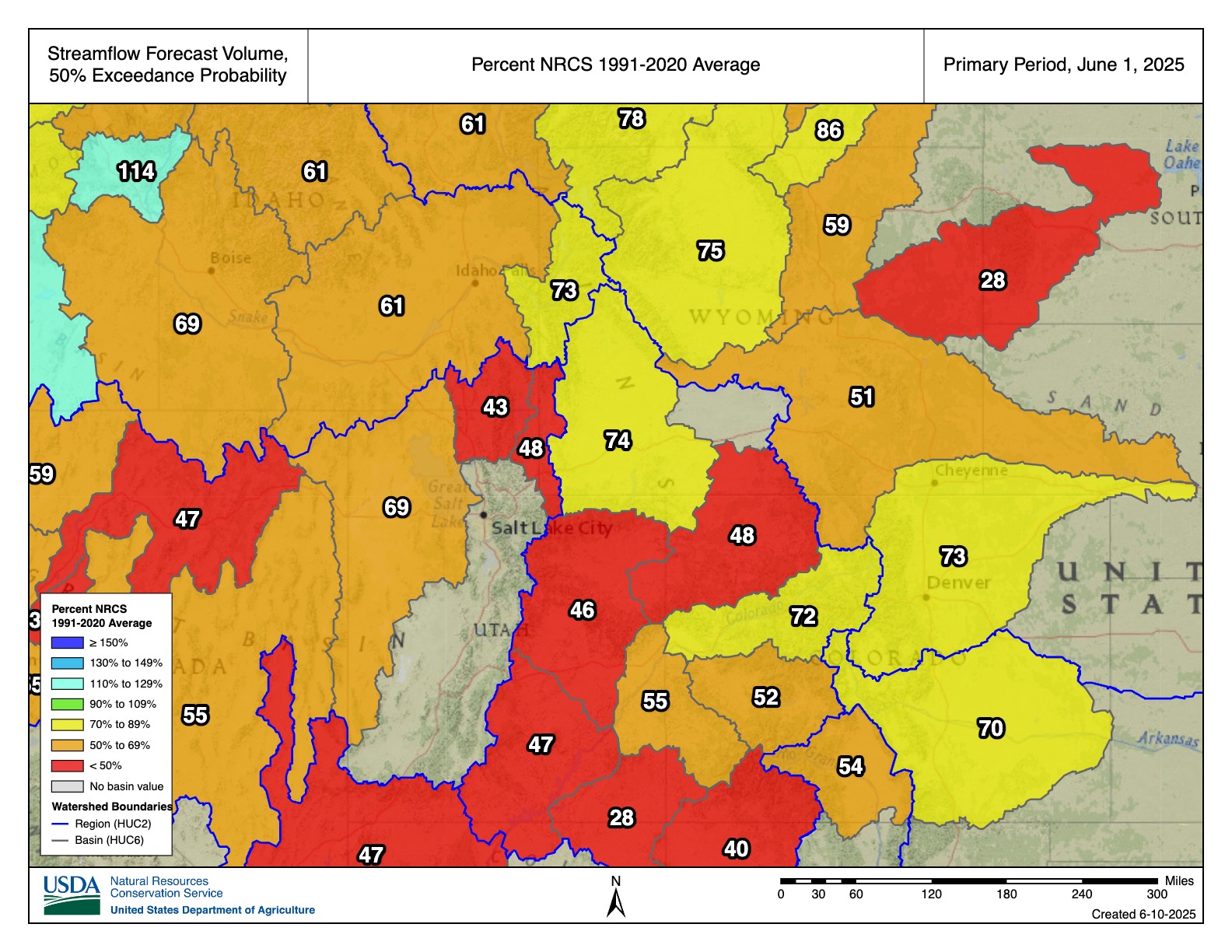
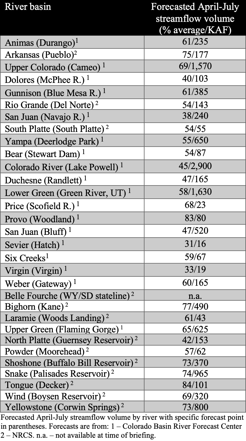
June 1 seasonal (April-July) streamflow volume forecasts are all below to much below average for the region. Many river basins have much below average forecasts (50-69%), including the Animas, Upper Colorado, Gunnison, Rio Grande, South Platte, Yampa, Bear, Lower Green, Price, Six Creeks, Weber, Laramie, Upper Green, Powder, and Wind River Basins. Forecasts are below average (70-89%) for the Arkansas, Provo, Bighorn, Shoshone, Snake, Tongue, and Yellowstone River Basins. Forecasts are exceptionally below average (<50%) for the Dolores, San Juan, Duchesne, Sevier, Virgin, and North Platte River Basins. There are no basins with near average forecasts (90-109%) in the region. Seasonal streamflow is forecasted at 45% of average for Lake Powell.
Note: both NRCS and CBRFC provide seasonal streamflow forecasts for the Upper Colorado River Basin and these forecasts occasionally differ due to differences in streamflow forecasting models.
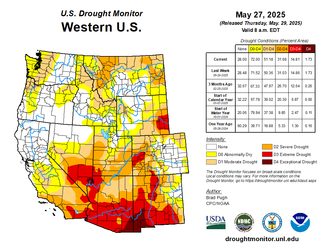
On May 27, drought conditions covered 53% of the region, a 1% regional improvement from April 29. Above normal precipitation in southeastern Colorado caused the removal of severe (D2) drought and much of the moderate (D1) drought conditions in that part of the state. However, extreme (D3) drought expanded on the West Slope of Colorado, as well as D2 and D1 drought conditions, causing statewide drought coverage to increase by 5%. Drought coverage decreased in Wyoming by 10%, and slightly in Utah by 2%, in May. However, D3 drought conditions persist in southeastern Wyoming and southwestern Utah.

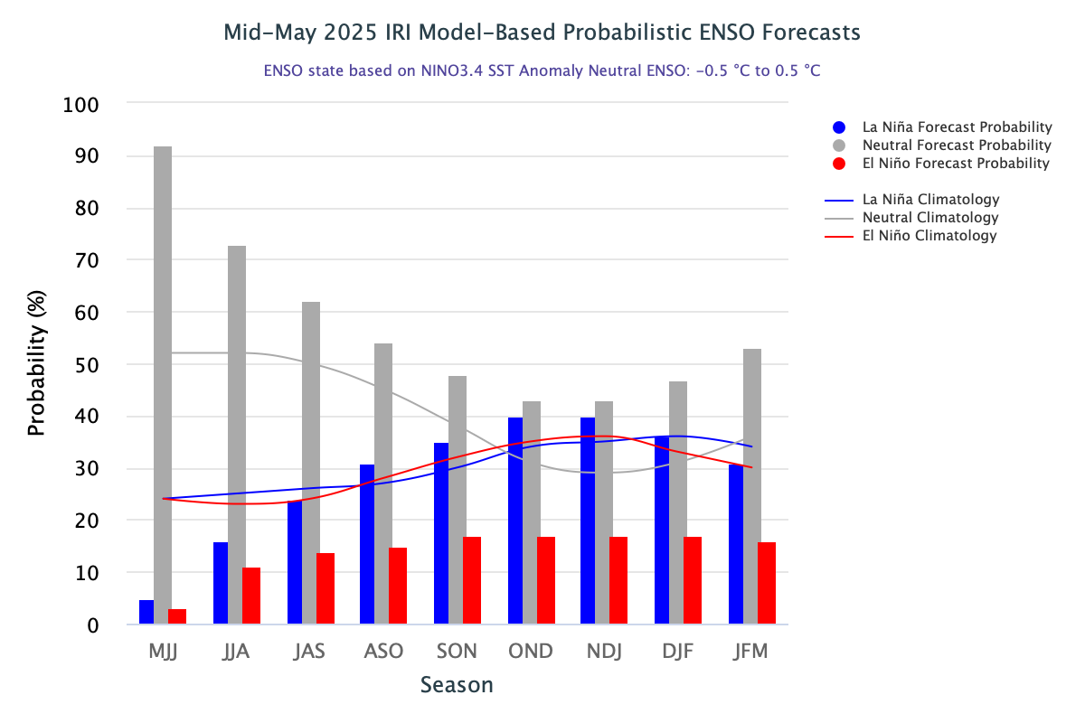
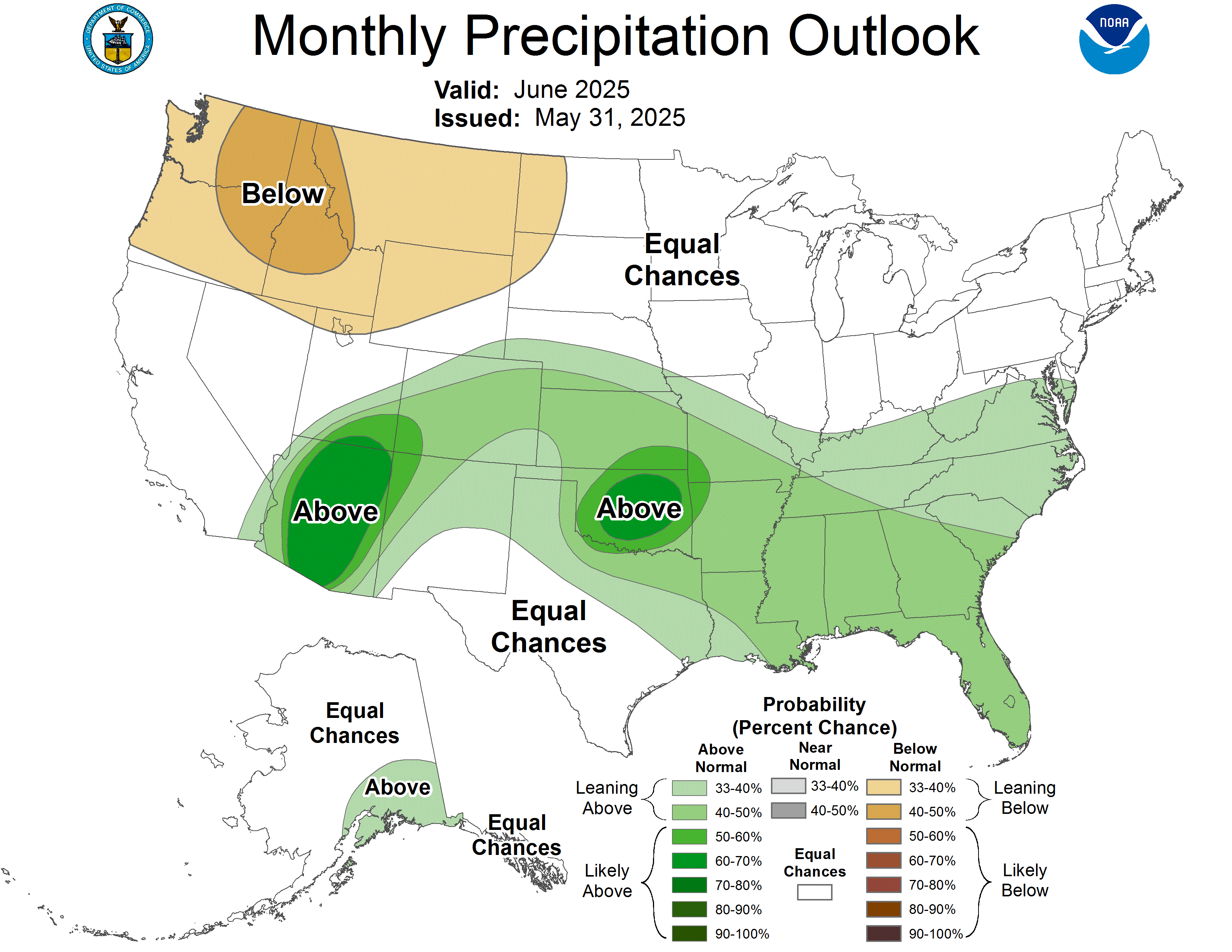
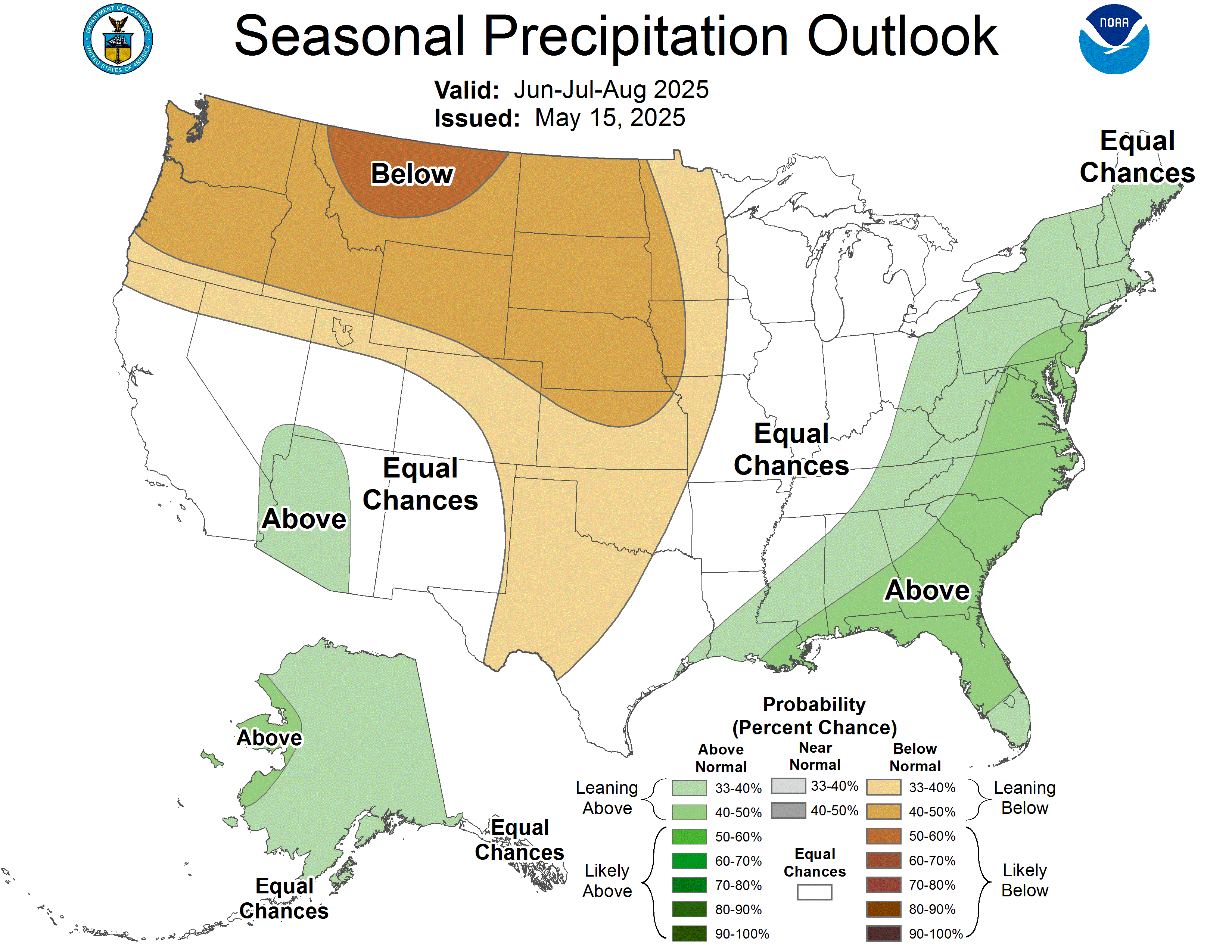
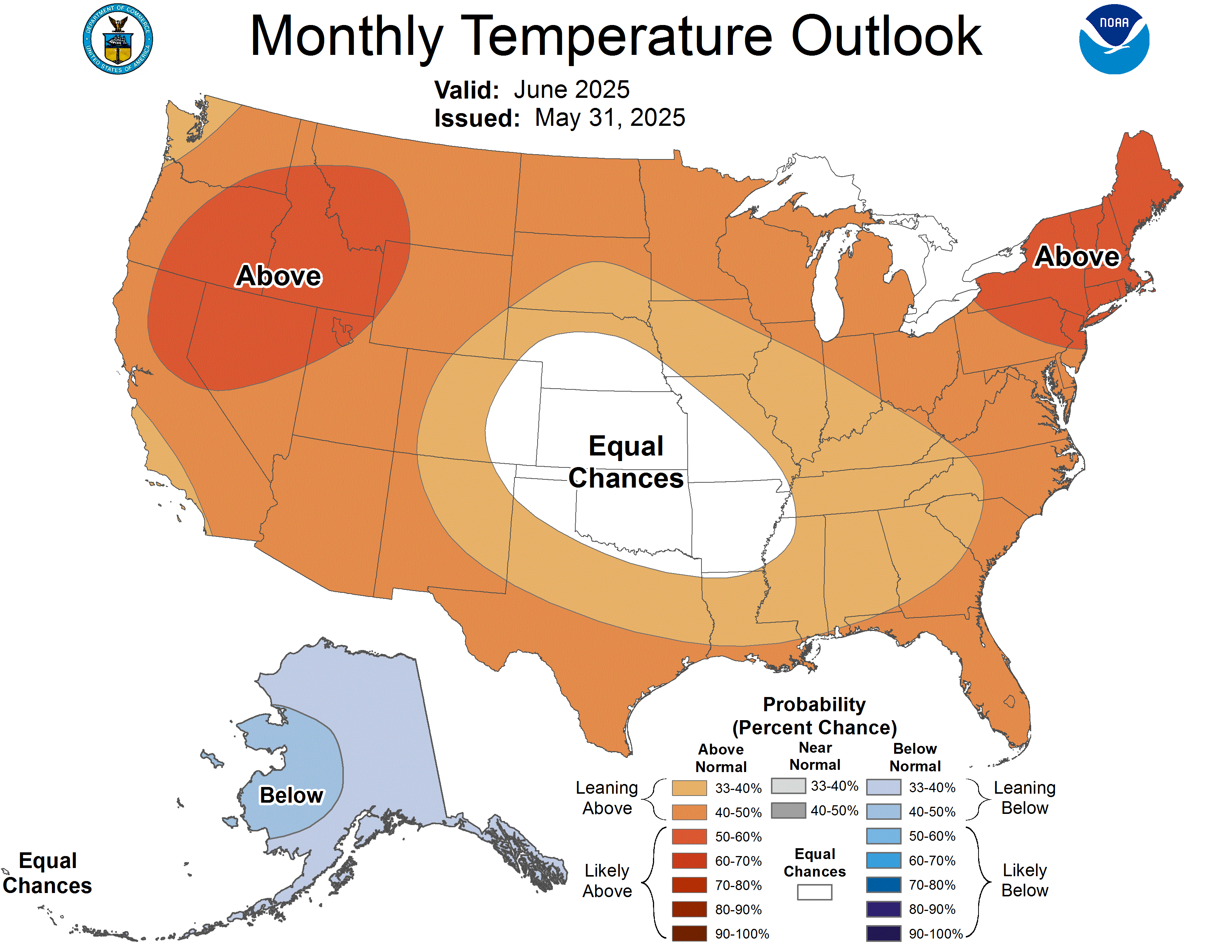
ENSO-neutral conditions continued in May, and ENSO-neutral conditions are favored through the summer with chances exceeding 50% through early fall. The NOAA monthly outlook for June suggests an increased probability of above average precipitation in Colorado and southeastern Utah and below average precipitation in northern and western Wyoming, and above average temperatures for most of the region. The NOAA seasonal outlook for June-August suggests an increased probability of below average precipitation in Wyoming, northern Utah, and northern and eastern Colorado, and above average temperatures throughout the region, particularly in Utah, western Colorado, and southwestern Wyoming.

Significant weather event: Eastern Colorado tornadoes. On May 18, between 1-2 pm MT, four tornadoes occurred near the Denver metro area in Elbert, Arapahoe, and Adams Counties. Three of the four tornadoes were classified as EF2 tornadoes, which are considered significant (111-135 mph) tornadoes on the Enhanced Fujita (EF) Scale. The first EF2 tornado occurred in the Elkhorn Ranch neighborhood in northwest Elbert County, with estimated peak winds of 125 mph. The second and third EF2 tornadoes occurred west and north of Bennett, Colorado, with estimated peak winds of 125 mph and 112 mph, respectively. Many homes were damaged; however, there were no reported injuries or fatalities.
On May 23, between 5-6:15 pm MT, three tornadoes occurred in Logan and Washington Counties in northeastern Colorado, one of which was an EF2 tornado. The estimated peak wind of the EF2 tornado was 118 mph. The supercell that produced these tornadoes also produced golf ball to baseball-sized hail in northern Washington County. Most of the observed damage was snapped power poles and trees. There were no reported injuries or fatalities.
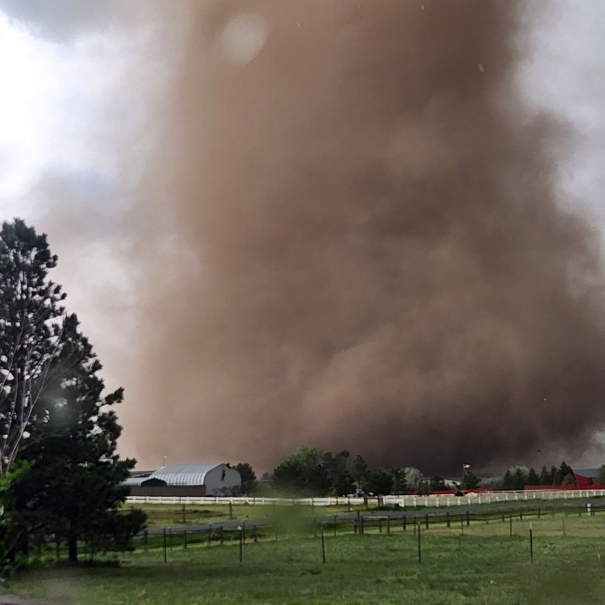
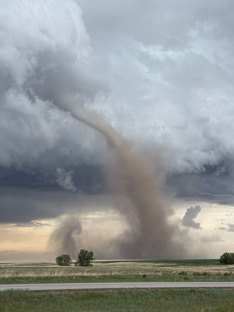
Photos by Caryn Hill (left) and Sirlin John (right), May 18, 2025.
Sources: