July 10, 2025 - CO, UT, WY
During June, much of the region experienced above average temperatures and below average precipitation. Record low precipitation fell across parts of northern Utah and southwestern Wyoming while much above average precipitation was observed in southern Utah and southwestern Colorado. As of July 1, seasonal snowmelt was completed with many mountain locations melting out 1-2 weeks earlier than average. Seasonal streamflow volume forecasts remained below to much below normal with the inflow to Lake Powell forecasted to be 42% of average. Regional coverage of drought expanded significantly from 53% in early June to 63% on July 1, driven largely by expansion of drought in Utah. Drought conditions are likely to persist or worsen as NOAA seasonal forecasts suggest above average regional temperatures and below average precipitation for Wyoming during July to September.
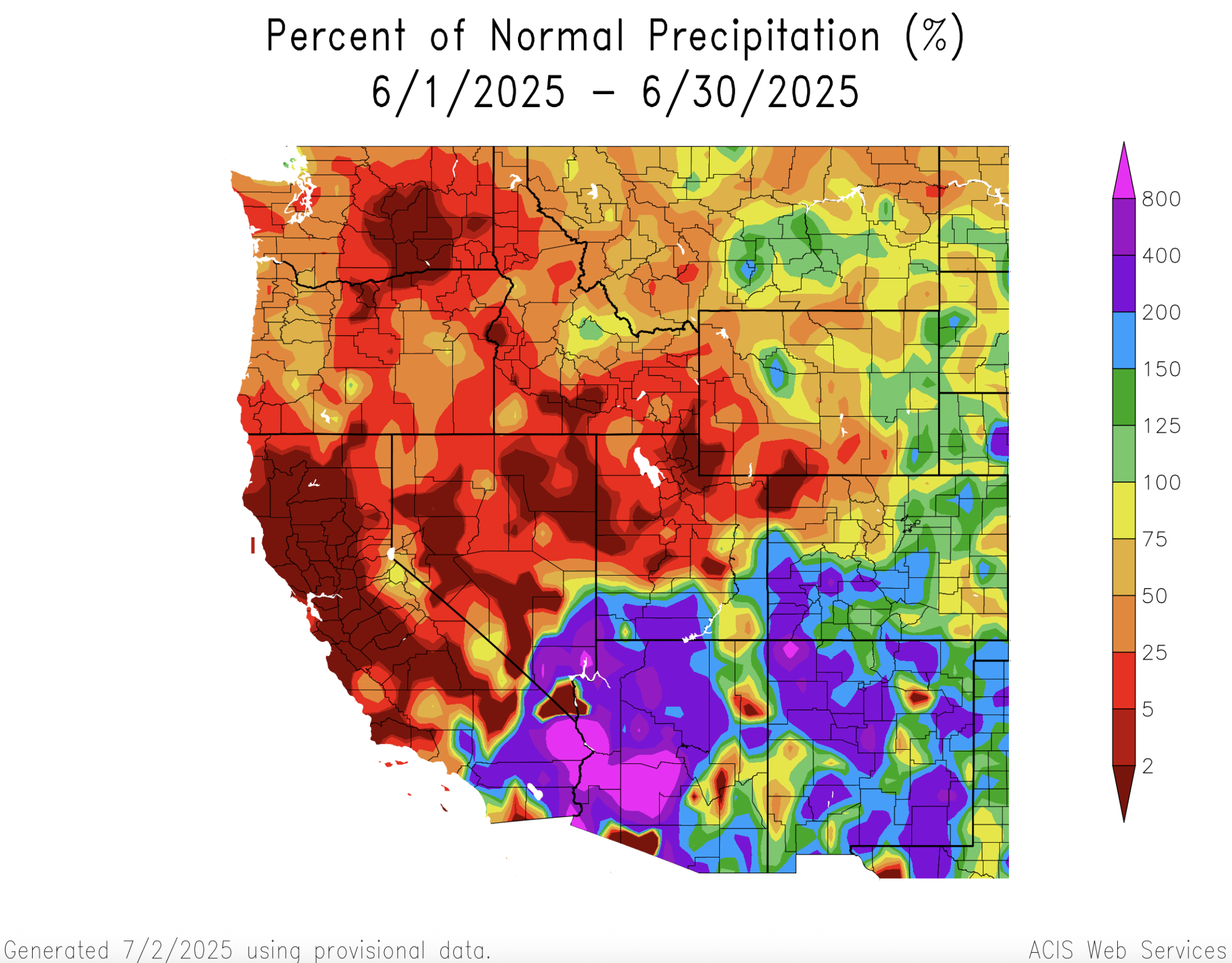
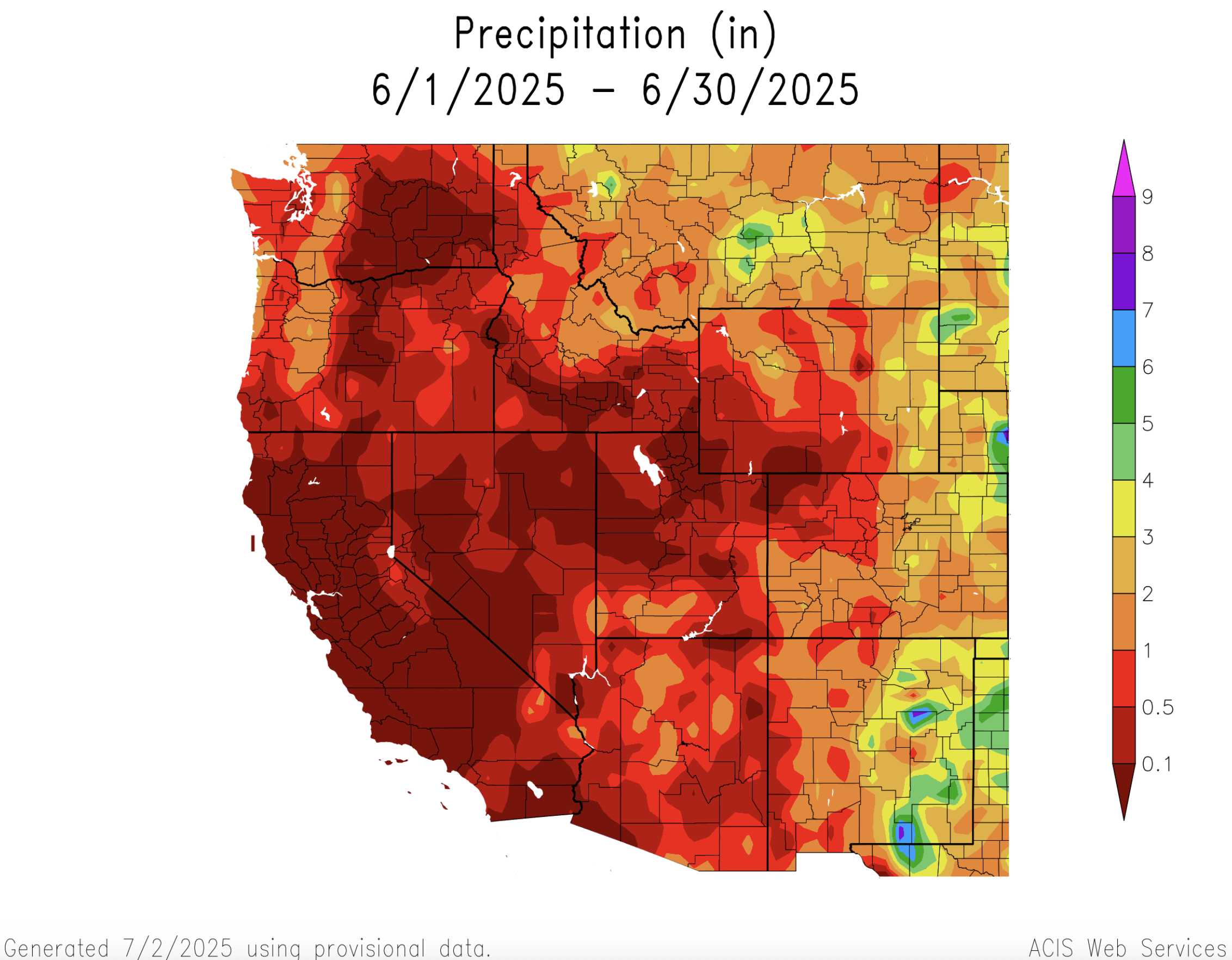
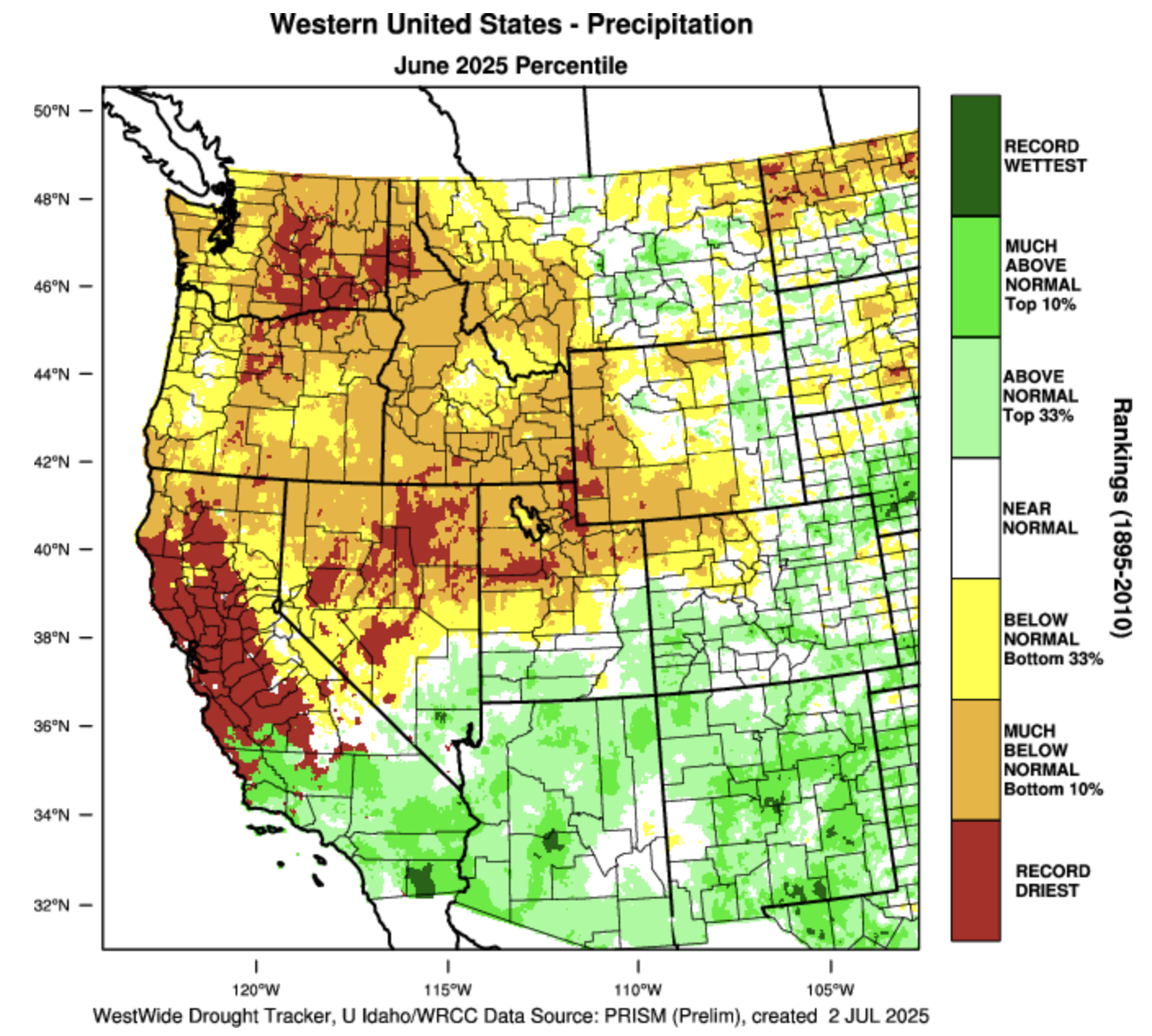
Above average June precipitation was observed in southern Utah, eastern Wyoming and the majority of Colorado. Much of Utah and Wyoming and northwestern Colorado received below average precipitation during June. Parts of southern Colorado and southern Utah received twice the average June rainfall while some locations in northern Utah and southwestern Wyoming observed record low June rainfall totals. Average June rainfall is typically low in the Intermountain West and areas of southern Utah and southwestern Colorado with 150-400% of average June rainfall observed total rainfall amounts of 1-2 inches.
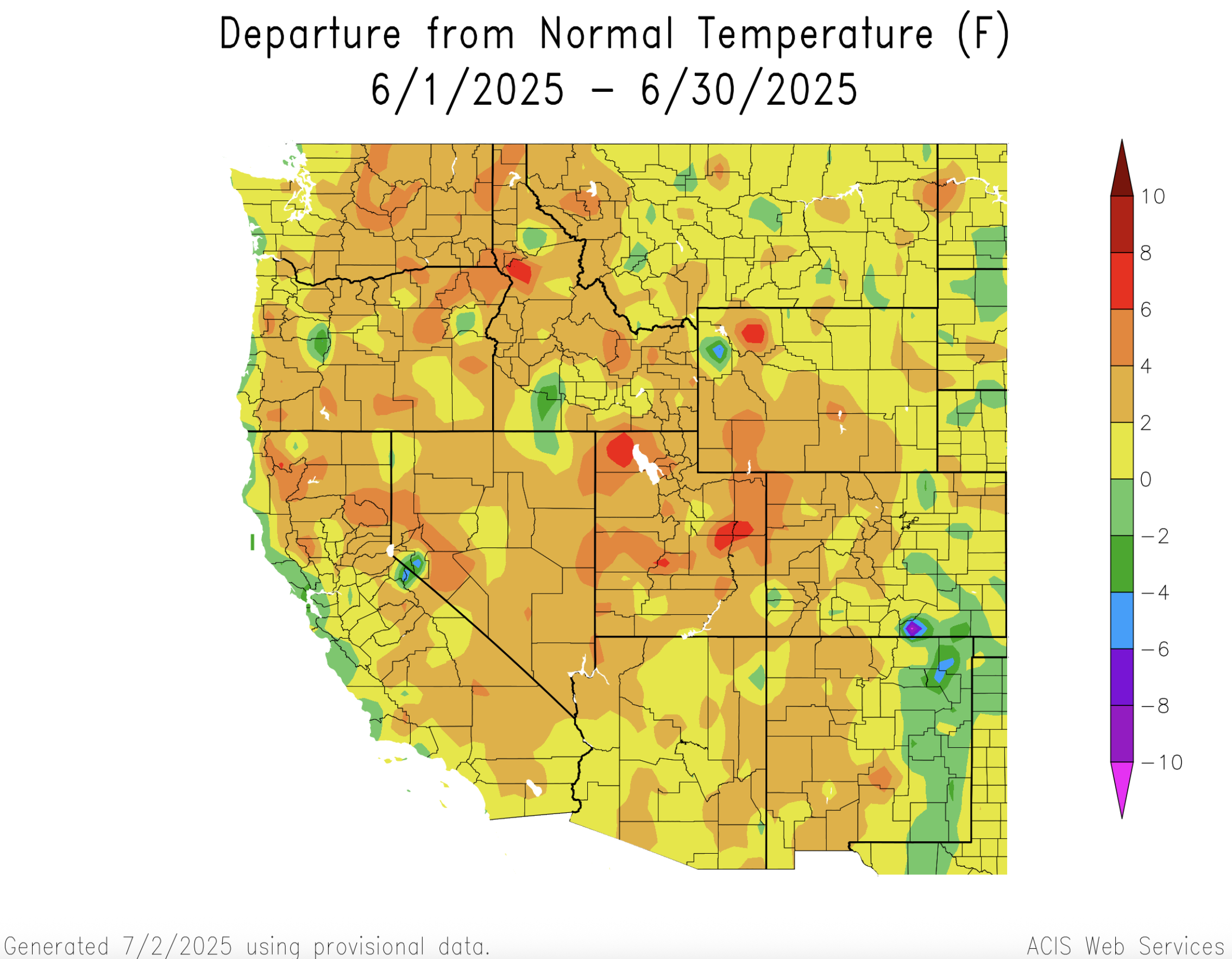
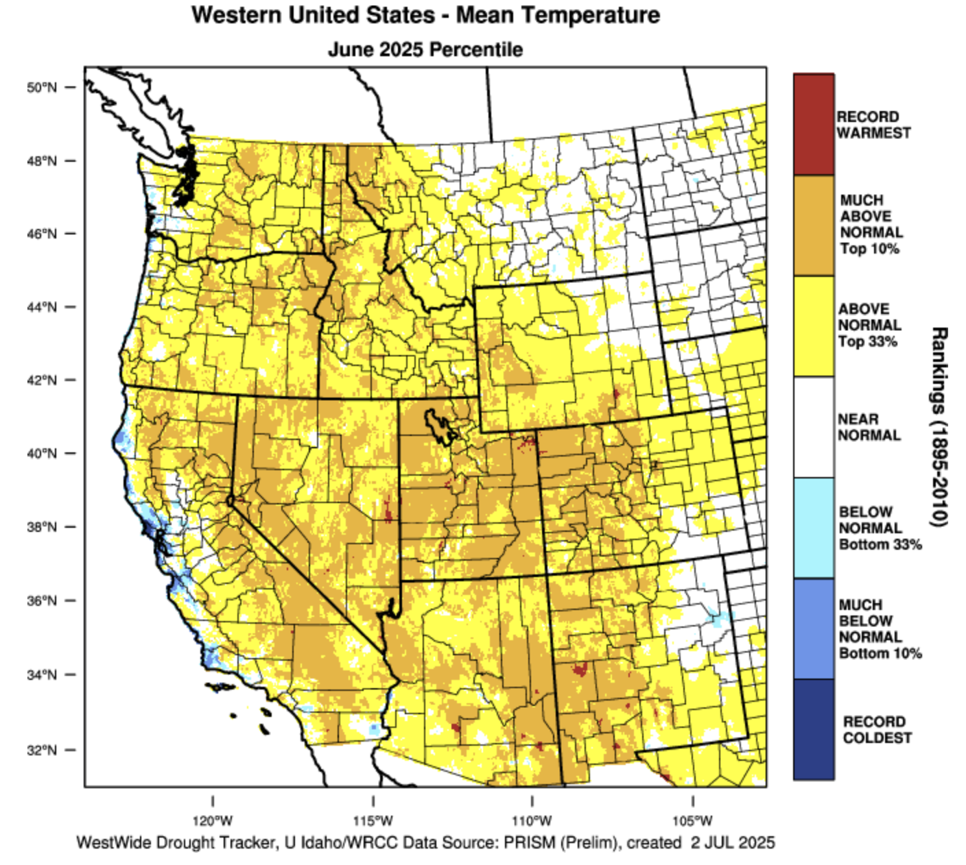
June temperatures were above average for much of Colorado, Utah and Wyoming, except for eastern Colorado and Wyoming where temperatures were up to two degrees below average. The warmest temperatures were observed in Utah, northwestern Colorado, and western Wyoming where June average temperatures were in the top 10% of all observations since 1895.
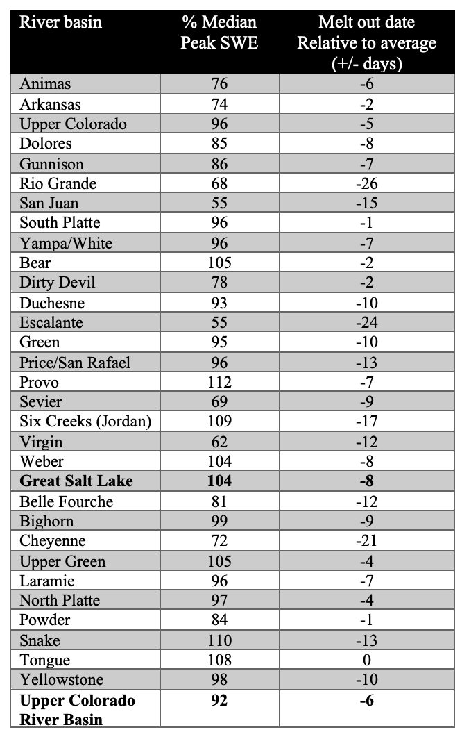
As of July 1st, snowpack was melted out across the region and snowmelt occurred earlier than average across all basins except the Tongue River Basin in northern Wyoming. In Colorado, snowmelt occurred only a few days early in the Arkansas and South Platte River Basins, around a week early in the Animas, Colorado Headwaters, Dolores, Gunnison and Yampa River Basins, two weeks early in the San Juan River Basin and nearly four weeks early in the Rio Grande River Basin. In Utah, snowmelt was only a few days early in the Bear River Basin, 1-2 weeks early in the northern Utah, Price, Sevier and Virgin River Basins and 24 days early in the Escalante River Basin. In Wyoming, snowmelt occurred earlier than average in all basins except the Tongue River Basin, with the Belle Fouche, Cheyenne and Snake River Basins melting out 2-3 weeks early.
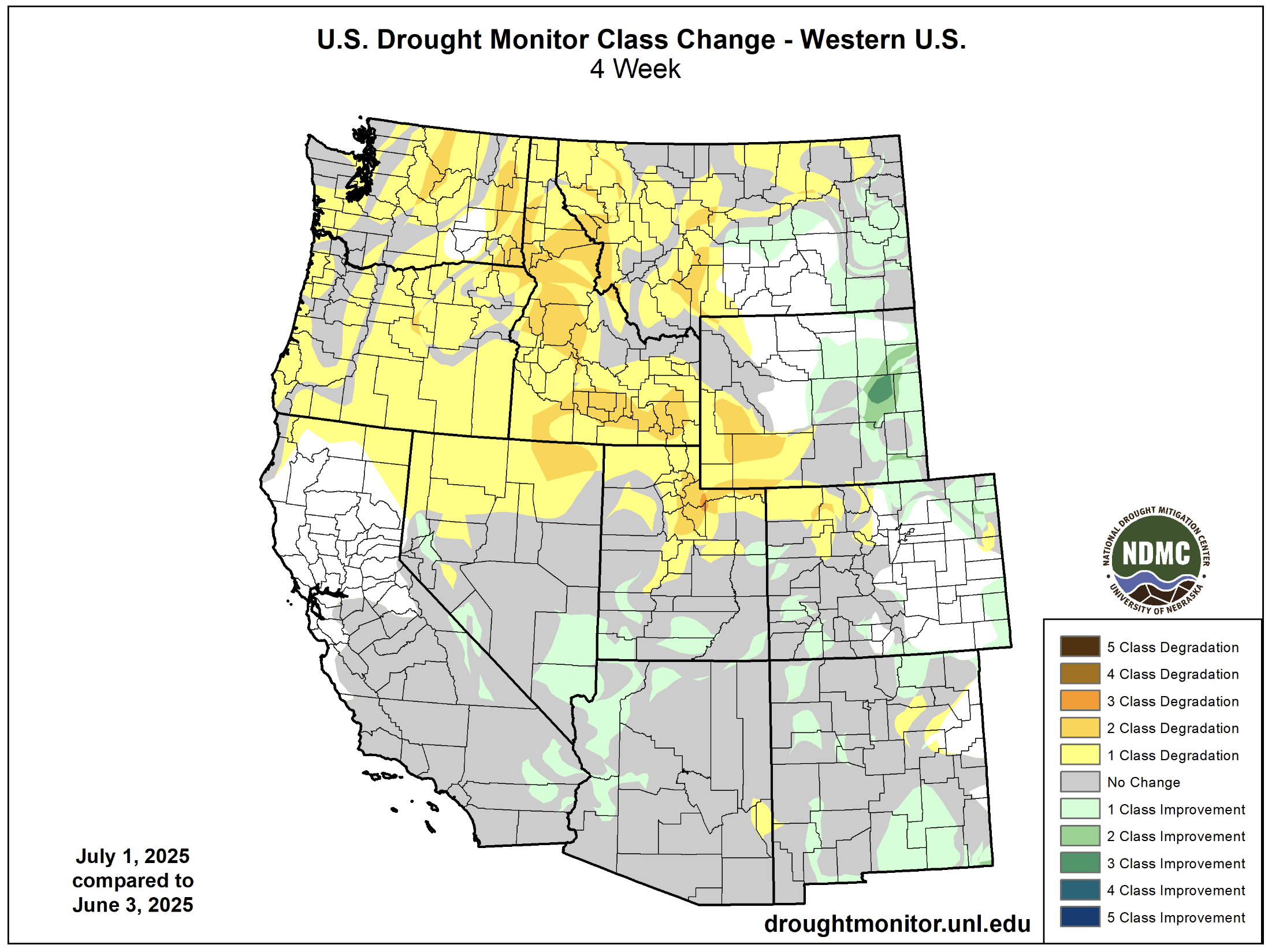
Regional drought coverage expanded from 53% in early June to 63% as of July 1 with all of Utah and about half of Colorado and Wyoming experiencing drought. Extreme (D3) drought conditions expanded in western Colorado but were removed from southwestern Utah and southeastern Wyoming where above average June precipitation was observed. Drought worsened by one to two classes in northern Utah and southwestern Wyoming, but drought conditions improved in portions of eastern and southern Colorado and southern Utah. In eastern Wyoming, drought conditions improved by one to three drought classes.

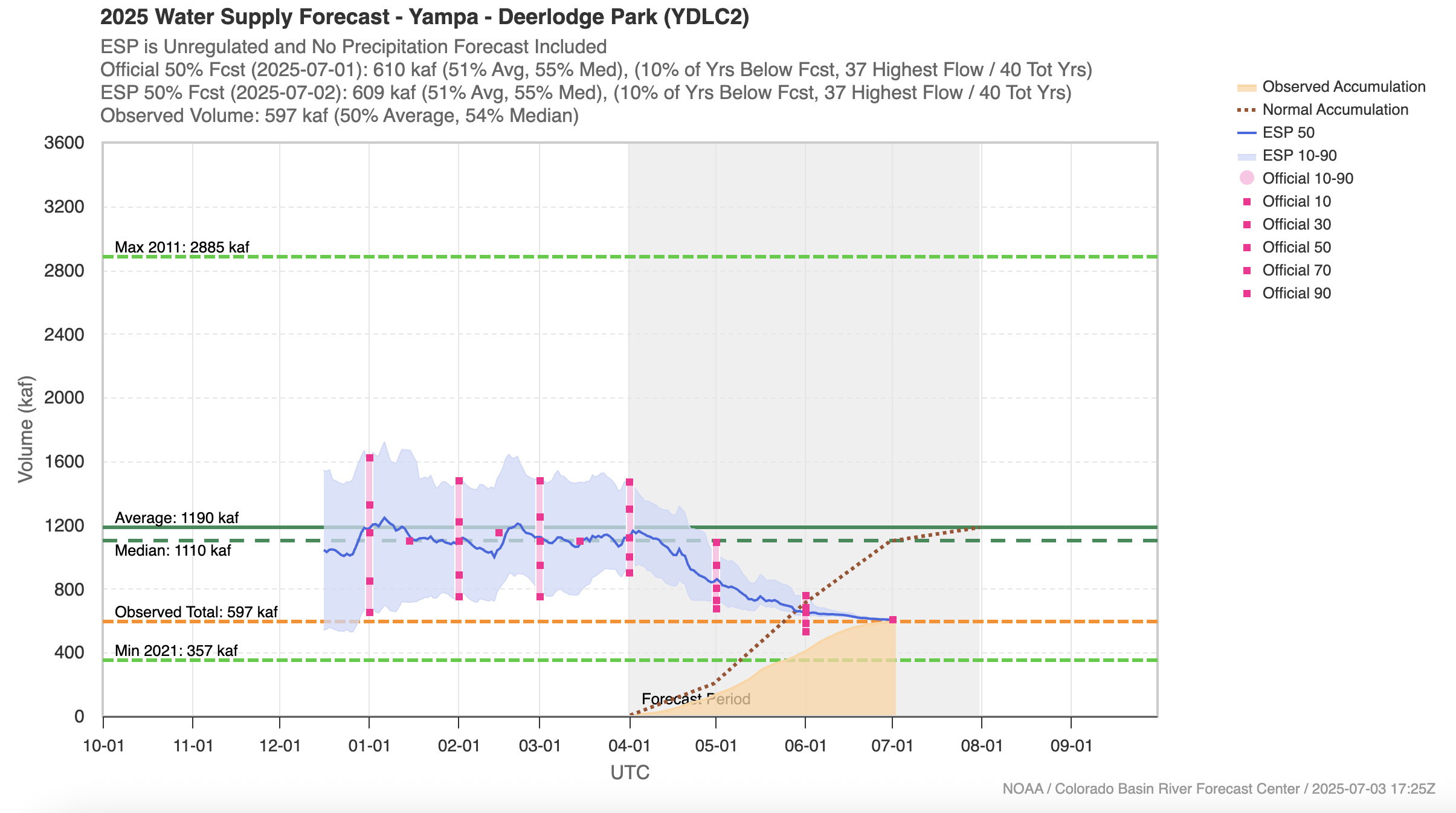
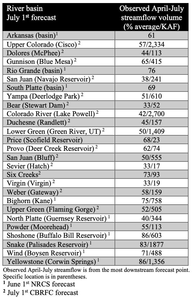
Seasonal streamflow volume forecasts remained below to much below average with the final forecasts of the year ranging from 33% of average for Utah’s Bear and Virgin River Basins to 86% of average in Wyoming’s Shoshone and Yellowstone River Basins. For nearly all regional river basins, streamflow volume forecasts significantly decreased from April 1 to June or July 1. The evolution of the Yampa River seasonal streamflow forecast exemplifies a pattern seen across the Intermountain West. After a near average winter snowpack, the April 1 forecast indicated an average seasonal streamflow volume, but by July 1, the Yampa River forecast declined to only 51% of average. Much below streamflow volume forecasts (<60% of average) were issued for the Colorado Headwaters, Dolores, San Juan and Yampa River Basins in Colorado, the Bear, Duchesne, Green, San Juan, Sevier, Virgin and Weber River Basins in Utah, and the Green, North Platte and Powder River Basins in Wyoming. The inflow forecast for Lake Powell was a paltry 42% of average on July 1.
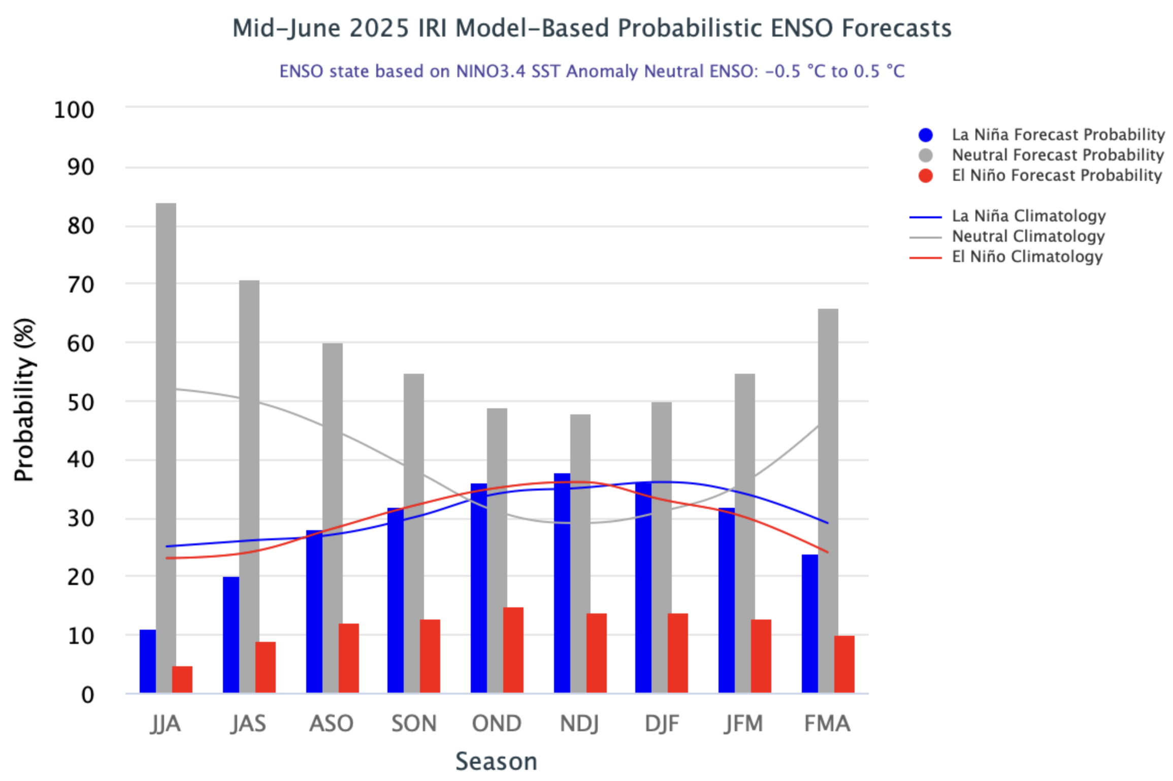
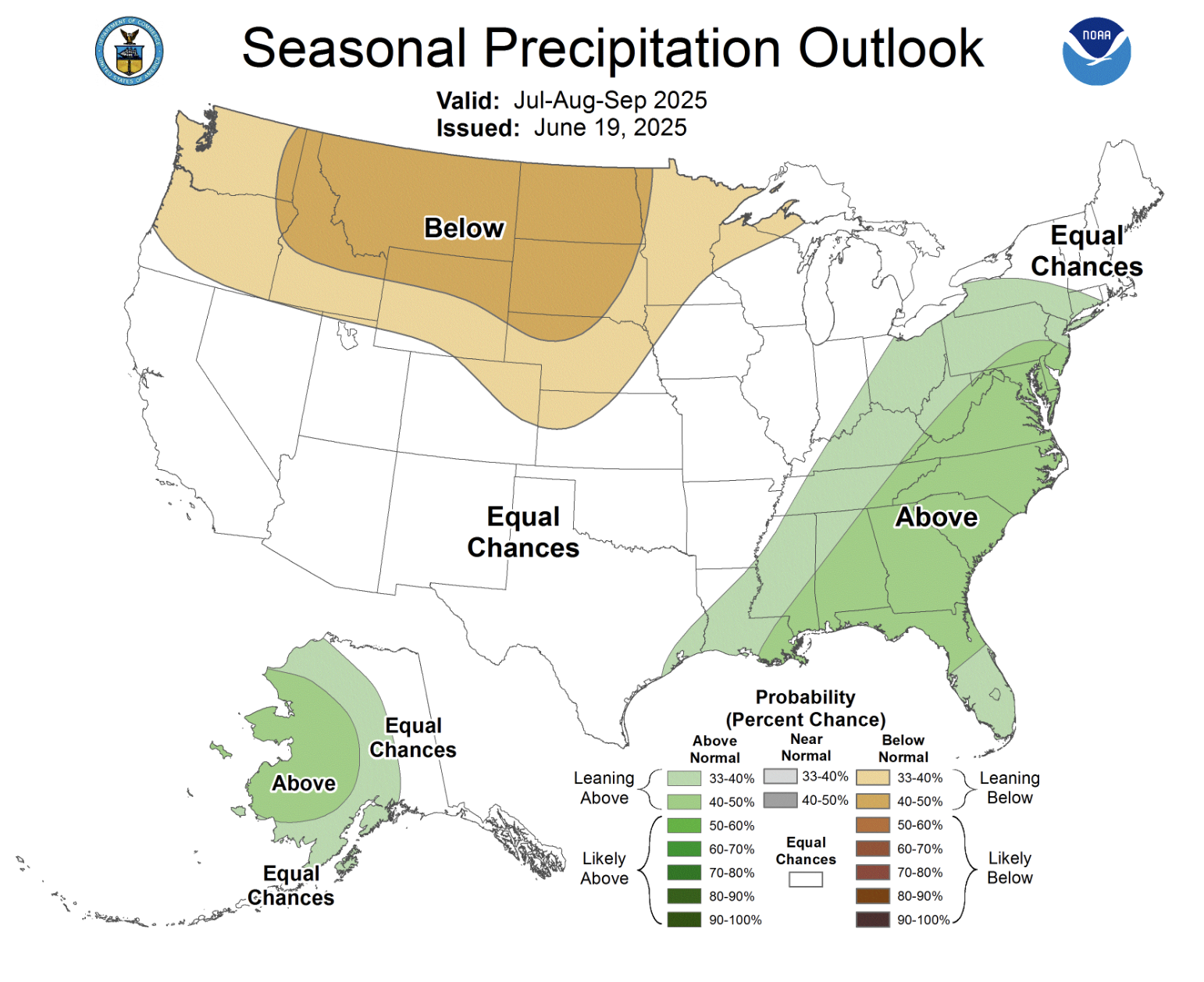
ENSO neutral conditions currently exist in the eastern Pacific Ocean and remain most likely throughout the forecast period. The NOAA seasonal precipitation forecast for July-September suggests an increased probability of below average precipitation for Wyoming and northeastern Colorado. The seasonal temperature forecast suggests a high probability of above average temperatures for the entire region.