December 8, 2025 - CO, UT, WY
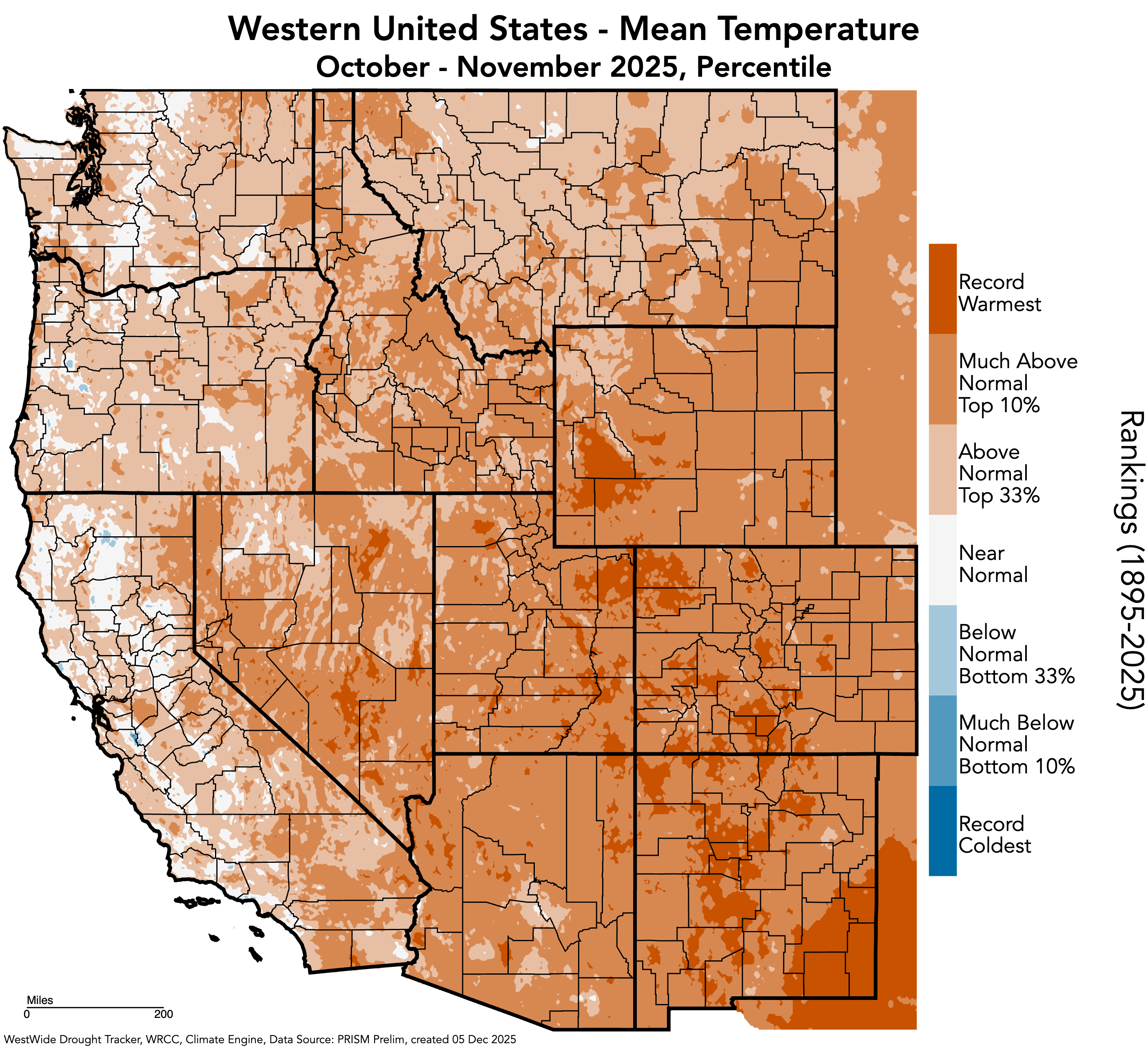
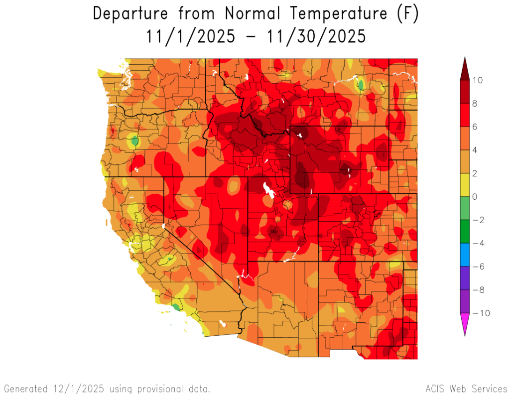
A hot and dry November left the Intermountain West with much below average snowpack conditions. November temperatures were four degrees above average region-wide and much of Utah and Wyoming baked under mean temperatures that were six to ten degrees above average. High temperatures coupled with mostly below normal precipitation caused low snow water equivalent (SWE) and worsening drought conditions.
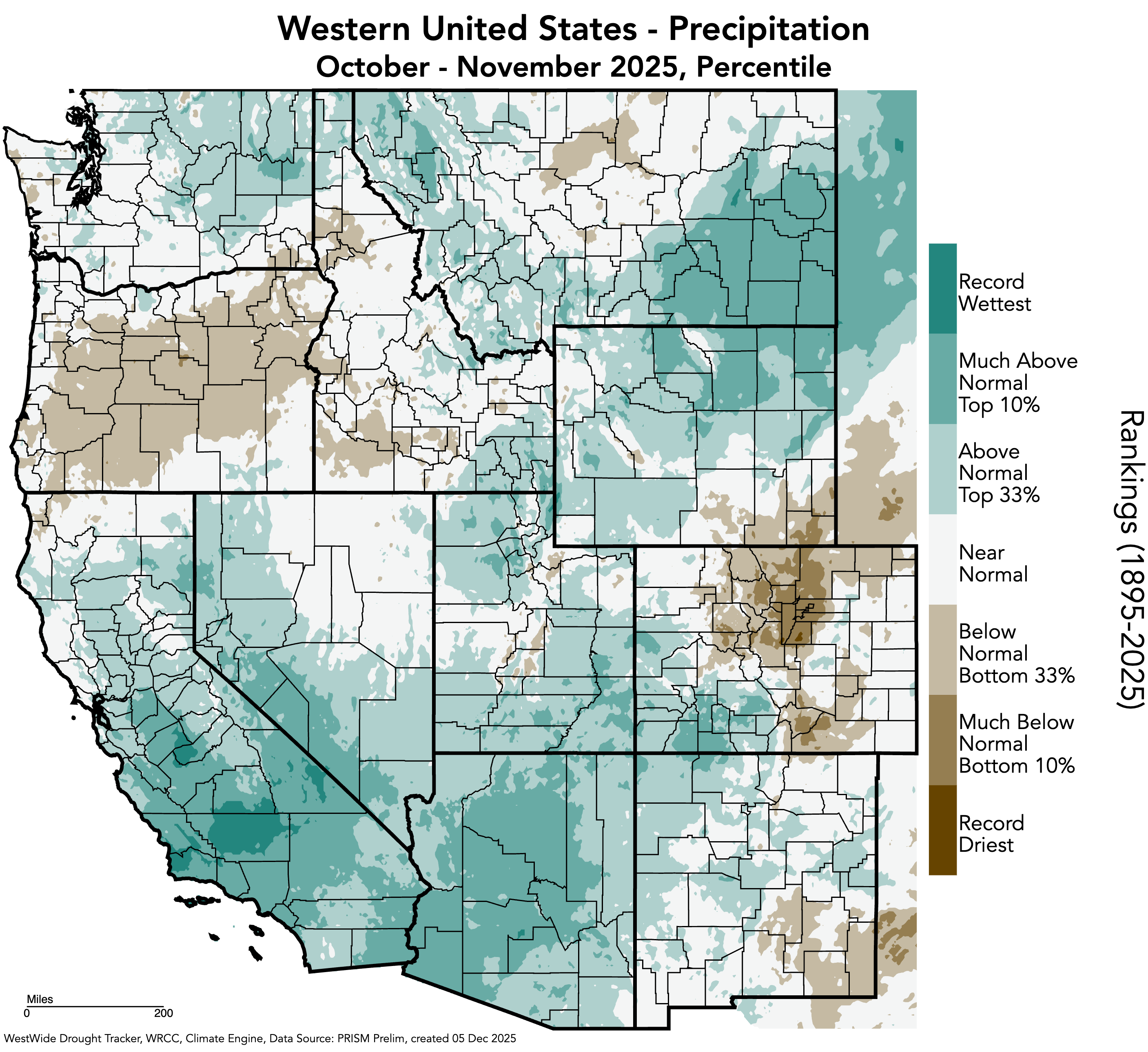
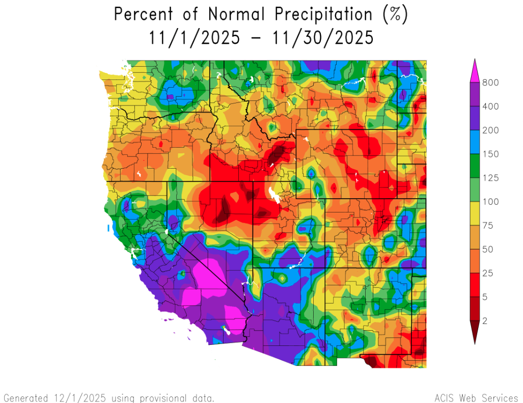
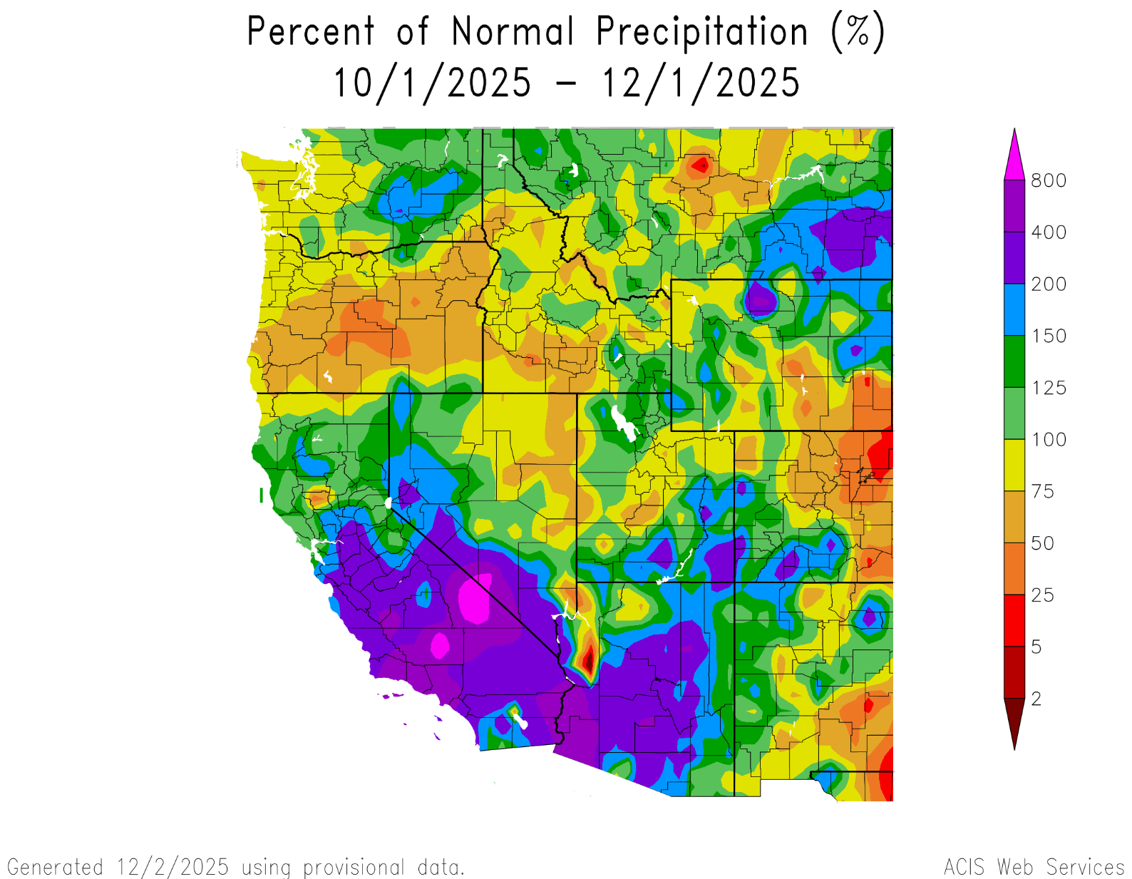
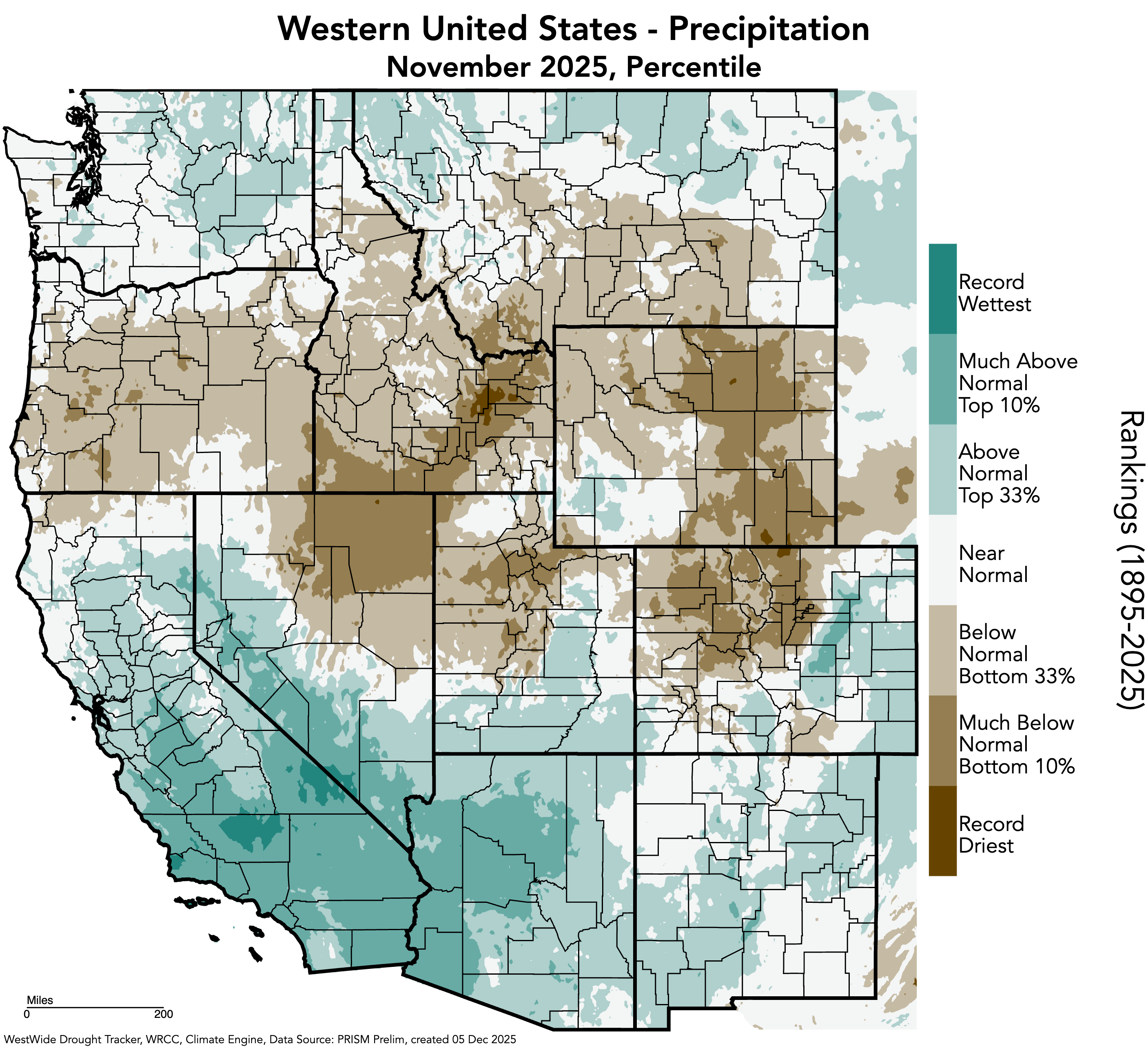
November precipitation was much below average for much of the region, especially in Wyoming, northern Colorado and northern Utah, which received less than half of normal precipitation. Much above average November precipitation was observed in southern Utah and eastern Colorado. Record dry Novembers were observed at thirteen locations in Wyoming, ten locations in Colorado and five locations in Utah. Despite dry November conditions, regional water year precipitation is near to above average except for eastern Colorado and southeastern Wyoming.
November was an extremely warm month, especially in western Wyoming, where monthly temperatures were more than eight degrees above average. The entire region observed November temperatures that were at least four degrees above average, with all of Utah, nearly all of Wyoming and western Colorado experiencing temperatures that exceeded six degrees above average. Record warm October conditions were observed in western Colorado, southwestern Wyoming and throughout Utah.

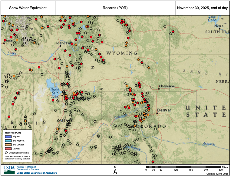
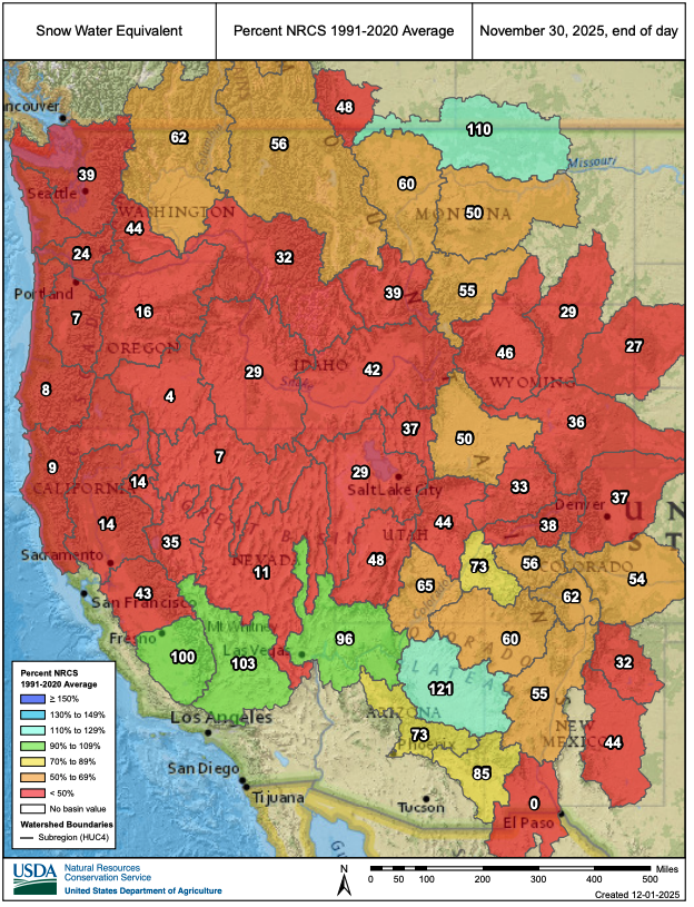
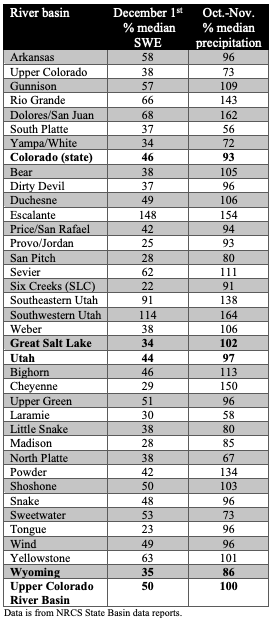
Record low SWE conditions exist at many locations in Colorado, Utah and Wyoming. A hot and dry November left most regional river basins with SWE conditions at less than 50% of average, with the least snow in the Six Creeks near Salt Lake City, where December 1st SWE is 22% of median. Slightly better SWE conditions exist in southern Colorado and southern Utah.
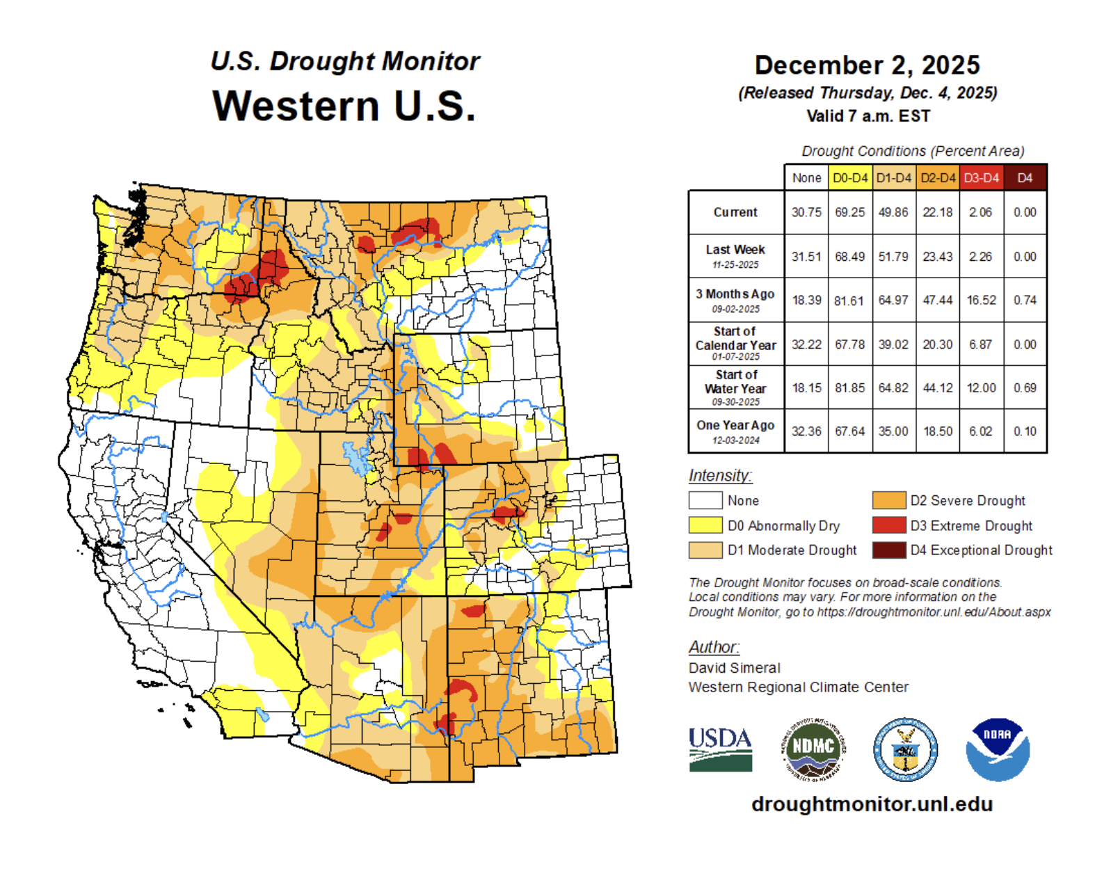
Regional drought coverage expanded slightly during November, increasing from 51% five weeks ago to 54% on December 2. Eastern Colorado and eastern Wyoming remain drought-free, but drought emerged along the northern Front Range and adjacent plains. Coverage of drought in Utah dropped below 100% for the first time in five months. Utah and Colorado were last free from drought six years ago, while the current drought in Wyoming began five years ago.
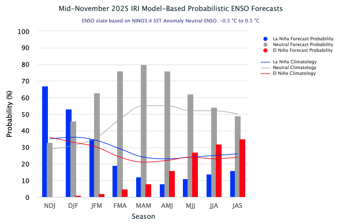
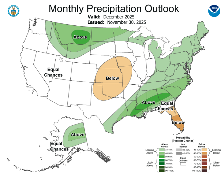
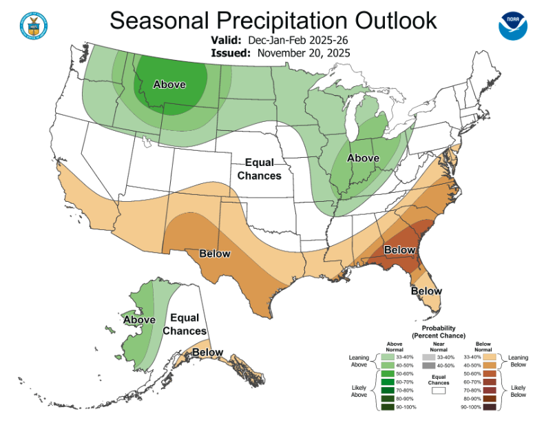
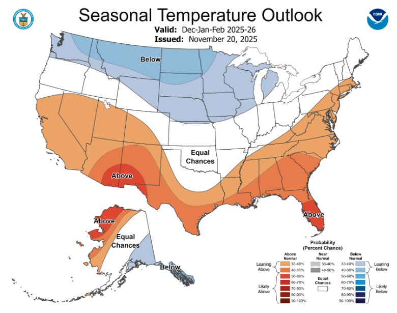
A NOAA La Niña Advisory is still in effect as eastern Pacific Ocean temperatures are below average. Weak La Niña conditions are expected to transition (60% probability) to neutral conditions by early 2026. The NOAA December Precipitation Outlook suggests above average precipitation for most of Wyoming. For the winter months (Dec-Feb), there is an increased probability for above average temperatures in Utah and southwestern Colorado. In Wyoming, there is an increased probability for above average precipitation and below average temperatures.
Record high temperatures drive record low snowpack. On December 1, record low SWE conditions were present at 52 regional Snotel sites in northern Colorado, northern Utah, and across Wyoming. Despite very low snowpack conditions, water year precipitation is above average for the region, except in northern Colorado. During early October, daily precipitation records were set in Utah and Colorado, including widespread flooding in southwest Colorado. Due to the tropical origin of those storms, nearly all precipitation fell as rain. Contrasting precipitation, water year temperatures are much above average with record high temperatures observed in parts of western Colorado, eastern Utah, and southwestern Wyoming. Consequently, the current snow drought is primarily the result of high temperatures rather than low precipitation. While October precipitation generally fell as rain in regional mountains, above average precipitation has increased soil moisture, which could help to bolster the efficiency of runoff in 2026.