April 8, 2025 - CO, UT, WY
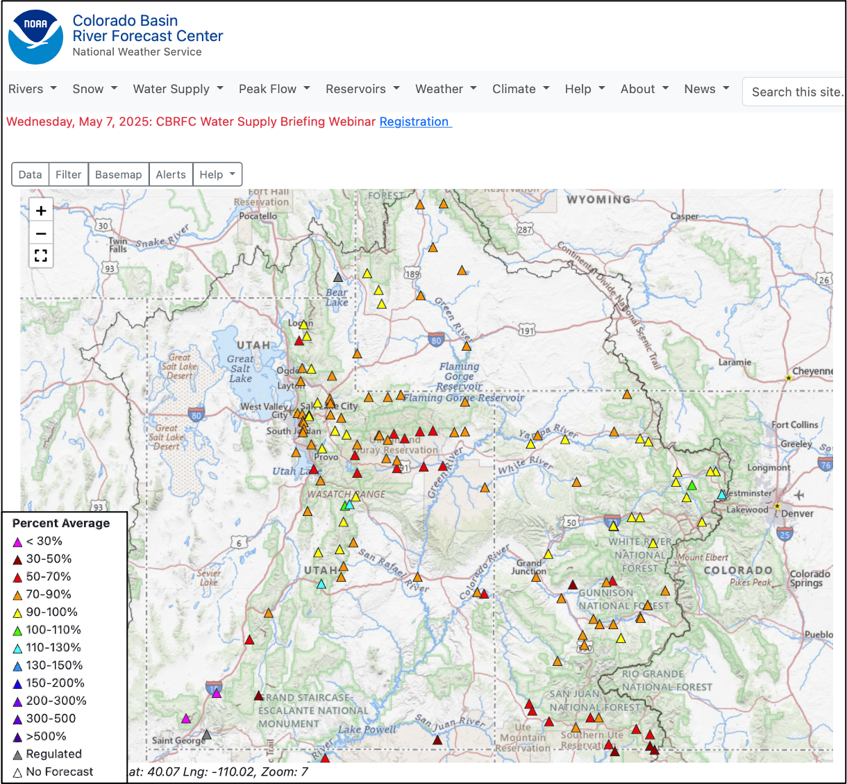
With the snow accumulation portion of the 2025 water year drawing to a close, snowpack in much of the region was near average, except for southern Colorado, southern Utah and northeastern Wyoming where snowpack ranged from 50-80% of average. Above average precipitation in northern Utah and much of Wyoming added to snowpack during March and caused the removal of drought conditions from the Wasatch Front and northern and central Wyoming. A late-March rain/snow event produced record precipitation along the northern Front Range and Eastern Plains and alleviated drought. Seasonal streamflow volume forecasts vary from much below average in southern Utah and southwestern Colorado to near average forecasts for more northerly river basins such as the Colorado headwaters, Yampa, North Platte and Bighorn River Basins. The streamflow volume for Lake Powell’s inflow is forecasted at 67% of average.
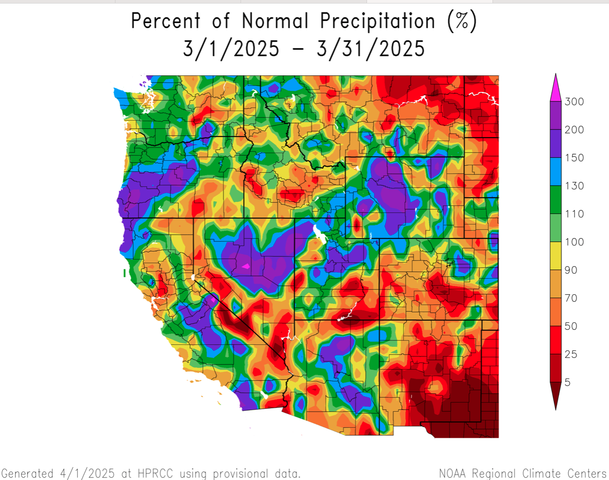
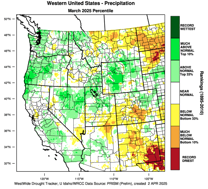
March precipitation was near-to-above average in Wyoming and much of Utah. Below average March precipitation fell across much of Colorado and southeastern Utah. In northern Utah, March precipitation was 130-200% of average and large areas of Wyoming received 130-300% of average March precipitation. Parts of southern Colorado and southeastern Utah received less than 50% of average March precipitation, further worsening drought conditions. Six long-term weather monitoring sites in eastern Colorado received record-low March precipitation.
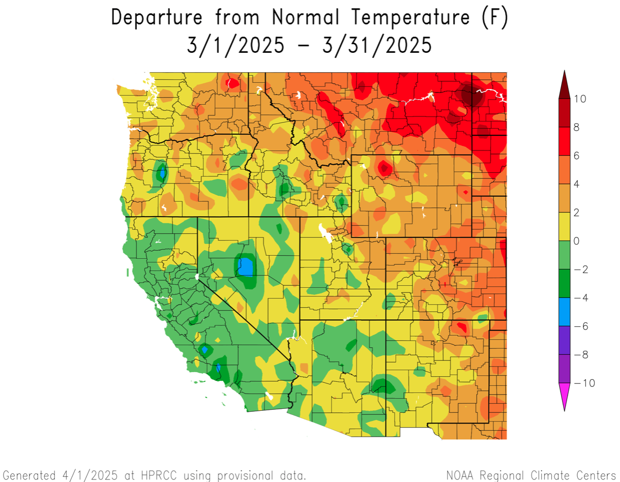
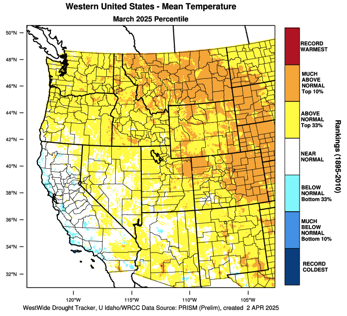
March temperatures were mostly above average. In Utah and southwestern Colorado, March temperatures were within two degrees of average. March temperatures in other parts of Colorado and Wyoming were two to six degrees above average.
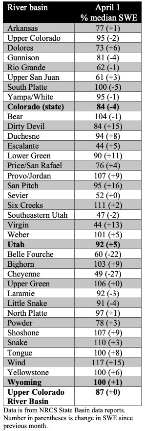
April 1 snow water equivalent (SWE) was near average for much of Wyoming, northern Colorado and northern Utah, ranging from 90% in the Lower Green to 110% in the Upper Snake River Basins. In southern Colorado and southern Utah, April 1 SWE was below to much below average, ranging from 44% in the Virgin to 80% in the Gunnison River Basins. On a statewide basis, SWE was near average in Utah (92%) and Wyoming (100%), but below average in Colorado (84%). In southwestern Utah, eight Snotel sites at elevations ranging from 6,000-8,900 feet have completely melted, which is 14 to 34 days earlier than average.
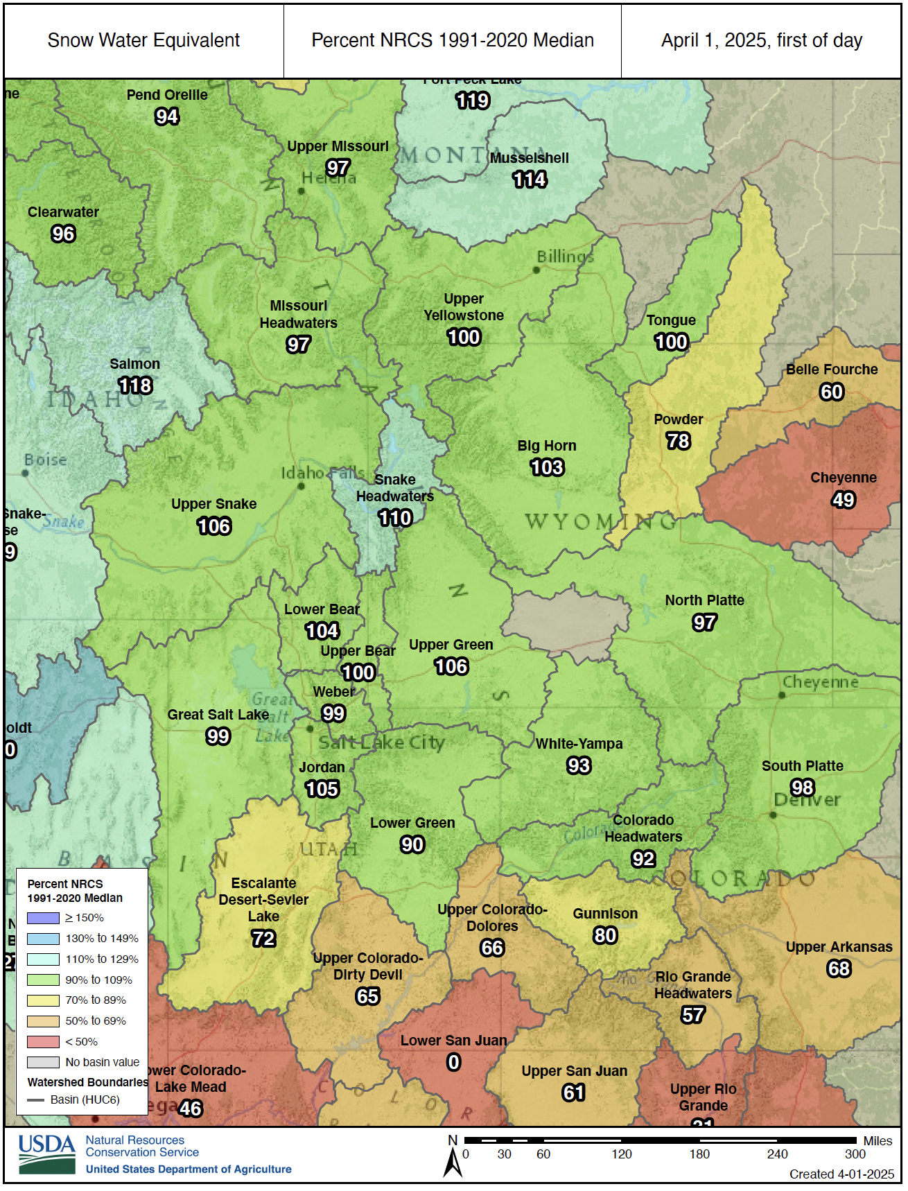
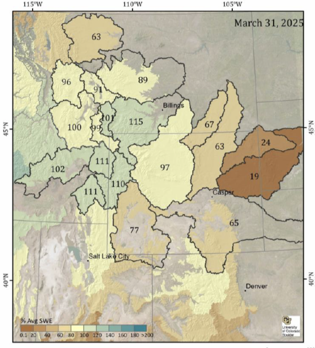
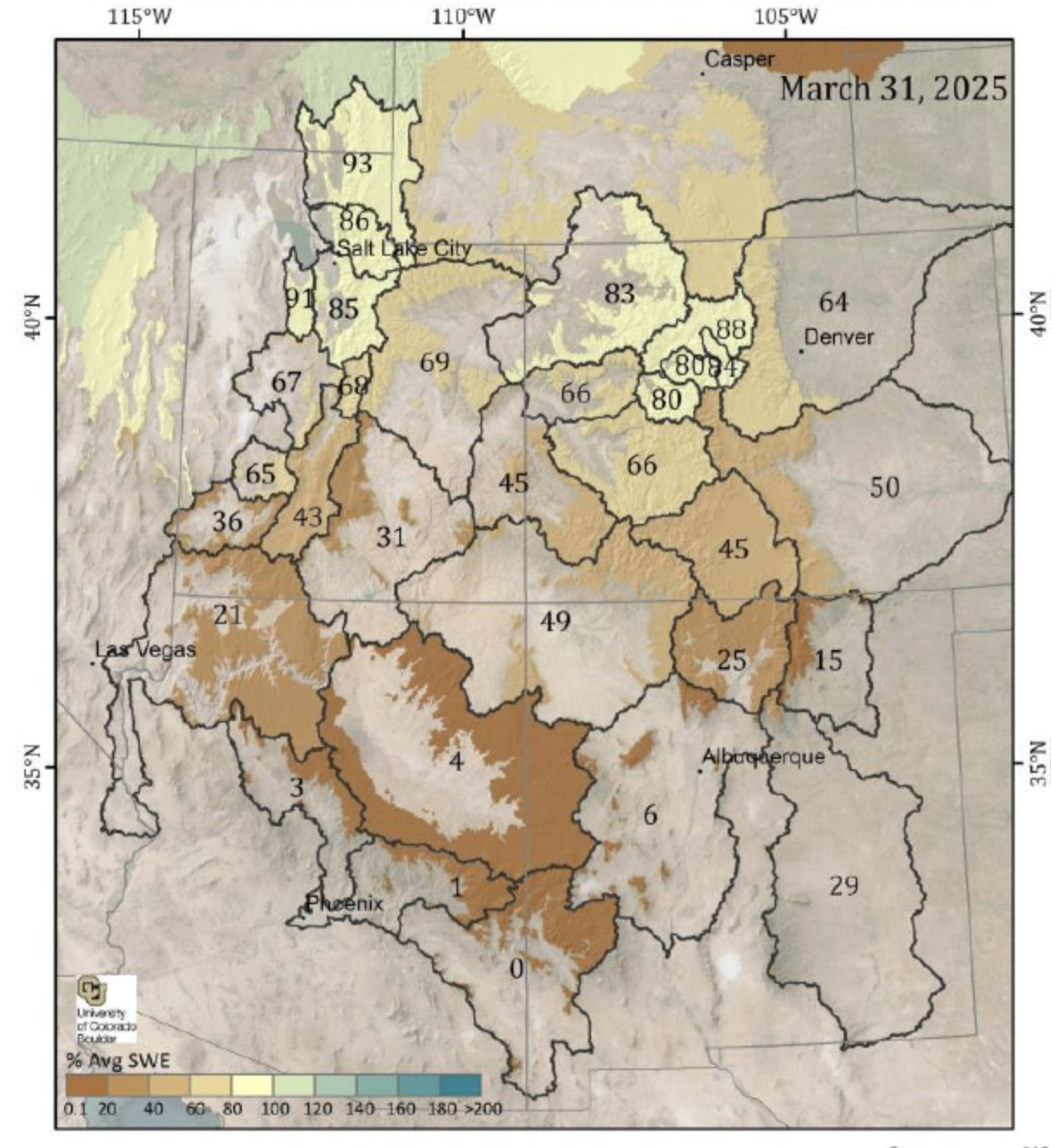
Spatial estimates of SWE on March 31, provided by INSTAAR at the University of Colorado, show lower estimates of SWE relative to average for all river basins except Wyoming’s Bighorn, Snake and Yellowstone Basins. The lower percent average SWE from spatial SWE estimates compared to Snotel-derived SWE is largely due to the inclusion of low elevation snowpack in the spatial SWE estimates which is not well-represented in the Snotel network. Snowpack at elevations below Snotel sites was generally low in 2025 due to higher snow levels and periods of warm sunny weather in March. The entire Spatial SWE report for 3/31/25 can be downloaded here.
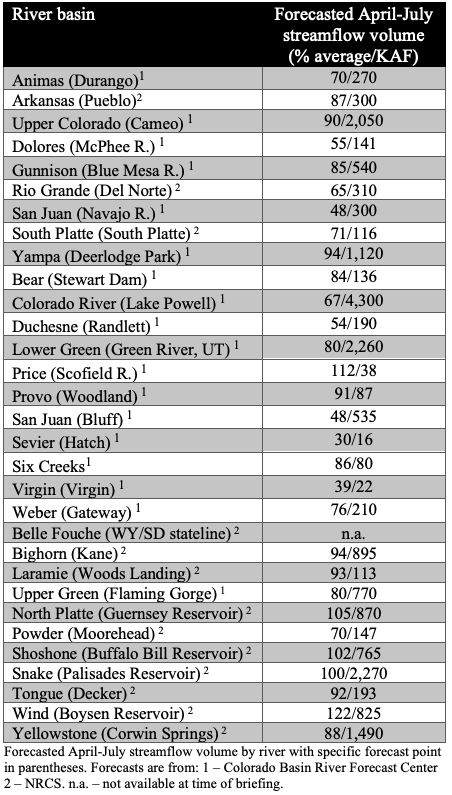
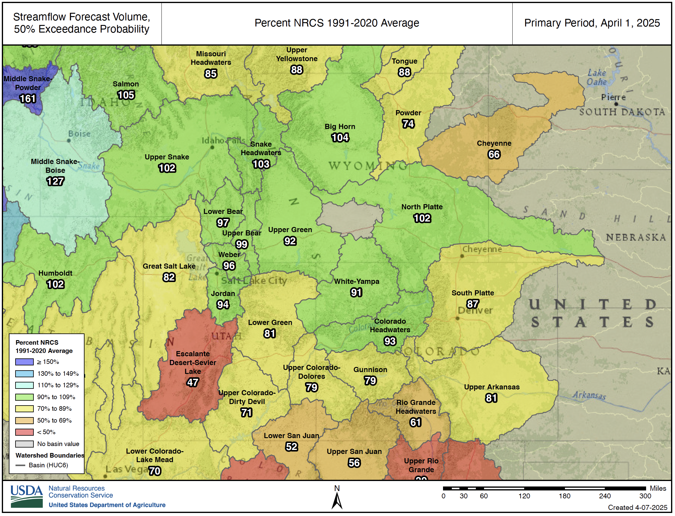
April 1 seasonal (April-July) streamflow volume forecasts were near-to-below average across the region. In general, seasonal streamflow volume forecasts were near average in the North and below or much below average in the South. In the Upper Colorado River Basin, near average streamflow volumes are forecasted for the Colorado Headwaters (90%) and the Yampa (94%); below average streamflow volumes for the Upper Green (80%), Lower Green (80%) and Gunnison (85%); and much below average streamflow volume for the Dolores (55%) and San Juan (48%). Seasonal streamflow is forecasted at 67% of average for Lake Powell. In the Missouri River Basin, near average seasonal streamflow volumes are forecasted for the Bighorn and North Platte River Basins, and below average streamflow is forecasted for the Arkansas, Cheyenne, Powder, South Platte and Tongue River Basins. Note: both NRCS and the Colorado Basin River Forecast Center (CBRFC) provide seasonal streamflow forecasts for the Upper Colorado River Basin and these forecasts occasionally differ due to differences in streamflow forecasting models. For example, the April 1, 2025 seasonal streamflow forecast for the Upper Green River at Flaming Gorge is 80% from the CBRFC and 94% from the NRCS.
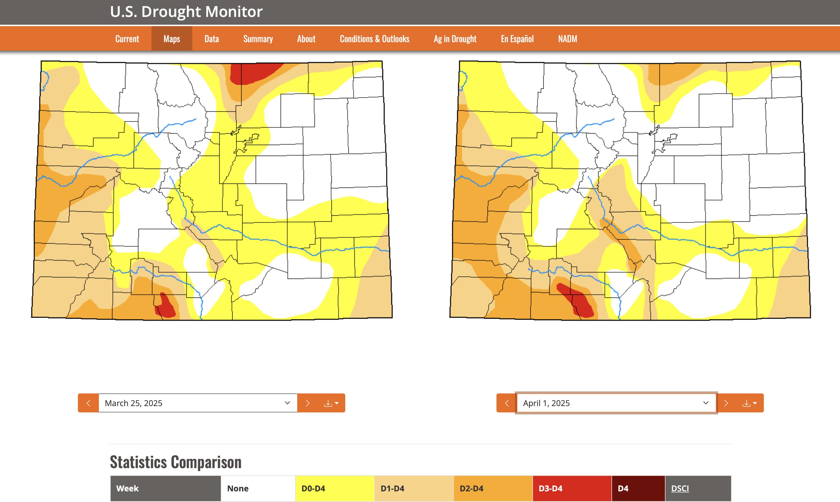
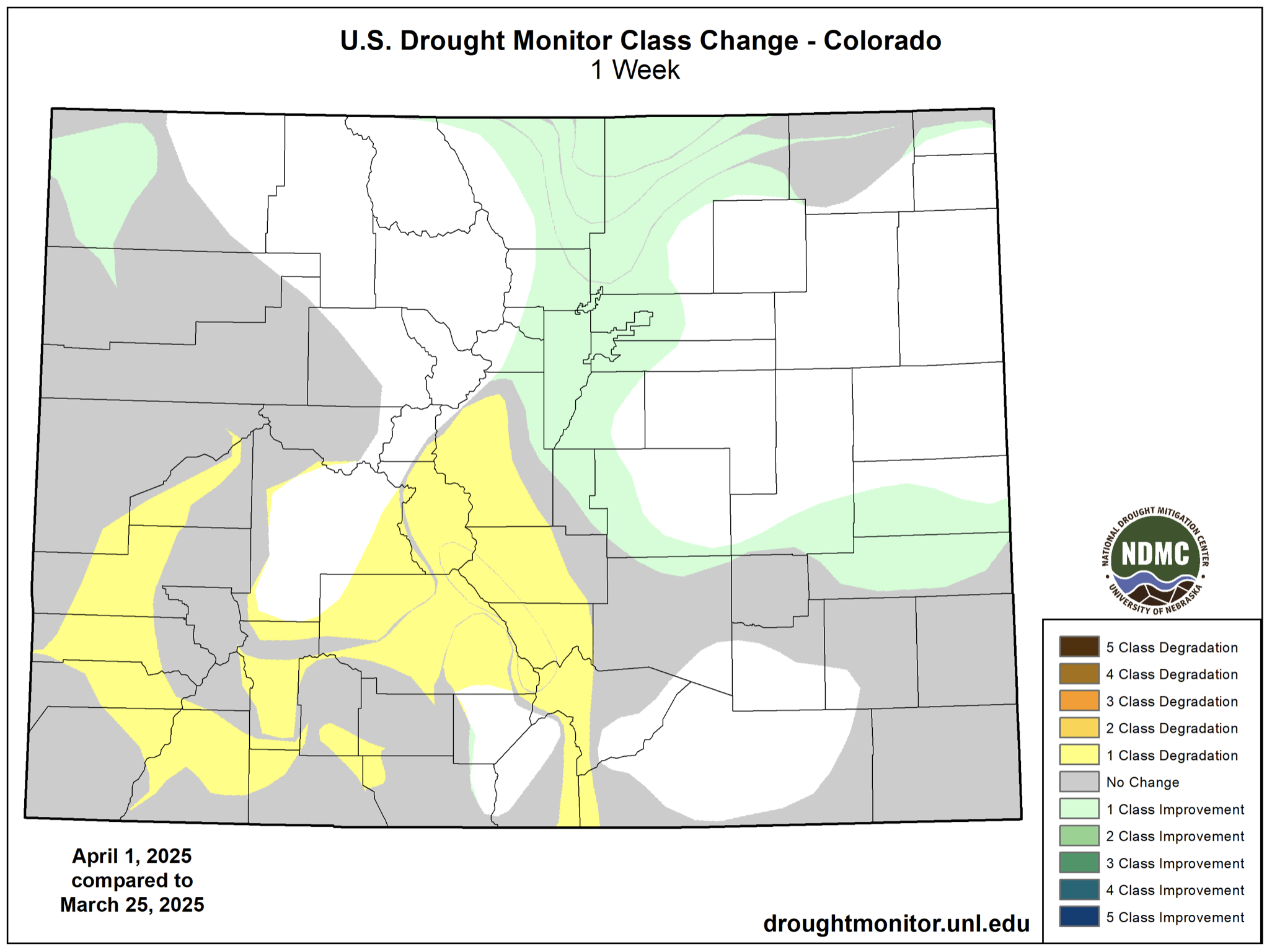
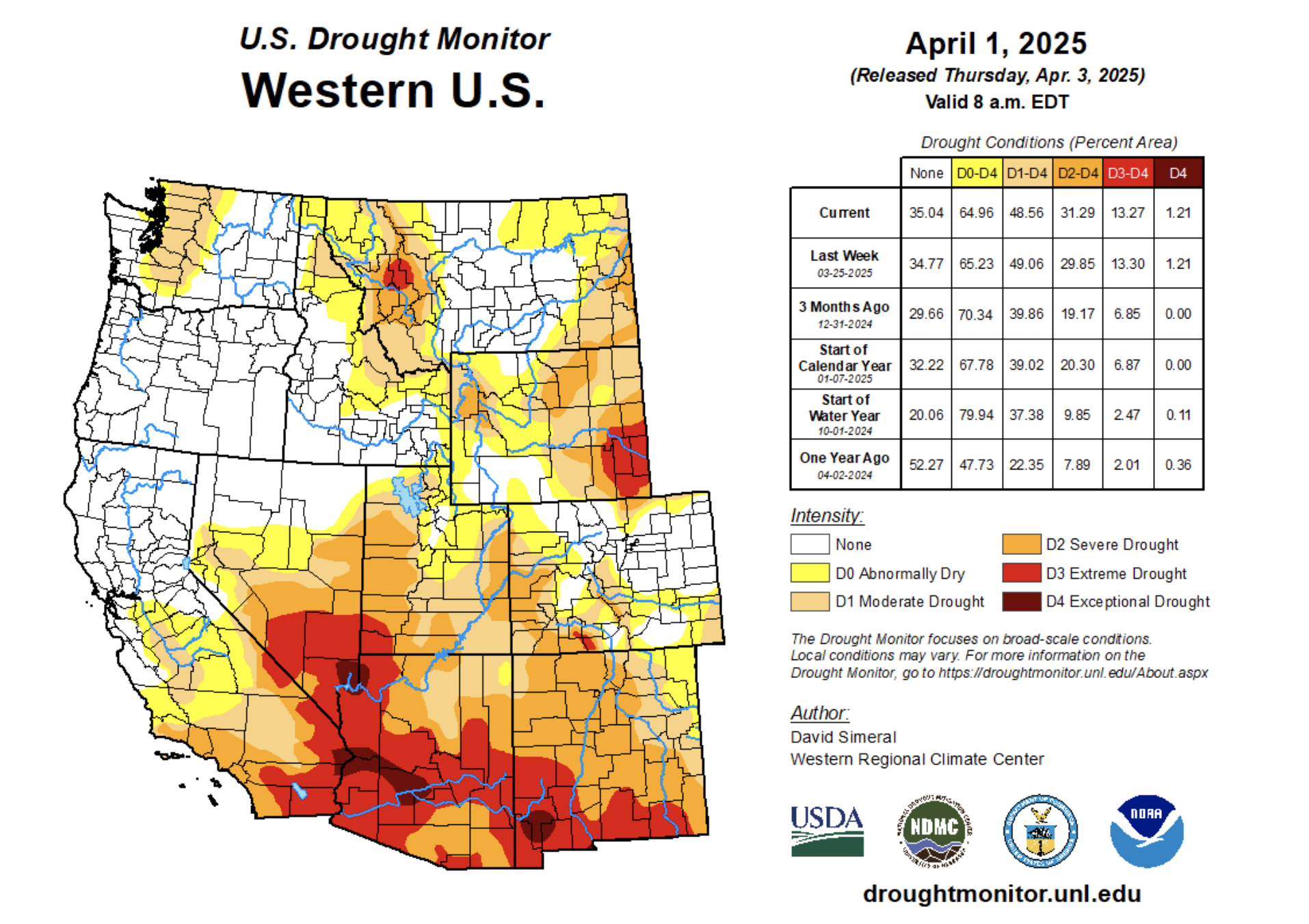
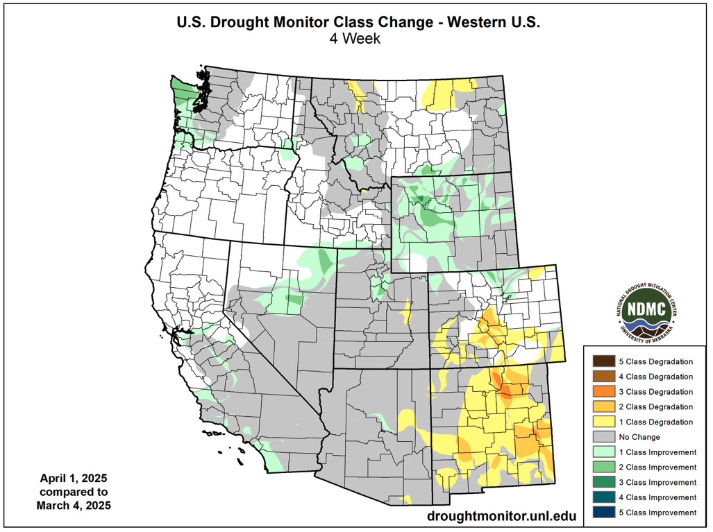
On April 1, drought conditions covered 54% of the region, a 2% regional decline from February 25. Significant expansion of drought in Colorado during March was offset by the removal of drought conditions along the Wasatch Front in northern Utah and in northern and central Wyoming. Extreme drought conditions were removed from the Snake and Powder River Basins and the area of severe drought contracted during March. Drought conditions expanded and became more severe in western Colorado and drought conditions emerged in both central and southeastern Colorado during March.
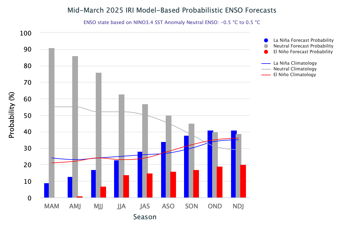
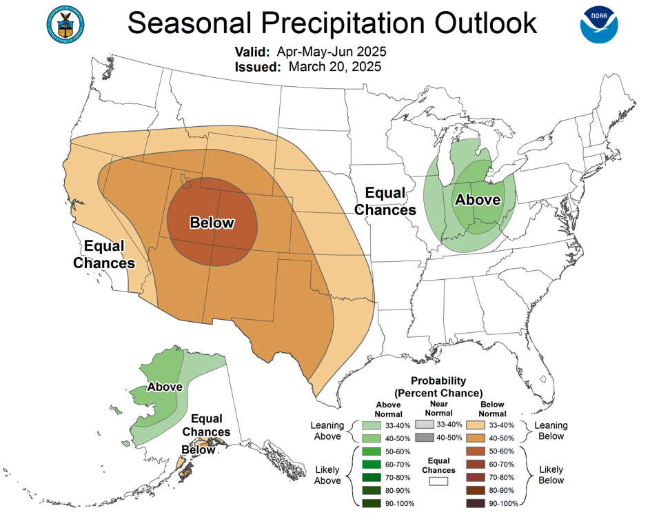
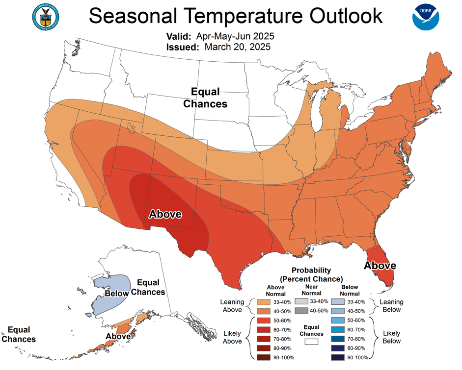
Pacific Ocean temperatures were near average in March, ENSO is currently in a neutral phase, and there is a greater than 50% probability of ENSO-neutral conditions continuing through early fall. The NOAA monthly outlook for April suggests an increased probability of below average precipitation and above average temperatures across most of Colorado and Utah. The NOAA Seasonal Precipitation Outlook (April-June) indicates an increased probability of below average precipitation for the entire region, especially in Utah and western Colorado. There is also an increased probability of above average temperatures for Colorado, Utah and southwestern Wyoming during April-June.

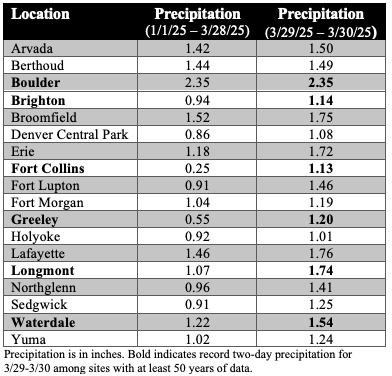
Significant weather event: Record Front Range precipitation. After a dry January-March, record precipitation fell across the northern Front Range and Eastern Plains of Colorado on March 29-30. Rain fell for most of the event at lower elevations with wet snow accumulating in the foothills. Daily precipitation records were set on March 29 in Boulder (1.41”), Brighton (0.46”), Eastonville (0.70”), Greeley (0.60”), Longmont (0.66”) and Winter Park (0.76”) and two-day precipitation records were set on March 29-30 at 11 locations with more than 50 years of data. Notably, more rain fell on March 29-30 than in all of 2025 at 18 locations. The late March rain and snow event caused a one-category improvement in drought conditions, including the removal of all drought and abnormally dry conditions across a large swath of northeastern Colorado. An area of extreme drought was also removed from Larimer County.