2025 SW Colorado Flooding
Download the assessment here.
Purpose of the report: This rapid assessment, produced by the Western Water Assessment (WWA), serves as a scientific resource for understanding drivers and impacts of the flooding events that occurred from October 10th -14th, 2025 in southwest Colorado. The report is designed to support local resilience building efforts and hazard planning for communities in the region. It provides the longterm and recent historical context for the flooding, hydrologic characteristics of the flood event, and an assessment of the local probability of an event of this magnitude.
Key Findings:
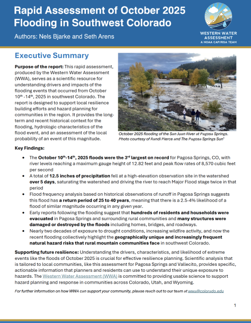
• The October 10th-14th, 2025 floods were the 3rd largest on record for Pagosa Springs, CO, with river levels reaching a maximum gauge height of 12.82 feet and peak flow rates of 8,570 cubic feet per second
• A total of 12.5 inches of precipitation fell at a high-elevation observation site in the watershed over 5 days, saturating the watershed and driving the river to reach Major Flood stage twice in that period
• Flood frequency analysis based on historical observations of runoff in Pagosa Springs suggests this flood has a return period of 25 to 40 years, meaning that there is a 2.5-4% likelihood of a flood of similar magnitude occurring in any given year.
• Early reports following the flooding suggest that hundreds of residents and households were evacuated in Pagosa Springs and surrounding rural communities and many structures were damaged or destroyed by the floods including homes, bridges, and roadways.
• Nearly two decades of exposure to drought conditions, increasing wildfire activity, and now the recent flooding collectively highlight the geographically unique and increasingly frequent natural hazard risks that rural mountain communities face in southwest Colorado.
Supporting future resilience: Understanding the drivers, characteristics, and likelihood of extreme events like the floods of October 2025 is crucial for effective resilience planning. Scientific analysis that is tailored to local communities, like this assessment for Pagosa Springs and Vallecito, provides specific, actionable information that planners and residents can use to understand their unique exposure to hazards. The Western Water Assessment (WWA) is committed to providing usable science to support hazard planning and response in communities across Colorado, Utah, and Wyoming.
For further information on how WWA can support your community, please reach out to our team at wwa@colorado.edu.