April 5, 2024 - CO, UT, WY
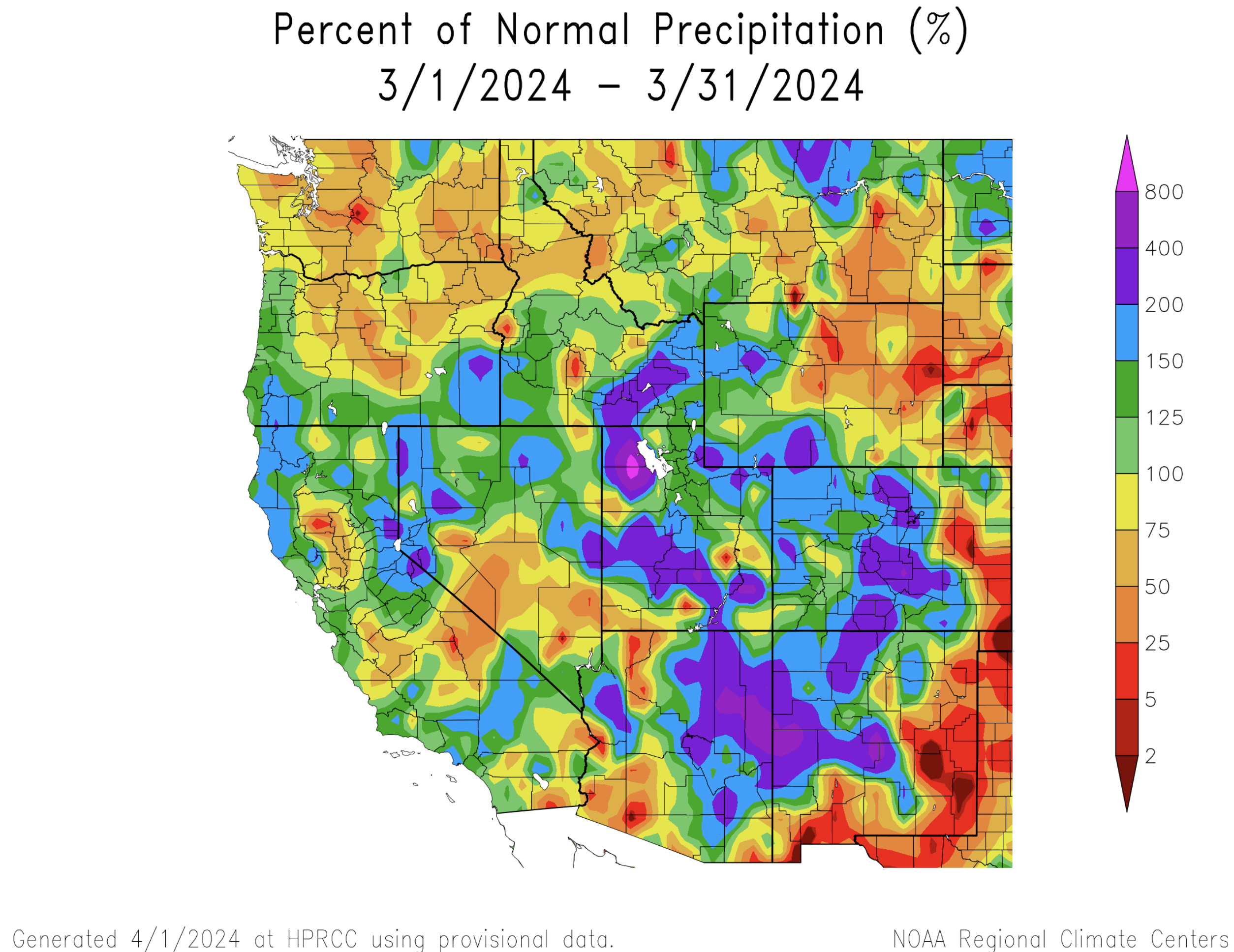
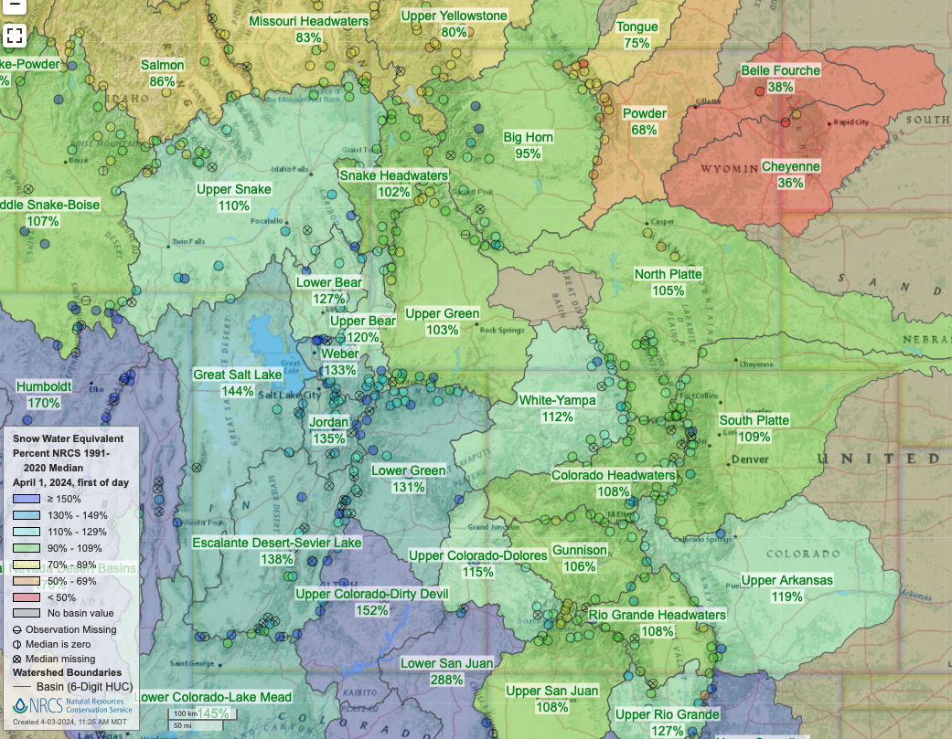
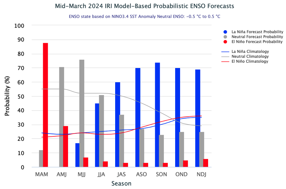
Precipitation was generally above average and temperatures were near-average in the Intermountain West during March; large areas of Colorado, Utah and southwestern Wyoming received greater than 150% of average March precipitation. April 1st snow water equivalent (SWE) was above average in Colorado (112%) and Utah (131%) and average in Wyoming. Seasonal streamflow volume forecasts are near-average in much of the Upper Colorado River Basin and above average in northern Utah. El Niño conditions are expected to end soon with neutral ENSO conditions likely during summer and there is at least a 60% chance of La Niña conditions emerging by fall.
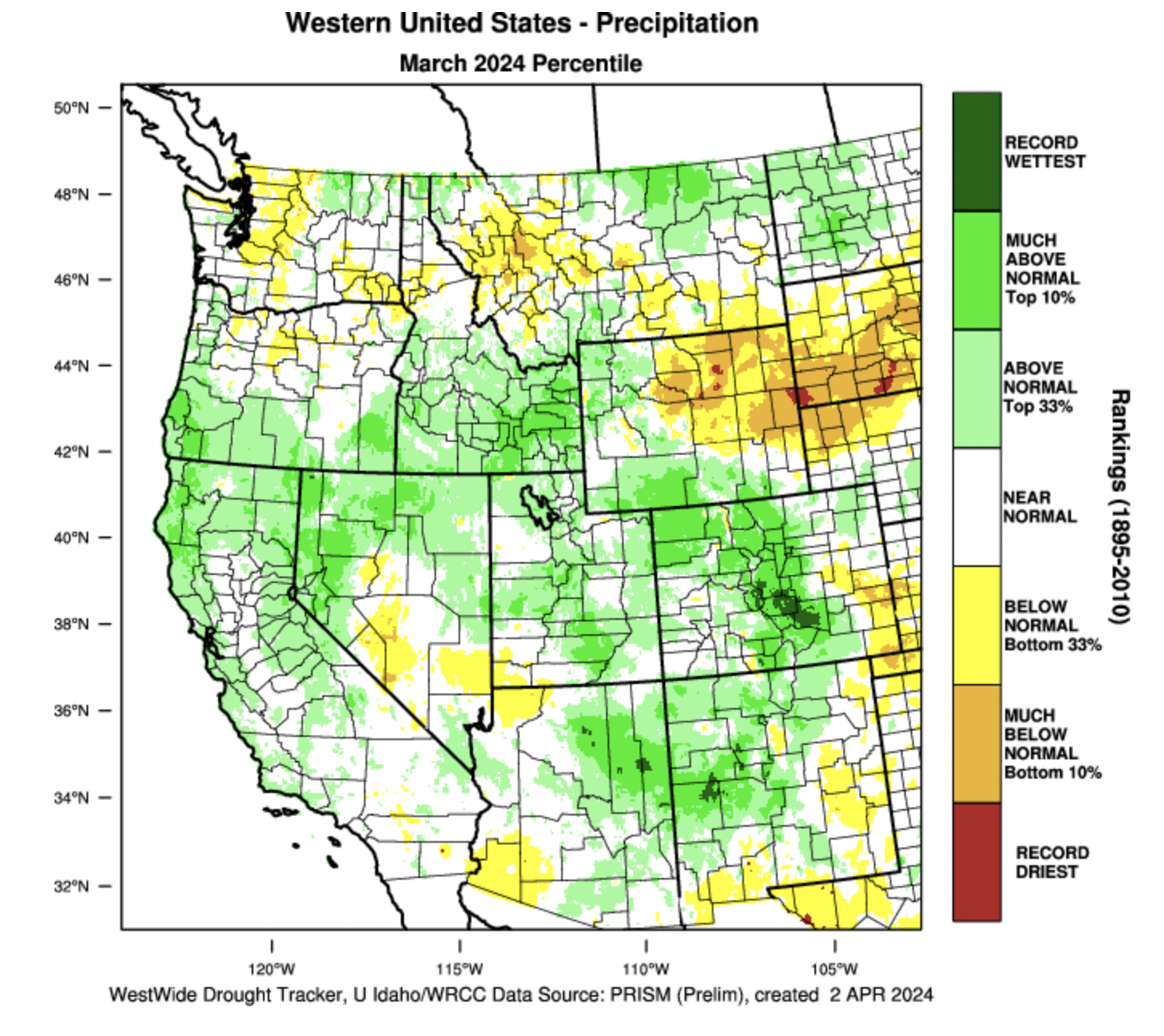
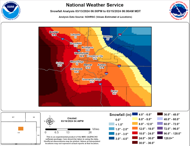
Regional precipitation during March was generally near-to-above average except in northeastern Wyoming and southeastern Colorado where precipitation was below average. Large areas of Colorado, central Utah and southwestern Wyoming saw greater than 150% of average March precipitation. Areas of greater than 200% of average precipitation along the Front Range and east of the Continental Divide in Colorado were driven by a large upslope snowstorm mid-month. The March 13-15 snowstorm contributed to record wet March conditions in Custer, Fremont, Park, Pueblo and Teller Counties.
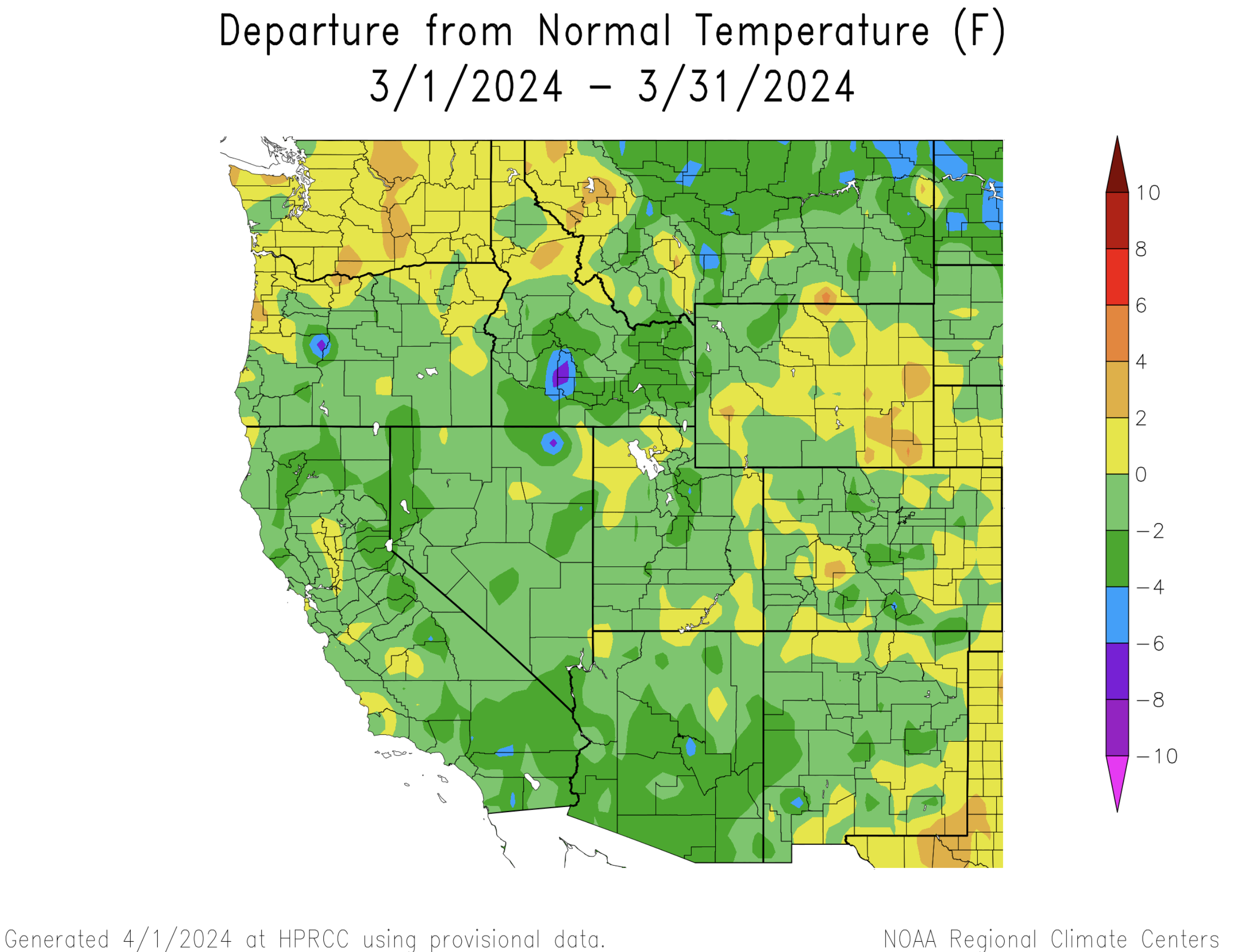
Temperatures during March were within 2 degrees of average for most of the region with the warmest conditions occurring in eastern Colorado and eastern Wyoming. March temperatures were 2-4 degrees below average in the Wasatch Mountains and in isolated Colorado mountain locations.
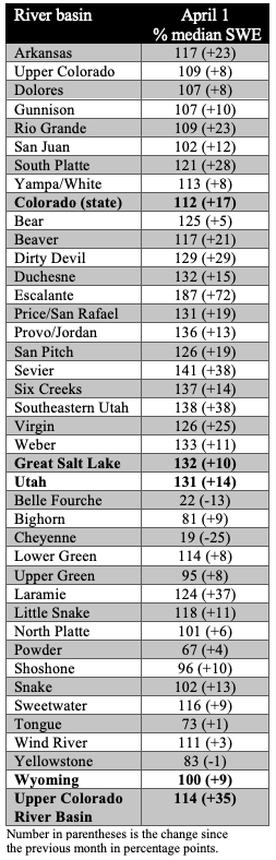
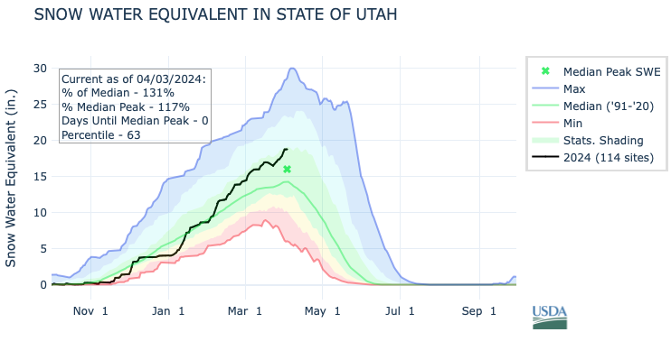
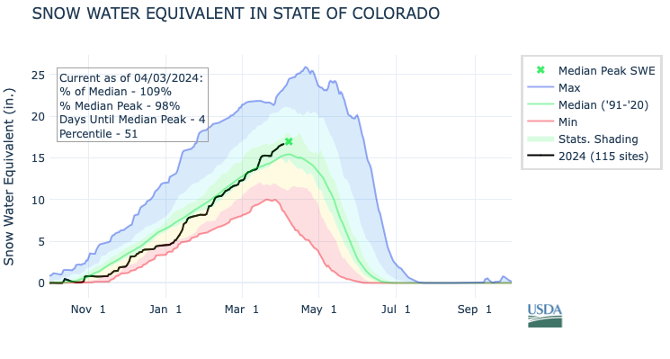
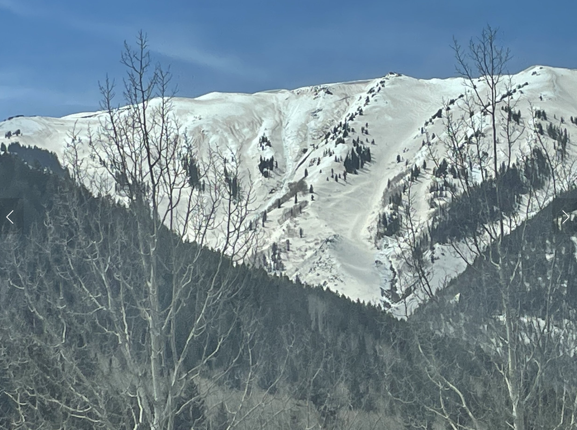
April 1st snow water equivalent was near-to-above average for all regional river basins except in northeastern Wyoming where SWE was below-to-much-below average. As a statewide average, SWE conditions are 112% of average in Colorado, 131% of average in Utah and 100% of average in Wyoming. Across the entire Upper Colorado River Basin, April 1st SWE is 114% of average. While the 2024 snowpack is not nearly as impressive as the 2023 snowpack, the 2023 water year ends with the second year in a row of above average snowpack for most of the region. Snowpack in northeastern Wyoming’s Powder and Tongue River Basins was around 70% of average and SWE in the Belle Fourche and Cheyenne River Basins was less than 40% of average. A significant dust storm deposited dust on snowpacks across much of Colorado and the Wasatch Mountains in Utah. A particularly thick layer of dust was deposited in the Roaring Fork Basin and San Juan Mountains. The dust layer is currently buried under several feet of snow at many locations, but will likely speed snowmelt later in the spring.
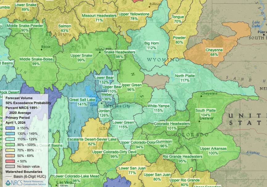
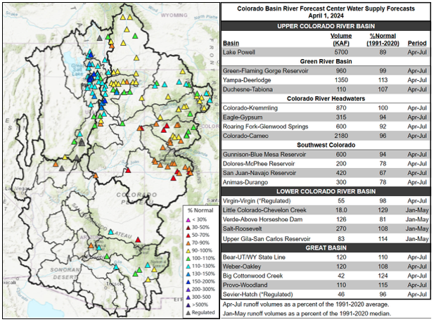
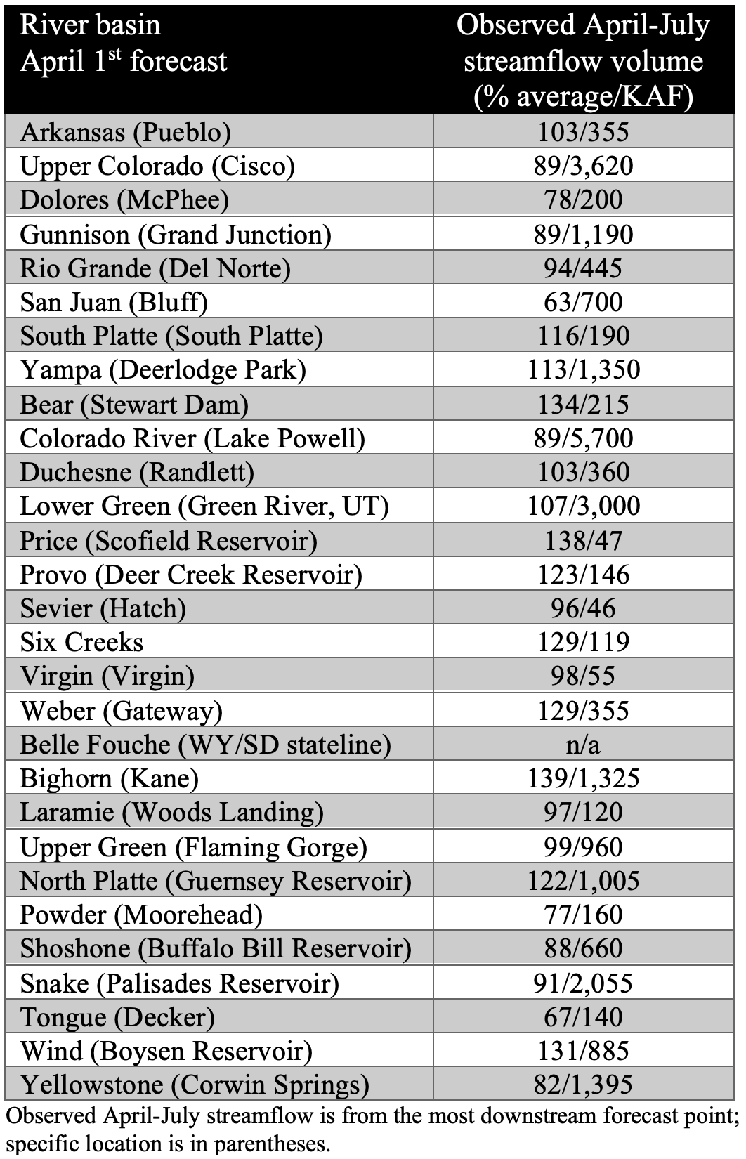
Seasonal streamflow forecasts for large areas of the Upper Colorado River and Great Basins are near-average. Seasonal streamflow forecasts are highest in the Great Basin (Bear, Provo, Six Creeks and Provo) and in the Yampa River Basin. The San Juan and Dolores River Basins are forecasted to have below average seasonal streamflow volumes despite near-average SWE conditions. Seasonal streamflow volume for Lake Powell is forecasted to be 89% of average, an inefficient runoff considering April 1st SWE in the Upper Colorado River Basin is 114% of median.
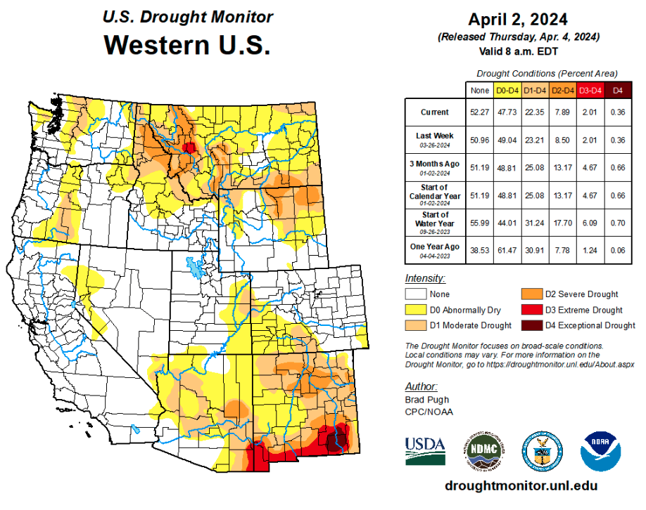
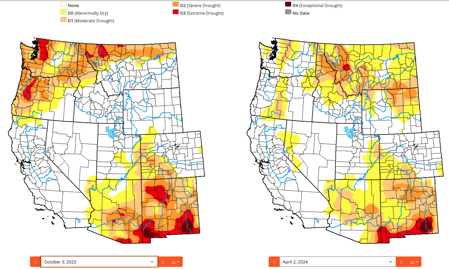
Above average March precipitation caused a slight decrease in regional drought coverage and D1-D2 drought now covers 12% of the region. Drought conditions were entirely removed from northern Colorado and southern Wyoming and severe drought conditions (D2) were removed from south-central Colorado and the Yellowstone Plateau. Severe (D2) drought conditions expanded in coverage in northeastern Wyoming. Since the start of the water year, total regional coverage of drought increased from 9% to 12% of the region. Since October, drought conditions have improved in western Colorado and eastern Utah and D1-D2 drought has developed in northern Wyoming.
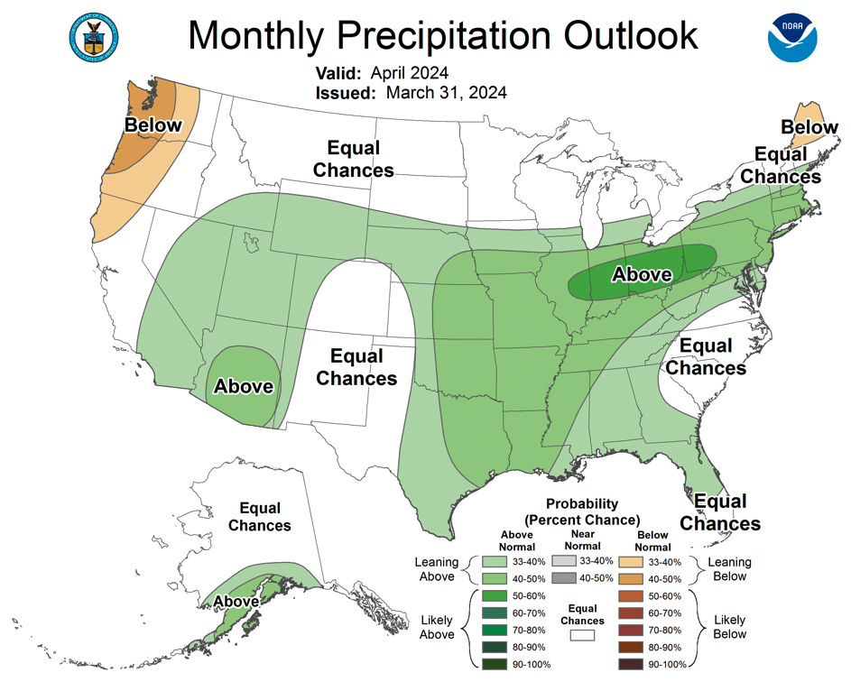
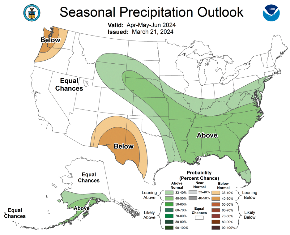
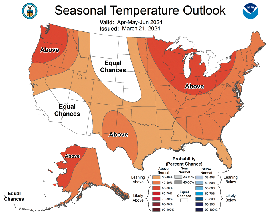
As of mid-March, El Niño conditions continue in the eastern Pacific Ocean, but the trend in cooling ocean temperatures is expected to continue and will likely soon lead to neutral ENSO conditions. There is a 50-75% probability that neutral ENSO conditions will prevail through the summer, but by early fall, there is greater than a 60% chance of La Niña conditions developing. The NOAA monthly outlook suggests an increased probability of above average precipitation during April for Utah, Wyoming and western Colorado; there are equal chances of above or below normal temperatures during April. The NOAA Seasonal Outlook for April-June suggests an increased probability of above average precipitation for Wyoming and northeastern Colorado and an increased probability of above average temperature for Utah and most of Colorado.
Significant March weather event: Front Range snowstorm. On March 13-15, a significant upslope storm impacted the Front Range of Colorado from Fort Collins to Pueblo. One to five feet of snow fell from Boulder south to Pueblo with the most significant snowfall occurring in the foothills east of the Continental Divide. Amongst sites with at least 50 years of weather data, 28 sites broke daily snowfall records and 31 sites broke daily precipitation records during the March 13-15 storm. Daily snowfall records were broken in Canon City (12.2”), Colorado Springs (10”), Estes Park (23.3”), Evergreen (22”), Gross Reservoir (19”) and Ruxton Park (20”). In Boulder, the daily precipitation record was broken on March 14th (2.33”) and the snowstorm was the 12th largest on record with 21.9”. The highest three-day snowfall totals were in Aspen Springs (61.5”), Evergreen (61”), Idaho Springs (53.7”) and Nederland (53”). A strong east-west gradient in snowfall totals occurred with this storm as precipitation was slow to change over to snow along the Interstate 25 corridor. For example, nearly 30” of snow fell in Golden, 12” in Denver and only 5.7” at Denver International Airport.
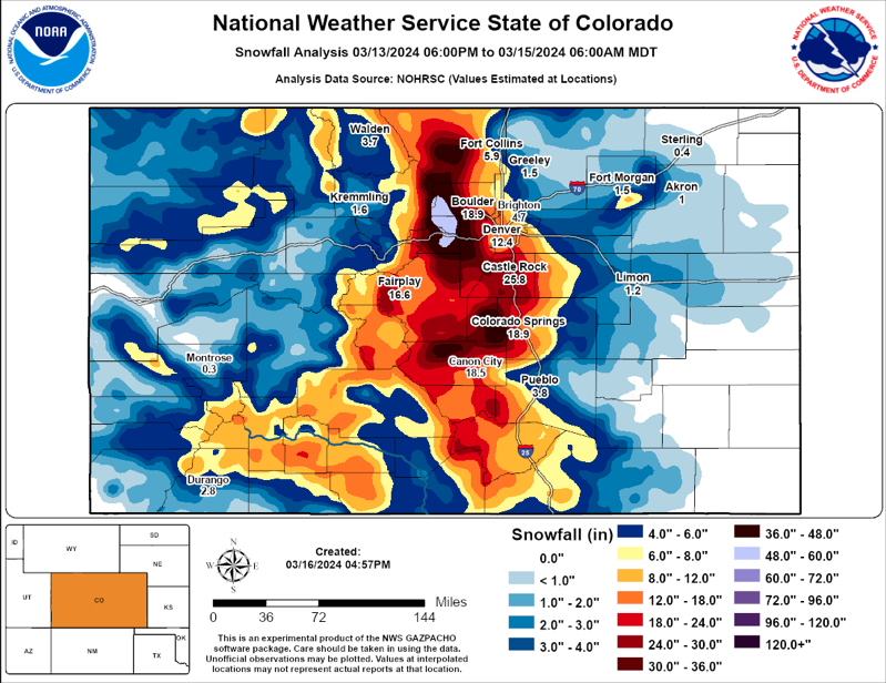
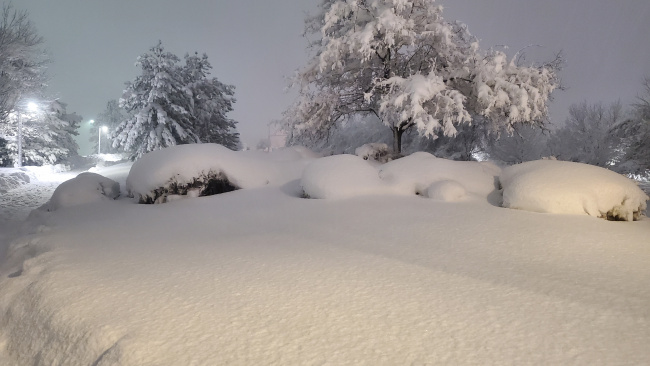
Snow in Broomfield, CO. March 14, 2024. Credit: NWS Boulder.